12,632 results
ref. CZC-11677Gravée par P.F. Tardieu, authentique datée vers 1790, sur papier fort, recto uniquement, pliable, dimensions : 39 cm x 27 cm, parfait état. Dynastie de rois de France, la dynastie des Capétiens est issue du roi Hugues Ier Capet, auquel elle doit son nom. Celui-ci, en mettant en place l’hérédité dynastique, est devenu la souche commune des trois dynasties de souverains – Capétiens, Valois, Bourbons – qui se sont succédé sur le trône de France jusqu'en 1848 (c'est-à-dire pendant près d'un millénaire), et dont les branches collatérales ont régné sur les royaumes de Naples, de Hongrie et d'Espagne. Classeur 3
ref. CZC-11678Gravée par P.F. Tardieu, authentique datée vers 1790, sur papier fort, recto uniquement, pliable, dimensions : 39 cm x 27 cm, parfait état. L'Empire carolingien est le résultat de l'expansion territoriale du royaume franc sous l'influence de la dynastie carolingienne pendant le haut Moyen Âge. Il s'étend de l'Europe occidentale à l'Europe centrale. Charlemagne était à la tête de près de la moitié de l'Europe et de 10 millions de sujets, de la Mer du Nord à la Méditerranée. Par ses conquêtes, le fondateur de la dynastie carolingienne a doublé l'étendue des territoires soumis aux rois des Francs, et a régné sur un empire de 1,2 million de km2. Classeur 3
ref. CZC-11678Gravée par P.F. Tardieu, authentique datée vers 1790, sur papier fort, recto uniquement, pliable, dimensions : 39 cm x 27 cm, parfait état. L'Empire carolingien est le résultat de l'expansion territoriale du royaume franc sous l'influence de la dynastie carolingienne pendant le haut Moyen Âge. Il s'étend de l'Europe occidentale à l'Europe centrale. Charlemagne était à la tête de près de la moitié de l'Europe et de 10 millions de sujets, de la Mer du Nord à la Méditerranée. Par ses conquêtes, le fondateur de la dynastie carolingienne a doublé l'étendue des territoires soumis aux rois des Francs, et a régné sur un empire de 1,2 million de km2. Classeur 3
1821ref. 163241821 emboitage éditeur avec son étiquette. 16 sections montées sur toile et pliées, formant une carte de 570 x 480 mm., aquarellée, Edinburgh Macredie, Skelty & co. 54, Princes street 1821
1939ref. 29724HBDJ 1939 on title & Copyright Pg 1st edition VG/VG- PRICECLIPPED But $3 on back of DJ Contains two folding maps Clean lightly-worn copy in Green Cloth with Gold Illustration & Titles DJ has rub Wear Spine & Tiny TEARS & Extremities Chips Lightly worn hardcover in the original dust cover. Book shows very light wear Dust cover is price-clipped and shows wear/chipping to spine ends. A very clean copy that I will call Very Good. Measures 6 1/8 X 8 3/4 284 pages. Contains two folding maps. Dodd, Mead and Co. hardcover
1987ref. GrayTPB2KW104Random House 1987. Trade paperback. Very good. Prompt shipment with tracking. we ship in CLEAN SECURE NEW boxes Very good trade paperback clean Random House paperback
1886pp. 55, (1), Folding Sketch of Lines and Reconnaissances, (11) Large Folding General Maps and Detail Drawings, (56) Full page Photogravures accompanying report. Plates very slightly soiled and damp stained. Some maps and drawings soiled at folds. 4to. Original full cloth binding, worn at extremities. Hardbound. The cross-Nicaragua route for a trans-oceanic canal was only one of several considered, before settling on Panama. LATIN AMERICA BOX 1
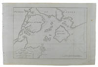
1749ref. 136795Paris. circa1749. Black and white engraved map of Quanzhou and Zhangzhou 21.1 x 30 cm here spelled Chin-chew and Chang-chew and both final words with added superscript "ou" on watermarked laid paper 25.6 x 38 cm original folds a few marginal spots simplified compass rose and a decorative fleur de lis bottom right in very good condition. Attractive map including the estuary of Quanzhou River Xiamen Emowi and Kinmen or Quemoy Quemowi island. The map was designed by the eminent French cartographer Jacques-Nicolas Bellin and here published as plate No. 22 in the impressive 15 volume compilation of voyages "Histoire Generale des Voyages" by Antoine François Prévost. . unknown
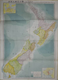
1572ref. 154080Tokyo: 統制社Tosei-sha. 昭和18 Showa1943. Folding colour map of New Zealand with inset of Auckland and Wellington top and bottom corners1:2000000 scale little light browning. Original envelope worn with closed tears. 54 x 76.5cm. Good copy. Scale plan of New Zealand printed by Tosei in 1943. The map legend shows infrastructure deemed important to the Land Survey Bureau of the General Staff Headquaters of the Imperial Japanese army such as boundaries powerlines quarries and mines; railroads sea-routes etc. . 統制社(Tosei-sha) unknown
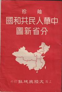
1952ref. 215851大陸輿地社. 1952. Charming pocket size atlas with double page coloured map showing China as a whole and the provinces with inset maps of special geographical features and a description of key information about each province vertical text. Text in traditional Chinese characters names on map read from right to left or vertically. Light wear little light browning but maps very clean and bright very good condition 14.5 x 9.8cm. . 大陸輿地社. unknown
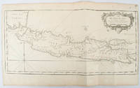
1750ref. 136782circa1750. Black and white copperplate engraving map of Java a little light even browning neat colour pencil highlighting of rivers and two settlements. Folded as issued. Good copy. 26 x 44cm. Issued in Prevost's Histoire Générale des Voyages ou nouvelle collection de toutes les relations de voyages par mer et par terre. . unknown
ref. 1886705445.Gmap. Good. Access codes and supplements are not guaranteed with used items. May be an ex-library book. unknown
ref. DADAX0313249636New unknown
ref. SONG0080449441Used: Good unknown
ref. SONG0712349189Used: Good unknown
2008ref. SBBIH-7MPYQLS6RK3CPhilip's 2008. hardcover. Acceptable. Please see the condition note after this for details if this is missing please consider Acceptable to mean poor quality that could include major staining water damage writing missing dustjacket etc etc. Our books are dispatched from a Yorkshire former cotton mill. We list via barcode/ISBN so please note that the images are stock images and may not be the exact copy you receive furthermore the details about edition and year might not be accurate as many publishers reuse the same ISBN for multiple editions and as we simply scan a barcode or enter an ISBN we do not check the validity of the edition data when listing. If you're looking for an exact edition please don't order at least not without checking with us first although we don't always have time to check. We aim to dispatch prompty the service used will depend on order value and book size. We can ship to most countries see our shipping policies. Payment is via Abe only. Philip's hardcover
2008ref. SBBIH-XL4NKQUGZS7WPhilip's 2008. hardcover. Good. Our good condition books are generally good for reading but not for gifting or collecting. They could have imperfections such as creasing fanning inscriptions margin notes yellowing staining on edge or cover or pages bumps scuffs etc etc sometimes multiple of these. It's a wide category that encompasses anything that isn't almost-new down to anything that is slightly better than poor. We would NOT recommend gifting Good books - these should be considered reading copies. Our books are dispatched from a Yorkshire former cotton mill. We list via barcode/ISBN so please note that the images are stock images and may not be the exact copy you receive furthermore the details about edition and year might not be accurate as many publishers reuse the same ISBN for multiple editions and as we simply scan a barcode or enter an ISBN we do not check the validity of the edition data when listing. If you're looking for an exact edition please don't order at least not without checking with us first although we don't always have time to check. We aim to dispatch prompty the service used will depend on order value and book size. We can ship to most countries see our shipping policies. Payment is via Abe only. Philip's hardcover
ref. DADAX0823220079New unknown
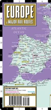
2008ref. Q-1886705305Streetwise Maps 2008-12-27. Map. New. In shrink wrap. Looks like an interesting title! Streetwise Maps unknown
ref. Erik van Mingroot and EduNot in perfect condition. unknown
ref. 1845878795.Gpaperback. Good. Access codes and supplements are not guaranteed with used items. May be an ex-library book. paperback
ref. 1875992154.Gpaperback. Good. Access codes and supplements are not guaranteed with used items. May be an ex-library book. paperback
1963Ten issues in offwhite printed wraps; approx. 40-60p per issue, b&w illus., maps ; 25 cm Offerd as a lot only. Includes Number 5 Printed Maps of Tasmania ; No.16 Dictionary of Mapmakers Part I ; No. 32 French Explorer Maps of New Zealand; No. 39 Comparative Cartography ; No. 40 Dictionary of Mapmakers Part III; No. 44 Printed Maps of New South Wales, 1773-1873 ; No. 45 Smith's Virginai and its Derivatives ; No. 68 Printed Maps of America Part 1 by Tooley ; No. 69 Printed Maps of Amerca Part II by Tooley; No. 80 Printed Maps of America Part III by Tooley. || Cartography; Maps. Maps -- Bibliography. Cartes -- Collectionneurs et collections. Maps, Cartas; Bibliography.
2009New English Paperback. Folio. (42 x 30 cm). In English and Turkish. [96] p., color maps. Çanakkale tahkimat haritasi. [= Fortifications maps of Gallipoli War]. Edited by Ahmet Tetik, Ayse Seven.
1998ref. Q-0881309206Thomas Brothers Maps 1998-03-01. Paperback. New. In shrink wrap. Looks like an interesting title! Thomas Brothers Maps paperback