LEIRIS Michel; DELANGE Jacqueline:Livre Rare Book

12,176 results
1967ref. 9730Paris, Gallimard, coll. L'univers des formes, 1967. In-4 de [12]-447-[10] pages, pleine toile rouge avec titre doré au dos et au premier plat, jaquette photographique couleurs. Minimes accrocs en bords de jaquette, pour le reste en parfaite condition.
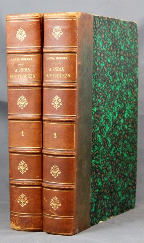
1886ref. 2149Lisboa, Imprensa Nacional, 1886. 2 vol. in-8 de XXVII-281 + XII-313-[2] pages, demi-basane marron, dos à nerfs orné de filet et fleurons dorés. Dos passés, quelques griffures aux dos, coiffes épiderméess rousseurs.
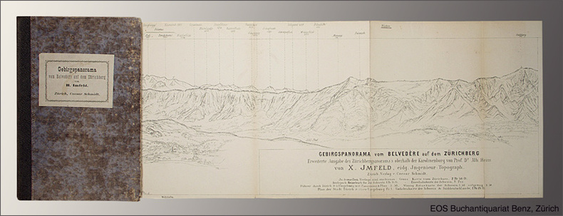
1877ref. 1544AGZürich, Caesar Schmidt, o.J. (1877). Gef. Federlithographie (Leporello) in Halbleinenumschlag (8°). Bildformat: 16,8 x 167 cm. Blattformat: 19,1 x 168 cm. (Einbanddeckel stärker berieben und bestossen).
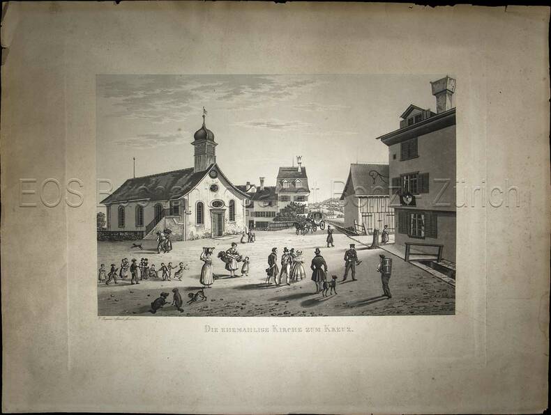
1838ref. 845CG(1838). Aquatinta, gezeichnet und gestochen von Johann Jakob Sperli d. Ä. Blattgrösse: 40 x 53 cm. Plattengrösse: 31 x 40 cm. Bildausschnitt: 23,2 x 34,5 cm.
ref. 2721PHOTOTYPE BERTHAUD , sans date ( 1870 environ ) , recueil de 35 cartes , trés bon état de consevation des cartes de format 30 x 60 cm environ
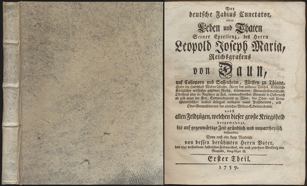
1759ref. 62498CBs.l., 1759-1760. 4°. 21,5 x 17,5 cm. 4 Blatt, 182 Seiten, 3 Blatt, 86 Seiten. Insgesamt 6 Tafeln (inklusive Frontispize). Späterer Pergmanentband im Stile der Zeit auf drei Bünden mit Rundum-Rotschnitt. [2 Warenabbildungen]
1771ref. 27423Paris Lattré 1771 4 cartes anciennes colorées d'époque en vert , rouge et jaune, cartouche non coloré, gravée par Arrivet. Format total : 50 centimètres de haut par 39 centimètres de large, 1771 Paris Lattré Editeur,
1772ref. PHO-1360Paris , Saillant & Nyon, 1772 , 2 volumes in-8 (195x130) relié demi toile moderne sous emboîtages , dos lisse avec pièces de titre , auteur et tomaison , initiale en pied , 2ff. xliii , 336pp-2ff.453pp,1ff-1ff. , sans les cartes et planches, ex-libris (famille Kerchove).
1861ref. 16650Lisboa Typographia do Futuro 1861 in-16 de 20 pp. br., couverture inf. rose conservée
ref. 8964Carte générale de l’Egypte et de l’Arabie Pétrée par H. BRUE géographe Paris Mais 1822. Format 560 x 435mm dépliée, entoilée. 140 x 225mm pliée. Carte de la Sénégambie du Soudan et de la Guinée septentrionale par A. BRUE 1822. 560x440mm entoilée. Carte générale des états du nord de l’Afrique de la méditerranée et de l’Europe par A. BRUE 1828. 570x435mm. Entoilée. Carte comparée des régences d’Alger et de Tunis dressée par le chevalier LAPIE Paris 1828 765x565mm. Carte générale de l’Egypte et de la Nubie dressée par Frédéric CAILLIAUD 1827. 700x440mm, entoilée. Tunisie 760x540mm. L’ensemble dans un étui cartonné, Titre et fers dorés (trace d’une petite mouillure en pied, sans gravité.)
1824ref. 27501824 Etienne Ledoux Libraire Editeur, Paris, 1824. 6 volumes in-12, reliure plein veau marbré, dos lisse orné de frises et de dentelles en queue, pièces de titre et tomaison maroquin rouge, plats ornés de filets et dentelles en encadrement, dentelles intérieures et tranches jaspées, orné de 100 cartes coloriées ou vues de ville en noir hors-texte par A.M. Perrot, gravées par Blanchard, 279, 263, 303, 241, 246 et 238 pages. Rousseurs, néanmoins bel exemplaire.
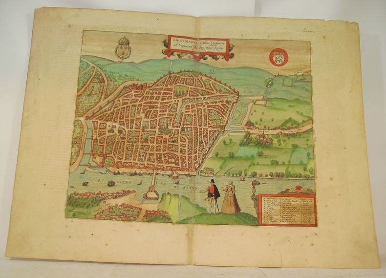
ref. 16633Cologne, circa 1590. Gravure à belles marges (40 x 54 cm), rehaussée en couleurs avec texte en latin au dos.
1598Carta tratta dalla prima edizione della Cosmographia Universalis di Paulus Merula, stampata ad Amsterdam nel 1605. Le mappe usate per illustrare la prima edizione della Cosmografia di Merula sono realizzate nel 1598 da Jodocus Hondius e Pieter Van den Keere (Kaerius) e quindi utilizzate dall'editore Cornelis Claesz per illustrare lavori di Apian, Linschoten e Merula. Incisione in rame, inserita in una pagina di testo, in perfette condizioni. Map of the World from the first edition of Cosmographia Universalis by Paul Merula, printed in Amsterdam in 1605.The map was first issued in 1598 by Cornelis Claesz and engraved and realized by Jodocus Hondius and Pietre vand den Keere (Kaerius). Claesz used the plate to illustrate various works he published by Peter Apian, Jan van Linschoten, Paul Merula and others. Copperplate, inset in a page text, very good conditions. King, Miniature Maps, pp. 80/81.
1741ref. PHO-2241Amsterdam, chez Jean Catuffe, 1741-43, 3 vol. in-12(170x100mm), 2ffnch., xiii-5ffnch(table) 428pp -1ffnch ,8ffnch – 262pp, 10ffnch-320pp., relié plein veau époque, dos à nerfs ornés avec pièce de titre et tomaison, tome 1 reliure différente. Coins usés, coiffes arasées avec petit manque au dos tome 2, mouillure claire en marge (T1), en coin (T2), page de titre presque détachée (T2), ex-libris manuscrit au tome 1 « Duplat de Monticourt »
1745ref. 21113A Paris, chez l'auteur, 1745. Dimensions : 618 x 498 (cuvette) + passe-partout + cadre.
1817ref. 11715AB1817. Vienna Geistinger 1817. 71 : 148 cm. Manyfolded contemporary coloured engraving. Contemporary mounted on linen. Interesting historical map giving an broad overview of the development of the history from ancient times until the 18th century. Friedrich Strass 1766-1846 was a teacher at the monastery of Berge near Magdeburg. His "Strom der Zeiten" got a great populariety and was admired also from the foreign countries. - As mostly browned. unknown
1763Pianta topografica delle vestigia dell'antica Roma, a proiezione e figurazione verticale, pubblicata nel 1763 nell'opera di Ridolfino Venuti "Accurata, e succinta descrizione topografica delle antichità di Roma".Incisa da Niccolò Mogalli e Giovanni Petroschi, su disegno di R. Venuti.Le indicazioni toponomastiche in parte sono riportate nella pianta, in parte in una rubrica di 77 numeri posta ai lati. In basso, a destra, la firma degli incisori. La seconda edizione della lastra, reca la data 1823.Incisione su rame, in ottimo stato di conservazione. Pianta topografica delle vestigia dell'antica Roma, a proiezione e figurazione verticale, pubblicata nel 1763 nell'opera di Ridolfino Venuti "Accurata, e succinta descrizione topografica delle antichità di Roma".Incisa da Niccolò Mogalli e Giovanni Petroschi, su disegno di R. Venuti.Le indicazioni toponomastiche in parte sono riportate nella pianta, in parte in una rubrica di 77 numeri posta ai lati. In basso, a destra, la firma degli incisori. La seconda edizione della lastra, reca la data 1823.Incisione su rame, in ottimo stato di conservazione. Frutaz, Le piante di Roma, XXXVIII; L. Schudt, Le guide di Roma, p. 405, n. 769; Caldana (2013): p. 107, n. I.64.
1789Carta tratta dalla rara raccolta di carte geografiche denominata Atlante Geografico, prima stesura delle opera dell’abate Bartolomeo Borghi, pubblicata in Siena dal Pazzini Carli. Molte delle carte, datate tra il 1788 ed il 1800, sono incise da Agostino Costa e poi successivamente inserite nell’opera Atlante generale dell'ab. Bartolommeo Borghi, pubblicato a Firenze nel 1819.Bartolomeo Borghi, che Vermiglioli (Biografia degli scrittori perugini, 1829) definisce "uno dei migliori geografi dell'Europa", nacque nel 1750 a Monte del Lago, piccola frazione del comune di Magione, in provincia di Perugia, sulle rive del Trasimeno. Ordinato sacerdote nel 1774, trascorse i primi anni del suo mandato nel paese natale, poi a Magione e quindi a Sorbello (Cortona).Appassionato studioso di geografia, applicò dapprima le sue conoscenze all'analisi delle terre a lui più familiari: nel 1770 scrisse Descrizione geografica, fisica e naturale del Lago Trasimeno (che sarà tuttavia data alle stampe per la prima volta solo nel 1821), e nel 1791 pubblicò negli atti dell'Accademia etrusca di Cortona una Dissertazione sopra l'antica geografia dell'Etruria, Umbria e Piceno, arricchendo entrambe le opere di una carta delle regioni descritte. Intanto la sua fama di cartografo, oltre che di geografo, cresceva, tanto da fargli ottenere le nomine a membro delle Accademie Cortonese e Reale di Firenze, e procurargli l'incarico, da parte di Pietro Leopoldo, di delineare la carta del catasto pubblico di Cortona e del contado di Castiglione.Nello stesso tempo gli orizzonti geografici della sua attività si allargavano sensibilmente, e se nell'Atlante Novissimo, illustrato ed accresciuto sulle osservazioni, e scoperte fatte dai più celebri e più recenti cartografi di Antonio Zatta (Venezia 1779-1785) il suo contributo fu ancora legato all'area toscana, nell'Atlante geografico che si pubblicò a Siena da Pazzini Carli tra il 1798 ed il 1800 il Borghi tracciò la maggior parte delle carte e spaziò dalle province del Sud-Est dell'Inghilterra, al Regno di Danimarca, alla Romania. Una sorta di prova generale, quest'ultima, della sua opera più importante, quell'Atlante generale dell'ab. Bartolommeo Borghi, pubblicato a Firenze nel 1819. L'Atlante, corredato da brevi descrizioni storiche, politiche, civili e naturali che introducono le carte relative ai territori afferenti a ciascun Impero o Regno illustrato, rispecchia il nuovo assetto geo-politico attuato dal Congresso di Vienna. Incisione in rame, in buone condizioni. Due fogli da 330x250mm. Map taken form the very rare Atlante Geografico, the first draft of the abbot Bartolomeo Borghi, published in Siena by Pazzini Carli. Many of the mapss, dated between 1788 and 1800, are engraved by Agostino Costa and then later incorporated in the Atlante Generale di Bartolomeo Borghi, published in Florence in 1819.Bartolomeo Borghi, who Vermiglioli (Biography of writers Perugini, 1829) calls "one of the best geographers of Europe", was born in 1750 in Monte del Lago, a small fraction of the town of Mansfield, in the province of Perugia, on the shores of Lake Trasimeno. Ordained in 1774, spent the first years of his term in his hometown, then to Mansfield and then Sorbello (Cortona).A passionate student of geography, first applied his knowledge to the analysis of land more familiar to him: Cortona and Tuscany. Meanwhile, his fame as a cartographer, as well as a geographer, was growing, so that he get the nomination as a member of the Royal Academies of Florence and Cortona, and give him the job, by Pietro Leopoldo, to outline the map's of the public land Cortona and the county of Castiglione.At the same time the geographical horizons of its activities widened considerably, and if in the Atlas Novissimo, illustrated and amplified the observations and discoveries made by the most recent and most famous cartographer Antonio Zatta (Venice 1779-1785) his contribution was still related area of Tuscany, in the Atlas geographic monthly published in Siena by Pazzini Carli between 1798 and 1800 the villages drew most of the maps and spaced from the provinces of South-East of England, the Kingdom of Denmark, Romania.A sort of dress rehearsal, the latter, his most important work, the Atlante General of AB. Bartolomeo Borghi, published in Florence in 1819. The Atlas, accompanied by brief descriptions of historical, political, civil and natural to introduce the papers relating to the territories belonging to each United Empire or illustrated, reflects the new geo-political structure implemented by the Congress of Vienna.Two sheets of 330x250mm.
17501 carte sous encadrement verre et bois au format 76 x 65 cm (format du cadre), le format apparent de la carte, sous marie-louise, est de 61 x 50,5 cm, frontières rehaussée en couleur, 1750 Bel état pour cette belle carte ancienne de Terre Sainte, déjà encadrée. A saisir. Français
ref. 12034DBo.J. Peter Schenk der Jüngere, geboren am 15. Februar 1693 in Amsterdam, gestorben am 14. Januar 1775 ebenda. Deutscher Kupferstecher und Kartenverleger, der als bedeutendster Verleger sächsischer Spezialkarten in der ersten Hälfte des 18. Jahrhunderts gilt. [4 Warenabbildungen]
1601Carta geografica del mondo nella classica rappresentazione dei due emisferi, tratta dall'Epitome Theatri Orteliani, edizione latina del 1601. Il Vrients, nel 1601, acquisisce da Ortelius le lastre dell’Epitome, ripubblicandola con qualche variante, includendo questa nuova carta del mondo. Incisione in rame, in ottimo stato di conservazione. Double hemisphere world map, from Epitome Theatri Orteliani, latin edition.In 1601 the plates for Ortelius’ Epitome were acquired to be printed by Jan Baptiste Vrients, which he did with small changes. The miniature oval world map introduced in 1588 was retained and an additional small double hemispherical world map introduced. Copperplate, in excellent conditions. Rare. Shirley, The Mapping of the World, 231.
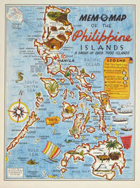
1945ref. 204557U.S.A.: Mem-O-Map Co. 1945. Colour pictographic / pictorial map 32.1 x 23.8 cms; 35.4 x 26.6 cms sheet very good condition. Rare pictorial map published in 1945 by John G. Drury aTechnical Officer who served with the 214th Ordnance Battalion to mark the end of World War II as souvenirs for the military. Military personnel could fill in banners "came in on good ship." and "departed on good ship." their name organisation and "Line of Advance or movement" blank in this example. Pictographs mark various memorable spots and wildlife including larger-than-life insects. A "Terrible Tillie Typhoon" looms over the coast at Luzon. Drury published a series of five maps: Philippines and Okinawa in 1945; Japan and Korea Oahu and Europe in 1946. They are all scarce. “These almost whimsical maps are designed to support the creation of personalised geographies. At a time when digital mapping is beginning to experiment with the creation of personalised content that would render the same map in different ways for different users Mem-O-Maps demonstrate the principle in action." Kenneth Field ICA Commission on Map Design. . Mem-O-Map Co. unknown
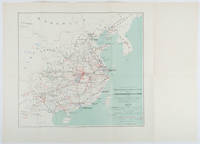
1898ref. 214719Paris.: Erhard Frères. 1898. Lithographed folding colour map 44.5 x 49.5 cms; 54.6 x 76.3 cms sheet towns and cities items of production and trade routes highlighted in red original folds in very good clean condition. Detailed map prepared for the Lyon Chamber of Commerce Mission to China under the direction of a young Henri Brenier 1867-1962 with the purpose of advancing French colonial expansion and shoring up the interests of the dominant Lyon silk trade. The map shows the principal centres of population production waterways roads telegraph lines and railroads togther with the centres of production and distribution for coal iron tin gold and silver opium tea rice sugar peanuts cinnamon wool medicinal plants and leather. The trade mission was organized following the Treaty of Shimonoseki and the end of the Sino-Japanese War: the Chamber of Commerce of Lyon understood that end of this war would signal a profound economic development and change. . Erhard Frères hardcover
1679ref. 78821[Paris, A. Dezailler, 1679]. 28,5 x 36,5. Unter Passepartout.
1948ref. 055564Division Of Mines Department Of Natural Resources State Of California 1948. 1st Edition 2nd Printing. Hardcover. Near Fine. Xvi 773 Pp; Errata On Last Page; Folding Map In Pocket At Rear. Brown Cloth. Stated Second Printing With Errata At Rear. Near Fine No Marks. With Folding Map In Pocket At Rear In Fine Condition. When They Pump The Oil And Gas Out The Land Sinks But The Producers Are Then Far Away. Division Of Mines, Department Of Natural Resources, State Of California hardcover