Staff, Tinsel Road,Biblio.com

4.945 resultados
ref. 7780456like new. unknown
ref. DADAX0268040125New unknown
ref. 3659040789.Gpaperback. Good. Access codes and supplements are not guaranteed with used items. May be an ex-library book. paperback
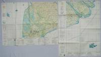
1967ref. 203840Washington D.C.: Army Map Service. 1967. Two printed colour adjoining maps 73 x 55.6 cms and 55.6 x 73 cm original folds inked operational annotations to the Quan Long sheet multiple marginal legends noting aerodromes and radio facilities roads railroads and boundaries glossary of terms much of the text is in both English and Vietnamese in very good condition. Detailed U. S. Army maps of the Mekong Delta and Southern Vietnam extending from Rach Gia in the north to the area just south of Quan Long Ca Mau in the south and east including BacLieu and CanTho. The island of Con son is at lower right of the Khanh Hu'ng sheet. Operational notes are inked around Quan Long are marked and the U Minh Forest the impenetrable "forest of darkness" is noted in ink. . . Army Map Service. unknown
ref. DADAX0226263231New unknown
ref. 3841757111.Gpaperback. Good. Access codes and supplements are not guaranteed with used items. May be an ex-library book. paperback
ref. DADAX0520369319New unknown
ref. DADAX0520291387New unknown
2019ref. 2-6200012008Editorial Académica Española 2019. Paperback. New. 244 pages. Spanish language. 8.66x5.91x0.55 inches. Editorial Académica Española paperback
ref. DADAX0520286448New unknown
ref. DADAX0199791511New unknown
2010ref. DADAX1849963959Springer 2010-09-20. 2010. hardcover. New. 6.14x0.63x9.21. Buy with confidence. Excellent Customer Service & Return policy. Springer hardcover
ref. DADAX0230319238New unknown
ref. DADAX0333749634New unknown
ref. DADAX0333920961New unknown
ref. DADAX0333920716New unknown
2010ref. 53686Grove Press Black Cat. Near Fine. 2010. First Edition; First Printing. Softcover. Softcover first edition stated with full number line. Inscribed/signed to the ffep by Solares with his doodle. Inner covers toned. Plastic protective cover. ; 5.3 X 1.3 X 8.1 inches; 436 pages; Signed by Author . Grove Press, Black Cat paperback
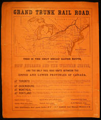
1857ref. 030223Philadelphia Pennsylvania: Printed By Henry B. Ashmead 1857. Single-sided broadside with a route map at top of the sheet text information on the various routes printed below. Produced for use in Colton's uncommon Advertising Atlas of America 1857; American companies used the publication as an advertising vehicle to promote their businesses. Approx. 15 1/2" x 18 1/4" overall size; printed black on pale orange polished-paper heavy stock. Some edge tips wear and overall dustiness & soiling; edges with closed tears that have old tissue repairs on the reverse; in good condition. . Broadside. Broadside. Good. Printed By Henry B. Ashmead
1920ref. 63120Chicago: White Pass & Yukon Route Rathbun-Grant-Heller Co. ca. 1920. 8vo. 4 x 9 in. 16 pp. in 46 2 triple-column format on 9 x 12 in. sheets with numerous photo illustrations double-column route map w/ White & Pass & Yukon line logo. Self-printed softcovers beautiful cover art of Alaskan Native Americans in canoe watching a Yukon River steamer minor shelfwear some rubbing still VG copy. First edition thus of this very scarce travel brochure detailing the trip by steamship and railroad along the White Pass & Yukon Route from Skagway Alaska through Ketchikan Atlin Lake district and through the Skagway Valley to Dawson City on the Yukon River Yukon Territory. White Pass & Yukon Route, Rathbun-Grant-Heller Co., paperback
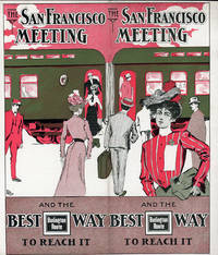
1901ref. 51617N.P.: Privately printed 1901. 1901. 9 1/4" x 8" in clorful pictorial wrapper folded at center. 12 pp. Illustrations. Schedule. Overview of San Francisco along with information on its climate Chinatown The Cliff House Golden Gate Park Sutro Baths and Museum Nob Hill and side trips from San Francisco to include brief information on Monterey San Jose Paciic Grove Lake Tahoe Los Angeles etc. Information on the Burlington Route train and its railroad cars. Finally a schedule for the trip from Omaha .by way of Denver and Salt Lake City and onto San Francisco. Light soiling and light wear to the extremities. Very good. Privately printed, 1901. unknown
1894ref. 57598San Francisco CA: Standard Asphalt Company of California Printed by Bosqui Printing & Engraving Co. 1894. 8vo. 8 pp unpaginated. printed in red & black. Black printed softcovers white lettering front cover company logo illust. on back cover minor shelfwear slight rubbing very slight chip to upper right corner still VG copy. First edition of this scarce promotional brochure by this pioneering California oil and mining company initially drawing upon petroleum and asphalt mines near Bakersfield California by the late 1880’s. They had originally drawn upon deposits in Asphalto and Hazleton but later these were played out due to high production costs to refine out the clay but later the company made a large discovery in 1893 just prior to the publication of this promotional piece touting 79% level of bitumen and production of asphalt vital for use in lacquers paints and road construction. Worldcat locates 1 copy UC Berkeley; See: Asphaltum Mineral Resources of the United States 1893-1894 1895 pp. 633-634; Asphaltum Standard Asphalt Company of California Los Angeles Herald April 5 1891 p. 6. Standard Asphalt Company of California, Printed by Bosqui Printing & Engraving Co., paperback
ref. 3001Trenton: The Company; Press of the Emporium 1846. . 8vo self-wrappers side-stitched Not found in OCLC. Trenton: [The Company]; Press of the Emporium, 1846. unknown
ref. 3001Trenton: The Company; Press of the Emporium 1846. . 8vo self-wrappers side-stitched Not found in OCLC. Trenton: [The Company]; Press of the Emporium, 1846. unknown books
1900ref. 60562Buffalo NY: Kellogg Iron Works ca. 1900. Oblong 8vo. 9.5 x 6 in. 16 pp unpaginated. printed photo plate followed by plates of elevations and bridge plans. Original gray printed softcovers black lettering front cover minor corner chip to first page couple closed tears w/ minor repairs dustsoiling to fore-edges still a VG- copy. First edition of this exceedingly scarce catalogue of touting “Kellogg”truss bridges which consisted of Pratt inner bracing with additional diagonals and were popular in the Northeast at the end of the 1800’s until about 1901-1905 spanning between 75 to 150 feet. These types of bridges played a crucial role in road building driven by the Good Roads Movement during the opening decades of the 20th century. At the end of the 19th century less than 50% of roads within American cities were paved and the very few highways and turnpikes connecting cities and towns were little more than crushed rock macadam dirt roads or even paths. Although founded in the 1880s by bicycling enthusiasts the Good Roads Movement at the beginning of the 20th century began to be driven largely by advocates of the automobile who favored sturdy durable bridges which could be easily maintained. These Kellogg truss bridges featured riveted steel trusses and were often anchored in stone foundations. Charles H. Kellogg the elder was an active bridge engineer and builder whose firm wen through several different configurations and owners between 1870-1915 while his son Charles H. Kellogg the younger operated his own company from 1891-1901 and should not be confused with the short-lived Kellogg Iron Bridge Works Co. which was using the Union Bridge Company’s shop. No copies in Worldcat; See: Mead & Hunt Contextual Study of New York State’s Pre-1961 Bridges pp. 23 & 93 1999. Kellogg Iron Works, paperback
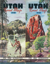
1939ref. 46819Denver: Smith-Brooks Press 1939. 1939. PICTORIAL MAP. 28" x 22 3/4" sheet folded to 36 panels. 18 panels offers a road map of Utah and with legend. Index to cities and towns as well as populations shown on borders. Inset at foot of sheet is a listing of historical markers. Opposite 18 panels offers 2 colorful cover panels a 2-panel black and white map showing paved and graded roads in the western U.S. and a 22 1/2" x 14" color pictorial map of the state and with a listing of and a bit of information on "Outstanding Scenic and Recreational Attractions" each of which are highlighted on the pictorial map. Light wear to edges and folds. Very good. [Smith-Brooks Press], 1939. unknown