4.945 resultados
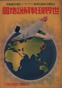
1937ref. 208633大阪朝日新聞社. Osaka Asahi Shinbunsha. Showa 12 1937. 10 colour maps not including insets or sketch maps in text on 12 pages. Handsome world map features as the centre fold colour pictorial paper wrappers. A little light soiling and horizontal crease wrappers. An attractive atlas. 38 x 26.7cm. A large format atlas with six pages of coloured maps showing the nations of the world and five pages of Japanese text. The publication seems to have been produced to celebrate the 1937 world record flight from Tokyo to London by Iinuma Masaaki and Tsugayoshi Kenji in their plane 'Kamikaze' which was sponsored by the Asahi Newspaper. The front cover depicts the plane soaring over a map of the world while the back cover also had a colour image of the 'Kamikaze' with an advertisement for the Oji Paper Company which we are told donated a hundred million yen to support the flight. The name 'Kamikaze" had at that stage not yet taken on the connotations which it acquired during the Pacific War. The maps inside the volume show political boundaries major cities and transport routes. The opening pages show the Japanese Empire including Japan proper Korea Karufuto and Manchukuo with small insets covering Taiwan the Chishima Archipelago and Japan's South Sea mandate. The accompanying text focuses on Japan's newly acquired client state of Manchukuo detailing its area population principle products etc while the map includes graphs illustrating Japan's trade with the world and with Manchukuo. China receives an entry of its own with a map of the Chinese Republic and information on the political situation population trade and infrastructure. The central pages of the volume are taken up with a double-spread map of the world including depictions of the flags of a selection of the world's nations. Other sections of the work cover Asia Europe America Africa and Oceania grouped together. The discussion of Oceania includes a section on Hawaii and some small and improbable depictions of Maori and Indigenous Australians. . 大阪朝日新聞社. [Osaka Asahi Shinbunsha]. unknown
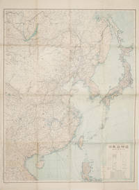
1419ref. 160524Tokyo.: 大日本帝國陸地測量部. 昭和14 1939. Large colour folding Japanese WWII map. Scale 1:5000000 featuring Japan Korea Taiwan Karafuto Eastern China parts of French Indochina and the Northern Philippines US colony in detail. Legend includes territorial boundaries national and regional and shows some borders as unclear i.e. Taiwan and bordering region along Northeast China the Soviet Union and Mongolia air routes submarine communication cables linking major costal cities i.e. Hong Kong Xiamen Shanghai Nagasaki etc. airports radio stations mining fields and more. A small chart shows the names of mountains rivers and lakes also included adjacent to legend. Some small holes at folds creases and some minor loss edges generally very good. Text in Japanese. 109 x 77.8cm. . 大日本帝國陸地測量部. unknown
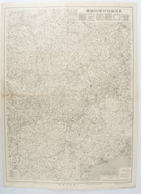
1572ref. 172829大阪. Osaka.: 大阪毎日新聞社. Osaka Mainichi Shinbunsha. 昭和 13 1938. Black and white map folded showing Hankow one of the three cities which merged to become Wuhan 54.5 x 49cm scale 1:2000000. Some light browning tiny closed tear upper margin neatly repaired with conservation standard tape. Good copy. This Hankow/Hankou War Situation Map is a supplement map of Osaka Mainichi Newspaper on 25 August 1938. The two inset maps show the region around Nanjing and Hong Kong. It gives detailed place names of Hankow area. . 大阪毎日新聞社. [Osaka Mainichi Shinbunsha]. unknown
1819ref. 162103Tokyo.: Tōseisha. Showa 18 1943. Folding colour map of Australia 54.2 x 76.4cm. Some foxing particularly along folds and upper right margins a few repaired tears and small holes at folds.With original sleeve. The 15th map in the Standard Maps of Greater East Asia series of 20 maps. Shows the natural resources such as sheep gold pearl diary regions opals etc. Tasmania appears as an inset in the bottom right corner. Text in Japanese. . Tōseisha. unknown
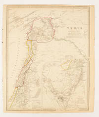
1843ref. 174934London.: Chapman & Hall. 1843. Engraved map with outline hand colour 39.4 x 31.4 cm inset map "Continuation from the Dead Sea to Mount Sinai" with finely engraved notes and a key to the Divisions under control of the Turkish Government manuscript pagination in an early hand to the top right edge tear nicks and browning but in very good condition. A most attractive map with detailed notes published when Syria was still under control of the Ottoman Empire. . Chapman & Hall. unknown
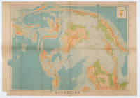
1572ref. 160533Tokyo.: 日本名所圖繪社.Nihon Meisho Zuesha. 昭和 17 1942. Folding Japanese coloured map of the Malay Archipelago and Thailand during World War II scale 1:8500000. Legend in lower corner indicates altitudes. Ink annotation in Japanese left edge. Pin holes at three corners upper right corner torn with loss evenly browned otherwise very good. Text in Japanese and English. 52.8 x 75.6cm. This map shows most of Thailand former Indochina Hainan Province and South China Sea Sumatra and Java Sea Borneo the Philippine Islands Celebes Timor New Guinea and parts of Micronesia. Natural resources such as tobacco spices wood sugar metal mines tin iron and etc. rice and other resources are indicated on the map. . 日本名所圖繪社.[Nihon Meisho Zuesha]. unknown
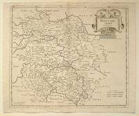
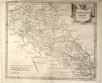
ref. 64216London.: Gibson. Early 18th Century. Black and white map from Camden's Britannia showing towns roads rivers and landforms 38 x 46.5 cm. . [Gibson.] unknown
ref. 64139London.: Gibson. Early 18th Century. Engraved map on watermarked paper central fold 38 x 46.5 cm decorative title cartouche towns roads rivers and landforms shown; from Gibson's edition of Camden's Britannia upper edge trimmed by the original binder causing minor loss to the border at the inner edge but in very good condition. . [Gibson.] unknown
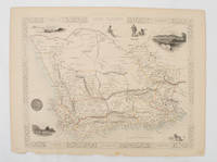
1851ref. 174666London.: Tallis John. 1851. Lithographed map 24.2 x 32 cm districts picked out in original hand colour inset vignette illustrations decorative border lower margin ragged but the attractive map in very good condition. Attractive decorative map from "Tallis's illustrated atlas and modern history of the world." one of the last great illustrated series of world maps. The fine vignettes are of Cape Town Graham Town and entrance to the Knysha Heads. . (Tallis, John). unknown
ref. 847039505X.Gpaperback. Good. Access codes and supplements are not guaranteed with used items. May be an ex-library book. paperback
2019ref. 2-6200050147Editorial Académica Española 2019. Paperback. New. 344 pages. Spanish language. 8.66x5.91x0.78 inches. Editorial Académica Española paperback
2008Paperback Like New. Ships from publishers directly. Pls. allow a minimum of 4 - 6 weeks delivery time as this is a new book.
ref. 3846576557.Gpaperback. Good. Access codes and supplements are not guaranteed with used items. May be an ex-library book. paperback
ref. 35885887like new. unknown
2010ref. DADAX1793601631Lexington Books 2020-10-19. hardcover. New. 6.25x0.95x9.04. Buy with confidence. Excellent Customer Service & Return policy. Lexington Books hardcover
19878vo., First Edition, with numerous photographs throughout; laminated pictorial boards, a near fine copy. VERY SCARCE, ESPECIALLY IN THIS CONDITION.
ref. A9780443184130Hardback. New. hardcover
197263 pages. Includes two-page black and white illustration of Janis. Songs include: All is Loneliness; By, Bye Baby; Down on Me; Ego Rock; Flower in the Sun; Half Moon (Seven Song); Kozmic Blues; Move Over; Road Block; Summertime; Try (Just a Little Bit Harder). Somewhat above-average but not excessive wear. Binding intact. A sound copy of this vintage compilation. Book
1889ref. 1933PRIMERA EDICION.- Barcelona: Imp. Henrich y Cia. 1889.- XIII276 p.; en 4º. 23 cm.- Interesantes biografías americanas: Santiago Liniers; Félix Frías amplio estudio biográfico; Mi padre; El Tte. General Pedernera; Domingo Sarmiento.- CONTINUA EN EL MISMO VOLUMEN: ESTRADA Santiago.- Discursos / Precedidos de una introducción de D. Santiago Liniers.- Barcelona: Imp. Henrich y Cia. 1889.- XV327 p. 1 h.; 4º 23 cm.; Las 2 obras encuadernadas en un solo volumen en Media Piel de la época.- RARO. El lomo restaurado de un desgarro en la cabeza y algunas pequeñas rozaduras. En la portadilla lleva estampado un pequeño sello tampón del anterior propietario. Las portadas con mínimas y tenues motas de óxido. Dicho esto que es preceptivo el libro se encuentra por lo demás en muy buen estado. HISTORIA POLÃTICA Y DERECHO POLÃTICO-INTERNACIONAL AMERICANOS DESDE LA INDEPENDENCIA Libro en español Imp. Henrich y Cia. hardcover
ref. 9591In 12 à l’italienne, cartonné, dos toilé vert, plats cartonnés illustrés. Titre, 42 pages, (21 pages recto). 16 illustrations en couleurs, à pleine page pour la plupart, de A. FRANCK. L’auteur est représenté comme conducteur d’un rouleau compresseur –gravure 15. Envoi manuscrit autographe de l’auteur. Service typographique des armées alliées d’Orient 1918. Ce modeste album est dédié au service routier de la IIIème armée, l’armée de "Verdun" en souvenir de la "Voie Sacrée" qui nous mena à la victoire. Petites rousseurs, sans gravité en début et fin de volume.
ref. DADAX0521116244New unknown
ref. 849264382X.Gpaperback. Good. Access codes and supplements are not guaranteed with used items. May be an ex-library book. paperback
2012ref. DADAX3846576557Eae Editorial Academia Espanola 2012-08-02. paperback. New. 5.91x1.14x8.66. Buy with confidence. Excellent Customer Service & Return policy. Eae Editorial Academia Espanola paperback
2006ref. x-0313312141Greenwood Pub Group 2006. Hardcover. New. new title edition. 392 pages. 10.25x7.50x1.25 inches. Greenwood Pub Group hardcover
2023ref. x-0443184135Elsevier 2023. Hardcover. New. 240 pages. 10.00x7.00x0.55 inches. Elsevier hardcover