Photographs Drigh Road (TE Lawrence) T EBiblio.com
4,931 results
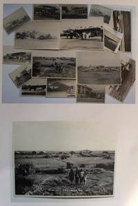
1930ref. 0559431930. Photographic Image. Very Good. No Binding. A collection of 15 black and white photographic prints 1 Drigh Road RAF camp 1921 8x6 ins; 2 ms note on the back " Imperial Airways machine crashed at Jack Persia Sept 1929 3 killed" 8x5 ins; 3 plane with personnel and buildings ms note "Long distance flight French Drigh Road 14/12/29"; 4 crashed plane ms note "First Wapiti crash Drigh Road 8x5 ins; 5 Farey-Napier monoplane; 6 Iris biplane on water 8x5 ins; 7 West Camp shops RAF Cranwell; 8 plane "Pride of Detroit" in hanger ms note Drigh Road air base Sept 4th 1927" 5x3 ins; 9 plane with ground crew and hangers ms note Drigh Road Sept 15th 1927"; 10 biplane GB-EKBU with onlookers ms note "first Moth to fly to India Leake & Stark 10.1.27 5x3 ins; 11 Blackburn Dart at Cranwell with 4 other photographs of Drigh and unidentified locations. All in very good condition. T.E. Shaw was at Drigh Base from 7.1.27 until 26.5.28. A nice collection. unknown
2026ref. x-1666969567Bloomsbury USA Academic 2026. Hardcover. New. 208 pages. 9.01x6.00x1.01 inches. Bloomsbury USA Academic hardcover
1964ref. 2407100220xbvkKyoto, Jimbunkagaku Kenkyusho Kyoto University, 1964. 889 (1) pages. - Publisher's gilt titled orange-colour cloth-binding in the publ. slipcase; 4to.(ca. 26 x 19 x 5 cm; ca. 2 kg.).
1965ref. 2407100221xbvkKyoto, Jimbunkagaku Kenkyusho Kyoto University, 1965. 20 p., pages 883-1.825 (1) pages. - Publisher's gilt titled orange-colour cloth-binding in the publ. slipcase; 4to.(ca. 26 x 19 x 5 cm; ca. 2 kg.).
1960ref. 2407100214xbvkKyoto, Jimbunkagaku Kenkyusho Kyoto University, 1954/1960. 120 (1) / 178 (1) pages. - Publisher's gilt titled orange-colour cloth-bindings in the publ. slipcases; 4to.(ca. 26 x 19 x 4 cm; ca. 2 kg.).
1960ref. 2407100218xbvkKyoto, Jimbunkagaku Kenkyusho Kyoto University, 1960. 887 (2) pages. - Publisher's gilt titled orange-colour cloth-binding in the publ. slipcase; 4to.(ca. 26 x 19 x 5 cm; ca. 2 kg.).
2026ref. x-1475874596Bloomsbury Publishing Plc 2026. Hardcover. New. 200 pages. 6.24x0.64x9.24 inches. Bloomsbury Publishing Plc hardcover
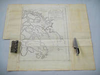
1749ref. 136781Paris. circa1749. Black and white engraved map on laid paper showing entrance to Pearl/Canton river Macao and the area which would become Hong Kong Sinn-gan-hien folded designed by the prominent French cartographer Jacques-Nicolas Bellin. This map is No. 16 Vol. 5 from the impressive 15-volume "Histoire Generale des Voyages" compiled by French novelist Antoine François Prévost. The walled city of Canton upper section is divided into areas of Tartar and Chinese. Some light even browning on paper added at margins good copy. Map measures 25.7 x 20.5. . unknown
ref. DADAX0415230179New unknown
ref. SONG1787112799Used: Good unknown
ref. ria9780198726456_inpHardcover. New. New Book; Fast Shipping from UK; Not signed; Not First Edition; Network theory is a major topic of interdisciplinary research which covers diverse areas including physics mathematics and sociology. This book covers all the basics and the most commonly used concepts in the field provides examples o hardcover
ref. 35885887-nnew. unknown
1862ref. 111032294Printed by R. & R. CLARK Edinburgh: PRINTED FOR PRIVATE CIRCULATION 1862. Book. Fair. Hardcover. First Edition. 12mo - over 6¾ - 7¾" tall. Age-toned cover with black border and chocolate endpapers gilt spine title and gilt - In Memoriam. 1862 at front cover center. Fair condition with partially re-glued inner spine to text block and old tape at the inside front. Some page sections have been moved slightly forward from the binding and there is a separation at the contents gutter. The cover is spotted and sunned with frays at the corners and the pages are lightly foxed. Whole page 1863 associated related inscription at the half-title page with a 1971 inscription below from another relative. Pasted picture of his wife opposite the title page. Civil War era book. 7 x 4 1/2 with 133 pages. Rare. PRINTED FOR PRIVATE CIRCULATION Hardcover
ref. DADAX1557987734New unknown
1935ref. K-2157M?nchen, Oscar Brunn Verlag, [um 1935]. Formatangabe ca 51 x 67 cm, gefaltet zu 20 Segmenten, Ausgabe: einf?rbig mit Wald- und Wasseraufdruck, farbige Skiroutenmarkierungen ; Zustand: Kartenblatt entlang Falzkanten stellenweise offen, Broschurvorderseite lose (Umschlag), sonst gut
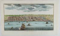
1750ref. 177186circa1750. Hand-coloured engraving 19.5 x 35.6 cm 25.5 x 41.6 cm sheet original folds two old paper repairs not affecting the image a trifle toned but in very good condition Attractive bird's-eye view town plan of Makassar in Sulawesi prepared for Abbé Prevost's monumental 'Histoire Générale des Voyages.' . unknown
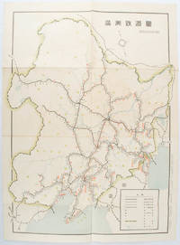
1519ref. 172590奉天. Mukuden.: 満鉄鉄道総局. Mantetsu Tetsudo Sokyoku. 昭和 15 1940. Colour folded map seven small very holes not affecting the printed image otherwise good. 53 x 38.5cm Map showing the comprehensive railway network in Manchuria with names of all the stations. It includes the lines run by the South Manchurian Railway Company their temporary industrial lines light rail as well as the lines run by other Russian and Chinese companies. By 1940 the network had expanded so much that it included almost the whole of Manchuria. . 満鉄鉄道総局. [Mantetsu Tetsudo Sokyoku]. unknown
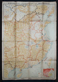
1938ref. 159295Tokyo: 大日本雄辯會講談社 Dainihon Yūbenkai Kōdansha. Shōwa 13. 1938. Two large detailed maps of China and on the reverse of the Soviet Union in Asia Manchuria and Mongolia printed double sided on a single large sheet. Issued as a supplement to Volume 14 Number 1 of the magazine Kingu on New Year's Day in 1938. Holes at a number of holes causing a small amount of loss some occasional browning some chipping on margins. The map has clearly been used but is still largely complete. The colourful map of China on a scale of 1:2600000 includes part of Manchukuo and Inner and Outer Mongolia on the north and part of French Indochina to the south-west. It shows East Hebei Autonomous Anti- Communist Council Jidong Fanggong Zizhi Zhengfu 冀東防共自治政府 south of Manchukuo which existed from late 1935 until February the 1st1938. The legend includes national and provincial borders cities roads railways sea and air routes and undersea cables. There is an inset map of East Asia titled "Present Situation of Far East" on the lower right corner which shows the areas under influence of Communism and those under influence of/controlled or colonised by the United Kingdom France Japan and China. The map on the reverse printed in blue and black shows the Asian section of the Soviet Union Manchuria and Mongolia on a scale of 1:3000000. There is an inset map of Asia titled "Asian Continent" at the upper left corner the area enclosed by a rectangle which indicates the area covered in this map. The legend includes cities railways roads national borders district borders province borders and air routes. . 大日本雄辯會講談社 [Dainihon Yūbenkai Kōdansha]. unknown
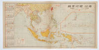
1572ref. 160545No place of publication.: 朝日新聞社. The Asahi Shimbun. 昭和十五1940. Published by 朝日新聞社 The Asahi Shimbun Japanese folding coloured WWII map with a calendar from January to June Shōwa 15 at the left scale 1:300000. Map includes French Indochina Dutch East Indies and parts of the territory of Papua China and British India. Some light browning and foxing otherwise very good. Text in Japanese. 25.3 x 51cm. Legend at lower left lists the boundaries between continents countries and provincials or regions railways airline routes capitals and Japanese embassies and consulates. The natural resources are indicated across the map. The map also shows parts of the territory of Papua under Australia's administration " 濠洲委任統治領 Gōshū inin tōchiryō". . 朝日新聞社. [The Asahi Shimbun]. unknown
ref. BN589153Indestructible Indestructible Cristina C. Road unknown
ref. BN324939Promopress. Softcover. Bagues: Tour du monde en 500 créations artistiques Bagues: Tour du monde en 500 créations artistiques Nicolas Estrada Promopress paperback
ref. 35883197-nnew. unknown
ref. 46849574-nnew. unknown
ref. BN738992Barcelona : Oceano. Comedias Comedias Shakespeare und Ezequiel Martinez Estrada Barcelona : Oceano unknown
ref. DADAX0823083446New unknown