Estrada, JBiblio.com

4945 risultati
2014rif. x-134932888XPalgrave Macmillan 2014. Paperback. New. 183 pages. 8.50x5.51x0.45 inches. Palgrave Macmillan paperback
rif. 9999316484.Gpaperback. Good. Access codes and supplements are not guaranteed with used items. May be an ex-library book. paperback
rif. SONG1949445038Used: Good unknown
rif. 45609644-nnew. unknown
rif. 1409259420.Ghardcover. Good. Access codes and supplements are not guaranteed with used items. May be an ex-library book. hardcover
2022rif. x-1662853319Liberty Hill Publishing 2022. Hardcover. New. 516 pages. 6.00x1.31x9.00 inches. Liberty Hill Publishing hardcover
rif. 9994984373.Gpaperback. Good. Access codes and supplements are not guaranteed with used items. May be an ex-library book. paperback
rif. DADAX0548056463New unknown
rif. SONG1498235298Used: Good unknown
rif. 3847369911.Gpaperback. Good. Access codes and supplements are not guaranteed with used items. May be an ex-library book. paperback
2008rif. Q-1593762151Soft Skull 2008-10-01. Paperback. New. New. In shrink wrap. Looks like an interesting title! Soft Skull paperback
1986rif. g8301Dordrecht: Dr W. Junk Publishers. VG : in very good condition without dust jacket. Minor chip at spine head. 1986. First Edition. Green hardback cover. 270mm x 200mm 11" x 8". 392pp. Heavy item - shipping supplement may apply for overseas. . Dr W. Junk Publishers hardcover
1940rif. 73032AB1940. Ninth Edition. Glasgow Brown Son & Ferguson Ltd 1940. 12 cm x 18 cm. 155 pages plus additional unnumbered pages of publisher's advertising. Original Hardcover/ Very good condition with only very minor signs of external wear. Includes for example the following essays: International Regulations for Preventing Collisions at Sea / Extracts from the Merchant Shipping Act / Flashing Sound Signalling Morse / Range of Lights / To Determine the Direction in Which a Steam Vessel is Heading / Terms Associated with Sailing Vessels / Distress Signals / and many more. hardcover
1940rif. 73060AB1940. London Geographia No Date c.1940. 10 cm x 15 cm. 40 Pages. Original Softcover. Excellent condition with only very minor signs of external wear. Covers slightly stained by water. Some traces of rust through pages. Includes for example the following essays: 15 Special Maps of 100 Miles Round London / Comprehensive Guide to 149 Routes / Index to Routes of 100 Miles Round London. paperback
rif. DADAX0253335590New unknown
rif. SONG0485113317Used: Good unknown
2013rif. 1-3659071951Editorial Académica Española 2013. Paperback. New. 92 pages. Spanish language. 8.50x5.79x0.39 inches. Editorial Académica Española paperback
2017rif. x-3319695134Palgrave Pivot 2017. Hardcover. New. 101 pages. 8.25x6.00x0.25 inches. Palgrave Pivot hardcover
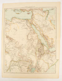
1895rif. 175108London.: Times Atlas of the World. 1895. Double-page folding map printed in colour 46.5 x 36.5 cm. edges gilt central fold with an inset map of Somaliland Somalia and the island of Sokotra key to European possessions outlined in colour small edge fold tears affecting the margin only and two other small edge tears slight toning at the edgaes but in very good condition. Attractive and detailed map prepared for the first edition of "The Times Atlas of the World". . (Times Atlas of the World). unknown
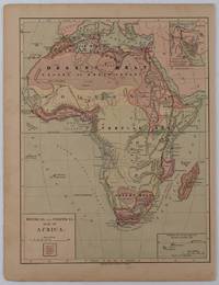
1877rif. 176015New York.: Harper & Brothers. circa1877. Chromolithographed map with outlne handcolour 27.1 x 21 cm major towns marked with a red cross relief by hachures ocean currents marked two inset maps of the Suez canal and Mascarene Island two very small marginal edge tears not affecting the map slight toning unrelated text on the verso prepared for "Harper's School Geography" in very good condition Interesting map of Africa before the escalation of the European race for colonial possessions from 1880. The map shows: the European possessions of the Cape Colony Transvaal Republic Orange River Republic and Natal; regions of the continent as fertile belts and desert belts; and indicates agricultural and other production such as palm oil ivory skins and cattle. Major cities are shown with important trade centers highlighted with a red cross. Prepared for US students in "Harper's School Geography" longitude is shown from the Greenwich prime meridian at the head of the map and from the Washington prime meridian at the foot. A small outline map of Ohio is included for relative scale. . Harper & Brothers. unknown
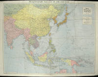
1940rif. 205763London.: Hutchinson & Co. Circa1940. Full colour folding map 70.7 x 93 cms; 76 x 101.2 cms sheet original folds short fold splits previous owner's neat title markings on the verso but the map in very good condition. A "Geographia" map of the war theatre in Asia and the Pacific including the northernmost coast of Australia. Showing railways and canals roads and steamer routes oilfields and pipe lines and a key to the unfederated states of Malaya. The Spratley Islands are marked as French and Thai territorial claims within French Indo China are marked. . Hutchinson & Co. unknown
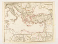
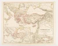
rif. 174950Gotha.: Justus Perthes. Map with original colour and outline hand-colour 32.2 x 40 cm text in German five inset maps central fold slight marginal toning and spotting on the verso but in very good condition. A most handsome and highly detailed map detailing the Eastern provinces of the Byzantine/Roman Empire in the time of the Roman Emperor Justinian 527-565. The inset maps depict Carthage Rome Constantinople Naples and a Western continuation of the main map originally issued for the "Hand-Atlas für die Geschichte des Mittelatters und die Neueren Zeit" . Justus Perthes. unknown
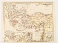
1874rif. 174914Gotha: Justus Perthes. 1874. Map with original colour and outline hand-colour 32.2 x 40 cm three inset maps text in German central fold slight marginal toning in very good condition. A most handsome map detailing the Eastern Roman Empire from the immigration of Hungarians in Ponnonia around 895 to the subjugation of the Bulgarian Empire by Emperor Basilius in 1019. The inset maps depict Divisions of the Empire Palestine and the Themata around Propontis present day Sea of Marmara issued for the "Hand-Atlas für die Geschichte des Mittelatters und die Neueren Zeit". . Justus Perthes unknown
1876rif. 174911Gotha: Justus Perthes. 1876. Map with original colour and outline hand-colour 32.2 x 40 cm text in German four inset maps central fold slight marginal toning and spotting on the verso but in very good condition. A most handsome and highly detailed map detailing the Eastern provinces of the Byzantine/Roman Empire before the Fourth Crusade. The inset maps depict Constantinople Divisions of the Empire and Antioch issued for the "Hand-Atlas für die Geschichte des Mittelatters und die Neueren Zeit" . Justus Perthes unknown
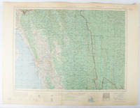
1955rif. 173072Washington D.C.: Army Map Service U.S. Army. 1955. Large colour map. 1:250000 scale. Transverse mercator projection. 23°00'N 91°30'E-22°00'N 93°00'E. Series U502 Sheet NF 46-6 Edition 1-AMS. Map measures 57.3 x 75.8cm. Slight wear creasing even light browning small closed tears on edges upper-right corner little foxed. Shows signs of use but map is clean and complete. Corps of Engineers Army Map Service map of Chittagong and surrounds compiled in 1955. Based on the British Indian one-inch and half-inch map series from 1938-43 and 1936-43 respectively. . Army Map Service, U.S. Army. unknown