4.388 Ergebnisse
2008Best.-Nr. 013390New York - London Phaidon 2008 In-4 Cartonnage et étui illustrés de l'éditeur
Best.-Nr. 010808Rodez Cognac Paris Les Amis d'Alexandre Vialatte 0 26 volumes in-12 Brochés
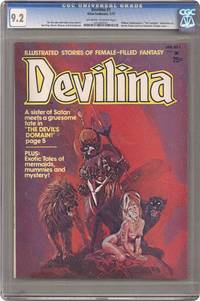
1975Best.-Nr. 008587New York: ATLAS SEABOARD 1975. Magazine. Illus. by REECE RALPH : SPARLING JACK : MARCOS PABLO. New. Magazine. 1st Edition. Magazine - 1st. Print - CGC Graded 9.2 NM- Off White to White Pages - Includes Satans Domain The Lost Tomb of Nefertiri Lay of the Sea Midnight Muse Merchants of Evil plus an adaptation of Shakespeares The Tempest. Also an article about the vampires of cinema. Part of the short-lived Atlas line from former Marvel publisher Martin Goodman. Cover by Alberto Pujolar was later reused for Vampirells No. 111. . ATLAS SEABOARD Paperback
1918Best.-Nr. 62523Peoria IL: Avery Company Manufacturers 1918. 4to. 24 pp unpaginated. printed in red gray & black throughout. Photo text illustrations throughout decorative borders illustrations. Self-printed colour-illustrated softcovers cover art of Avery road tractors and scrapers front & back minor edgewear creasing minor wear & dustsoiling w/ tiny closed tears at spine still VG- copy. First edition of this uncommon catalogue of equipment which played a crucial role in road building driven by the Good Roads Movement during the opening decades of the 20th century. At the end of the 19th century less than 50% of roads within American cities were paved and the very few highways and turnpikes connecting cities and towns were little more than crushed rock macadam dirt roads or even paths. Sidewalks were nearly unknown and unlike Europe road construction was not primarily managed by national or local governments. Although founded in the 1880s by bicycling enthusiasts the Good Roads Movement at the beginning of the 20th century began to be driven largely by advocates of the automobile. This catalogue illustrates Avery road tractors graders scarifiers blades drag scrapers and more building roads in Texas Oklahoma Idaho Nebraska Kansas Indiana and more. The Avery company was founded initially in Galesburg IL following the Civil War by Robert and John Avery with Robert as the ever-intrepid inventor and machinist one of whose earliest inventions was the riding cultivator. By 1883 and teamed up with his brother Cyrus the company proved successful and after 1892 became well-known for their internal combustion engine equipment. By 1920 the company led by Bartholomew employed 4000 people and pioneered motor cultivators and road-building equipment but was hit by the post-World War I depression about the time this catalogue was issued and although the company attempted to reorganize and laid off 90% of its workforce it failed by 1923 and was renamed the Avery Power Machinery Co. The company limped through the Great Depression and closed finally in World War II. No copies in Worldcat; See: Mowitz The Once-Great Tractor Innovator Lost to Time Successful Farming Nov. 20 2024. Avery Company Manufacturers, paperback
Best.-Nr. 38691306-nnew. unknown
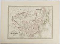
1837Best.-Nr. 177519Paris. circa1837. Engraved map with original outline hand-colour 22 x 30 cm; 28.8 x 38.6 cm sheet marginal repair to the lower corner not affecting the map sheet lightly age-toned in very good condition preserved in a window mount. Fine map of China Japan and Central Asia noting Manchuria "Mandchourie" bordering Northern India and Turkestan in the West and Russia "Russie d'Asie" in the North. From the estate of the late collector and scholar Arthur Hacker with his pencilled catalogue mark on the verso. . unknown
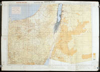
1942Best.-Nr. 207841London.: Royal Engineers. July1942. Printed colour topographical map mounted on linen 56.7 x 79.2 cms; 64.6 x 89. 5 cms sheet original folds edgewear small marginal chips a little dusty but in good condition. Detailed World War II operational map of Egypt and the Middle East issued by 512 Army Field Survey Company of the Royal Engineers. The map is marked "Not to be Published" in the upper right margin. Railways roads camel tracks telegraph lines boundaries altitudes towns and villages are marked. . Royal Engineers. unknown
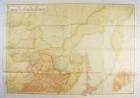
1419Best.-Nr. 171112東京. Tokyo.: 伊林書店. Ibayashi Shoten. 昭和14 1939. Colour printed folding map 78 X 109cm minor damage original envelope 27.5 x 20cm. Very good copy. This map offers comprehensive information on northern China Manchuria the Soviet Union and Hokkaido including Kuril Islands under the Japanese control. It also includes the Jewish Autonomous State which existed in the late 1930s. The inset map provides detailed information on the border area of Japan Manchuria and the Soviet Union. Legends include national borders railways major cities iron mines and oil wells. Published in 1939 this map is an expression of the tension Japan felt in its relationship with the Soviet Union. At the time the Soviet Union was seen as the mighty threat to the lying just north of Manchuria and Japan . . 伊林書店. [Ibayashi Shoten]. unknown
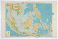
1572Best.-Nr. 160538東京.Tokyo.: 日本名所圖繪社.Nihon Meisho Zuesha. 昭和16 1941. Folding colour Japanese map of the Malay Archipelago and Thailand scale 1: 8500000 with attractive original pictorial paper envelope. This map also shows the Dutch French and American colonies. Hainan Province and the South China Sea are shown in the north. Agricultural and mineral resources indicated across the map. Few small holes at holes and other light signs of wear. Slipcase lttle torn. Text in Japanese and English. 53.3 × 78.2cm. . 日本名所圖繪社.[Nihon Meisho Zuesha]. unknown
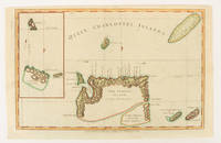
1784Best.-Nr. 174895London.: Alexander Hogg at the King's Arms. circa1784. Engraved map on laid paper 21.4 x 33.7 cm inset of Gower's Simson's and Carteret's Island early outline hand colour trimmed to the plate mark at the top edge three small edge tears affecting the upper margin only slight paper toning but a most attractive map in very good condition. Fine impression of the Queen Charlotte's Islands Solomon Islands. It features the Swallow's track the ship's route taken by Captain Philip Carteret in 1767 the British naval officer and explorer who participated in two of the Royal Navy's circumnavigation expeditions in 1764–66 and 1766–69. . Alexander Hogg at the King's Arms. unknown
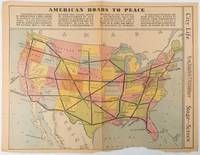
1938Best.-Nr. 215547Los Angeles.: Los Angeles Examiner. Sunday 1 May1938. Printed colour pictorial map 33 x 48 cms; 41.8 x 54.5 cms sheet central fold sheet toned corners chipped with some loss to the bottom border and at the central fold in good condition; and on the verso "Movie-Go-Round" by Louella O. Parsons black and white photos and advertisements. Pictorial map printed for the weekend supplement of the Randolph Hearst owned newspaper the Los Angeles Examiner. The map-maker and artist Howard Burke had also worked for the San Francisco Examiner and was known for pictorial maps many with a persuasive or rhetorical edge and as here were designed to shore up American patriotism and defences against a wider world in the increasingly turbulent pre-war 1930s. The caption to this map outlines a multi-billion dollar 25 year proposal by Congressman J. Buell Snyder for a network of coast to coast transcontinental highways "in case of an attack by a foreign power at any point along the border". Buell Snyder earned the soubriquet "the father of superhighways" and during the War he was assigned to a Congressional Committee in charge of appropriations for the War Department. Scarce. . Los Angeles Examiner. unknown
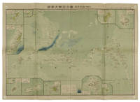
1819Best.-Nr. 155215統正社 Tōseisha . Showa 18 1943. Colour folded map 54. x 76.5cm. Pinholes at corners light even browning good copy. This Japanese map of Micronesia shows the Mariana Islands Eastern and Western Caroline Islands Marshall Islands and Gilbert Islands. The separate maps around the edge are clockwise from the upper right corner: Jaluit Atoll Guam Island Rota Island Saipan Island Palau Islands Yap Island Hall Islands Pohnpei Island Truk Islands and Kusaie Island. . 統正社 [Tōseisha ]. unknown
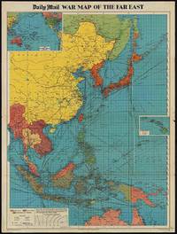
1944Best.-Nr. 205765London.: George Philip & Son. 1944. Full colour folding map 101.5 x 76cm sheet inset maps legend folding into title wrapper 25.7 x 19.4 cm covers a little dusty and discoloured a few short fold splits without loss but the map in very good bright condition. Map of the Pacific Theatre of World War II with borders drawn as they stood in 1937 - complete with Chinese claims on Mongolia Tuva and Tibet. Shows transportation routes principal railways oil fields Allied naval bases territory occupied by the British Empire French Empire and the United States. This map shows only the northernmost section of Australia which allows for much better detail of the countries of East Asia. Small inset map of the Hawaiin Islands at mid right. Inset map of the Pacific Ocean at upper left. . George Philip & Son. unknown
Best.-Nr. 6545007like new. unknown
Best.-Nr. DADAX0961587547New unknown
2009Best.-Nr. Q-1401890326Cengage Learning 2009-01-27. Paperback. New. In shrink wrap. Looks like an interesting title! Cengage Learning paperback
2017Best.-Nr. __1498758266CRC Pr I Llc 2017. Hardcover. New. 251 pages. 11.00x8.00x0.50 inches. CRC Pr I Llc hardcover
20028vo., First Edition thus, with coloured and monochrome plates; GRRC binding of black cloth, upper board blocked in gilt with GRRC crest, black faux-leather back lettered in gilt, gilt edges, patterned endpapers, black ribbon marker, a near fine copy in publisher's blocked board slip-case. EDITION LIMITED TO 600 NUMBERED COPIES SIGNED BY WALKER AND LORD MARCH (THIS COPY NO. 590).
Best.-Nr. SBC 9780387258546Brand New. Book Condition New U.S. EDITION. We Do not Ship APO FPO AND PO BOX. Customer satisfaction guaranteed. HARDCOVER hardcover
2020Best.-Nr. 2081502111906437science publisher 2020. Soft Cover. Fine. The book is in fine condition. science publisher paperback
2022Best.-Nr. 2081502111904898science publisher 2022. Soft Cover. Fine. The book is in fine condition. science publisher paperback
Best.-Nr. DADAX3110655640De Gruyter 2019-11-18. 1. hardcover. New. 6.14x0.94x9.21. Buy with confidence. Excellent Customer Service & Return policy. De Gruyter hardcover
Best.-Nr. DADAX1780641451New unknown
1995Best.-Nr. 5965014John Wiley and Sons 1995. This is an ex-library book and may have the usual library/used-book markings inside.This book has hardback covers. In good all round condition. Please note the Image in this listing is a stock photo and may not match the covers of the actual item800grams ISBN:9780471960126 John Wiley and Sons hardcover
1898Very Good English Original bdg. Roy. 8vo. (24 x 17 cm). In English. Many b/w plates. [xii], 340 p., 1 folding huge map. A tour through the famine districs of India.