4.359 Ergebnisse
1912Best.-Nr. 13113Monmouth Illinois:: Western Road Tool Company 1912. loose sheets as issued. Fine. Approx. 10-1/2 x 14 inches. Illustrated from photographs heightened in red and line drawings. Offering the "Perfection Gang" Road Drag horse gang drags scrapers plows grader blades and other road machines with order form. Western Road Tool Company, unknown
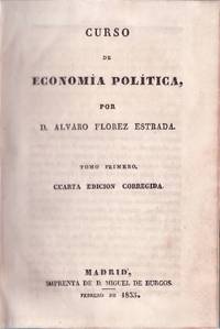
Best.-Nr. 698521Imprenta de D. Miguel de Burgos 1835 Madrid. 22x15. Pasta española con hierros y tejuelo. 385 y 508 pgs. Cantos tintados en amarillo. N12243 Imprenta de D. Miguel de Burgos, 1835, Madrid. hardcover
Best.-Nr. LDM0033481We ship worldwide. 100% guarentee. BRAND NEW unknown
Best.-Nr. 2540692like new. unknown
Best.-Nr. 27254Paris Chez Vincent 1768 in 12 (14,5x8,5) 1 volume reliure plein veau fauve marbré de l'époque, dos lisse orné, pièce de maroquin rouge, tranches teintées rouge, XX et 280 pages, coiffes et coins légèrement usés. Rare. Bon exemplaire ( Photographies sur demande / We can send pictures of this book on simple request )
2008Best.-Nr. 2081502111901867chinese science and technology 2008. Soft Cover. Fine. The book is in fine condition. chinese science and technology paperback
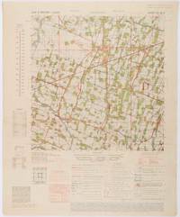
1945Best.-Nr. 200411Washington D.C.: Army Map Service. First edition - revised AMS4. 1945. Army survey map printed in colour 36.7 x 36.7 cm; 58 x 48 cm sheet conversion graph glossary and administrative index to the inner margin; scale three column legend index to adjoining sheets and notes re grid references and mean declination to the foot; sheet toned a very few edge tears the map in very good condition. Wartime map produced by the US Army Map Service AMS who formed in 1942 and were at the forefront of military mapping campaigns during WWII and the post-war years. The very detailed map shows residency and administrative boundaries transportation ground and water features vegetation cultivation ruins religious sites "Graves; Chinese native" and "Cemetery; heathen Christian" walls hedges populated places built-up areas and buildings with those of iron stone wood and bamboo differentiated by colour; fishponds plantations and much more. . Army Map Service. unknown
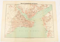
1925Best.-Nr. 174961Constantinople.: The Anglo-American Book & Newsagency. 1925. Printed folding colour map 36 x 49.2 cm street grids for Stambul Pera Galata and Skutari railways and landing places marked small fold splits affecting the margins only now repaired with archival material two small holes at central folds pin-holes to the four corner some age-toning but in very good condition. A scarce map of the historic peninsula soon after the Republic of Turkey was founded and the capital moved to Ankara. Printed for the tourist market this map is a rare survival. . The Anglo-American Book & Newsagency. unknown
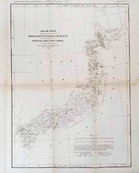
1878Best.-Nr. 210211Philadelphia.: American Institute of Mining Engineers. Sherman & Co. printers. 1878. Large folding map of Japan showing "some of the more important Mining Districts Coal Fields etc." small fold split without loss tables 67pp. Covers a little scuffed and discoloured overall in very good condition. Scarce offprint separately paginated of a paper included in Volume V of the Transactions of the American Institute of Mining Engineers. The author Henry S. Munroe had been retained by the Japanese Government as Assistant Geologist and Mining Engineer with the Geological Survey of Yesso for the Hokkaidō Colonization Agency. His work laid the foundations for the future coal mining industry in Hokkaido. The report contains two lengthy tables relating to coal production and quality. . American Institute of Mining Engineers. Sherman & Co., printers. unknown
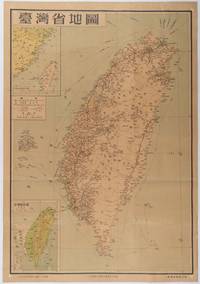
1954Best.-Nr. 215869地圖出版社. Reprint. 1954. Colour folding map of Taiwan showing all major cities towns and villages railways highways roads rivers and sea routes. Topographical inset map at lower left Taiwan Straits with mainland coast inset map at top left. Each map has its own scale. Text in traditional Chinese characters. Washi repairs along some folds on reverse pin marks at corners evenly browned and a little faded. A nice map of Taiwan in fair condition. 77 x 53.8cm. . 地圖出版社. unknown
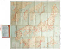
1927Best.-Nr. 215711Tokyo.: Japanese Government Railways. Circa1927. Large folding colour map 78.5 x 80 cm of Japan and Korea 6 inset maps one of which shows Taiwan scale 1:1640000 for Hondo Shikoku and Kyushu 1:2340000 for Chosen; tipped into the original orange cloth covered case with orange ties text in 31 panels on the verso one a little age-toned a few very small fold splits without loss a very good copy. Attractive tourist map for the English-speaking traveller issued by the Japanese Government Railways with extensive notes for tours and points of interest on the verso short descriptions of cities and sites to visit principal theatres with suggestions for cafes restaurants and department stores. . Japanese Government Railways. hardcover
Best.-Nr. 6545007-nnew. unknown
1909Best.-Nr. 2111902160200634Higashi-Tsukima-gun Office 1909. Soft Cover. Fine. Volume: 1 Higashi-Tsukima-gun Office paperback
2007Best.-Nr. x-3540719172Springer Verlag 2007. Hardcover. New. 1st edition. 290 pages. 9.25x6.00x0.75 inches. Springer Verlag hardcover
1756Best.-Nr. 92353Thomas Baskett. London. 1756. First edition. 1756. 36 pages with title page not bound but held together with paper clips. Page edges very chipped last blank page lacks portions and is very torn and worn. Stain to top of title. Was originally folded in half so paper clip marks are visible to right margin of title. SCARCE. unknown
Best.-Nr. BN92838Veiatlas Norge: Veikart = road maps = Strassenkarten 1:300 000 : bykart = city maps = Stadtplane 1:20 000 Norwegian Edition Unknown Binding Veiatlas Norge: Veikart = road maps = Strassenkarten 1:300 000 : bykart = city maps = Stadtplane 1:20 000 Norwegian Edition Unknown Binding Veiatlas Norge: Veikart = road maps = Strassenkarten 1:300 000 : bykart = city maps = Stadtplane 1:20 000 Norwegian Edition Unknown Binding unknown
Best.-Nr. DADAX1489995137Springer 2014-10-22. 2006. paperback. New. 6.10x1.40x9.25. Buy with confidence. Excellent Customer Service & Return policy. Springer paperback
2010Best.-Nr. 1-3642091016Springer 2010. Paperback. New. 312 pages. 9.00x6.00x0.71 inches. Springer paperback
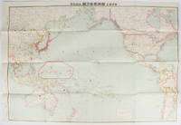
Best.-Nr. 169329東京. Tokyo.: 九段書房.Kudan shobo. 大正十四 1925. Coloured folding Japanese map showing the military strength of Japan the United States and the United Kingdom in the Pacific original pictorial envelope scale not given. Some small holes at folds occasional light foxing a prior owner's signature on reverse minor wear envelope. Very good copy in like envelope. Map measures 54.4 x 78.8cm. The explanatory text in Japanese printed on the reverse in blue summarises the colonial possessions of the US and the UK as well as providing a comparison between the land size naval presence natural resources immigration issues and maritime transport capacities of Japan the United States and the United Kingdom. Legend indicates national regional provincial territorial boundaries canals undersea cables airline routes metropolitans capital cities mining fields hot springs ancient battle fields major trade ports Japanese embassies and consular offices. A large area marked 日本委任统治 "South Pacific Mandate" highlighted in a box is adjacent to Australian occupied Papua New Guinea. . 九段書房.[Kudan shobo]. unknown
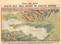
1945Best.-Nr. 209335Chicago.: Chicago Daily Tribune. 28 July1945. Colour bird's eye view map 22.4 x 39.3 cms on a newspaper leaf trimmed to a half sheet 29.8 x 41.6 cms including caption slight toning at an old central fold the map in very good condition. Unrelated black and white photographic illustrations on the verso "Pre-flight Trainers used in Chicago to give ground instruction to would-be pilots" and "New rekindled Montauk Light Long Island N.Y." Map published in the Chicago Daily Tribune days before the bombing of Hiroshima on August 61945. "Perspective map of Tokyo bay and contiguous land and sea areas showing Tokyo Yokohama the Yokosuka naval base industrial sections and other features .In this map north is at the right instead of at the top - an expedient adopted to show all of the bay as large as possible in half page space." caption . Chicago Daily Tribune. unknown
Best.-Nr. 51720972like new. unknown
Best.-Nr. 51720972-nnew. unknown
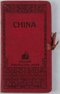
1920Best.-Nr. 161936no date. circa1920. Linen backed colour folding map of China insets of Peking and Environs and Hongkong and Canton in lower left corner. 54 x 63.8cm. Table of place names at upper left gives the cities that "By a recent ordinance of the Republic all 'Fu' 'Chow'' and 'Ting' cities have been nominally reduced to the rank of 'Hsien'. The following parallel list gives the 'Fu' cities the names of which have been officially changed together with the new form adapted." Map folds into a red cloth covered case with ribbon ties 19 x 10.3cm. Title and decoration printed in black on upper cover. Trifle foxed on linen backing a little insect damage case in a few small places otherwise a very good clean map. . hardcover
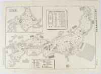
1955Best.-Nr. 172396No publication details. Circa1955. Chinese black and white military map of Japan based on a map issued by 赤旗報 Shimbun Akahata on 24 June 1953. No scale given inset map of Hokkaido upper left corner legend lower section showing air and navy bases military exercise bases ammunition dump shooting ranges for the air force and navy headquarters of the coast guard etc. Text upper section provides details of the different types of US military bases and infrastructure. Text in traditional Chinese. 25.8 x 35.8cm. . No publication details. unknown
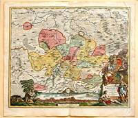
1717Best.-Nr. 61880Nuremberg.: Johann Baptist Homann. 1717. A beautifully engraved hand coloured map of North East Germany showing the area around Erfurt in detail. In the centre of the map is a small plan of Erfurt which is also shown as a panoramic view at the foot of the map and titled 'St. Petersburg'. An elaborate decorative title cartouche in the lower right corner depicts allegorical figures surrounded by the produce of the land including sheaves of wheat; a beehive; and a cornucopia of fruits. Cherubs holding a coat of arms float up from the scene on the right while on the lower left a centaur sits meditatively beneath a pine tree amongst slaughtered cattle. Physical features of the area are illustrated and farming areas shown by fields which criss-cross across the map. A clear dark impression the work of an outstanding German cartographer who in 1715 was appointed as imperial geographer by Emperor Charles VI. This map also includes "Schwan See" Swan Lake under a town of the same name which has since disappeared. Hand coloured two very minor splits at upper and lower edges on centre fold and not affecting engraved area a handsome map 54 x 61.5 cm. . [Johann Baptist Homann.] unknown