Conway, Gerry; Estrada, Ric and othersBiblio.com
4388 risultati
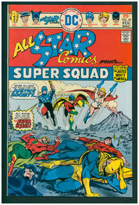
1976rif. 38001New York: DC Comics 1976. First Edition. Stapled wraps. First appearance of Power Girl. Very Fine 8.5. ; 17 x 26 cm. DC Comics unknown
2015rif. x-0198726457Oxford Univ Pr 2015. Hardcover. New. 1st edition. 288 pages. 10.25x8.00x0.75 inches. Oxford Univ Pr hardcover
2011rif. DADAX019959175XOxford University Press 2011-12-17. 1. hardcover. New. 7.50x1.25x9.50. Buy with confidence. Excellent Customer Service & Return policy. Oxford University Press hardcover
2010rif. 2-1608766047Nova Science Publishers Inc 2010. Hardcover. New. 274 pages. 9.00x6.00x0.75 inches. Nova Science Publishers Inc hardcover
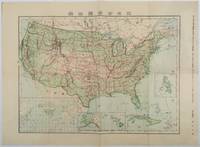
1911rif. 179415Tokyo.: 楠山正雄. Kusuyama Masao. Meiji 44 1911. Colour folding map 40 x 55cm inset maps showing the Philippines Alaska and Hawaii very good copy. This map was a supplement of October 1911 issue of a monthly magazine Shin Nippon 新日本 which was published between 1911 and 1918. The main map covers the contiguous United States with inset maps of the world showing the American territories of Alaska Hawaii and the Philippines. Curiously Cuba has been marked as an American territory having been directly occupied from 1906 to 1909 though at the time still beholden to the 1903 Cuban-American Treaty of Relations. . 楠山正雄. [Kusuyama Masao]. unknown
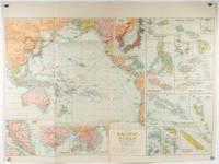
1945rif. 180206Sydney.: H.E.C. Robinson. Circa1945. Full colour inset maps principal cities and towns marked shipping routes international boundaries and railways. 99 x 73cm. Some small insect damage has been repaired on the verso visible on map as a few small lighter areas in the western Pacific. Pinpoint holes at folds paper repair along cover but a very good clean copy. From the Sydney publisher H.E.C. Robinson the firm founded in 1895 by Herbert Robinson 1857-1933 a founder of the Royal Geographical Society of Australasia. Although the map is undated North and South Korea are shown as divided which occurred in late 1945 and Manchuria is marked as still under Soviet occupation which only lasted until 1946 at which point it was handed over to Communist China. As well as what now would be considered Southeast Asia the main map shows the eastern half of India Tibet and parts of Mongolia the USSR and East Asia. Inset maps include: Caroline Islands Marshall Islands Federation of Malaya Singapore Hong Kong Taiwan Japan Hawaiian Islands Philippine Islands Midway Gaum and Wake Islands Fiji Islands Eastern & Western Samoa Santa Cruz and Solomon Islands New Caledonia Rabaul Tahiti Lord Howe etc. . H.E.C. Robinson. unknown
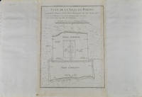
1749rif. 136794Paris. circa1749. Black and white engraved plan map of Peking on laid paper folded designed by the prominent French cartographer Jacques-Nicolas Bellin. This map is No. 18 Vol. 5 from the impressive 15-volume "Histoire Generale des Voyages" compiled by French novelist Antoine François Prévost. This city map shows two areas of walled cities: Ville Tartare Imperial city and the Forbidden City and Ville Chinoise ethnic Han residential area. Notes A and B represents buildings within the Forbidden City. A: Lieu de Plaisance ou l'on voit une Montagne faite a la main B: Grandes Cours du Palais de l'Empereur. Two missionary buildings French and Portuguese as well as the Tower of Mathematics illustrated within Ville Tartare. Two temples illustrated side by side near the south gate of the Ville Chinoise. Overall in good condition very light browning on edges and darker toning along the borders of the map. Text in French. Map measures 21 x 16.4cm. . unknown
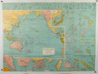
1930rif. 205997Sydney: H.E.C. Robinson. Circa1930s. Printed colour maps in all 65.5 x 99cm the main map roughly 50 x 65 cm on a single sheet 76 x 101.3 cms; a little carelessly folded decorative blue title cover a little dusty and a few fold splits and edgewear but in good condition. The exceptional feature of this map are the twenty six large scale inset maps of Pacific islands including: Malay States Singapore Hong Kong these at lower left Japan Philippine Islands Hawaiian Islands Fiji Solomon Islands Western and Eastern Samoa Tahiti Saipan New Caledonia and Dependencies and many others. The main map of the Pacific Ocean stretches from Southeast Asia including all of Australia and New Zealand the west coast of the Americas the Kamchatka Peninsula Manchukuo Manchuria and most of China. Korea and Taiwan are marked as Japanese Territory. Possessions of Britain France the Netherlands and the United States are highlighted. An incredibly rich source of information on the Pacific theatre during the years leading up to World War II. From the Sydney publisher H.E.C. Robinson the firm founded in 1895 by Herbert Robinson 1857-1933 a founder of the Royal Geographical Society of Australasia. . H.E.C. Robinson. unknown
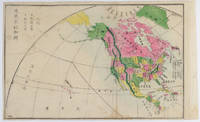
1877rif. 159812Kyoto.: 村上勘兵衛 文部省刊行. Murakami Kanbē; Monbushō kankō. Meiji 10 1877. Colour woodblock map of North and Central America. From the Journal of World Geography 萬國地誌略 published in 1877. Printed area measures 33.5 x 21cm a good copy with occasional soiling. . 村上勘兵衛, 文部省刊行. [Murakami Kanbē; Monbushō kanko& unknown
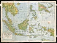
1940rif. 211106Sydney.: H.E.C. Robinson Pty. Ltd. circa1940. Full colour folding map 71 x 97 cms; 76.2 x 10² cms sheet blank on verso save for a neat inked stamp "East Indies" inset map of New Guinea and Papua heights shown by colour very good clean condition. Large scale World War II era map by Sydney publisher H. E. C. Robinson. Extremely detailed map it is coloured according to height above sea level and showing naval bases railways shipping routes air routes. Includes smaller inset map of "New Guinea & Papua" showing the eastern part of the island. . H.E.C. Robinson Pty. Ltd. unknown
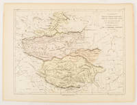
1856rif. 175109Paris.: Gustave Barba Editeur. 1856. Lithographed map with original hand colour central fold 24.2 x 31.5 cm marginal toning plate number in manuscript in very good condition. Finely engraved Dufour map of Central Asia prepared for his "Atlas Populaire" showing East Turkestan Petite Boukharie and Kalmykia Dzoungarie Mongolia and Tibet. . Gustave Barba Editeur. unknown
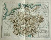
1800rif. 57070c1800. Copper engraving with handcolouring map shows Germany and parts of France Italie Hongrie Pologne and Prusse sic. Minor hole upper border few closed tears and some browning edges otherwise a clean and bright image. Map measures approximately 34 x 46cm. . unknown
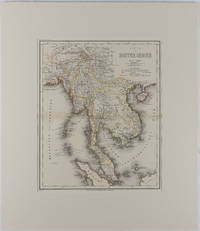
1866rif. 175919Hildburghausen: Bibliographischen Instituts. 1866. Engraved map with outline hand colour central fold 37 x 30 cm 47.4 x 36.2 cm sheet colour key to territorial control and administrative boundaries major cites towns roads rivers and mountains relief shown by hachures light toning in very good condition preserved in modern window mount. Detailed 19th Century regional map of the Malay Peninsula Vietnam Cambodia etc. extending from the Straits of Malaca and Singapore north to Hainan and the Gulf of Tonquin. Text in German prepared for Meyer's Hand Atlas noted in the marginal caption top-left . Bibliographischen Instituts unknown
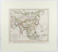
1855rif. 173439Gotha.: Perthes Justus. Circa1855. Engraved map 44.1 x 36.3 cm sheet size 35.8 x 29.7cm map size plate mark map with original hand colouring and hand coloured key noting Islamic "Mohammedanische" Buddhist "Buddhaistische" and European territories by country. Unusual map in an early issue. It was included as map 39 in Stieler's "Hand-Atlas uber alle Theile der Erde und uber das Weltgebaude by Frederic von Stulpnagel" revised by Hermann Berghaus in 1855. The issue is noted to the top right: Ausg. in 63BI. no XIV. Fine outline hand colouring denotes territories by religion and Chinese ports open to European trade and Japanese ports open to American trade. . Perthes, Justus. unknown
rif. DADAX0385546017New unknown
1957Features: New York to Paris - around the world in one hundred and seventy days - from the files of George Schuster; 1957 Glidden Tour; World's Largest Antique Auto Meet - the national fall meet at Hershey; The "One Car" Club - Road Testing a 1913 Merz Cyclecar; The Eastbourne Battle of Flowers in May, 1896; Basket Case on a Budget - or - Who Needs Money When He Has a Friend? - a three-year restoration of a Ford Town Car - article with photos; Self-Propelled Vehicles from 1400 to 1900 - today's automobile got its start in the dark ages - article with photos; 7th annual "Old Car Festival" at Ford's Greenfield Village; America's Fastest Antique Car - Thomas J. Lester's 1913 LozierIn Duster and Veil; Opel and Vauxhall celebrate anniversaries with introduction to American Market - article with photos; Memories of a DuPont Special; Sixtieth Anniversary for Olds; Ford Facts - Black Radiator Restorations; Index for November, 1945, Volume 9, No. 3-4 to Fall, 1957, Volume 21, No. 3 *39 Pages*; and more. Average wear. Unmarked. A sound copy. Magazine
1800rif. DZN-1341Paris chez Favre, de l'imprimerie de B. Duchesne 1800. Petit in-8 (17X11 cm), (1 feuillet d'avis au public sur la contrefaçon)-XXXII-155 pages, une grande carte rempliée en noir, (1 feuillet). cartonné papier muet légèrement frotté.@2138.
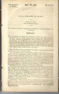
1839rif. 28837Washington 1839. 25th Cong. 3d Sess. H.Rep.322. 167pp disbound. Six folding maps and chart. Several text leaves browned Very Good plus. Reviewing proposals and data for a canal route including a memorial from Matthew Carey. Morrison 5 noting only 3 maps. unknown
1839rif. 28837Washington 1839. 25th Cong. 3d Sess. H.Rep.322. 167pp disbound. Six folding maps and chart. Several text leaves browned Very Good plus. Reviewing proposals and data for a canal route including a memorial from Matthew Carey. Morrison 5 noting only 3 maps. unknown books
1938rif. 59631Portland OR: Works Progress Administration of Oregon ca. 1938. 4to. 4 pp. 41 leaves unnumbered. including mimeograph map embossed “Mimeograph” paper watermark at fore-edges of some leaves. Contemporary quarter simulated calf over embossed “Writing Portfolio” boards fuzzy textured brown endpapers light interior uniform toning scuffing edgewear very faint off-gassing odor still VG exemplar from library of Alfred Powers. First edition of No. 5 in the Historical Records Survey of Oregon series reproducing and detailing the intricacies of the preserved original abstract of the Willamette Valley & Cascade Wagon Road Co. held in Prineville OR. WV & CWR Co. The Wagon Road co. was originally incorporated in March 1864 by Luther Elkins D.W. Balland Morgan Kees John Settle and others opening a route connecting Albany OR with the bunchgrass range in Central Oregon. The toll road was finally finished by 1868 using Chinese-American labor with Jason Wheeler overseeing construction and later J.A. White. In 1884 C.E.S. Wood began practicing law in Portland OR specializing in maritime and corporate law as well as serving as land agent for Lazard Freres the New York banking firm controlling the WV & CWR Co. wagon road grant stretching from Albany OR to the Idaho border. Subsequent to the details included in this abstract Wood would negotiate the sale of the wagon road to Louis HIll son of railroad tycoon James J. Hill and the million-dollar commission allowed him to retire and relocate to northern California with Sara Bard Field. The wagon road was converted to US Highway 20 the Santiam Highway and completed in September 1939. Worldcat locates 8 copies LA Nat Hist. Mus Boise SU OR Hist. Soc. Lib. U of W Wash State Lib. Yale OR State Lib. U of O; See: Bingham Charles Erskine Scott Wood 1990 pp. 8-9 47; See: Griffith Works Progress Administration Oregon June 1936 p. 10. Works Progress Administration of Oregon, hardcover
1858rif. 30039New York: Benjamin Corlies 1858. Original printed glossy wrappers light fading to lettering. Stitched. 10 2 blanks pp. Near Fine. Founded in 1847 as the Rock Island and LaSalle Rail Road Company the Chicago and Rock Island reincorporated in 1851 and adopted these bylaws in 1858. In 1880 the Company was reorganized as the Chicago Rock Island and Pacific Railway. 131 Eberstadt 354. Benjamin Corlies unknown
1858rif. 30039New York: Benjamin Corlies 1858. Original printed glossy wrappers light fading to lettering. Stitched. 10 2 blanks pp. Near Fine. Founded in 1847 as the Rock Island and LaSalle Rail Road Company the Chicago and Rock Island reincorporated in 1851 and adopted these bylaws in 1858. In 1880 the Company was reorganized as the Chicago Rock Island and Pacific Railway. 131 Eberstadt 354. Benjamin Corlies unknown books
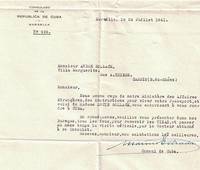
rif. 16-4373Marseille France: 24 juillet 1941. . TLS with franked envelope approving a visa for André and Lucie Bollack of Cassis.Provenance Estate of Paul Lombard. Né en 1889 Paul Lombard a été rédacteur en chef de la revue L’Homme libre journal de Clémenceau et critique littéraire sous le pseudonyme de Louis Méritan. Paul Lombard est de ces critiques qui comme l’a montré Thierry Laget Proust Prix Goncourt Gallimard 2019 reprochaient à l’Académie Goncourt d’avoir décerné leur prix à un écrivain trop vieux trop riche : "Au lieu de cela cette année le prix Goncourt … échoit à M. Proust qui n’est pas jeune : il a conquis en peu de jours une notoriété dont j’ignore le secret ; le prix Goncourt même s’il l’a mérité ne lui sera d’aucune utilité" déplore-t-il dans L’Homme libre du 11 décembre 1919 p. 2. Probablement aurait-il préféré que Les Croix de bois de Dorgelès remportât de prix d’autant que l'écrivain avait été un collaborateur régulier de L’Homme libre.Expertise by Ségolène Beauchamp 86bis rue de Bellébat 45000 Orléans and Pierre Prévost 75 rue Michel Ange 75016 Paris. Marseille, France: 24 juillet 1941. unknown
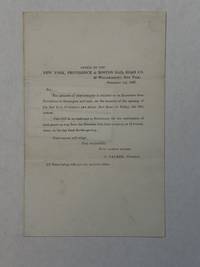
1837rif. 228771837. 4.75" x 7.5" folded. 1 3 blank pp gilt edges. Old wax seal remnants with small blank edge tear caused by opening the seal. 'Hazzard Esq. New Port' in script on back. Very Good. A rare ephemeron of this railroad and early American railroad travel. The printed invitation is on the first page. The ticket is loosely affixed to blank page 3. It is printed 'Excursion Over the New York Providence and Boston Rail Road. November 10th 1837. 'Mr. Hazzard' is written in script on its verso. unknown
1837rif. 228771837. 4.75" x 7.5" folded. 1 3 blank pp gilt edges. Old wax seal remnants with small blank edge tear caused by opening the seal. 'Hazzard Esq. New Port' in script on back. Very Good. A rare ephemeron of this railroad and early American railroad travel. The printed invitation is on the first page. The ticket is loosely affixed to blank page 3. It is printed 'Excursion Over the New York Providence and Boston Rail Road. November 10th 1837. 'Mr. Hazzard' is written in script on its verso. unknown books