Lee, Luke; Estrada, HectorBiblio.com

4 945 résultats
réf. 35885887-nnew. unknown
1862réf. 111032294Printed by R. & R. CLARK Edinburgh: PRINTED FOR PRIVATE CIRCULATION 1862. Book. Fair. Hardcover. First Edition. 12mo - over 6¾ - 7¾" tall. Age-toned cover with black border and chocolate endpapers gilt spine title and gilt - In Memoriam. 1862 at front cover center. Fair condition with partially re-glued inner spine to text block and old tape at the inside front. Some page sections have been moved slightly forward from the binding and there is a separation at the contents gutter. The cover is spotted and sunned with frays at the corners and the pages are lightly foxed. Whole page 1863 associated related inscription at the half-title page with a 1971 inscription below from another relative. Pasted picture of his wife opposite the title page. Civil War era book. 7 x 4 1/2 with 133 pages. Rare. PRINTED FOR PRIVATE CIRCULATION Hardcover
réf. DADAX1557987734New unknown
1935réf. K-2157M?nchen, Oscar Brunn Verlag, [um 1935]. Formatangabe ca 51 x 67 cm, gefaltet zu 20 Segmenten, Ausgabe: einf?rbig mit Wald- und Wasseraufdruck, farbige Skiroutenmarkierungen ; Zustand: Kartenblatt entlang Falzkanten stellenweise offen, Broschurvorderseite lose (Umschlag), sonst gut
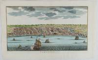
1750réf. 177186circa1750. Hand-coloured engraving 19.5 x 35.6 cm 25.5 x 41.6 cm sheet original folds two old paper repairs not affecting the image a trifle toned but in very good condition Attractive bird's-eye view town plan of Makassar in Sulawesi prepared for Abbé Prevost's monumental 'Histoire Générale des Voyages.' . unknown
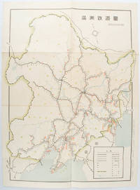
1519réf. 172590奉天. Mukuden.: 満鉄鉄道総局. Mantetsu Tetsudo Sokyoku. 昭和 15 1940. Colour folded map seven small very holes not affecting the printed image otherwise good. 53 x 38.5cm Map showing the comprehensive railway network in Manchuria with names of all the stations. It includes the lines run by the South Manchurian Railway Company their temporary industrial lines light rail as well as the lines run by other Russian and Chinese companies. By 1940 the network had expanded so much that it included almost the whole of Manchuria. . 満鉄鉄道総局. [Mantetsu Tetsudo Sokyoku]. unknown
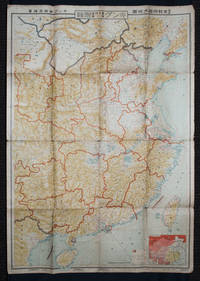
1938réf. 159295Tokyo: 大日本雄辯會講談社 Dainihon Yūbenkai Kōdansha. Shōwa 13. 1938. Two large detailed maps of China and on the reverse of the Soviet Union in Asia Manchuria and Mongolia printed double sided on a single large sheet. Issued as a supplement to Volume 14 Number 1 of the magazine Kingu on New Year's Day in 1938. Holes at a number of holes causing a small amount of loss some occasional browning some chipping on margins. The map has clearly been used but is still largely complete. The colourful map of China on a scale of 1:2600000 includes part of Manchukuo and Inner and Outer Mongolia on the north and part of French Indochina to the south-west. It shows East Hebei Autonomous Anti- Communist Council Jidong Fanggong Zizhi Zhengfu 冀東防共自治政府 south of Manchukuo which existed from late 1935 until February the 1st1938. The legend includes national and provincial borders cities roads railways sea and air routes and undersea cables. There is an inset map of East Asia titled "Present Situation of Far East" on the lower right corner which shows the areas under influence of Communism and those under influence of/controlled or colonised by the United Kingdom France Japan and China. The map on the reverse printed in blue and black shows the Asian section of the Soviet Union Manchuria and Mongolia on a scale of 1:3000000. There is an inset map of Asia titled "Asian Continent" at the upper left corner the area enclosed by a rectangle which indicates the area covered in this map. The legend includes cities railways roads national borders district borders province borders and air routes. . 大日本雄辯會講談社 [Dainihon Yūbenkai Kōdansha]. unknown
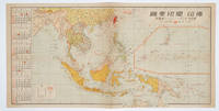
1572réf. 160545No place of publication.: 朝日新聞社. The Asahi Shimbun. 昭和十五1940. Published by 朝日新聞社 The Asahi Shimbun Japanese folding coloured WWII map with a calendar from January to June Shōwa 15 at the left scale 1:300000. Map includes French Indochina Dutch East Indies and parts of the territory of Papua China and British India. Some light browning and foxing otherwise very good. Text in Japanese. 25.3 x 51cm. Legend at lower left lists the boundaries between continents countries and provincials or regions railways airline routes capitals and Japanese embassies and consulates. The natural resources are indicated across the map. The map also shows parts of the territory of Papua under Australia's administration " 濠洲委任統治領 Gōshū inin tōchiryō". . 朝日新聞社. [The Asahi Shimbun]. unknown
réf. BN589153Indestructible Indestructible Cristina C. Road unknown
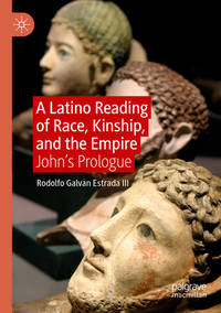
réf. BN324939Promopress. Softcover. Bagues: Tour du monde en 500 créations artistiques Bagues: Tour du monde en 500 créations artistiques Nicolas Estrada Promopress paperback
réf. 35883197-nnew. unknown
réf. 46849574-nnew. unknown
réf. BN738992Barcelona : Oceano. Comedias Comedias Shakespeare und Ezequiel Martinez Estrada Barcelona : Oceano unknown
réf. DADAX0823083446New unknown
réf. DADAX089838043XNew unknown
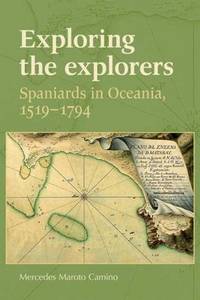
2009réf. x-0719077796Manchester Univ Pr 2009. Hardcover. New. 1st edition. 256 pages. 9.50x6.25x0.75 inches. Manchester Univ Pr hardcover
réf. DADAX0080430538New unknown
réf. CBS 9781634855617US Edition. New. Brand New! Fast Delivery US Edition and ship within 24-48 hours. Deliver by FedEx and Dhl & Aramex UPS & USPS and we do accept APO and PO BOX Addresses. Order can be delivered worldwide within 6-10 days and we do have flat rate for up to 2LB. Extra shipping charges will be requested if the Book weight is more than 5 LB. This Item May be shipped from India United states & United Kingdom. Depending on your location and availability. unknown
réf. SONG1581695632Used: Good unknown
1988[5], 6-144 pages. Index. Generously illustrated with maps and black and white reproductions of archival photos. "The fifth and final volume in the Maple Leaf Route series on the Canadian campaign in Northwest Europe 1944-45. Concentrates on the battles in the Rhineland during February and March 1945. A careful examination of the available documents, Canadian, British, American and German, has produced an account of this period which provides new insights. The Rhine crossing and the battles of April-May 1944 in the Netherlands and Germany are also described in some detail." - dust jacket. Average wear to book which is bound in golden boards. Binding intact. Prior owner's bookplate and tiny erasure upon front free endpaper. Fly specks [?) to right edge of front panel of dust jacket which otherwise shows average wear and is now preserved in archival-grade Brodart. A sound copy of this important Canadian military history. Cooke [3e] p.237. Book
1961[6], 168 pages. 9.5" x 6.5". Includes black and white illustrations by C.W. Jefferys from the Imperial Oil Collection. "Here we have the history of [Albion Township] , written by Esther Heyes, who is well qualified for such research and writing by her previous newspaper experience, and published by Werden Leavens of The Bolton Enterprise, well-known for his interest in historical projects. The Township lay outside the land included in the Toronto Purchase from the Indians in 1787-8 and belonged to the Mississauga Indians until 1818." - Preface. Former library copy with usual markings and above-average wear. Binding intact. Dust jacket preserved in glossy new archival-grade Brodart. A worthy reference copy of this informative Ontario local history. Bishop p.1100 Book
1971Features: Ste. Marie among the Hurons; The Development of Moose Factory; Simcoe Memorial Foundation; Expert Help for Museums; Ontario Heritage Foundation; Old Fort William - Hinge of a Nation; Charm of Williamstown; Niagara-on-the-Lake; Early Ontario Glass; Ontario's Pioneer Villages; The Thunder Bay Route West; On the Trail of the Nor'Westers; The Development of Ontario Painting; Collecting Furniture in Ontario; Earthen Pottery; Ontario Silversmiths; Ontario chairs; Ontario - The Textile Arts; Mennonite Traditional Arts. Average wear. Sound copy. Book
réf. 6851759Manchester University Press . Hardback. New. pp. xi 243 Maps Manchester University Press hardcover
réf. DADAX019881951XNew unknown
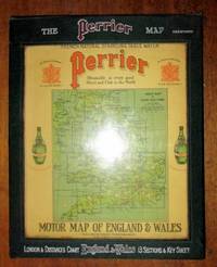
1922réf. 198554United Kingdom: George Philip & Son for Perrier 1922. Book. Very Good. Hardcover. a very good set of sectional coloured maps on an 8 miles to the inch scale in original case undated but around 1920-1923 as the Road lettering and numbering system A1 A40 etc are not here used and earlier than 1920 copies were backed onto linen fourteen maps distance card Index sheet all printed on card and with linen index taps to top edge lacking tab for Card Six Index card with Perrier advertising and reference to Royal Warrant of George V housed in a very good original wooden sided case lettered silver and red on green cloth plastic front to case revealing maps behind two press fasteners to rear flap a very well preserved set. George Philip & Son for Perrier Hardcover