DUFOUR, AUGUSTE HENRI; BONAPARTE, ERHARD R (ENGRAVERS); AND TANNEUR ET COMPANIE (LITHOGRAPHERS).Biblio.com
4931 risultati
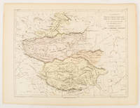
1856rif. 175109Paris.: Gustave Barba Editeur. 1856. Lithographed map with original hand colour central fold 24.2 x 31.5 cm marginal toning plate number in manuscript in very good condition. Finely engraved Dufour map of Central Asia prepared for his "Atlas Populaire" showing East Turkestan Petite Boukharie and Kalmykia Dzoungarie Mongolia and Tibet. . Gustave Barba Editeur. unknown
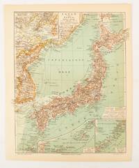
1902rif. 174898Leipzig.: Bibliographisches Institut. 1902-1908. Map printed in colour 27.2 x 21.4 cm inset colour key to territorial administration by country inset "western continuation of the main chart" including the Gulf of Tschili and Tsientsin and two insets at the foot of the map to the Kuril and the Ryuku Islands text in Geman central fold slight edge toning but in very good condition. Attractive map text in German prepared for Meyers Großes Konversations-Lexikon. . Bibliographisches Institut unknown
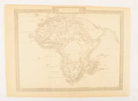
1880rif. 174956London.: The London Printing and Publishing Company. Circa1880s. Printed map 24 x 32.1 cm decorative border two original vertical folds paper toned mainly at the edges inner margin of the sheet ragged but in good order. A late edition of the map used for the well-known Tallis map this without the characteristic vignettes and on thinner paper. . The London Printing and Publishing Company. unknown
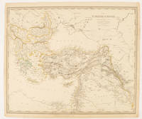
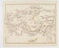
1840rif. 174957London.: Charles Knight & Co. circa1840s. Lithographed map with original outline hand-colour 31.9 x 39.1 cm small marginal tears neatly repaired with archival material but no loss small surface abrasion affecting the border at the foot edgewear and browning inked pagination in an early hand but in very good condition. A handsome map with fine topographical engraving also showing the borders with Hungary Russia and Persia. . Charles Knight & Co. unknown
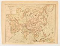
1875rif. 174830New York.: Harper & Brothers. 1875. Map printed in colour polar projection 21 x 27.1 cm marginal spotting and toning small edge tears to the inner margin but in god condition. Prepared for "Harper's School Geography" first published by Harper & Brothers in 1875. The map shows physical features mountains steppes plains rivers and deserts etc. together with sources of primary production: whale fisheries furs coffe tea minerals etc.The verso of the map with references and attractive line engravings part of the entry for Netherlands and Belgium. . Harper & Brothers. unknown
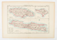
1880rif. 174937London Edinburgh & Glasgow.: William Mackenzie. 1880. Map printed in colour with original outline hand colour 29.8 x 22.7 cm central fold edge toning but in very good condition. Published for inclusion in "The National Encyclopaedia: A Dictionary of Useful Knowledge". . William Mackenzie. unknown
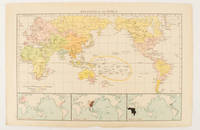
1900rif. 174875London and New York.: Encyclopedia Britannica. circa1900. Map in three insets after W & AK Johnston engravers with printed outline colour 18.9 x 28.9 cm central fold paper age-toned but in very good condition. Interesting map which first appeared in the ninth edition of Encyclopedia Britannica. . [Encyclopedia Britannica] unknown
1895rif. 175135London.: Times Atlas of the World. 1895. Map printed in colour 23.2 x 35.9 cm. two edges gilt with three inset maps key to religions outlined in colour bottom margin chipped edges browned a few silverfish abrasions affecting the verso but in good condition. . (Times Atlas of the World) unknown
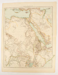
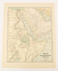
1895rif. 175108London.: Times Atlas of the World. 1895. Double-page folding map printed in colour 46.5 x 36.5 cm. edges gilt central fold with an inset map of Somaliland Somalia and the island of Sokotra key to European possessions outlined in colour small edge fold tears affecting the margin only and two other small edge tears slight toning at the edgaes but in very good condition. Attractive and detailed map prepared for the first edition of "The Times Atlas of the World". . (Times Atlas of the World). unknown
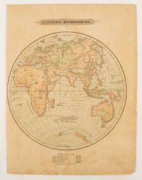
1875rif. 175128Harper & Brothers. 1875. Spherical map printed in colour 21.3 x 21.2 cm with shaded key to elevation and ocean currents unrelated text on the verso paper toned and margins soiled bottom edge ragged small sealed to to the inner margin but in sound condition. Map showing the five continents of Asia Africa Antarctica Europe and Australia. Published by Harper & Brothers for inclusion in their "School Geography". Plateau of Tibet very prominently marked. Gobi Desert and Plateau of Mongolia also marked India described as Hindostan Indo-China includes Thailand. . Harper & Brothers. unknown
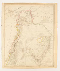
1843rif. 174934London.: Chapman & Hall. 1843. Engraved map with outline hand colour 39.4 x 31.4 cm inset map "Continuation from the Dead Sea to Mount Sinai" with finely engraved notes and a key to the Divisions under control of the Turkish Government manuscript pagination in an early hand to the top right edge tear nicks and browning but in very good condition. A most attractive map with detailed notes published when Syria was still under control of the Ottoman Empire. . Chapman & Hall. unknown
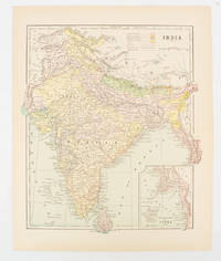
1910rif. 174839New York. circa1910. Printed colour map 29 x 25 cm with inset map of the Eastern Part of India colour key reference key to the ruling divisions current and projected railways and telegraphs also shown central fold slight toning; in very good condition. Interesting map shaded by Divisions: the Presidencies of Bengal Madras Bombay Ceylon "Native States under British Protection" and "Independent States" Nepal and Bhutan. . unknown
1893rif. 174920New York.: Hunt & Eaton. Circa1893. Printed map in colour elevation shown with hachures 29 x 23.5 cm text on the verso relating to entries for Afghanistan Beluchistan and Turkey prepared for Hunt & Eaton's "New York Recorder's Atlas" small tears to the top edge but in very good condition. . Hunt & Eaton. unknown
1739rif. 174921London.: The Gentleman's Magazine. circa1739. Engraved map 22.2 x 31.4 31.1 x 33 cm sheet size elaborate explanatory key in three columns at the foot original folds sealed 2 cm tear to the lower part of the inner margin one other small fold tear no loss inner margin of the key trimmed with some loss an original fault paper browned and spotted on the verso but an historic map in good condition. . [The Gentleman's Magazine]. unknown
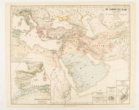
1877rif. 174916Gotha: Justus Perthes. 1877. Map with original colour and outline hand-colour 33.1 x 40.2 cm four inset maps text in German central fold slight marginal edge wear and spotting to the verso but in very good condition. A handsome map detailing the lands of Islam from Hegra in AD 622 to the fall of the Umayyads in AD 750. The inset maps depict a western extension to the main map and city plans for Damascus Jathrib & Medina and Mecca issued for the "Hand-Atlas für die Geschichte des Mittelatters und die Neueren Zeit". . Justus Perthes unknown
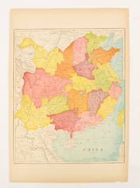
1900rif. 174904circa1900. Map printed in colour text in English provinces shaded in colour 28.3 x 23.2 cm central fold paper toned a small edge tear confined to the outer margin but in good condition. . unknown
1830rif. 175250London.: Society for the Diffusion of Useful Knowledge. Baldwin & Cradock. 1830. Engraved map wth outline hand colour 29.7 x 42 cm relief shown in hachures key to abbreviations including "Ancient Ruins" the west and east extremities attactively engraved to burst through the border original folds map with occasional spotting more pronounced at the lower corner edges a little ragged small chip to the inner margin no loss to the map manuscript pagination in the lower corner but in good condition. . Society for the Diffusion of Useful Knowledge. Baldwin & Cradock. unknown
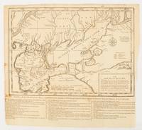
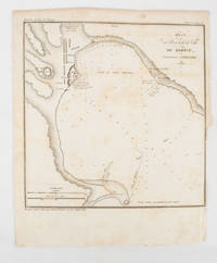
1839rif. 175248Paris.: Librairie de Gide. 1839. Engraved map 21.1 x 20.8 cm 27 x 22 cm sheet original folds trimmed to the inner margin with slight loss to the border only map spotted but otherwise in sound condition. Map of the Port of Kerch in Crimea prepared for the 1839 edition of the French Journal "Nouvelles Annales des Voyages." the editors for this edition amongst others the translator and geographer Jean-Baptiste Benoît Eyriès and Alexander von Humboldt founding members of the world's first geographical society the Société de Géographie. . (Librairie de Gide). unknown
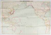
rif. 169329東京. Tokyo.: 九段書房.Kudan shobo. 大正十四 1925. Coloured folding Japanese map showing the military strength of Japan the United States and the United Kingdom in the Pacific original pictorial envelope scale not given. Some small holes at folds occasional light foxing a prior owner's signature on reverse minor wear envelope. Very good copy in like envelope. Map measures 54.4 x 78.8cm. The explanatory text in Japanese printed on the reverse in blue summarises the colonial possessions of the US and the UK as well as providing a comparison between the land size naval presence natural resources immigration issues and maritime transport capacities of Japan the United States and the United Kingdom. Legend indicates national regional provincial territorial boundaries canals undersea cables airline routes metropolitans capital cities mining fields hot springs ancient battle fields major trade ports Japanese embassies and consular offices. A large area marked 日本委任统治 "South Pacific Mandate" highlighted in a box is adjacent to Australian occupied Papua New Guinea. . 九段書房.[Kudan shobo]. unknown
1819rif. 162103Tokyo.: Tōseisha. Showa 18 1943. Folding colour map of Australia 54.2 x 76.4cm. Some foxing particularly along folds and upper right margins a few repaired tears and small holes at folds.With original sleeve. The 15th map in the Standard Maps of Greater East Asia series of 20 maps. Shows the natural resources such as sheep gold pearl diary regions opals etc. Tasmania appears as an inset in the bottom right corner. Text in Japanese. . Tōseisha. unknown
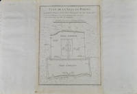
1749rif. 136794Paris. circa1749. Black and white engraved plan map of Peking on laid paper folded designed by the prominent French cartographer Jacques-Nicolas Bellin. This map is No. 18 Vol. 5 from the impressive 15-volume "Histoire Generale des Voyages" compiled by French novelist Antoine François Prévost. This city map shows two areas of walled cities: Ville Tartare Imperial city and the Forbidden City and Ville Chinoise ethnic Han residential area. Notes A and B represents buildings within the Forbidden City. A: Lieu de Plaisance ou l'on voit une Montagne faite a la main B: Grandes Cours du Palais de l'Empereur. Two missionary buildings French and Portuguese as well as the Tower of Mathematics illustrated within Ville Tartare. Two temples illustrated side by side near the south gate of the Ville Chinoise. Overall in good condition very light browning on edges and darker toning along the borders of the map. Text in French. Map measures 21 x 16.4cm. . unknown
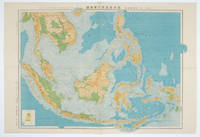
1572rif. 160538東京.Tokyo.: 日本名所圖繪社.Nihon Meisho Zuesha. 昭和16 1941. Folding colour Japanese map of the Malay Archipelago and Thailand scale 1: 8500000 with attractive original pictorial paper envelope. This map also shows the Dutch French and American colonies. Hainan Province and the South China Sea are shown in the north. Agricultural and mineral resources indicated across the map. Few small holes at holes and other light signs of wear. Slipcase lttle torn. Text in Japanese and English. 53.3 × 78.2cm. . 日本名所圖繪社.[Nihon Meisho Zuesha]. unknown
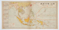
1572rif. 160545No place of publication.: 朝日新聞社. The Asahi Shimbun. 昭和十五1940. Published by 朝日新聞社 The Asahi Shimbun Japanese folding coloured WWII map with a calendar from January to June Shōwa 15 at the left scale 1:300000. Map includes French Indochina Dutch East Indies and parts of the territory of Papua China and British India. Some light browning and foxing otherwise very good. Text in Japanese. 25.3 x 51cm. Legend at lower left lists the boundaries between continents countries and provincials or regions railways airline routes capitals and Japanese embassies and consulates. The natural resources are indicated across the map. The map also shows parts of the territory of Papua under Australia's administration " 濠洲委任統治領 Gōshū inin tōchiryō". . 朝日新聞社. [The Asahi Shimbun]. unknown
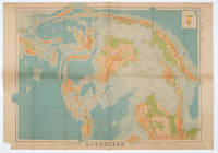
1572rif. 160533Tokyo.: 日本名所圖繪社.Nihon Meisho Zuesha. 昭和 17 1942. Folding Japanese coloured map of the Malay Archipelago and Thailand during World War II scale 1:8500000. Legend in lower corner indicates altitudes. Ink annotation in Japanese left edge. Pin holes at three corners upper right corner torn with loss evenly browned otherwise very good. Text in Japanese and English. 52.8 x 75.6cm. This map shows most of Thailand former Indochina Hainan Province and South China Sea Sumatra and Java Sea Borneo the Philippine Islands Celebes Timor New Guinea and parts of Micronesia. Natural resources such as tobacco spices wood sugar metal mines tin iron and etc. rice and other resources are indicated on the map. . 日本名所圖繪社.[Nihon Meisho Zuesha]. unknown
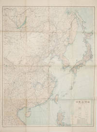
1419rif. 160524Tokyo.: 大日本帝國陸地測量部. 昭和14 1939. Large colour folding Japanese WWII map. Scale 1:5000000 featuring Japan Korea Taiwan Karafuto Eastern China parts of French Indochina and the Northern Philippines US colony in detail. Legend includes territorial boundaries national and regional and shows some borders as unclear i.e. Taiwan and bordering region along Northeast China the Soviet Union and Mongolia air routes submarine communication cables linking major costal cities i.e. Hong Kong Xiamen Shanghai Nagasaki etc. airports radio stations mining fields and more. A small chart shows the names of mountains rivers and lakes also included adjacent to legend. Some small holes at folds creases and some minor loss edges generally very good. Text in Japanese. 109 x 77.8cm. . 大日本帝國陸地測量部. unknown