5 227 résultats
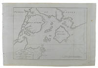
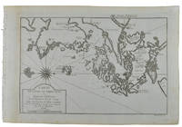
1749réf. 136826Paris. circa1749. Black and white engraved map on watermarked laid paper 20.9 x 32.7cm showing coastal area of Zhejiang Province Province de Che-kiang including Zhoushan Archipelago Isle de Chusan Zhoushan Bay Bay de Chusan and Xiangshan County Siang-chan-luen a walled city outside of upper border Ningbo Ning-po prefecture under Qing administration title cartouche lower left original folds. This map is No. 3 Vol. 6 from the impressive 15-volume "Histoire Generale des Voyages" compiled by Antoine François Prévost. Even browning mainly to the sheet edges in very good condition. . unknown
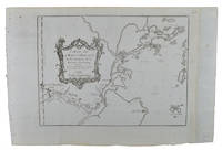
1749réf. 136795Paris. circa1749. Black and white engraved map of Quanzhou and Zhangzhou 21.1 x 30 cm here spelled Chin-chew and Chang-chew and both final words with added superscript "ou" on watermarked laid paper 25.6 x 38 cm original folds a few marginal spots simplified compass rose and a decorative fleur de lis bottom right in very good condition. Attractive map including the estuary of Quanzhou River Xiamen Emowi and Kinmen or Quemoy Quemowi island. The map was designed by the eminent French cartographer Jacques-Nicolas Bellin and here published as plate No. 22 in the impressive 15 volume compilation of voyages "Histoire Generale des Voyages" by Antoine François Prévost. . unknown
1749réf. 136827Paris. Circa1749. Engraved map on watermarked laid paper 20 x 27.3 cm of Fuzhou and coastline of Fujian Province original folds designed by the great French cartographer Jacques-Nicolas Bellin. This map is from the impressive 15-volume "Histoire Génèrale des Voyages" compiled by Antoine François Prévost map no. 2 Vol. 6. This map shows the estuary of Yangtze River Rivière de Chang. Very light browning on sheet edges but in very good condition. . unknown
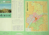
1977réf. 137003No place of publication.: 江苏人民出版社.Jiangsu ren min chu ban she. 1st Edition 2nd Printing. 1977. Colour Chinese transportation map featuring the city of Nanjing capital city of Jiangsu Province and its surrounding regions. Upper side: A transpiration map of Nanjing and neighbouring counties right section with a list of names of stations buses trains coaches ferries and their addresses lower right edge tourist guide including the addresses and phone numbers of major travel agents hospitals cinemas and more left section accompanied by two tables of bus routes. On reverse: a "Map of Nanjing Municipal Transpiration Map" scale not given a chart of terminus for bus and trolley bus lower right section. Some soiling on reverse stamp of a prior dealer in Guangzhou a handwritten date of "September 17th 1977" upper side light creases good copy. Text in Chinese. Sheet measures 37.8 x 52.3cm. . 江苏人民出版社.[Jiangsu ren min chu ban she]. unknown
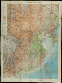
1953réf. 161304Edinburgh.: John Bartholomew & Son Ltd. 1953. Colour folding map laid down on linen. Scale 1:450000. 97 x 72 cm. Small holes and tears at some folds a little light browning. Cloth tape repair at fold adjoining upper card cover. Frederick Warne label upper cover a little creased and torn key includes glossary of Chinese geographical terms translated into English. Contour-coloured world map series. Published in the period immediately following the Korean War this map shows the 38th Parallel. . John Bartholomew & Son Ltd. hardcover
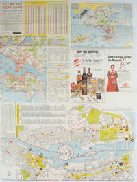
1976réf. 161881Hong Kong.: Walter K. Hoffman. January/February1976. Coloured tourist map brochure of maps of Hong Kong printed both sides six maps in total folded. Brochure also includes advertisements currency rates. Minor tears along folds otherwise in good condition. Text in traditional Chinese English and Japanese. Sheet measures 58.2 x 43.4cm. Sheet includes 6 individual maps: Map of British Crown Colony of Hong Kong Map of the Urban Area with routes for public transportation Map of Tsimshatsui large scale street map Map of Central District large scale street map Map of Wanchai large scale street map Map of Causeway Bay large scale street map Map of Portuguese Overseas Province of Macau. On the maps of Central and TST the names of many businesses hotels etc are marked. . Walter K. Hoffman. unknown
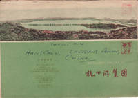
1962réf. 160933杭州.Hangzhou.: 浙江人民出版社.Zhejiang renmin chu ban she. 2nd Edition 3rd Printing. 1962. Folding colour tourist brochure for Hangzhou. One side shows large map of Hangzhou the other 5 more detailed maps chops and previous owner's annotations upper cover small hole at one fold some light wear and browning good. Text in both traditional and simplified Chinese. Sheet size 53.9 x 38.3cm folded size 13.5 x 19.2cm. One side includes a legend an inset showing tourist spots surrounding Hangzhou a table shows lists of Hangzhou's hospitality industry e.g. hotels cinemas swimming pools restaurants department stores etc. The other side includes five individual tourist maps: Viewing Fish at Flower Pond 花港觀魚 Lingyin Temple 靈隱 Hangzhou Bus Map 杭州市公交路线图 Lonely Mountain 孤山 Dreaming of the Tiger Spring 虎跑. . 浙江人民出版社.[Zhejiang renmin chu ban she]. unknown
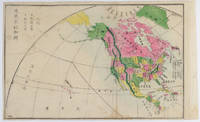
1877réf. 159812Kyoto.: 村上勘兵衛 文部省刊行. Murakami Kanbē; Monbushō kankō. Meiji 10 1877. Colour woodblock map of North and Central America. From the Journal of World Geography 萬國地誌略 published in 1877. Printed area measures 33.5 x 21cm a good copy with occasional soiling. . 村上勘兵衛, 文部省刊行. [Murakami Kanbē; Monbushō kanko& unknown
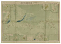
1819réf. 155215統正社 Tōseisha . Showa 18 1943. Colour folded map 54. x 76.5cm. Pinholes at corners light even browning good copy. This Japanese map of Micronesia shows the Mariana Islands Eastern and Western Caroline Islands Marshall Islands and Gilbert Islands. The separate maps around the edge are clockwise from the upper right corner: Jaluit Atoll Guam Island Rota Island Saipan Island Palau Islands Yap Island Hall Islands Pohnpei Island Truk Islands and Kusaie Island. . 統正社 [Tōseisha ]. unknown
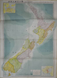
1572réf. 154080Tokyo: 統制社Tosei-sha. 昭和18 Showa1943. Folding colour map of New Zealand with inset of Auckland and Wellington top and bottom corners1:2000000 scale little light browning. Original envelope worn with closed tears. 54 x 76.5cm. Good copy. Scale plan of New Zealand printed by Tosei in 1943. The map legend shows infrastructure deemed important to the Land Survey Bureau of the General Staff Headquaters of the Imperial Japanese army such as boundaries powerlines quarries and mines; railroads sea-routes etc. . 統制社(Tosei-sha) unknown
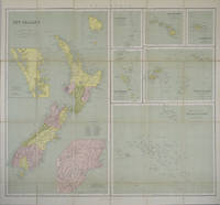
1865réf. 154409London.: George Philip & Son. 1865. 9 coloured maps by William Hughes segmented and mounted on linen 55.3 x 65.2cm. Folds into cloth covered case 17.2 x 12cm. Spine of case little faded and ribbon tie missing. Relief shown by hachures and spot heights. Philips' series of travelling maps series. Very good copy. Features a dominant map of New Zealand with 3 maps as insets to this map and 6 other maps separately shown within their own borders. The 3 inset maps are: Norfolk Island and Philip Island; Enlarged map of Auckland and the adjacent country; Enlarged plan of the country around Dunedin and the eastern portion of the Otago Gold Fields from Thomson's map. The 6 maps in addition to the New Zealand map are The Ladrones or Mariana Islands; The Sandwhich Islands; The Galapagos Islands; The New Hebrides and Santa Cruz Islands; The Feejee Friendly and Samoan Islands; The Marquesas Society and Low Archipelago. The New Zealand maps includes a list of native tribes and their locations. . George Philip & Son. hardcover
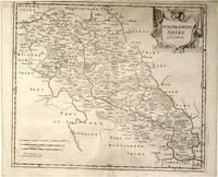
réf. 64216London.: Gibson. Early 18th Century. Black and white map from Camden's Britannia showing towns roads rivers and landforms 38 x 46.5 cm. . [Gibson.] unknown
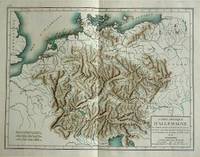
1800réf. 57070c1800. Copper engraving with handcolouring map shows Germany and parts of France Italie Hongrie Pologne and Prusse sic. Minor hole upper border few closed tears and some browning edges otherwise a clean and bright image. Map measures approximately 34 x 46cm. . unknown
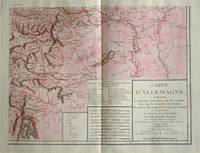
1805réf. 570721805. Copper engraving with handcolouring map shows the border of the Austrian Empire and Hungary Vienne sic and the Danube can be seen at the top of the map Two keys and scale inset. Few closed tears and some browning edges otherwise a clean and bright image. Map measures approximately 34 x 44cm. Map of Germany indicating the present division of this empire as well as the new possessions of the princes who make up the Germanic body and including Batavia and Helvetia Switzerland with their divisions. by E. Mentelle a member of the institute and P. G. Chanlaire one of the authors of the National Atlas. An xiii 1805. Paris. There is a key to the explanation of the signs and an explanation of the colours used for the district of the various states contained in this map. . unknown
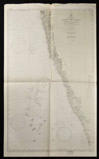
1937réf. 65133Washington. D.C.: U.S. Navy Hydrographic Office. 10th edition. 1937. Two charts black and white folded as issued. #1589: sheet measures approx. 89 x 118cm #1590: 127 x 76cm little creased at upper edge. Very good. A great length of the coast is here charted with much detail marked along the coast including rivers towns and the topography. The charts mark soundings in fathoms or feet and various natural and man-made features of the coastal area. Both are stamped "Corrected Through Notice to Mariners Feb. 17 1951". . U.S. Navy Hydrographic Office. unknown
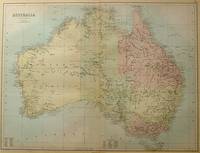
1884réf. 56997Edinburgh.: A & C Black. 1884. Printed colour map of Australia some light foxing few minor tears browned edges still a clear and bright image. Map measures approximately 42 x 55cm. . A & C Black unknown
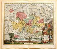
1717réf. 61880Nuremberg.: Johann Baptist Homann. 1717. A beautifully engraved hand coloured map of North East Germany showing the area around Erfurt in detail. In the centre of the map is a small plan of Erfurt which is also shown as a panoramic view at the foot of the map and titled 'St. Petersburg'. An elaborate decorative title cartouche in the lower right corner depicts allegorical figures surrounded by the produce of the land including sheaves of wheat; a beehive; and a cornucopia of fruits. Cherubs holding a coat of arms float up from the scene on the right while on the lower left a centaur sits meditatively beneath a pine tree amongst slaughtered cattle. Physical features of the area are illustrated and farming areas shown by fields which criss-cross across the map. A clear dark impression the work of an outstanding German cartographer who in 1715 was appointed as imperial geographer by Emperor Charles VI. This map also includes "Schwan See" Swan Lake under a town of the same name which has since disappeared. Hand coloured two very minor splits at upper and lower edges on centre fold and not affecting engraved area a handsome map 54 x 61.5 cm. . [Johann Baptist Homann.] unknown
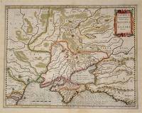
réf. 54794Amsterdam.: Jodocus Hondius. Circa Early 17th Century. Map depicting the southeastern part of present day Ukraine and the Crimean peninsula including the northern most part of the Black Sea and reaching north to Smolensk. Published by Hondius in the French edition of the Mercator-Hondius Atlas. Hand outline colour topographical detail shown pictorially some wear along centrefold occasional pale foxing mostly in margins decorative title cartouche upper right corner French text on verso showing through clear plate mark even age toning 48.5 x 58 cm. . [Jodocus Hondius]. unknown
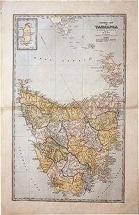
1888réf. 61874Sydney.: The Picturesque Atlas Publishing Company. 1888. A large and detailed map of Tasmania from The Picturesque Atlas Publishing Company showing railroads existing as well as under construction and coloured regions dividing the island into districts. Hachures depict landforms detailed index to place names on verso small inset upper left corner showing Kind Island printed colour 70 x 45.5 cm. . The Picturesque Atlas Publishing Company. unknown
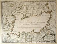
1723réf. 54819Rainer Ottens. 1723. A most attractive map with early outline hand colour vertical fold barely visible diagonal crease upper half of map few very pale small brown spots otherwise a clean and bright image. Numbering in red pencil few annotations in pencil and light number stamp on reverse however not at all visible from front of map or affecting image. Sheet measures 46.6 x 60.2cm. . Rainer Ottens. unknown
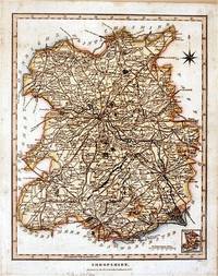
1827réf. 61872London.: J. Wilkes. 1827. Attractive hand coloured map of Shropshire 27.5 x 21.5 cm. very occasional light foxing on reverse but not visible on the image itself. A most attractive map. . [J. Wilkes.] unknown
1584réf. 64215Antwerp.: Abraham Ortelius. circa1584. Two engraved maps on laid paper each 30.3 x 19.5 cm printed on the one sheet 48 x 60 cm original fold attractive hand colour with related French text on verso slight toning and spotting to the margins but the maps in very good condition preserved in a modern window mount. Attractive maps of the German coast published in Ortelius' great atlas "Theatrum Orbis.". The left-hand map showing the mouths of the Elbe complete with sea monster and Eider Rivers and the coast of Schleswig-Holstein; the right-hand map of the Baltic coast with the Pomeranian islands of Rugen and Usedom. . (Abraham Ortelius). unknown
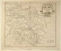
réf. 64139London.: Gibson. Early 18th Century. Engraved map on watermarked paper central fold 38 x 46.5 cm decorative title cartouche towns roads rivers and landforms shown; from Gibson's edition of Camden's Britannia upper edge trimmed by the original binder causing minor loss to the border at the inner edge but in very good condition. . [Gibson.] unknown
réf. 1287361501.Gpaperback. Good. Access codes and supplements are not guaranteed with used items. May be an ex-library book. paperback
réf. 0548829373.Gpaperback. Good. Access codes and supplements are not guaranteed with used items. May be an ex-library book. paperback