[TOURIST MAP - JAPAN, KOREA AND TAIWAN].Biblio.com
5 228 résultats
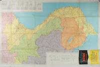
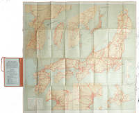
1927réf. 215711Tokyo.: Japanese Government Railways. Circa1927. Large folding colour map 78.5 x 80 cm of Japan and Korea 6 inset maps one of which shows Taiwan scale 1:1640000 for Hondo Shikoku and Kyushu 1:2340000 for Chosen; tipped into the original orange cloth covered case with orange ties text in 31 panels on the verso one a little age-toned a few very small fold splits without loss a very good copy. Attractive tourist map for the English-speaking traveller issued by the Japanese Government Railways with extensive notes for tours and points of interest on the verso short descriptions of cities and sites to visit principal theatres with suggestions for cafes restaurants and department stores. . Japanese Government Railways. hardcover
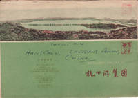
1962réf. 160933杭州.Hangzhou.: 浙江人民出版社.Zhejiang renmin chu ban she. 2nd Edition 3rd Printing. 1962. Folding colour tourist brochure for Hangzhou. One side shows large map of Hangzhou the other 5 more detailed maps chops and previous owner's annotations upper cover small hole at one fold some light wear and browning good. Text in both traditional and simplified Chinese. Sheet size 53.9 x 38.3cm folded size 13.5 x 19.2cm. One side includes a legend an inset showing tourist spots surrounding Hangzhou a table shows lists of Hangzhou's hospitality industry e.g. hotels cinemas swimming pools restaurants department stores etc. The other side includes five individual tourist maps: Viewing Fish at Flower Pond 花港觀魚 Lingyin Temple 靈隱 Hangzhou Bus Map 杭州市公交路线图 Lonely Mountain 孤山 Dreaming of the Tiger Spring 虎跑. . 浙江人民出版社.[Zhejiang renmin chu ban she]. unknown
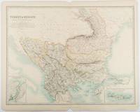
1893réf. 177055Edinburgh & London.: W. & A. K. Johnston. 1893. Engraved map with original outline hand-colour 44 x 57.4 cm map two inset maps of the Bosphorus and Crete; central fold corners chipped with loss lower edge with several small marginal tears neatly repaired head and foot clipped at the fold with loss to the margin but the map in very good condition. Detailed and finely engraved map also showing submarine telegraph lines and relief by hachures. Re-issue of the map first published in 1863 for "Keith Johnston's Royal Atlas of Modern Geography". . W. & A. K. Johnston unknown
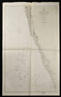
1937réf. 65133Washington. D.C.: U.S. Navy Hydrographic Office. 10th edition. 1937. Two charts black and white folded as issued. #1589: sheet measures approx. 89 x 118cm #1590: 127 x 76cm little creased at upper edge. Very good. A great length of the coast is here charted with much detail marked along the coast including rivers towns and the topography. The charts mark soundings in fathoms or feet and various natural and man-made features of the coastal area. Both are stamped "Corrected Through Notice to Mariners Feb. 17 1951". . U.S. Navy Hydrographic Office. unknown
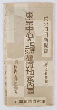
1419réf. 163423東京日日新聞社. Showa 14 19391939. Title on map :東京中心の健康地案内鳥瞰圖. Tōkyō chūshin no kenkōchi annai chōkanzu. Colour map of region around Tokyo with inset map in lower right corner. Few closed tears along central fold larger tear repaired small holes at folds a little light browning. Measures 19.5 cm x 9.5 cm when folded and 38.7 cm x 54 cm when open. Bird's eye view map of the region around Tokyo showing places where the residents of the city can go for healthy one two or three day trips. The map published by the Tokyo Nichi Nichi Newspaper in 1939 highlights hot springs golf courses beaches parks fishing areas mountains shrines and ski areas. The mark ハ indicates hiking courses. On the reverse side the distance to each resort area the way to get there and the costs are detailed. Users of the map area are warned that the areas circled in red around the mouth of Tokyo Bay is a military area where photos cannot be taken without permission. Even with the rising tides of war in 1939 city people were clearly still looking for ways to escape the noise and dust of the city for health-giving recreation. . 東京日日新聞社. unknown
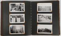
réf. 177650154 black and white snapshots held in place with photograph corners in a patterned fabric covered photograph album. Sizes of the photographs vary from 5 x7.5cm to 8.5 x 12.5cm. Black and white folding map of Burma 34.7 x 24cm loosely inserted two insets on the map show an elephant carrying teak a mahout on his back and a small map showing Burma's location within the region. Although the photographs are not individually captioned the album is divided into sections titled in white ink. Some blank leaves towards the rear of the album a separate section of 10 photographs titled "Burma & China" fills the last leaves. Six photographs are evenly browned all others are in excellent condition. A very interesting photograph album in excellent condition. A fascinating photographic record of events on the crucial Burma Road in southwestern China during and immediately after the Pacific War. An inscription on the final leaf gives the name John Barry Williams and the date 6/23/42 to 1/15/46. The Burma Road was constructed in 1936-1937 mainly to enable the allies to send material to China which was then at war with Japan. After the occupation of Burma by Japan in 1942 the flow of goods was cut until 1945 when in the last months of the war allied troops reconnected the transport corridor from Burma to China. Meanwhile war materiel continued to be transported by plane between Yunnan in China and India over the section of eastern Himalayas known as 'The Hump'. The owner of this album appears to have been a US serviceman stationed at Tsuyung Airfield in the Chinese province of Yunnan - the main transport hub at the Chinese end of the Hump route. The first photos in the album show scenes of the Burma Road and the Salween River on the border of Yunnan and Burma. There are a number of fine black-and-white photos of everyday life in the area including a village street a local salt mine a farmer ploughing with water buffaloes a street scene in Tsyuyung town women and children repairing the road and a train of pack ponies taking goods to market along the Burma Road in China. There are also images of a serviceman named Washburn holding up a captured Japanese flag. The following series of photos is labelled '780 Engineer Petroleum Distribution Co. Pipeline India-Burma-China 1944 and 1945' and shows scenes of the contruction of this vital fuel link with photos shot in India in the jungles of Burma and in southwestern China. The photos give a vivid image of the magnitude of the construction task showing teams camping out in rugged terrain and crossing rivers on makeshift bridges. A final group of photos labelled 'Burma and China' includes shots of a parachute drop from a plane and an image of allied soldiers with local villagers. A small map of Burma and Tibet published in 1948 has been loosely inserted in the front of the volume. . unknown
réf. 17801Bruxelles, Le Cormier, 1998. Un volume in-8°, broché.
1970réf. 197689Chicago.: Rand McNally. circa1970. Very large folding colour map 136 x 89 cms folding to 30.5 x 22.8 cm legend and glossary with a gazetteer in an upper corner to North and South Vietnam Cambodia and Laos small fold split no loss in very good condition. Extremely detailed map of Indochina scale of 1 inch to approximately 20 miles with roads paths trails railroads airports marked and indexes to cities and towns and population totals in South Vietnam North Vietnam Cambodia and Laos. Includes a glossary of foreign terms and a brief gazetteer. . Rand McNally. unknown
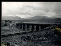
réf. 32483AB1974. Scotland 1974-2002. Oblong-Folio 44 cm wide x 36 cm high. Hardcover / Original Full-Leather Folders with stong black cardboards and original tissue-guards. Excellent condition with only minor signs of wear. With hundreds of manuscript annotations on the photography the photography-technique film used and with extensive elaborations on each photograph in these albums. More images on request ! Album 1: Covers the years 1974 1977 and 1978. The West Highland Line is walked from Arrochar a 1977 driving and camping holiday and a 1978 seventeen day touring holiday with many nights sleeping in a car fill the leaves with c. 200 b/w original photographs. Album 2: Covers the years 1991 and 1992. It is noted that 1990 is the fourth year that returning locomotives from the Mallaig line will work south over the West Highland main line. Images of Corrour Summit Glasgow to Fort William trains and many many more bridges viaducts tunnels stations and signalling equipment fill the leaves. c.182 b/w original photographs. Album 3: Covers 1993. More colour photographs now fill the leaves and annotations cease to second half of album. c 270 b/w colour and tinted original photographs. Album 4: Covers 1999 and 2002. Many images from The Highlands Rail Festival in Sept 1999. c.250 b/w and colour original photographs. An extraordinary photographic record and passion project presented in 4 huge well-bound albums containing over 900 fine photographs taken curated and annotated by an unidentified railway enthusiast and talented photographer. The albums span 4 decades recording trips to some of the most scenic and famous rail locations in the UK. The West Highland Line is returned to again and again over the decades and our photographer captures Scotlands most dramatic landscapes and railways as the route passes on its way from Glasgow to Mallaig through sections including Corrour and Rannoch Moor. Albums and contents in fine condition. A tissue guard between every leaf protects the photographs within. A single photograph of a middle aged man among every other photograph which records a detail of the railway is the only clue to the albums previous ownership and perhaps authorship. Partial description by our colleague Dr.Christian White from Christian White Rare Books in Ilkley UK. __________________________________________________________________________________________________________ The West Highland Line Scottish Gaelic: Rathad Iarainn nan Eilean "Iron Road to the Isles" is a railway line linking the ports of Mallaig and Oban in the Scottish Highlands to Glasgow in Central Scotland. The line was voted the top rail journey in the world by readers of independent travel magazine Wanderlust in 2009 ahead of the notable Trans-Siberian line in Russia and the Cuzco to Machu Picchu line in Peru. The ScotRail website has since reported that the line has been voted the most scenic railway line in the world for the second year running. The West Highland Line is one of two railway lines that access the remote and mountainous west coast of Scotland the other being the Kyle of Lochalsh Line which connects Inverness with Kyle of Lochalsh. The line is the westernmost railway line in Great Britain. At least in part the West Highland Line is the same railway line as that referred to as the West Highland Railway. History: The route was built in several sections: Glasgow Queen Street to Cowlairs Junction - Edinburgh and Glasgow Railway Cowlairs Junction to Bowling - Glasgow Dumbarton and Helensburgh Railway later absorbed into the Edinburgh and Glasgow Railway Bowling to Dumbarton Central - Lanarkshire and Dumbartonshire Railway operated by the Caledonian Railway Dumbarton Central to Dalreoch - Caledonian and Dumbartonshire Junction Railway Dalreoch to Craigendoran - Glasgow Dumbarton and Helensburgh Railway Craigendoran to Fort William opened 11 August 1894 - West Highland Railway sponsored by the North British Railway Crianlarich to Oban - Callander and Oban Railway operated by the Caledonian Railway. There is an additional section from Fort William or a junction near Fort William to Mallaig built as the Mallaig Extension Railway. The West Highland Railway approved the construction of the line at their annual meeting in January 1895. The line faced potential closure as part of the Beeching cuts in 1963 and again in 1995 due to reduced revenues. Route description: Shortly after leaving Glasgow Queen Street station and beyond Queen Street Tunnel the line diverges from the main trunk route to Edinburgh Waverley and Perth at Cowlairs and follows a northwesterly course through the suburbs of Maryhill and Kelvindale. Between Westerton and Dumbarton the route is shared with the North Clyde Line to Helensburgh Central before branching northward at Craigendoran Junction towards Garelochhead the section where the West Highland Line itself is generally accepted to begin. It gives high-level views of the Gare Loch and Loch Long before emerging alongside the northwesterly shores of Loch Lomond then climbs Glen Falloch to Crianlarich. The branch to Oban diverges at Crianlarich an important Highland junction of both road and rail and runs through Glen Lochy to Dalmally and through the Pass of Brander to reach salt water at Taynuilt and Connel Ferry before a final climb over a hill to Oban. About three miles five kilometres from Crianlarich the Mallaig and Oban routes both pass through the village of Tyndrum but they are served by separate stations making it an unusually small settlement to be served by more than one railway station. After Bridge of Orchy the line to Mallaig climbs onto Rannoch Moor past the former crossing point at Gorton Crossing to Rannoch station. In winter the moor is often covered with snow and deer may be seen running from the approaching train. The station at Corrour on the moor is one of the most remote stations in Britain and is not accessible by any public road. This is the summit of the line at 1347 ft 410 m above sea level. Carrying on northwards the line descends above the shores of Loch Treig and through the narrow Monessie Gorge. The final stop before Fort William is Spean Bridge. The section between Fort William and Mallaig passes over the Glenfinnan Viaduct through Arisaig with its views of the Small Isles of Rùm Eigg Muck and Canna and the white sands of Morar before coming to Mallaig itself. With the exception of the route between Glasgow Queen Street and Helensburgh Upper and the short section between Fort William Junction and Fort William station the railway is signalled using the Radio Electronic Token Block controlled from the signal box at Banavie station. Notable railway-related features Glenfinnan Viaduct The Horse Shoe Curve between Upper Tyndrum and Bridge of Orchy The Cruach Rock snowshed between Rannoch and Corrour Glenfinnan Viaduct between Locheilside and Glenfinnan The Pass of Brander stone signals between Dalmally and Taynuilt Arisaig is the most westerly railway station in Great Britain West Highland Line in film: Train crossing bridge at Banavie The summit of the line just north of Corrour Glenfinnan Viaduct on the line between Fort William and Mallaig is a filming location for the Hogwarts Express in the Harry Potter series of films. Eddie McConnell's poetic documentary A Line for All Seasons 1970 showcases the line and its history set against the scenery of the western highlands as it changes through the seasons. Corrour features in Trainspotting 1996 directed by Danny Boyle. Source: Wikipedia hardcover
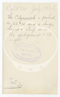
1935réf. 152267N.p.: N.p. 1935. Archive of 24 vernacular photographs documenting a 1935 summer road trip through the badlands of South Dakota Idaho and Wyoming. Each photograph with manuscript ink annotations identifying location to the margins and manuscript pencil annotations to the verso noting locations and dates along with the stamp of Rays photography studio in LaCrosse WI. Captured in the archive are various natural landmarks including Shoshone Canyon IXL Ranch and Bighorn Mountains in Wyoming Bald Mountain in Idaho and the Black Hills Badlands and Missouri River in South Dakota. Also included are a few photographs taken along US Route 14 one of the original US highways of 1926 an east-west route running 1398 miles. An alternately charming and chilling collection of Depression-era travel photography in the Midwest and Mountain West. 23 photographs 4.5 x 2.17 inches 1 photograph 3.5 x 2.75 inches. Generally Very Good plus some with light fading and age toning. N.p. unknown
1935réf. 152267N.p.: N.p. 1935. Archive of 24 vernacular photographs documenting a 1935 summer road trip through the badlands of South Dakota Idaho and Wyoming. Each photograph with manuscript ink annotations identifying location to the margins and manuscript pencil annotations to the verso noting locations and dates along with the stamp of Rays photography studio in LaCrosse WI. Captured in the archive are various natural landmarks including Shoshone Canyon IXL Ranch and Bighorn Mountains in Wyoming Bald Mountain in Idaho and the Black Hills Badlands and Missouri River in South Dakota. Also included are a few photographs taken along US Route 14 one of the original US highways of 1926 an east-west route running 1398 miles. An alternately charming and chilling collection of Depression-era travel photography in the Midwest and Mountain West. 23 photographs 4.5 x 2.17 inches 1 photograph 3.5 x 2.75 inches. Generally Very Good plus some with light fading and age toning. N.p. unknown books
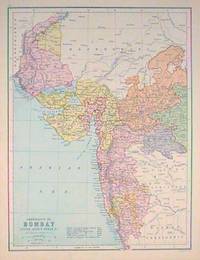
1880réf. 187528Edinburgh.: J. Bartholomew. circa1880s. Map 40.2 x 30.4 cms with printed colour and outline hand colour in very good condition. Handsome map with colonial interests attractively coloured. . J. Bartholomew unknown
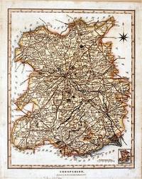
1827réf. 61872London.: J. Wilkes. 1827. Attractive hand coloured map of Shropshire 27.5 x 21.5 cm. very occasional light foxing on reverse but not visible on the image itself. A most attractive map. . [J. Wilkes.] unknown
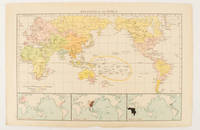
1895réf. 175135London.: Times Atlas of the World. 1895. Map printed in colour 23.2 x 35.9 cm. two edges gilt with three inset maps key to religions outlined in colour bottom margin chipped edges browned a few silverfish abrasions affecting the verso but in good condition. . (Times Atlas of the World) unknown
1943réf. 206908Chicago.: Geographical Publishing Company. 1943. 10 printed colour maps on a large single sheet 91 x 71 cm small inset map of the European theatre chronology of events original folds a few short fold splits archivally sealed; in very good condition. A suite of numbered U.S. war maps with Allied action overstamped in red by the publisher that for Germany and France with pictorial stamps for strategic targets including "Chemical Factories" and "Airplane Factories". The maps numbered 1 to 10: English Channel; Italy; Southern Greece; Western Mediterranean Sea; Germany and France; Baltic Sea and Scandinavia; China Burma India; Japan; Tokyo; and Greater Pacific Battle Zone: a large half sheet map noting the placement of US and Japanese bases. The "Chronology of Important War Events" lists action from the bombing of Pearl Harbour: "Japan's day of Infamy: Japanese air attack cripples American Fleet at Pearl Harbour" to March 21 1944 "Germans take over key political posts in Bulgaria and Romania". Issued by the Geographical Publishing Company of Chicago this educational sheet includes an advertisement for WLS Chicago "The prairie farmer station" with a list of their war broadcasts and a world clock. . Geographical Publishing Company. unknown
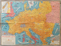
1944réf. 206781Toronto.: C.C. Petersen. 1944. Colour pictorial map 51 x 67 cm two small inset maps of Scandinavia and the Baltic and South Greece and the Dodecanese on the verso a black and white world map showing the Pacific Theatre marking keys events of the war and in European world history folding into the original pictorial pocket a little toned and marked 25.8 x 17.7 cm small fold split but in very good condition. A scarce map in the "Dated Events" series published by C.C. Petersen in Canada and distributed throughout North America commemorating D-Day. The colour map by Stanley Turner encompasses the area from England as far south as the French border with Spain and as far east as the USSR and Turkey. "With this invasion map you will be able to follow the progress of the Allied troops on their way to smash Germany.". The text at lower left goes on to elaborate on the features shown on the map from elevation "major battles are seldom fought on the tops of mountains" to pictographs of bombs falling. The black and white map on the verso shows the Far Eastern theatre of war centring on the Pacific Ocean with the Asian landmass including India and the USSR at upper left Australia at lower left and North America and the coast of South America at right of the map. Naval bases are shown and significant events in the war are noted in text boxes. A handsome production of a scarce map rarely seen with the original pictorial pocket. . C.C. Petersen. unknown
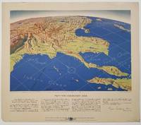
1944réf. 200808Remington Rand. 1944. Five printed colour maps each: 31.4 x 47 cms; 46.3 x 53.3 cms sheet central fold marginal edge wear chips and a few small edge tears tidemark affecting the ocean at the outer edge of Map VII but all the maps in very good condition. From a series of World War II battlefront maps "for the delight of arm-chair strategists" published by the Library Bureau of Remington Rand seven were published. Taken from a bird's eye view of the globe and with relief artistically rendered by artist Kenneth Thompson 1907-1996 and descriptive text by George Fielding Eliot 1894-1971. Eliot spent his youth in Australia attending Melbourne University serving with distinction in the Australian Infantry in WWI. Moving to the United States after a short stint in Canada serving with the RCMP her served as a reserve officer in the U.S. Army reserve in military intelligence from 1922 to 1933 and during WWII Eliot famously broadcast the first extended television coverage following the attack on Pearl Harbor. He continued to write books and articles about military strategy and world politics into the 1960s. In keeping with the "aviation-age" cartography of Richard Edes Harrison the unusual perspective of the maps--from above and often with a direction other than north at the top of the map--challenges the viewer to reconsider the geopolitical situation with the text of Eliot as a further prompt his captions below: Map III Italy & South France "Hannibal Caesar and Napoleon made their reputations here" Map IV The Western Front "Will the cockpit of 1918 see the decisive battles of 1944" Map V Southeastern Asia "The road to Mandalay -- and to China --along which bombs for Tokyo must travel" Map VI The Southwest Pacific "Island-hopping toward Japan -- in short and long hops" Map V11 The North Pacific "Here the enemy trusts in the protection of vast ocean distances" . Remington Rand. unknown
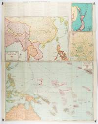
1944réf. 205765London.: George Philip & Son. 1944. Full colour folding map 101.5 x 76cm sheet inset maps legend folding into title wrapper 25.7 x 19.4 cm covers a little dusty and discoloured a few short fold splits without loss but the map in very good bright condition. Map of the Pacific Theatre of World War II with borders drawn as they stood in 1937 - complete with Chinese claims on Mongolia Tuva and Tibet. Shows transportation routes principal railways oil fields Allied naval bases territory occupied by the British Empire French Empire and the United States. This map shows only the northernmost section of Australia which allows for much better detail of the countries of East Asia. Small inset map of the Hawaiin Islands at mid right. Inset map of the Pacific Ocean at upper left. . George Philip & Son. unknown
1819réf. 162103Tokyo.: Tōseisha. Showa 18 1943. Folding colour map of Australia 54.2 x 76.4cm. Some foxing particularly along folds and upper right margins a few repaired tears and small holes at folds.With original sleeve. The 15th map in the Standard Maps of Greater East Asia series of 20 maps. Shows the natural resources such as sheep gold pearl diary regions opals etc. Tasmania appears as an inset in the bottom right corner. Text in Japanese. . Tōseisha. unknown
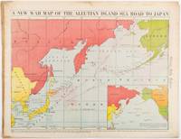
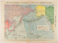
1942réf. 206849Chicago.: Chicago Daily Tribune. 28 January1942. Printed colour map 40.3 x 53.6 cm; 46.5 x 60 cm sheet inset map of the North Pacific back cover from a section of the Chicago Daily Tribune newspaper pages 21-34 January 28 1942; central fold edgewear and browning with a few minor tears not affecting the map in very good condition. Based on a Rand McNally map and issued less than two months after the bombing of Pearl Harbour by the Japanese. The Tribune briskly got to work issuing maps for readers showing the beginnings of the war with Japan. Later maps were also published for sale separately but remarkably few have survived. The map shows "the nearness of our Aleutian Island chain west of Alaska to the islands of Japan. At Dutch Harbor and other points in the Aleutians are actual and potential sea and air bases lying on the shortest route from northwestern United States to Japan." The inset map at lower right situates the areas in the larger map in respect to the countries bordering the North Pacific Ocean. Included with the map is the complete newspaper section from which it is the final full page. Covering sport and the market with half a dozen popular comic strips including "Dick Tracy" and "Little Orphan Annie" it shows a domestic United States a world away from what had been seen as a European War. ". the historic Chicago Tribune was an innovator in color inks and printing but also a pioneer in bringing colorful art in the form of illustrations photographs cartoons and advertisements to the average person in an everyday medium." see The Janet A. Ginsburg Chicago Tribune Collection Michigan State University Libraries." . Chicago Daily Tribune. unknown
1942réf. 180751Chicago.: Chicago Daily Tribune. Friday June 51942. Printed colour map on a single newspaper leaf 37.5 x 53.2 cm; 44.7 x 59.8 cm sheet inset legend marginal browning and at the folds some undulation of paper and tide mark along lower section but in remarkably bright very good condition. Strategic map published in the Chicago Daily Tribune "The World's Greatest Newspaper" on June 5th 1942 two days after the Japanese attack on Dutch Harbor the site of the US army and navy bases in the Aleutians and as it transpired at the outset of the Battle of MIdway. The owner and proprietor of the Tribune Robert McCormick was staunchly against the United States entering the war and had firm views once it had occurred that American resources should not be used defending the British Empire. Famously the Tribune published the "Victory Program" Roosevelt’s military plan to prepare the United States for possible entry into World War II and was subject to prosecution for an alleged violation of the Espionage Act relating to the newspaper’s front-page account of the Battle of Midway 4-7 June 1942. It became an important test case for the limits of free speech and censorship during war-time. The Legend shows territorial Control of Ocean Areas marking Japanese Naval and Air bases as of 1941 and "according to latest reports" those established in the first six months of 1942. Also shown are pre-war sovereignties as at the bombing of Pearl Harbour on December 7th 1941. The Anson Archipelago is shown but a question mark "indicates islands etc. whose existence or give position is doubtful…". . Chicago Daily Tribune. unknown
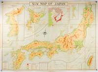
1935réf. 214827Tokyo.: Nihon-Kenkyusha. 1935. Large folding colour map of Japan 74.3 x 10⁵ cms; folding into printed card covers 27 x 19.5 cms: 9 insets: Chosen Korea; Hokkaido; Chisima Islands; General Map of Japan and Manchuokuo; Karafuto Saghalien; Okinawa Loochoo; Taiwan Formosa; Micronesia; Ogasawara; Hajijoshima; the covers a litle worn and marked and the sheet slightly toned but the map is in very bright clean condition. Scarce World War II era map of Japan including Korea published in English by Kenkyusha. Founded in 1907 it had a history of publishing for students of English and the English market. An attractively composed map in remarkbable condition; with the insets circled around the islands of Japan heights marked in graduations from green to red and showing provinces railways roads steamer routes Buddhist and Shinto Temples. . Nihon-Kenkyusha. unknown
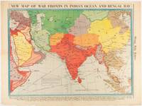
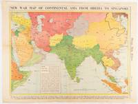
1942réf. 180782Chicago.: Chicago Daily Tribune. April 211942. Printed colour map on a single newspaper leaf 37.5 x 53.2 cm; 60 x 45 x 59.6 cm sheet marginal browning and at the folds but remarkably bright in very good condition. World War II map of Asia save for Japan showing British allies colonies and lines of supply and marking Japanese territorial occupation published in the Chicago Daily Tribune "The World's Greatest Newspaper" in April 1942. "The Indian Ocean and the Bay of Bengal are the strategic waters in this campaign in which the occupied parts of Burma and the Andaman Islands serve as bases" caption ". the historic Chicago Tribune was an innovator in color inks and printing but also a pioneer in bringing colorful art in the form of illustrations photographs cartoons and advertisements to the average person in an everyday medium." see The Janet A. Ginsburg Chicago Tribune Collection Michigan State University Libraries. . Chicago Daily Tribune. unknown
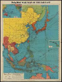
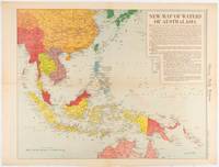
1619réf. 180757Chicago.: Chicago Daily Tribune. December 161942. Printed colour map on a single newspaper leaf 41.6 x 52.8 cm; 45 x 60 cm sheet inset legends marginal browning and at the folds but remarkably bright in very good condition. Map of Southeast Asia published in the Chicago Daily Tribune "The World's Greatest Newspaper" delineating the Pacific theatre of war with a detailed text legend. "This is a new war map of the far east showing an important part of southeastern Asia and Australasian waters from a station in which according to Prime Minister Curtin of Australia a United States fleet will operate." Interestingly New Guinea is marked as British rather than as an Australian administrative region which it became following the Treaty of Versailles. "… the historic Chicago Tribune was an innovator in color inks and printing but also a pioneer in bringing colorful art in the form of illustrations photographs cartoons and advertisements to the average person in an everyday medium." see The Janet A. Ginsburg Chicago Tribune Collection Michigan State University Libraries. . Chicago Daily Tribune. unknown
1942réf. 180760Chicago.: Chicago Daily Tribune. January 91942. Printed colour map on a single newspaper leaf 37.2 x 53.4 cm; 45 x 59.9 cm sheet inset legend marginal browning and at the folds lower margin with small edges tears not affecting the caption but remarkably bright in very good condition. Rare map of Asia "Between Suez on the west and Shanghai on the east" showing territorial interests and theatres of war published in the Chicago Daily Tribune in January 1942 barely two months after the Uniited States had joined the war effort after the bombing of Pearl Harbour. Thailand and Vietnam "French Indo-China" are marked "Occupied by the Japanese" and north-eastern China similarly marked Iran "Anglo-Russian Occupation" and the Gulf states "British Ally". The caption notes that "The map inludes waters thru which runs the British life line from the Suez canal to remote Australia and New Zealand. Nearly half the people in the world live in the lands shown on this map--more than 450 million for example in China and more than 375 million in India". ". the historic Chicago Tribune was an innovator in color inks and printing but also a pioneer in bringing colorful art in the form of illustrations photographs cartoons and advertisements to the average person in an everyday medium." see The Janet A. Ginsburg Chicago Tribune Collection Michigan State University Libraries. . Chicago Daily Tribune. unknown