John SpeedBiblio.com
1,309 results
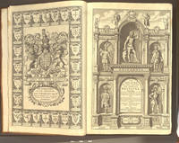
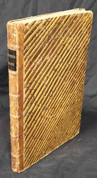
1614ref. 655K5London: William Hall and John Beale 1614. Leather. Very Good. 16.5" by 11". Christoph Schweitzer. A very scarce edition of this highly historically significant work of British history written by an extremely influential historian and cartographer and offering a thorough exegesis of early British history from Julius Caesar to King James. A reissue of the 1611 first edition with imprint date altered as called for. ESTC Citation No. S122020. Folio. The work is very scarce with the 1614 reissue being a particularly scarce edition. Collated lacking errata leaf to the rear of the work and front and rear blank. Leaf 802 is misnumbered as leaf 801 as called for. Pagination is continuous from 'The Theatre of The Empire of Great Britaine' but the work is considered complete as a single volume. Contains the exceptionally scarce three leaves between pi 1 and Mm2 containing the author's preface. This is not present in the ESTC copy. Engraved title page has been trimmed and mounted with slight loss to fore edge. With an engraved title page and vignette engravings throughout by Christoph Schweitzer. John Speed is renowned for his work as both a leading English cartographer and historian and is considered one of the best known English mapmakers of the early modern period. Following encouragement from English antiquarian and historian William Camden Speed began this work published first in 1611 as the 'Historie of Great Britaine'. Many of the historical sources utilised for the work remain unknown although they do include the work of cartographers Christopher Saxton and John Norden. The work is considered a continuation of The Theatre of the Empire of Great Britaine first published between 1611 and 1612 within which is contained the first set of individual county maps of England and Wales. Speed himself considered his History of Great Britaine his major work the majority of which was funded by Sir Fulke Grevillean the Elizabethan poet dramatist and statesman. The work offers a highly detailed summary of Early English history and whilst the work has been criticised for a number of inaccuracies the subsequent frequent citations of the work in later historical pieces reflect its historical significance. Among others the work offers detailed information regarding the early successors and founders of English institutions including The Saxons Henry VIII and Edward IV. Written by one of the most influential historians and cartographers of the early modern period this extremely scarce 1614 edition of The History of Great Britaine is a sought after piece of significant historical and literary non fiction. Rebacked with the original contemporary calf boards preserved. Externally very smart with professional repair to the extremities. Slight rubbing and marking to the boards. Hinges slightly strained but firm. Evidence of bookplate removal to rear pastedown. Internally firmly bound. Engraved title page has been trimmed and mounted with slight loss to fore edge. Lacking front and rear blank and errata leaf to the rear of the work. The occasional light tidemark to the extremity of the occasional leaf. Handling marks and the occasional spot. The occasional contemporary ink annotations heavier to the final leaf. The occasional closed tear. Professional repair to leaf 5A2. Very Good William Hall and John Beale hardcover
ref. 124311London Printed at London by Robert Barker Printer to the Kings most excellent Majesttie and by the Assignes of John Bill 1632-1633. . Four works in 1 vol.; folio 35.5 x 23.5 cm; engraved general title signed 'Guilielmus Hole' partially burnished out as noted by ESTC with date in imprint altered to read '1633' on the plate engraved NT title dated 1632 full-page woodcut illustration of Adam & Eve to verso of A10 final f. of preliminaries note ff A7-8 with incorrect printed signatures as A6-7 woodcut initials head and tailpieces further illustrated with Speed's genealogies and double-page map of Canaan occasional toning final f. of Psalmes laid down title of Common Prayer affixed via stub Speed map with loss to central portion of design with final f. reinforced to verso at gutter margin and tape repair to margin A1 of Old Testament with closed tear crudely repaired lower margin of Adam & Eve woodcut with tape repair not affecting design some further closed repairs throughout later endpapers; contemporary calf gilt lozenge device to covers bisecting the initials 'I' and 'E' gilt faded upper brass clasp in working order remnants of the lower clasp joints and corners expertly restored very good. A very well preserved folio edition of the King James Bible complete in the original clasped calfskin binding with Speed's Genealogies including his double-page engraved map of Canaan The Book of Common Prayer and Sternhold & Hopkins' Psalmes. The elaborate title border is that engraved by William Hole d.1624 which had been used before in the folio Geneva Bible of 1607. 'As a copperplate-engraver Hole remained a specialist in engraving maps music and lettering. and he stands at the head of the seventeenth-century tradition of engravers who worked for writing-masters. He engraved the plates to Martin Billingsley's The Pens Excellencie or The Secretaries Delighte of 1618 the first important English engraved copybook dedicated to Charles as Prince of Wales and he was also responsible for the first engraved plates of music made outside Italy: the famous Parthenia of 161213 which contained music by William Byrd John Bull and Orlando Gibbons and Angelo Notari's Prime musiche nuove of 1613' ODNB. Our example a variant with the date in the imprint of the engraved general title altered on the plate to read '1633'. ESTC S122379 variant; Herbert 466; DM 359. London, Printed at London by Robert Barker, Printer to [the] Kings most excellent Ma[jes]ttie and by the Assignes of John Bill, unknown
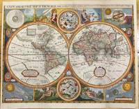
1659ref. M9858London 1659. Very Good backed on acid free tissue paper for long term preservation. Notes: Scarce third state of Robert Walton's decorative map of the World based upon the earlier edition of John Speed's World map. Double hemisphere map of the World with portraits of the four great explorers of the era Sir Francis Drake Thomas Candish Oliver Van Noort and Ferdinand Magellan. California is depicted as an Island with an unusual Northwest Coast of America. The map is surrounded by smaller celestial hemispheres and the four elements with notes on the South Pole & Straits of Magellan. Walton's map is rarer than John Speed's map and is of equal artistic and cartographic importance. Size : 398x530 mm 15.67x20.87 Inches Coloring: Hand Colored Reference: Shirley #397. Category: Maps World; unknown
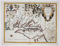
1676ref. 9394London 1676. No Binding. Near Fine. 14 3/4 x 19 ¼ inches. Fine hand color; wear to bottom of centerfold else fine condition. A very attractive near-mint example. Speed's handsomely engraved work is one of the earliest English maps of the area and one of the first to demarcate the borders of colonial Virginia and Maryland. Just three years before the publication of Speed's map Augustine Herrman had conducted the first thorough surveys of Maryland at the behest of Lord Baltimore. Speed's was one of the first maps to adopt this groundbreaking cartography. However in general outline Speed still followed the prototype of Captain John Smith who conducted the first European survey of Chesapeake Bay. Speed's map "is the last major derivative of the Smith map and it is unique as an example of the transition from one basic prototype map to another. The delineation of the land area follows Smith while the toponymic prototype was the Herrman map of 1673." Verner in Tooley Mapping of America p.170 A particularly important feature derived from Herrman by Speed is the boundary line indicated by a double row of trees between Virginia and Maryland on the Eastern Shore. English text on the verso contains extensive descriptions of Virginia and Maryland. unknown
1676ref. 9394London 1676. No Binding. Near Fine. 14 3/4 x 19 ¼ inches. Fine hand color; wear to bottom of centerfold else fine condition. A very attractive near-mint example. Speed's handsomely engraved work is one of the earliest English maps of the area and one of the first to demarcate the borders of colonial Virginia and Maryland. Just three years before the publication of Speed's map Augustine Herrman had conducted the first thorough surveys of Maryland at the behest of Lord Baltimore. Speed's was one of the first maps to adopt this groundbreaking cartography. However in general outline Speed still followed the prototype of Captain John Smith who conducted the first European survey of Chesapeake Bay. Speed's map "is the last major derivative of the Smith map and it is unique as an example of the transition from one basic prototype map to another. The delineation of the land area follows Smith while the toponymic prototype was the Herrman map of 1673." Verner in Tooley Mapping of America p.170 A particularly important feature derived from Herrman by Speed is the boundary line indicated by a double row of trees between Virginia and Maryland on the Eastern Shore. English text on the verso contains extensive descriptions of Virginia and Maryland. unknown books
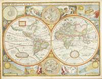
ref. 5309London: Sold by Tho:Bassett in Fleetstreet and Richard Chiswell in St. Pauls Church Yard. 1627-76. No binding. Very Good. 420 x 560 mm. in full recent wash colour in excellent condition with good margins all round. A very attractive example from the most prestigious English world atlas of the seventeenth century by John Speed 1552-1629. This is Speed's classic representation of the world surrounded by allegorical border depiction's of the four elements. The alignments of the 'Heavens and Elements' 'Figure of the Spheare' and illustrations of a solar and lunar eclipse appear in the four corners. Two attractive hemispheres of the heavens are in the centre and the whole is finished off with roundel portraits of the first four circumnavigators. Speed is the most famous of all the English map-makers. His two most celebrated publications are 'The Theatre of the Empire of Great Britain' covering the British Isles first published in 161112 and the 'Prospect of the Most Famous Parts of the World' first published in 1627. Speed was a tailor by profession with a great interest in history and maps. He wanted to produce an English atlas of the same high standards and quality as those published on the continent. The 'Prospect of the Most Famous Parts of the World' was published in 1627 two years before the death of Speed. Ownership of the atlas passed through various hands until sometime after 1668 when Roger Rea sold the rights to Thomas Bassett and Richard Chiswell. Bassett was a specialist in legal books and Chiswell was the publisher for the Royal Society. The final 1676 edition of the 'Prospect' includes eight further maps on seven sheets appearing for the first and only time. Phillips 1909- 488; Shirley 1984 317; Shirley 2004 T.Spe 1j; Skelton 1970 92; Wing 1945-51 S4886. Sold by Tho:Bassett in Fleetstreet and Richard Chiswell in St. Pauls Church Yard. 1627-[76] unknown
ref. 124155London Imprinted at London by Robert Barker Printer to the Kings most Excellent Maiestie 1617. . Third distinct folio edition; folio 41.5 x 28.5 cm; woodcut general and New Testament titles the former laid down and the latter supplied from a different copy with 18th-century inscriptions in pen to verso woodcut initials decorative head and tailpieces calendar printed in red and black three further supplied ff all in the Speed Genealogies comprising A2 woodcut of Adam and Eve and D1-2 forming the map of Canaan old paper repairs to margins of 3K3-4 3O3-4 and final 4 ff in quire 6D light staining to lower corners of gathering 2F-2H more significant dampstaining to final three quires but overall a remarkably well-preserved and clean example; contemporary blind-panelled calf expertly rebacked corners and extremities repaired very good; foliation: A4 B4 C6 D4 A-C6 D2 A-6D6. The third distinct folio edition of the King James Bible printed in large black-letter type and bound with John Speed's 1552-1629 Genealogies Recorded in the Sacred Scriptures including his acclaimed double-page map of Canaan. When James VI of Scotland ascended to the English throne in 1603 he found the country a place of religious discord symbolised by the use of two distinct translations of the Bible. The Bishops' Bible was the official voice of the Church while the Geneva Bible more Calvinist in tone with extensive study notes and commentary was preferred by the general populace and the growing Puritan sect. James was keen to heal these divisions and to wean his people off the Geneva which he felt encouraged sedition and republicanism. To this end the King convened the Hampton Court Conference in 1604 where the new English version was conceived. The new authorised translation was not initially a success: the Geneva Bible remained prevalent until at least 1644 when the last known seventeenth-century edition was brought to the press. Nevertheless overtime it grew in popularity and has widely come to be seen as a towering achievement in the history of English prose contributing more idioms to our language than many other single source including Shakespeare with examples ranging from feet of clay to reap the whirlwind. ESTC S122467; Herbert 353; DM 273. London, Imprinted at London by Robert Barker, Printer to the Kings most Excellent Maiestie, 1617. unknown
1676ref. 008029London: at the George in Fleet-street and at the Rose and Crown in St.Paul's Church-yard: Thomas Bassett & Richard Chiswell 1676. Hardcover. Very Good. Elephant Folio - over 15 - 23" tall. SPEED John. Regarded as a landmark in the history of British topography In 18 century sheep gilt edge tooling tips repaired. Re-spined to style raised bands decorative gilt tooling contemporary gilt/calf title label. Internally engraved armorial frontispiece and additional decorative title letterpress general title printed in red & black part titles to books two three and four printed in black Wales Scotland and Ireland and letterpress title to 'Prospect' also printed in black preliminary text leaves including dedication present 'A New and Accurat Map of the World.' erroneously bound in after the contents page of 'The Theatre' ninety-six complete uncoloured engraved maps 68 in the Theatre and 28 in the Prospect 16 2 126 5-6 5-8 Civil wars 10 leaves of roads 1 Scotland tp 1 129-146 pp. Prospect f the World 1676 2 3-56 pp 11 index several maps trimmed with slight loss to the strap-work margin very occasional marginal closed tears and staining lacking the maps of Berkshire Derbyshire and Shropshire but replaced with examples from the first edition of 1611 map of Derbyshire stained and toned Spain torn with loss to the upper left right corner tip Denmark torn with small area of loss to the right hand margin each map with descriptive text to the verso index bound at rear additional armorial frontispiece and decorative title trimmed to neat line and attached to recto and verso of blank leaf and additional title page both loosely inserted 18th-century bookplate of James Norman and old auction catalogue entry to the front paste down front free endpaper with ink stamp of I. Pickersgill ink name to tp Cha Hillear. 415274 mm.ESTC R13825 . Wing S4886. Chubb XXVII. John Speed's 'Theatre' is regarded as a landmark in the history of British topography. It was the first English attempt to produce a grand scale atlas including the first maps of the provinces of Ireland. The 'Theatre' evolved into a world atlas with the addition of the 'Prospect' in 1627. The 1676 edition of the Prospect includes seven new maps which were not present in the 1627 edition: Virginia and Maryland New England Carolina Jamaica and Barbados East India Russia and Canaan. Signatures: 9 B2-D2 E A F-R H1 T V-2O S1 Q2-3U -3 10 3X-3Z1 4A-4E. Prospect 1 B-2e 4f-4h2 with all maps printed on the inner forme of the register and text printed on the outer forme. Thomas Bassett & Richard Chiswell hardcover
ref. 10728London: Printed & Sold by Henry Overton at ye white Horse without Newgate. 1743. No binding. Very Good. ONE OF THE RAREST EDITIONS OF SPEED. Folio 435 x 290 mm. contemporary quarter calf marbled paper boards spine with raised bands black calf gilt title label affixed light wear. With engraved title page dated 1743 'A Sett of the Counties of England and Wales' with contemporary manuscript notations and 58 double-page engraved maps all in fine early outline colour front free endpaper with light water stain wormtrack though lower corner of first few leaves mostly in the margin Lincoln with wax mark Northumberland with old repaired tear final map with wrinkle to right side otherwise in good condition. A very fresh example of one of the rarest editions of John Speed's folio atlas. Hodson recorded only two complete examples I have now identified seven. Following Henry Overton's acquisition of the Speed plates from Christopher Browne in 1713 the printed maps had only been available in loose form. Clients did request them to be bound as atlases and a few survive. But until 1743 there was no intention on Overton's behalf to publish an atlas. Neither of the two adverts located refer to the maps being available in this manner. In February 1743 the papers of the day carried an advertisement stating 'Lately Re-Printed Speed's Sett of the Counties of England and Wales . each printed on a Sheet of Royal Paper neatly colour'd and bound in Marble Paper with red Leather Backs and Corners. Price 18s. Sold either in Setts or single Maps by Henry Overton .' These were available either 'Coloured or Plain' according to the index in the atlas. The reason for its issue is unclear. Following the earliest known issue of the maps whilst in Overton's possession two further distinct periods of issue can be defined before this atlas edition. Following the Jacobite rising in 1715 five of the northern county maps were revised to include Henry Overton's imprint those of Cumberland Durham Lancashire Northumberland and Westmoreland. They all included roads and in the case of Northumberland this can be sourced to the John Warburton map of the county published in August 1716. Of this Speed—Overton II as it is called there are two known examples. During this period the plates became very worn and Overton had many of them retouched. There are two known examples falling into this classification of which only one survives. For this final issue in atlas form many of the old dates on the plates were removed crudely. Also for a reason unknown the date 1738 was added to that of Huntington. This Speed — Overton IV as it is classified contained the same engraved title page by Robert White 1646-1703 with the addition of 'by John Speed. Reprinted Anno 1743.' The typographic index is entirely re-set with the title 'A Sett of the Counties of England and Wales with their Ilands containing Fifty Eight MAPS; each on a Sheet of Royal Paper. By JOHN SPEED. Reprinted in the YEAR 1743. With ADDITIONS.' There follows a list of the 58 maps after which is an advert stating 'Sold either in Compleat Setts Bound or Single either Coloured or Plain … Neatly Bound in Marble Paper with Leather Back and Corners Coloured Price 1l. 4s.' Overton's two sheet atlas of the world is also noted. Known complete examples: Burden collection Cambridge University Library Atlas 3.74.3 Phillips auction 30 April 1987 lot 477 to Burgess Bonham's London 27 March 2007 lot 469 with other maps Bonham's London 11 November 2015 lot 146 with 6 additional maps Sizergh Castle Cumbria National Trust This example The Speed — Overton atlas or collection of maps was still available for sale on 7 October 1745 during the Jacobite rising when an advert was placed in the 'General Advertiser'. The atlas no doubt continued to be available until his death in 1751 and was probably still available at the hands of his successor his son also Henry Overton. Although Henry the Younger remained in business until at least 1763 i Printed & Sold by Henry Overton at ye white Horse without Newgate. 1743 unknown