SPEED, JohnBiblio.com
1,011 results
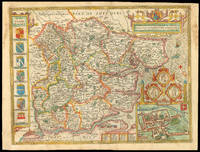
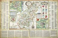
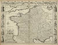
ref. 5318London: Sold by Tho:Bassett in Fleetstreet and Richard Chiswell in St. Pauls Church Yard. 1627-76. No binding. Very Good. 410 x 525 mm. in excellent condition. A very attractive example from the most prestigious English world atlas of the seventeenth century by John Speed 1552-1629. The carte-a-figures panels at the side depict various national dress from those of the King and Queen at the top to tradesmen. The top of the map bears eight views of French towns including Angiers Poictiers Poitiers Orleans Paris Roan Rochelle Bordeaux and Calis Calais. The whole is engraved by Dirck Gryp who signs the plate bottom centre. Speed is the most famous of all the English map-makers. His two most celebrated publications are 'The Theatre of the Empire of Great Britain' covering the British Isles first published in 161112 and the 'Prospect of the Most Famous Parts of the World' first published in 1627. Speed was a tailor by profession with a great interest in history and maps. He wanted to produce an English atlas of the same high standards and quality as those published on the continent. The 'Prospect of the Most Famous Parts of the World' was published in 1627 two years before the death of Speed. Ownership of the atlas passed through various hands until sometime after 1668 when Roger Rea sold the rights to Thomas Bassett and Richard Chiswell. Bassett was a specialist in legal books and Chiswell was the publisher for the Royal Society. The final 1676 edition of the 'Prospect' includes eight further maps on seven sheets appearing for the first and only time. Phillips 'Atlases' 488; Shirley BL T.Spe 1j; Skelton 92; Wing S4886. Sold by Tho:Bassett in Fleetstreet and Richard Chiswell in St. Pauls Church Yard. 1627-[76] unknown
1676ref. 53206The Theatre of the Empire of Great Britain. T Bassett & R Chiswell. 1676. A very attractive map of Suffolk with inset of Ipswich enclosed in an elegant border. On the right of this is a pictorial reference to Bodicia Queen of the Iceni who occupied the area today known as East Anglia. On the left stands a Roman General. Numerous coats of arms of the Dukes and Earles of Suffolk and Clare adorn either side. At the bottom left a cherub holds dividers over the scale on the right a cupid holds a wind rose. Copper engraving. Fine condition good margins but some slight offsetting. Mounted size: 72 x 60 cm. Hand coloured. Size: 51 x 38 cm. 20 x 15 inches. unknown
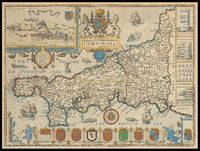
1710ref. 21976London: And Now Sold by Henry Overton at the White Horse without Newgate London 1710-1743. 385 by 510mm. 15.25 by 20 inches. Speed's map of Cornwall Double-page engraved map with hand colour. A map of Cornwall from one of the Overton editions of the first large-scale atlas of the British Isles Speed's 'Theatre'. In the top left-hand corner is a prospect of 'Launceston or Ancient Dunhevet'. Along the right-hand side of the map four antiquities are illustrated including the Hurlers Stones which according to legend are men petrified for playing hurling on a Sunday. The sea around the peninsula is filled with sea-monsters and ships. John Speed 1552-1629 was the outstanding cartographer of his age. By trade a merchant tailor but by proclivity a historian it was the patronage of Sir Fulke Greville poet and statesman that allowed him to pursue this interest in earnest. His 'Theatre of Great Britain' from which the present work is drawn was first published in 1611 or 1612 and is 'the earliest English attempt at atlas-production on a grand scale' Skelton. Drawing heavily on the work of Saxton and Norden little of Speed's cartography is original he acknowledges 'I have put my sickle into other mens corne' instead it is his blend of cartography and history incorporating town-plans vignettes and genealogy that makes Speed an innovator. This map is from one of the editions of the 'Prospect' published by Henry Overton between ca. 1710 and 1743. Unlike in earlier editions the verso of the maps tend to be blank. And Now Sold by Henry Overton at the White Horse without Newgate London,
1986ref. 14185E Rutherford New Jersey U.S.A.: Putnam Pub Group. New. Hardcover. FREE UPGRADE to Courier/Priority Shipping Upon Request - IN STOCK AND IMMEDIATELY AVAILABLE FOR SHIPMENT - -- with a bonus offer--; 014185; AUTHORS AMERICAN GUILLAIN BARRE SYNDROME . 1986. 0399130861 . Putnam Pub Group hardcover
1971ref. 28242Louisville KY: J. B. Speed Art Museum. As New. Paperback. FREE UPGRADE to Courier/Priority Shipping Upon Request - IN STOCK AND IMMEDIATELY AVAILABLE FOR SHIPMENT - AS NEW THE TEXT BLOCK IS PRISTINE CLEAN UNMARKED AND IN EXCELLENT CONDITION - . Light creasing curling and smudging to covers. -- with a bonus offer--; T-SPEEDMONUM . 1971. J. B. Speed Art Museum paperback
2014ref. 110683Archaeopress Archaeology. New. Paperback. FREE UPGRADE to Courier/Priority Shipping Upon Request - IN STOCK AND IMMEDIATELY AVAILABLE FOR SHIPMENT - Flawless copy brand new pristine never opened - -- with a bonus offer-- . 2014. 178491004X . Archaeopress Archaeology paperback
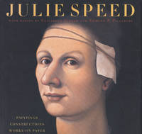
2004ref. 86198University of Texas Press. New. Hardcover. FREE UPGRADE to Courier/Priority Shipping Upon Request - IN STOCK AND IMMEDIATELY AVAILABLE FOR SHIPMENT - Flawless copy brand new pristine never opened -- 193 pages; many color illustrations. -- with a bonus offer--; Julie Speed's meticulous craftsmanship and attention to detail bring to mind the work of painters from the fifteenth and sixteenth century Renaissance. Unlike those artists however Speed is inspired by an almost limitless number of easily available sources and is unencumbered by the sexual and societal restrictions of past centuries which gives her the freedom to paint what she wants and the way she wants. This places her body of work squarely in the present. Utilizing her keen sense of the absurd Speed ponders the big questions--the role of religion isolation and longing sexuality sin and guilt--with a sly sometimes black sense of humor and a steadfast refusal to offer the viewer any tidy resolutions. It is the emphatically open-ended and omnivorous nature of her work combining anxiety erotica and violence with the subversive power of beauty that puts Speed in the vanguard of a return to figurative painting in contemporary art. To bring Speed's mysterious and compelling work to a wider audience this beautifully illustrated volume presents one hundred color plates of her oil paintings constructions and works on paper. Accompanying the plates are essays by art historians Elizabeth Ferrer and Edmund Pillsbury that discuss Speed’s relationship to generations of figurative painters from the artists of the Renaissance to the present as well as her affinities with and differences from the surrealists dadaists and other historical movements. Rounding out the volume are fascinating excerpts from the "Books of Conversation" a series of public journals initiated by the Austin Museum of Art in connection with a touring survey of Speed's work in which museum-goers wrote down their ideas opinions and questions for the artist to which she provided written answers. . 2004. 0292702728 . University of Texas Press hardcover
2006ref. 100762Tuttle Publishing. New. Paperback. FREE UPGRADE to Courier/Priority Shipping Upon Request - IN STOCK AND IMMEDIATELY AVAILABLE FOR SHIPMENT - Flawless copy brand new pristine never opened -- 384 pages. Publisher's description: "Gain a deeper appreciation for Chinese art and architecture by understanding its symbols. The Yin and Yang dragon phoenix five elements and other symbols are explained in their historical and cultural context. Chinese Symbolism and Art Motifs also includes articles on Chinese beliefs customs arts and crafts foods agriculture and medicine. Originally published in 1941 this is the standard reference book with over 400 illustrations to help clarify and define this ancient complex culture." -- with a bonus offer--; Gain a deeper appreciation for Chinese art and architecture by understanding its symbols. The Yin and Yang dragon phoenix five elements and other symbols are explained in their historical and cultural context. Chinese Symbolism and Art Motifs also includes articles on Chinese beliefs customs arts and crafts foods agriculture and medicine. Originally published in 1941 this is the standard reference book with over 400 illustrations to help clarify and define this ancient complex culture. . 2006. 080483704X . Tuttle Publishing paperback
1623ref. LD8073London: Printed by John Beale for George Humble 1623. Second edition. Hardcover. Very Good. Folio 340 x 220mm. xx 1258pp. 74 numerous error in paging and register. Signatures: par.6 1st leaf blank A8; B-2H6; I4; 2K-4S6; 4T4; 4V-4Y6; 4Z8 4Z8 sic 4Z4; 5A-5T6; 5V1 of 4. Printers device of Humble on title head- and tail- pieces and initials throughout. Many in text engravings including 8 full page genealogies and numerous woodcuts throughout of coins and seals. Text in double column. Period full English calf rebacked and restored at corners in modern leather and stamped in gilt Historie of Great Britain Speed; lacking frontis. title somewhat browned and remargined text block lightly browned around edges lacking final 3 leaves of Table otherwise good. Sold as is. Large white on black bookplate of Dr. Otto Orren Fisher of Detroit Michigan to front pastedown. Second Edition of Speeds Historie of Great Britain. Second Edition revised and enlarged and reissued in 1625 and again in 1627; Speeds Historie of Great Britain was originally published in 1612 with The Theatre of the Empire of Great Britaine as a companion volume though continuously paginated The Historie being the second work and the contents listing refers to the first four books which were part of the Theatre although this work books 5 - 10 is complete in itself. His account of the reign of Henry VIII p. 998 is followed by an appendix described in the running head as A Catalogue of the Religious Houses Colledges and Hospitals sometimes in England and Wales. These sections hold a wealth of information on early successors and founders of English Institutions. It was likely Speed an apt historian himself borrowed many of his materials from William Camden and was supplied by many Sir Robert Cotton Sir Henry Spelman and other antiquaries with whom he was acquainted. Although he probably had access to historical sources that are now lost to us he certainly used the work of Saxton and Norden his work as a historian is considered mediocre and secondary in importance to his map-making and the town plans he drew. Despite its many defects the Historie was very frequently cited by later writers. An important rich historical and artifactual book on Early English history. STC 2nd ed. 23046.3 Printed by John Beale for George Humble hardcover
1623ref. LD8073London: Printed by John Beale for George Humble 1623. Second edition. Hardcover. Very Good. Folio 340 x 220mm. xx 1258pp. 74 numerous error in paging and register. Signatures: par.6 1st leaf blank A8; B-2H6; I4; 2K-4S6; 4T4; 4V-4Y6; 4Z8 4Z8 sic 4Z4; 5A-5T6; 5V1 of 4. Printers device of Humble on title head- and tail- pieces and initials throughout. Many in text engravings including 8 full page genealogies and numerous woodcuts throughout of coins and seals. Text in double column. Period full English calf rebacked and restored at corners in modern leather and stamped in gilt Historie of Great Britain Speed; lacking frontis. title somewhat browned and remargined text block lightly browned around edges lacking final 3 leaves of Table otherwise good. Sold as is. Large white on black bookplate of Dr. Otto Orren Fisher of Detroit Michigan to front pastedown. Second Edition of Speeds Historie of Great Britain. Second Edition revised and enlarged and reissued in 1625 and again in 1627; Speeds Historie of Great Britain was originally published in 1612 with The Theatre of the Empire of Great Britaine as a companion volume though continuously paginated The Historie being the second work and the contents listing refers to the first four books which were part of the Theatre although this work books 5 - 10 is complete in itself. His account of the reign of Henry VIII p. 998 is followed by an appendix described in the running head as A Catalogue of the Religious Houses Colledges and Hospitals sometimes in England and Wales. These sections hold a wealth of information on early successors and founders of English Institutions. It was likely Speed an apt historian himself borrowed many of his materials from William Camden and was supplied by many Sir Robert Cotton Sir Henry Spelman and other antiquaries with whom he was acquainted. Although he probably had access to historical sources that are now lost to us he certainly used the work of Saxton and Norden his work as a historian is considered mediocre and secondary in importance to his map-making and the town plans he drew. Despite its many defects the Historie was very frequently cited by later writers. An important rich historical and artifactual book on Early English history. STC 2nd ed. 23046.3 Printed by John Beale for George Humble hardcover books
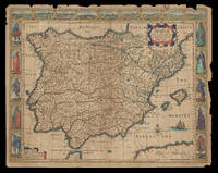
1626ref. 21921London: Are to be sold by Thomas Bassett in Fleet Street & Richard Chiswell in St. Pauls Churchyard 1626 but 1676. 415 by 540mm. 16.25 by 21.25 inches. Speed's map of Spain Double-page engraved map with hand-colour some wear to edges. A map of Spain from the 1676 edition of the first atlas compiled and published by an Englishman Speed's 'Prospect'. A decorative border along the top illustrates views of major cities including Granada and Barcelona and along each side there are depictions of figures in regional costume. The Balearics appear marked as the 'Pyne Ilands'. Accompanying text in English 'The Description of Spain' is printed on the reverse. John Speed 1552-1629 was the outstanding cartographer of his age. By trade a merchant tailor but by proclivity a historian it was the patronage of Sir Fulke Greville poet and statesman that allowed him to pursue this interest in earnest. His 'Theatre of Great Britain' first published in 1611 or 1612 was the first large-scale printed atlas of the British Isles. The 'Prospect of the Most Famous Parts of the World' from which the present work is drawn appeared in 1627 bound with the 'Theatre' and is the first world atlas compiled by an Englishman to be published in England. Engraved in Amsterdam many of the maps are anglicized versions of works by Dutch makers in distinctive carte-à-figure style featuring borders with figures in local costume and city views. This map is from the 1676 edition of the 'Prospect' published by Thomas Bassett and Richard Chiswell. While not as rare as the earlier publications this edition is perhaps the most important given that it is the first to include the nine new maps: among them Virginia and Maryland Barbados and Russia. It is also the last time that the 'Prospect' was printed as an atlas. Shirley Atlases T.SPE-2f. Are to be sold by Thomas Bassett in Fleet Street & Richard Chiswell in St. Pauls Churchyard,
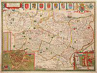
1676ref. 80193The Theatre of the Empire of Great Britain. T Bassett & R Chiswell. 1676. A beautiful map of Kent based on the work of Philip Symonson. Insets of the cathedral cities of Canterbury and Rochester and seven coats of arms. Due to Kent's extensive coastline and proximity to France and the Netherlands it had unrivalled advantages for trade thus making its defence imperative. Dover Castle had long been a linchpin in the defence of the realm but most other castles in Kent were made redundant when a series of modern artillery forts like Deal and Walmer were constructed in the 1540's by Henry VIII. These were to protect the anchorage of the Downs which the Navy had recently taken to using. The adoption of other fleet-anchorages along the Thames and the Medway and the establishment of dockyards at Deptford and Woolwich by Henry VIII and at Chatham by Elizabeth I turned Kent into the best defended area in the kingdom throughout the Tudor and early Stuart periods. Copper engraving. Very good condition. Hand coloured. Sheet size: 395 x 510 mm. Mount size: 590 x 705 mm Nigel Nicolson A Tudor Atlas by John Speed unknown
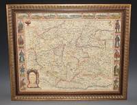
ref. 97473Are to be sold by Ric. Chiswell on St. Pauls Church yard and by The: Bassett in Fleetstreet. 1676. Lg.map engr.surface ca 55 cm x 42 cm. Frame 61.5cm x 50cm Nicely hand-coloured. An attractive and decorative map Featured "carte a figure" map adorned with side panels depicting costumed figures and further enhanced with a row of city views along the top. Prague is at the centre. The Danube River flows from west to east along the bottom of the map. An inset at right explains the symbols used. Very good. Framed in double glazed Mount. English text on verso. From: A Prospect of the Most Famous Parts of the World London Th. Bassett & R. Chiswell 1676. Are to be sold by Ric. Chiswell on St. Pauls Church yard and by The: Bassett in Fleetstreet. 1676 unknown
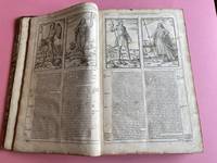
1614ref. 038884London: John Sudbury & George Humble 1614. Book. Illus. by Christoph Schweitzer. Good. Hardcover. Folio. A scarce edition of this important work on British history. This is a reissue of the 1611 first edition with the date to the title page altered accordingly ESTC No. S122020. While the text starts on p. 151 this book is complete in its own right: conceived as a companion volume to Speed's grand atlas "The Theatre of the Empire of Great Britaine" and the pagination continues from that work. Fully collated includes the errata leaf to the rear often lacking the scarce "Proeme" author's preface; it is only the front and rear blanks not present. There are several errors with the pagination e.g. pp. 804 & 805 are numbered 796 & 797; Leaf 802 is misnumbered as leaf 801. Collation: frontispiece portrait later - dated July 28 1629; dedication page to the most high and most potent monarch James of Great Britaine.; The Contents 3 pages; The Proeme To the Learned and Lovers of Great Britaines Glory. pp. 151-154; main text pp. 155-894 beginning at Chap. 1. The Site and Circuit of Great Britaines Monarchie and ending with Book 10 - James of that name the first.; A Summary Conclusion of the Whole 3 pages; imprint page Imprinted at London by William Hall and John Beale for John Sudbury & George Humble; The Second index - 46 pages and finally the "Faults escaped" leaf errata. Numerous engravings in the text by Christoph Schweitzer including coins seals people head and tail-pieces. Contemporary or later half-calf binding with red title label to the spine. Binding worn and rubbed with both boards detached. Contents generally very good first few leaves detached pages generally clean title page laid-down with several chips as shown in photographs this and the later frontispiece plate dust marked. Provenance: with the Baptist College Library Bristol bookplate and that of "A. Gifford of the Museum" Dr Andrew Gifford 1700 -1784. A Baptist minister and the first assistant librarian in the British Museum's Department of Manuscripts. He was also the museum's first numismatist in 1756 Early inconspicuous manuscript shelf marks to the first few pages. A good complete copy though ideally requiring rebinding. A particularly scarce edition. A large heavy book a small postal surcharge may apply. John Sudbury & George Humble Hardcover
1665ref. 1761London: to be solde by Roger Rea ye elder & younger at ye Golden Crosse in Cornhill agt. ye Exchang 1665. 410 by 550mm. 16.25 by 21.75 inches. Double-page engraved map fine contemporary outline hand colour upper left and right margins skilfully repaired margins reinforced with japan paper. The map bears the imprint of Roger Rea the Elder and Younger. The Reas had purchased the rights to Speed's work from William Garrett in 1659 who had previously purchased them from the widow of William Humble in the same year. Skelton suggests that the father and son intended a new edition of the atlas for the Restoration of 1660. However the atlas would appear not to have been published until 1665. This is borne out by an advertisement in the Term Catalogue by the subsequent owners of the plates Thomas Bassett and Richard Chiswell in 1675: "Mr John Speed's. Geography of the Kingdoms of England Scotland and Ireland. together with his Prospect. all in one entire Volume hath been for seven Years past out of Print the greatest part of an Impression then newly Printed being destroyed by the late dreadful Fire 1666". This is borne out by the rarity of the Rea edition of the atlas. There is evidence that they planned an edition of 1666 as there are impressions of Sussex Buckingham and Derby with Rea's imprint which bear that date. Rea would later sell the plates to Bassett and Chiswell who would publish a new edition in 1676. to be solde by Roger Rea ye elder & younger at ye Golden Crosse in Cornhill agt. ye Exchang, unknown
1627ref. 0020055London: George Humble. Sumptuously rebound in quarter calf by Period Binders of Bath with bright gilt titles to spine and five raised bands new cream endpapers with complementing brown buckram boards preserving Armorial Bookplate of Arthur Levin Josephs to fixed front endpaper. First page is professionally relaid title page followed by Dedication page Contents Page and Index of Chapters 12 155/924pp Second Index of Principal Events A to Z46pp. Numerous engarvings throughout as called for. Two pages in unpaginated second index at end have three inch horizontal tears with no loss. Otherwise all VG. . Very Good. Hardcover. Second Edition. 1627. George Humble hardcover
1676ref. LTH20-A-5London: Thomas Bassett; Richard Chiswell 1676. Leather. Good. 17.5" by 13". None. A collection of leaves from the highly sought after geographical work; The Theatre of the Empire of Great Britain. Complete with the maps this is around £100000. Containing; the original title page in both red and black printing two dedication pages "To the Right Honourable Sir Joseph Sheldon" and "To the Most High and Most Potent Monarch James" three leaves of the preface three leaves of poetical works the "Contents of the Chorographical Part The First Book" through to the contents of "The King's Dominions Abroad" the title page to "The Second Book: Containing the Principality of Wales" page 97 and 98 of this work five leaves of road branch diagrams the title page to "The Third Book: Containing a General View of the Kingdom of Scotland" page 129 of this work the title page to "The Fourth Book: Containing the Kingdom of Ireland" page 135 of this work the title page to "A Prospect of the Most Famous Parts of the World" and the complete Index. Rebacked in a full contemporary calf binding with the original calf boards. Externally a trifle rubbed with wear to the extremities and minor cocking to the spine. Both hinges are tender. Internally binding is a little strained in places with some leaves working loose. Work is seriously incomplete with what is present listed above. Some scattered spotting and handling marks. Good Thomas Bassett; Richard Chiswell hardcover
1665ref. 1785London: to be solde by Roger Rea ye Elder and younger at ye Golden Crosse in Cornhill against the Exchange 1665. 410 by 550mm. 16.25 by 21.75 inches. Double-page engraved map upper left and right margins skilfully repaired margins reinforced with japan paper. The map bears the imprint of Roger Rea the Elder and Younger. The Reas had purchased the rights to Speed's work from William Garrett in 1659 who had previously purchased them from the widow of William Humble in the same year. Skelton suggests that the father and son intended a new edition of the atlas for the Restoration of 1660. However the atlas would appear not to have been published until 1665. This is borne out by an advertisement in the Term Catalogue by the subsequent owners of the plates Thomas Bassett and Richard Chiswell in 1675: "Mr John Speed's. Geography of the Kingdoms of England Scotland and Ireland. together with his Prospect. all in one entire Volume hath been for seven Years past out of Print the greatest part of an Impression then newly Printed being destroyed by the late dreadful Fire 1666". This is borne out by the rarity of the Rea edition of the atlas. There is evidence that they planned an edition of 1666 as there are impressions of Sussex Buckingham and Derby with Rea's imprint which bear that date. Rea would later sell the plates to Bassett and Chiswell who would publish a new edition in 1676. to be solde by Roger Rea ye Elder and younger at ye Golden Crosse in Cornhill against the Exchange, unknown
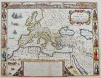
1651ref. M8291London: Tho: Basset; Richard Chiswell c. 1651. Very Good. Notes: StolenHighly decorative map of the Roman Empire. Includes illustrations of ships and sea monsters as well as various animals placed in their native lands. Includes a decorative cartouche on the upper right side and a brief historical description of the history of the Roman Empire at the bottom of the map. Illustrations of Rome Geneva Jerusalem Venice Constantinople and Alexandria as well as various native people in costumes are placed around the map. Size : 391x509 mm 15.40x20.05 Inches Coloring: Original Hand Coloring Category: Maps Mediterranean Sea; Maps Asia Near East Turkey; Maps Europe Continent; Maps Africa Continent; Tho: Basset; Richard Chiswell unknown
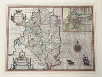
1610ref. M9855London c.1610. Very Good. Notes: John Speed's map of Leinster county; also with an early plan of Dublin. Size : 382x511 mm 15.04x20.12 Inches Coloring: Original Hand Coloring Category: Maps Europe Ireland; unknown
ref. 41599LONDON JOHN DAWSON FOR GEORGE HUMBLE 1632. .THEIR ORIGINALS MANNERS HABITS WARRES COINES AND SEALS; WITH SUCCESSIONS LIVES ACTS AND ISSUES WITH THE ENGLISH MONARCH. THIRD EDITION. QUARTO ENGRAVED FRONTIS. 1232 PAGES WITH SUMMARY AND INDEX MANY WOODCUTS OF ARMS COINS AND PORTRAITS. SOMETIME REBOUND IN HALF LEATHER OVER MARBLED BOARDS NEW ENDPAPERS RAISED BANDS GILT TITLES. THE TITLE AND FRONTIS. HAVE BEEN REMOUNTED WITH SOME LOSS TO THE EDGES. WEAKNESS TO FRONT HINGE BUT A REMARKABLY GOOD HANDSOME COPY VERY CLEAN. LONDON, JOHN DAWSON FOR GEORGE HUMBLE, 1632 hardcover
ref. 9885London: Thomas Snodham for John Sudburie and George Humble and are to be sold in Popes-head Palace. 1615. No binding. Good. 495 x 745 mm. early outline and wash colour with pasted descriptive text to three sides slight loss to the upper left hand corner otherwise in good condition. An exceedingly rare John Speed map in broadsheet format i.e. with descriptive text pasted around the map. This 'edition' is little understood and requires further study not having been worked on since Skelton in the 1960s. The 'Theatre of the Empire of Great Britaine' by John Speed is arguably the second most important English county atlas ever printed and quite probably the most famous. It is the earliest published atlas of the entire British Isles. The first edition was long in preparation. The engraving of the maps is the work of Jodocus Hondius 1563-1612 thirty-three of them bear his signature including this one. Needing to find a competent engraver the publisher George Humble had turned to the ever present Dutch and in May 1606 was in Amsterdam. He may well have carried a letter from Camden to Hondius dated 27 April 1606 which recommends Speed's work to his care. On 12 May a notarial act records the contract between Humble Jodocus Hondius and Cornelis Claesz. The dates on many of the proof maps surviving are given as 160'_' suggesting an earlier completion than occurred. Indeed the date 1608 is suggested by the granting on 29 April that year to Humble of a royal privilege for 21 years. The cause for the delay in publication is unclear but may have been due to the death of Claesz in May 1609. Hondius was executor of the will and no doubt the whole process caused delays. Hondius was also suffering his age and died in 1612. The engraving was completed by 1610 a date which appears on 54 of the maps. The general title page of the 'Theatre of the Empire of Great Britaine' is dated 1611 but 1612 appears in the imprint of the Third and Fourth books. The final work was printed by William Hall and John Beale for John Sudbury and George Humble. The work was clearly successful as within a short space of time a further edition was envisaged. It was to be the work of the printer William Hall however his death in 1614 left the project incomplete. It was completed by Thomas Snodham fl.1603-25 a printer 'at St. Botolph's without Aldersgate'. The text was entirely reset and finally published in 1616 the date appearing on the titles to the second third and fourth parts. Two separate sets of text survive differentiated by the separate colophon that each contains. That for the map of England reads 'Printed at London by William Hall for John Sudburie and George Humble' with the date unfortunately being defective. All the others bear Snodham's name in place of that of Hall's and the date 1615. The British Library set C.175.i.19 lacks any accompanying maps. The second example is found at the Bodleian Library C.17.b.1 and is with the text pasted around the maps as here. However it contains some maps in a later state which are found in examples of the regular format of the atlas dated to 1623. Whittaker's study of the maps of Northamptonshire does not identify any differences to this plate. Skelton suggests that 'the text is accurately printed and the line-endings correspond to those of the 161416 edition. It appears probable that the text was imposed in the form exemplified in the B.M. British Library and Bodleian copies for pasting round the edges of each map for sale or display as a sheet or broadside; for this practice there are contemporary analogies'. The text itself is largely derived from that of William Camden's 'Britannia'. The map contains two significant town plans of Northampton and Peterborough. The draft manuscripts for many of these reside at Merton College Oxford. Examples of the county maps with text pasted to the verso do appear the last known to me being in 2010. However examples with the text pasted in broadsheet format are excessively rare. We acquired Sussex in a smaller auction in the 1970' Thomas Snodham for John Sudburie and George Humble, and are to be sold in Popes-head Palace. 1615 unknown
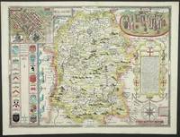
ref. 11256London: John Sudbury and George Humble. 1612. No binding. Very Good. FIRST EDITION IN FULL EARLY WASH COLOUR. 380 x 510 mm. full early wash colour small paper crease upper right corner otherwise in very good condition. A very rare example of John Speed's map of the county of Wiltshire in its first issue in full original wash colour. The map is derived from that published by Christopher Saxton in 1576 and enhanced by the addition of boundaries 'the Shires diuisions into Lathes Hundreds Wapentakes and Cantreds . I have separated'. He goes on to tell us that the source for much of this information was the 'Parlament Rowles'. Roads are not yet identified. In the upper corners are plans of 'Salesbury' and 'Stonehenge'. That of Salisbury is believed to be the work of Speed himself. The draft manuscripts for many of these reside at Merton College Oxford. The atlas provided the first comprehensive collection of English town plans some the earliest of their kind. This map was engraved by Jodocus Hondius 1563-1612 and was completed by 1610 as written in his imprint at the bottom. The general title page is dated 1611 but 1612 appears in the imprint of the Third and Fourth books. The final work was printed by William Hall and John Beale for John Sudbury and George Humble. The woodblocks cut for the verso text are the work of Christopher Schwytzer. The text itself is largely derived from that of William Camden's 'Britannia'. John Speed 1552-1629 is the best known and among collectors the most popular British cartographer. He was like his father a tailor by trade with a passion for history. On joining the Society of Antiquaries he took his first steps towards the compilation of the atlas that has placed him among the cartographic immortals. The 67 maps are drawn principally from those of Christopher Saxton and where available John Norden. Five maps are acknowledged to each of them. Three of them are derived from William Smith. Bendall Sarah 2002 'Draft Town Maps for John Speed's 'Theatre of the Empire of Great Britaine'' in Imago Mundi 54 pp. 30-45; Chubb 1911 Chubb 1927 24; ESTC S11797; Globe 1985 p. 99; Hind 1952-64 II pp. 67-95; Hodson 1974 7.1; Kingley 1982 pp. 215-6 7.1; Schilder MCN VII pp. 481-2; Schilder 2008 VIII pp. 165-70; Shirley 2004 T.Spe 1b; Skelton 1970 7; Tooley 1977 'John Speed. A Personal View' in The Map Collector no. 1 pp. 4-9; Worms & Baynton-Williams 2011 pp. 328-9 335-6 & 641-2. John Sudbury and George Humble. 1612 unknown
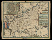
1676ref. 21930London: Sold by Tho: Basset in Fleet Street and Richard Chiswell in St. Pauls Church yard 1676. 405 by 515mm. 16 by 20.25 inches. Speed's map of Russia Double-page engraved map with hand-colour. A map of Russia one of the nine new maps added to the 1676 edition of Speed's 'Prospect' the first atlas compiled and published by an Englishman. Unusually this map is not in the carte-à-figure style that characterizes the 'Prospect'. Instead set in the top left-hand corner of the map is a detailed plan of Moscow with points of particular interest such as 'The Emperours Palace' and 'The Horse market' labelled. On the right-hand side is an elaborate cartouche containing views including 'Archangel' Arkhangelsk and 'A Hott House'. Accompanying text in English 'The Description of Russia' is printed on the reverse. John Speed 1552-1629 was the outstanding cartographer of his age. By trade a merchant tailor but by proclivity a historian it was the patronage of Sir Fulke Greville poet and statesman that allowed him to pursue this interest in earnest. His 'Theatre of Great Britain' first published in 1611 or 1612 was the first large-scale printed atlas of the British Isles. The 'Prospect of the Most Famous Parts of the World' from which the present work is drawn appeared in 1627 bound with the 'Theatre' and is the first world atlas compiled by an Englishman to be published in England. Engraved in Amsterdam many of the maps are anglicized versions of works by Dutch makers in distinctive carte-à-figure style featuring borders with figures in local costume and city views. This map is from the 1676 edition of the 'Prospect' published by Thomas Bassett and Richard Chiswell. While not as rare as the earlier publications this edition is perhaps the most important given that it is the first to include the nine new maps: among them Virginia and Maryland Barbados and the present example Russia. It is also the last time that the 'Prospect' was printed as an atlas. Shirley Atlases T.SPE-2f. Sold by Tho: Basset in Fleet Street and Richard Chiswell in St. Pauls Church yard,
1632ref. 30290London: John Dawson for George Humble 1632. Folio pp. 22 1237 i.e. 1281 - page numbers 1043-1086 assigned to recto only 85; includes the preliminary blank leaf; engraved frontispiece portrait of Speed by S. Savery numerous woodcut illustrations and genealogical tables throughout; numerous woodcut initials and ornaments; contemporary full calf perfunctorily rebacked in brown calf maroon morocco label on spine; several clean tears entering text no loss leaf 5a with small piece missing from fore-edge causing minor loss to a few words and numbers light occasional dampstains; a good sound complete copy. A continuation of his Theatre of Great Britaine whose contents are described in this volume as "The Chorographicall Part" accounting for the first 4 books. This volume "The Historicall Part" therefore begins with "the fifth booke" but is complete in itself. STC 23049; Graesse V 462-63; Lowndes 2471-72. John Dawson, for George Humble unknown