|
MENS
Carte en couleurs au 1/50 000?, type 1922. Feuille XXII-37.
Une feuille 62x56 cm.
|
|
|
Mentelle, E. et P. G. Chanlaire
Carte de la Hongrie, de la Transilvanie et de Pays Adja'cents Appartenants a la Maison d'Autriche. Zeitgenössisch grenzkolorierte Kupferstichkarte.
Paris, um 1800. Plattengröße:44x34 cm, Blattgröße: 56,9x43,4 cm; verstärkter Mittelfalz, No. 102 im linken Plattenrand, in der Mitte im ob. Plattenrand: Longitude de Meridien de l'Isle de Fer;, im unt. Plattenrand Longitude Orientale du Meridien de Paris; sauberes, deko
Bookseller reference : KART0163

|
|
|
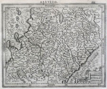
MERCATOR (Gerard);HONDIUS (Jodocus);
[ABRUZZES] Abruzzo et Terra di Lavoro.
Dordrecht Adrianus Bottius 1610 143 x 178 mm.
Bookseller reference : LBW0618b
|
|
|
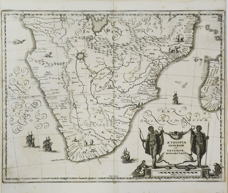
MERIAN (Matthäus).
[AFRIQUE MERIDIONALE] Æthiopia inferior vel exterior Monomotapa.
[1649]. 286 x 373 mm.
Bookseller reference : LBW-3606
|
|
|
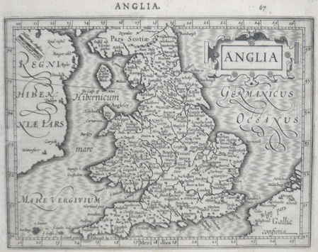
MERCATOR (Gerard) & HONDIUS (Jodocus).
[ANGLETERRE] Anglia.
[Dordrecht, Adrianus Bottius, 1610]. 145 x 183 mm.
Bookseller reference : LBW06160
|
|
|
MERIAN (Matthäus).
[ANGLETERRE] Dower.
[1649]. 218 x 208 mm.
Bookseller reference : LBW-3446

|
|
|
MERCATOR (Gerard) & HONDIUS (Jodocus).
[ASIE DU SUD-EST] India orientalis.
[Dordrecht, Adrianus Bottius, 1610]. 150 x 184 mm.
Bookseller reference : LBW06147

|
|
|
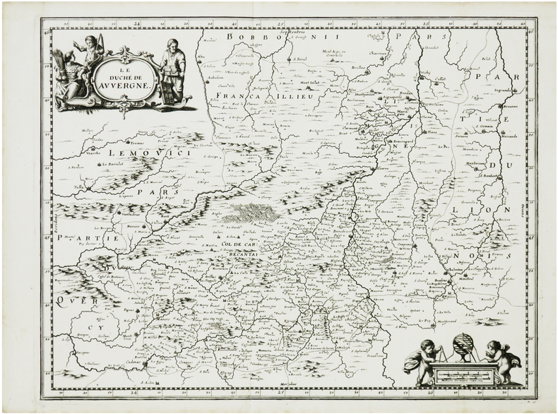
MERIAN (Matthäus).
[AUVERGNE] Le duché de Auvergne.
[Francfort, 1657]. 278 x 359 mm.
Bookseller reference : LBW-7369
|
|
|
MERIAN (Matthäus).
[AVIGNON] Civitatis Avenionis omnimq viarum et ædificiorum eius perfecta delineatio 1635.
[1649]. 263 x 341 mm.
Bookseller reference : LBW-3526

|
|
|
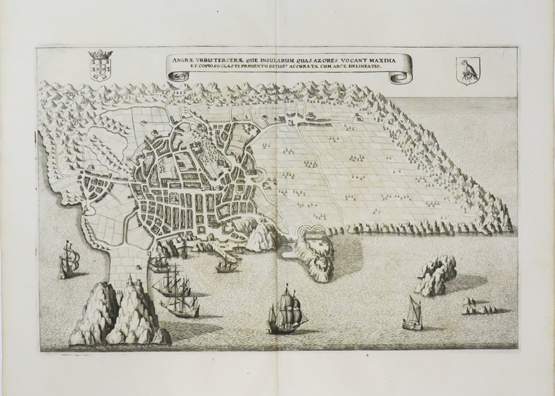
MERIAN (Matthäus).
[AÇORES] Angræ urbis Terceræ que insularum quas Azores vocant maxima.
[1649]. 209 x 329 mm.
Bookseller reference : LBW-3615
|
|
|
MERCATOR (Gerard);HONDIUS (Jodocus);
[BRESCIA/MILAN] Brescia episcopatus Mediolanu ducatus.
Dordrecht Adrianus Bottius 1610 147 x 180 mm.
Bookseller reference : LBW06171

|
|
|
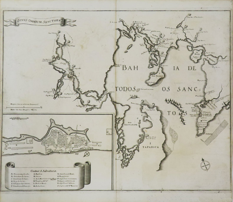
MERIAN (Matthäus).
[BRESIL] Sinus Omnium Sanctoru.
[1649]. 295 x 377 mm.
Bookseller reference : LBW-3608
|
|
|
MERIAN (Matthäus).
[BURGOS] Burgos.
[1649]. 187 x 311 mm.
Bookseller reference : LBW-3440

|
|
|
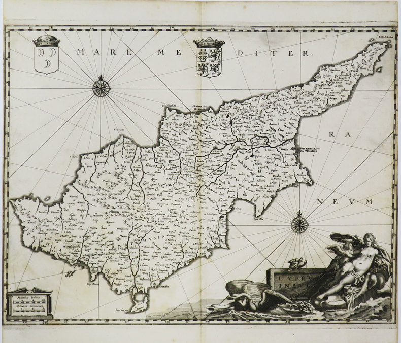
MERIAN (Matthäus).
[CHYPRE] Cyprus insula.
[1649]. 287 x 380 mm.
Bookseller reference : LBW-3600
|
|
|
MERCATOR (Gerard) & HONDIUS (Jodocus).
[CORSE/SARDAIGNE] Corsica - Sardinia.
[Dordrecht, Adrianus Bottius, 1610]. 142 x 180 mm.
Bookseller reference : LBW0618d

|
|
|
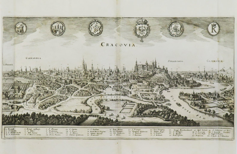
MERIAN (Matthäus).
[CRACOVIE] Cracovia.
[1649]. 203 x 389 mm.
Bookseller reference : LBW-3597
|
|
|
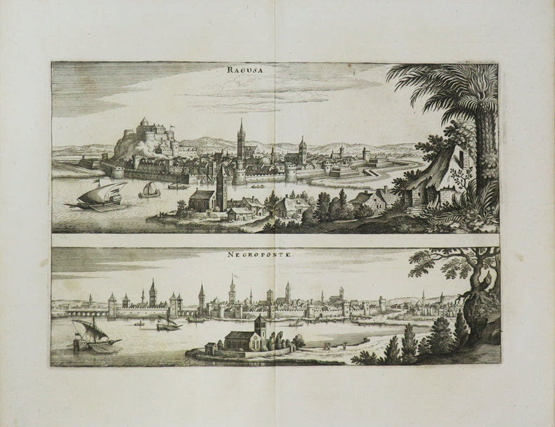
MERIAN (Matthäus).
[CROATIE] Ragusa - Negroponte.
[1649]. 205 x 305 mm.
Bookseller reference : LBW-3599
|
|
|
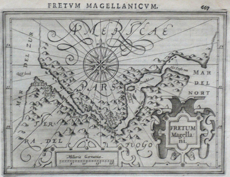
MERCATOR (Gerard) & HONDIUS (Jodocus).
[DETROIT DE MAGELLAN] Fretum Magellani.
[Dordrecht, Adrianus Bottius, 1610]. 131 x 171 mm.
Bookseller reference : LBW06157
|
|
|
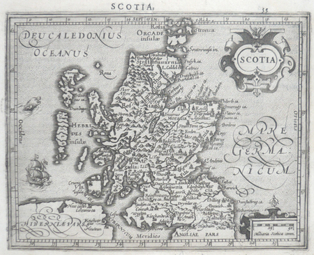
MERCATOR (Gerard) & HONDIUS (Jodocus).
[ECOSSE] Scotia.
[Dordrecht, Adrianus Bottius,]. 1610 150 x 185 mm.
Bookseller reference : LBW0615f
|
|
|
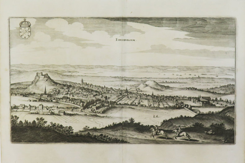
MERIAN (Matthäus).
[ECOSSE] Edynburgum.
[1649]. 196 x 350 mm.
Bookseller reference : LBW-3472
|
|
|
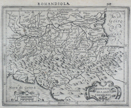
MERCATOR (Gerard);HONDIUS (Jodocus);
[EMILIE-ROMAGNE] Romandiola cum D. Parmensi.
Dordrecht Adrianus Bottius 1610 145 x 178 mm.
Bookseller reference : LBW0616f
|
|
|
MERCATOR (Gerard) & HONDIUS (Jodocus).
[ETHIOPIE] Abissinorum regnu.
[Dordrecht, Adrianus Bottius, 1610]. 142 x 178 mm.
Bookseller reference : LBW06151

|
|
|
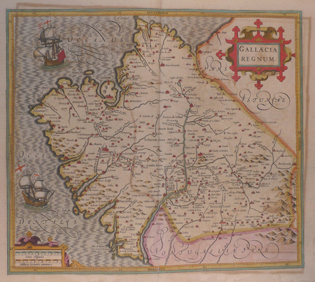
MERCATOR (Gerard);
[GALICE] Gallaecia regnum.
Amsterdam 1628-33 366 x 415 mm.
Bookseller reference : LBW02505
|
|
|
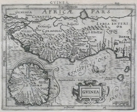
MERCATOR (Gerard) & HONDIUS (Jodocus).
[GUINEE] Guinea.
[Dordrecht, Adrianus Bottius, 1610]. 150 x 183 mm.
Bookseller reference : LBW06150
|
|
|
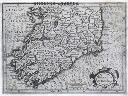
MERCATOR (Gerard) & HONDIUS (Jodocus).
[IRLANDE] Hiberniae v. tabula.
[Dordrecht, Adrianus Bottius, 1610]. 136 x 184 mm.
Bookseller reference : LBW0615e
|
|
|
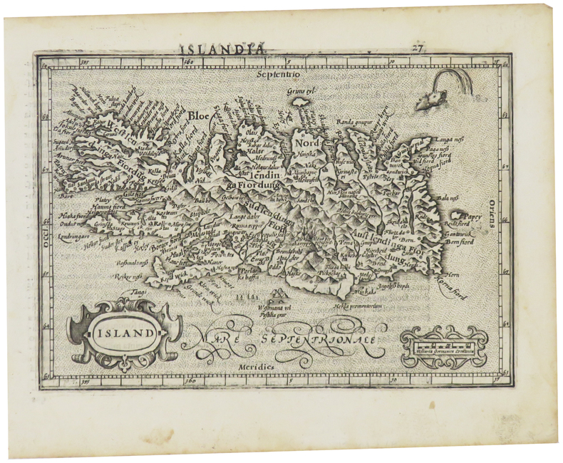
MERCATOR (Gerard) & HONDIUS (Jodocus).
[ISLANDE] Island.
[Dordrecht, Adrianus Bottius, 1610]. 134 x 186 mm.
Bookseller reference : LBW0615c
|
|
|
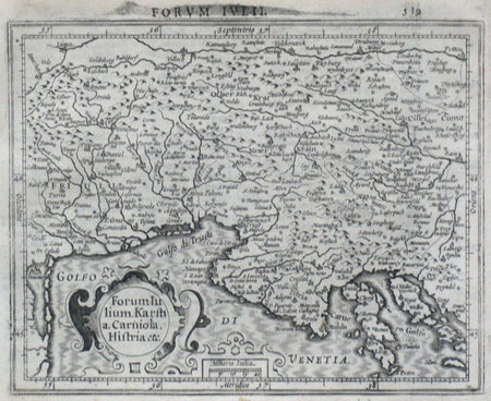
MERCATOR (Gerard);HONDIUS (Jodocus);
[ITALIE DU NORD] Forum Iulium Karstia Carniola Histria etc.
Dordrecht Adrianus Bottius 1610 143 x 178 mm.
Bookseller reference : LBW06172
|
|
|
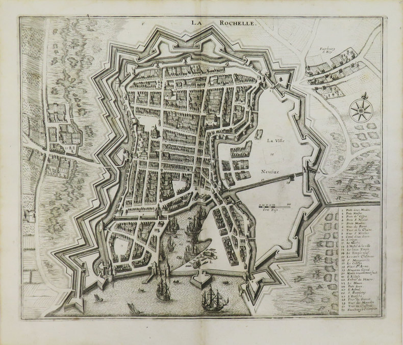
MERIAN (Matthäus).
[LA ROCHELLE] La Rochelle.
[1649]. 289 x 346 mm.
Bookseller reference : LBW-3539
|
|
|
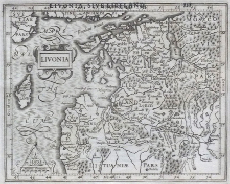
MERCATOR (Gerard) & HONDIUS (Jodocus).
[LETTONIE] Livonia.
[Dordrecht, Adrianus Bottius, 1610]. 151 x 188 mm.
Bookseller reference : LBW06161
|
|
|
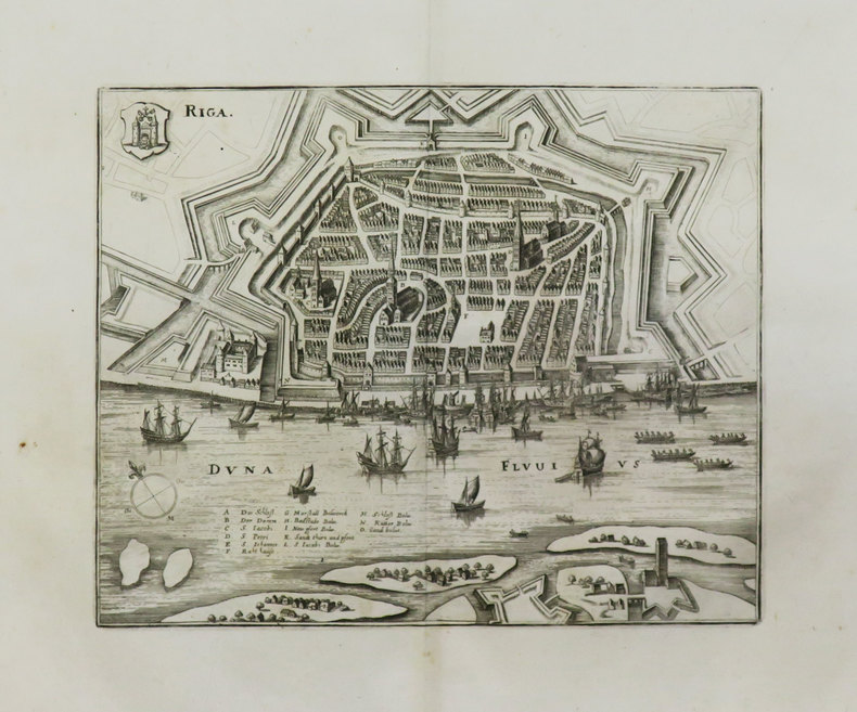
MERIAN (Matthäus).
[LETTONIE] Riga.
[1649]. 216 x 260 mm.
Bookseller reference : LBW-3594
|
|
|
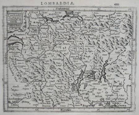
MERCATOR (Gerard);HONDIUS (Jodocus);
[LOMBARDIE] Lombardiae alpestris pars occidentalis cum Valesia.
Dordrecht Adrianus Bottius 1610 149 x 179 mm.
Bookseller reference : LBW0616d
|
|
|
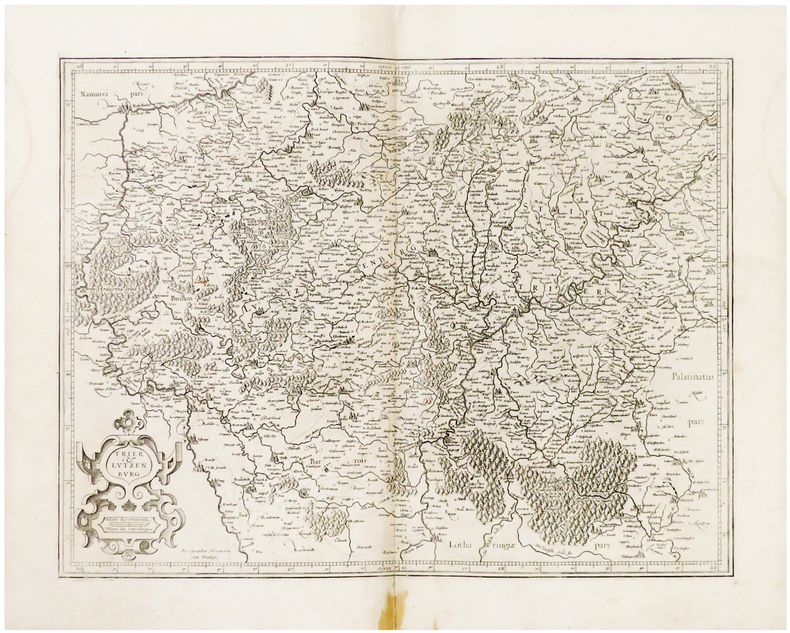
MERCATOR (Gerard).
[LUXEMBOURG] Trier & Lutzenburg.
[Amsterdam, 1603-1622]. 366 x 474 mm.
Bookseller reference : LBW04179
|
|
|
MERCATOR (Gerard) & HONDIUS (Jodocus).
[MEXIQUE] Hispania Nova.
[Dordrecht, Adrianus Bottius, 1610]. 146 x 184 mm.
Bookseller reference : LBW06153

|
|
|
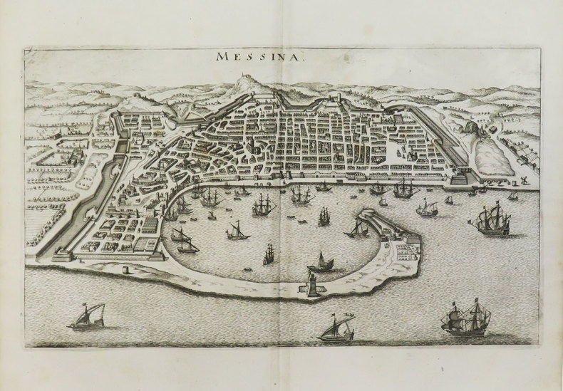
MERIAN (Matthäus).
[MESSINE] Messina.
[1649]. 203 x 350 mm.
Bookseller reference : LBW-3477
|
|
|
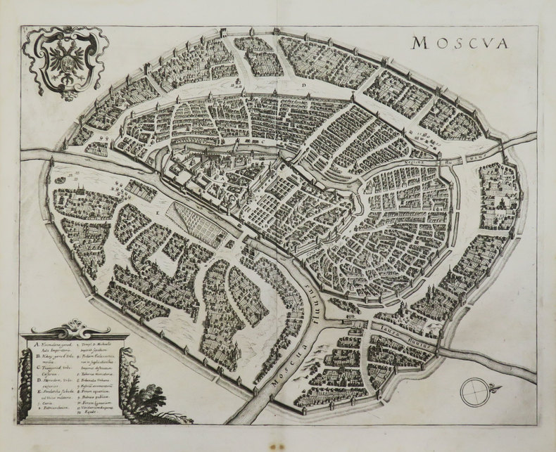
MERIAN (Matthäus).
[MOSCOU] Moscua.
[1649]. 270 x 351 mm.
Bookseller reference : LBW-3598
|
|
|
MERIAN (Matthäus).
[NANCY] Nanceium - Nancy.
[1649]. 229 x 348 mm.
Bookseller reference : LBW-3461

|
|
|
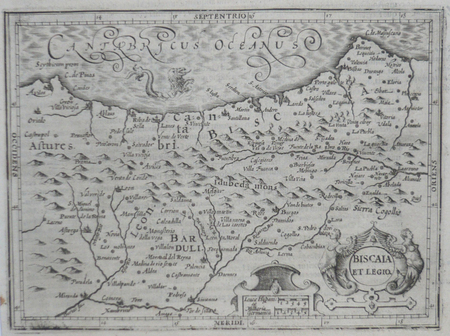
MERCATOR (Gerard);HONDIUS (Jodocus);
[PAYS BASQUE ESPAGNOL] Biscaia et Legio.
Dordrecht Adrianus Bottius 1610 147 x 180 mm.
Bookseller reference : LBW06164
|
|
|
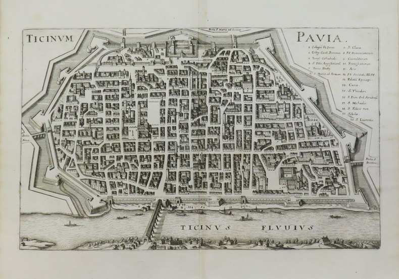
MERIAN (Matthäus).
[PAVIE] Ticinum - Pavia.
[1649]. 217 x 343 mm.
Bookseller reference : LBW-3591
|
|
|
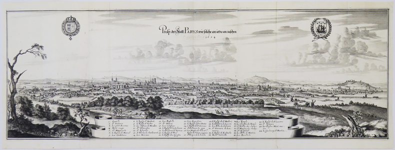
MERIAN (Matthäus).
[PARIS] Prosp. der Statt Parys wie solche an ietzo anzusehen 1654.
[Francfort, 1655]. En trois feuilles jointes de 262 x 795 mm.
Bookseller reference : LBW-4900
|
|
|
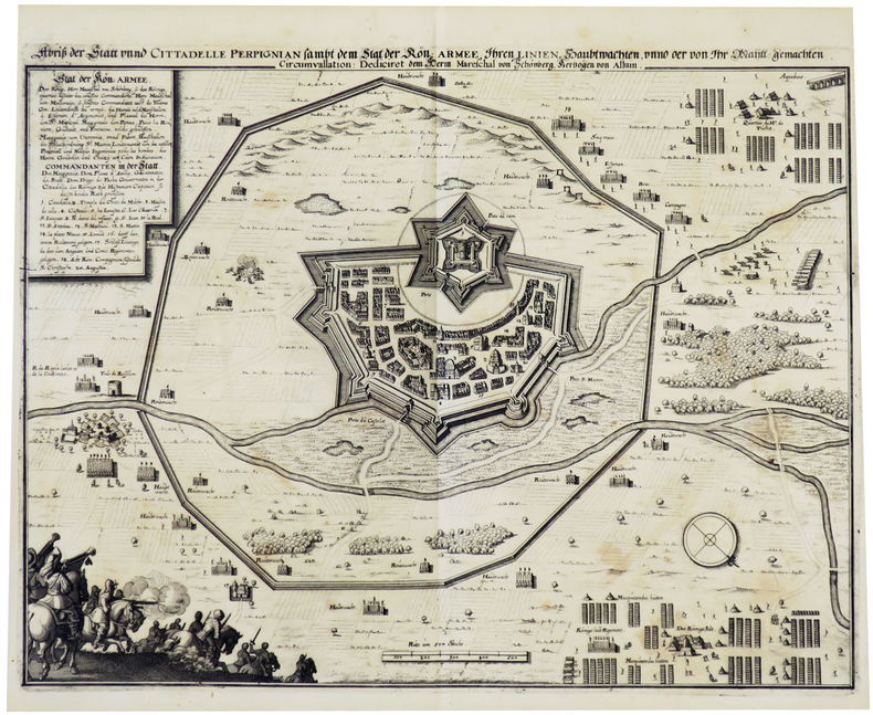
MERIAN (Matthäus).
[PERPIGNAN] Abri? der Statt unnd Cittadelle Perpignian.
[1648]. 281 x 366 mm.
Bookseller reference : LBW-5506
|
|
|
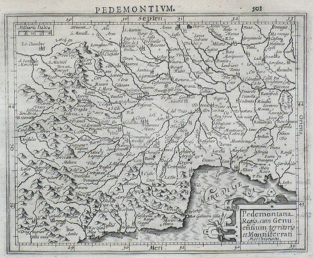
MERCATOR (Gerard);HONDIUS (Jodocus);
[PIEMONT] Pedemontana regio, cum Genuensium territorio et Montifferrati marchionatu.
Dordrecht Adrianus Bottius 1610 147 x 178 mm.
Bookseller reference : LBW0616e
|
|
|
MERCATOR (Gerard);HONDIUS (Jodocus);
[POUILLES/CALABRE] Puglia Piana terra di Barri Otrato etc.
Dordrecht Adrianus Bottius 1610 134 x 177 mm.
Bookseller reference : LBW0618c

|
|
|
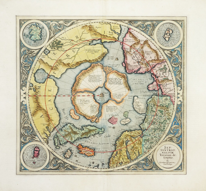
MERCATOR (Gerard).
[POLE NORD] Septentrionalium terrarum descriptio.
Amsterdam, 1607-1612. 367 x 393 mm.
Bookseller reference : LBW-1903
|
|
|
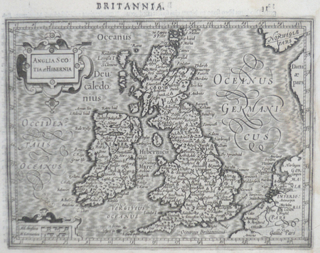
MERCATOR (Gerard) & HONDIUS (Jodocus).
[ROYAUME-UNI] Anglia Scotia et Hibernia.
[Dordrecht, Adrianus Bottius, 1610]. 142 x 178 mm.
Bookseller reference : LBW0615d
|
|
|
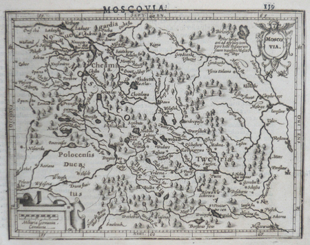
MERCATOR (Gerard) & HONDIUS (Jodocus).
[RUSSIE] Moscovia.
[Dordrecht, Adrianus Bottius, 1610]. 133 x 171 mm.
Bookseller reference : LBW06162
|
|
|
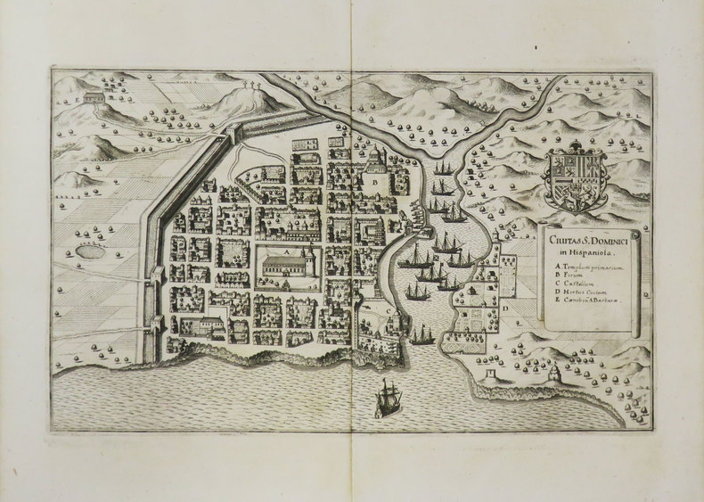
MERIAN (Matthäus).
[SAINT-DOMINGUE] Civitas S. Dominici in Hispaniola.
[1649]. 193 x 324 mm.
Bookseller reference : LBW-3470
|
|
|
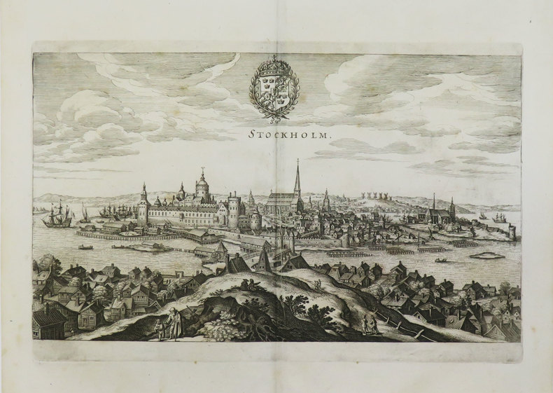
MERIAN (Matthäus).
[SUEDE] Stockholm.
[1649]. 194 x 330 mm.
Bookseller reference : LBW-3596
|
|
|
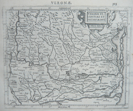
MERCATOR (Gerard);HONDIUS (Jodocus);
[VERONE] Veronae Vicentiae et Pataviae dit.
Dordrecht Adrianus Bottius 1610 150 x 178 mm.
Bookseller reference : LBW06170
|
|
|
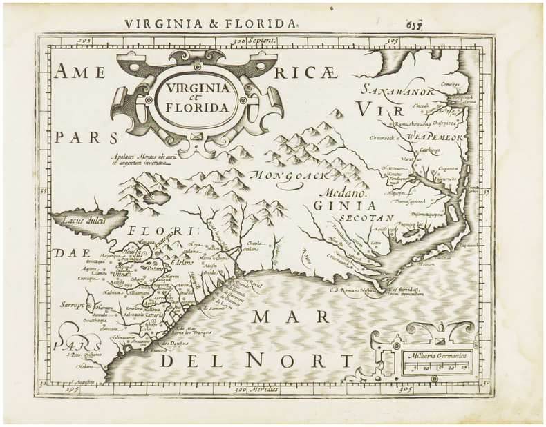
MERCATOR (Gerard) & HONDIUS (Jodocus).
[VIRGINIE/FLORIDE] Virginia et Florida.
[Dordrecht, Adrianus Bottius, 1610]. 152 x 183 mm.
Bookseller reference : LBW06154
|
|
|
MERLE Jean-Toussaint:
Anecdotes historiques et politiques pour servir à l'histoire de la conquête d'Alger en 1830.
Paris, Imprimerie-Librairie de G.-A. Dentu, 1832. In-8 broché de XXXII-400 pages.
Bookseller reference : 20944

|
|
 Receive by email
 Download as PDF document
 RSS feed


