|
Collins Maps
2020 Collins Big Road Atlas Britain and Northern Ireland
2019-09-01. Good. Ships with Tracking Number! INTERNATIONAL WORLDWIDE Shipping available. May not contain Access Codes or Supplements. May be re-issue. May be ex-library. Shipping & Handling by region. Buy with confidence excellent customer service! unknown
Bookseller reference : 0008318689 ISBN : 0008318689 9780008318680

|
|
|
Collins Maps
2020 Collins Essential Road Atlas Britain and Northern Ireland
2019-09-01. Good. Ships with Tracking Number! INTERNATIONAL WORLDWIDE Shipping available. May not contain Access Codes or Supplements. May be re-issue. May be ex-library. Shipping & Handling by region. Buy with confidence excellent customer service! unknown
Bookseller reference : 0008318700q ISBN : 0008318700 9780008318703

|
|
|
Collins Maps
2020 Collins Road Map Ireland
2019-10-01. New. Ships with Tracking Number! INTERNATIONAL WORLDWIDE Shipping available. May be re-issue. Buy with confidence excellent customer service! unknown
Bookseller reference : 0008318735n ISBN : 0008318735 9780008318734

|
|
|
Collins Maps
2020 Collins Essential Road Atlas Europe
2019-09-01. Good. Ships with Tracking Number! INTERNATIONAL WORLDWIDE Shipping available. May not contain Access Codes or Supplements. May be re-issue. May be ex-library. Shipping & Handling by region. Buy with confidence excellent customer service! unknown
Bookseller reference : 0008319758q ISBN : 0008319758 9780008319755

|
|
|
Collins Maps
2020 Collins Big Road Atlas Britain and Northern Ireland
2019-09-01. New. Ships with Tracking Number! INTERNATIONAL WORLDWIDE Shipping available. May be re-issue. Buy with confidence excellent customer service! unknown
Bookseller reference : 0008318689n ISBN : 0008318689 9780008318680

|
|
|
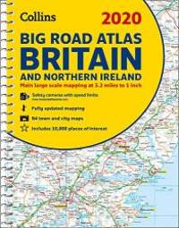
Collins Maps
2020 Collins Big Road Atlas Britain and Northern Ireland
Spiral bound. New. The ultimate 3.2 miles to 1 inch scale A3 spiral bound road atlas of Britain and Northern Ireland for 2020 featuring Collins' popular and well-established road mapping. Designed for exceptional clarity and ease of use. The atlas includes a wide range of urban area maps at even larger scale and 64 d unknown
Bookseller reference : ria9780008318697_new ISBN : 0008318697 9780008318697

|
|
|
Collins Maps
2020 Collins Map of Ireland
Sheet map. New. Full colour map of Ireland at 9 miles to 1 inch 1:570240 with clear detailed road network and counties and new administrative areas shown in colour. This double-sided map covers the whole of Ireland and is ideal for reference or route planning. This map of Ireland shows the road network in det unknown
Bookseller reference : ria9780008318734_new ISBN : 0008318735 9780008318734

|
|
|
Collins Maps
2020 Collins Essential Road Atlas Europe
Spiral bound. New. Up-to-date A4 spiral bound road atlas of Europe. Contains clear detailed road mapping perfect for touring the Mediterranean Iberian peninsula Scandinavia and many other European tourist destinations. Scale of main maps 1:1000000 1 cm to 10 km / 1 inch to 16 miles. Main Features Clear easy t unknown
Bookseller reference : ria9780008319755_new ISBN : 0008319758 9780008319755

|
|
|
Collins Maps
2020 Collins Road Map Britain
Collins. New. Special order direct from the distributor Collins unknown
Bookseller reference : ING9780008318727 ISBN : 0008318727 9780008318727

|
|
|
Collins Maps
2020 Collins Big Road Atlas Britain and Northern Ireland
2019-09-01. New. Ships with Tracking Number! INTERNATIONAL WORLDWIDE Shipping available. May be re-issue. Buy with confidence excellent customer service! unknown
Bookseller reference : 0008318697n ISBN : 0008318697 9780008318697

|
|
|
Collins Maps
2020 Collins Road Map Britain
2019-10-01. New. Ships with Tracking Number! INTERNATIONAL WORLDWIDE Shipping available. May be re-issue. Buy with confidence excellent customer service! unknown
Bookseller reference : 0008318727n ISBN : 0008318727 9780008318727

|
|
|
Collins Maps
2020 Collins Essential Road Atlas Europe
2019-09-01. New. Ships with Tracking Number! INTERNATIONAL WORLDWIDE Shipping available. May be re-issue. Buy with confidence excellent customer service! unknown
Bookseller reference : 0008319758n ISBN : 0008319758 9780008319755

|
|
|
Collins Maps
2020 Collins Road Map Scotland
2019-10-01. New. Ships with Tracking Number! INTERNATIONAL WORLDWIDE Shipping available. May be re-issue. Buy with confidence excellent customer service! unknown
Bookseller reference : 0008318743n ISBN : 0008318743 9780008318741

|
|
|
Collins Maps
2020 Collins Handy Road Atlas Britain and Ireland
2019-09-01. New. Ships with Tracking Number! INTERNATIONAL WORLDWIDE Shipping available. May be re-issue. Buy with confidence excellent customer service! unknown
Bookseller reference : 0008318719n ISBN : 0008318719 9780008318710

|
|
|
Collins Maps
2020 Collins Essential Road Atlas Britain and Northern Ireland
2019-09-01. New. Ships with Tracking Number! INTERNATIONAL WORLDWIDE Shipping available. May be re-issue. Buy with confidence excellent customer service! unknown
Bookseller reference : 0008318700n ISBN : 0008318700 9780008318703

|
|
|
Collins Maps
2020 Collins Road Map Britain
2019-10-01. Good. Ships with Tracking Number! INTERNATIONAL WORLDWIDE Shipping available. May not contain Access Codes or Supplements. May be re-issue. May be ex-library. Shipping & Handling by region. Buy with confidence excellent customer service! unknown
Bookseller reference : 0008318727 ISBN : 0008318727 9780008318727

|
|
|
Collins Maps
2020 Collins Road Map Scotland
2019-10-01. Good. Ships with Tracking Number! INTERNATIONAL WORLDWIDE Shipping available. May not contain Access Codes or Supplements. May be re-issue. May be ex-library. Shipping & Handling by region. Buy with confidence excellent customer service! unknown
Bookseller reference : 0008318743 ISBN : 0008318743 9780008318741

|
|
|
Collins Maps
2020 Collins Big Road Atlas Britain and Northern Ireland
2019-09-01. Good. Ships with Tracking Number! INTERNATIONAL WORLDWIDE Shipping available. May not contain Access Codes or Supplements. May be re-issue. May be ex-library. Shipping & Handling by region. Buy with confidence excellent customer service! unknown
Bookseller reference : 0008318697q ISBN : 0008318697 9780008318697
|
|
|
Collins Maps
2020 Collins Big Road Atlas Britain and Northern Ireland
Collins. New. Special order direct from the distributor Collins unknown
Bookseller reference : ING9780008318680 ISBN : 0008318689 9780008318680

|
|
|
Collins Maps
2020 Collins Big Road Atlas Britain and Northern Ireland
Collins. New. Special order direct from the distributor Collins unknown
Bookseller reference : ING9780008318697 ISBN : 0008318697 9780008318697
|
|
|
Collins Maps
2020 Collins Map of Ireland
Sheet map. As New. Full colour map of Ireland at 9 miles to 1 inch 1:570240 with clear detailed road network and counties and new administrative areas shown in colour. This double-sided map covers the whole of Ireland and is ideal for reference or route planning. This map of Ireland shows the road network in det unknown
Bookseller reference : ria9780008318734_rkm ISBN : 0008318735 9780008318734
|
|
|
Collins Maps
2020 Collins Essential Road Atlas Europe
Spiral bound. As New. Up-to-date A4 spiral bound road atlas of Europe. Contains clear detailed road mapping perfect for touring the Mediterranean Iberian peninsula Scandinavia and many other European tourist destinations. Scale of main maps 1:1000000 1 cm to 10 km / 1 inch to 16 miles. Main Features Clear easy t unknown
Bookseller reference : ria9780008319755_rkm ISBN : 0008319758 9780008319755
|
|
|
Collins Maps
2020 Collins Big Road Atlas Britain and Northern Ireland
Spiral bound. As New. The ultimate 3.2 miles to 1 inch scale A3 spiral bound road atlas of Britain and Northern Ireland for 2020 featuring Collins' popular and well-established road mapping. Designed for exceptional clarity and ease of use. The atlas includes a wide range of urban area maps at even larger scale and 64 d unknown
Bookseller reference : ria9780008318697_rkm ISBN : 0008318697 9780008318697
|
|
|
Collins Maps
2021 Collins Big Road Atlas Britain
Spiral bound. New. The ultimate 3.2 miles to 1 inch scale large format paperback road atlas of Britain featuring Collins' popular and well established road mapping and designed for exceptional clarity and ease of use. unknown
Bookseller reference : A9780008374372 ISBN : 0008374376 9780008374372

|
|
|
Collins Maps
2021 Collins Map of Britain
Sheet map folded. New. Full colour double-sided map of Great Britain at 8.7 miles to 1 inch 1:550000 with clear detailed road network and administrative areas shown in colour. unknown
Bookseller reference : A9780008374402 ISBN : 0008374406 9780008374402

|
|
|
Collins Maps
2021 Collins Map of Europe
Sheet map folded. New. A fully revised and updated colour road map of Europe at a scale of 79 miles to 1 inch / 50km to 1cm 1: 5000000. Roads motorways European Route numbers railways airports cities and towns are clearly shown making the map ideal for route-finding and planning journeys. unknown
Bookseller reference : A9780008374341 ISBN : 0008374341 9780008374341

|
|
|
Collins Maps
Aberdeen Pocket Map: The perfect way to explore Aberdeen Maps
Collins 2018. Map. New. 5.51x3.54x0.24 inches. Collins unknown
Bookseller reference : __0008285632 ISBN : 0008285632 9780008285630

|
|
|
Collins Maps
Aberdeen Pocket Map: The Perfect Way to Explore Aberdeen
2018-06-01. Good. Ships with Tracking Number! INTERNATIONAL WORLDWIDE Shipping available. May not contain Access Codes or Supplements. May be re-issue. May be ex-library. Shipping & Handling by region. Buy with confidence excellent customer service! unknown
Bookseller reference : 0008285632 ISBN : 0008285632 9780008285630

|
|
|
Collins Maps
Aberdeen Pocket Map: The Perfect Way to Explore Aberdeen
2018-06-01. New. Ships with Tracking Number! INTERNATIONAL WORLDWIDE Shipping available. May be re-issue. Buy with confidence excellent customer service! unknown
Bookseller reference : 0008285632n ISBN : 0008285632 9780008285630

|
|
|
Collins Maps Staff; Collins UK Publishing Staff
Belfast Streetfinder Colour Atlas
HarperCollins Publishers Limited 2014. Paperback. Good. Disclaimer:A copy that has been read but remains in clean condition. All pages are intact and the cover is intact. The spine may show signs of wear. Pages can include limited notes and highlighting and the copy can include previous owner inscriptions. At ThriftBooks our motto is: Read More Spend Less.Dust jacket quality is not guaranteed. HarperCollins Publishers Limited paperback
Bookseller reference : G0007493789I3N00 ISBN : 0007493789 9780007493784

|
|
|
Collins Maps
Belfast Streetfinder Colour Atlas Streetfinder Atlas
Collins. New edition. Paperback. Used; Good. Simply Brit Shipped with Premium postal service within 24 hours from the UK with impressive delivery time. We have dispatched from our book depository; items of good condition to over ten million satisfied customers worldwide. We are committed to providing you with reliable and efficient service at all times. 04/02/2009 Collins paperback
Bookseller reference : 2948158 ISBN : 0007257570 9780007257577

|
|
|
Collins Maps
Big Road Atlas Britain 2021: A3 Spiral
Harpercollins Publishers 2020. Spiral Bound. New. new ed edition. 176 pages. Harpercollins Publishers unknown
Bookseller reference : __0008374376 ISBN : 0008374376 9780008374372

|
|
|
Collins Maps
Big Road Atlas Britain 2021: A3 Paperback
Harpercollins Publishers 2020. Paperback / Softback. New. new ed edition. 176 pages. Harpercollins Publishers paperback
Bookseller reference : __0008374368 ISBN : 0008374368 9780008374365

|
|
|
Collins Maps
Birmingham & the Heart of England - No. 3 Collins Nicholson Waterways Guides
Nicholson 2018. Spiral-bound. New. 192 pages. 8.27x5.83x0.39 inches. Nicholson unknown
Bookseller reference : __000825799X ISBN : 000825799X 9780008257996

|
|
|
Collins Maps
Birmingham & the Heart of England - No. 3 Collins Nicholson Waterways Guides
2018-05-01. New. Ships with Tracking Number! INTERNATIONAL WORLDWIDE Shipping available. May be re-issue. Buy with confidence excellent customer service! unknown
Bookseller reference : 000825799Xn ISBN : 000825799x 9780008257996

|
|
|
Collins Maps
Birmingham & the Heart of England - No. 3 Collins Nicholson Waterways Guides
2018-05-01. Good. Ships with Tracking Number! INTERNATIONAL WORLDWIDE Shipping available. May not contain Access Codes or Supplements. May be re-issue. May be ex-library. Shipping & Handling by region. Buy with confidence excellent customer service! unknown
Bookseller reference : 000825799X ISBN : 000825799x 9780008257996

|
|
|
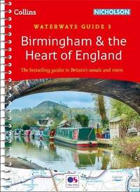
Collins Maps
Birmingham & the Heart of England: Waterways Guide 3 Collins Nicholson Waterways Guides
Spiral bound. New. The number 1 choice for all users of the inland waterways. This established popular and practical guide covers the canals and waterways around Birmingham and central England. unknown
Bookseller reference : A9780008257996 ISBN : 000825799x 9780008257996
|
|
|
Collins Maps
Birmingham & the Heart of England Collins Nicholson Waterways Guides
2014-04-03. Good. Ships with Tracking Number! INTERNATIONAL WORLDWIDE Shipping available. May not contain Access Codes or Supplements. May be re-issue. May be ex-library. Shipping & Handling by region. Buy with confidence excellent customer service! unknown
Bookseller reference : 0007538995 ISBN : 0007538995 9780007538997

|
|
|
Collins Maps
Caribbean Wall Map
Harpercollins Publishers 2018. Sheet Map Folded. New. Harpercollins Publishers unknown
Bookseller reference : __0008300402 ISBN : 0008300402 9780008300401
|
|
|
Collins Maps
Castles Map of Scotland Collins Pictorial Maps
Sheet map folded. New. Explore Scotland's ancient monuments with this pictorial map featuring over 700 castles and fortified houses. Includes an easy-to-use index listing visitor information and an attractive selection of photographs. unknown
Bookseller reference : A9780008368265 ISBN : 0008368260 9780008368265

|
|
|
Collins Maps Tabraham Chris
Castles Map Of Scotland
Harpercollins Publishers 2020. Sheet Map Folded. New. new ed edition. Harpercollins Publishers unknown
Bookseller reference : __0008368260 ISBN : 0008368260 9780008368265

|
|
|
Collins Maps
Children's Folded Map Of The United Kingdom
Harpercollins Publishers 2017. Sheet Map Folded. New. Harpercollins Publishers unknown
Bookseller reference : __0008242186 ISBN : 0008242186 9780008242183

|
|
|
Collins Maps
Children's Wall Map Of The United Kingdom And Ireland
Harpercollins Publishers 2017. Sheet Map Rolled. New. Harpercollins Publishers unknown
Bookseller reference : __0008212082 ISBN : 0008212082 9780008212087

|
|
|
Collins Maps
Children's Wall Map of the United Kingdom and Ireland
Sheet map rolled. New. Colourful Illustrated Map of the United Kingdom and Ireland unknown
Bookseller reference : A9780008212087 ISBN : 0008212082 9780008212087

|
|
|
Collins Maps
Children's Wall Map of the United Kingdom and Ireland
2017-05-04. New. Ships with Tracking Number! INTERNATIONAL WORLDWIDE Shipping available. May be re-issue. Buy with confidence excellent customer service! unknown
Bookseller reference : 0008212082n ISBN : 0008212082 9780008212087

|
|
|
Collins Maps
Children's Wall Map of the United Kingdom and Ireland
2017-05-04. Good. Ships with Tracking Number! INTERNATIONAL WORLDWIDE Shipping available. May not contain Access Codes or Supplements. May be re-issue. May be ex-library. Shipping & Handling by region. Buy with confidence excellent customer service! unknown
Bookseller reference : 0008212082 ISBN : 0008212082 9780008212087

|
|
|
Collins Maps
Clans and Tartans: Traditional Scottish Tartans Collins Little Books
HarperCollins UK. Used - Good. Shows some signs of wear and may have some markings on the inside. HarperCollins UK unknown
Bookseller reference : GRP117221940 ISBN : 0008251096 9780008251093

|
|
|
Collins Maps
Clans and Tartans: Traditional Scottish Tartans Collins Little Books
2018-05-01. Good. Ships with Tracking Number! INTERNATIONAL WORLDWIDE Shipping available. May not contain Access Codes or Supplements. May be re-issue. May be ex-library. Shipping & Handling by region. Buy with confidence excellent customer service! unknown
Bookseller reference : 0008251096 ISBN : 0008251096 9780008251093

|
|
|
Collins Maps
Clans and Tartans: Traditional Scottish Tartans Collins Little Books
2018-05-01. Good. Ships with Tracking Number! INTERNATIONAL WORLDWIDE Shipping available. May not contain Access Codes or Supplements. May be re-issue. May be ex-library. Shipping & Handling by region. Buy with confidence excellent customer service! unknown
Bookseller reference : 0008251096q ISBN : 0008251096 9780008251093

|
|
|
Collins Maps
Clans and Tartans: Traditional Scottish Tartans Collins Little Books
2018-05-01. New. Ships with Tracking Number! INTERNATIONAL WORLDWIDE Shipping available. May be re-issue. Buy with confidence excellent customer service! unknown
Bookseller reference : 0008251096n ISBN : 0008251096 9780008251093

|
|
 Receive by email
 Download as PDF document
 RSS feed


