|
MOHAMMAD HAMDAN, AL-HASSAL LABIB, (Mapmakers and prepared by).
Plates 48 & 49: [Arabic map of Danube River [with] Sweden and Norway] Nahr-al-Tuna [with] Al-Suid wa al-Norwij.
Very Good Arabic Original b/w map. Some stains on extremities. Oblong 4to. (20x27 cm); Maps' sizes: 15x21 cm apprx. In Arabic. Two maps with front and its verso. Plate numbers 48 & 49. From one of late editions of 'Al-atlas al-hadithat fî takhtit aqalim al'arz siyasiyya wa iqtisadiyya hesab minhaj wa zarat'al-meraz fî al-umumiyya'. Mohammad Hamdan and Hassal Labib were two geography teachers (muderris) and cartographers in 'Amiri' School according to the info of 'Atlas'.
|
|
|
MOHAMMAD HAMDAN, AL-HASSAL LABIB, (Mapmakers and prepared by).
Plates 50 & 51: [Arabic map of Basin of Baltic Sea [with] basin of the Rhine] Hawza-i Bahr-i Baltiq [with] Hawza al-Rin.
Very Good Arabic Original b/w map. Some stains on extremities. Oblong 4to. (20x27 cm); Maps' sizes: 15x21 cm apprx. In Arabic. Two maps with front and its verso. Plate numbers 50 & 51. From one of late editions of 'Al-atlas al-hadithat fî takhtit aqalim al'arz siyasiyya wa iqtisadiyya hesab minhaj wa zarat'al-meraz fî al-umumiyya'. Mohammad Hamdan and Hassal Labib were two geography teachers (muderris) and cartographers in 'Amiri' School according to the info of 'Atlas'.
|
|
|
MOHAMMAD HAMDAN, AL-HASSAL LABIB, (Mapmakers and prepared by).
Plates 52 & 53: [Arabic map of River Rhône [with] the Mediterranean Sea] Al-nehr al-Ron [with] Al-Bahr al-Abiad al-Mutawasit.
Very Good Arabic Original b/w map. Some stains on extremities. Oblong 4to. (20x27 cm); Maps' sizes: 15x21 cm apprx. In Arabic. Two maps with front and its verso. Plate numbers 52 & 53. From one of late editions of 'Al-atlas al-hadithat fî takhtit aqalim al'arz siyasiyya wa iqtisadiyya hesab minhaj wa zarat'al-meraz fî al-umumiyya'. Mohammad Hamdan and Hassal Labib were two geography teachers (muderris) and cartographers in 'Amiri' School according to the info of 'Atlas'.
|
|
|
MOHAMMAD HAMDAN, AL-HASSAL LABIB, (Mapmakers and prepared by).
Plates 54 & 55: [Arabic map of Northern Sea [with] Natural Asia] Bahr al-Shimal [with] Asia al-Tabieia.
Very Good Arabic Original b/w map. Some stains on extremities. Oblong 4to. (20x27 cm); Maps' sizes: 15x21 cm apprx. In Arabic. Two maps with front and its verso. Plate numbers 54 & 55. From one of late editions of 'Al-atlas al-hadithat fî takhtit aqalim al'arz siyasiyya wa iqtisadiyya hesab minhaj wa zarat'al-meraz fî al-umumiyya'. Mohammad Hamdan and Hassal Labib were two geography teachers (muderris) and cartographers in 'Amiri' School according to the info of 'Atlas'.
|
|
|
MOHAMMAD HAMDAN, AL-HASSAL LABIB, (Mapmakers and prepared by).
Plates 56 & 57: [Arabic map of political Asia [with] Asian Rain from May to October] Asia al-Siyasiyya [with] Asia al-amtar min Mayu 'iillaa 'Uktubar.
Very Good Arabic Original b/w map. Some stains on extremities. Oblong 4to. (20x27 cm); Maps' sizes: 15x21 cm apprx. In Arabic. Two maps with front and its verso. Plate numbers 56 & 57. From one of late editions of 'Al-atlas al-hadithat fî takhtit aqalim al'arz siyasiyya wa iqtisadiyya hesab minhaj wa zarat'al-meraz fî al-umumiyya'. Mohammad Hamdan and Hassal Labib were two geography teachers (muderris) and cartographers in 'Amiri' School according to the info of 'Atlas'.
|
|
|
MOHAMMAD HAMDAN, AL-HASSAL LABIB, (Mapmakers and prepared by).
Plates 58 & 59: [Arabic map of Asian Rain from April to November [with] Flora of Asia] Asia al-amtar min Nufember 'iillaa Abril [with] Nebât-i Asia.
Very Good Arabic Original b/w map. Some stains on extremities. Oblong 4to. (20x27 cm); Maps' sizes: 15x21 cm apprx. In Arabic. Two maps with front and its verso. Plate numbers 58 & 59. From one of late editions of 'Al-atlas al-hadithat fî takhtit aqalim al'arz siyasiyya wa iqtisadiyya hesab minhaj wa zarat'al-meraz fî al-umumiyya'. Mohammad Hamdan and Hassal Labib were two geography teachers (muderris) and cartographers in 'Amiri' School according to the info of 'Atlas'.
|
|
|
Moinot I.
LEVES DE PLANS A LA STADIA. Notes pratiques pour études de tracés.
(Codice OS/0208) In 4° (28 cm) IV-83 pp. Edition originale, 9 planches dépliantes et nombreuses figures dans le texte. Anciennes notes marginales (en italien), peu de soulignures. Marges non rognées. Manque d'un coin blanc (ne touchant pas le texte). Toile moderne, plat original gardé. Très bon état. ~~~ SPEDIZIONE IN ITALIA SEMPRE TRACCIATA

|
|
|
Molinari Maurizio
Atlante del mondo che cambia. Le mappe che spiegano le sfide del nostro tempo
br. Il mutamento è una costante fondamentale del nostro mondo, tanto sul piano geopolitico quanto negli aspetti economici e sociali, ma all'inizio del terzo millennio la velocità e la frequenza di queste trasformazioni ha raggiunto un'intensità inedita. Da questa consapevolezza, e dalla necessità di comprendere quanto accade, nasce l'idea di questo libro: unire lo strumento tradizionale della mappa alla ricerca sui dati per descrivere il mondo che cambia. Individuando otto trend - dai conflitti combattuti a quelli latenti, dall'emergenza climatica alle discriminazioni razziali, dalle diseguaglianze sociali al sovranismo, passando per il fenomeno migratorio, la parità di genere e l'emergenza sanitaria legata all'esplodere delle epidemie - Molinari racconta il mutamento e le sue conseguenze profonde, con l'acutezza dell'osservatore esperto e la lucidità del grande giornalista, mettendo a punto uno strumento prezioso per chiunque voglia esplorare il futuro.

|
|
|
Moll, Herman
CANAAN PALESTINE OR THE HOLY LAND: DIVIDED INTO THE TWELVE TRIBES OF ISRAEL
Map. 1st Edition. Framed and matted. 9 X 7.5 inches. In English. An original copper-engraved map of Palestine by the legendary cartographer Herman Moll circa 1709, and later hand-colored. Herman Moll (1654 1732) , was a London cartographer, engraver, and publisher
. Moll's exact place of origin is unknown, although his birth year is generally accepted to be the year 1654. He moved to England in 1678 and opened a book and map store in London
Moll's maps were in his lifetime and after very influential, and are still among the most sought after aesthetic engravings in the history of cartography. (Wikipedia, 2017) OCLC lists 1 copy worldwide (Bayerische Staatsbibliothek) . Also digitized at NLI, see: Laor 499. Very good condition. (ART-26-5)

|
|
|
Mollo Tranquillo
Athenae cum portibus Piraeeo et Phalereo et regione adjacente
Incisione su rame, foglio 472 x 380 mm (420 x 310 mm alla battuta) a pieni margini su carta vergata. Carta della città di atene con il porto, dentro doppio riquadro inciso. In basso a sinistra, fuori riquadro dentro battura " S.B.V. Adm 20 Kr. W.W.". A destra: "C.P.S.C.R.A.M.". Qualche segno di ossidazione. Mollo Maria Laurentio Tranquillo (1767-1837) nato nella Svizzera italiana fu grafico, incisore, commerciante di musica e grande editore d'arte a Vienna .

|
|
|
MONSIEUR LE CURE DE SAINT PHILIBERT
Abbaye Saint Philibert, Tournus.
MONSIEUR LE CURE DE SAINT PHILIBERT, 1959, feuillet in8 dactylographié de 10 pages + plans, état moyen.
書籍販売業者の参照番号
: 5309
|
|
|
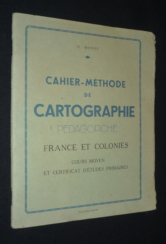
Monot H.
Cahier-méthode de cartographie. Pédagofiche. France et colonies. Cours moyen et Certificat d'études primaires
Monot H. Dos agrafé In-8 (17,8 x 21,8 cm), dos agrafé, 40 pages, sans date ; rabat du premier plat frotté et fendu aux extrémités, par ailleurs assez bon état général. Livraison a domicile (La Poste) ou en Mondial Relay sur simple demande.
書籍販売業者の参照番号
: vg236
|
|
|
MONMONIER, Mark.
How to lie with Maps.
The University of Chicago Press, 1991. in-8, 176 pages.
書籍販売業者の参照番号
: 80368
|
|
|
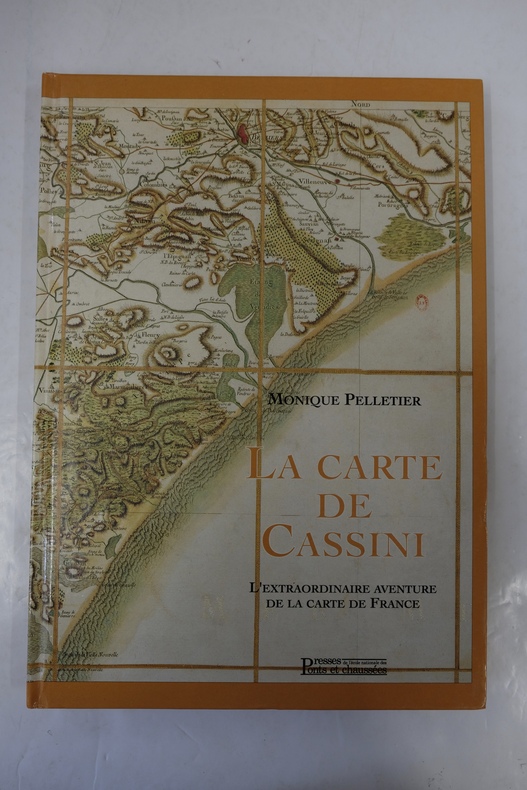
Monique Pelletier
La carte de Cassini, l'extraordinaire aventure de la carte de France
1990, Presses de l'École Nationale des Ponts et Chaussées. In-4, relié, cartonnage bradel, 260 pages. Iconographie n&b. Très bon exemplaire, proche du neuf.
書籍販売業者の参照番号
: GEO500M
|
|
|
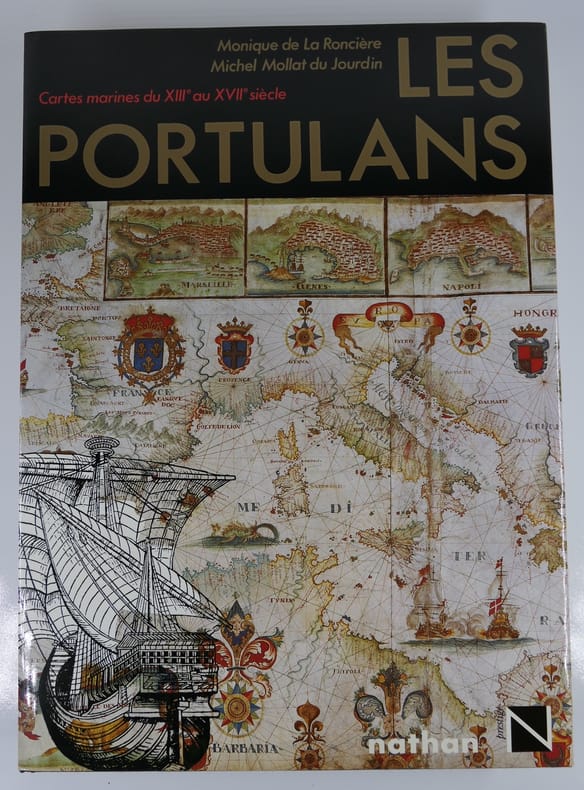
Monique de La Roncière
Les Portulans : Cartes marines du XIIIe au XVIIe siècle
Paris, Nathan, 1984, in-4, relié, jaquette éditeur, 295 pages. Etat de neuf. Sous emboîtage muet. ISBN 2092905384
書籍販売業者の参照番号
: 81442 ISBN : 2092905384
|
|
|
MONMONIER, Mark.
Spying with Maps. Surveillance Technologies and the Future of Privacy.
The University of Chicago Press, 2002. Hardcover in-8, 239 pages. With unclipped DW.
書籍販売業者の参照番号
: 80373
|
|
|
Monaco, Franco
Roma curiosa. Guida turistica
16x21 cm, oblungo, pp. 140, numerose fotografie nel testo anche ironiche. brossura editoriale illustrata, titolo al piatto, minime abrasioni alla prima copertina per il resto esemplare molto buono

|
|
|
MONMONIER, Mark.
How to lie with Maps.
in-8, 176 pages. Book in very fine condition. [P-14]
|
|
|
MONMONIER, Mark.
Spying with Maps. Surveillance Technologies and the Future of Privacy.
Hardcover in-8, 239 pages. With unclipped DW. Book in very fine condition. [SO-4]
|
|
|
MONTANARI Armando a cura.
Pianta dei beni culturali artistici e ambientali del Lazio (esclusa Roma).
In-4° gr. pp. 125 con 7 grandi carte a col. più volte ripiegate f.t. Bross. edit.
|
|
|
MONTEFORTI B., RAGGI G.
Per la GEOLOGIA dell'ENTROTERRA di LA SPEZIA tra SARZANA e ZIGNAGO. Con grande CARTA GEOLOGICA a COLORI. Estr. orig. da Boll. Soc. Geol. It., 94, 1975
In-8° (cm. 26,5x18), pp. 17 (da p. 927 a p. 943) + 1 grande CARTA GEOLOGICA a COLORI di cm. 79x71,5, ripiegata in fascetta a parte. Bross. edit. Perfetta la carta, lievi mende alla copertina dell'estratto in bross. edit. INVIO degli Autori al piatto ant.
|
|
|
Moorehead Alan
La grande avventura di Cooper's Creek
illustrazioni

|
|
|
Moorehead Alan
The Blue Nile
illustrazioni in bianco e nero

|
|
|
Moorehead Alan
The White Nile
illustrazioni in bianco e nero

|
|
|
MORI Matsuda
AJIA REKISHI CHIZU ( ATLAS HISTORIQUE DE L’ASIE). En langue japonaise
Heibonsha, Tokyo, 1966
書籍販売業者の参照番号
: 22552
|
|
|
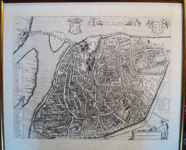
Mortier Pierre
AVENIO vulgo AVIGNON
Célèbre plan de la ville d’Avignon. De grandes dimensions, de nombreux détails apparaissent. Certainement un des plus beaux plans. Cadre doré. Petite fente dans le pli originel de la planche. Bon état Encadré très bon Avignon 1671 42,0 x 52,5 cm. 54 x 62 cm avec le cadre.
書籍販売業者の参照番号
: 5482
|
|
|
MORITZ, Eduard:
Die Entwickelung des Kartenbildes der Nord- und Ostseeländer bis auf Mercator. Mit besonderer Berücksichtigung Deutschlands. (Nachdruck).
Amsterdam, Meridian, 1967, gr. in-8°, V + 84 S., Original-Leinenband.
書籍販売業者の参照番号
: 9457aaf
|
|
|
MORAND PAUL
Hiver Caraibe .
1929 ernest Flammarion 1929 état d'usage 259 pages in 12 ébarbures petit manque sur dernier plat.
書籍販売業者の参照番号
: 7653
|
|
|
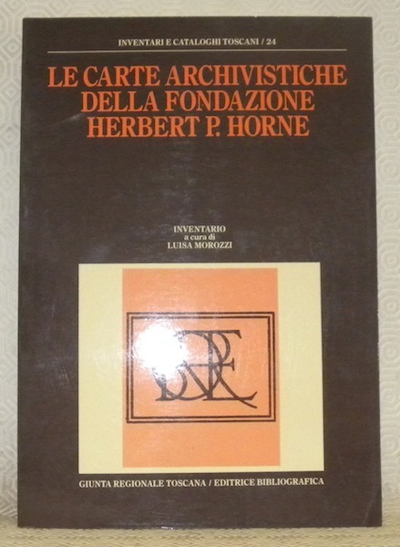
MOROZZI, Luisa (inventario a cura di).
Le carte archivistiche della Fondazione Herbert P. Horne. Presentazione di Ugo Procacci. Inventari e Cataloghi Toscani, n.° 24.
Milano, Giunta regionale toscana & Editrice Bibliografica 1988, 300x210mm, XLII - 376pagine, in brossura. Timbro biblioteca. Ottimo stato.
書籍販売業者の参照番号
: 76892
|
|
|
MORISSON TONY
Les Andes.
Collection les les grandes étendues sauvages,éditions time life 1980 très bon état 184 pages in 4.
書籍販売業者の参照番号
: 3652
|
|
|
Mora Zerbini Gemmalisa
La controversia Cook-Peary per il raggiungimento del Polo Nord
illustrazioni in bianco e nero

|
|
|
MORANDINI G. -
Una carta batimetrica del Lago di Saima.
(Roma, 1941) 8vo stralcio con copertina posticcia muta, pp. 541/546 con una illustrazione. - !! ATTENZIONE !!: Con il termine estratto (o stralcio) intendiamo riferirci ad un fascicolo contenente un articolo di rivista, sia che esso sia stato stampato a parte utilizzando la stessa composizione sia che provenga direttamente da una rivista. Le pagine sono indicate come "da/a", ad esempio: 229/231 significa che il testo è composto da tre pagine. Quando la rivista di provenienza non viene indicata é perchè ci è sconosciuta. - !! ATTENTION !!: : NOT A BOOK : “estratto” or “stralcio” means simply a few pages, original nonetheless, printed in a magazine. Pages are indicated as in "from” “to", for example: 229/231 means the text comprises three pages (229, 230 and 231). If the magazine that contained the pages is not mentioned, it is because it is unknown to us.

|
|
|
MORDEN
Map of HUNTINGDON
1695. COLOURED F 16x11 . 1695. unknown
書籍販売業者の参照番号
: Map279
|
|
|
MORDEN
Map of HUNTINGDON
1695. UNCOLOURED F 16x11 . 1695. unknown
書籍販売業者の参照番号
: Map278
|
|
|
MORDEN
Map of LINCOLNSHIRE
1720. UNCOLOURED V.G. 14.25 X 16.5 . 1720. unknown
書籍販売業者の参照番号
: Map356
|
|
|
MORDEN
Map of NORTHUMBERLAND
1695. UNCOLOURED 16.5X14.25 . 1695. unknown
書籍販売業者の参照番号
: Map435
|
|
|
MORDEN
Map of NOTTINGHAMSHIRE
1695. HAND COLOURED V. G. 16.5 X 13.75 . 1695. unknown
書籍販売業者の参照番号
: Map477
|
|
|
MORDEN
Map of NOTTINGHAMSHIRE
1695. HAND COLOURED V.G. 13.75 X 16.5 . 1695. unknown
書籍販売業者の参照番号
: Map480
|
|
|
MORDEN
Map of WESTMORLAND
1695. UNCOLOURED V.G. 14.25 X16.75 . 1695. unknown
書籍販売業者の参照番号
: Map633
|
|
|
MORDEN Robert
CAMBRIDGESHIRE
London: Abel Swal and Amsham & John Churchill 1695. ND 1695- 43x36 cms 16.5 x 14 inches. Uncoloured copy with a margin and no clipping. Nice dark impression printed on thick paper. PLEASE EMAIL FOR PHOTO. Fine. Folio. Abel Swal and Amsham & John Churchill unknown
書籍販売業者の参照番号
: Map723
|
|
|
MORDEN Robert
PLAYING CARD Map of Lincolnshire VIII
London: H. Turpin 1773. Single map of Lincolnshire. A fine uncoloured copy of the last issue of Robert Moderns playing card maps. Approx 55x90mms. Title to the head wth Roman numeral VIII and the uncoloured map to the main section enclosed with double ruled lines above and below with county dimensions and distances at the foot. Harry Turpin published a 52 sheet set of these maps between 1764 and 1787 but no exact date is known for publication. RARE. Please email for photos. 3rd edition. Fine. H. Turpin unknown
書籍販売業者の参照番号
: Map922
|
|
|
Moreland Carl; & David Bannister
Christie's Collectors Guides : Antique Maps Second Edition
Oxford UK: Phaidon / Christie's 1986. A beautful copy. Fine condition in a Fine dust jacket. NOT price clipped �14.95. NO chips. NO tears. NO creases. NO fading. Bright clean square and tight. Sharp corners. NOT a library discard. NO owner's name or bookplate. NOT a remainder. Crisp and unmarked. 1986. 2nd edition corrected. Describes the processes of map making from the year 1470 on. Lists with brief biographies and descriptions of their major works the principal map makers from 1450 to 1850. Gives advice on collecting and caring for maps etc. With 168 illustrations some in color. Bound in the original gilt-stamped blue boards. Complete with dust jacket. 7.75" wide by 10" tall. Second Edition. Hardcover. Fine condition/Fine dust jacket. ix 314pp. Great Packaging Fast Shipping. Phaidon / Christie's Hardcover
書籍販売業者の参照番号
: 018087 ISBN : 0714880345 9780714880341
|
|
|
Moreland Carl - Bannister David
Antique Maps. Christie Collectors Guides.
Ril. in tela con sovr., cm 23,5x19,5, pp 314, ill. in b/n.. - ISBN: 0780714880341

|
|
|
MORELAND CARL - BANNISTER DAVID
Christie's Collectors Guides. Antique maps.
in 8°, cart. edit. con sovracc. edit. ill., pp. (10),326, con num. ill. n.t., testo in lingua inglese, ottimo es.. (L026/d) (la spedizione standard è SEMPRE tracciata con raccomandata-piego di libri, eventuale fattura da richiedere all'ordine)
|
|
|
Moret,Léon.
Précis de Géologie.
<br/> NOTE: ammaccatura all'angolo inf. del piatto ant., altrimenti buon esemplare.<br/> TITOLO: Précis de Géologie. <br/> AUTORE: Moret,Léon.<br/> EDITORE: Masson & Cie<br/> DATA ED.: 1947,<br/> COLLANA: buon esemplare.)<br/>
|
|
|
MORGHEN Filippo
Pianta del Cratere.
(cm. 21x36) il campo inc. + ampi margini, con la descrizione dei luoghi elencati sotto la pianta. Trattasi della pianta litorale dei confini del Cratere dei Campi Flegrei, appartenente ad una famosa raccolta di ben 43 tavole. Edizione speciale su carta azzurrina.

|
|
|
Mori A.
Nuova valutazione della superficie del Regno.
(Firenze, Tip. M. Ricci, 1896), in-8, copertina fittizia, pp. 7. Estratto.
|
|
|
Mori Alberto
Le carte Geografiche e loro lettura e interpretazione
In 8° br. pp. 255, con 15 tav. b/n f/t, ben tenuto
|
|
|
MORI Assunto -
Cartografia primitiva.
Milano, 1910, stralcio con copertina posticcia muta, pp. 306/311 con ill. - !! ATTENZIONE !!: Con il termine estratto (o stralcio) intendiamo riferirci ad un fascicolo contenente un articolo di rivista, sia che esso sia stato stampato a parte utilizzando la stessa composizione sia che provenga direttamente da una rivista. Le pagine sono indicate come "da/a", ad esempio: 229/231 significa che il testo è composto da tre pagine. Quando la rivista di provenienza non viene indicata é perchè ci è sconosciuta. - !! ATTENTION !!: : NOT A BOOK : “estratto” or “stralcio” means simply a few pages, original nonetheless, printed in a magazine. Pages are indicated as in "from” “to", for example: 229/231 means the text comprises three pages (229, 230 and 231). If the magazine that contained the pages is not mentioned, it is because it is unknown to us.

|
|
|
MORI Attilio
Come progredi' la conoscenza geografica della Toscana nel secolo XIX. Contributo alla storia della geografia italiana
In 8, pp. 56. Br. rifatta. Estratto dagli 'Atti del Congresso Geografico italiano' (Firenze, 12-17 aprile 1898). Testo sugli studi geografici e cartografici in Toscana dalla fine del XVIII secolo. Fra gli argomenti: Lavori geodetici e cartografici dei Francesi in Toscana; determinazioni astronomiche e geodetiche del Barone de Zach; triangolazione dell'Inghirami; nuovo catasto e carta geometrica della Toscana, etc... Mori fu docente di Geografia all'Universita' di Firenze fra 1932 e 1935.
|
|
 検索結果のメールを受信する
 PDFファイルの検索結果をダウンロード
 RSSフィード


