|
OECD Territorial Reviews Istanbul, Turkey
Paperback in very good condition. Used
|
|
|
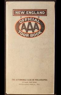
Official AAA Tour Book: New England with map
Washington DC: American Automobile Association 1927. Paperback. Very Good -. 120 p.: illustrations maps 1 large folded map of New England attached to inside of back cover; 24 cm. Grey paper covers printed in black and red. Contents: Descriptive Section -- Routings -- Tourist Camps -- Customs Regulations -- Ferry Schedules. Outside of back cover has illustrated advertisement for Gulf gasoline. In Very Good- Condition: cover separated from text block; covers slightly soiled; ends of spine rubbed; clean and tight. American Automobile Association paperback
Bookseller reference : 003343
|
|
|
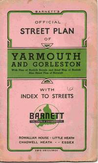
Official Street Plan of Yarmouth and Gorleston with Index to Streets
Chadwell Heath Essex: Barnett. Soft cover. Good/No Jacket as published. A street plan of the east coast town and port. Generally tidy but there are a couple of red pencil annotations on the map. Not dated but probably 1960s. The advertisement on the back is for the original Lacon's brewery which closed in 1968. All orders processed promptly and shipped from the UK. <br/> <br/> Barnett paperback
Bookseller reference : 024993
|
|
|
Olympia. Brief History and Complete Guide
Athens: Editions Olympic Flame 1972. Soft cover. Good/No Jacket as published. 6.5" x 9.5. A well illustrated guide to the ruins of Olympia Greece home of the Olympic flame. Some wear to the edges. In English. All orders processed and shipped promptly from the UK. Please email with your questions. <br/> <br/> Editions Olympic Flame paperback
Bookseller reference : 014170

|
|
|
Olympic National Park Washington Brochure and Map
The United States Department of the Interior 1961. Book. Very Good. Soft cover. The United States Department of the Interior 1961. Very good. Measures approximately 23" x 18". . The United States Department of the Interior Paperback
Bookseller reference : 015708
|
|
|
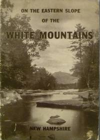
On the Eastern Slope of the White Mountains
Vintage New Hampshire Travel Guide Circa 1940s 4to size staple-bound softcover booklet with photo illustrated covers; 64 pages profusely illustrated with black and white photographs throughout inside back cover is a map. Private Press: Conway Chamber of Commerce; Conway New Hampshire undated circa 1940s Includes: Conway Passaconaway North Conway Kearsarge Chatham Madison Intervale Jackson Bartlett Crawford Notch Pinkham Notch Gorham Randolph Shelburne Chocorua Wonalancet Edgewear and rubbing to covers some creasing on covers and very light creasing to a few pages; some light soil on front cover. . Stapled. Good/No Jacket. 4to - over 9¾" - 12" tall. Paperback
Bookseller reference : 005844
|
|
|
Oonark-Pangnark
Ottawa: National Museums of Canada 1970. Paperback. Very Good/No Dj. 4to. Unpaginated circa 24 pages 19 B/W plates of the art pieces 1970 exhibition catalogue from the National Museum of Man. National Museums of Canada paperback
Bookseller reference : 184320
|
|
|
ORBITAL FLIGHT OF JOHN H. GLENN, JR. Hearing before the Senate Committee on aeronautical and space sciences. Testimony of astronauts and NASA officials held on February 28, 1962.
Washington, Government Printing office, 1962. 3, 126 S. m. 6 Tafeln, 1 Portraittafel. OBroschur (Titel u. letzte Seite m. Anmerkungen u. Stempeln, Bibliothekskarte verso Inhaltsverzeichnis).
Bookseller reference : 1260493
|
|
|
ORDAL. L'Aragall - Sant Jaume - Montcau - Puig d'Agulles - Puig Bernat - Sant Pons - Pla d'Ardenya - Mapa
S.l., s.e., s.a (c. 1950). Mapa excursionista revisado por el Dr. N. Llopis Lladó. Escala 1:25.000. Mapa entelado y plegado en carpeta de tela cerrada con goma. Muy buen ejemplar.
|
|
|
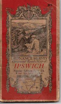
Ordnance Survey Contoured Road Map of Ipswich. Sheet 87. Popular Edition One Inch Map
Southampton: The Director General Ordnance Survey 1933. Soft cover. Good/No Jacket as published. Map on cloth. Trimley / Bawdsey to the south and Debenham to the north west and Leiston to the north east. The covers show some signs of wear / handling / use but still quite sound and the map itself is in good order. All orders processed promptly and shipped from the UK. <br/> <br/> The Director General Ordnance Survey paperback
Bookseller reference : 028986
|
|
|
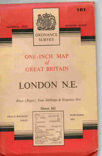
Ordnance Survey London N.E. Sheet 161. One-inch map of Great Britain
Chessington Surrey: Director General of the Ordnance Survey 1958. Soft cover. Good/No Jacket as published. A one inch to one mile Ordnance Survey map of this part of London on paper. In clean and sound condition without marks or inscriptions. All orders processed and shipped promptly from the UK <br/> <br/> Director General of the Ordnance Survey paperback
Bookseller reference : 028534
|
|
|
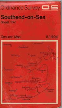
Ordnance Survey Southend-on-Sea. Sheet 162. One-inch map of Great Britain
Chessington Surrey: Director General of the Ordnance Survey 1969. Soft cover. Good/No Jacket as published. A one inch to one mile Ordnance Survey map of this part of south east Essex. In clean and sound condition without marks or inscriptions. The card covers show signs of handling. All orders processed and shipped promptly from the UK <br/> <br/> Director General of the Ordnance Survey paperback
Bookseller reference : 028546
|
|
|
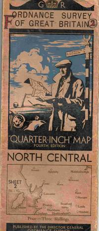
Ordnance Survey of Great Britain Quarter-Inch Map Fourth Edition North Central. Sheet 2.
Southampton: The Director General Ordnance Survey 1935. Soft cover. Good/No Jacket as published. Map on cloth. Some signs of wear / handling / use but still quite sound. All orders processed promptly and shipped from the UK. <br/> <br/> The Director General Ordnance Survey paperback
Bookseller reference : 028346
|
|
|
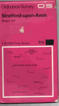
Ordnance Survey Stratford-upon-Avon. Sheet 151
Southampton: Director General of the Ordnance Survey 1974. Soft cover. Good/No Jacket as published. A 1:50000 First Series Ordnance Survey map of this part of the midlands on paper. In clean and sound condition without marks or inscriptions but some folds are starting to fail but all is one piece. There are th remains of a label on th front cover. All orders processed and shipped promptly from the UK. <br/> <br/> Director General of the Ordnance Survey paperback
Bookseller reference : 025176
|
|
|
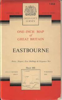
Ordnance Survey Eastbourne Sheet 183. One-inch map of Great Britain
Chessington Surrey: Director General of the Ordnance Survey 1960. Soft cover. Good/No Jacket as published. A one inch to one mile Ordnance Survey map of this part of England on paper. In clean and sound condition with some evidence of handling / use. All orders processed and shipped promptly from the UK. <br/> <br/> Director General of the Ordnance Survey paperback
Bookseller reference : 024081
|
|
|
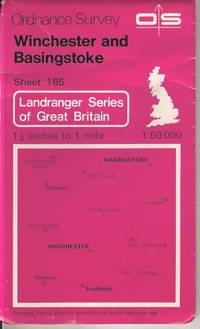
Ordnance Survey Winchester and Basingstoke Sheet 185. 1:50000 Landranger Series of Great Britain
Southampton: Director General of the Ordnance Survey 1984. Soft cover. Good/No Jacket as published. A 1:50000 scale Ordnance Survey map of this part of the England on paper. In clean and sound condition with a few small red ink annotated circles. All orders processed and shipped promptly from the UK. <br/> <br/> Director General of the Ordnance Survey paperback
Bookseller reference : 023958
|
|
|
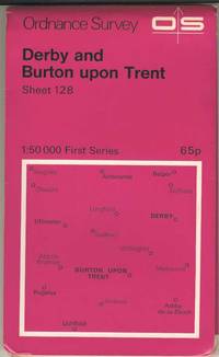
Ordnance Survey Derby and Burton upon Trent Sheet 128. 1:50000 First Series
Southampton: Director General of the Ordnance Survey 1974. Soft cover. Very Good/No Jacket as published. A 1:50000 scale Ordnance Survey map of this part of the East Midlands on paper. In clean and sound condition without marks or inscriptions. All orders processed and shipped promptly from the UK . <br/> <br/> Director General of the Ordnance Survey paperback
Bookseller reference : 023763
|
|
|
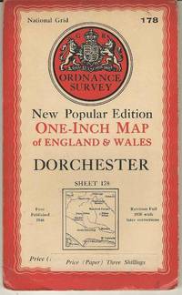
Ordnance Survey Dorchester Sheet 178. New Popular Edition
Southampton: Director General of the Ordnance Survey 1946. Soft cover. Good/No Jacket as published. A one inch to one mile Ordnance Survey map of this part of southern England on paper. In clean and sound condition. All orders processed and shipped promptly from the UK. Please call or email with your questions. <br/> <br/> Director General of the Ordnance Survey paperback
Bookseller reference : 023758
|
|
|
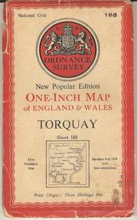
Ordnance Survey Torquay Sheet 188. New Popular Edition
Southampton: Director General of the Ordnance Survey 1946. Soft cover. Fair/No Jacket as published. A one inch to one mile Ordnance Survey map of this part of south Devon. All orders processed and shipped promptly from the UK. Please email with your questions. <br/> <br/> Director General of the Ordnance Survey paperback
Bookseller reference : 023760
|
|
|
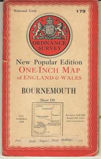
Ordnance Survey Bournemouth Sheet 179. New Popular Edition
Southampton: Director General of the Ordnance Survey 1947. Soft cover. Good/No Jacket as published. A one inch to one mile Ordnance Survey map of this part of southern England on paper. In clean and sound condition. All orders processed and shipped promptly from the UK. Please email with your questions. <br/> <br/> Director General of the Ordnance Survey paperback
Bookseller reference : 023759
|
|
|
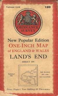
Ordnance Survey Land's End Sheet 189. New Popular Edition
Southampton: Director General of the Ordnance Survey 1946. Soft cover. Fair/No Jacket as published. A one inch to one mile Ordnance Survey map of this part of south west England. A tidy copy but there is some minor wear / signs of handling and old tape repairs. All orders processed and shipped promptly from the UK. Please call or email with your questions. <br/> <br/> Director General of the Ordnance Survey paperback
Bookseller reference : 023757
|
|
|
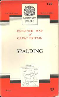
Ordnance Survey Spalding Sheet 123. One-inch map of Great Britain
Chessington Surrey: Director General of the Ordnance Survey 1963. Soft cover. Very Good/No Jacket as published. A one inch to one mile Ordnance Survey map of this part of Lincolnshire on paper. In clean and sound condition without marks or inscriptions. All orders processed and shipped promptly from the UK. <br/> <br/> Director General of the Ordnance Survey paperback
Bookseller reference : 023754
|
|
|
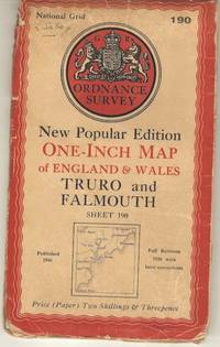
Ordnance Survey Truro and Falmouth Sheet 190. New Popular Edition
Southampton: Director General of the Ordnance Survey 1946. Soft cover. Good/No Jacket as published. A one inch to one mile Ordnance Survey map of this part of southern England on paper. In clean and sound condition some handling wear. All orders processed and shipped promptly from the UK. Please email with your questions. <br/> <br/> Director General of the Ordnance Survey paperback
Bookseller reference : 023768
|
|
|
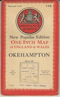
Ordnance Survey Okehampton Sheet 175. New Popular Edition
Southampton: Director General of the Ordnance Survey 1946. Soft cover. Good/No Jacket as published. A one inch to one mile Ordnance Survey map of this part of southern England on paper. In clean and sound condition some handling wear. All orders processed and shipped promptly from the UK. Please email with your questions. <br/> <br/> Director General of the Ordnance Survey paperback
Bookseller reference : 023767
|
|
|
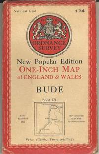
Ordnance Survey Bude Sheet 174. New Popular Edition
Southampton: Director General of the Ordnance Survey 1946. Soft cover. Good/No Jacket as published. A one inch to one mile Ordnance Survey map of this part of southern England on cloth. In clean and sound condition some handling wear. All orders processed and shipped promptly from the UK. Please call or email with your questions. <br/> <br/> Director General of the Ordnance Survey paperback
Bookseller reference : 023766
|
|
|
Ordnance Survey Banbury Bicester & Chipping Norton Brackley Explorer Sheet 191
Southampton: Director General of the Ordnance Survey 1999. Soft cover. Good/No Jacket as published. A 1:25000 Ordnance Survey map of this part of the Cotswolds in England 1999 revision. In clean and sound condition without marks or inscriptions. All orders processed and shipped promptly from the UK. Please email with your questions. <br/> <br/> Director General of the Ordnance Survey paperback
Bookseller reference : 023166 ISBN : 0319218228 9780319218228

|
|
|
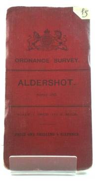
Ordnance Survey: Aldershot: Sheet 285
Ordnance Survey 1904. Fold out map in good condition. Lightly marked and worn cover. Sticker on the front. The rear lower edge and its leading corner are peeling. Minor marks and age related wear to the interior however the main content remains clear. Scale: one inch to a mile. CM. Paperback. Good. Used. Ordnance Survey Paperback
Bookseller reference : 479688
|
|
|
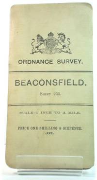
Ordnance Survey: Beaconsfield: Sheet 255
Ordnance Survey 1904. Fold out map in good condition. Lightly marked and worn cover. Minor marks and age related wear to the interior however the main content remains clear. Scale: one inch to a mile. CM. Paperback. Good. Used. Ordnance Survey Paperback
Bookseller reference : 479689
|
|
|
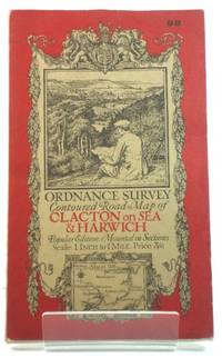
Ordnance Survey: Contoured Road Map of Clacton on Sea and Harwich: Sheet 98
Ordnance Survey 1921. Fold out map in good condition. Lightly marked and worn cover. Minor marks and age related wear to the interior however the main content remains clear. Scale: one inch to a mile. CM. Paperback. Good. Used. Ordnance Survey Paperback
Bookseller reference : 479691
|
|
|
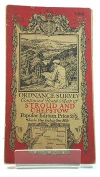
Ordnance Survey: Contoured Road Map of Stroud and Chepstow: Sheet 103
Ordnance Survey 1919. Fold out map in good condition. Road corrections to 1929; railways to 1928. Lightly marked and worn cover. Minor marks and age related wear to the interior. Pen and embossed stamp on the margin. The main content remains clear. Scale: one inch to a mile. CM. Paperback. Good. Used. Ordnance Survey Paperback
Bookseller reference : 479694
|
|
|
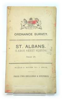
Ordnance Survey: St. Albans. Large Sheet Series. Sheet 29.
Southampton: Ordnance Survey 1906. Paperback map in good condition. Scale - 2 miles to 1 inch. Map is tanned stained and edge-worn. One or two leading corners are creased. Sticker on reverse of map. Map remains clear throughout. HCW. Paperback. Good. Used. Ordnance Survey Paperback
Bookseller reference : 471268
|
|
|
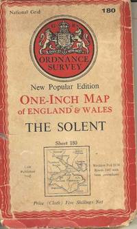
Ordnance Survey The Solent Sheet 180. One-Inch Map of Great Britain
Chessington: Director General of the Ordnance Survey 1962. Soft cover. Good/No Jacket as published. A one inch to one mile Ordnance Survey map Seventh Series of this part of southern England / Isle of Wight. On paper. In sound condition without marks or inscriptions. There is some wear / signs of handling to the cover and map. All orders processed and shipped promptly from the UK. Please email with your questions. <br/> <br/> Director General of the Ordnance Survey paperback
Bookseller reference : 016977
|
|
|
Ordnance Survey Map of Land's End District
Southampton U.K.: Ordnance Survey Office 1912. Softcover. Fold-out colour map. Covers are quite faded. Front cover has a dark mark near centre and small sticker at lower edge. Back cover has one or two small grubby marks. Map is quite faded along edges and creases but appear in good overall condition for its age. AF. paperback. Good/No Dust Jacket. Used. Ordnance Survey Office Paperback
Bookseller reference : 271771
|
|
|
Ordnance Survey Map of Land's End District
Softcover. Fold-out colour map. Covers are quite faded. Front cover has a dark mark near centre and small sticker at lower edge. Back cover has one or two small grubby marks. Map is quite faded along edges and creases but appear in good overall condition for its age. AF Used
|
|
|
Ordnance Survey: Aldershot: Sheet 285
Fold out map in good condition. Lightly marked and worn cover. Sticker on the front. The rear lower edge and its leading corner are peeling. Minor marks and age related wear to the interior, however the main content remains clear. Scale: one inch to a mile. CM Used
|
|
|
Ordnance Survey: Beaconsfield: Sheet 255
Fold out map in good condition. Lightly marked and worn cover. Minor marks and age related wear to the interior, however the main content remains clear. Scale: one inch to a mile. CM Used
|
|
|
Ordnance Survey: Contoured Road Map of Clacton on Sea and Harwich: Sheet 98
Fold out map in good condition. Lightly marked and worn cover. Minor marks and age related wear to the interior, however the main content remains clear. Scale: one inch to a mile. CM Used
|
|
|
Ordnance Survey: Contoured Road Map of Stroud and Chepstow: Sheet 103
Fold out map in good condition. Road corrections to 1929; railways to 1928. Lightly marked and worn cover. Minor marks and age related wear to the interior. Pen and embossed stamp on the margin. The main content remains clear. Scale: one inch to a mile. CM Used
|
|
|
Ordnance Survey: St. Albans. (Large Sheet Series). Sheet 29.
Paperback map in good condition. Scale - 2 miles to 1 inch. Map is tanned, stained and edge-worn. One or two leading corners are creased. Sticker on reverse of map. Map remains clear throughout. HCW Used
|
|
|
Orlando Eyewitness Travel Top 10 Travel Guides
DK Eyewitness Travel July 2002. Trade Paperback. New/Paperback No jacket. NEW BOOK DK Eyewitness Travel paperback
Bookseller reference : 1003 ISBN : 0789484358 9780789484352

|
|
|
Our Globe. A Universal picturesque Album
Philadelphia, The North -American Bibliographic Institution 1840 In-4 à l’italienne 19,5 x 27,5 cm. Reliure de l’époque pleine basane brune, dos et plats ornés d’un décor floral gaufré, tête dorée, 96 planches gravées sur acier, 394-V pp. Rousseurs marginales, quelqes pages de texte brunies.
Bookseller reference : 87992
|
|
|
Our globe : a universal picturesque album in weekly numbers, first volume comprising the numbers 1 to 52.
Edited by the North-American Bibiographic Institution, Philadelphia, in-8, format à l'italienne, reliure cuir, décors à froid sur les plats et sur le dos, nombreuses gravures. Bords des plats et coiffes frottées, mors fragiles, nombreuses rousseurs, une cinquantaine de pages très jaunies, manque 10 gravures.
Bookseller reference : 43232
|
|
|
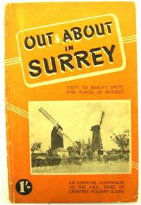
Out and About in Surrey: Visits to Beauty Spots and Places of Interest
Brighton: Crabtree Press 1958. Paperback in good condition. Covers are rubbed and a little grubby with age water marks to rear cover and to lower edges of pages. Pages are all intact and clean throughout. AD. Paperback. Good. Used. Crabtree Press Paperback
Bookseller reference : 519260
|
|
|
Out and About in Surrey: Visits to Beauty Spots and Places of Interest
Paperback in good condition. Covers are rubbed and a little grubby with age, water marks to rear cover and to lower edges of pages. Pages are all intact and clean throughout. AD Used
|
|
|
PAISEA. TIERRA / MAR - Valencia 2006 - Ilustrado - Edición bilingüe
Valencia, Edit. Arquia, 2006. Numerosas ilustraciones en color. 96 p. 8º. Rústica editortial ilustrada. Muy buen ejemplar.
|
|
|
Paläste, Schlösser, Residenzen. Zentren Europäischer Geschichte. Hrsg. von Hermann Boekhoff, Gerhard Joop u. Fritz Winzer.
Georg Westermann Verlag, 1971, gr. in-4to, 368 S., 180 Farbtafeln u. zahlreich. abbild. im Text, Original-Leinen, Orig. ill. U.
Bookseller reference : 45480aaf
|
|
|
PALAIS ET JARDINS DE VERSAILLES & TRIANON
Au depot central maison de publications photographiques Montmartre. Hardcover. Good. Au depot central maison de publications photographiques Montmartre sans datevers 1920.Format à l'italienneoblong175 x 115 cm. Reliure pleine toile percaiine rouge.Petit album comprenant: 31p 11p 7p texte : 17 vues en n&bimpression au rectoversos vierges 8p.Services chemins de fer. qq rousseurs Bon état général. <br/> <br/> Au depot central maison de publications photographiques, Montmartre hardcover
Bookseller reference : 021995

|
|
|
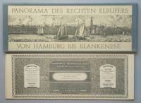
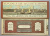
Panorama des rechten Elb-Ufers von Hamburg bis Blankenese in achtzehn aneinander gereihten Blättern nach der Natur aufgenommen von T. B. Wilms die Schiffe v. E. Eduard Hasse auf Stein gezeichnet von J. W. Jan Willem de Vos. Ausgabe B farbig. REPRINT der Ausgabe Hamburg Ch. Fuchs 1835.
Hamburg 1972. . Eines von 2000 num. Exemplaren. - Außentitel: "Panorama des rechten Elbufers von Hamburg bis Blankenes". - A panorama of the right bank of the Elbe from Hamburg to Blankenese = Panorama de la rive droite de l'Elbe de Hambourg jusqu'ŕ Blankenese. - Eines von 2000 num. Exemplaren. - Mappe etwas angestaubt; kurze Schabstellen am Rand-/Falz sonst gut gutes sauberes Exemplar (Hamburg, 1972). unknown
Bookseller reference : 72740
|
|
|
Panorama des rechten Elb-Ufers von Hamburg bis Blankenese in achtzehn aneinander gereihten Blättern nach der Natur aufgenommen von T. B. Wilms die Schiffe v. E. Eduard Hasse auf Stein gezeichnet von J. W. Jan Willem de Vos. Ausgabe A schwarz-weiß. REPRINT der Ausgabe Hamburg Ch. Fuchs 1835.
Hamburg 1972. . Eines von 1000 num. Exemplaren. - Außentitel: "Panorama des rechten Elbufers von Hamburg bis Blankenes". - A panorama of the right bank of the Elbe from Hamburg to Blankenese = Panorama de la rive droite de l'Elbe de Hambourg jusqu'ŕ Blankenese. - Mappehinterdeckel mit Ölfleck; Leporello selbst gut und sauber (Hamburg, 1972). unknown
Bookseller reference : 9257 ISBN : 387102032X 9783871020322
|
|
|
Paquebot à turbine VERA CRUZ.Constructeur: S.A. John Cockerill Seraing (Belgique). Armador: Companhia Colonial de Navegaçâo, Lisboa (Portugal).
Catalogue in-12 oblong, 24 pp., photos, plan, menu à bord du 24 Février 1952. Couverturte illustrée par L. TACK.
Bookseller reference : PAQ20

|
|
 Receive by email
 Download as PDF document
 RSS feed


