|
Anne-Sophie Tiberghien
Mon coeur s'appelle Amazonie
Robert Laffont 1983 289 pages in8. 1983. broché. 289 pages.
Bookseller reference : 5831

|
|
|
ANNELIESE KLÜCKS
L'ALLEMAGNE, REGARDS SUR L'EUROPE.
ROMAIN PAGES EDITIONS. 1993. In-Folio. Cartonné. Bon état, Couv. convenable, Dos satisfaisant, Intérieur frais. 128 pages. Jaquette illustrée en couleurs. Nombreuses photos en couleurs dans et hors texte.. Avec Jaquette. . . Classification Dewey : 910.4-Voyages
Bookseller reference : R260108862
|
|
|
Anneliese Klücks
Merveilleuse Venise
France loisirs 1998 136 pages in4. 1998. reliure cartonnée editeur. 136 pages.
Bookseller reference : 1725

|
|
|
ANNELISESE KLÜCKS
LES DERNIERES ILES DE REVE : Saint Barthélemy
MINERVA. 1996. In-4. Cartonnage d'éditeurs. Bon état, Couv. convenable, Dos satisfaisant, Intérieur frais. 92 pages. Nombreuses photographies en couleur, dans le texte et hors texte, par Bertrand Machet.. . . . Classification Dewey : 910-Géographie générale. Voyages
Bookseller reference : R240006861

|
|
|
ANNIBALDI Giovanni, FRANCESCHINI Gino, MARCHINI Giuseppe, PAOLI Rodolfo, TAGLIAVINI Carlo, VARESE Claudio (a cura di),
Marche
Gino Franceschini (La storia), Carlo Tagliavini (La terra e la gente), Giovanni Annibaldi (L?archeologia), Giuseppe Marchini (L?arte), Claudio Varese (La letteratura), Rodolfo Paoli (La musica). Presentazione di Riccardo Pacini. Con 328 fotografie in nero e a colori n.t. e CXXXIV in tavole f.t. anche a piena pagina. Nota bibliografica. Carta degli Itinerari. Indice dei nomi di persona. Indice dei luoghi e delle cose notevoli. Indice delle illustrazioni. Referenze fotografiche. Opera edita dalla Electa Editrice per conto della Banca Nazionale del Lavoro Titoli in oro al dorso, incisione a secco al piatto, risguardi figurati (La Marca anconitana e le terre confinanti. Mercator Gerard, Atlas, 1606). Custodia in cartone telato con illustrazione a colori applicata al piatto. 4to. pp. 484. . Ottimo (Fine). . . .

|
|
|
ANNUAIRE
ANNUAIRE DIPLOMATIQUE ET CONSULAIRE de la République Française pour 1902.
Paris Berger-Levrault et Cie 1902. In-8 490pp. Plein chagrin rouge, dos à nerfs orné de cadres de filets dorés, encadrement de 5 filets dorés sur les plats, tête dorée, dentelle dorée sur bordure intérieure, rel époque. Petit accroc sur la coiffe supérieure et 1 coin, 1 mors fragile. Exp bien relié.
Bookseller reference : GIT011b7
|
|
|
ANON
British Guiana; British Empire Exhibition, Wembly 1924
8vo [22 x 14 cm]; [vi], 103, [iii] pp, numerous photo plates, tables, charts, folding colored map at end. original cloth, gilt title lettering is bright, very light cover wear, interior is quite clean, overall near fine. A picture of this book is available upon request by email. A detailed description of the geography, Kaieteur Falls, population including indigenous, immigration, settlements, flora and fauna, timber and forestry, agriculture especially sugar and rice, mining, commerce, opportunities. etc. with excellent illustrations.
|
|
|
Anon
English Lake Scenery
London: John Walker and Company 1880. 48p 25 col plates col title page. Or red black and gilt cloth with recessed ttile panel in red blue green and gilt. Some rubbing and edge wear. Minor damage to 9 plates. Somewhat shaken. Wonderful fresh chromolithographs of English lakes. Photos available. First Edition. Hard Cover. Very Good. Illus. by Lydon A. F. Large 8vo. John Walker and Company Hardcover
Bookseller reference : 006208
|
|
|
Anon
Germany
An excellent introduction to Germany and its people. Revised English edition. Water stains on lower right corners of pages.
|
|
|
ANON
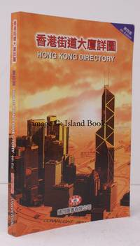
Hong Kong Directory. NEAR FINE COPY
Universal Publications Hong Kong 1998. 8vo. Fourth Edition indexes and captions in English and Chinese with very numerous details coloured maps; original pictorial wrappers a near fine copy. SCARCE. [Universal Publications, Hong Kong], unknown
Bookseller reference : 22022
|
|
|
Anon
Lives and Voyages of Drake Cavendish and Dampier Including an Introductory View of the Earlier Discoveries in the South Sea and the History of the Buccaneers with Portraits Engraved By Horsburgh
Edinburgh: Oliver and Boyd 1831. Hardcover rebound in brown leather. Very Good/No dustjacket. Smaller 8vo. Horsburgh. pp. 461 rebound in brown leather with bright paper label on psine. Oliver and Boyd hardcover
Bookseller reference : 323969
|
|
|
Anon
Petworth (Sussex) Rural District
No. 72 'Rural England' Series. With 16 photographs and District Map. Not dated but gives Rateable values for 1955/6. 31 pages. Slightly soiled covers. Crease to edge of fold-out map at rear. Back cover has some ink scribbles. Page 10 has annotation in margin and underlining of five words, in red ink.
|
|
|
Anon
Railway Stories Vol. XIX No.2 January 1936 -Vol.XX No.1 June 1936
Toronto: The Maclean Publishing Company 1936. First edition . Hardcover. Good/No Dustjacket. 4to. pp.144144144144144144 The Maclean Publishing Company hardcover
Bookseller reference : 247352
|
|
|
Anon
THE AMICABLE QUIXOTE OR ENTHUSIASM OF FRIENDSHIP 4 volumes
London: Printed for J. Walker 1788. Book. Very Good. Hardcover. First Edition. 12mo. A very good four volume set in contemporary full tree calf binding with double lettering pieces in red and green. Complete pp. iii-vii 1 222; 2 206; 2 238 & 2 198. No half-titles which may or may not be wanting but the pagination for the prelims to vol. I might suggest that one is required Very good bindings with a little rubbing a couple of volumes slightly chipped to the head/tail of the spines corners lightly bruised. Contents clean and tight manuscript Greek initials to title pages dated 1788 otherwise unmarked no foxing paper crisp. A very good set. A Rare Eighteenth Century Novel. We have managed to located just one other copy at auction in the last thirty years and that at Sotheby's sale of July 21 1993 where it made £1000 on the hammer though seemingly not such a nice copy. Referenced by: ESTC T068744. Printed for J. Walker Hardcover
Bookseller reference : 024356

|
|
|
ANON
The Columbian Atlas of the World containing Large-scale Colored maps of each State and Territory in the United States, Provinces of Canada, Every Foreign Country, the Continents and their Subdivisions
folio [37 x 31 cm or 14.5 x 12 inches]; 159 pp, 156 pages of colored maps, charts, including many double page, title printed in red and black. original blue pictorial gilt and blind-stamped cloth, gilt title lettering on cover, a little worn at spine ends, corners, very good+ clean and sound copy. A picture of this book is available upon request by email. This is not to be confused with the Columbian World's Fair atlas nor the Columbian Atlas of the World We Live In, which was in much smaller format. This atlas is quite large and filled with very detailed colored maps, starting with fine double-page maps of the world and of North America. The maps of the USA include the whole country, individual states and city maps showing streets (Boston, NY city, Brooklyn, Buffalo, Philadelphia, Baltimore, Washington DC, Cincinnati, Cleveland, Chicago, Detroit, St. Paul, Minneapolis, St. Louis, St. Joseph, Kansas city, New Orleans, San Francisco from Rand McNally Co, plus others as insets). Canadian maps include country, provinces and territories, some provinces showing counties. Other maps include: Mexico, Central America, West Indies, South America (plus other maps of regions of South America), Europe and individual countries, Polar area, Asia, double-page of Palestine with Jerusalem inset, Turkey and its provinces, Indochina, India, Japan, Persia, double of Africa showing colonial borders, South Africa, Egypt with Cairo inset, North Africa, Abyssinia, Australia, New Zealand, etc, plus other charts. Maps have city, province, county indexes in margins.
|
|
|
Anon
The Dunlop Guide to Great Britain
Still has original bookmark attached. Date assumed from Lighting Up Tables which start April 1938. xiv, 31, 910, 102 pages. Signature at top of front free endpaper. Page 605-8 loose. Wear on extremities and some marks to covers.
|
|
|
ANON
The Republic of Uruguay, South America; its Geography, History, Rural Industries, Commerce, and General Statistics
8vo; xii, 168pp, maps (1 folding), tables. original blind-stamped cloth, minor wear, 2 leaves with crease, fine. A picture of this book is available upon request by email. A factual and statistical description of the country and economy, including population of towns, revenue sources and institutions. Scarce.
|
|
|
ANON
The River Jordan: Pictorial and Descriptive
12mo [18 x 13 cm]; 22 pp, 6 fine mounted coloured lithographed plates (chromolithographs), including frontis, each in decorative border. original blind-stamped pictorial gilt cloth, gilt title lettering on spine and cover, small chip at spine end, endpaper signature, lightly foxed, very good in attractive binding. A picture of this book is available upon request by email. The attractive plates are views on or near the Jordan River.
|
|
|
Anon
The Story of St. Mary's Church Melton Mowbray
A small booklet giving the history of the church. With a plan, some photographs and advertisements at beginning and end. Some foxing on covers.
|
|
|
ANON.
Epitome Repetitionis Theologicæ. Thet är Kort Begrep Utaf Salighets Lärans Utdrag til the nedre Scholarnas bruk...
Stockholm, Hartwig Gercken, 1737. Lille 8vo. Samt. hldrbd. Rygforgyldning. Ryg med brugsspor. Revne i ene fals, men ikke løs. 192 pp.
Bookseller reference : 20057
|
|
|
ANON.
Epitome Repetitionis Theologicæ. Thet är Kort Begrep Utaf Salighets Lärans Utdrag til the nedre Scholarnas bruk...
Stockholm, Hartwig Gercken, 1737. Lille 8vo. Samt. hldrbd. Rygforgyldning. Ryg med brugsspor. Revne i ene fals, men ikke løs. 192 pp.
|
|
|
ANON:
Manuscript journal of a tour by bicycle and train through Normandy in April 1910.
"A Saunter to 'Le Bocage Normandy' and back"- "April 2nd 1910 waxed and waned bright still and cold. After getting my pupils off in the morning I managed to pack and start with my bicycle and luggage by the afternoon express from Redhill to Brighton. There I went to Lewes where I met my cousin Percy Roxby.".Very legibly writen on 42-pages approx. 11000 words interleaved in a photograph album containing 42 half-plate photographs illustrating the tour these inserted 1 per page into the album leaves. The volume measures 10 1/2 x 8 ix 2 1/2 inches and weighs 1.8 kg.The writer has much interest in architecture especially ecclesiastical which is reflected in his choice of subject for many of the photographs."Mont St. Michel.I can and must say a little about the general flavour we obtained from our one-night's visit as it will linger long with me. We fully expected to find the little islnd so crowded with buildings and human beings as to be spoilt to us as a pleasure resort. We were absolutely wrong! Owing probably to the time of the year.we found the little island-town almost given over to ourselves and the rustic inhabitants. We had been led to expect crowds of English and much touting among the citizens. We found none of either.And it was principally owing to this fact that the most delightful 18 hours of our tour in Normandy to me was at Mont St. Michele. We put up at Nadame Poulard's of Omelette fame. The Omelette came to us at dejeuner; very good; but nothing out-of-the-way for France. Moreover we find that Madame Poulard has now retired and the whole establishment is in in the hands of a Company! We climbed up to the Hotel leaving our bicycles at the garage of the City at the foot of the mount. No bicycle could enter the City-proper. We climbed to the Hotel and then we climbed up from there to our bedrooms in an anex to the Hotel.". unknown
Bookseller reference : 20209
|
|
|
Anonimo
Impressions de voyages. Promenades pittoresques en France
In 16, pp. 36. Gora estesa ma assai leggera alle cc. Bella cartonat. edit. con incisione in rilievo oro al p. ant. Raccolta di impressioni di viaggio: Roc-amadour; Biarritz; Le mont Saint-Michel; La cathedral de chartres.
|
|
|
ANONIMO,
A trip to Italy
600 photographic illustrations of the principal objects of interest. Senza data di pubblicazione (fine 1800 inizi 1900) . 4to. pp. 112. . Molto buono (Very Good). . . .

|
|
|
ANONIMO,
Calendario manual y guia de foresteros en Madrid para el ano 1833 - Estado militar de Espana ano de
Con 4 litografie: 2 ai frontespizi e 2 ritratti dei reali di Spagna, Ferdinando VII e Maria Cristina di Borbone. Una carta ripiegata ''Mapa d los Reynos de Espana y Portugal'' Tagli dorati. 24mo (cm 12x8). pp. 252 - 276. . Molto buono (Very Good). Pagine in ottimo stato. Lievi abrasioni agli angoli del dorso. Canalino anteriore rovinato (Minor damage to spine). Prima edizione (First Edition). .

|
|
|
ANONIMO.
ATLAS TURISTICO MUNDIAL.
28x20. 240p. Fotogr. Mapas.

|
|
|
ANONIMO.
ATLAS TURISTICO MUNDIAL.
28x20. 127p. Fotogr. Mapas.

|
|
|
ANONIMO.
VIAJE ALREDEDOR DEL MUNDO, AVENTURAS DE UN JOVEN MARINO.
23x15. 158p. Anotaciones en guarda delantera. Sello anterior poseedor. Cubierta y lomo rozados. Ilstr. M. Ángel. Enc. 1/2 tela cart. Ed.

|
|
|
Anonyme
"Le passage du Pôle Arctique au Pôle Antarctique par le centre du monde (Collection ""Tout un monde lointain"")"
Verdier. 1980. In-12. Broché. Bon état, Couv. convenable, Dos satisfaisant, Intérieur frais. 101 pages. Nombreuses illustrations en noir et blanc, hors texte. Adhésif sur le 1er contre-plat. Pliure sur le 1er plat.. . . . Classification Dewey : 910.4-Voyages
Bookseller reference : RO30323910

|
|
|
Anonyme
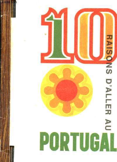
10 raisons d'aller au Portugal
Studio Tom. Non daté. In-16. Broché. Etat d'usage, Coins frottés, Dos satisfaisant, Intérieur frais. 10 pages augmentées de nombreuses photos et illustrations en couleurs, dans le texte.. . . . Classification Dewey : 910-Géographie générale. Voyages
Bookseller reference : R200103251
|
|
|
Anonyme
[ Carnet de cartes postales anciennes ] Roc-Amadour , 24 Cartes Détachables
1 vol. in-12 à l'italienne br., 24 cartes postales noir et blanc, avec légendes, édition du Pélerinage, s.d. (circa 1910 ) Etat très satisfaisant (les 3 prem. cartes mquent, bon état par ailleurs) Français

|
|
|
Anonyme
[ Carnet de cartes postales anciennes ] Souvenir du Château de Castelnau de Bretenoux (Lot)
1 vol. in-12 à l'italienne br., 10 cartes postales noir et blanc, avec légendes, s.d. (circa 1910 )
Bookseller reference : 36342

|
|
|
Anonyme
[ Carnet de cartes postales anciennes ] Souvenir du Château de Castelnau de Bretenoux (Lot)
1 vol. in-12 à l'italienne br., 10 cartes postales noir et blanc, avec légendes, s.d. (circa 1910 ) Bon état Français

|
|
|
ANONYME
[ANTILLES - AMERIQUE] Manuscrit inédit de 189 pages dun officier de marine français. [Souvenirs de marine, 1812-1823]
s. d. [1830] | 19 x 24.6 cm | Relié
Bookseller reference : 89604
|
|
|
ANONYME
[ARGENTINE] Compagnie du chemin de fer de Rosario à Puerto-Belgrano. Rapport du liquidateur judiciaire à MM. les créanciers. - Projet de concordat
Imprimerie Chaix | Paris 1917 | 20.5 x 27 cm | Broché
Bookseller reference : 90048
|
|
|
ANONYME
[REPUBLIQUE D'HAITI] Loi qui règle les droits des douanes sur le commerce extérieur, et relative aux mouvemens du cabotage sur les côtes de la république
Librairie de l'Industrie Renard | Paris 1825 | 13.5 x 21.5 cm | Broché
Bookseller reference : 90618
|
|
|
Anonyme
A travers l'Italie - Guide du Comité national des Pélerinages
Librairie Saint Paul, Paris, s.d. In-12 (16 x 11 cm) broché, couverture imprimée, illustrations en noir, nombreux plans et cartes rempliés, 472 pages. Brochage fané, "Italie" manuscrit sur le dos.
Bookseller reference : 24180

|
|
|
Anonyme
A travers l'Italie - Guide du Comité national des Pélerinages
Librairie Saint Paul, Paris, s.d. In-12 (16 x 11 cm) broché, couverture imprimée, illustrations en noir, nombreux plans et cartes rempliés, 472 pages. Brochage fané, "Italie" manuscrit sur le dos. Ligurie, Toscane, Ombrie, Piémont, Lombardie, Vénétie, Emilie, Marches.

|
|
|
Anonyme
Abrégé de tous les voyages autour du monde depuis Magellan jusqu'à d'Uroille et Laplace - TomeII
Ad Mame et Cie. Non daté. In-12. Relié. Etat d'usage, Couv. convenable, Dos satisfaisant, Quelques rousseurs. 311 pages augmentées d'un frontispice et de quelques illustrations en noir et blanc, sous serpente. Tranches jaspés. Plats aux armes du College de St-Sever.? Titre, fleurons et tomaison dorés au dos.. . . . Classification Dewey : 910.4-Voyages
Bookseller reference : R200106869

|
|
|
Anonyme
Album artistique de la France & de ses colonies orne de 30 chromos
1900 DELAGRAVE sans date (avant 1900),IN8 oblong a l’italienne,30 chromolithographies collées,format 20X 12,5 cm,texte au dos,bon etat,a plusieurs sujets( departements,anime);bon etat,rare
Bookseller reference : 16121

|
|
|
ANONYME
ALBUM INTERNATIONAL DES VILLES D'EAUX, des Manufacturiers, du Commerce et de l'Industrie, 21e année 1883. Paris 1883. In-folio 137ffnch. Cartonnage éditeur percaline rouge, dos et plats ornés à froid et dorés, tranches dorées. Abondamment illustré dans le texte et à pleine page de gravures: thermes (en France, Belgique, Suisse), hôtels, restaurants, cafés (Paris et province), nombreuses publicités (produits pharmaceutiques, voitures à chevaux, liqueurs...). Dorure passée, 1 cahier déboité.
Bookseller reference : GIT0029e
|
|
|
Anonyme
Annuaire de l'Association des anciens élèves du Lycée de Douai 1922-1923 et 1925-1926
Imprimerie Crépin & Lunven, Douai, 1923 et 1926. Deux volumes in-8, brochés, 106 pp. et 94 pp. 1922-1923 : 60e année. Réunion générale du dimanche 28 mai 1922 - Liste des membres décédés : 1865-1922 - Liste alphabétique des associés.1925-1926 : 63e année. Réunion générale du dimanche 24 mai 1925 - Liste des membres décédés : 1865-1925 ...
Bookseller reference : 6004
|
|
|
Anonyme
Atlas des enfants
ou nouvelle méthode pour apprendre la géographie avec un nouveau traité de la sphère et XXIV cartes enluminées. Nouvelle édition corrigée & fort augmentée.In 12 plein cuir fauve raciné,dos lisse,pièce de titre cuir rouge,roulette dorée.Frontispice gravé,titre,XII,360 pages, XXII cartes dépliantes en couleurs suivi de Traité de la sphère où l’on explique le mouvement des astres & les systèmes du monde ancien & moderne,l’usage des globes & des mesures géographiques.Nouvelle édition corrigée et augmentée, titre,frontispice:carte XXIII 60 pages et XXIV A Lyon Chez Bruyset frères et fils 1783 mouillure en tête jusqu’à la page XII et angle inférieur du nouveau traité de la sphère de la page 52 à la fin.Fort rare La structure de cet ouvrage s’articule,autour des 24 cartes,toutes coloriées. Celles-ci ne contiennent aucun nom, seulement des chiffres, des lettres et des signes afin que les enfants puissent apprendre par cœur et s’y repérer. L’Atlas se charge ensuite de les expliquer,sans fioriture. En effet,"la meilleure méthode géographique est sans contredit,celle qui joint à la brièveté, l’ordre le plus commode pour la mémoire des enfants",l’auteur ayant ainsi choisi de se cantonner à la stricte géographie, et non verser dans des détails historiques et économiques, qui pourraient perdre l’attention Aussi,l’étude afférente à chaque carte se décline selon un ordre naturel, s’intéressant tout d’abord au terroir d’un pays,aux mœurs de ses habitants,puis les principales divisions de ce pays, ses villes,ses rivières,ses caps et ses montagnes,tout en finissant en établissant ses limites.Les renseignements sont donc très nombreux sur l’Europe de cette époque. Concernant l’Atlas,22 carte(l’exemplaire est complet, toutes dépliantes.Dans le traité de la sphère,on trouve deux cartes dépliantes,celle représentant la sphère,celle représentant les systèmes
Bookseller reference : 5417

|
|
|
Anonyme
Atlas géographique [ Carte de la France en puzzle de bois ]
1 grande carte de 48 x 66 cm en puzzle en bois de plus de 180 pièces, rangées dans la boîte d'origine en bois et cartons, sur 4 niveaux organisés par 4 feuilles cartonnées avec chacune 2 ruban mauves permettant l'extraction des pièces. La boîte d'origine, au format 30,5 x 41 cm, est recouverte d'un papier richement illustré portant l'indication "Atlas géographique", sous le couvercle on peut lire l'inscription manuscrite :" France n° 12" et la grande étiquette " Au paradis des enfants", 156 rue de Rivoli, 1 rue de Louvre, Paris" (circa 1875-1895). La carte contient notamment un "Tableau des anciens grands départements de la France indiquant l'époque et les circonstances de leur rattachement à la couronne" Très beau et impressionnant puzzle géographique en bois, en parfait état et parfaitement complet de l'intégralité des pièces. La boîte d'origine, très fragile, mérite restauration (manque de papier sur les rebords du cadre, le couvercle est très faible et partiellement déboîté). Il est aujourd'hui devenu très difficile de trouver des puzzle géographiques en bois de ce format en si bel état et parfaitement complet de toutes leurs pièces. Français

|
|
|
Anonyme
Atlas manuel de géographie moderne
72 pp., 54 cartes imprimées en couleurs, s.d. (circa 1900), dos lég. fr.
|
|
|
Anonyme
Berck-Plage30 vues détachables
Lévy et Heurbein réunis, Paris, s.d. [v. 1920-1930?]. In-12, format allongé, Berck-Plage
Bookseller reference : 7530
|
|
|
Anonyme
Brouage, ses remparts, Pays de Champlain
Anonyme. Non daté. In-8. Broché. Bon état, Couv. convenable, Dos satisfaisant, Intérieur frais. 14 pages augmentées de quelques illustrations monochromme dans et hors texte.. . . . Classification Dewey : 910.4-Voyages
Bookseller reference : R200108369
|
|
|
ANONYME
Compagnie aérienne : statuts déposés en l'étude de Me Boca notaire à Valenciennes
- Imp. de Vaugirard, Paris 1909, 14x21,5cm, broché. - First edition. Foxing to the lower cover. Rare. [FRENCH VERSION FOLLOWS] Edition originale. Piqûres sur le deuxième plat. Rare.
|
|
|
Anonyme
Der landkreis euskirchen im bild
Euskirchen 1966 147 pages in4. 1966. Relié jaquette. 147 pages.
Bookseller reference : 160115

|
|
|
Anonyme
Egine-Poros Hydra - croisière d'un jour
United Travel Press. 1985. In-8. Broché. Bon état, Couv. convenable, Dos satisfaisant, Intérieur frais. 69 pages augmentées de nombreuses photos, cartes couleurs dans et hors texte.. . . . Classification Dewey : 910.4-Voyages
Bookseller reference : RO30313928

|
|

 Receive by email
 Download as PDF document
 RSS feed
 Permanent link


