|
[Maps - Eastern Tibet]
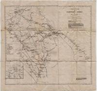
Part of Kam or Eastern Tibet
Cambridge: Cambridge University Press 1922. Loose sheet mounted on linen. Good-. Eric Teichman. Map printed in color measuring 26.5 x 25 inches. With a Tibetan glossary. Provides Teichman's routes as well as other routes along with villages monasteries or groups of farms. Edgewear with light stains here and there. In. From Travels of a Consular Officer in Eastern Tibet Together With A History of the Relations between China Tibet and India and mounted on linen. The map was clearly used perhaps in the field as evidence of wear including a split in the paper not the linen on which it's mounted suggests. From the collection of Asian books and maps formed by Albert Ravenholt. On verso Ravenholt has written "Teichman's Kam 28 degrees 25' - 33 degrees 20'. [Cambridge University Press] unknown
Riferimento per il libraio : 5331
|
|
|
[MAPS - IRAQ].
Reconnaissance maps of Iraq.
UK Government: Survey Directorate HQ Tenth Army / Indian Field Survey Co. 1942. 42 chromolithographed topographic maps of parts of Iraq made from aerial photographs during World War II on a scale of 1:100000 and 1:253440 a quarter-inch to a mile. 68 x 50.5 cm & 60 x 47 cm. An impressive collection of Iraq maps compiled from the most current aerial photography and produced by the British Army for use in the Persian theatre of war during World War II. The cities and regions covered include Ain Sifni Aqra Tel Afar Salman Pak BaQuba Sumaika Penjwin Halabja Baghdad Kirkuk Dulaim Erbil and Mosul divisions.Previously folded. Generally well-preserved. Survey Directorate HQ Tenth Army / Indian Field Survey Co., unknown
Riferimento per il libraio : L7VCIV4N38L2
|
|
|
[MAPS - IRAN - WWII].
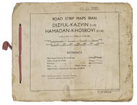
Road strip maps Iran. Dizful-Kazvin 1-10 Hamadan-Khosrovi 11-16.
83 Rep Group. I.E." 1944. Original beige printed paper wrappers side stichted by hand through 3 holes with a reddish pink cloth ribbon. Oblong 21 x 255 cm. With 1 index map and 16 numbered folding strip maps. Exceptionally rare collection of folded strip maps of roads in Western Iran which was very likely meant for military use during the Second World War. The abbreviated inscription on the front wrapper possibly stands for "24th brigade branch transportation office" though it is unknown which 24th brigade this would have been. The maps were originally printed on quarter inch sheets in 1942 and have been significantly enlarged for this edition to a scale of 1 inch to 2 miles. We have not been able to trace any other copies of either the first or second edition of this work anywhere.With an owner's inscription on the front wrapper. The maps and back wrapper have been reinforced with bookbinder's gauze. The wrappers are somewhat soiled creased and the edges are somewhat frayed. The maps have slightly browned and the index map has a small brown stain in the lower outer corner without affecting the image. Otherwise in good condition. 83 Rep Group. I.E.", hardcover
Riferimento per il libraio : ABC_47944
|
|
|
[Maps - Mongolia]
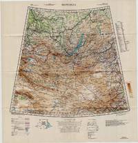
Large Color WWII Map of Mongolia
Washington D.C.: U.S. Army Army Map Service 1942. Loose sheet. Near Fine. Sheet 22 1/M North K-O 46-50. Full color map measures 28 x 29 inches. With a list of authorities i.e. other maps consulted in the creation of this map. Glossary. Index to boundaries. Folds as issued. An especially bright copy. First published 1931 by the War Office this edition is labeled "For Use by War and Navy Department Agencies Only. Not for Sale or Distribution." Revised to aid the US WWII effort in the Far East special emphasis is applied to railways international boundaries and "nomadic encampments." From the collection of Asian books and maps formed by Albert Ravenholt. U.S. Army, Army Map Service unknown
Riferimento per il libraio : 5330
|
|
|
[MAPS - NETHERLANDS]. [LE ROUGE, George-Louis].
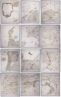
La Hollande en 12 feuilles dont les six premieres contiennent la Hollande .
Paris: Jean A. Dezauche successor of Delisle & Buache 1790. Each map in contemporary box with green morocco spines with titles 'Hollande' and 'Zelande' lettered in gold and green paper sides with ornamental gilt borders along the edges. Together ca. 230 x 155 cm. Engraved and etched map hand-coloured in outlines the cities coloured red. Printed on 12 sheets each divided into 4 segments numbered 1-48. The 48 segments are mounted on contemporary linen and folded the edges reinforced with blue ribbon. With: 2 LE ROUGE George Louis. Topographie de la Zelande en 9 feuilles traduitte de l'Hollandois. Second title: Partie orientale de la Flandre Hollandoise
Paris Jean A. Dezauche 1790. Large engraved and etched wall map hand-coloured in outlines the cities coloured in red printed on 9 numbered sheets each divided in 4 segments numbered 1-36 size each sheet 48 x 56.5 cm; the 36 segments are mounted on contemporary linen the edges reinforced with blue ribbon. Two large complementary wall maps of the seven Dutch provinces covering 1 the provinces Holland Utrecht Friesland Groningen Overijssel and Gelderland and a part of Brabant bound to the line Steenbergen - Roermond and 2 Zeeland. Both are rare especially the map of Zeeland. They were the first maps of the Netherlands on such a large scale mostly about 1:105000 but with some eastern regions squeezed in at about 1:140000. Fully assembled the map of Hollande would measure about 230 x 155 cm and the map of Zeeland about 143 x 175 cm.Originally published in 1748 Le Rouge's 21 plates for the two maps were revised for publication in a second state by Jean Crepy ca. 1770. The map in its present third state was revised and published by Jean A. Dezauche in 1790. On the back of each sheet is an engraved label with the sheet number and the name of the region covered added in manuscript.From the library of Marco-Antonio III 1730-1800 Prince Borghese: on each box is the engraved armorial bookplate of the library of this Borghese Prince. Marc-Antonio's son Camillo Filippo Ludovico 1775-1832 married Napoleon's sister in 1803.Boxes are slightly scuffed. A remarkable copy with a princely provenance.l De Vries 'Een Franse wandkaart van Nederland uit 1748' in: Caert-Thresoor 1 1982 pp. 24-29; cf. BMC Printed maps VIII cols. 967 & 969 1748 edition; not in Donkersloot-de Vrij; Oehme A French world atlas in: Imago mundi 25 1971 pp. 55-64 on Le Rouge. Jean A. Dezauche, successor of Delisle & Buache, unknown
Riferimento per il libraio : 23331
|
|
|
[MAPS - POCKET]. BLEGEN, John [Johan].
Blegen’s pocket map and reference book.
Chicago: J. Blegen 1896. 12mo. 69 1 pp. With 1 large folding double-sided map “The World†on recto “United States†on verso with illustrated ads for steamship lines and Milwaukie road on recto above World map edgewear rubbing at crease folds some creasing at fore-edges couple very minor closed tears at folds. Quarter-brown cloth over beige boards decorative blue border blue lettering minor soiling edgewear still VG copy. First edition of this very scarce travel guide and pocket map issued by Blegen 1842-1927 a Norwegian-American steamship travel agent from the 1890’s into the 20th Century. His concise guidebook offered railway fares from Chicago Ocean steamship rates from New York Montreal New Orleans and San Francisco along with postage rates death mortality statistics for major American cities Brownsville TX sported 45 per 1000 while Salt Lake was 8 per 1000 coin equivalents and even a guide to sanatoriums and health spas in Europe. No physical printed copies located in Worldcat only digital or print-on-demand copies. J. Blegen, hardcover
Riferimento per il libraio : 59118
|
|
|
[MAPS - PORTLAND, OREGON]. BYINGTON, [Fred Fletcher] & BROWN, CA (Cartographer). C A
Nonpareil indexed map of Portland Oregon. . . .
Portland OR: Published by Byington Printing Co. March 1952. 1 large folding map sized 21 x 23 printed in red & black inset map on verso of map as well as street and city guide index street traction system transportation information and zones. Map folds down into small printed portfolio w/ fold-over flap printed in red & black illust. of mill on front light toning still VG. First edition thus of this updated city map with postal zones and all of the motorcoach lines and electric trolley lines delineated. The map is of particular interest as showing Portland OR neighborhoods before the clearing and construction of Interstate-5 and the outlines of the destroyed city of Vanport. Destroyed in the 1948 flood Oregon’s second largest city had been originally constructed by Henry Kaiser outside of the Portland city limits in order to house a large influx of African-American workers largely barred by Oregon discriminatory laws. Byington 1862-1956 was a California printer who moved to Oregon following World War I would own and operate Byington Printing Co. until his death. No copies located in Worldcat. Published by Byington Printing Co., unknown
Riferimento per il libraio : 56432
|
|
|
[MAPS -- AUTOMOBILE & BICYCLE TRAVEL].
Wincarnis motor & cyclist map of England. Various sections. . . .
London & Norwich UK: Coleman & Co. Ltd. John Bartholomew & Co. Fletcher & Son Ltd. Litho ca. 1910. Sixteen parts. 64 pp unpaginated. double-page colour-lithograph maps throughout sized 9.5 x 7.2 when unfolded. Self-printed colour lithograph softcovers decorated title cover on front of each installment Wincarnis tonic advertisement in full colour on back cover edgewear thumbing minor chipping to a few fore-edges & corners still a G set. First edition thus of this uncommon and complete set of promotional maps for automobile travelers and bicyclists in Edwardian England whose drivers and riders were often fueled by the “delicious tonic and restorative recommended by over 8000 medical men.†The 16 maps featuring sections from London to Cornwall South Wales to Manchester and Lincolnshire to Yorkshire offered an accurate and compact set of travel maps documenting main roads secondary roads “other roads typically nearly impassable local lanes & livestock paths railways and rivers. Wincarnis was first introduced as a medicinal treatment in the Victorian era was a liqueur derived from a mix of secret herbs & spices meat extract malt extract infused with cloves nutmeg and citrus and although not openly marketed as alcoholic featured a significant 17-18% alcohol content. Therapeutic use was widely encouraged and severe motoring and bicycle accidents often included drivers and riders under the influence. Following the 1914 Parliamentary “Commission on Patent Medicines†investigation numerous changes and rules were changed regarding marketing and sales of such products as well as curtailing of hyping the “Restorative†properties. Worldcat locates 2 sets 1 undated - Hartley Library; 1 set misdated -- Wellcome; See: Drinking for Health: Proprietary Tonic Wines Chapter 10 Drinking in Victorian and Edwardian Britain: Beyond the Spectre of the Drunkard National Library of Medicine 2018. Coleman & Co., Ltd., John Bartholomew & Co., Fletcher & Son, Ltd. Litho, paperback
Riferimento per il libraio : 63113
|
|
|
[MAPS -- GLOBES].
The global map.
Minneapolis MN: Global Map Co. ca. 1941. Oblong folio 22.5 x 11.25 in. Two rotating wheels each showing hemisphere projection maps which are attached to a thick brown base w/ printed labels on front cover original rivets still present printed paper label and instructions on verso some rubbing & edgewear minor foxing & scuffing still a G exemplar. First edition of this fascinating and scarce global map which allows the user to view steamship or airline distance routes as well as the principal railroads. The global map was designed so that opposite halves of the earth’s surface could be rotated and synchronized enabling continuous and accurate spherical relationships across any point on the rotating maps. The label on the back lists the area in square miles and population totals of the world. The map is dated to around 1941 because of the inclusion of Vichy France the government allowed by the Nazi occupiers after the fall of France in 1940. Global Map Co., unknown
Riferimento per il libraio : 48041
|
|
|
[MAPS -- IRELAND]. WALKER, J[ohn], WALKER, C[harles], & [Alexander].
Walker’s Ireland. 15-panel dissected hand-coloured engraved map.
London: J.&C. Walker 9 Castle Street Published by Longman & Co. ca. 1844. 16mo. 3.5 x 5 in. folding out to 13.25 x 16.5 in. dissected 15-panel hand-coloured steel-engraved map linen-backed w/ 3 leaf folding population and mileage distance chart from Dublin by County mounted on front pastedown. Dark gray-green publisher’s cloth portfolio pocket binding decorative borders in blind gilt lettering stamped on front cover a NF copy. First edition thus of this very scarce dissected pocket map of Ireland published against the backdrop of the full impact of the Great Potato Famine which from 1841-1851 resulted in the diaspora and death of nearly 30% of the Irish population and as reflected in the mileage table mounted with the map the population in 1845 had already dropped from 8.2 million in 1841 to 7.7 million by 1844 and it would plummet further to below 6.5 million by 1851. The bulk of these emigrated to the United States Canada and the United Kingdom resulting in the fact that Ireland’s current population still resides below the high of 1841 and nearly 38 million Irish-Americans claim descent from the successive waves of migration much of which channeled through New York’s Lower East Side and the Bowery in the 19th-Century. John Walker 1787-1873 was a British mapmaker engraver lithographer hydrographer draughtsman and publisher publishing nautical charts and geographical maps with his brothers Charles and Alexander in their firm J.&C. Walker located at 9 Castle Street Holborn from 1841-1847 and moving to 37 Castle St. in 1848 where they remained to 1875. Much of their work was published under the auspices of the Society for the Diffusion of Useful Knowledge or S.D.U.K. Worldcat locates 1 copy Yale. J.&C. Walker, 9 Castle Street, Published by Longman & Co., hardcover
Riferimento per il libraio : 63111
|
|
|
[MAPS -- NEW YORK, NEW JERSEY & PENNSYLVANIA]. MacNAIR, Henry
A survey of the Empire Group with a complete distance table a compendious index of cities and post offices with populations and much statistical data. . . .
Boston: The Bullard Co. Inc. 1909. Large folding accordion-style folded map printed in red & black sized 41 x 38 in. which when entirely folded into covers measures 5.5 x 11.25 in. Original burgundy-coloured boards small lozenge map of New York & Pennsylvania on front cover some edgewear rubbing minor tidemark to upper fore-edge of 1 corner still VG- copy. Second edition revised of this scarce and well documented map showing good roads for automobile travel railroads canals new Erie Barge Canal Steamship lines ferries lighthouses electric railway lines and more. First published in 1908 and then again in 1910 MacNair drew from US government surveys State surveys and other original commercial sources. Worldcat locates 2 copies. The Bullard Co., Inc., hardcover
Riferimento per il libraio : 52792
|
|
|
[MAPS -- OHIO RAILROADS].
Railroad map of Ohio. Published by the State prepared under the direction of. . . .
Columbus OH: The Columbus Lithograph Co. Commissioners of Public Printing of Ohio 1914. One linen-backed dissected folding map. 8vo. 4 x 8.25 in. which folds out into 32 panel 28.5 x 32.5 in. colour lithograph map w/ illustration of steam locomotive and electric railway in lower right corner rail lines demarcated in colours very minor age toning at folds slight creasing edgewear still a NF copy preserved in the original black cloth portfolio case w/ “Ohio Railway Map†stamped in gilt on front cover. First edition thus of this Progressive Era Ohio railroad map demarcating the steam railroads such as the Baltimore & Ohio RR Cincinnati Georgetown & Portsmouth RR Detroit Toledo & Ironton Ry Erie Railroad New York Central Pennsylvania RR in colours with index below. Also included are identifying routes of the electric railways operating at the time along with telegraph companies express companies and even the Pullman Car Company. The Columbus Lithograph Co., Commissioners of Public Printing of Ohio, hardcover
Riferimento per il libraio : 63899
|
|
|
[MAPS -- PICTORIAL].
America: beauty wonders inspiration progress without end. . . .
Chicago IL: The Pullman Company Poole Bros. Inc. Railroads of the United States Canada & Mexico 1936. 4to. 24 pp unpaginated. which folds out into giant oblong atlas folio pictorial colour map 32 x 27 in. on verso illustration borders and self-printed over on recto in orange & black w/ photo illustrations slight age toning slight shelfwear couple very slight closed tears still VG bright copy. First edition of this delightful promotional map issued by Pullman & the Poole Bros. for advocating rail travel from British Columbia to Central Mexico Atlantic to Pacific along the Gulf of Mexico and Baja California. The cartographer and cartoonist has filled each area of the map with charming little pictorial vignettes highlighting historic sites National Parks recreational sports and other leisure activities. The Pullman Sleeping Car diagram depicts sections with drawing-room two compartments and double bedrooms with promotional photos. Worldcat locates 4 copies Boston Pub Osher Map Lib. U of MO St. Louis SMU. The Pullman Company, Poole Bros., Inc.], Railroads of the United States, Canada & Mexico, unknown
Riferimento per il libraio : 64218
|
|
|
[MAPS -- PICTORIAL PUZZLE MAP]. WHITE, W[illiam] F[letcher].
Map of United States products - resources. . . No. 630.
New York: Platt & Munk Co. Inc. 1959. Oblong folio. 15 x 11 in. Approx. 75 pieces puzzle pictorial map illustration of 48 state products. Colour-illustrated box w/ label affixed on front cover announcing “Now includes Alaska the 49th State! but puzzle w/o additional image of Alaska red white & blue ribbing fore-edges minor scuffing 1 corner w/ tear & old scotch tape repair w/ former ownership marking of “Kathy†on lid still a VG copy and publisher’s ad for “Let’s Fly Away with Mother Goose†laid-in. Later printing of this surprisingly scarce pictorial map puzzle originally issued by Platt & Munk in 1932 featuring the artwork depicting Sequoia trees & fruits in California mining & sheep in Utah cattle & sheep in Montana hogs corn & wheat in Nebraska and citrus cotton oil & cattle in Texas. White 1884-1948 was an artist who trained & lived in Brooklyn NY and spent much of his later career through World War II as an instructor in fashion design and art renderings at the 5th Avenue Fashion Art Design School which preceded FIT and also featured other instructors such as Louis A. Eisele. Platt & Munk Co., Inc., unknown
Riferimento per il libraio : 61207
|
|
|
[MAPS -- PICTORIAL].
See America: America invites you. . . .
Chicago IL: The Pullman Company Poole Bros. Inc. Railroads of the United States Canada & Mexico c. 1936 1938. 4to. 24 pp unpaginated. which folds out into giant oblong atlas folio pictorial colour map 32 x 27 in. on verso orange & blue-tinted illustrations borders and self-printed over on recto in orange & blue w/ photo illustrations self-printed Art Deco cover art depicting streamliner steaming across America w/ Native American & Mexican American in foreground by Leslie Ragan slight age toning minor spotting dustsoiling couple very slight closed tears at fold creases still a VG bright copy. Second edition of this delightful and scarce promotional map issued by Pullman & the Poole Bros. for advocating Streamliner rail travel from British Columbia to Central Mexico Atlantic to Pacific along the Gulf of Mexico and Baja California. The cartographer and cartoonist has filled each area of the map with charming little pictorial vignettes highlighting historic sites National Parks recreational sports and other leisure activities. The Pullman Sleeping Car diagram depicts sections with drawing-room two compartments and double bedrooms with promotional photos. Ragan’s b. 1897 paintings and cover art graced New York Central and other railroads from 1925 through the 1950’s. This particular cover art was used the next year for the 1939 Golden Gate International Exposition World’s Fair brochures time tables and posters. Worldcat locates 1 copy Stanford. The Pullman Company, Poole Bros., Inc.], Railroads of the United States, Canada & Mexico, unknown
Riferimento per il libraio : 64019
|
|
|
[MAPS -- PICTORIAL AMERICANA]. WAGNER, N
The Greyhound map of this amazing America: natural and man-made wonders reached best by Greyhound and principal connecting bus lines. . . .
Chicago IL: Greyhound Corp. 1941. Oblong atlas folio colour-illustrated pictorial map sized 30 x 20 in. fold creases as issued w/ site index specifically listed on the verso couple text illustrations of Greyhound bus minor age toning couple slight closed tears very minor shelfwear still VG copy. A charming pictorial map focused on natural and some manmade roadside attractions across the United States with Wagner’s pictorial caricatures ranging from the charming to politically incorrect especially for Native American depictions. Attractions range from Craters of the Moon in Idaho to Grasshopper Glacier near Cooke MT Old Faithful in Yellowstone National Park to the Great Salt Lake in Utah. Other depictions include the statue of Tom Sawyer and Huckleberry Finn in Hannibal MO Fort McHenry where Francis Scott Key penned the National Anthem and more. Greyhound Corp., unknown
Riferimento per il libraio : 64221
|
|
|
[MAPS -- ROME]. SICKLER, F[riedrich] Ch[Carl] L[udwig].
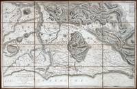
Plan topographique de la Campagne de Rome dessine et explique. . . a l’usage des voyageurs. . . ; Plan topographique de la Campagne de Rome consideree sous le rapport de la geologie et des antiquites dessine et explique. . . ; Pantogramma ou vue descriptive generale de la Campagne de Rome dessine et explique. . . .
Rome: Venance Monaldini Librarie Place d’Espagne No. 79 1816-1821. Four works. 1st -- Large dissected copper-engraved map dissected & mounted on linen 35.5 x 22.75 in. slight foxing edgewear closed tears at corner folds a couple folds w/ archival repair tape on verso over linen; 2nd & 3rd - 8vo. 63 1; 15 1 pp. With large folding copper-engraved frontisp. highlighting section of the pantogram. Original marbled wrappers very slight chipping head & foot of spine; 4th -- large 3-sheet “Pantogram†or panoramic view of Rome 63 x 8.75 in. all preserved together in open-backed slipcase wrapped in patterned blue paper printed cover label manuscript pricing information & title in ink some scuffing & edgewear still an overall VG set. Second edition of the large dissected map of Rome and surrounding countryside fourth edition of the two-in-one handbook illustrating the coast along the Tyrrhenian Sea from Lake Bracchiano to Mount Circe and inland to the Central Apennines foothills. Sickler’s 1773-1836 Panoramic elevated view of Rome with text key above identifying churches monuments and historical locations in 19th-Century Rome together with the map and handbooks here were key references for those taking the Grand Tour following the Napoleonic Wars which had devastated much of the Continent. Pietro Ruga 1772-1850 was a noted Italian engraver printmaker furniture designer and architectural draftsman best remembered for his maps and pocket panoramic views of Rome. Venance Monaldini Librarie, Place d’Espagne, No. 79, unknown
Riferimento per il libraio : 60225
|
|
|
[MAPS -- SOUTH AMERICA].
The new world school map of South America. . . .
Syracuse NY: Empire New England Company Inc. ca. 1920. Double Elephant folio. 51 x 59 in. Large colour-printed map dissected and mounted on linen backing brass grommets at upper fore-edge for hanging title stamped on verso minor edgewear at creases very minor lifting at seams minor dustsoiling to outer linen when folded still a VG exemplar. First edition thus of this scarce education map of post-World War I South American geography. The map details the principal railways water routes major cities steamship routes and geographical and political details. The Empire New England Company was active in upstate New York from about 1915 until the end of the 1920s selling educational supplies maps textbooks and more. The New World School Maps could be purchased individually or in cases which held between 6-10 individual maps for school uses according to company literature of the period. Worldcat locates 1 copy Buffalo & Erie County Public Library smaller size - 1931 ed. Empire New England Company, Inc., unknown
Riferimento per il libraio : 52936
|
|
|
[MAPS -- WALL PULL-DOWN CASE]. ATWOOD, Wallace W[alter] (Ed).
Atwood Regional-Political Series seven pull-down map quarter-sawn oak wall case: Asia including U.S.S.R. in Europe; South America; Europe; United States; Africa; Australia and the Far East; North America.
Chicago IL: Published by A.J. Nystryom & Co. Maps Globes Charts 1934. Seven large linen-backed colour lithograph maps sized from 43.5 x 72 in. to 51.5 x 60 in. all mounted on their original spring-loaded rollers wooden pull dowel & metal ring pull some creasing minor edgewear creasing soot soiling to the lower margin averaging about 6-7 in. due to exposure when rolled “Europe†and “United States†with faint tidemark & discoloration at left margin some minor creasing wear all preserved in the original A.J. Nystrom quarter-sawn oak wall bracket sized 58.5 x 15.25 x 3.25 in. all pull-down maps firmly secured in their steel brackets preserving 6 of the 7 original labels on the edge of the pull-down dowels still a VG- set of maps in their original configuration. First editions thus of this complete and exceptional example of the Atwood/A.J. Nystrom Regional-Political Series Map Case reflecting the many geographical and political changes between World War I and World War II. Such changes are reflected in the appearance of Manchoukuo the Japanese controlled rump state established in Manchuria in 1932 by the Japanese Empire and also depicting Korea still as Chosen. The Europe map depicts the East Prussia still controlled by the Weimar Republic and then after Hitler ascended to power; while Africa still retains much of the colonial powers as shown in the Belgian Congo Anglo-Egyptian Sudan French Equatorial Africa and even Beuchuanaland. The Australia and the Far East Map clearly defines the Japanese United States British & Australian mandates across the South Pacific. Atwood 1872-1949 was a noted geographer and educator who was a member of both the New Jersey and Wisconsin Geological Surveys served in the US Geological Survey served as professor of Physiography at Harvard and later from 1920-1946 when he produced these maps was President of Clark University and Head of its School of Geography. No similar complete sets located in Worldcat. Published by A.J. Nystryom & Co., Maps, Globes, Charts, unknown
Riferimento per il libraio : 61915
|
|
|
[Maps – Maine] CS Hammond & Co / RM Lewsen & Co C S R M
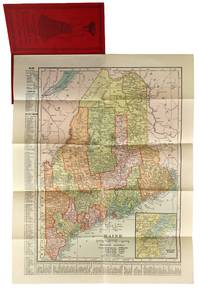
Fold-out Map of Maine
New York: C.S. Hammond & Co 1904. Very Good . New York: C.S. Hammond & Co. 1904. Fold-out map of Maine in red pictorial wrappers 33x26 cm. Wrappers gently creased and dust soiled with mild water damage and previous paperclip ghosting. Interior has calendars for 1905 and 1906 and another ad for R. M. Lewsen & Co which matches the exterior proclaiming they are the largest cloak store and leading millinery store in Maine. Map folded with only light toning. A Very Good or better example. C.S. Hammond & Co unknown
Riferimento per il libraio : 47779
|
|
|
[maps; French Revolution]
Maps of Sites of the War and Counter-Revolution of France 1792-1794
unknown: unknown likely early 1800s. Ephemera. Very Good. A collection of 8 engraved maps 420 x 280 mm including wide margins numbered in Arabic or Roman numerals see below otherwise seemingly uniform. From an unknown source. It includes: 1 Bombardement de Lille par l'Armee Autrichienne en 1792 with the stamp of Depot de la Guerre Bibliotheque in the top margin; 2 Siege de la Citadelle d'Anvers par l'Armee Francaise en 1792; III Siege de Valenciennes par l'Armee Coalisee Anglaise Hannovrienne et Autrichienne en 1793; VIII Siege d'Ypres par l'Armee Francaise en 1794; IX Siege de Charleroy par les Francais en 1794; X Siege de Landrecies par les Francais en 1794; XI Siege du Quesnoy par les Francaise in 1794; and XIII Siege de Nieuport par l'Armee Francaise en 1794. A bit foxed; flattened crease down the middle from folding these were perhaps pulled from a book where they were mounted on stubs along the crease. <br/><br/> [unknown] unknown
Riferimento per il libraio : D7401
|
|
|
[maps]
Etablissement Militaire de St. Bernard. Atlas des batiments
c. early 19th century. Hardcover. Very Good. Half cloth and marbled paper over boards handwritten label on upper board; oblong folio 460 x 360 mm; entirely handwritten and drawn in black ink on the rectos only with "tableau des batiments militaires" and 7 maps. Boards heavily scuffed; binding shaken; some dusty finger-smudges here and there. Sold as is. <br/><br/> hardcover
Riferimento per il libraio : LD7400
|
|
|
[MAPS]
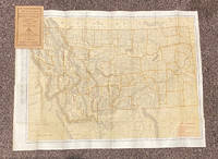
Indexed Pocket Map: Tourists' and Shippers' Guide to Montana
Chicago & New York: Rand McNally & Co 1920. 12mo. 32 pp text; large color folding map 20 1/2" x 27 1/2"; printed on both sides. The front side shows railroads electric lines counties cities towns villages post offices lakes rivers etc. The verso shows the Montana automobile road map. Montana is home to two of the country's most beautiful and iconic National Parks - Yellowstone and Glacier. Printed stiff brown wrappers in fine condition; 3 short closed tears along lower edge of map. Rand McNally & Co unknown
Riferimento per il libraio : 20799
|
|
|
[Maps] [Africa] Central Angling Advisory Board of Kenya Colony
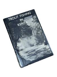
Trout Fishing in Kenya
Nairobi Kenya: Printed in E. Africa by W. Boyd & Co 1950. First edition. 18x13cm 64pp. Illustrated ads photos fold out map attached at rear. Staple bound in illustrated wrappers. Old tape reinforcement to spine edges rubbed owner's name to front cover. Upper corners stained else clean internally and very good. <br /> <br /> Very scarce mid-century publication a guide for English and American sportsmen seeking angling opportunities in Kenya Colony. Brown and Rainbow Trout eggs were introduced into the rivers by colonists around 1905. The sport was a popular pastime for the colonists and tourist fishing in the region continues to thrive today. The three color map at rear shows the Kenya Highlands with principle trout rivers roads and railways.<br /> <br /> OCLC cites a single holding at the University of California. Printed in E. Africa by W. Boyd & Co unknown
Riferimento per il libraio : 8975
|
|
|
[Maps] [California]
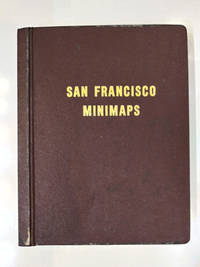
San Francisco Minimaps
San Francisco: The Realty Index Co 1969. Hardcover. Very good. 631pp. Folio 36.5 cm Burgundy boards. With dividers and tabs. Moderate scuffing to the extremities; some discoloration to endpapers else internally clean. May require extra postage due to weight. An attractive and highly detailed volume of miniature Assessor's Blocks Maps reduced in size to make a legible yet at the same time compact and uncluttered book. With zoning information sectional maps major development areas and Assessor's Block Maps. The Realty Index Co hardcover
Riferimento per il libraio : 58769
|
|
|
[Maps] [Joseph S Wilson]
Report of the Commissioner of the General Land Office for the Year 1866
Washington D.C: Government Printing Office 1867. 1st Edition. Hardcover. Very Good. Brown pebbled cloth boards with blindstamped rules; 9" tall; 151 pp plus large folding map. Good condition with wear to spine ends of corners of boards; map itself in very good condition colors bright folded properly modern tape reinforcement at creases. -- The "Map of the United States and Territories" by Joseph S. Wilson was one of the largest and most accurate maps of the country published at the time. It clearly marks major Native American territories and the colored mineral deposits show a clear rationale for expansion to the West. Joseph Wilson was Commissioner of the General Land Office both before and after the Civil War and this map was produced during the first year of his second tenure. The accompanying report asserts the United States' right to possession of the Western territories and states encourages the population thereof and admits to continuing arbitration land claims especially in California. Government Printing Office hardcover
Riferimento per il libraio : s02256
|
|
|
[MAPS] [San Francisco]
FUTURE DEVELOPMENT OF THE SAN FRANCISCO BAY AREA 1960-2020
<p>1st and only edition. 4to softcover 9 x11" Pages: xxi 94 Appendices. Approximately 130 pp. in all. Accompanied by 23 large folded maps in slipcase.</p><p>The booklet is subtitled "<strong>Economic Aspects of Comprehensive Survey of San Francisco Bay and Tributaries."</strong> It contains research data concerning land use population distribution freeway development employment and economic growth as well as a decade-by-decade chart for growth management. Most of the maps are 36"x42" some two-tone others in brilliant colors.</p><p>CONDITION: <strong>The maps are FINE</strong> folded to size with the appearance of never having been opened. <strong>The booklet is Good</strong>; a clean copy overall but with some discoloration to spine toning to rear cover and one rusted staple. The slipcase is well worn with substantial dampstaining not affecting the contents.</p> U.S. Army Corps of Engineers / U.S. Dept. of Commerce, 1957
Riferimento per il libraio : k251217i

|
|
|
[Maps] [Wyoming] Riley, WC W C
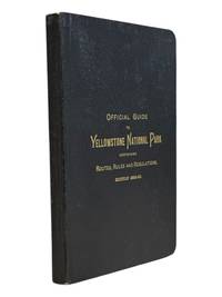
Official Guide to the Yellowstone National Park: A Manual for Tourists
St. Paul Minn: W.C. Riley 1889. 8vo 140 15pp ads and blank journal at rear. Illustrations maps large folding map in pocket at rear as issued. Original leather over card covers stamped in gilt on front with red page edges. Gift inscription on ffep in pencil dated 1907 else clean internally. A beautiful fine copy. <br /> <br /> Beautiful copy of this illustrated tourist's guide to Yellowstone giving descriptions of the attractions and features of the park with maps a brief history and rules and regulations. Riley issued a just few of these according to OCLC between 1886 and 1890. Scarce and more so in this condition - the nicest we've seen.<br /> <br /> <br /> . W.C. Riley unknown
Riferimento per il libraio : 9062
|
|
|
[Maps] Holmes, Burton (ed)
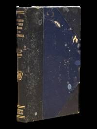
A Trip Around the World Through the Telebinocular
Meadville PA: Keystone View Company 1929. 3rd Edition. Hardcover. Very Good. <br /> <br /> Third edition 1929 12mo 321pp ix pamphlet with three location maps in rear pocket. 3/4 black morocco over blue cloth gilt stamped on spine. Very good with moderate to heavy spotting and soiling to boards. Some moisture staining to fore-edge of page block mainly at the rear index else clean internally. Keystone View Company hardcover
Riferimento per il libraio : 4297
|
|
|
[Maps] The Military Service Publishing Company
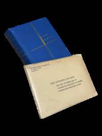
The R. O. T. C. Manual Infantry: A Textbook for the Reserve Officers' Training Corps First Year Basic Vols. 1 and 2 with map and ephemera
Harrisburg PA: The Military Service Publishing Company 1939. Hardcover. Very Good. <br /> <br /> Twenty first edition April 1939. 4to 216 pp. Publisher's blue cloth with gilt lettering and design. Very good with some soiling to boards and edges of page block. Clean internally with a few annotations in pencil throughout. Included is the supplementary envelope with Special Map "A" and four protractors only 2 are listed on the envelope. A few contemporary papers and supplementary materials for a course taken at the University of Wyoming are laid in as well. The Military Service Publishing Company hardcover
Riferimento per il libraio : 4298
|
|
|
[Maps] US Coast and Geodetic Survey U S
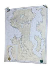
Seattle Harbor and Lake Washington
Washington D.C.: U.S. Coast and Geodetic Survey 1937. 4th edition. Large 2 color map 34.5 x 42.5" Date of 1948 stamped at the bottom along with stamps from Metsker's Maps in Tacoma. A couple small edge tears not extending into the image and light wrinkling around edges. A near fine example. <br /> <br /> Original WWII-era copy of this classic Seattle map showing shorelines depths tides etc. in full detail. This is #6449 of the U.S. Coast and Geodetic Survey the first edition appearing in 1922. U.S. Coast and Geodetic Survey unknown
Riferimento per il libraio : 9266
|
|
|
[Maps]; [Germany]
Guide-Panorama of the Rhine from Mayence to Cologne; With Descriptions of the Most Interesting Towns Villages etc. Close to the Respective Places Stamped in Relief
Mainz: W. Suder 1960. Later edition. Wraps. Near Fine. 24.5 cm x 11.5 cm folded in the wrappers. Map bound in the leporello style. Blue paper wraps printed in dark blue. A colorful map with captions printed in black in 16 folds. A map similar to this one was first published earlier in the twentieth century by a different press. The captions are in English. Castles and other landmarks from Bonn Cologne Linz Krahnenburg Koblenz and from several other suburbs and towns on the Rhine river are pictured and discussed in the map's margins. Light wear to the wraps else a sharp example. W. Suder unknown
Riferimento per il libraio : 000015404
|
|
|
[Maps]; [New York City]; [US History] U S
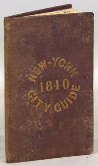
A Guide to the City of New-York; Containing an Alphabetical List of Streets &c. Accompanied by a new and Correct Map
New York: Tanner & Disturnell 1840. Later edition. Hardcover. Very Good. 64mo. 13 cm x 8 cm. 3 4-15 1 pp. Brown cloth with gold lettering on the front board. Yellow coated rear endpaper and rear pastedown. Illustrated with a frontispiece and with a folding map in the rear of the volume. The folding map in the rear of the volume is hand-colored. Its title is "New Map of the City of New-York with part of Brooklyn & Williamsburg". By J. Calvin Smith. Engraved on steel by Stiles Sherman & Smith. The folding map is dated 1840. Phillips 532. Guide books similar to this one were published as early as 1836. OCLC locates a few examples of this exact edition. With a list of wards streets and information on how to get around the city. A fascinating look at early nineteenth-century New York City. Light soiling to the cloth. Lacks the yellow free front endpaper and front pastedown. The folding map with one piece neatly detached but laid in the whole map is present. Tanner & Disturnell hardcover
Riferimento per il libraio : 000014171
|
|
|
[Maps]; [New York City]
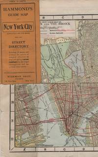
HAMMOND'S GUIDE MAP OF NEW YORK CITY: Manhattan and the Bronx
New York: Wehman Brothers Publishers 1913. Very good. An impressive color map of the island of Manhattan and the Bronx. Scale is 1" equals 1/2 mile and includes railroads subways elevated railroads surface railroads and proposed railroads. An uncommon early 20th Century New York City street map. Folding color map. Measuring approximately 18" x 36" when unfolded. In original printed card wrapper. Verso a thorough printed street index. Mild handling wear toning. A few tiny holes near fold corners. Overall well preserved; very good. Wehman Brothers Publishers unknown
Riferimento per il libraio : 41637
|
|
|
[Massachusetts – Maps – Cycling] Oliver, William T
Nine Cyclists’ Road Maps of Massachusetts Prepared for the Massachusetts Division of the League of American Wheelmen
Lynn Massachusetts: Arthur W. Robinson 1891. Nine of a ten-map series mostly measuring 14 ½ x 19 inches. Folded with slight marginal folding and wrinkling; Near Fine. Nine of a set of ten maps of the entire state of Massachusetts produced in 1891 for the League of American Wheelmen. The League was founded in Rhode Island in 1880 as a membership organization for cyclists. Besides presiding over racing and producing cycling guidebooks it advocated for increased government spending on road improvements especially for rural roads; these maps indicate roads of superior and inferior quality. In the 1890s there was a boom in cycling’s popularity mainly because of several inventions that allowed a safer and more pleasant ride compared to that of a penny-farthing.<br /> <br /> This group is near complete; we find two complete editions on OCLC. Arthur W. Robinson unknown
Riferimento per il libraio : List3031
|
|
|
[MATSUKI, TAMANOSUKE]. 松木玉之助.
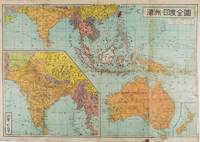
濠州・印度全圖. Gōshū Indo Zenzu. Complete Map of Australia and India.
東京.Tokyo.: 金鈴社. Kinrei-sha. 昭和十八 October 101943. Two maps printed in colour on a single side of a folded sheet. The map titled "Complete Map of India and Australia" shows the region covering Australia southern India western mainland south-east Asia Indonesia the Philippines and New Guinea. The other map titled "India and Burma" shows the region covering India Afghanistan the western section of China Burma and Thailand on the lower left side. New Zealand is in an inset map in the lower right corner. As the note on the cover says "Including the detailed descriptions of the Solomons New Guinea and southern islands" this map shows the theatres of the Pacific War and the surrounding areas. The map indicates agricultural and mineral resources as well as cities roads railways sea routes national borders etc. Cover and publication details printed on two panels on the reverse. Some marking and browning. . 金鈴社. [Kinrei-sha]. unknown
Riferimento per il libraio : 159290
|
|
|
[MERVEILLEUX Charles Frédéric]:
Mémoires instructifs pour un voyageur dans les divers Etats de l'Europe: contenant des anecdotes curieuses trés propres à éclaircir l'histoire du tems; avec des remarques sur le commerce & l'histoire naturelle.
Amsterdam, H. du Sauzet, 1738. 2 tomes en un volume in-12 de [8]-228; [4]-241-[3] pages, plein veau brun, dos à nerfs orné de filets et fleurons dorés, pièce de titre beige, roulette dorée sur les coupes, tranches rouges. Coins à peine frottés, tache d'encre p. 63 du tome 2.
Riferimento per il libraio : 8764

|
|
|
[Medina - Al-Ula].
Medina. World (Asia) 1:1,000,000. Series 1301. Edition 4-GSGS. Sheet NG-37 & part NG-36. [London], War Office and Air Ministry, 1960.
Colour printed map, ca. 810 x 608 mm. Scale: 1:1,000,000. Shows boundaries, highways and roads, railways, rivers and water features, and other details. Rare 4th GSGS edition of this map of Saudi Arabia, as part of the International Map of the World series, showing the western coastline as well as the cities Medina and Ha'il and the oasis of Al-Ula in the interior. - Stamp of ownership of Arizona State University, along with "withdrawn" and "superseded" stamps on top and next to it. - 56 mm piece of adhesive tape on top edge; pencil marks to lower right corner. OCLC 634944590. Cf. OCLC 35899626 (1962 ed.).
|
|
|
[MEKONG DELTA - VIETNAM WAR MAPS]
Khanh Hu'ng and Quan Long Vietnam. Series 1501 AIR. Sheets NC 48-10 & 11. Edition 2.
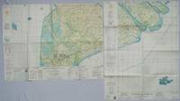
Washington D.C.: Army Map Service. 1967. Two printed colour adjoining maps 73 x 55.6 cms and 55.6 x 73 cms original folds inked operational annotations to the Quan Long sheet multiple marginal legends noting aerodromes and radio facilities roads railroads and boundaries glossary of terms much of the text is in both English and Vietnamese in very good condition. Detailed U. S. Army maps of the Mekong Delta and Southern Vietnam extending from Rach Gia in the north to the area just south of Quan Long Ca Mau in the south and east including BacLieu and CanTho. The island of Con son is at lower right of the Khanh Hu'ng sheet. Operational notes are inked around Quan Long are marked and the U Minh Forest the impenetrable "forest of darkness" is noted in ink. <br> <br>. . Army Map Service. unknown
Riferimento per il libraio : 203840
|
|
|
[Michelin]
CARTE MICHELIN N° 328 : AIN, HAUTE-SAVOIE
Une carte géographique "Local" au 1:150.000e, éditée en 2004, bon état
Riferimento per il libraio : LFA-126744324
|
|
|
[Michelin]
CARTE MICHELIN : SUISSE
Une carte au 1:400.000e, éditée en 1978, Michelin, bon état
Riferimento per il libraio : LFA-126750294
|
|
|
[Michelin]
CARTE MICHELIN : RHÔNE-ALPES
Une carte au 1:200.000e, éditée en 2012, Michelin, bon état
Riferimento per il libraio : LFA-126750293
|
|
|
[Miroir de l'Histoire]
MIROIR de l'HISTOIRE n° 169 Janvier 1964
Une revue de 110 pages, format 170 x 230 mm, illustrée, brochée
Riferimento per il libraio : LFA019c5
|
|
|
[MIDDLE EAST - MAP]. FISK & CO, (ENGRAVERS).
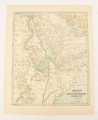
Egypt showing the Egyptian Soudan Arabia etc.
New York.: Hunt & Eaton. Circa1893. Printed map in colour elevation shown with hachures 29 x 23.5 cm text on the verso relating to entries for Afghanistan Beluchistan and Turkey prepared for Hunt & Eaton's "New York Recorder's Atlas" small tears to the top edge but in very good condition. . Hunt & Eaton. unknown
Riferimento per il libraio : 174920
|
|
|
[MIDDLE EAST--ANTIQUE MAP]
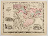
Johnson's Turkey in Asia Persia Arabia &c.
New York.: Johnson & Browning. circa1860. Engraved map 30.2 x 40.5 cm 34.5 x 45.5 cm sheet original hand-colour elaborate strapwork border three fine vignettes of Muscat Trebisond small marginal edge tears top corner chipped the map in very good condition. Most attractive decorative map of Arabia the Ottoman Empire Persia Afghanistan Beloochistan and surrounds by one of the most popular and successful 19th Century American atlas publishers. . Johnson & Browning. unknown
Riferimento per il libraio : 177019
|
|
|
[Middle East] - Gaebler, Eduard.
Vorder-Asien. Leipzig, [1892].
254 x 201 mm. Lithographed map. Scale 1:25,000,000. Gilt wooden frame (290 x 357 mm). Political map of the Middle East prior to WWI, detailing the Arabian Peninsula, the Gulf, Iran, and the Ottoman Empire, as well as parts of Africa, Russia and China. Among the labelled cities on the Gulf are Sharjah, Al-Wakrah and Manamah. With 4 inset maps showing Palestine (1:2,500,000) and Jerusalem with its surroundings (1:500,000) as well as the southern German states and Lake Constance for scale. - Early edition of Eduard Gaebler's map of western Asia, published published in "Neuester Hand-Atlas über alle Teile der Erde" (Leipzig, Gaebler's Geographisches Institut, 1892). The map saw numerous reissues; a revised edition appeared in Gaebler's "Kleiner Handatlas" as late as 1933. - Slight foxing. Frame shows some traces of worming; tiny piece of wood chipped near left margin. An appealing map in an attractive wooden frame with a gilt border.
|
|
|
[MINERAL RESOURCES OF JAPAN] MUNROE, HENRY S
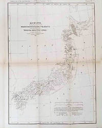
The Mineral Wealth of Japan.
Philadelphia.: American Institute of Mining Engineers. Sherman & Co. printers. 1878. Large folding map of Japan showing "some of the more important Mining Districts Coal Fields etc." small fold split without loss tables 67pp. Covers a little scuffed and discoloured overall in very good condition. Scarce offprint separately paginated of a paper included in Volume V of the Transactions of the American Institute of Mining Engineers. The author Henry S. Munroe had been retained by the Japanese Government as Assistant Geologist and Mining Engineer with the Geological Survey of Yesso for the Hokkaidō Colonization Agency. His work laid the foundations for the future coal mining industry in Hokkaido. The report contains two lengthy tables relating to coal production and quality. . American Institute of Mining Engineers. Sherman & Co., printers. unknown
Riferimento per il libraio : 210211
|
|
|
[MUSEUM OF CHINESE HISTORY] 中国历史博物馆.
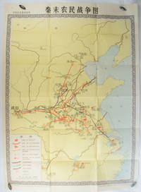
秦末农民战争图. Qin mo nong min zhan zheng tu. Chinese Educational Map - Map of Peasant Rebellion during Late Qin Period.
Beijing.: 地图出版社. Di tu chu ban she. 1st Edition 2nd Printing. 1981. Large Chinese coloured educational map folded scale 1:2000000. Legend lower left corner shows the routes of military advance led by peasant rebellion leaders' 陈胜Chen Sheng and 吴广Wu Guang in red and other military activities led by 项羽Xiang Yu and 刘邦Liu Bang in various colours. In original worn paper wrapper map in very good condition. Text in Chinese. Map measures 105.5 x 76.6cm. . 地图出版社. [Di tu chu ban she]. unknown
Riferimento per il libraio : 173280
|
|
|
[Mythology] [Pictorial Maps] Hess, Jaro
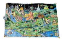
The Land of Make Believe
Holland MI: Charles R. Sligh Co 1958. Third edition. Large color map 26x37" The image remains bright but there is moderate wrinkling throughout more severe at the edges. There are several tape repairs to the margins and corners and several other edge tears one extending about 2" into the image. A good copy that has seen much use. Will ship rolled as was found. <br /> <br /> This is an original 1958 printing of this iconic pictorial fantasy map from Czech-born Michigan landscape painter Jaro Hess 1889-1979. Hess painted and first published this in 1930 the map showing some 60 references to nursery rhymes fairy tales and children's stories and offering escapism during the Great Depression. The first edition of the map shows a figure "The Wandering Jew" which was later as here changed to "The Wanderer." This third edition was published by the furniture magnate Charles R. Sligh and printed by Dickinson Brothers a lithography firm in Grand Rapids Michigan. Hagstrom co. acquired the rights to the image about 1982 and issued reprints.<br /> <br /> A bright and as typical heavily worn example of this beautiful and whimsical map. Charles R. Sligh Co unknown
Riferimento per il libraio : 9265
|
|
|
[N. A.].
[OTTOMAN MILITARY MAP of PATAGONIA and FALKLAND ISLANDS: ROUTE of DRESDEN] Alman kruvazörü Dresden'in takîbi ve tahrîbi.
Very Good Turkish, Ottoman (1500-1928) Original color map. Elephant folio. (59x75 cm). In Ottoman script. [OTTOMAN MILITARY MAP of PATAGONIA and FALKLAND ISLANDS: ROUTE of DRESDEN] Alman kruvazörü Dresden'in takîbi ve tahrîbi. SMS Dresden cruiser's routes between 1913-1915 (World War 1) on the Patagonian shelf; western shores of South America, Patagonia and Falkland Islands. Dresden spent much of her career overseas. After commissioning, she visited the United States in 1909 during the Hudson-Fulton Celebration, before returning to Germany to serve in the reconnaissance force of the High Seas Fleet for three years. In 1913, she was assigned to the Mediterranean Division. She was then sent to the Caribbean to protect German nationals during the Mexican Revolution. In mid-1914, she carried the former dictator Victoriano Huerta to Jamaica, where the British had granted him asylum. She was due to return to Germany in July 1914, but was prevented by the outbreak of World War I from doing so. At the onset of hostilities, Dresden operated as a commerce raider in South American waters in the Atlantic, then moved to the Pacific Ocean in September and joined Maximilian von Spee's East Asia Squadron. Dresden saw action in the Battle of Coronel in November, where she engaged the British cruiser HMS Glasgow, and at the Battle of the Falkland Islands in December, where she was the only German warship to escape destruction. She eluded her British pursuers for several more months, until she put into Robinson Crusoe Island in March 1915. Her engines were worn out and she had almost no coal left for her boilers, so the ship's captain contacted the local Chilean authorities to have Dresden interned. She was trapped by British cruisers, including her old opponent Glasgow. The British violated Chilean neutrality and opened fire on the ship in the Battle of Más a Tierra. The Germans scuttled Dresden and the majority of the crew escaped to be interned in Chile for the duration of the war. The wreck remains in the harbor; several artifacts, including her bell and compass, have been returned to Germany.
|
|

 Ricevere i risultati per e-mail
 Scaricare i risultati in PDF
 RSS feed
 Link
Link


