|
[IGN]
CARTE IGN n° 50 : SAINT-ETIENNE - LE PUY
Une carte série verte au 1:100.000e, éditée en 1987, bon état
Riferimento per il libraio : LFA-126740291
|
|
|
[IGN]
CARTE IGN n° 50 : SAINT-ETIENNE - LE PUY-en-VELAY
Une carte série verte au 1:100.000e, éditée en 1999, IGN, bon état
Riferimento per il libraio : LFA-126750291
|
|
|
[IGN]
CARTE IGN n° 51 : LYON GRENOBLE
Une carte topographique TOP 100 au 1:100.000e, éditée en 2003, bon état
Riferimento per il libraio : LFA-126744320
|
|
|
[IGN]
CARTE IGN n° D12: AVEYRON
Une carte départementale routière et administrative au 1:200.000e, éditée en 2010, bon état
Riferimento per il libraio : LFA-126728943
|
|
|
[IGN]
CARTE IGN n° D42 : LOIRE
Une carte départementale routière et administrative au 1:150.000e, éditée en 2014, bon état
Riferimento per il libraio : LFA-126749976
|
|
|
[IGN]
CARTE IGN RHONE-ALPES
Une carte routière et touristique R14 au 1:250.000e, éditée en 2014, bon état
Riferimento per il libraio : LFA-126749433
|
|
|
[IGN]
CARTE IGN RHONE-ALPES
Une carte routière et touristique R14 au 1:250.000e, éditée en 2009, Michelin, bon état
Riferimento per il libraio : LFA-126750290
|
|
|
[ILE DE LA REUNION] [CARTES POSTALES ANCIENNES]
Cartes postales anciennes sur l'Ile de la Réunion
Paris, Messageries Matimes, début du 20e siècle 1 ensemble de 10 cartes postales anciennes sur l'Ile de La Réunion
Riferimento per il libraio : 13420
|
|
|
[ILE MAURICE] [CARTES POSTALES ANCIENNES]
Cartes postales anciennes sur l'Ile Maurice
Paris, Messageries Matimes, début du 20e siècle 1 ensemble de 4 cartes postales anciennes sur l'Ile Maurice
Riferimento per il libraio : 13422
|
|
|
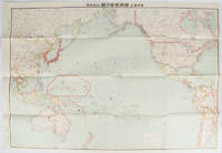
[INAGAKI, RIKICHI]. 稲垣利吉.
日・米・英・勢力圖太平洋上: 比較對照. Nichi bei ei seiryokuzu Taiheiyojo : Hikaku taisho. Military Strength of Japan the United States and the United Kingdom on the Pacific: A Comparison Map.
東京. Tokyo.: 九段書房.Kudan shobo. 大正十四 1925. Coloured folding Japanese map showing the military strength of Japan the United States and the United Kingdom in the Pacific original pictorial envelope scale not given. Some small holes at folds occasional light foxing a prior owner's signature on reverse minor wear envelope. Very good copy in like envelope. Map measures 54.4 x 78.8cm. The explanatory text in Japanese printed on the reverse in blue summarises the colonial possessions of the US and the UK as well as providing a comparison between the land size naval presence natural resources immigration issues and maritime transport capacities of Japan the United States and the United Kingdom. Legend indicates national regional provincial territorial boundaries canals undersea cables airline routes metropolitans capital cities mining fields hot springs ancient battle fields major trade ports Japanese embassies and consular offices. A large area marked 日本委任统治 "South Pacific Mandate" highlighted in a box is adjacent to Australian occupied Papua New Guinea. . 九段書房.[Kudan shobo]. unknown
Riferimento per il libraio : 169329
|
|
|
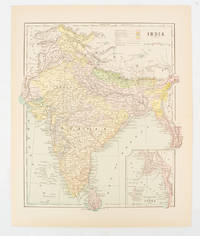
[INDIA - MAP] FISK & CO (ENGRAVERS)
India
New York. circa1910. Printed colour map 29 x 25 cm with inset map of the Eastern Part of India colour key reference key to the ruling divisions current and projected railways and telegraphs also shown central fold slight toning; in very good condition. Interesting map shaded by Divisions: the Presidencies of Bengal Madras Bombay Ceylon "Native States under British Protection" and "Independent States" Nepal and Bhutan. . unknown
Riferimento per il libraio : 174839
|
|
|
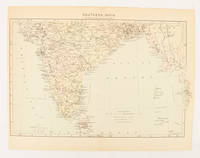
[INDIA - MAP]
Southern India
London. circa1910. Printed colour map on conjoined pages 22.3 x 33.7 railways submarine cables and heights above sea level marked faded but in very good condition. Map showing the ruling divisions by shading borders with Burma and the Andaman and Nicobar Islands also shown. . unknown
Riferimento per il libraio : 174841
|
|
|
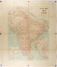
[INDIA - PRE PARTITION & BURMA - MAP]
Road Map of India and Burma.
Bombay.: Joshi & Co. circa1940. Colour lithographic map 66 x 50 cms; 81.x 68.5 cms sheet two inset maps and on the verso a full sheet "Relief Map of India" original folds with fold splits archivally strengthened several city names have been neatly underlined “Agartala” inked in the margin overall in good condition. Scarce Bombay-published map of the pre-Partition Indian sub-continent with two small inset maps one showing roads around Karachi and the other Burma. Through Routes Other Main Roads and Motorable Roads Subject to Weather are marked. The "Relief Map of India" on the verso includes Railway Lines Canals Steamer Routes Rivers Air Routes Navigable Canals and Broadcasting Stations. . Joshi & Co. unknown
Riferimento per il libraio : 211089
|
|
|
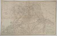
[INDIA - RAJASTHAN ANTIQUE MAP] SMITH, HM (LITHOGRAPHER). H M
Rajpootana and Adjoining States Sheet No. 4.
Calcutta.: Surveyor Generals Office. 1870. Reissue of 1859 edition. Lithographed map 57.2 x 93 cms; 61.1 x 96 cms sheet original folds old paper repairs to the verso and a sealed marginal tear central folds archivally strengthened some toning to the folds and creasing but the map in remarkably good clean condition. Impressive large Calcutta printing from the Survey of India showing Rajasthan Uttar Pradesh and surrounding states with extremely detailed delineation of settlements roads railways rivers and major points of interest the Taj Mahal is highlighted. . Surveyor Generals Office. unknown
Riferimento per il libraio : 189711
|
|
|
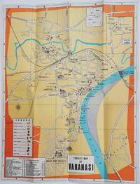
[INDIA - TOURIST MAP].
Tourist Map of Varanasi.
Circa1960. Folding colour tourist map of Varanasi in Uttar Pradesh province two inset maps of India and a gude map of Sarnath legend and key select Ghats shown railways "western style" and "Indian style" hotels marked in very good condition. 42.9 x 33.1 cm. . unknown
Riferimento per il libraio : 178269
|
|
|
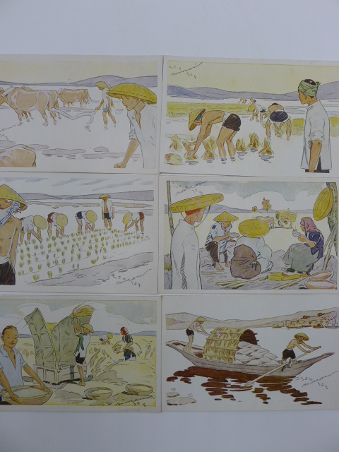
[INDOCHINE] - [CARTES POSTALES ANCIENNES] - [BOURDIN]
Le Riz d'Indo-Chine
Sans lieu, 1931. 1 ensemble de 6 cartes postales anciennes représentant les activités liées à la culture du riz en Indo-Chine.
Riferimento per il libraio : 8479
|
|
|
[INDOCHINE] [CARTES POSTALES ANCIENNES] [DIEULEFILS]
Cartes Postales anciennes du Tonkin
Hanoï, P. Dieulefils, Photographe-Editeur, vers 1900-1910. 1 album de cartes postales (114) consacrées au Tonkin et à Hanoï, ses monuments, ses rues, ses pagodes, ses édifices publics. La plupart des cartes sont animées, quelques-unes timbrées et oblitérées, très bon état d'ensemble.
Riferimento per il libraio : 10387
|
|
|
[INDOCHINE] [CARTES POSTALES ANCIENNES] [REGNAULT SARASIN]
Cartes postales anciennes sur l'Indochine
Paris, Editions du Figaro, sans date (1930?) 1 ensemble de 16 cartes postales anciennes représentant des scènes typiques indochinoises, des marchés, des monuments, des paysagesde l'Annam , du Tonkin, de la Cochinchine et du Cambodge, bon état.
Riferimento per il libraio : 12875
|
|
|
[INDOCHINE] [CARTES POSTALES ANCIENNES] [TETES COUPEES]
Indochine - Tonkin - Cartes postales anciennes
Indochine - Début du 20e siècle. 1 petit album cartonné comprenant 12 cartes postales anciennes timbrées. Ces carteséditées par Dieulefils ou par d'autres éditeurs, représentent des scènes de décapitation ou des têtes coupées de pirates tonkinois ou autres bandits de grands chemins. Curieux et insolite!
Riferimento per il libraio : 12876
|
|
|
[INDOCHINE] [RIZICULTURE] [CARTES]
Tonkin et Nord Annam - Cartes Rizicoles des Provinces au 1/250.000e
Hanoi, années 20. 1 ensemble de 18 cartes rizicoles des Provinces du Tonkin et Nord Annam, en parfait état, sous pochette.
Riferimento per il libraio : 6050
|
|
|
[INDOCHINE] [TONKIN] [CARTES POSTALES ANCIENNES] [DIEULEFILS]
Cartes Postales anciennes du Tonkin
Hanoï, P. Dieulefils, Photographe-Editeur, vers 1900-1910. 1 album de cartes postales (98) consacrées à Hanoï, ses monuments, ses rues, ses pagodes, ses édifices publics. Nombreuses cartes animées, quelques-unes timbrées et oblitérées, très bon état d'ensemble.
Riferimento per il libraio : 6191
|
|
|
[INDOCHINE] [VIETNAM [CARTES] [QUI NONN] [KANTUM] [DARLAC]
Carte de Qui Nonh
Paris, Avril 1945, Institut Géographique National. 1 grande carte, format 88*65 cm, à l'échelle 1/400.000e, en couleurs, dessinées par le S.G.M.A., publiées par l'Institut Géographique National en 1945., très bon état.
Riferimento per il libraio : 10423
|
|
|
[INDOCHINE] [VIETNAM [CARTES] [VINH]
Carte de Vinh Ouest
Paris, Avril 1945, Institut Géographique National. 1 grande carte, format 88*65 cm, à l'échelle 1/400.000e, en couleurs, dessinées par le S.G.M.A., publiées par l'Institut Géographique National en 1945., très bon état.
Riferimento per il libraio : 10422
|
|
|
[INDOCHINE] [VIETNAM [CARTES] [VINH]
Cartes de Vinh, Annam, Vinh Est et Vinh Ouest
Paris, Avril 1945, Institut Géographique National. 2 grandes cartes, format 88*65 cm, à l'échelle 1/400.000e, en couleurs, dessinées par le S.G.M.A., publiées par l'Institut Géographique National en 1945., très bon état.
Riferimento per il libraio : 8529

|
|
|
[INDOCHINE] [VIETNAM] [LAOS] [CAMBODGE] [CARTES] [[HUE OUEST]
Carte de Hué Ouest
Paris, Avril 1945, Institut Géographique National. 1 grande carte, format 92*72 cm, à l'échelle 1/400.000e, en couleurs, dessinées par le S.G.M.A., publiées par l'Institut Géographique National en 1945, très bon état.
Riferimento per il libraio : 10425
|
|
|
[INDOCHINE] [VIETNAM] [LAOS] [CAMBODGE] [CARTES] [KONG]{SIEM RAP] [ANGKOR]
Carte de Khong - Khong Ouest
Paris, Avril 1945, Institut Géographique National. 1 grande carte, format 92*72 cm, à l'échelle 1/400.000e, en couleurs, dessinées par le S.G.M.A., publiées par l'Institut Géographique National en 1945, très bon état.
Riferimento per il libraio : 10424
|
|
|
[INDOCHINE][VIETNAM][TONKIN] [CARTES] [HA DONG]
Cartes de Ha Dong, Delta du Tonkin, Ha Dong Est et Ha Dong Ouest
Hanoï, Mai 1917, Service Géographique de l'Indochine. 2 grandes cartes, format 45*65 cm, à l'échelle 1/25.000e, en couleurs, dressées, héliogravées et publiées par le Service Géographique de l'Indochine, sous la Direction du Capitaine Salel, très bon état.
Riferimento per il libraio : 8528

|
|
|
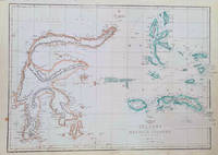
[INDONESIA - MAP OF SULAWESI & MALUKU ISLANDS] WELLER, EDWARD
Celebes and the Molucca Islands.
London.: Weekly Dispatch Atlas. circa1860. Map with outline handcolour 31.3 x 43.3; 33.3 x 48.7 cms sheet 12 x 17 inches small marginal bloom not affecting the map in very good condition. Detailed mapping of these two island groups by Edward Weller 1819–1884 from the ‘Weekly Dispatch Atlas’ an atlas published in monthly instalments from 1855 for subscribers to the long running newspaper. Weller was a pioneer in lithography and was sought after for his skill in producing detailed and accurate maps. . Weekly Dispatch Atlas. unknown
Riferimento per il libraio : 184035
|
|
|
[INDONESIA - WWII MAP].
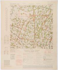
Java & Madura. 1:50000. Djombang. Sheet 53/XLIC. HIND 1090.
Washington D.C.: Army Map Service. First edition - revised AMS4. 1945. Army survey map printed in colour 36.7 x 36.7 cm; 58 x 48 cm sheet conversion graph glossary and administrative index to the inner margin; scale three column legend index to adjoining sheets and notes re grid references and mean declination to the foot; sheet toned a very few edge tears the map in very good condition. Wartime map produced by the US Army Map Service AMS who formed in 1942 and were at the forefront of military mapping campaigns during WWII and the post-war years. The very detailed map shows residency and administrative boundaries transportation ground and water features vegetation cultivation ruins religious sites "Graves; Chinese native" and "Cemetery; heathen Christian" walls hedges populated places built-up areas and buildings with those of iron stone wood and bamboo differentiated by colour; fishponds plantations and much more. . Army Map Service. unknown
Riferimento per il libraio : 200411
|
|
|
[INDONESIA - ANTIQUE PRINT] VAN DER SCHLEY, JAKOB
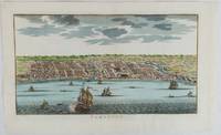
Samboupo.
circa1750. Hand-coloured engraving 19.5 x 35.6 cm 25.5 x 41.6 cm sheet original folds two old paper repairs not affecting the image a trifle toned but in very good condition Attractive bird's-eye view town plan of Makassar in Sulawesi prepared for Abbé Prevost's monumental 'Histoire Générale des Voyages.' . unknown
Riferimento per il libraio : 177186
|
|
|
[Institut Géographique National]
CARTE de FRANCE : AULUS les BAINS
Une carte dépliante au 1/50.000e (type 1922), format ouvert 750 x 565 mm, publiée en 1957, bon état
Riferimento per il libraio : LFA-126711119
|
|
|
[Institut Géographique National]
CARTE de FRANCE : FOIX n° 5-6
Une carte dépliante au 1/25.000e, format ouvert 725 x 555 mm, publiée en 1957, bon état
Riferimento per il libraio : LFA-126711118
|
|
|
[Institut Géographique National]
CARTE de FRANCE : VICDESSOS n° 1-2
Une carte dépliante au 1/25.000e, format ouvert 725 x 560 mm, publiée en 1962, bon état
Riferimento per il libraio : LFA-126711120
|
|
|
[Iran; Iraq; Maps] ['Published by Survey Directorate, GHQ Paiforce']: G H Q
Iran; Iraq; Paiforce WW2; Maps Fourteen 14 Index Maps mainly of areas/places in Iran
'Published by Survey Directorate G.H.Q. Paiforce 1944. All one page 20 x 33cms some stained but texts clear and complate. 1. Index map of Iraq and Iran for a 1:100000 scale survey series produced by the British military command PAIFORCE during World War II. All 20 x 32.5cm a couple sl. stained mainly good condition.1.Four Index maps of Iraq and Iran ¼ series I.D.R./X.D.R./G.S.G.S. 9002 3919 nos. 1-42.Index map of Iraq and Iran for a 1:100000 scale survey series produced by the British military command PAIFORCE during World War II. Index Map of 'Irq rn 1:100000 Series I.D.R. 9003'.3.Four Index Maps of places/areas of IRAN:a. Ahwaz 1:10000 series 1D MISC/563 to 573 stamped 11 June 1944b. Askaran and Sanandaj N.W. 1:25000 series …9005 stamped 25 June 1944c. Gach-I-Sar 1:50000 series stamped 11 June 1944d. Khurramshahr Abandan 1:12500 series4.Six Index Maps of places/areas of IRAQ all 1:25000 series ID 9005:a. Ba'qubab. Faidahc. Haffad. Hindiyae. Falluja f. MoselNo reference to other copies yet found. 'Published by Survey Directorate, G.H.Q. Paiforce [1944] unknown
Riferimento per il libraio : 26975
|
|
|
[ISHIBASHI GORO, GENERAL EDITOR]. 石橋五郎監修.
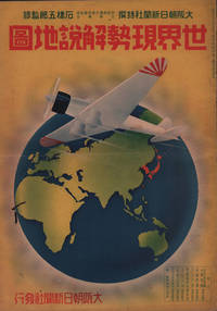
世界現勢解説地圖. Sekai Gensei Kaisetsu Chizu. Explanatory Maps of the Present State of the World.
大阪朝日新聞社. Osaka Asahi Shinbunsha. Showa 12 1937. 10 colour maps not including insets or sketch maps in text on 12 pages. Handsome world map features as the centre fold colour pictorial paper wrappers. A little light soiling and horizontal crease wrappers. An attractive atlas. 38 x 26.7cm. A large format atlas with six pages of coloured maps showing the nations of the world and five pages of Japanese text. The publication seems to have been produced to celebrate the 1937 world record flight from Tokyo to London by Iinuma Masaaki and Tsugayoshi Kenji in their plane 'Kamikaze' which was sponsored by the Asahi Newspaper. The front cover depicts the plane soaring over a map of the world while the back cover also had a colour image of the 'Kamikaze' with an advertisement for the Oji Paper Company which we are told donated a hundred million yen to support the flight. The name 'Kamikaze" had at that stage not yet taken on the connotations which it acquired during the Pacific War. <br> <br>The maps inside the volume show political boundaries major cities and transport routes. The opening pages show the Japanese Empire including Japan proper Korea Karufuto and Manchukuo with small insets covering Taiwan the Chishima Archipelago and Japan's South Sea mandate. The accompanying text focuses on Japan's newly acquired client state of Manchukuo detailing its area population principle products etc while the map includes graphs illustrating Japan's trade with the world and with Manchukuo. China receives an entry of its own with a map of the Chinese Republic and information on the political situation population trade and infrastructure. The central pages of the volume are taken up with a double-spread map of the world including depictions of the flags of a selection of the world's nations. Other sections of the work cover Asia Europe America Africa and Oceania grouped together. The discussion of Oceania includes a section on Hawaii and some small and improbable depictions of Maori and Indigenous Australians. . 大阪朝日新聞社. [Osaka Asahi Shinbunsha]. unknown
Riferimento per il libraio : 208633
|
|
|
[ISTANBUL - POST-TREATY OF LAUSANNE].
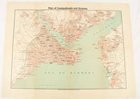
Plan of Constantinople and Environs.
Constantinople.: The Anglo-American Book & Newsagency. 1925. Printed folding colour map 36 x 49.2 cm street grids for Stambul Pera Galata and Skutari railways and landing places marked small fold splits affecting the margins only now repaired with archival material two small holes at central folds pin-holes to the four corner some age-toning but in very good condition. A scarce map of the historic peninsula soon after the Republic of Turkey was founded and the capital moved to Ankara. Printed for the tourist market this map is a rare survival. . The Anglo-American Book & Newsagency. unknown
Riferimento per il libraio : 174961
|
|
|
[Isère, Drôme] lot de 6 cartes d'électeurs signées par 5 préfets différents pour Christophe-François de Beaumont de Verneuil d'Auty (1769-1851).
[Isère, Drôme] lot de 6 cartes d'électeurs signées par 5 préfets différents pour Christophe-François de Beaumont de Verneuil d'Auty (1769-1851).
[Isère, Drôme] lot de 6 cartes d'électeurs signées par 5 préfets différents pour Christophe-François de Beaumont de Verneuil d'Auty (1769-1851). Cartes des élections de 1824, 1826, 1829, 1830, 1834 et 1836. Seule la dernière (la seule pour la Drôme) porte une mention d'imprimeur (Borel à Valence). Cartes d'électeur de Christophe-François de Beaumont, propriétaire à Roybon (Isère) puis à Moras-en-Valloire (Drôme). Elles sont signées par les préfets successif de l'Isère et de la Drôme : Charles Lemercier de Longpré (1778-1854), Jules de Clavières (1762-1849), Antoine Finot (17801844) - 2 cartes -, Charles Pellenc (1790-1872) et Jean François Léon Saladin (1795-1873). Une carte avec déchirures. On joint un bulletin de vote royaliste portant les noms de cinq candidats : Chevenaz, Lavalette, Meffrey, Murinais et Pina. Il s'agit des candidats pour une élection avant 1827 (Chenevaz meurt en 1829 et se présente donc la dernière fois en 1827.). [88-2]
Riferimento per il libraio : 015690

|
|
|
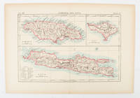
[JAMAICA AND JAVA AND BALI - MAP].
Jamaica and Java and Bali.
London and New York.: Encyclopedia Britannica. circa1900. Map in three insets after W & AK Johnston engravers with printed outline colour 18.9 x 28.9 cm central fold paper age-toned but in very good condition. Interesting map which first appeared in the ninth edition of Encyclopedia Britannica. . [Encyclopedia Britannica] unknown
Riferimento per il libraio : 174875
|
|
|
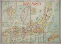
[JAPAN & TAIWAN - MAP] OKISHIO, TAKACHIKA
Map of Japan.
Kobe Japan.: Fuku-In-Kwan. 1906. Printed colour folding map on two conjoined sheets laid down 73.8 x 10⁵ cms foxing on verso not affecting map single pinhole in each corner scant spotting small fold splits no loss a few soft fold creases but in good condition. Very rare striking map of Japan published for the Western market. <br> <br>Created under the direction of Takachika Okishio featuring 10 inset maps: Chishima Kurile Islands Hokushu Hokkaido Ogasawara-Jima Bonin Islands Hachijo-Shima Ioshima Okinawa Saki-Shima Kyushu Saikaido Taiwan Formosa and Eastern Asia. The insets of Taiwan and Kyushu are the largest and centrally positioned. A Glossary and Explanation of Signs is printed at the foot of the map which list Towns Railway Stations Boundaries of Prefectures Notable Places Hot Springs Water-falls rapids Volcanoes Light-Houses Gold Silver and Coal-Oil fields. The Japanese Government Railway series of Travellers' Maps of Japan appear to have been modelled after this design. . Fuku-In-Kwan. unknown
Riferimento per il libraio : 197908
|
|
|
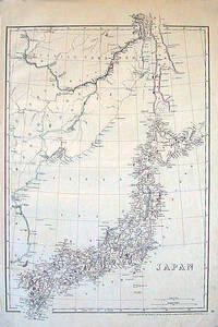
[JAPAN - 1850S MAP]
Japan.
London.: Cassell Petter & Galpin. circa1852. Map with outline handcolour 42.5 x 30.1 cms; 49.2 x 34.3 cms sheet margins a little toned small corner crase but in very good condition. Very detailed map of the Japanese islands with Sakhalin above and the coast of Manchuria and Korea. . Cassell, Petter & Galpin. unknown
Riferimento per il libraio : 185246
|
|
|
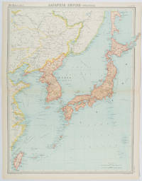
[JAPAN - MEIJI ERA MAP] BATHOLOMEW, JG J G
Japanese Empire - Political.
Edinburgh.: John Bartholomew & Son Ltd. 1922. Large double page map 54.2 x 43 cms map original fold some edge toning and to the fold but in very good condition. Large map prepared as plate 65 for “The Times Survey Atlas of the World” in 1922 and was prepared at the Edinburgh Geographical Institute under the direction of J G Bartholomew. The map shows Japan's territory inclusive of Korea southern Sakhalin and Taiwan. . John Bartholomew & Son Ltd. unknown
Riferimento per il libraio : 215880
|
|
|
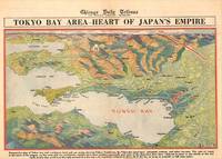
[JAPAN - TOKYO - WORLD WAR II MAP] GFROERER, CURT (ARTIST).
Tokyo Bay Area - Heart of Japan's Empire.
Chicago.: Chicago Daily Tribune. 28 July1945. Colour bird's eye view map 22.4 x 39.3 cms on a newspaper leaf trimmed to a half sheet 29.8 x 41.6 cms including caption slight toning at an old central fold the map in very good condition. <br>Unrelated black and white photographic illustrations on the verso "Pre-flight Trainers used in Chicago to give ground instruction to would-be pilots" and "New rekindled Montauk Light Long Island N.Y." Map published in the Chicago Daily Tribune days before the bombing of Hiroshima on August 61945. <br>"Perspective map of Tokyo bay and contiguous land and sea areas showing Tokyo Yokohama the Yokosuka naval base industrial sections and other features .In this map north is at the right instead of at the top - an expedient adopted to show all of the bay as large as possible in half page space." caption . Chicago Daily Tribune. unknown
Riferimento per il libraio : 209335
|
|
|
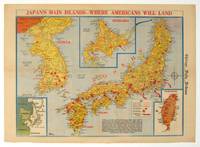
[JAPAN - WWII MAP] GFROERER, CURT (MAPMAKER).
Japan's Main Islands - Where Americans Will Land.
Chicago.: Chicago Daily Tribune. August1945. Printed colour pictorial map on a single newspaper leaf 37 x 52 cms; 43 x 59.5 cms sheet three inset maps archivally laid down on linen very good condition. Full page map published in the "Chicago Daily Tribune" after the bombing of Hiroshima and Nagasaki prior to occupation by US and Allied forces in September 1945. "This is a new map of the main islands of Japan where American occupational troops will land and establish their military rule." map text The legend notes "Places bombed by U.S. Air Forces with a red circle" and "Cities bombed by Atomic Bomb" with a red star. The main map shows the Japanese islands of Honshu Shikoku and Kyushu with the Korean peninsula. Inset maps show Hokkaido Formosa and a general map of the area. . Chicago Daily Tribune. unknown
Riferimento per il libraio : 208877
|
|
|
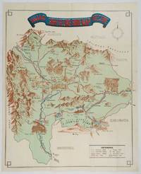
[JAPAN - YAMANASHI - MAP]
Yamanashi Prefecture Sight-Seeing Guide Map.
Kofu.: Onkodo Printing Co. circa1930s. Colour pictorial map 70.2 x 56 cms; 75.5 x 59.5 cms sheet light wear along the inner margin some soft creases from folding short split at center fold; in very good clean condition. An appealing and decorative map of Yamanashi Prefecture which while a process print has the attractive soft look of a lithograph adorned with vignettes of key attractions landmarks such as Mt. Fuji and industry such as silk and wine. The legend lists Railways 'Footing' Roads Hot Springs Hotels and National Parks. A scarce and attractive English language map for the tourist market. . Onkodo Printing Co., unknown
Riferimento per il libraio : 206841
|
|
|
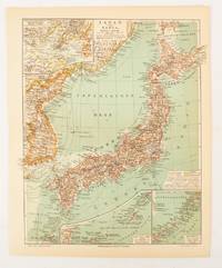
[JAPAN AND KOREA - MAP]. MEYERS, JOSEPH
Japan und Korea.
Leipzig.: Bibliographisches Institut. 1902-1908. Map printed in colour 27.2 x 21.4 cm inset colour key to territorial administration by country inset "western continuation of the main chart" including the Gulf of Tschili and Tsientsin and two insets at the foot of the map to the Kuril and the Ryuku Islands text in Geman central fold slight edge toning but in very good condition. Attractive map text in German prepared for Meyers Großes Konversations-Lexikon. . Bibliographisches Institut unknown
Riferimento per il libraio : 174898
|
|
|
[Japanese Hand-Coloured Wood-Block Printing]; [Maps and Atlases]; [Tokyo Map] Hyoshiya Ichirobe
A WOODBLOCK HAND-COLOURED MAP OF TOKYO; JAPAN EIRI EDO OEZU Illustrated Edo
Edo Tokyo: Hyoshiya Ichirobe Hayashi-shi Yoshinaga First month 1684 But Third month 1680. A large woodcut map of Edo Tokyo with fine handcolouring on joined and folded paper. The map is breathtaking in its detail and features many paintings of important landmarks temples bridges and people who are often pictured working or fishing from boats on the waterways running through Tokyo. A stunning and very rare woodblock map beautifully and unusually handcoloured. Roads blocks buildings open areas canals and waterways are all vividly laid out on this huge and most impressive map. 123.5 by 149.5 cm. folded within paper covers folds to 28 by 18 cm now preserved in a fine clamshell box. A remarkably well preserved and very rare item with some light rubbing due to age and as to be expected. A bit of old worming or light soiling and occasional small repairs but in all quite astonishing in its quality and beautifully preserved with bright and vivid colour and detail. AN EXTRAORDINARY ITEM REMARKABLE FOR BOTH ITS CARTOGRAPHIC DETAIL AND ITS ARTISTIC BEAUTY. The wood block printing shows land tenures of Daimyo and Hatamoto. It also shows temples and shrines includes a distance chart and descriptive listing of Daimyo showing crests and halberds. There is also a inset of the eastern portion of Edo. Hyoshiya Ichirobe (Hayashi-shi Yoshinaga) unknown
Riferimento per il libraio : 24285

|
|
|
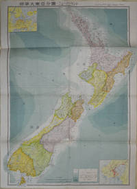
[JAPANESE WORLD WAR II MAP OF NEW ZEALAND].
標準大東亜分図: 17 ニュージーランド編. Hyōjun Dai tōa bunzu: 17 Nyuujiirandohen. Standard Maps of Greater East Asia: 17 New Zealand.
Tokyo: 統制社Tosei-sha. 昭和18 Showa1943. Folding colour map of New Zealand with inset of Auckland and Wellington top and bottom corners1:2000000 scale little light browning. Original envelope worn with closed tears. 54 x 76.5cm. Good copy. Scale plan of New Zealand printed by Tosei in 1943. The map legend shows infrastructure deemed important to the Land Survey Bureau of the General Staff Headquaters of the Imperial Japanese army such as boundaries powerlines quarries and mines; railroads sea-routes etc. . 統制社(Tosei-sha) unknown
Riferimento per il libraio : 154080
|
|
|
[JEU DE CARTES GÉOGRAPHIQUES] PERROT, Aristide Michel (1793-1879)
Analyse géographique sur les départements de la France.
Paris, Bourrut-Le Meri, Rue du Petit lion St Sauveur, [1819?]. Boite d’édition imitant un livre, recouvert de papier maroquiné rouge avec roulette florale dorée en encadrement sur les plats et un dos orné, titre doré au dos, glissière au niveau de la tranche supérieure.
Riferimento per il libraio : 12902
|
|
|
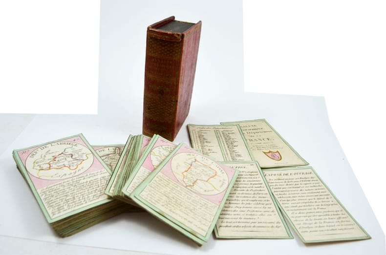
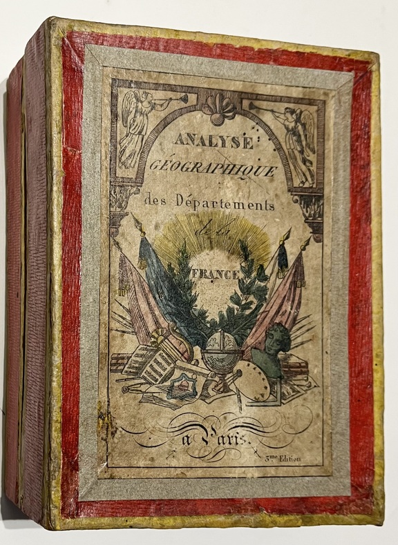
[JEU DE CARTES/ CARDS GAME]
Analyse géographique des départements de la France.
Paris, Bourrut Lemerie, [circa 1836]. 1836 Jeu de 90 cartes (132 x 82 mm). (quelques rousseurs) 1 boite d'origine (160 x 120 mm) en carton recouverte de papier rouge, titre imprimé en couleur sur le couvercle. (défauts d'usage)
Riferimento per il libraio : 5579
|
|
|
[Jeu de cartes]
[Jeu de cartes] Jeu des poètes composé de 80 cartes avec portraits et extraits de leurs oeuvres.
Neuchâtel: Delachaux & Niestlé, [c. 1910] Jeu de carte formé de 20 familles de 4 cartes. Chaque famille est attribuée à un poète. Dans sa boîte d'origine (défr.), cartes en bon état. Dimensions: cartes, 7,5 x 11,5 cm; boîte, 16,5 x 12,5 cm.
Riferimento per il libraio : 13967579
|
|

 Ricevere i risultati per e-mail
 Scaricare i risultati in PDF
 RSS feed
 Link
Link


