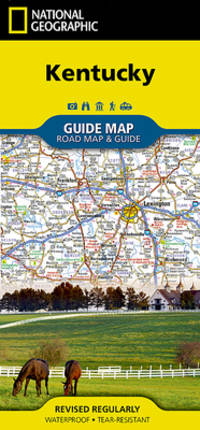
National Geographic Maps / NLGM. POSTER. 2009. :Binding:FoldedVendor: National Geographic MapsSubject:Travel United States South - East South Central AL KY MS TN . National Geographic Maps / NLGM unknown
Thomas Brothers Maps 1988. Paperback. Acceptable. Disclaimer:A readable copy. All pages are intact and the cover is intact. Pages can include considerable notes-in pen or highlighter-but the notes cannot obscure the text. At ThriftBooks our motto is: Read More Spend Less.Dust jacket quality is not guaranteed. Thomas Brothers Maps paperback
Bookseller reference : G0881302864I5N00 ISBN : 0881302864 9780881302868
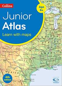
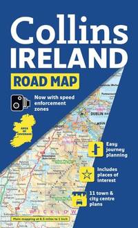
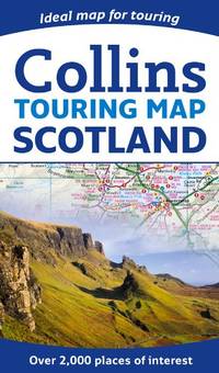
Collins. New Second edition. Paperback. Used; Good. Simply Brit welcome to our online used book store where affordability meets great quality. Dive into a world of captivating reads without breaking the bank. We take pride in offering a wide selection of used books from classics to hidden gems ensuring theres something for every literary palate. All orders are shipped within 24 hours and our lightning fast-delivery within 48 hours coupled with our prompt customer service ensures a smooth journey from ordering to delivery. Discover the joy of reading with us your trusted source for affordable books that do not compromise on quality. 12/04/2014 Collins paperback
Bookseller reference : 3038167 ISBN : 0008101019 9780008101015
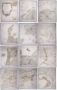
Two large complementary wall maps of the seven Dutch provinces covering 1 the provinces Holland Utrecht Friesland Groningen Overijssel and Gelderland and a part of Brabant bound to the line Steenbergen - Roermond and 2 Zeeland. Both are rare especially the map of Zeeland. They were the first maps of the Netherlands on such a large scale mostly about 1:105000 but with some eastern regions squeezed in at about 1:140000. Fully assembled the map of “Hollande” would measure about 230 x 155 cm and the map of Zeeland about 143 x 175 cm.Originally published in 1748 Le Rouge's 21 plates for the two maps were revised for publication in a second state by Jean Crepy ca. 1770. The map in its present third state was revised and published by Jean A. Dezauche in 1790. On the back of each sheet is an engraved label with the sheet number and the name of the region covered added in manuscript.From the library of Marco-Antonio III 1730-1800 Prince Borghese: on each box is the engraved armorial bookplate of the library of this Borghese Prince. Marc-Antonio's son Camillo Filippo Ludovico 1775-1832 married Napoleon's sister in 1803.Boxes are slightly scuffed. A remarkable copy with a princely provenance.l De Vries 'Een Franse wandkaart van Nederland uit 1748' in: Caert-Thresoor 1 1982 pp. 24-29; cf. BMC Printed maps VIII cols. 967 & 969 1748 edition; not in Donkersloot-de Vrij; Oehme “A French world atlas” in: Imago mundi 25 1971 pp. 55-64 on Le Rouge. unknown
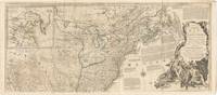
London: Printed for Robert Sayer 1775. Fourth Issue with title omitting the word "French" and date at lower margin changed to 2 July 1775. Large engraved four-sheet map of North America and the Caribbean with hand-colored outline figural title cartouche and two inset maps of California and Baffin & Hudson's Bay; each section measures 55cm x 122cm 21 11/16" x 48". Two vertical folds neatly reinforced on verso one on each half light wear to extremities with some faint scattered foxing several short edge tears and small splits at folds with shallow loss to upper right corner of upper half; margins untrimmed with horizontal portions unjoined; an attractive Very Good example. Stevens & Tree "Comparative Cartography" 49d in Tooley The Mapping of America p.81. Printed for Robert Sayer unknown
paperback. gebraucht sehr gut Originalbroschur Neu Verlagsfrisch. 90x68 cmbeidseitig . Mit Detailkarten von: -Rio San Juan 1:200.000 -Island Ometepe 1:200.000 -Delta RÃo San Juan 1:10.000 -Big and Little Corn Island 1:75.000 -und neu: zusätzlich: Isletas bei Granada 1:75.000 -zahlreiche Aktualisierungen an der Karibik Für Ihre Zufriedenheit versenden wir mit DHL und ausschließlich mit Trackingcode für eine sichere Sendungsverfolgung! Weitere Angebote unter antiquariat-kastanienhof paperback
Thomas Brothers Maps 1997. Spiral-bound. Good. Disclaimer:A copy that has been read but remains in clean condition. All pages are intact and the cover is intact. The spine may show signs of wear. Pages can include limited notes and highlighting and the copy can include previous owner inscriptions. At ThriftBooks our motto is: Read More Spend Less.Dust jacket quality is not guaranteed. Thomas Brothers Maps unknown
Bookseller reference : G0881308765I3N00 ISBN : 0881308765 9780881308761
Thomas Brothers Maps 1998-03-01. Paperback. Like New. Like New Inside and Outside. Clean and crisp pages w/no markings! You will be pleased. Excellent book! Metal spiral. z1s220B Some very minor shelf wear on cover. Fast Shipping Thomas Brothers Maps paperback
Bookseller reference : SKU1027443 ISBN : 0881309206 9780881309201
Nicholson 03/01/2012. Spi Rep. Spiral-bound. Used; Good. WE SHIP WITHIN 24 HRS FROM LONDON UK 98% OF OUR ORDERS ARE RECEIVED WITHIN 7-10 DAYS. We believe you will be completely satisfied with our quick and reliable service. All orders are dispatched as swiftly as possible! Buy with confidence! Greener Books. Nicholson unknown
Bookseller reference : 3535383 ISBN : 0007452594 9780007452590
Collins. New edition. Map. Used; Good. Simply Brit welcome to our online used book store where affordability meets great quality. Dive into a world of captivating reads without breaking the bank. We take pride in offering a wide selection of used books from classics to hidden gems ensuring theres something for every literary palate. All orders are shipped within 24 hours and our lightning fast-delivery within 48 hours coupled with our prompt customer service ensures a smooth journey from ordering to delivery. Discover the joy of reading with us your trusted source for affordable books that do not compromise on quality. 03/04/2010 Collins unknown
Bookseller reference : 1291529 ISBN : 0007320752 9780007320752
Michelin Travel Publications 2006. Paperback. Good. Pages can have notes/highlighting. Spine may show signs of wear. ~ ThriftBooks: Read More Spend Less.Dust jacket quality is not guaranteed. Michelin Travel Publications paperback
Bookseller reference : G2067119222I3N00 ISBN : 2067119222 9782067119222
Wide World of Maps 2014. Spiral-bound. Good. Pages can have notes/highlighting. Spine may show signs of wear. ~ ThriftBooks: Read More Spend Less.Dust jacket quality is not guaranteed. Wide World of Maps unknown
Bookseller reference : G1934839248I3N00 ISBN : 1934839248 9781934839249
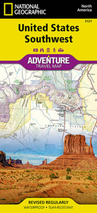
National Geographic Maps / NLGM. POSTER. 2015. 749717105164 :Binding:FoldedVendor: National Geographic MapsSubject:Travel United States General . National Geographic Maps / NLGM unknown
Hema Maps New Zealand Ltd 2014-10-20. Paperback. New. Spiral-bound.New Inside and Outside. Clean and crisp pages w/no markings! You will be pleased. Excellent book! z1s170B Some minor shelf wear on cover. Fast Shipping Hema Maps New Zealand Ltd paperback
Bookseller reference : SKU1022886 ISBN : 1877302929 9781877302923
Thomas Brothers Maps 2000-09-01. Spiral-bound. New. New Inside and Outside. Clean and crisp pages w/no markings! You will be pleased. Excellent book! z1s163C Some very minor shelf wear on cover. Fast Shipping Thomas Brothers Maps unknown
Bookseller reference : SKU1022344 ISBN : 1581742592 9781581742596
London: The Folio Society 2001. hardcover xxvi 317pp. Fine. Tall 8vo. In slipcase; front of slipcase printed in gold. Slipcase with light shelfwear. Else unblemished. Tight bright and clean. Illus. plates maps. Printed on Grosvenor Book Wove paper by St. Edmundsbury Press. Bound in full buckram by Cambridge University Press; blocked in gold design; top edge coloured brown to match buckram. Binding design title-page frieze and ornaments by Frances Button. The Folio Society Hardcover
Collins 04/29/2010. New edition. Spiral-bound. Used; Very Good. WE SHIP WITHIN 24 HRS FROM LONDON UK 98% OF OUR ORDERS ARE RECEIVED WITHIN 7-10 DAYS. We believe you will be completely satisfied with our quick and reliable service. All orders are dispatched as swiftly as possible! Buy with confidence! Greener Books. Collins unknown
Bookseller reference : 2827117 ISBN : 0007317883 9780007317882
Charming trompe-l'oeil of maps of European countries on a decorated background somewhat reminiscent of a church ceiling. It contains a French inscription "to my beloved parents" which together with some inconsistencies in the use of perspective suggest a young French artist. The maps show some interesting departures from reality: in the Netherlands parts of the province of Gelderland are shifted 50 kilometres to the north replacing Zwolle with Arnhem and Sweden lacks Stockholm but includes Copenhagen in place of Malmö. However the most humorous is in the map of Germany which lacks its western neighbours - the Netherlands Belgium Luxemburg and France - giving it an extensive North Sea coast. The gothic lettering is inconsistent in style with the artist apparently improvising an alphabet for each inscription in the process forgetting Denmark.Somewhat soiled and browned at the edges with several white spots due to overpainting; the sheets are coming loose from one another. unknown
 Receive by email
 Download as PDF document
 RSS feed