2 090 résultats
1999New English Original bdg. Atlas folio. (47 x 33 cm). Turkish text with figure captions in Turkish, German and English. 23, 128 p., 205 p. of plts., b/w ills. A very detailed and comprehensive survey of Constantinople's architecture, concentrating mainly on the religious. 150 copies were printed.
2018New Turkish Original bdg. HC. In publisher special box. Atlas folio. In Turkish. 336 p., fully color ills. Tarihte Türkiye haritalari: 2000 yillik harita koleksiyonu. This work begins from the first ages, continues with maps from Islamic geographers, maps with religious motifs, maps from the age of explorations and from the Ottoman Empire, goes until the Arabic letter maps from the early years of the Turkish Republic and ends with the map of Hatay joining the Turkish Republic in 1939. It is an indispensible work that traces the evolution of cartography in these lands. The collection, enriched with maps compiled from the major museums and libraries of England, France, the Netherlands, Russia and the USA, is the largest exhibition of maps of the Turkish lands. THis book is a product of nearly 20 years of work with 265 select maps in large 50 x 70 cm pages. A very heavy volume.
2008New English Original decorated leather bound. 4 compartments at spine. 19 volumes set: (217, [23] p.; 335 p.; 504 p.; 495 p.; 279 p.; 415 p.; 448 p.; 352 p.; 672 p.; 512 p.; 527 p.; 393, [4] p.; 397-794 p.; 272 p.; 240 p.; 224 p.; 224 p.; 396 p.; 376 p.). In Turkish. Color and b/w ills. "Eyüpsultan külliyati. Tarihi, kültürü ve sanatiyla: Vol.1: Eyüpsultan Sempozyumu I. Tebligler. Vol.2: Eyüpsultan Sempozyumu II. Tebligler. Vol.3: Eyüpsultan Sempozyumu III. Tebligler. Vol.4: Eyüpsultan Sempozyumu IV. Tebligler. Vol.5: Eyüpsultan Sempozyumu V. Tebligler. Vol.6: Eyüpsultan Sempozyumu VI. Tebligler. Vol.7: Eyüpsultan Sempozyumu VII. Tebligler. Vol.8: Eyüpsultan Sempozyumu VIII. Tebligler. Vol.9: Eyüpsultan Sempozyumu IX. Tebligler. Vol.10: Eyüpsultan Sempozyumu X. Tebligler. Vol.11: Eyüpsultan Sempozyumu IX seçki. Vol.12: Mehmet Nermi Haskan: Eyüp Sultan tarihi 1. Vol.13: Mehmet Nermi Haskan: Eyüp Sultan tarihi 2. Vol.14: Mehmet Nermi Haskan: Eyüplü meshurlar 1. Vol.15: Mehmet Nermi Haskan: Eyüplü meshurlar 2. Vol.16: Mehmet Nermi Haskan: Eyüplü hattatlar. Vol.17: Mehmet Nermi Haskan: Eyüplü musikisinaslar. Vol.18: Alasonyali Haci Cemal Ögüt: Eyyüb Sultan. Hz. Halid Ebu Eyyüb el-Ensari. Vol.19: Eyüp'ün altin yillari: 1994-2009.". Very heavy volumes as set. Will be sent with original trade box.
1911Very Good Turkish, Ottoman (1500-1928) Original cromolithograph mounted on cloth. Folded. Some foxing and slimming on creases. Oblong double elephant folio. (97 x 107 cm). In Ottoman script. Shows the Bosphorus, Istanbul city with detailed place names. Black Sea at North, Marmara Sea at South and the Princes' Islands seen at southwest area. Mapmaker not described usual like in Turkish military maps. An extremely rare the Bosphorus map with its unusual size. Not in TBBMM library (The Grand Assembly of Turkish Republic Liibrary). Not in Military Libraries in Turkey.
1916Very Good Turkish, Ottoman (1500-1928) Original color map. Folded. Oblong atlas folio. (50 x 60 cm). In Ottoman script. Shows Rhodes and Tilos Islands. Scale: 1/200.000. Hegira: 1332 = Gregorian: 1916. Not description on map-maker. This is one of the series of the Bonn projection maps which are the first map series in modern techniques in Turkey and the Ottoman Empire. This is one of the series of the Bonn projection maps which are the first map series in modern techniques in Turkey and the Ottoman Empire. In order to produce these maps covering Turkish territory, Reconnaissance Branch was incorporated into The Mapping Commission. The maps were produced in the datum based on the latitude and longitude of Ayasofya Mosque in an equal area Bonn Projection. The field works for the 123 sheets covering the country were conducted by 76 staff. The production was completed in 18 years starting from east-west. Fieldworks continued without stopping except in the years 1914 and 1920. This map series called also reconnaissance maps contributed a lot to producing 1:25.000 scale maps. A very detailed and attractive map of Rhodes Island showing its harbors and Ottoman place names.
1922Very Good Turkish, Ottoman (1500-1928) Original color map. 65,5x63 cm. In Ottoman script. This rare and decorative Gallipoli map including Hellespont, Gallipoli Peninsula, Suvla Bay, Seddülbahir, and Tenedos, the places of Gallipoli Aar in 1915 (Dardanelles Campaign) during World War 1, separated two map views. Seddulbahir and Suvla Bay at north and Straight, Peninsula, and its shores with Tenedos (now Bozcaada) at the southwest of the map. It's a very detailed and rare map printed with the series of "History of the Dardanelles Campaign" after the seven years of war. The Gallipoli campaign, also known as the Dardanelles campaign, the Battle of Gallipoli or the Battle of Çanakkale (Turkish: Çanakkale Savasi, or, Muharebâti), was a military campaign in the First World War that took place on the Gallipoli peninsula (Gelibolu in modern Turkey), from 17 February 1915 to 9 January 1916. The Entente powers, Britain (with Anzacs), France, and Russia, sought to weaken the Ottoman Empire, one of the Central Powers, by taking control of the Turkish straits.
1854réf. yd1551J. Noël et Fourmage, éditeurs Carte 1854 Carte ancienne (env. 87 x 63 cm dépliée), de l'Empire Ottoman, théâtre de la guerre en Europe et en Asie, dressée par Hérisson, comprenant un plan de Constantinople, de Chouma et ses environs, de Varna et de Silistrie, ainsi que de magnifiques ornements aquarellés (drapeaux), 2e édition, 1854 ; un petit défaut dans la marge gauche, par ailleurs très bel exemplaire. Livraison a domicile (La Poste) ou en Mondial Relay sur simple demande.
1732réf. PHO-1798Paris, Veuve Delormel et René Josse, 1732. In-12, plein veau, dos orné, pièce de titre rouge, tranches rouges (Reliure de l'époque). Ex-libris et ex-dono manuscrits anciens au titre, frottements et épidermures, coiffe sup. accidentée, 1 coin usé, manque le plan de Troie.
réf. 183362Berlin, G. Reimer, 1824-1825 2 tomes en un vol. in-4 carré, [4]-581 pp. en pagination continue, texte [grec seulement] sur deux colonnes, index, demi-veau prune, dos lisse orné de guirlandes en long et filets dorés, ainsi que de fleurons à froid, tranches marbrées (reliure de l'époque). Dos passé, rousseurs abondantes.
1948Very Good Arabic Original chromo-lithograph map in brown tones. On a special paper with an ongoing blindstamped "Regestre Robur" during the borders. Folded. 70x100 cm. In Arabic. Scale: 1 /1.000.000. Chipped on margins, split on folded traces. Slight discoloration and one stain on lower margin. Otherwise a good copy. An attractive and detailed map of Syria shows the capital (as Aleppo n that map), other cities like Damascus, Raqqa, Homs, Latakia, Ayn al-Arab, Idlib, Hama, Deir Ez-Zor, Jarabulus, et alli. And it shows Turkey on the north (as Turkey containing Hatay and Alexandrette), The Mediterranean shores of the land as well as Lebanon and Palestine (and Jerusalem) on the west, Sharq al-Urdun (Jordan) and Iraq on the south and east. It's very detailed on showing the roads spread throughout the land like railways and ancient roads from the Roman period. Additionally this roads can be followed to the other Arabic countries and regions on the map. This map was calligraphed by Kamel Al-Baba, (1905-1991), who was a Lebanese contemporary / modern calligrapher. He is the son of famous calligrapher Mokhtar Al-Baba. Cannot be found in WorldCat.; Not in Library of Congress Map Collection. Very scarce.
2012New New English In original bdg. In publisher's special slip-case. 13 volumes set: 366, 26 p.; 444, 28 p.; 556, 32 p.; 438, 18 p.; 567, 20 p.; 512, 20 p.; 552, 8 p.; 400 p.; 517, 26 p.; 367, 34 p.; 541, 34 p.; 521 p.; 893 p. Volume 12: Index in Armenian; Volume 13: Index in Turkish. With 13 CDs. Reprint edition. In Armenian. 500 copies were printed. Private yearbooks apart from state yearbooks are very important sources in order to understand the daily life of Armenian people of that time. In this respect, Surp Prgitch Armenian Hospital Yearbooks [1900-1910] are one of the primary sources which were just published before the Teotig [Teotig Laptchindjian] yearbooks [1907] and they are important sources in order to understand the social, academic, civil and religious life of that time.
1918Very Good Turkish, Ottoman (1500-1928) Original pictorial wrappers. Demy 8vo. (22 x 15 cm). In Ottoman script (Old Turkish with Arabic letters). 59 p., 23 unnumbered b/w plates. Occasionally fading on pages. Otherwise a very good copy. First edition of this extremely rare first science fiction book discusses the biological probability of the possibility of life on planets in the Solar System, with semi-fictional texts, in the light of scientific knowledge at the time of publication. Osman Nuri Eralp was a Turkish veterinarian and microbiologist. Eralp was born in Istanbul in the Ottoman Empire. He completed his university education at "Mekteb-i Tibbiye-i Mülkiye" which was the medical school of Darülfünun [i.e. House of Multiple Sciences, name of Istanbul University in Ottoman era]. To continue studying for a post-graduate qualification, he attended Sorbonne and Pasteur Institute. After graduation, he worked as a veterinarian while continuing his research studies. After the declaration of the Constitutional Regime in 1908, he worked as a full-time academic at Istanbul University and Ankara University. He lectured on histology and embryology. Eralp contributed notably to the field of bacteriology via his research on microorganisms (tuberculosis, anthrax, cholera, syphilis, gonorrhea), and the field of virology by his research on rinderpest. He wrote the first science fiction book in Turkey titled "Baska dünyalarda canli mahlûkât var midir" [i.e. Are there alive creatures in other worlds?]. (Wikipedia). Özege 1712.; TBTK 10040.; Not located in OCLC.
1989Fine Fine English Original bdg. Dust wrapper. Folio. (34 x 25 cm). In Turkish. 1168 p., color and b/w ills. A comprehensive study on the Princes' Islands throughout the history.
1958Fine Turkish Contemporary homogene black clothes. 4to. (27 x 19 cm). 5 volumes, 70 fascicles: (2884 p.), many color and b/w plates and ills. Istanbul ansiklopedisi. Vol. 1-5. [First 5 volumes of 11].
1792réf. 0044701792 Paris, Lavillette, 1792. Deux volumes in-8 (132 X 204 mm) basane fauve marbrée, dos lisse orné d'une roulette et filets dorés en place des nerfs, compartiments ornés de fers dorés, guirlande dorée en queue, pièces de titre et de tomaison maroquin rouge (reliure de l'époque). Tome I : (1) f. blanc, XVI-237 pages, (1) f. blanc - Tome II : (1) f. blanc, (2) ff. de faux-titre et titre, 256 pages, (1) f. blanc. Coiffe supérieure des deux tomes restaurée, important cerne de mouillure dans la marge latérale des huit premiers feuillets du tome I, plus discret des pages 33 à 85, puis pages 113 à 131, enfin taches brunes éparses des pages 225 à la fin de ce premier tome, taches sombres au dos du premier tome.
1815réf. PHO-637Paris, H. Nicolle, 1815. 3 volumes in-8 (205x130mm), plein veau raciné,dos misse orné avec titre et tomaison en maroquin,tranches marbrées ,un plat détaché , manque aux dos , coins usés, reliure d époque ,438pp.-462pp.-476pp.
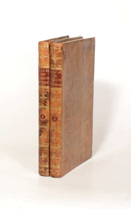
réf. 057854Paris Chez Denné jeune, Libraire An VIII 1797 in 8 (22,5x14,5) 2 volumes reliures demi foncée de l'époque, dos lisses orné de guirlandes dorés, non rognés. Tome 1: VIII et 371 pages, avec une vue gravée dépliante en frontispice (La pointe du Sérail vue du palais de l'ambassadeur à Pera). Tome 2: 292 pages, avec une vue gravée dépliante en frontispice (Vue de la plaine de Troyes), et une carte gravée dépliante (Esquisse de la plaine de Troyes). James Dallaway, 1763-1834, historien et topographe britannique. Bel exemplaire
1651réf. 21700London: Robert Daniel 1651. First edition. leather_bound. Contemporary Cambridge style full brown calf lacking spine label. Very good. 393 pages plus 5 leaves: Index Rerum & Verborum & Index Scripturarum. 32 x 21 cm. Translated and edited by Richard Montague. Parallel text in Latin and Greek. He is recognized in the Eastern Orthodox Church as St. Photios the Great viewed as the most important intellectual of his time - "the leading light of the ninth-century renaissance" and a central figure in both the conversion of the Slavs to Christianity. Considered by some scholars as only one of many Byzantine scholars of Armenian descent. Text generally clean and fresh. Armorial bookplate hinges cracked but firm woodcut device on title leaf Ddd browned minor marginal worming not affecting text errata. Lacks first blank free endpaper. BRUNET Vol. IV p.623. WING P2136. Robert Daniel unknown
1651réf. 21700London: Robert Daniel 1651. First edition. leather_bound. Contemporary Cambridge style full brown calf lacking spine label. Very good. 393 pages plus 5 leaves: Index Rerum & Verborum & Index Scripturarum. 32 x 21 cm. Translated and edited by Richard Montague. Parallel text in Latin and Greek. He is recognized in the Eastern Orthodox Church as St. Photios the Great viewed as the most important intellectual of his time - "the leading light of the ninth-century renaissance" and a central figure in both the conversion of the Slavs to Christianity. Considered by some scholars as only one of many Byzantine scholars of Armenian descent. Text generally clean and fresh. Armorial bookplate hinges cracked but firm woodcut device on title leaf Ddd browned minor marginal worming not affecting text errata. Lacks first blank free endpaper. BRUNET Vol. IV p.623. WING P2136. Robert Daniel unknown books
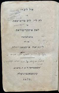
1873réf. 43536Konstantinoplah Constantinople: A. H. Boyagian Boyag'yan 1873. 8vo Original boards 2 volumes bound together 560 630 pages. 22 cm. 23 cm. In Ladino Only. Title translates as "The Book of the Law the Prophets and the Writings Translated into Ladino/Spanish." Ya'ari Reshimat Sifre Ladino no. 3. The publisher also issued a more common parallel Hebrew and Ladino bible the same year; this edition however is the scarcer Ladino only edition. "The translation of the Pentateuch in Hebrew vocalized square characters Constantinople 1547 was the first larger work which the Sephardic Jews of Turkey published in the language 'which the old Jews use. ' Twenty years later the entire Bible was published in several parts the third of which included the Later Prophets. This translation which agreed almost entirely with the one that appeared at Ferrara in Latin letters in 1553 was followed by another in four parts Constantinople 1739-45 in Ladino 'entero bien Ladinado'; seventy years later Israel b. Hayyim of Belgrade issued a translation Vienna 1813-16; the Constantinople edition was reprinted at Smyrna in 1838 et seq and again at Constantinople in 1873 all of these being in Rashi characters." EJ The Ladino Bible was later used by modern scholars and writers such as Holocaust survivor and poet Moshe Ha-Elion as a linguistic reference point to study authentic traditional Salonican and Turkish Ladino vocabulary. "All in all between 1493 and 1940 approximately 260 books and thirty periodicals were printed in Ladino in Istanbul most of them printed after 1730 out of a total of 758 publications in Hebrew type. As we have noted early Ladino publications focused on religion: Biblical commentary and texts religious law ethics and prayer books. These topics continued in the nineteenth century but the majority of publications in the later period were belles lettres history and biography sciences and communal and state laws and regulations. Of special social and cultural importance since the second half of the nineteenth century were Ladino periodicals which also served as publishers of books in Ladino. Having initially aimed to "Judaize" the Jews the objective of Ladino publishing in the later period was to modernize and entertain them while at the same time attempting to spread Judaic knowledge." Rachel Simon The Contribution of Hebrew Printing Houses and Printers in Istanbul to Ladino Culture and Scholarship SUBJECTS: Ladino literature. OCLC:79281753 & 976898012. OCLC locates only 4 sets of this rare Ladino-only edition only 2 in North America Harvard & UToronto. Well bound with some edgewear. Some markings and an inscription on the title page. Good Condition. Rare and important PSB-1-29-CC-'. Konstantinoplah [Constantinople]: A. H. Boyagian [Boyag'yan] unknown
1894Very Good Turkish, Ottoman (1500-1928) Original color map. Folded. Oblong folio. (35 x 52 cm). In Ottoman script. Color lithograph. It shows Sudan and West Africa, Atlas Ocean shores, Sahra Desert, and other parts of Africa. Scale: 1:15.000.000. A very detailed and attractive map. Slightly fading. Otherwise a very good copy. Dated Hegira: 1310 = [Gregorian 1894]. [EARLY OTTOMAN MAP of SUDAN] Sudan. Sâye-i Türkiye Hazret Gazi Sultan Abdülhamid Hân-i Sâni'de Maarif Umûmiye Nezâret-i Celîlesi ruhsatiyle meshur Haset tarafindan Fransa Cemiyet-i Cografya âzâlarindan mütesekkil komisyona mahsûs tanzîm edilmis oldugu son defaki atlasinin tercümesi olarak bu def'a Erkân-i Umûmiyye Dairesi Besinci Fen Subesi'ne me'mûr piyade mirlivâlarindan saâdetlü Ali Seref Pasa ve rifatlubinbasi fütûvvetlü Muhyiddin Efendi maarifetleriyle tertib ettirilmistir. Ali Seref Pasa or Hafix Ali Esref. He was a soldier, who was schooled in Paris as a cartographer around 1862. Already in Paris he published his first atlas with 22 maps, called 'Yeni atlas'. Upon his return to Istanbul he became a chief cartographer at the Maatbaa-i amire Printing Press in Beyazit, which was the successor of the Muteferrika press from 1727. Among others he translated the large Kiepert map of Anatolia to Ottoman. He died in 1907, leaving his large project of a gigantic map of Anatolia in 100 sheets unfinished. Ali's name is often misunderstood or even listed as two different people: Ali Seref Pasa and Hafiz Ali Esref. Until the surname law adopted on June 21, 1934, Turks did not have surnames. They were born with one first name and were until the adulthood described only as sons or daughters of their parent's names. Later they were given titles such as Effendi (Sir), Bey (Chief) or Hanim (Madam) for higher classes, or they were given names according to their work or class. The names were not inherited by children until 1934, when the surname law was enforced. The map maker Ali received names Seref, the honourable, and Pasa, the dignitary. He was also known as Hafiz, the memorizer of Qur'an and Esref, Proud. So Ali Seref Pasa would have a meaning 'Honourable Dignitary Ali, and Hafiz Ali Esref, Memorizer of Qur'an, Proud Ali. Daruttibaa - Matbaa-I Amire Printing Press: The first press in the Muslim world, called Daruttibaa, was founded in Istanbul by Ibrahim Muteferrika in 1727, with a permission of Sultan Ahmeet III. It was located in Muteferrika's house. The first book was published in 1729 and until 1742 sixteen other works followed. After Muteferrika's death, the press was supressed for printing, as printed books were considered dangerous. In 1796 the press was purchased by the government and moved to Uskudar in Istanbul, and in 1831 finally to Beyazit, where it was renamed to Matbaa-i Amire in 1866. The press was closed in 1901 and was reopened in 1908 under the name 'Âmire' In 1927 the name changed to State Printing House. The press still exists and is known for publishing school and educational books. Extremely rare. Not in OCLC.; Not in TBMM Map Collection.
1915Very Good Turkish, Ottoman (1500-1928) Modern cloth bdg. Small 4to. (26 x 19 cm). In Ottoman script (Old Turkish with Arabic letters). 24 p. First edition of this epic and historically important account, describing the siege and fall of the Byzantine Empire and Constantinople by Ottoman Sultan Mehmet II in 1453. This is one of the finest literary examples of sixteenth-century Ottoman prose. "This description of the conquest of Istanbul in 1453 is mentioned only by Ismail Pasha in his "Hediyyetü'l Arifîn". The text, which was published as a supplement to TOEM (parts 20 and 21, Istanbul 1331) is said to be taken from a manuscript owned by Halis Efendi. The introduction to Ca'fer Çelebi's life was also written by Halis Efendi. The work is written in a very elegant style, with ayets, hadith, and beyts in Arabic, Persian, and Turkish scattered throughout the text and may be considered one of the finest examples of sixteenth-century Ottoman prose writing. [.] Ca'fer's work is in some aspects a reliable source for the conquest of Istanbul. The preparation for the siege is given in this work. The council of war which was held before the siege and in particular Mehmed II's speech to the council is very detailed and the chain placed across the entrance to the Golden Horn and its history is very well described in this work as well. During the siege, the Byzantines received help from the outside. Ca'fer is specific about this and states that "four huge vessels full of provisions, soldiers and ammunition came to help of the Byzantines". After the last attack, Constantinople fell into the hands of the Ottoman army. The date given for this is 857 Cem. I. 20 Seshenbe in Ca'fer's work. The plundering and looting which occurred during the first three days of the conquest are vividly described by Ca'fer Çelebi, but the withdrawal of Justinian and his men which preceded the conquest and the death of the Byzantine Emperor during the capture of the city are omitted in this work. Ca'fer's closing lines are devoted to the conversion of St. Sophia (Ayasofya) into a mosque by Mehmed II. Ca'fer Çelebi used eyewitness accounts as well as written works. It is certain that he did not rely exclusively on any source which is not extant, for the departs from Ruhi, Enverî, Tursun Beg, Neshrî, and Asikpasha-zâde either by adding new information or giving a conflicting account." (Erünsal). Özege 11953; TBTK 7066.
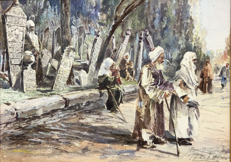
1910réf. 1605131910. Signiert "Paoletti" wohl datiert und bezeichnet "Constantinople / (1)910". Auf Aquarellpapier, fest auf Pappe aufgezogen und unter Passepartout montiert. 19,7 x 27,8 cm.
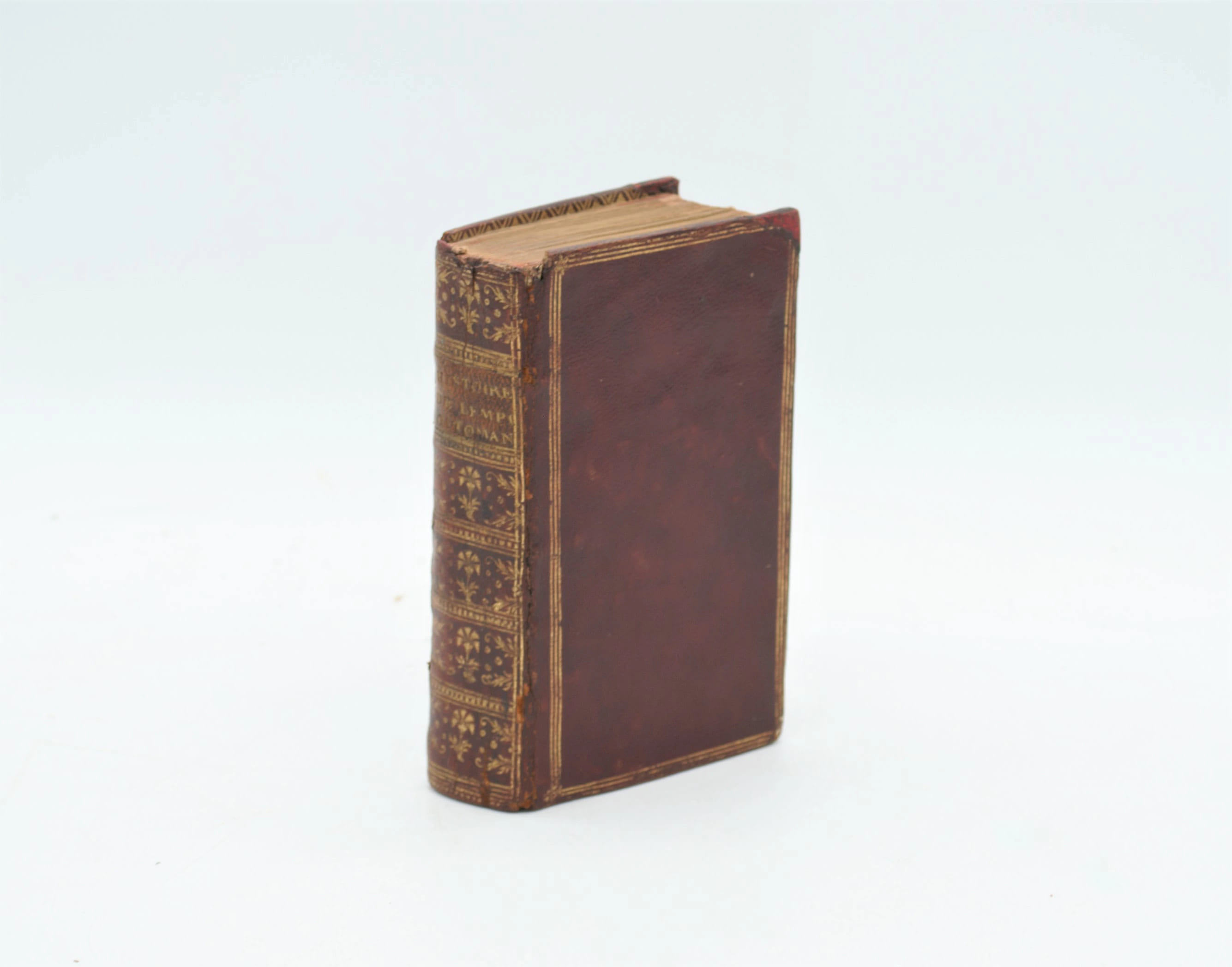
1714réf. PHO-2652Amsterdam, chez David Mortier, 1714, in-12 (130x80mm) ,498pp-6ff.n.c., relié plein maroquin rouge époque, triples filets sur les plats, dos richement orné avec titre, frise intérieure, tranches dorées, coiffe sup. absente, réparation aux coins, titre en rouge et noir, illustré d’un frontispice et de 17 planches dont 14 dépliantes (4 avec manque) certaines avec réparations, quelques brunissures.
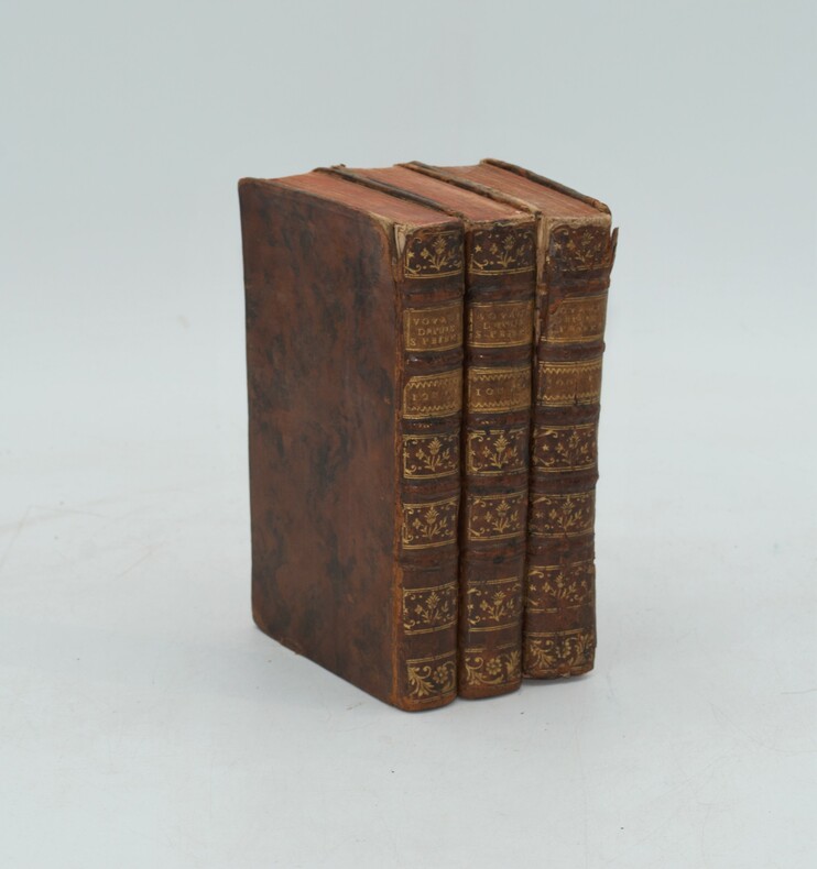
1766réf. PHO-1265Paris, Robin, 1766. 3 volumes in-12, veau marbré, dos là nerfs orné (Reliure de l'époque) avec pièce de titre et tomaison , tranches rouges , ex-libris sur le contre-plat , défauts de reliure , coins et coiffes usés , début de fentes aux charnières , etc.