M. SINAN GENIM.MareMagnum
WALSH, ROBERTLivre Rare Book
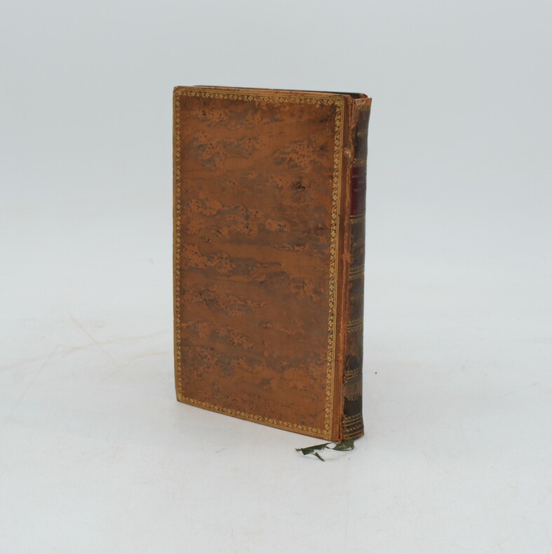
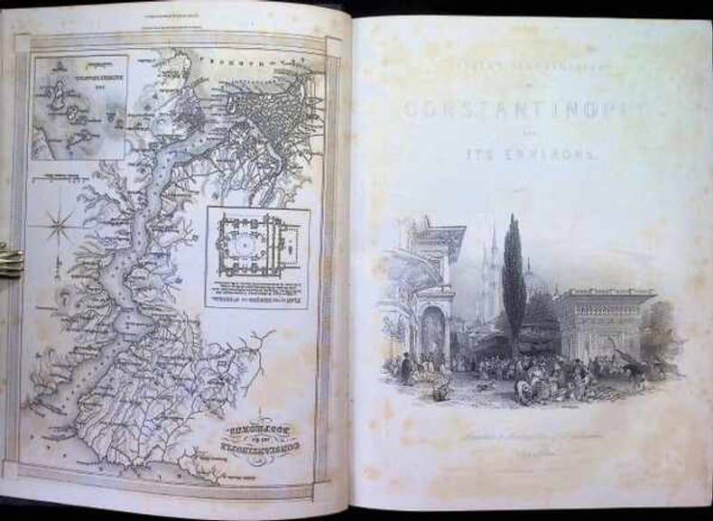
Fisher s illustrations of Constantinople and its Environs
1838réf. 0172621838 Peter and Jackson Hardcover
Antiquariaat Tanchelmus b.v · Berchem, Belgique749,00 €
2 090 résultats
2006Fine English Original cloth binding. Oblong folio. (70 x 48 cm). 419 p.; 448 p. B/w photos. 500 copies were printed. From Konstantiniyye to Istanbul Photographs of the Rumeli Shore of the Bosphorus from the mid-19th to the 20th Century is comprised of the works by photography masters who practiced their art in Istanbul from the end of the 19th to the early years of the 20th century. This is a unique selection from The Suna and ¿nan K¿raç Collection of Old Istanbul photographs reveal the magnificent structures, the daily life and the intriguing personalities of an Istanbul of the past.
1838réf. 0172621838 Peter and Jackson Hardcover
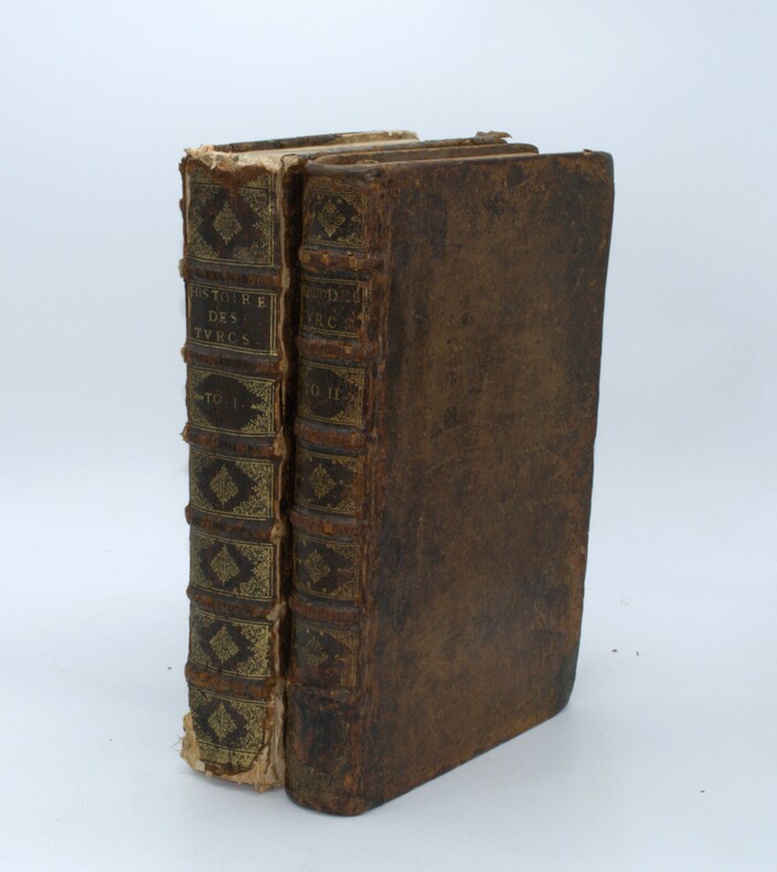
1632réf. PHO-757Paris, chez Claude Cramoisy rue Sainct Jacques au Sacrifice d'Abel,1632. 4 parties en un vol. in-folio (sur 2), veau brun, dos à nerfs orné (reliure de l'époque). Reliure usagée, manques de cuir au dos, coins émoussés, frottés et épidermures. Seconde continuation de l'histoire des Turcs depuis l'an M.DC.XII jusques à présent. Par le Sieur de SAINCT LAZARE, historiographe. 1632. [2] ff., pp. 909-1015, [1] p. (Action de graces), [32] pp. (tables). 3 portraits (Osman Ier, Mustapha II, Amurath IV gravé sur cuivre à pleine page. Illustrations de Blaise de VIGENÈRE Bourbonnois, sur l'Histoire de Chalcondile Athénien, de la décadence de l'Empire Grec, & establissement de celuy des Turcs. 289 col. et [3] pp. (table). 2 portraits (Empereur et Patriarche) gravés à pleine page. Le Triomphe et Victoire de la Croix, contre les erreurs de Mahomet. Discours auquel les impertinences de l'Alcoran sont démonstrées, & que le signe de nostre Redemption regne encore triomphant sur le trosne de ses ennemis. [et] Observations et remarques plus notables de la providence de Dieu ; en l'accroissement de la domination des Princes Othomans, et décadence de l'Empire Grec, & autres seigneuries qu'ils possèdent à présent. Sur l'Histoire des Turcs de Laonic Chalcondile, Athénien. Par Artus THOMAS, sieur d'Embry, Parisien. 4 pp. puis col. 5-128, [2] pp. table. Plusieurs descriptions des Accoustrements tant des magistrats et officiers de la Porte de l'Empereur des Turcs, que des peuples assujectis à son Empire. Avec les figures representant le tout au naturel, tirees des Medailles antiques & descriptions de ceux qui ont frequenté parmy ces nations, ou des bons Autheurs qui en ont escrit. 54 ff. (sur 65), dont 1 feuillet titre intermédiaire, 1 page avis au lecteur et 52 (sur 62) planches de costumes gravées à pleine page (avec leur page explicative en regard). Les planches, représentant des costumes d’hommes et de femmes, ont été gravées en taille douce d'après les dessins d'après nature de Nicolas NICOLAY, gravés sur bois la première fois par Louis Danet pour l'édition des "Quatre premiers livres des navigations et périgrinations orientales" de 1567. Manque les ff. 2, 4, 7, 10, 14, 17, 22, 25, 31, 45, 63. Déch. avec manque pl. 52. Quelques ff. désolidarisés. Tableaux Prophétiques des Empereurs Severe et Leon, avec leurs epigrammes predisans la ruine de la Monarchie des Turcs. Ausquels on a adjousté l'exposition d'iceux, tirée tant de ce qui a esté cy-devant iprimé, que de plusieurs manuscrits ; avec une notable Prophetie qui se retrouve en langue Arabesque, & quelques autres à ce propos. Par Artus Thomas, sieur d'Embry Parisien. pp.65-112 pp. Manque les pp. 113-114, les 3 dernières pp. de table et la planche dépliante. 17 figures gravées à pleine page avec leur explication sur la page en regard. Mouillures et rousseurs, galeries de ver en marge int. des premiers et derniers feuillets, déchirures marginales atteignant parfois le texte ou la gravure, et plus étendues sur qqs ff., restauration de papier pp. 103-104 de la dernière partie.P2-8B
2016New Turkish Original bdg. HC. 4to. (30 x 25 cm). In Turkish. 10 volumes set: (5320 p.), many color and b/w plates. Büyük Istanbul tarihi ansiklopedisi: Antik çagdan XXI. yüzyila. 10 volumes set. Edited by Coskun Yilmaz. Encyclopaedia of the history of Istanbul. 35 kg. An oversize and very heavy set. Extra shipping fee will be requested. Set will be sent with two separate its huge original commercial boxes.
1895Very Good Turkish, Ottoman (1500-1928) Original color map. Folded. Oblong folio. (35 x 52 cm). In Ottoman script. Color lithograph. A very detailed and attractive Ottoman map of America. Scale: 1:12.000.000. Otherwise a very good copy. Slightly chipped extremities. Dated Hegira: 1311 = [Gregorian 1895]. Ali Seref Pasa or Hafiz Ali Esref. He was a soldier, who was schooled in Paris as a cartographer around 1862. Already in Paris he published his first atlas with 22 maps, called 'Yeni atlas'. Upon his return to Istanbul he became a chief cartographer at the Maatbaa-i amire Printing Press in Beyazit, which was the successor of the Muteferrika press from 1727. Among others he translated the large Kiepert map of Anatolia to Ottoman. He died in 1907, leaving his large project of a gigantic map of Anatolia in 100 sheets unfinished. Ali's name is often misunderstood or even listed as two different people: Ali Seref Pasa and Hafiz Ali Esref. Until the surname law adopted on June 21, 1934, Turks did not have surnames. They were born with one first name and were until the adulthood described only as sons or daughters of their parent's names. Later they were given titles such as Effendi (Sir), Bey (Chief) or Hanim (Madam) for higher classes, or they were given names according to their work or class. The names were not inherited by children until 1934, when the surname law was enforced. The map maker Ali received names Seref, the honourable, and Pasa, the dignitary. He was also known as Hafiz, the memorizer of Qur'an and Esref, Proud. So Ali Seref Pasa would have a meaning 'Honourable Dignitary Ali, and Hafiz Ali Esref, Memorizer of Qur'an, Proud Ali. Daruttibaa - Matbaa-I Amire Printing Press: The first press in the Muslim world, called Daruttibaa, was founded in Istanbul by Ibrahim Muteferrika in 1727, with a permission of Sultan Ahmeet III. It was located in Muteferrika's house. The first book was published in 1729 and until 1742 sixteen other works followed. After Muteferrika's death, the press was supressed for printing, as printed books were considered dangerous. In 1796 the press was purchased by the government and moved to Uskudar in Istanbul, and in 1831 finally to Beyazit, where it was renamed to Matbaa-i Amire in 1866. The press was closed in 1901 and was reopened in 1908 under the name 'Âmire' In 1927 the name changed to State Printing House. The press still exists and is known for publishing school and educational books. Extremely rare. Not in OCLC.; Not in TBMM Map Collection.
2001New English Original bdg. HC. In publisher's box. Folio. (41 x 34 cm). In English. 365 p., 187 color photographic plts. Sculptured for eternity. Treasures of Hellenistic, Roman and Byzantine art from Istanbul Archaeological Museum. Photos by Ahmet Ertug. "The Istanbul Archaeological Museum is home to some of the world's most important collections of archaeological artifacts. The text of this splendid book, whose subject is the museum's rich collections of Hellenistic, Roman, and Byzantine sculpture, was prepared by Dr. R. R. R. Smith, a professor of archaeology at Oxford University. All the works were photographed by Ahmet Ertug, whose images of such masterpieces as the Alexander, Sidamara, and Lycian sarcophagi are presented as stunning panoramic views. The photographs in this book together with facsimile reproductions of the original sculptures were exhibited in the Tuileries Gardens of the Louvre Museum in Paris in August and September 2002, an artistic event that was attended by about 50 thousand people in the course of just two months' time. 34 by 41 cms., hardbound covered with Japanese cloth, presented in a special case.". A very heavy volume. Extra shipping fee will be requested.
1913réf. 055948Rodosto & Constantinopoli: Manuscript & Typescript 3-9 October 1913. 1913. No Binding. Very Good. 8vo - over 7¾ - 9¾" tall. A one-page typed letter with autograph marginal notes and a two-page manuscript report in black ink. Both are written on bifolia papers with "Renage's Mill" watermark One is "Banknote Paper" the other is "Extra Strong". "Agenzia Consolare d'Italia Rodosto" & "Consolato Generale d'Italia in Constantinopoli" letterheads. 27x21 cm. The letter is in Italian report is in French. 1 p.; 2 p. Signed. Except for the horizontal centre-fold in very clean condition. A letter written by the Italian Consul General in Constantinople to the Italian chargé d'affaires accompanied by a historically significant report from the Consular Agent in Rodosto provides valuable first-hand information about the outbreak of epidemic diseases such as cholera and typhus among humans and anthrax and bubonic plague among animals in the Ottoman Empire in 1913. It also sheds light on the authorities' failure to address these public health crises while offering significant insights into the Muslim immigrants arriving in convoys to the region during the ongoing Balkan Wars. This is an invaluable firsthand account of the Sixth Cholera Pandemic in the Ottoman Empire "a time when the Empire's foundations were shaken by the Balkan War military defeats territorial losses the plight of refugees and immigrants and the dreadful calamity of the cholera epidemic between 1911 and 1913 during which no reliable official records exist regarding the exact number of cholera cases and deaths". Unat. The manuscript report opens by stating the number of direct death cases as rendered in the translation: "I believe it is my duty to inform you that on the 27th a case of cholera followed by death was reported in the town. The day before yesterday there were four other cases two of them fatal; yesterday four new ones two of which were fatal; today another case. So out of ten cases there have been five deaths." The letter goes on: "The other municipality requested a credit of 1000 piastres from Constantinople to take the measures required by the circumstances. Unfortunately no reply has been given and our local officials do not know to which authority they should turn." "Cholera is present in Kirklareli Quarante Églises Baba-Eski Babaeski à Vise Vize à Bounar-Hissar Pinarhisar à Luli Bourgaz Lüleburgaz à Ouzun Keupiru Uzunköprü and aound Krichan Kirikhan. In Tchorlou Çorlu typhus is wreaking havoc and smallpox is present here. Our entire region is devastated by an epizootic outbreak: smallpox and foot-and-mouth disease among the sheep anthrax and bubonic plague among the oxen and buffaloes. Money and serum have been requested from the Ministry of Agriculture but there has been no response. The chief veterinarian I spoke with assured me that it would be impossible to do anything until he has serum to treat the livestock and that if the epidemic disease continues to spread like this the livestock will be completely wiped out in our region." The Royal Consular Agent states that during and after the war between the Turks and Bulgarians also known as the Battle of Kirkkilise which was part of the Balkan Wars Muslim immigrants who continually flocked to Kirklareli and the surrounding areas brought cholera and other epidemic diseases to the region. "Regularly there are convoys of migrants who had left their villages in the surrounding areas of Adrianople Quarante Églises Lüleburgaz etc. before the Turco-Bulgarian War arriving from Anatolia by steamships. They are the ones who brought us cholera and the epidemic disease." He ended his manuscript report by stating there is no way to convince the authorities to have them disembark elsewhere outside the city or to prevent the arrival of these immigrants who are being directed utilizing forced requisitions to areas where cholera is spreading. This report was presented to the Italian chargé d'affaires with this letter additionally as below: "Healt Manuscript & Typescript, 3-9 October 1913. unknown
réf. 110751L'Edition d'Art H. Piazza et Cie, 1904, 1 volume in-8 de 230x170 mm environ, 261 pages, reliure signée S. de Lancker plein chagrin aubergine, dos à 5 nerfs portant titres dorés, tranche de tête dorée, gardes ornées de motifs dorés, sous étui recouvert du même papier que les gardes avec ouverture en cuir assorti et intérieur en suédine bleu clair, feuillets non rognés, couvertures et dos illustrés conservés. Exemplaire numéroté N° 185, un des 260 exemplaires sur papier vélin à la cuve, de Blanchet frères et Kléber, numérotés de 41 à 300, avec 1 dessin original non retenu pour le livre, et 63 compositions aquarellées, certains rehaussées à l'or, ainsi que quelques ornements décoratifs, par Manuel ORAZI. Dos et ouverture de l'étui insolés avec des frottements sur les mors et les coiffes et sur l'étui.
1927Very Good Turkish, Ottoman (1500-1928) Original bdg. Large roy. 8vo. (24 x 20 cm). In Ottoman script. (Old Turkish with Arabic letters). 16 p., 15 chromo-lithographed maps. Some markings on the two maps. Otherwise a very good copy. First edition of this scarce atlas for Turkish primary schools drawn and published by Turkish geographical educators and cartographers in the early Republican period of Turkey. This fine atlas was printed in London, in a period after the proclamation of the Republic, before the Letter Revolution in 1928. Duran studied in Istanbul and Paris. He worked as a geography teacher in various high schools then he became a lecturer and a manager at Ankara Gazi Education Institute for a while. He was known for his writings on various topics and especially for his works on geography. Born in the imperial period, Duran signed the first cartographic studies of the Republic of Turkey with the transition to the Republican administration. Özege 8764.
1833réf. PHO-614Paris, Firmin Didot frères, 1833. In-8, VII-365pp. Relié plein veau marron époque,liseré fleuri sur les plats, dos orné avec pièce de titre et auteur en maroquin dos orné , plat détaché, cachet de bibliothèque.
1789réf. 0033301789 Paris, Durand, Père & Fils, 1789. In-8 (129 X 205 mm) demi-veau fauve marbré à petits coins de vélin ivoire, dos lisse orné d'un double filet doré en place des nerfs, caissons dorés, titre doré, tranches mouchetées en rouge (reliure de l'époque) ; faux-titre, titre, carte dépliante, 306 pages, (1) f. de privilège, 6 planches dépliantes.
1678réf. 17181678 Chez Johannes van Someren, Amsterdam, 1678. In-24, plein veau glacé (postérieur), reliure signée Abich en pied, Chiffre doré sur les plats. (4), 271, (3) pages. Titre gravé. Gravure sur bois in-texte en caractères arabiques (La Illahé Illa Alla, Muhamed Resoul Alla).Fait suite aux "Six Voyages"
1903réf. 0056451903 Paris, Hetzel, [1903-1904]. Grand in-8 percaline rouge de l'éditeur ornée de fers spéciaux, titre dans le cartouche, tranches dorées (Engel Rel., d'après une plaque de C. Blancheland). ; (2) ff. de faux-titre (avec frontispice au verso) et titre, 410 pages. Rousseurs au feuillet de titre.
1983réf. 260207014Studion Publishers 1983. hardcover. Good. 9x6x1. Cover has light wear. Text unmarked small smudge on a few pages. Good solid binding. Ships Next Business Day. Studion Publishers hardcover
2016New New English Original bdg. Dust wrapper. In publisher's special box. 4to. (1934, [4] p.), color and b/w ills. A journey through maps from the Ottoman world to the Republic of Turkey. From Constantinople to Istanbul between the 15th and the 20th centuries. The cartographic collection of Erhan Öner. 4 volumes set. A project of passion and patience: For four decades Erhan Öner has been painstakingly collecting maps of Turkey, assembling a cartographic collection that is now one of the largest and most comprehensive of the area. His maps range in date from the 15th century, the early days of the Ottoman Empire, through to the 20th century and the early days of the Republic, and encompass historical, military, marine and archaeological maps, and even postcards with maps on them. Examples by the renowned cartographers Abraham Ortelius, Gerardus Mercator, Jodocus Hondius, Homann Heirs, Freres Lotter, Visscher Family, Sanson Family, John Speed and Frederick de Wit are among the highlights. A project of passion and patience, Öner's collection is finally being published in a four-volume catalogue. Displaying as many as 1,500 maps on 2,000 pages, it will be an important reference work for academics, researchers and fellow collectors. At the same time it is a visual feast, with beautiful illustrations, engravings and vignettes. Contents: Vol. 1: HISTORICAL MAPS OF TURKEY. 15th - 16th Centuries, 17th Century, 18th Century, 19th Century, 20th Century. TURKEY IN EUROPE. Vol. 2: REGIONAL MAPS. Black Sea, Thrace, Sea of Marmara Dardanelles, Aegean Archipelago. Mediterranean Sea, Central, Eastern and South East of Turkey,Middle East, Serial. OTTOMAN VILAYETS AND SANCAKS Postcard Maps, Yumni Maps. Other Vilayet Maps PORT PLANS. RAILWAYS. RELIGION RELATED MAPS, THE RETREAT OF THE TEN THOUSAND MAPS. GEOLOGICAL MAPS. POSTCARD MAPS. CLIPPINGS. Vol. 3: MILITARY MAPS. War and Peace Maps and Plans Maps of Erkan-¿ Harbiye. Harita Umum Müdürlügü, Milli Müdâfaa Vekâleti. Harita Genel Müdürlügü, Harita Genel Direktörlügü Maps of War Office & Ordnance Survey Office, Henri & Richard Kiepert Maps. ATLASES. Vol. 4: ISTANBUL NECIP BEY MAPS OF ISTANBUL: Societe Anonyme, Ottomane d'etudes et d'entreprises Urbanies. KESFlYÂT VE ¿NSAAT TÜRK ANON¿M S¿RKETl, TURKISH SURVEY AND CONSTRUCTION COMPANY UNFINISHED MAP OF ¿STANBUL, INSURANCE PLANS OF ISTANBUL. ARCHEOLOGICAL MAPS. OTHER CITIES. INFORMATION ABOUT CARTOGRAPHERS. ENGRAVERS AND BOOK PUBLISHERS.
2001New German Original bdg. HC. Elephant folio. (67 x 51 cm). -Text book: 30 x 24 cm- In German. 2 volumes set: ([xii], [vii], [Lii], 140 p., 2 plates.; 39 color and b/w plts. (Tafeln)). Limited reprint edition (all copies are numbered) of 1854-1855 Berlin edition of Salzenberg's book exemplifying a growing 19th-century appreciation of Romanesque and 'Byzantine' architecture. For the original edition see Blackmer 1483; Brunet V, 103. "Salzenberg's important work remains the major source of information about the mosaics of St. Sophia". (Blackmer). 1000 copies were printed for individual persons. This copy belonged to 'Ender S. Özer Bagciman. All copies were numbered. (651/1000). The churches Salzenberg describes illustrating the development of a Christian architecture away from the secular long nave basilica or of the classical temple (never intended for congregational use), to a Greek-cross plan with a central dome, allowing greater accessibility to the altar table. Most of the text is devoted to the cathedral of the Holy Wisdom [i.e. Hagia Sophia], built-in Constantinople for Justinian I by Anthemius of Tralles and Isidore of Miletus, who dared to set a large dome over a square with the support of pendentives, achieving, with eastern and western half-domes, an uninterrupted span of over 200 feet. This building provided a model or inspiration to architects of the Middle East and Europe seeking to experiment with central, domed structures. Contents: Titelblatt.; Frontispiz.; Titelblatt.; Inhalt des Textes.; Vorwort.; Einleitung.; Verschiedene Baureste der aelteren Zeit.; Agios Johannes, Klosterkirche des Studios.; Agios Sergios, Kirche des Klosters Hormisdas.; Agia Sophia.; Agia Irene.; Agia Theotokos, Klosterkirche des Lips.; Agios Pantokrator.; Saalbau des Hebdomon.; Cisterne des Philoxenos (Bin-Bir-Direk).; Wasserpfeiler oder Suterasi.; Kirchen aus Klein-Asien.; Anmerkungen.; Anhang: Des Silentiarius Paulus: Beschreibung der Heiligen Sophia und des Ambon.; Vorwort.; I-VI i: Die H. Sophia des Silentarius Paulus.; VII-XIV Der Ambon.; Verzeichniss der Abbildungen.; Blatt I - XXXIX.; Maßstab/Farbkeil.
1747réf. PHO-1539Paris, Mortier et Merigot & Piget, 1747. 2 volumes in-4, relié plein veau époque, dos à nerf orné avec pièce de titre et tomaison, tranches rouges, illustré de 16 planches dont 3 vues dépliantes, tome 1 ; manque la pièce de tomaison, coiffes et coins usés, début de fente, ressaut de feuillets, adhésif sur la page de garde, Tome 2 ; manque aux coins, coiffes usées, début de fente, traces de réparation aux cartes, déchirure sans manque, ressaut de feuillets.
réf. 44661Brissot-Thivars.1819.2 vols.in-8 en cartonnage d'époque,reliures imitation cuir romantique.271 et 318 p. BE.Ex-libris.Légères mouillures.Reliures frottées.
1662réf. PHO-1467Paris :Augustin Courbé et Sébastien Cramoisy, 1662. 2 volumes in-folio, Tome1:Histoire des Turcs, 11ff.-907pp.-14ff. , tome 2 :Histoire des Turcs ;6ff.-204pp.-6ff.,Histoire générale du Serrail...2ff.-89pp.-273 colonnes-1f., Plusieurs descriptions des accoutremens...63 feuillets numérotés, Tableaux prophétiques...1f.-68-116-2ff.,Les annales du Sultan...85pp.-4ff., illustré d’un titre gravé, 2 planches doubles ( Constantinople et Portrait de l’armée…),3 portraits de Sultan , 2 portraits en pieds , 62 gravures de personnages et costumes et 16(17)tableaux prophétiques , relié plein veau époque , dos à nerfs ornés avec titre et tomaison , tome 1, relié à l’envers ,charnières fendues , coins et coiffes abîmés,manque le titre gravé,les portraits et le texte afférents, Tome 2, frottements ,traces de réparations, plan de Constantinople détaché avec manque au coin, réparation au Portrait de l’armée du sultan,manque le premier tableau prophétique et le dernier feuillet de la table des matières , travail de ver sur quelques feuillets sans atteinte, brunissures , qlqs taches.
réf. 96464A Paris, chez Gervais Clovzier, 1670, 1664, 1653, 1665, série reconstituée de 4 volumes in-8 de 240x185 mm environ, Tome I : (1) f., (4) ff. (titre, au lecteurs)-348-102 pages (4) ff. (table), (1)f., - Tome II : (1) f.,1 frontispice, (5) ff. (titre, épistre, sonnet), 622 pages, (26) ff. (table des matières, privilège), (1) f., - Tome III : (1) f., (8) ff. (titre, 2 frontispices, epistre), 649 pages, (10) ff. (table des matières), (1) ff., - Tome IV : (1) f., (6) ff. titre, épistre, éloge), 597 pages, (6) ff. (table), (1) ff., plein veau granité brun, dos à nerfs, titres et tomaisons dorés sur pièces de titre en maroquin bordeaux pour les derniers tomes (sans pièces de titre pour les 2 premiers tomes), coupes dorées. Epidermures, coins et coiffes émoussés, coiffes endommagées pour le tome I avec manque de cuir, quelques mouillures (tome III et IV) et trous de ver, 4 volumes (série reconstituée), avec 1 portrait dans le tome II, 1 portrait et une planche dans le tome III, 5 plans in-texte (sans la carte hors-texte).
1828réf. 51526Constantinople, Matbaa-i Amire, 1828 (1243 h.). Small 4to. (22 x 16 cm.). Contemp. full calf. with flap. A tear in the flap. Rebacked. Blindtooling to covers and a medaillon on front and back. Covers a bit rubbed. 3,4,259 pp. A small burnmark in inner margins of the last 8 leaves, otherwise internally clean and fine. Printed arabic types in Turkish/ Ottoman Turkish.
1828réf. 51526Constantinople Matbaa-i Amire 1828 1243 h. Small 4to. 22 x 16 cm. Contemp. full calf. with flap. A tear in the flap. Rebacked. Blindtooling to covers and a medaillon on front and back. Covers a bit rubbed. 34259 pp. A small burnmark in inner margins of the last 8 leaves otherwise internally clean and fine. Printed arabic types in Turkish/ Ottoman Turkish. First edition. Esad Effendi Turkish historian born 1790 dead 1848. The work deals with the armed forces hydrology etc. unknown
1916Very Good Turkish, Ottoman (1500-1928) Contemporary red cloth. Roy. 8vo. (24 x 16 cm). In Ottoman script (Old Turkish with Arabic letters). [1], 229, [1] p., many b/w and color ills., 30 chromo-lithographed maps. Wear and fading on spine, some ex-library stamps on the colophon and several blank pages, ownership ink inscription and signature on the first page-overall a good copy. First edition of this rare Ottoman atlas for the primary schools in the late Ottoman Empire, including beautiful 30 chromo-lithographed maps of the Ottoman land according to administrative regions (provinces) and richly illustrated with b/w plates of the cities and provinces in the Middle East. Map list: 1. World map 2. Complete Imperial Ottoman 3. Arabian Peninsula 4. Anatolia 5. Asia Minor 6. Marmara and Black Sea 7. Aegean (The Archipelago) 8. Demography of Anatolia and Syria, Libya, etc 9. Administrative map of Anatolia 10. Map of mines of Anatolia 11. Agricultural map of the Imperial Ottoman 12. Arabian Peninsula 13. Map of the Edirne Vilayat [Adrianople Province of the Ottoman Empire] 14. Map of the Bosphorus 15. Map of the Hüdavendigâr Vilayat [Brusa Province] 16. Maps of Izmit and Biga Sanjaks 17. Map of Aydin Vilayat and Mentese Sanjak 18. Map of the Konya Vilayat 19. Maps of the Adana Vilayat and the Mediterranean Sea 20. Maps of the Erzurum and Ankara Vilayats 21. MAps of Kastamonu Vilayat and Bolu Sanjak 22. Map of the Trebizond Vilayat 23. Maps of the Van and Bitlis Vilayats 24. Maps of the Sivas and Harput Vilayats 25. Maps of the Bagdad and Basrah Vilayats 26. Map of the Mosul Vilayat and Day al-Zor Sanjak 27. Map of the Aleppo Vilayat and Urfa Sanjak 28. Map of the Syria and Beirut Vilayats 29. Map of the Arabia 30. Maps of the Yemen vilayat and Asir Sanjak. This atlas was printed four times for the different classes of the early Turkish / Ottoman schools, during World War 1 (two times in 1916) and the National Struggle (two times in 1921). Geylangil was born in Istanbul in 1887 and studied in Aleppo and Baghdad. Geylangil, who also studied economic geography, taught geography at many schools, including Galatasaray High School. Until his death, he wrote 14 books on geography, most of which were geographical atlases. In 1941, he was among the founding members of the Turkish Geographical Society. Özege 23216.; TBTK 11481.; We couldn't find any copy of this edition worldwide.
1868Very Good Turkish, Ottoman (1500-1928) Contemporary quarter leather bdg. Rebacked boards. Foolscap 8vo. (18 x 12 cm). In Ottoman script (Old Turkish with Arabic letters). 220 p. Very rare early book of the concise biographies of 137 people who served as admirals in the Ottoman Empire between 1352 and 1853, written by Mehmed Izzet Pasha (d. 1853), son of Turkish admiral Abdullah Râmiz Pasha (d. 1813). Ceridehâne Printing House was founded for publishing Ceride-i Havâdîs [i.e. The Journal of News], which was the first semi-official newspaper in the Ottoman Empire. This journal was published from 1840 to 1877 and was founded by William Nosworthy Churchill (1796-1846), a British-born journalist who moved to Turkey aged 19. He was the cause of a diplomatic incident that resulted in the temporary severance of diplomatic relations between Britain and the Ottoman Empire. Babinger p. 323/2.; Özege 6951.; Library of Congress. Karl Süssheim Collection, no. 1336., OCLC: 11810438, 880485954.
1839Very Good Turkish, Ottoman (1500-1928) Original newspaper taken from a volume. Folio. (42,5 x 28 cm). In Ottoman script (Old Turkish with Arabic letters). [5] p. Extremely rare early issue of this first official newspaper of the Ottoman Empire after the proclamation of Reform (Tanzîmât) in 1839, informed Daguerre's new and weird invention ("photography" as it would be called in the 1850s) to the Ottoman peoples and readers. The article reads: "It is the talk of the town, steam engines have been able to run on rails in factories in recent years. Meanwhile, a man carefully focused on his thoughts so much and the craft turned into a strange art, and finally, a coquettish mirror (surface) appeared. This skillful Frenchman named Daguerre drew the lines of objects by reflecting the sunlight with the methods of the different science of art he learned, drew the contours of the objects, and gave 20 years secretly and openly to the formation of this strange art. Finally, he reached the goal and this event won the appreciation and admiration of everyone. This is to say, the image of the object, in the form of a large or small box free from light, is pictured inside by passing through the glass in front of it. In order for the reflected picture to be captured on a surface, some chemicals must be prepared. Daguerre has achieved this mix based on his experience. This substance applied on the plate is called iodine. After the plate is kept in the vapor of the iodine for a few minutes, it is immediately placed in the dark box, and the image passing through the window of the box is pictured for five minutes. Considering that some of the things that should be hidden are captured like this, it will be understood what a valuable invention this is...". In the continuation of the article, it is written that an Englishman named Talbot (Henry Fox Talbot) found the same thing with almost the same processes (!), but Daguerre had taken pictures before. Takvim-i Vekâyi was the first fully Turkish-language newspaper. It was launched in 1831 by Sultan Mahmud II, taking over from the Moniteur ottoman as the Official Gazette of the Ottoman Empire. With the beginning of the Tanzimat reform period, Takvim-i Vekayi produced versions in multiple language editions. It ceased publication in 1878, resuming in 1891-2, before being closed again. It resumed in 1908 until around 1922. In the 1831-1878 period it published a total of 2119 issues - an average of slightly less than one a week.