FARIA (Antonio de Portugal, Visconde de)Biblio.com

9 195 résultats
réf. 2006PG203Extraits Notes et Documents Tome I. Imprimerie Nationale de V. Ramperti. Milan. 1909. De 325x235 cm. Com vi 123 viii págs. Brochado. Ilustrado em extratexto sobre papel couché com a reprodução de dois retratos de descendentes de D. António Prior do Crato. Contém a transcrição de documentos dos séculos XVI a XIX em francês latim alemão neerlandês reproduz cartas que lhe foram enviadas com informações sobre D. António bibliografia das obras usadas para escrever as obras sobre D. António e uma lista alfabética das pessoas que contribuiram com informações e documentos para a elaboração da obra. Fonte muito importante para o estudo da inserção nas famílias nobres europeias dos descendentes de D. António e dos seus apoiantes. I-104-I-31 unknown
1908réf. 48516ABWien und Leipzig, C.W. Stern, 1908. 43,5x32 cm. 4 Bl. (unaufgeschnitten), 30 Tafeln. Lose in OBr.-Decke in OHLn.-Mappe.
1979Paris, Fondation Calouste Gulbenkian centre culturel Portugais 1979. Grand In-4 broché de 122 + 24 planches hors texte. Tableaux dépliants; Tirage à 50 exemplaires. Avec envoi. Très bon état
1969réf. 471520Frankfurt, Sauer & Auvermann, 1969-75. Zusammen über 1880 S. Originalleinen.
1714Carta geografica della Spagna e del Portogallo, raffigurante i principali reami. La carta è arricchita da un bel cartiglio con personaggi e imbarcazioni. Piega centrale editoriale, restauri
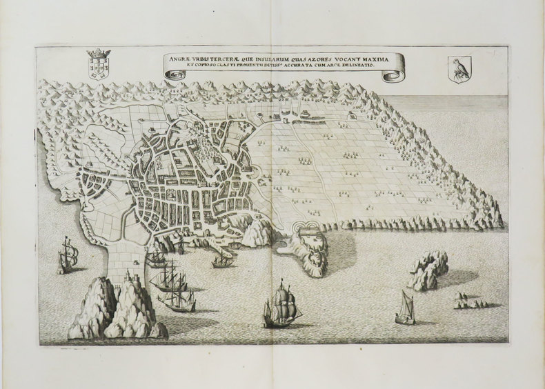
1649réf. LBW-3615[1649]. 209 x 329 mm.
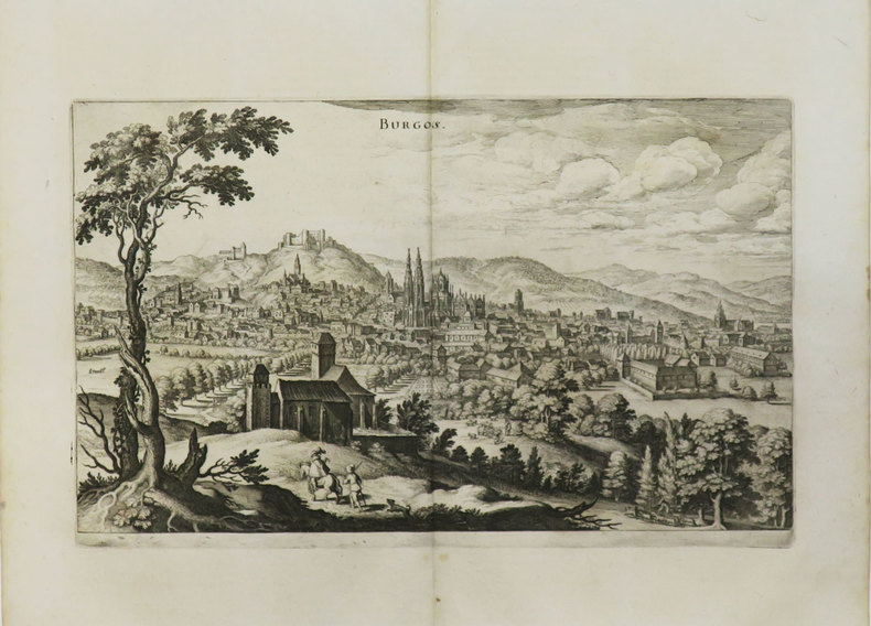
1649réf. LBW-3440[1649]. 187 x 311 mm.
1883réf. LBW-5473Paris, Auto. Marchadier et Cie, 1883. 295 x 462 mm.
réf. LI189(Coloniae Agr., c. 1600 ?). In-8o, 1f+xiv+782+ index. Exemplaire propre mais galerie de vers a la marge superieure de 100 feuilles environ sans page de titre, rel. velin contemp. avec ornement au milieu, dos a nerfs.
1865In 4, pp. 40 con 7 tavv. in lit. f.t. Strappo e mancanza al p. post., all'ultima c. di sguardia e al marg. est. delle ultime 4 tavv. (la mancanza non intacca l'illustrazione). Firma al p. ant. Br. ed. Primeiro importante monografia arqueológica publicada em Portugal. Da Costa Pereira (1809-1889) professor de cadeira de Mineralogia e Geologia da Escola Politecnica de Lisboa.
1889In 8° (17x11,5 cm); (2), 12, (2) pp. Senza brossura ma non slegato. Dedica autografa dell'autore al noto ecclesiastico genovese studioso di Colombo che visse a lungo a Lisbona (dove resse la chiesa di Loreto), Prospero Luigi Peragallo. Prima rarissima edizione, un solo esemplare censito in ICCU, di questa poesia del noto letterato, storico e poeta originario di Lisbona, José Ramos Coelho. A lui si deve una notevole "Historia do Infante Don Duarte irmão de el-Rey Don João IV" che insieme a diversi componimenti poetici rappresenta il punto più alto della sua produzione letteraria. A lui si devono anche numerosi studi sull'espansione commerciale marittima portoghese. Qualche macchiolina leggerissima di foxing, dovuta alla qualità della carta e per il resto esemplare in buone-ottime condizioni di conservazione. Very Rare, first edition.
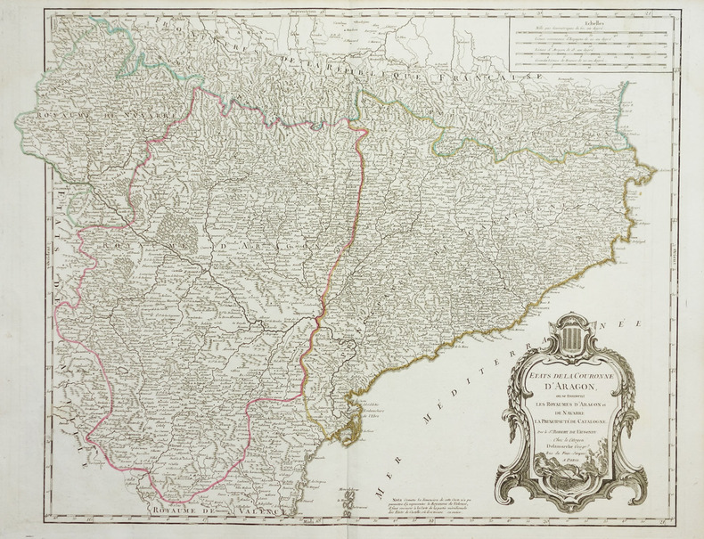
1780réf. LBW-1951vers 1780. 480 x 620 mm.
2007réf. 100124601Alianza editorial 2007 15 494x3 81x20 828cm. 2007. Broché.
2007réf. 100124609Alianza editorial 2007 15 494x3 81x20 828cm. 2007. Broché.
réf. 115840Paris Furne et Cie 1844-1865 9 vol. relié 9 vol. in-8, demi-chagrin vert, dos à nerfs ornés de fleurons et encadrements dorés. Nouvelle édition revue et corrigée. Série comprenant les neuf premiers tomes (sur 14) de cette monumentale histoire de l'Espagne. Très bon exemplaire en reliure d'époque.
réf. 115840Paris Furne et Cie 1844-1865 9 vol. relié 9 vol. in-8, demi-chagrin vert, dos à nerfs ornés de fleurons et encadrements dorés. Nouvelle édition revue et corrigée. Série comprenant les neuf premiers tomes (sur 14) de cette monumentale histoire de l'Espagne. Très bon exemplaire en reliure d'époque.
réf. 13981556Lisbonne: Imprimerie Lisbonense, 1839 in-8, 116 pages. Broché, couv. de relai muette, non coupé, bon état. Edition originale.
réf. 13983293Lisboa: Imprensa Nacionam, 1903 in-4, xii-274 pages, nombreuses illustrations dans le texte et 17 planches hors texte (certaines en couleurs, certaines se dépliant. Bibliographie, index. Reliure moderne en basane bleue, les plats étant divisés en 2 bandes verticales de basane bleue et blanche, dos lisse orné de filets dorés, le premier plat est orné d'une plaque émaillée avec les armes du Portugal, tête dorée, couvertures conservées, très bel exemplaire (rel. Carlos Guerreiro). EDITION ORIGINALE de cette monographie sur le palais royal de Cintra (Sintra).
1903réf. 8120BBLausanne, Bridel, 1903. Gross-8°. XLVI, 390 S., 1 Titelportrait in Heliogravüre, 7 (1 doppelblattgross) Tafeln in Heliogravüre, 1 gefaltete genealogische Tafel der Familie Saussure. Marmorierter Hldrbd. der Zeit mit goldgeprägtem Rückenschildchen. OBroschur eingebunden.
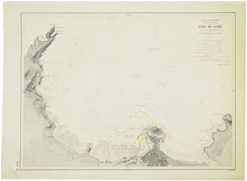
1887réf. LBW-5712Service Hydrographique de la Marine, 1887. 319 x 432 mm.
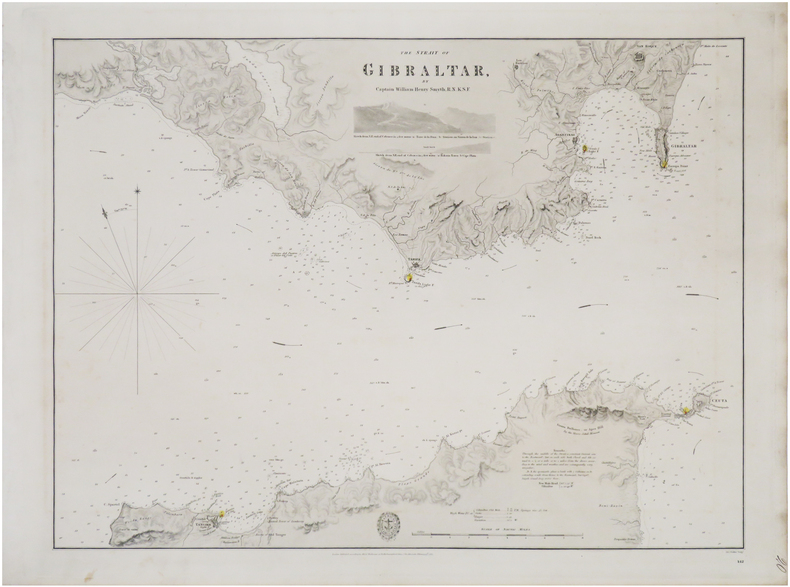
1833réf. LBW-8936London, Hydrographical Office of the Admiralty, 1833. 445 x 592 mm.
1850Carta geografica della penisola iberica in 4 fogli
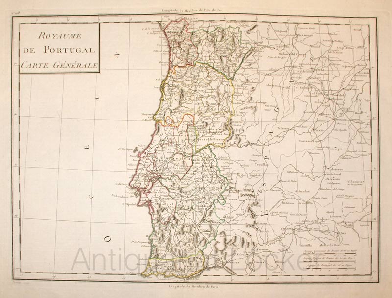
1800réf. KART0161Paris, um 1800. Plattengröße:45x34 cm, Blattgröße: 56,8x43,4 cm; verstärkter Mittelfalz, No. 108 im linken Plattenrand, in der Mitte im unt. Plattenrand: Longitude du Meridien de Paris; sauberes, dekoratives Blatt.
1804- le carte edite dal Depot de la Marine -Per contrastare lo strapotere navale della flotta inglese re Luigi XIV comprese la necessita di dotare le sue navi di carte nautiche in grado di renderle competitive con la marina antagonista. Un primo tentativo si ebbe con il Neptune Francais del 1693, ma solo agli inizi del diciottesimo secolo iniziò una grande campagna di rilievo delle coste del Mediterraneo e di altri mari, che portò alla realizzazione di numerose mappe, raccolte nel Dépot des Cartes et Planes de la Marine del 1720. Tuttavia il fondatore dell’idrografia francese può essere considerato a tutti gli effetti Jacques Nicolas Bellin (1703-1772) che per oltre cinquant’anni fu al servizio della Marina quale ingegnere e cartografo, tanto che gli venne assegnato il titolo quale primo “Ingegnere Idrografo della Marina” e quindi addirittura quello di “Idrografo Reale”. Durante il suo servizio gli furono commissionati i rilievi delle coste francesi prima e successivamente quelle di praticamente tutto il mondo conosciuto. La sua produzione fu immensa e le sue carte nautiche, di grande qualità, apparvero in più edizioni fino oltre la fine del diciottesimo secolo. Questo grande fondo cartografico diede vita alla produzione ed alla vendita di carte navali, prima basate su quelle del Bellin, successivamente ampliate e migliorate da altri ingegneri di marina, sia francesi che non. Le carte nautiche venivano vendute separatamente e recavano tutte l’inconfondibile timbro con l’ancora e le corone (quando regnava la monarchia) del Depot Generale de la Marine. Raccolte delle stesse carte venivano invece pubblicate sotto il nome di Neptune Francois, monumentale opera che ebbe numerosissime ristampe fino alla metà del secolo successivo. Il seguente gruppo di carte è tratto da un volume denominato Neptune de la Méditerranée, riguardante il Mediterraneo. Dove possibile sono indicati il nome del cartografo, spesso un capitano di vascello, e la data della carta. Incisioni in rame, in eccellente stato di conservazione, salvo controindicazioni.Carta nautica del golfo di Gibilterra, ridotta da quella disegnata nel 1786 dal celebre idrografo spagnolo Vicent Tofino de San Miguel (1732-95). To fight against the powerful English fleet, king Louis XIV decided to endow his ships with nautical charts that could enable them to compete with the enemy. The Neptune Francais, in 1693, can be considered a first attempt, but it was only at the beginning of the Eighteenth century that a campaign of study of the Mediterranean coasts and sea was started, leading to the realization of maps, collected in the Dépot des Cartes et Planes de la Marine in 1720. Nevertheless, the real founder of French hydrography can be considered Jacques Nicolas Bellin (1703-1772), who served for more than fifty years the navy as engineer and cartographer, which win him first the title of "Hydrographer Engineer of the Navy" and then of "Royal Hydrographer". His first commitment was to study the French coasts fisrt, and then of the whole world. His production was massive and his nautical charts, due also to their quality, were published in many edition until the end of the XVIII century. This allowance led to the production and the selling of sea charts, at first based on those from Bellin, then developed by other navy engineers. The sea charts were sold separately, all bearing the stamp with the anchor and the crowns of the Depot Generale de la Marine. Collections of the same charts have been published under the name of Neptune Francois, a monumental work which has been reissued many times until the half of the following century. The following group of charts is taken from a volume entitled Neptune de la Méditerranée, about the Mediterranean sea. Where possible, there is the name of the cartographer, very often the captain of the ship, and the date of the chart.
1804- le carte edite dal Depot de la Marine -Per contrastare lo strapotere navale della flotta inglese re Luigi XIV comprese la necessita di dotare le sue navi di carte nautiche in grado di renderle competitive con la marina antagonista. Un primo tentativo si ebbe con il Neptune Francais del 1693, ma solo agli inizi del diciottesimo secolo iniziò una grande campagna di rilievo delle coste del Mediterraneo e di altri mari, che portò alla realizzazione di numerose mappe, raccolte nel Dépot des Cartes et Planes de la Marine del 1720. Tuttavia il fondatore dell’idrografia francese può essere considerato a tutti gli effetti Jacques Nicolas Bellin (1703-1772) che per oltre cinquant’anni fu al servizio della Marina quale ingegnere e cartografo, tanto che gli venne assegnato il titolo quale primo “Ingegnere Idrografo della Marina” e quindi addirittura quello di “Idrografo Reale”. Durante il suo servizio gli furono commissionati i rilievi delle coste francesi prima e successivamente quelle di praticamente tutto il mondo conosciuto. La sua produzione fu immensa e le sue carte nautiche, di grande qualità, apparvero in più edizioni fino oltre la fine del diciottesimo secolo. Questo grande fondo cartografico diede vita alla produzione ed alla vendita di carte navali, prima basate su quelle del Bellin, successivamente ampliate e migliorate da altri ingegneri di marina, sia francesi che non. Le carte nautiche venivano vendute separatamente e recavano tutte l’inconfondibile timbro con l’ancora e le corone (quando regnava la monarchia) del Depot Generale de la Marine. Raccolte delle stesse carte venivano invece pubblicate sotto il nome di Neptune Francois, monumentale opera che ebbe numerosissime ristampe fino alla metà del secolo successivo. Il seguente gruppo di carte è tratto da un volume denominato Neptune de la Méditerranée, riguardante il Mediterraneo. Dove possibile sono indicati il nome del cartografo, spesso un capitano di vascello, e la data della carta. Incisioni in rame, in eccellente stato di conservazione, salvo controindicazioni.Grande carta nautica dello stretto di Gibilterra, raffigurante le coste spagnole da Cadice a Gibilterra e quelle del Marocco da Arzille a Punta Cala Mazari. To fight against the powerful English fleet, king Louis XIV decided to endow his ships with nautical charts that could enable them to compete with the enemy. The Neptune Francais, in 1693, can be considered a first attempt, but it was only at the beginning of the Eighteenth century that a campaign of study of the Mediterranean coasts and sea was started, leading to the realization of maps, collected in the Dépot des Cartes et Planes de la Marine in 1720. Nevertheless, the real founder of French hydrography can be considered Jacques Nicolas Bellin (1703-1772), who served for more than fifty years the navy as engineer and cartographer, which win him first the title of "Hydrographer Engineer of the Navy" and then of "Royal Hydrographer". His first commitment was to study the French coasts fisrt, and then of the whole world. His production was massive and his nautical charts, due also to their quality, were published in many edition until the end of the XVIII century. This allowance led to the production and the selling of sea charts, at first based on those from Bellin, then developed by other navy engineers. The sea charts were sold separately, all bearing the stamp with the anchor and the crowns of the Depot Generale de la Marine. Collections of the same charts have been published under the name of Neptune Francois, a monumental work which has been reissued many times until the half of the following century. The following group of charts is taken from a volume entitled Neptune de la Méditerranée, about the Mediterranean sea. Where possible, there is the name of the cartographer, very often the captain of the ship, and the date of the chart.