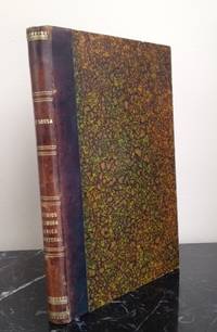
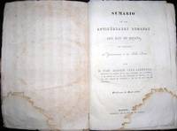
LÓPEZ y VARGAZ MACHUCA (Tomás).Livre Rare Book
9 172 résultats
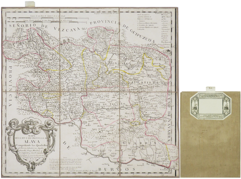
1770réf. LBW-8659Madrid, 1770. En 6 sections montées sur toile et repliées, formant une carte de 387 x 400 mm ; étiquette de l'éditeur parisien Charles Picquet au dos, onglet de vélin numéroté en manuscrit.
1953réf. 4068BBLissabon, Guimarães & C.a Editores, 1953. 8°. (1) Bl., 316 (1) S., (2) Bl.; (1) Bl., 342 S., (2) Bl. Privater Halblederbde. mit verg. Fileten auf Decken u. Rücken. + Wichtig: Für unsere Kunden in der EU erfolgt der Versand alle 14 Tage verzollt ab Deutschland / Postbank-Konto in Deutschland vorhanden + 2 Bde. "Portugal contemporâneo".
réf. 202411London and New York, Frederick Warne and Co, 1886 6 vol. in-8, env. 480 pp. par vol., portrait en frontispice (T. I) et 55 planches (plans de bataille, théâtres d'opérations, cartes ou plans), veau aubergine, dos ornés à petits nerfs soulignés de pointillés dorés, filets et caissons dorés, double filet doré et roulette à froid d'encadrement sur les plats, mascaron doré en écoinçon, pièces de titre et de tomaison, tranches peignées (rel. de l'époque). Qqs rousseurs discrètes, dos passés, petites éraflures aux dos, coiffes un peu frottées (deux plus abîmées).
1570Carta della Spagna, tratta dal Theatrum Orbis Terrarum di Ortelius, il primo atlante moderno del mondo. Edizione francese del 1598. Grande cartiglio, 2 mostri marini e due navi. Sulla base della mappa di Carolus Clusius o di Charles de l'Escluse (1526-1609) un botanico di professione, che ha pubblicato una mappa in 6 fogli della Spagna nel 1571. Carta tratta dal Theatrum Orbis Terrarum e che è considerato il primo vero “atlante” moderno. L’opera fu pubblicata in 7 lingue e 36 edizioni, per il quale – nel 1570 - Ortelius ottenne il privilegio, ovvero una sorta di diritto d'autore che impediva ad altri cartografi di pubblicare i propri lavori. Il Theatrum rappresentava il lavoro più avanzato del lavoro della descrizione cartografica. L’Ortelius vi raccolse il sapere geografico e cartografico del suo tempo, proponendo in 147 spettacolari tavole incise l’immagine più fedele del mondo allora conosciuto e, in alcune straordinarie “carte storiche”, regioni e itinerari tratti dalla letteratura, dalla mitologia, dalla tradizione. Ortelius fu anche il primo a citare le fonti, menzionando i nomi dei cartografi nel “catalogus auctorum”. Dal 1598 al 1612 le edizioni postume del Theatrum furono realizzate dal suo collaboratore Johannes Baptiste Vrients. Incisione in rame, eccellente coloritura coeva, in ottimo stato di conservazione. Striking example of Ortelius' map of Spain, from Ortelius' Theatrum Orbis Terrarum, the first modern atlas of the world. French edition of 1598. Large cartouche, 2 sea monsters and two ships. Based upon the map of Carolus Clusius or Charles de l'Escluse (1526-1609) a botanist by profession, who published a 6 sheet map of Spain in 1571. Map taken from the Theatrum Orbis Terrarum, which is considered the first true modern "Atlas". The work was published in 7 languages and 36 editions, for which - in 1570 - Ortelius obtained the privilege, a kind of copyright that prevented other cartographers from publishing his works. The Theatrum represented the most advanced work of cartographic description. Ortelius collected in it the geographical and cartographic knowledge of his time, proposing in 147 spectacular engraved plates the most faithful image of the world then known and, in some extraordinary "historical maps", regions and routes taken from literature, mythology, tradition. Ortelius was also the first to cite sources, mentioning the names of cartographers in the "catalogus auctorum". From 1598 to 1612 the posthumous editions of the Theatrum were made by his collaborator Johannes Baptiste Vrients. Copper engraving, contemporary coloring, in good condition. M. Van den Broecke "Ortelius Atlas Maps" (2011), n. 25; Imagens de Portugal e Ilhas Atlanticas, p. 54 n. 12.
1773réf. LBW-7642Lisboa, Regia Officina Typografica, 1773. In-4 de 4 pp., broché.
1780réf. LBW-3315Paris, Lattré, [circa 1780]. 400 x 550 mm.
1756réf. 43158En Europe, Aux dépens de la Compagnie, 1756. In-12 de XI-(1)-542-(2) pp.Supplément aux réflexions sur le désastre de Lisbonne avec un journal des phénomènes depuis le 1er novembre 1755, et des remarques sur la playe des sauterelles annoncée par St Jean. Sans lieu, 1757. In-12 de (2)-LXII-216 pp.Les deux pièces reliées en 1 vol. in-12, veau marbré, dos lisse orné, pièce de titre en maroquin rouge, filet à froid d'encadrement sur les plats, tranches marbrées (reliure de l'époque).
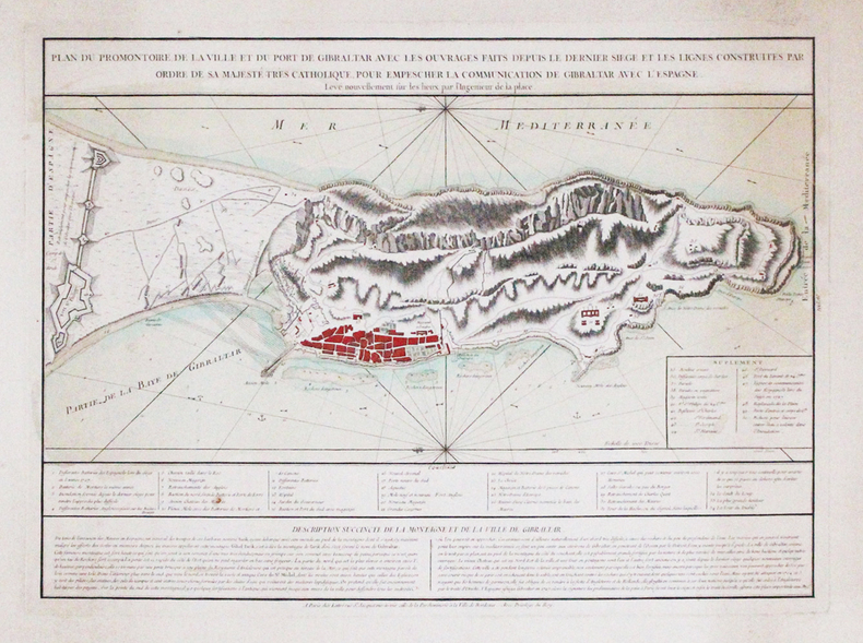
600Carta geografica della Spagna e del Portogallo, raffigurante le divisioni in reami e principati con confini in coloritura coeva. Al lato sx. tre vignette raffiguranti la pianta e un prospetto della città di Barcellona e la Baia di Gibilterra. In calce un'altra vignetta, raffigura il golfo di Cadice. La carta è arricchita da un bel cartiglio. Pieghe editoriali
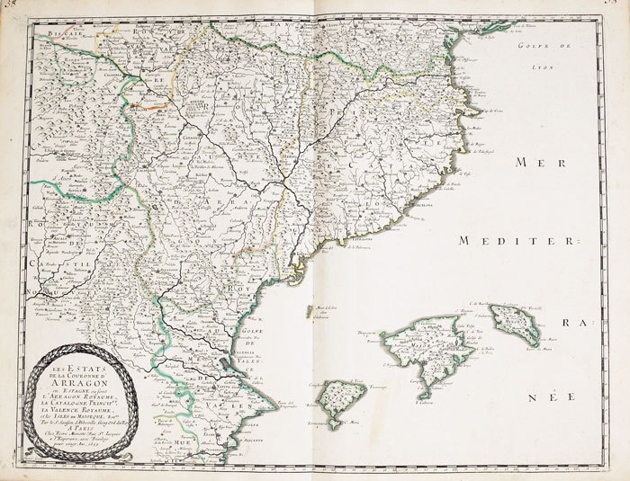
1652réf. LBW-2301Paris, Pierre Mariette, 1652. 532 x 410 mm.
1658réf. LBW-2290Paris, Em casa del autor, 1654 [1658]. En deux feuilles de 415 x 535 mm chacune.
1663réf. LBW-9481663 417 x 378 mm.
1794RARITA’ CARTOGRAFICA Sconosciuta piccola carta geografica con imprint di Pietro Zancon e data 1794, appartenente a un non documentato atlante in miniatura dal titolo “Atlante tascabile per le dame”, suddiviso in tre tomi, stampati “IN VENETIA Presso G. Zatta”, senza data ma circa 1795. Si tratta di carte da visita – con un apposito spazio bianco dove apporre il proprio nome – dove compare l’imprint o di Pietro Zancon (accompagnato dalla data 1794) o di Giacomo Zatta (con data 1794 o 1795), che, come si legge sul frontespizio, risulta l’editore dell’opera. Possiamo ipotizzare che la serie, iniziata da Zancon fu poi terminata dallo Zatta. Sulla carta dell’Italia – presumibilmente la prima tavola dell’opera – compare stampato il nome di Chiara Minelli Rota, nobildonna veneziana che sposò Antonio Rota nel 1794; tutte le restanti 65 carte recano lo spazio bianco privo di nome. In precedenza, le carte erano note solo attraverso una serie, priva di imprint editoriale, venduta 21 anni fa (1999) dall’Antiquariaat Haas di Bedburg Hau; parlando con Stephan Haas, la serie, priva di titolo e dati editoriali si componeva di 70 mappe. Le carte furono vendute separatamente sotto il nome di G. Bonatti, firma dell’incisore che si trova nella carta della Francia. In seguito, le tavole furono attribuite a Pietro Zaricen da Geoffrey King (cfr. Miniature Antique Maps, p. 181). Il nome dello Zaricen viene dedotto dalla carta della contea del Roussillon, che reca l’iscrizione “Venezia 1794 App.o P. Zancon”, letto erroneamente come Zaricen. Lajos Szantai include la carta dell’Ungheria nella sua cartobibliografia, traducendo il nome dell’autore in Zancen (cfr. Atlas Hungaricus 1528-1850). Sempre King, che non menziona nessuna carta firmata da Zatta, sostiene che “About the turn of the century a signed card of the first edition, with a map of the province of Roussillon in the south of France, was seen at an Ephemera Society Fair in London”. Questo esemplare sembrerebbe oggi quello conservato alla Yale University Library [1978 351], che lo descrive composto da 70 carte geografiche. Non sappiamo se sia il numero totale delle mappe, e l’assenza di un indice o dell’elenco non consente di stabilire l’esatto numero delle carte che lo compongono. http://hdl.handle.net/10079/bibid/3611852Confrontando le carte erroneamente attribuite allo Zaricen ci si accorge che la lastra è abrasa in corrispondenza della firma di Zancon o Zatta. Molto scarse sono le notizie sulle carte che possiamo ora definire “ex Zaricen”. Jason Hubbard nella sua bibliografia recente sulle carte del Giappone raffigura la carta priva dell’imprint “App.o G. Zatta” attribuendola - sulla base delle informazioni bibliografiche finora note – a Giuseppe Bonatti e Pietro Zaricen: “This is one of the 70-odd geographical cards, printed on one side only, acquired by the Haas brothers in 1999. The cards cover countries around the world and include detailed map of Italian provinces. The card with the map of France carries the inscription: G. Bonatti fece; and it is presumed that Bonatti engraved all of them although this is questioned by King” (cfr. J. Hubbard, Japoniae Insulae, n. 124). Il nostro esemplare della carta della Francia, che reca l’imprint “Venezia 1794, App.o P. Zancon” reca in basso a destra la firma di Bonatti sopra menzionata. Dunque, l’unica differenza tra questa serie di sconosciute carte sembra essere la presenza degli imprint editoriali di Zancon e Zatta, accompagnati dalla data 1794 o 1795. Giuseppe Bonatti è menzionato da V. Valerio nella qualità di incisore cresciuto alla scuola Remondini di Bassano, autore di alcune carte per l’atlante di Pazzini Carli (Siena, 1788-1800) e per l’Atlante Geografico di Carlo Antonio Barbiellini (Milano, 1807). Dal 1809 in poi lavorò come incisore per il Deposito della Guerra di Milano (cfr. V. Valerio, Cartografi Veneti, p. 153). Pietro Zancon era, assieme al ... A GREAT RARITY Unknown small map with imprint by Pietro Zancon and date 1794, belonging to an undocumented miniature atlas entitled “Atlante tascabile per le dame” (Pocket Atlas for ladies), divided into three volumes, printed "IN VENETIA Presso G. Zatta", undated but about 1795. A rare set of visiting cards published in Italy features pretty little maps of all parts of the world - with a special white space where to put your name - where the imprint appears or of Pietro Zancon (accompanied by the date 1794) or Giacomo Zatta (with the date 1794 or 1795), who, as can be read on the title page, is the publisher of the whole Atlas. We can speculate that the series, started by Zancon was later terminated by Zatta. On the map of Italy is printed - presumably the first map of the work - the name of Chiara Minelli Rota, Venetian noblewoman who married Antonio Rota in 1794; all remaining 65 maps bear the blank space without names. Previously, the maps were known only through a series, without editorial imprint, sold 21 years ago (1999) by the Antiquariaat Haas of Bedburg Hau; speaking with Stephan Haas, the series, without title and printing details, consisted of 70 maps. The maps were sold separately under the name of G. Bonatti, the engraver's signature found on the map of France. Later, the plates were attributed to Pietro Zaricen by Geoffrey King (see Miniature Antique Maps, p. 181). The name of Zaricen is derived from the Roussillon county map, which bears the inscription "Venice 1794 App.o P. Zancon", incorrectly read as Zaricen. Lajos Szantai includes the map of Hungary in his cartobibliography, translating the author's name into Zancen (see Atlas Hungaricus 1528-1850). Always King, who does not mention any map signed by Zatta, said: "About the turn of the century a signed card of the first edition, with a map of the province of Roussillon in the south of France, was seen at an Ephemera Society Fair in London ". This copy would seem to be the one preserved in the Yale University Library [call number 1978 351], which describes it as being composed of 70 maps. We do not know if it is the total number of maps, and the absence of an index or list does not allow to establish the exact number of maps. http://hdl.handle.net/10079/bibid/3611852 Comparing the maps erroneously attributed to Zaricen one realizes that the plate is erased in correspondence with the signature of Zancon or Zatta. There are very little information on the maps, that we can now define as "ex Zaricen". Jason Hubbard in his recent bibliography on the maps of Japan depicts the map without the imprint "App.o G. Zatta" attributing it - on the basis of the bibliographic information so far known - to Giuseppe Bonatti and Pietro Zaricen: “This is one of the 70-odd geographical cards, printed on one side only, acquired by the Haas brothers in 1999. The cards cover countries around the world and include detailed map of Italian provinces. The card with the map of France carries the inscription: G. Bonatti fece; and it is presumed that Bonatti engraved all of them although this is questioned by King” (cf. J. Hubbard, Japoniae Insulae, n. 124). Our copy of the map of France, which bears the imprint "Venice 1794, App.o P. Zancon", also shows the signature of Bonatti mentioned at the bottom right. Therefore, the only difference between this series of unknown maps seems to be the presence of the addresses of Zancon and Zatta, accompanied by the date 1794 or 1795. Giuseppe Bonatti is mentioned by V. Valerio as an engraver raised at the Remondini school in Bassano, author of some maps for the atlas of Pazzini Carli (Siena, 1788-1800) and for the geographical atlas of Carlo Antonio Barbiellini (Milan, 1807). From 1809 onwards he worked as an engraver for the Milan Deposito della Guerra (see V. Valerio, Cartografi Veneti, p. 153). Pietro Zancon was, together with the most famous brother Gaetano, a native engraver of Bassano del Grappa, who grew up at the Remondini prin...
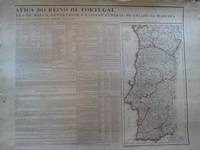
réf. $G001032.- Dedicada ao Illmo. e Ex.mo Senhor Tenente General Florencio Joze Core‡ de Mello Governador e CapitaÚ do Estado da Mdeira. Cuatro hojas de 77x55 cms. Con cuadros en cada una de ellas en los que se habla de la historia y geografía de Portugal. Con un precioso mapa de Portugal en una de ellas de 47x25 cms. Grabado por E. Collin. En los cuadros se recogen datos de Universidades Hombres Illustres Nacionaes Memgros d'Academia Real dasSciencias Notas históricas Ejército División Civil del Reino Órdenes Militares Órdenes Religiosas Monarquía Portuguesa y Grandes del Reino. Impresionante obra de principios del XIX 180. . . OBRA GRAFICA / Mapas unknown
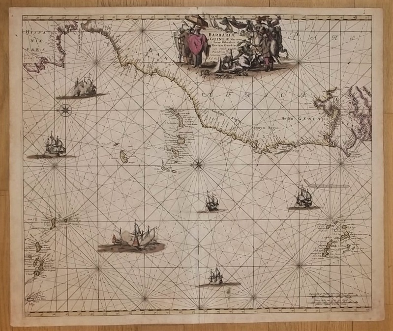
1700réf. 17367Amsterdam, de Wit, 1675 (recte um 1700). Ca. 49,5 cm x 57 cm. [4 Warenabbildungen]
réf. 74917aafLisbonne, Impr. de l'Académie royale des Sciences, in-4to, demi-toile (bibl.).
1797réf. 20333Paris, F. Buisson, an VI de la république [1797]. 2 volumes in-8 de [4]-VIII-268 et [4]-260 pages, plein veau raciné brun, dos lisses ornés de filets, roulettes et fleurons dorés, pièces de titre et tomaison havane, filet doré sur les coupes.
1953réf. 4068BB2 Bde. Lissabon, Guimarães & C.a Editores, 1953. 8°. (1) Bl., 316 (1) S., (2) Bl.; (1) Bl., 342 S., (2) Bl. Privater Halblederbde. mit verg. Fileten auf Decken u. Rücken. "Portugal contemporâneo".
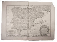
1708réf. E7GCJJB1RUYXParis 1708. Hubert Jaillot Engraved map on 2 assembled sheets 55.5 x 78 cm engraved by Cordier. With title in decorated cartouche on the bottom right corner scales and privilege in decorated cartouche on the bottom left corner and a few lines coloured in green. Large map of Spain and Portugal this state with a privilege for 20 years granted in 1708. Engraved by Cordier after the map by Nicolas Sanson.Strengthened fold damaged corners but map in very good condition.l Cf. Pastoureau Jail. II A map 91. unknown
Madrid, en la Imprenta Real, 1803. Once volúmenes en 4to. menor, ocho para la "Recreacón Filosófica" y tres para las "Cartas Físico Matemáticas"; XXIV pp., LVIII-341 pp. y 5 láminas plegadas + IV-474 pp., 4 lám.+ IV-522 pp., 3 lám. + IV-323 pp., 5 lám. + IV-405 pp., 5 lám. + IV-529 pp., 5 lám. + VI-479 pp. + 4 hs., 246 pp. + 3 hs., 230 pp., 15 lám. + 242 pp., 6 lám. + VI-234 pp., 5 lám., apreciandose la carencia de una lámina en el tomo tercero y otra en el décimo, únicamente. Rastros de moho en el tomo cuarto. Encuadernación uniforme en piel marbreada, de la época, con tejuelos.
Coimbra: Conimbricae, apud Emmanuelem Rodericum de Almeyda, 1682. Folio; 2 hojas, 182 folios numerados, 26 hojas, la última blanca. Encuadernación de época en piel, con gofrados en seco en ambos planos. Lomera ornada.
1789réf. 145041789. Sousa João de. Vestigios da lingoa arabica em Portugal ou lexicon etymologico das palavras e nomes portuguezes que tem origem Arabica 1789 a foundational linguistic study documenting the influence of Arabic language and culture on Portuguese vocabulary. João de Sousa an eighteenth century scholar of Arabic born in Damascus and later active in Portugal served as the first professor of Arabic at the University of Lisbon and was an associated member of the Academia Real das Sciencias. His work emerged from the scholarly environment of late Enlightenment Portugal when the study of language history and cultural transmission became central concerns of learned academies. The book records the long historical impact of Arabic speaking societies in the Iberian Peninsula where centuries of Islamic presence from the early Middle Ages through the late fifteenth century left lasting linguistic and cultural traces in Portuguese. Sousa João de. Vestigios da lingoa arabica em Portugal ou lexicon etymologico das palavras e nomes portuguezes que tem origem Arabica. Lisbon: Na Officina da Academia Real das Sciencias 1789. First edition. The work was produced under the authority of the Academia Real das Sciencias of Lisbon and represents the first etymological dictionary devoted specifically to Portuguese words of Arabic origin. Entries are arranged alphabetically in Portuguese and followed by the corresponding Arabic word or source a transliteration and an explanatory discussion. The lexicon also identifies Portuguese terms that entered the language through Arabic but ultimately derived from other linguistic traditions including Hebrew Greek Persian and Turkish. Among the loanwords catalogued are terms relating to plants spices agricultural products architecture and place names illustrating the wide range of everyday vocabulary shaped by centuries of cultural exchange between Islamic and Iberian societies. The book appeared during a period when European scholars increasingly examined the linguistic consequences of medieval cultural contact between Islamic and Christian societies in the Mediterranean world. The Iberian Peninsula in particular preserved a large body of Arabic derived vocabulary that entered both Portuguese and Spanish through trade agriculture science and administrative life during the centuries of Muslim rule and cultural interaction. Sousa's lexicon became an important early contribution to the study of these linguistic exchanges and preceded later nineteenth century scholarship on the subject. A second edition was published in 1830 and further studies such as the work of Francisco de S. Luiz did not appear until several decades later. Quarto volume with twenty preliminary pages and 160 pages of text woodcut device of the Academia Real das Sciencias on the title page bound in mid nineteenth century quarter sheep over marbled boards with pictorial lithograph bookplate of José Bernardo Pereira Martins. Small binder's ticket of Santos & Alves of Lisbon on the front pastedown occasional marginal annotations in ink and pencil minor repair to the upper margin of the title page and two other leaves without loss and slight wear to spine ends and corners. Overall very good condition. unknown books
1832réf. OB901Madrid: Imprenta de Miguel de Burgos 1832. First Edition. Soft Cover. xxviii 538 p.; 32 cm. A survey region by region of Roman inscriptions on structures throughout Spain; a book of considerable rarity. Palau 50767. Waterstain in lower corner margins of cover & first two leaves; original paper wrappers with original spine label untrimmed; Very Good. Stock#OB901 oversize. Imprenta de Miguel de Burgos paperback
1789réf. 145041789. Sousa João de. Vestigios da lingoa arabica em Portugal ou lexicon etymologico das palavras e nomes portuguezes que tem origem Arabica 1789 a foundational linguistic study documenting the influence of Arabic language and culture on Portuguese vocabulary. João de Sousa an eighteenth century scholar of Arabic born in Damascus and later active in Portugal served as the first professor of Arabic at the University of Lisbon and was an associated member of the Academia Real das Sciencias. His work emerged from the scholarly environment of late Enlightenment Portugal when the study of language history and cultural transmission became central concerns of learned academies. The book records the long historical impact of Arabic speaking societies in the Iberian Peninsula where centuries of Islamic presence from the early Middle Ages through the late fifteenth century left lasting linguistic and cultural traces in Portuguese. Sousa João de. Vestigios da lingoa arabica em Portugal ou lexicon etymologico das palavras e nomes portuguezes que tem origem Arabica. Lisbon: Na Officina da Academia Real das Sciencias 1789. First edition. The work was produced under the authority of the Academia Real das Sciencias of Lisbon and represents the first etymological dictionary devoted specifically to Portuguese words of Arabic origin. Entries are arranged alphabetically in Portuguese and followed by the corresponding Arabic word or source a transliteration and an explanatory discussion. The lexicon also identifies Portuguese terms that entered the language through Arabic but ultimately derived from other linguistic traditions including Hebrew Greek Persian and Turkish. Among the loanwords catalogued are terms relating to plants spices agricultural products architecture and place names illustrating the wide range of everyday vocabulary shaped by centuries of cultural exchange between Islamic and Iberian societies. The book appeared during a period when European scholars increasingly examined the linguistic consequences of medieval cultural contact between Islamic and Christian societies in the Mediterranean world. The Iberian Peninsula in particular preserved a large body of Arabic derived vocabulary that entered both Portuguese and Spanish through trade agriculture science and administrative life during the centuries of Muslim rule and cultural interaction. Sousa's lexicon became an important early contribution to the study of these linguistic exchanges and preceded later nineteenth century scholarship on the subject. A second edition was published in 1830 and further studies such as the work of Francisco de S. Luiz did not appear until several decades later. Quarto volume with twenty preliminary pages and 160 pages of text woodcut device of the Academia Real das Sciencias on the title page bound in mid nineteenth century quarter sheep over marbled boards with pictorial lithograph bookplate of José Bernardo Pereira Martins. Small binder's ticket of Santos & Alves of Lisbon on the front pastedown occasional marginal annotations in ink and pencil minor repair to the upper margin of the title page and two other leaves without loss and slight wear to spine ends and corners. Overall very good condition. unknown
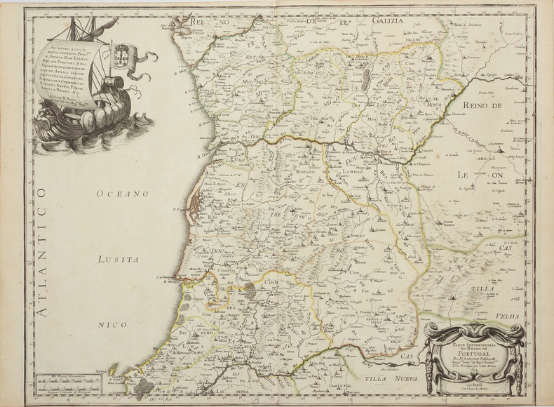
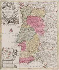
1762réf. 200016AG1762. Augsburg Georg Friderich Lotter 1762. Original hand-coloured Engraving. Plate Size: 49 cm x 57.7 cm. Sheet Size: 51.6 cm x 59.6 cm. Original map. Very good condition. Clean and crisp. Map orientated to the North. Slight roughness to top right corner edge. Border with longitudinal and latitudinal information. A richly detailed and very interesting map showing the Kingdom of Portugal and the Algarves. Relief shown pictorially with rivers mountains and major and minor settlements depicted through keys. The internal subdivisions of the kingdom are also highlighted as are the religious bishoprics and Archdioceses administrative areas of the Catholic Church. Lisbon is shown at the mouth of the 'Tajo' Tagus River. Cartouche in lower left corner decorated with Classical allusion encloses inset map showing the coastal region of Brazil then a Portuguese colony. The Captaincies of Brazil which were the administrative divisions and hereditary fiefs of the colony are delineated. Interior of Brazil carries inscription 'Brasilia Regnum in America Merido' with allegorical scene with native figures. Relief shown pictorially with rivers mountains and settlements depicted. Beneath inset map are map legends and a triple bar scale. Large decorative title cartouche located in the top left corner of map. Portugal's tradition of maritime exploration and conquest and naval strength are alluded to with the depiction of the canon lances accompanying the coat-of-arms of the House of Aviz and naval vessels and the mythological figure in the foreground. Above the title lies the coat-of arms of the Kingdom of Portugal and the Algarves. The year that the map was published 1762 saw the Seven Years War spread in the Iberian Pennisula as Franco-Spanish forces staged an unsuccessful invasion of Portugal which was then in alliance with Britain. Tobias Lotter was a German publisher and engraver who married the daughter of the elder Matthaus Seutter in Augsburg. Largely under his own responsibility but still under Seutter Lotter created the 'Atlas Minor' which was created between 1740 and 1744. He engraved many of Seutters maps and eventually succeeded to the business in 1756 becoming one of the better-known cartographers in the eighteenth-century German School. After his death the business was carried on by his son M.A. Lotter. Wikipedia unknown
Amsterdam, Nicolau van Ravesteyn, 1647, 16 x 10,5 cm., pergamino a la romana de época, 4 hojas + 796 págs. + 10 hojas - (Sigue, al fin de la obra:) Manifesto Per la partenza de Ministri Apostolici dall Corte di Portogallo. 44 págs.