Arabie, Phipps (Editor)/ Hubert, Lawrence J (Editor)/ De Soete, G (Editor)/ Soete, Geert De (Editor)Biblio.com

1 482 résultats
1996réf. x-9810212879World Scientific Pub Co Inc 1996. Paperback. New. illustrated edition. 490 pages. 9.00x6.75x1.25 inches. World Scientific Pub Co Inc paperback
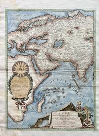
1690réf. 78466Uten sted Uten år. Ca. 1690. Folio. Arkets størrelse : 50 cm X 70 cm. Originalt kobberstikk med nyere håndkolorering. Folio. Size of sheet : 50 cm X 70 cm. Original copper engraving with recent handcolouring. Italiensk. Svak fuktskjold ved nedre venstre hjørne. A bit waterstained at lower left margin.P. M. Coronelli står for Padre Maestro Coronelli Fader Magister Coronelli som viser til â Vincenzo Maria Coronelli 1650–1718. Han var en berømt italiensk fransiskanermunk kosmograf kartograf og globusmaker fra Venezia. Forkortelsen «P.M.» sees ofte på de gamle kartene og globusene hans sammen med tittelen hans. Wikipedia. unknown
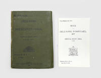
1917réf. 192206Calcutta: Superintendent Government Printing India 1917. With the loosely inserted index Second edition significantly expanded and revised from the first of 1915 including updated sections on Al Hasa and Nejd and the rule of the Saud dynasty as well as 22 additional route descriptions in the final section. The 20-page index tucked into the end band was issued only with a subset of copies. The first edition issued in March 1915 went through three small printings in a year but the outbreak of the Arab Revolt and the upswing in the Mesopotamian Campaign necessitated its revision. Chapters discuss history geography populations resources maritime issues and administration while also providing British intelligence on the Ottoman forces. On the "fighting qualities of local Arabs of Mesopotamia" the compilers observe that "for several years the Arabs have been very friendly towards the British and on several occasions prominent chiefs have come forward with suggestions of a British Protectorate" p. 90. The routes draw on a variety of sources including Lorimer reports by captains Shakespear and Leachman the Danish explorer Barclay Raunkiaer Lieutenant Arnold Wilson and recent intelligence supplied by Lieutenant-Colonel L. S. Newmarch Resident and Consul-General at Baghdad. In a reflection of the region's changing geopolitics the list of important personages is reduced from 25 in the first edition to only 11. Octavo. Folding heliozincographed map of Lower Mesopotamia in front pocket 3 folding tables errata slip tipped in facing p. 34; tables in text. With 20-page separate index loosely inserted in rear band. Original green diagonal-grain cloth wallet binding spine and front cover lettered in black. Title page with contemporary pencil ownership inscription of Lieutenant-Colonel Austin Romauld O'Flaherty officer commanding 33 British General Hospital Mesopotamia. General signs of use spine sunned small tidemarks internally short split along fold of map; index volume re-sewn: very good. hardcover
réf. DADAX0415711401New unknown
réf. DADAX0367866749New unknown
réf. DADAX0415522226New unknown
réf. 45805683like new. unknown
réf. 45805683-nnew. unknown
réf. DADAX1138466689New unknown
1980réf. 225521980. Arabian American Oil Company. Aramco and Its World: Arabia and the Middle East published in 1980 documents the corporate information system through which Aramco explained Saudi history Islamic culture regional geography petroleum engineering and industrial development to employees and a wider English-language audience. Replacing the longstanding Aramco Handbook title the volume grew from instructional booklets created during the company's postwar expansion to orient incoming American personnel unfamiliar with Arabic and Saudi social practices. Its coordinated use of historical narrative landscape photography technical diagrams and cultural guidance reveals how Aramco presented itself as both a petroleum enterprise and an intermediary between Saudi Arabia and the industrialized West providing primary-source evidence for research into corporate communications expatriate training petroleum infrastructure and United States-Saudi relations. Publication coincided with the Saudi government's acquisition of a 100 percent participation interest in Aramco's concession rights production and facilities although the Saudi Arabian Oil Company was not formally created to assume Aramco's responsibilities until 1988. Arabian American Oil Company. Aramco and Its World: Arabia and the Middle East. Washington D.C.: Arabian American Oil Company 1980. First edition in this revised and retitled form. xi 275 pages. Profusely illustrated with color photographs maps and diagrams including double-page and folding material. Publisher's blue cloth lettered in turquoise; no dust jacket. Large 4to. A large folding color map titled "The Arabian Peninsula" drawn by Don Thompson and measuring approximately 24 × 36 inches is inserted at the rear. The book traces the growth of the modern Saudi state the geography of the peninsula and the development of Aramco's petroleum system. Illustrated cultural sections show desert dwellings coffee preparation camel travel goat herding Islamic calligraphy and landscapes including Jabal al-Fil while technical chapters record seismic surveying in the Rubʿ al Khali drilling equipment instrument-filled control rooms offshore platforms tanker-loading facilities and the geometrically arranged storage and refining installations at Ras Tanura. Maps locate Middle Eastern oil fields and Aramco concession areas and charts using 1978 data compare global petroleum production reserves and consumption. The folding map extends the volume's educational purpose beyond the bound text presenting topography cities transportation routes and political boundaries on a scale suited to reference or display. A manuscript inscription on the front free endpaper reads "Dear Dick and Susie.I'm on page 117" preserving evidence of the book's circulation as a personal or professional presentation copy. The volume's detailed visual record is governed by Aramco's institutional viewpoint. Its photographs and diagrams demonstrate the process by which geological surveying extraction refining transportation and export operated as an integrated industrial network while its treatment of Bedouin life and Saudi culture translates complex communities into introductory material for predominantly foreign readers. The timing gives this edition particular interpretive value: its language continues the company's established narrative of technological leadership and cultural mediation even as ownership of the petroleum enterprise passed fully to the Saudi government. Official Aramco histories confirm that Saudi participation reached 100 percent in 1980 making the book evidence of both the mature American corporate communication apparatus and the transition toward Saudi control. Light sunning and small marks affect the blue cloth; the folding map is clean and well preserved and the contents remain sound. Very good. A substantial illustrated record of the technical and cultural knowledge Aramco used to explain its operations during a pivotal year in the transfer of Saudi petroleum ownership. unknown
réf. DADAX2370742003New unknown
réf. DADAX0367171570New unknown
réf. DADAX0801454115New unknown
réf. DADAX1138780022New unknown
2021réf. x-3030704394Springer Nature 2021. Paperback. New. 391 pages. 9.25x6.10x0.81 inches. Springer Nature paperback
1926réf. 144231926. Gröber Karl. Two Views of the Mosque at Mecca 1926. Pair of original copperplate photogravures depicting the Masjid al-Haram the Sacred or Grand Mosque in Mecca Islam's holiest city and the destination of the annual Hajj pilgrimage. The mosque surrounds the Kaaba toward which Muslims worldwide turn in daily prayer. Published in 1926 the illustrations date from the early period of Saudi rule over Mecca following the city's conquest by Abdulaziz Ibn Saud in 1924. The two views record the mosque from ground-level and elevated perspectives preserving photographic documentation of the sacred precinct before the extensive architectural expansions of the later twentieth century. Gröber Karl photographer. Two Views of the Mosque at Mecca. 1926. Two original copperplate photogravures after photographs by Gröber published in the first edition of a 1926 book containing his text and photographic illustrations. Each sheet measures approximately 8.25" x 10.25" with a printed area of approximately 6.25" x 8.25". The first photogravure presents a ground-level view of the mosque recording its architecture from within the surrounding urban setting. The second provides a bird's-eye view of the mosque showing the sacred complex from an elevated perspective. Both illustrations reproduce the tonal gradations and architectural details of the original photographs through the copperplate photogravure process. The illustrations were published during a decisive period in the modern history of Mecca. Following the collapse of Ottoman authority in the Hejaz during the First World War the city came under Hashemite rule before its capture by Ibn Saud in 1924. In 1926 Ibn Saud assumed the title King of the Hejaz incorporating Mecca into the expanding Saudi state. The paired views record the mosque's architectural setting during this transition preceding the major expansion and redevelopment campaigns undertaken from the mid-twentieth century onward. Both original photogravures are in excellent condition presenting complementary perspectives of the Grand Mosque as reproduced in 1926. unknown
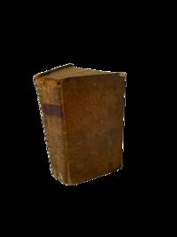
1780réf. 144401780. Irwin Eyles. A Series of Adventures in the Course of a Voyage up the Red Sea 1780. Early Dublin edition of Irwin's firsthand account of his 1777 journey along the Arabian and Egyptian coasts of the Red Sea and through the deserts of Upper Egypt. Born in Calcutta and employed by the British East India Company Irwin undertook the journey after his dismissal from Company service in 1776 traveling to England to seek redress. His eleven-month passage involved encounters with pirates detention difficult desert crossings and travel through territories seldom described firsthand by European visitors. Written as a series of letters addressed to an unnamed lady the narrative records maritime commerce Bedouin encounters local customs and relations between European travelers and Arab populations in the late eighteenth century. Irwin's account also documents the practical difficulties of traveling between British India and Europe through the Red Sea and Ottoman-controlled Egypt. Irwin Eyles. A Series of Adventures in the Course of a Voyage up the Red Sea on the Coast of Arabia and Egypt; and of a Route through the Deserts of Thebais Hitherto Unknown to the European Traveller in the year MDCCLXXVII in Letters to a Lady. Dublin: Sleater Whitestone Potts Colles Wilson Jenkins Flin et al. 1780. Early Dublin edition. One volume 576 pages described as quarto 4to. Bound in antique full leather with gilt decoration to the spine and original title label. Retains the original folding map of the Red Sea with two additional maps lacking. The narrative follows Irwin's passage from India toward England including his experiences along the Arabian coast and his overland journey from Cosseir Quseir through the Egyptian desert toward the Nile Luxor Cairo and Alexandria. His letters describe encounters with local inhabitants the difficulties of desert transportation and conditions in the ports and settlements through which he traveled. The text also includes Irwin's poems "Ode to the Desert" and "Ode to the Nile." The work is referenced in Blackmer Collection 865 and Atabey Collection 609. Published in 1780 Irwin's narrative belongs to the early literature of British travel through the Arabian Peninsula and Egypt when the East India Company's expanding commercial interests made the Red Sea an increasingly consequential passage between India and Europe. His descriptions of Bedouin groups including episodes characterized by the historian Kathryn Tidrick as a prolonged account of Bedouin treachery also preserve the prejudices and expectations through which British travelers interpreted Arab societies. The letters combine personal misadventure with geographical observations and descriptions of regional transportation commerce and encounters between foreign travelers and local authorities. The rear board has been reattached with dark stitching while the front hinge has a 3½" split but remains firm. Corners are bumped and worn with wear and some chipping to the head and foot of the spine. Interior pages remain in very good condition; overall good condition. An early Dublin printing retaining its folding Red Sea map and Irwin's account of travel through Arabia and Egypt in 1777. unknown
réf. DADAX1859640052New unknown
réf. DADAX0801494842New unknown
réf. DADAX0791095169New unknown
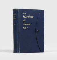
1916réf. 192452London: Admiralty War Staff Intelligence Division May 1916. A detailed intelligence handbook the folding maps in excellent condition First edition of this regional survey for the armed services published for official use only and compiled by the Arab Bureau's David Hogarth following his recruitment to naval intelligence in 1915. The four folding maps present Arabia's settlements tribal distribution and orographic and land-surface features. After general physical and social surveys chapters cover Bedouin tribes the Hejaz Asir Yemen Aden and the Hadhramaut Oman the Gulf coast Nejd Jebel Shammar the northern Nefud and Dahanah belts and settled tribes. The appendices comprise a system of transliteration from Arabic to English and an extensive glossary of topographical terms. "The sources from which this work has been compiled include native information obtained for the purpose since the outbreak of the war. This applies in particular to the strength and distribution of the Bedouin tribes and to their political relationships. Recent information from native sources has also been used for parts of the Red Sea littoral such as the little-known region of Asir" preliminary note. Volume II published the following year was concerned with detailed routes. The work was reissued in 1920. Octavo. With 15 photographic halftone plates 4 folding colour maps in end pocket. Original blue cloth flap case metal stud-fastener spine and front cover lettered in gilt. Annotated bookplate of Royal Artillery Institution Woolwich. Shadow from old label on spine fold of front flap splitting at ends and consequently a little fragile ring stain on outer face of folded map another map with small pinhole couple of small splash marks: a very good copy indeed. hardcover
réf. 47523492like new. unknown
réf. DADAX1138108669New unknown
réf. DADAX0300192010New unknown