CollectifLivre Rare Book

12.228 resultados
1986ref. RO30362856Les éditions de l'amateur. 1986. In-8. Broché. Etat passable, Coins frottés, Dos satisfaisant, Papier jauni. 536 pages. Rares accrocs au dos. Quelques rousseurs. Nombreuses illustrations en noir et blanc et en couleurs.. . . . Classification Dewey : 741.68-Illustrations des cartes postales
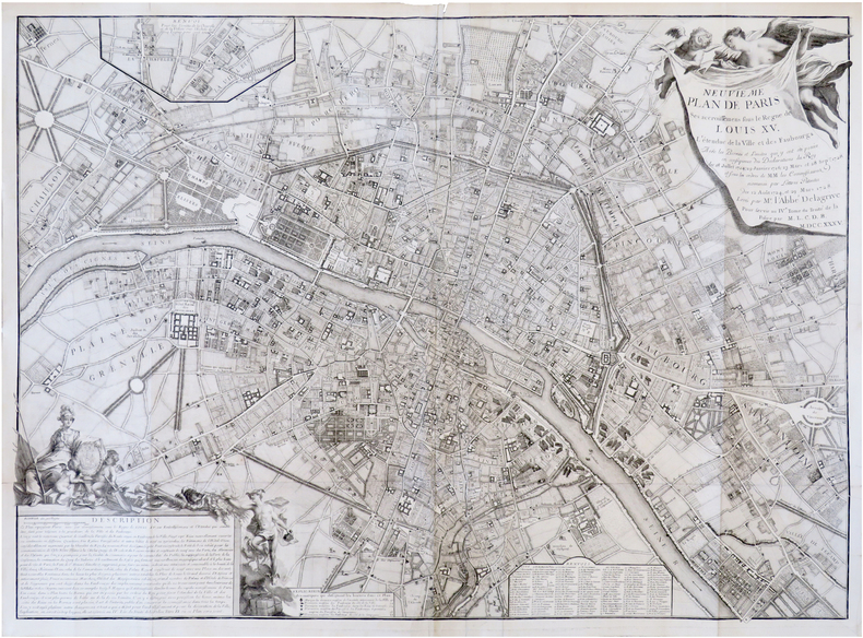
1735ref. LBW-7372Paris, 1735. 614 x 845 mm.
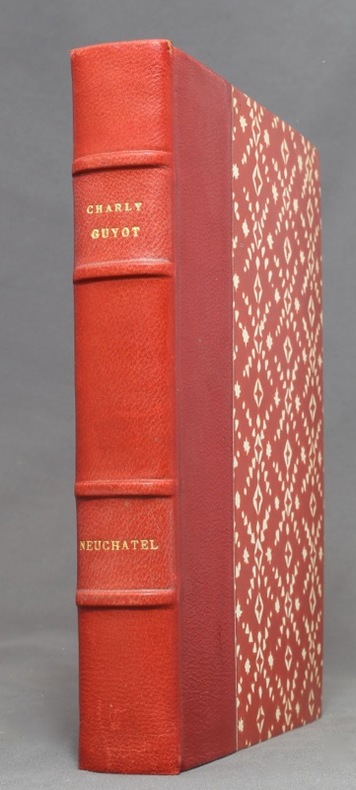
1946ref. 1127Neuchâtel, La Neuchâteloise, 1946. In-8 de 299 pages, demi-maroquin rouge, dos à 4 nerfs, couvertures et dos conservés. Nom de possesseur sur garde.
1806ref. 117991806 toilée. carte , 65 x 102 , Vienne Artaria et cie , 1806,
1977ref. 184371977, Neudin, in-8 broché de 183 pages, couverture illustrée en couleurs, illustrations noir et blanc, et couleurs hors-texte. Tous les résultats des ventes, conseils et adresses, classements chronologique, thématique et géographique avec 10 000 rubriques cotées, étude d'environ 3000 illustrateurs. | Etat : Bon état général (Ref.: ref9553)
1984ref. 325341984, Neudin, in-8 broché de 540 pages, couverture dorée, illustrations noir et blanc, et couleurs hors-texte | Etat : Bon état général (Ref.: ref82179)
1985ref. 325351985, Neudin, in-8 broché de 542 pages, couverture rouge, illustrations noir et blanc, et couleurs hors-texte | Etat : Bon état général (Ref.: ref82180)
1986ref. 325361986, Neudin, in-8 broché de 536 pages, couverture noire, illustrations noir et blanc, et couleurs hors-texte | Etat : Bon état général (Ref.: ref82181)
1986ref. 325371986, Neudin, in-8 broché de 536 pages, couverture noire, illustrations noir et blanc, et couleurs hors-texte | Etat : Bon état général, couverture défraîchie (Ref.: ref82182)
1983ref. 325381983, Neudin, in-8 broché de 542 pages, couverture grise, illustrations noir et blanc, et couleurs hors-texte | Etat : Bon état général, couverture défraîchie (Ref.: ref82183)
1994ref. 326361994, Neudin, in-8 broché de 512 pages, couverture orange illustrée en couleurs, 400 illustrations noir et blanc, et couleurs hors-texte | Etat : Bon état général (Ref.: ref82233)
1981ref. 370251981, Neudin, in-8 broché de 542 pages, couverture jaune illustrée en couleurs, 600 illustrations noir et blanc, et couleurs hors-texte | Etat : Bon état général, couverture légèrement défraîchie (Ref.: ref84027)
1900ref. 55490Glogau, Carl Flemming (ca. 1900). Orig. printed clothbacked boards. Map in colour (42 x 48 cm.) inserted and folded.
Format: 49 x 56 cm. *Mehrfach gefaltet. Oberrand mit kleiner (hinterlegter) Fehlstelle (ca. 4 x 2,5 cm). Landkarten de
1784Carta geografica de l mondo inserita nell'atlante degli eredi della tipografia Homann. Dal punto di vista cartografico la mappa presenta diverse innovazioni ed aggiornamenti, soprattutto nel Pacifico dove sono mostrate le scoperte di Cook del 1770. I Grandi Laghi si presentano come un unico enorme specchio d'acqua e la California ha una forma strana, con la Baja che sembra quasi un'isola. L'Australia comprende diversi toponimi sulla costa orientale, frutto delle scoperte di Cook nel 1770. Tuttavia, l'isola di Van Diemens è ancora mostrata collegata alla terraferma. Sono disegnate le rotte di diverse esplorazioni della fine del XVIII secolo. Johann Baptist Homann è stato un geografo e cartografo tedesco; nel 1702 fondò la sua casa editrice. Homann acquisì fama come uno dei principali cartografi tedeschi, e nel 1715 fu nominato geografo imperiale dall'imperatore Carlo VI. Nello stesso anno fu anche nominato membro dell'Accademia Prussiana delle Scienze a Berlino. Nel 1716 Homann pubblicò il suo capolavoro Grosser Atlas ueber die ganze Welt. Numerose mappe furono redatte in collaborazione con l'incisore Christoph Weigel. Homann morì a Norimberga nel 1724. Gli successe suo figlio Johann Christoph (1703-1730). L'azienda continuò dopo la sua morte come azienda degli eredi Homann, gestita da Johann Michael Franz e Johann Georg Ebersberger. Dopo successivi cambiamenti nella gestione, l'azienda si sciolse nel 1852. Incisione in rame, finemente colorata a mano, in ottimo stato di conservazione. This interesting world map presents some curious cartography, given the date of the map. The Great Lakes are shown as one huge body of water and California is strangely shaped with the Baja nearly appearing as an island. Australia includes several place names on the eastern coast, which resulted from Cook's discoveries in 1770. However, Van Diemens Land is still shown connected to the mainland. The tracks of several late 18th century expeditions are shown. Color key and German text panel below the hemispheres. Johann Baptist Homann was a German geographer and cartographer; in 1702 he founded his own publishing house. Homann acquired renown as a leading German cartographer, and in 1715 was appointed Imperial Geographer by Emperor Charles VI. In the same year he was also named a member of the Prussian Academy of Sciences in Berlin. In 1716 Homann published his masterpiece Grosser Atlas ueber die ganze Welt; numerous maps were drawn up in cooperation with the engraver Christoph Weigel the Elder. Homann died in Nuremberg in 1724 and was succeeded by his son Johann Christoph (1703-1730). The company carried on upon his death as Homann heirs company, managed by Johann Michael Franz and Johann Georg Ebersberger. After subsequent changes in management the company folded in 1852. Etching with fine later hand colour, very good condition.
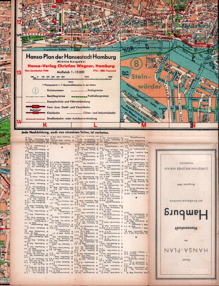
1946ref. 87956Hamburg, Christian Wegner, 1946. Mehrfach gefalt. farb. Faltplan im Maßstab 1:15 000. Kartengröße: 55,5 x 74,5 cm. Blattgröße: 56,5 x 75,5 cm; Faltmaß: 19 x 10 cm.
1939ref. 87955Hamburg, Hansa-Verlag Heinz Thiele, 1939. 1 farb. Falt-Plan im Maßstab 1:15 000, verso 4 s-w. Beikarten. Blattgröße 70 x 82 cm, Deckel 19 cm. Mit 32 S. Register. Illustr. OBrosch.
17904 (statt 6) grenzkolorierte Kupferstiche, je ca. 864:635 mm (Plattenmaß 748:536 mm). Frankreichteil aus dem Schalbacher-Schrämbl'schen "Großen Allgemeinen Atlas" (1786-1803; hier Bll. Nr. 29-33). Es fehlen Bl. 30 (Elsaß, Lothringen, Champagne, Picardie, Artois) und Bl. 34 (Südfrankreich). Gestochen von I. W. Engelmann; Maßstab ca. 1:680.000. - Im breiten w. Rand minimal angestaubt bzw. kl. Einrisse, sonst sauberes, gutes Exemplar. Dörflinger/Hühnel I, 134, 29-33.
1900Glogau, Carl Flemming (ca. 1900). Orig. printed clothbacked boards. Map in colour (42 x 48 cm.) inserted and folded.
29 x 36 cm (Blattgröße: 36 x 44 cm *Blatt 35 aus Meyers grosser Zeitungs-Atlas. - Sauber und gut erhalten, breitrandig. Graphiken de
635 x 1302 mm. Mehrfarbige Kupferstichkarte, 44 Segmente auf Leinen aufgezogen mit Legende auf der linken Seite. Gefaltet in marmoriertem Umschlag und Schuber der Zeit mit goldgepr. Rückenschildchen "Grundriss von Wien". Der "inhaltlich vorzügliche" (Austria Picta) Grundrissplan von Wien, hier im seltenen Mehrfarben-Kupferstichdruck. Erstmals 1789 erschienen und noch mehrfach wiederaufgelegt. "Unter den Karten, die Artaria und Comp. [...] verlegte, bildet die von Stephan Jakubicska gezeichnete und Sebastian Mansfeld gestochene Umgebungskarte von Wien zweifelsohne den qualitativen Höhepunkt [...] Als Grundlage für die Arbeit dienten zweifelsohne die entsprechenden Sektionen der sog. Josephinischen Landesaufnahme [...] Es handelt sich hiermit um die einzige Karte, die auf Grund der streng geheimgehaltenen Josephinischen Landesaufnahme entworfen und im gleichen Maßstab (1:28.800) und in der gleichen Ausführung (Geländedarstellung) wie diese an die Öffentlichkeit gelangte [...] Jakubicskas Karte stellt jedoch keine bloße Kopie der Josephinischen Landesaufnahme dar: zum einen sind die [...] eingetretenen Veränderungen in der Topographie berücksichtigt [...], zum anderen hat Jakubicska die Karte nach Südosten orientiert, um im üblichen Quer-(Imperialfolio-)Format auch die kaiserliche Sommerresidenz Laxenburg unterzubringen" (Dörflinger, S. 285f.). - Mit den oft fehlenden ergänzenden Kartensegmenten von Baden und Trumau, die die Karte ab der dritten Ausgabe 1799 nach Südwesten erweiterten. Die vorliegende Neuausgabe von 1803 unterscheidet sich "von ihrer Vorgängerin durch einen geringfügig geänderten Titel [...], durch den zusätzlichen französischen Titel [...] und durch die Einzeichnung der 'Cavallerie Lager' und 'Infanterie Lager' bei Münchendorf", die in der Folgeausgabe von 1805 wieder entfernt wurden (Dörflinger, S. 371). - Alte hs. Bibliothekssignatur auf der Karte verso sowie auf dem Umschlag. Der Schuber unbedeutend berieben; die Karte ausgezeichnet erhalten. Dörflinger, Österr. Karten im frühen 19. Jh., S. 371. Vgl. Dörflinger, Österr. Karten des 18. Jhs., Art 11. Austria Picta, 108.
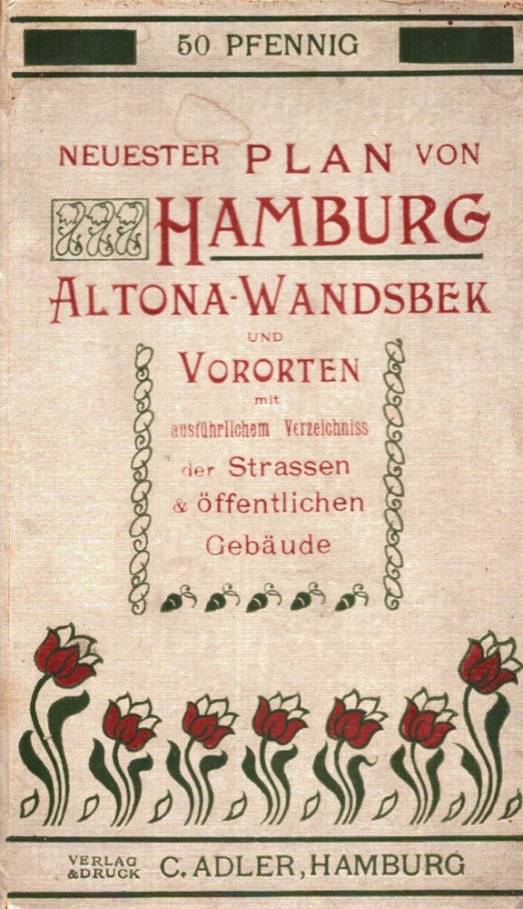
1915ref. 39340Hamburg, C. Adler, [ca. 1915]. 24 S. Straßenverzeichnis (mit Sondermarkierungen für A: Altona, W: Wandsbek, O: Ohlsdorf-Fuhlsbüttel und P: Preussisches Gebiet). Mit 1 mehrf. gefalt. farb. lithogr. Plan im Maßstab 1:18.000. Blattgröße 49,5 x 65 cm. Deckel cm. OLn.
1817ref. 11715AB1817. Vienna Geistinger 1817. 71 : 148 cm. Manyfolded contemporary coloured engraving. Contemporary mounted on linen. Interesting historical map giving an broad overview of the development of the history from ancient times until the 18th century. Friedrich Strass 1766-1846 was a teacher at the monastery of Berge near Magdeburg. His "Strom der Zeiten" got a great populariety and was admired also from the foreign countries. - As mostly browned. unknown
1998A clean, unmarked book with a tight binding. 8 3/4"w x 11 1/4"h. 216 pages. Many b&w photos.
ref. 0783499000.Gmap. Good. Access codes and supplements are not guaranteed with used items. May be an ex-library book. unknown