Benchmark MapsBiblio.com
12.228 resultados
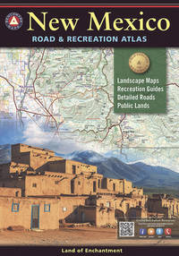
2021ref. 1-0929591615National Geographic Maps 2021. Paperback. New. map edition. 96 pages. 15.00x10.25x0.30 inches. National Geographic Maps paperback
ref. ANAIS-0929591895National Geographic Maps. paperback. Good. 11x0.6x15.6. Buy with confidence. Excellent Customer Service & Return policy. National Geographic Maps paperback
2012ref. DADAX0929591895National Geographic Maps 2012-11-05. 2016. paperback. New. 11.00x0.50x15.50. Buy with confidence. Excellent Customer Service & Return policy. National Geographic Maps paperback
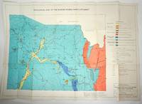
1960ref. 29317Sydney: Dept. of Mines NSW 1960. First printing. Maps. Overall very good condition. 21 loose folding maps of mining in New South Wales. Various sizes in the original stiff paper titled wrapper. Titled 'Maps for Technical Reports Volume 8 1960' on the spine in black. The "Folder of maps accompanies v. 8 1960 other volumes have maps in back pockets." Maps include: Geological Map of the Pike Creek Dam Site; Gold Occurrence in Portions 72 and 78 Parish Tomalla County Hawes; Sample Positions of Quartz Veins in Pportions 72 and 78 Parish Tomalla County Hawes; Plan of the Emu Creek Mine Area; Emu Creek Mine Inset "A"; Emu Creek Mining Syndicate Damsite; Mount Copper Area - Rockley; Plan of "The Mount" Copper Mine showing Rock Type; DLA 950 Sara River; Sections Looking Upstream Across Sara River on DLA950; Kopi Hollow Gypsum Deposit; Locality Map. Extractive Industries City of the Blue Mountains; Lower MacLeay River District; Wells of the Lower MacLeay River District; Conductive Map Lower MacLeay River District; Rainfall Map of the Wollombi Brook Catchment; Map of Wollombi Brook Warkworht-Broke Section; General Geology of the Wollombi Brook; General Geology of the Wollombi Brook; Geological Survey of the Border Rivers Inner Catchment. Maps in excellent condition on thick paper varied sizes 37.25 x 26.5" 26 x 18" 18 x 13" 13 x 9" in tan stiff paper folder torn. Listed in one of Libraries Australia ID 55570014 127080025 4104725 139998138 154863371. Dept. of Mines NSW unknown
1945ref. 70987Chicago IL: Rand McNally & Co 1945. Map 26 ¼ x 29 ¾ inches Lake Michigan blue parks golf courses and boulevards dark green elevated lines and stations and subways red bus lines and railroads are also marked; marked CG99 in margin but without a date. Recto maps north Chicago to Evanston verso south Chicago to Calumet City inset map recto 31 ½ x 6 inches maps the North Shore from Evanston to Waukegan. Folded into narrow 8vo cream wrappers printed in red "Chicago Pocket Map". Traces of mounting on rear wrapper verso else very good. Rand McNally & Co unknown books
1974ref. 2083002116200974Meiji Maps Tatsumi Ueno and others 1974. Soft Cover. Fine. The book is in fine condition. Meiji Maps Tatsumi Ueno and others paperback
1807London, Rob. Laurie and Ja. Whittle, 1807. 62x49,5 cm. Kobberstukket kort over Sverige med Sundet og til Gävle og Fahlun i nord, Gotland og den Botniske Bugt i øst. I smuk original helkolorering. Rent frisk eksemplar trykt på kraftigt papir.
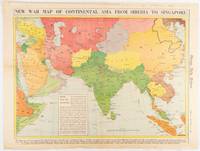
1942ref. 180760Chicago.: Chicago Daily Tribune. January 91942. Printed colour map on a single newspaper leaf 37.2 x 53.4 cm; 45 x 59.9 cm sheet inset legend marginal browning and at the folds lower margin with small edges tears not affecting the caption but remarkably bright in very good condition. Rare map of Asia "Between Suez on the west and Shanghai on the east" showing territorial interests and theatres of war published in the Chicago Daily Tribune in January 1942 barely two months after the Uniited States had joined the war effort after the bombing of Pearl Harbour. Thailand and Vietnam "French Indo-China" are marked "Occupied by the Japanese" and north-eastern China similarly marked Iran "Anglo-Russian Occupation" and the Gulf states "British Ally". The caption notes that "The map inludes waters thru which runs the British life line from the Suez canal to remote Australia and New Zealand. Nearly half the people in the world live in the lands shown on this map--more than 450 million for example in China and more than 375 million in India". ". the historic Chicago Tribune was an innovator in color inks and printing but also a pioneer in bringing colorful art in the form of illustrations photographs cartoons and advertisements to the average person in an everyday medium." see The Janet A. Ginsburg Chicago Tribune Collection Michigan State University Libraries. . Chicago Daily Tribune. unknown
1954VIII + 60 pages . Un plan en couleurs dépliant - Map of lover New York et deux plans en noir .- 60 p. , 250 gr
2004ref. SBBI-mon0000029953Compass Maps 2004. map. Good. Our good condition books are generally good for reading but not for gifting or collecting. They could have imperfections such as creasing fanning inscriptions margin notes yellowing staining on edge or cover or pages bumps scuffs etc etc sometimes multiple of these. It's a wide category that encompasses anything that isn't almost-new down to anything that is slightly better than poor. We would NOT recommend gifting Good books - these should be considered reading copies. Our books are dispatched from a Yorkshire former cotton mill. We list via barcode/ISBN so please note that the images are stock images and may not be the exact copy you receive furthermore the details about edition and year might not be accurate as many publishers reuse the same ISBN for multiple editions and as we simply scan a barcode or enter an ISBN we do not check the validity of the edition data when listing. If you're looking for an exact edition please don't order at least not without checking with us first although we don't always have time to check. We aim to dispatch prompty the service used will depend on order value and book size. We can ship to most countries see our shipping policies. Payment is via Abe only. Compass Maps unknown
1963ref. 80578Wesleyan University Press. As New. Hardcover. FREE UPGRADE to Courier/Priority Shipping Upon Request - IN STOCK AND IMMEDIATELY AVAILABLE FOR SHIPMENT - AS NEW THE TEXT BLOCK IS PRISTINE CLEAN UNMARKED AND IN EXCELLENT CONDITION - - xiv 430 pp. 154 photos. bibliog. index 4to. -- with a bonus offer-- . 1963. Wesleyan University Press hardcover
2005ref. Q-1841393908Compass Maps 2005-03-04. Paperback. New. New. In shrink wrap. Looks like an interesting title! Compass Maps paperback
ref. 1845879570.Gmap. Good. Access codes and supplements are not guaranteed with used items. May be an ex-library book. unknown
2012ref. 1-1597752371Natl Geographic Society Maps 2012. Paperback. New. rol map edition. 1 pages. 31.80x2.00x1.90 inches. Natl Geographic Society Maps paperback
ref. 1845878167.Gmap. Good. Access codes and supplements are not guaranteed with used items. May be an ex-library book. unknown
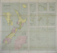
1865ref. 154409London.: George Philip & Son. 1865. 9 coloured maps by William Hughes segmented and mounted on linen 55.3 x 65.2cm. Folds into cloth covered case 17.2 x 12cm. Spine of case little faded and ribbon tie missing. Relief shown by hachures and spot heights. Philips' series of travelling maps series. Very good copy. Features a dominant map of New Zealand with 3 maps as insets to this map and 6 other maps separately shown within their own borders. The 3 inset maps are: Norfolk Island and Philip Island; Enlarged map of Auckland and the adjacent country; Enlarged plan of the country around Dunedin and the eastern portion of the Otago Gold Fields from Thomson's map. The 6 maps in addition to the New Zealand map are The Ladrones or Mariana Islands; The Sandwhich Islands; The Galapagos Islands; The New Hebrides and Santa Cruz Islands; The Feejee Friendly and Samoan Islands; The Marquesas Society and Low Archipelago. The New Zealand maps includes a list of native tribes and their locations. . George Philip & Son. hardcover
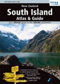
2009ref. SBBIH-MBDS4RPVCWMPHema Maps New Zealand Ltd 2009. map. Good. Our good condition books are generally good for reading but not for gifting or collecting. They could have imperfections such as creasing fanning inscriptions margin notes yellowing staining on edge or cover or pages bumps scuffs etc etc sometimes multiple of these. It's a wide category that encompasses anything that isn't almost-new down to anything that is slightly better than poor. We would NOT recommend gifting Good books - these should be considered reading copies. Our books are dispatched from a Yorkshire former cotton mill. We list via barcode/ISBN so please note that the images are stock images and may not be the exact copy you receive furthermore the details about edition and year might not be accurate as many publishers reuse the same ISBN for multiple editions and as we simply scan a barcode or enter an ISBN we do not check the validity of the edition data when listing. If you're looking for an exact edition please don't order at least not without checking with us first although we don't always have time to check. We aim to dispatch prompty the service used will depend on order value and book size. We can ship to most countries see our shipping policies. Payment is via Abe only. Hema Maps New Zealand Ltd unknown
ref. SONG1925625044HEMA 2018-06-01. 6th edition. spiral_bound. Used: Good. 7.09x1.00x9.84. Buy with confidence. Excellent Customer Service & Return policy. HEMA unknown
ref. DADAX1925625036HEMA 2018-12-20. 6th edition. spiral_bound. New. 8.74x0.59x11.77. Buy with confidence. Excellent Customer Service & Return policy. HEMA unknown
ref. 1877302651.Gspiral_bound. Good. Access codes and supplements are not guaranteed with used items. May be an ex-library book. unknown
1999ref. SBBI-mon0000049829APA Publications Pte Ltd 1999. misc_supplies. Good. Our good condition books are generally good for reading but not for gifting or collecting. They could have imperfections such as creasing fanning inscriptions margin notes yellowing staining on edge or cover or pages bumps scuffs etc etc sometimes multiple of these. It's a wide category that encompasses anything that isn't almost-new down to anything that is slightly better than poor. We would NOT recommend gifting Good books - these should be considered reading copies. Our books are dispatched from a Yorkshire former cotton mill. We list via barcode/ISBN so please note that the images are stock images and may not be the exact copy you receive furthermore the details about edition and year might not be accurate as many publishers reuse the same ISBN for multiple editions and as we simply scan a barcode or enter an ISBN we do not check the validity of the edition data when listing. If you're looking for an exact edition please don't order at least not without checking with us first although we don't always have time to check. We aim to dispatch prompty the service used will depend on order value and book size. We can ship to most countries see our shipping policies. Payment is via Abe only. APA Publications Pte Ltd unknown
2014ref. SBBIH-DU5AHF55KJB5Hema Maps New Zealand Ltd 2014. map. Good. Our good condition books are generally good for reading but not for gifting or collecting. They could have imperfections such as creasing fanning inscriptions margin notes yellowing staining on edge or cover or pages bumps scuffs etc etc sometimes multiple of these. It's a wide category that encompasses anything that isn't almost-new down to anything that is slightly better than poor. We would NOT recommend gifting Good books - these should be considered reading copies. Our books are dispatched from a Yorkshire former cotton mill. We list via barcode/ISBN so please note that the images are stock images and may not be the exact copy you receive furthermore the details about edition and year might not be accurate as many publishers reuse the same ISBN for multiple editions and as we simply scan a barcode or enter an ISBN we do not check the validity of the edition data when listing. If you're looking for an exact edition please don't order at least not without checking with us first although we don't always have time to check. We aim to dispatch prompty the service used will depend on order value and book size. We can ship to most countries see our shipping policies. Payment is via Abe only. Hema Maps New Zealand Ltd unknown
2008ref. SBBIH-WKZAECDOILJ6Hema Maps New Zealand Ltd 2008. map. Acceptable. Please see the condition note after this for details if this is missing please consider Acceptable to mean poor quality that could include major staining water damage writing missing dustjacket etc etc. Our books are dispatched from a Yorkshire former cotton mill. We list via barcode/ISBN so please note that the images are stock images and may not be the exact copy you receive furthermore the details about edition and year might not be accurate as many publishers reuse the same ISBN for multiple editions and as we simply scan a barcode or enter an ISBN we do not check the validity of the edition data when listing. If you're looking for an exact edition please don't order at least not without checking with us first although we don't always have time to check. We aim to dispatch prompty the service used will depend on order value and book size. We can ship to most countries see our shipping policies. Payment is via Abe only. Hema Maps New Zealand Ltd unknown
ref. 1875992154.Gpaperback. Good. Access codes and supplements are not guaranteed with used items. May be an ex-library book. paperback
1968Very slight marks to a few pages. No inscriptions. A very clean very tight copy with bright unmarked boards and no bumping to corners. Dust jacket not price clipped with very slight marking, creasing/rubbing to edges and small tears to spine ends. 111pp. New Zealand in 1968 in fifty-two full page colour plates with extensive detail and caption on opposite pages. A very scarce book.