12.289 resultados
194438" wide by 25.5" high. Dated June, 1944. Moderate wear. Nice copy. Map
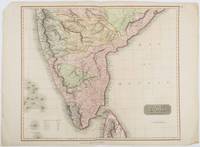
1816ref. 185242London.: Thomson. 1816. Engraved map with full handcolour 50.5 x 59.7 cms ; 53.9 x 73.8 cms sheet central fold a few minor edge tears one intruding into the top border the map unscathed marginal edgewear two corners with some loss but the map in very good crisp condition. An elegant map with great detail prepared for John Thomson's influential "New General Atlas" 1814-1821. Showing India from 20 degrees to 7 degrees north of the equator and includes the northern half of Ceylon with territorial interests attractively coloured. . Thomson. unknown
1708ref. 8917London: John Nicholson 1708. Full Leather. Very Good binding. Octavo. xxxviii 2 412; 2 382 2 ads 32 index pp. maps. First edition. Contemporary paneled-calf boards with modern reback. Title page to Volume 1 and four of the eight maps are lacking but are supplied in tasteful facsimile. The maps in facsimile are the North America New England Virginia and Maryland and Carolina. Bindings are solid and presently nicely; contents are clean and bright; but for the maps and title page this is an exceptional set. Of this work William Reese writes: "This basic 18th-century reference work on British America . . . offers an excellent comprehensive survey of Great Britain's American colonies at the point when those on the mainland of North America had grown past their initial phase and were expanding rapidly in population and productivity. . . . This important contemporary work would probably have been the first point of reference for any Englishman at the time" Reese Struggle for North America 1. Usually attributed to Oldmixon who penned the dedication but occasionally gets attributed to Moll according to Sabin. A significant work by the British historian. Howes O-61 "aa"; European Americana 1708/95; ESTC T45485; Sabin 57156. John Nicholson unknown
1965Traditional road map measuring 20" x 40" when unfolded. One side provides colour maps of the province. The back side provides very detailed information about campsites around the province and extensive information about B.C.'s native fish as well as hunting and fishing regulations, including fees. Unmarked with moderate wear. A sound vintage copy. Map
1962Traditional road map measuring 20" x 40" when unfolded. One side provides a colour map of the province. The back side provides very detailed information about campsites around the province and extensive information about B.C.'s native fish as well as hunting and fishing regulations, including fees. Unmarked with moderate wear. A sound vintage copy. Map
1957176 pages. Endpapers decorated with colour maps. Designed to tell the story of what British Columbia was and is. Tells stories of romance and adventure; of exploration and settlement; of the search for riches in furs, in gold, in fisheries, farming and forestry. Tells the story of development; of the building of a character and a homogeneous province; of a God-fearing pioneering people dedicated to progress, strengthened by their contest with a great land at first reluctant to yield its full resources. Contents: agriculture; historical background; committees; education; energy and power; fisheries; forestry and logging; government; mining; programme; recreation. Illustrated with a multitude of interesting old black and white photographs as well as some modern colour photos. Attractive colour-illustrated boards. Book
1976Catalogue No. En 64-14w/7N-7S. Folds open to reveal two large fold-out maps. Average wear. Minimal markings. A sound working copy. Book
193036 pages. Incudes 17 pages of maps of Provincial locales. Sepia-tone reproductions of photos of picturesque Provincial scenes. Unmarked. Average wear and external soiling. Binding intact. A sound copy of the lovely B.C. tourism memento. Book
1959Traditional road map measuring 31" x 24" when unfolded. Provides excellent colour map coverage of the Province as well as detailed, and now historic, information about campsites in regions around the province. Moderate wear. Four-inch opening along a fold. A quality vintage copy. Map
19689" x 4" - folds out to 24" x 18". Colour map on one side shows B.C. Ferry routes. Reverse side provides details of tourist destinations with colour photos, reservation details for the sailing to Prince Rupert, corporate contact details, and a brief statement by W.A.C. Bennett. Unmarked with moderate wear. A sound copy. Book
1903ref. 75062London: McCorquodale 1903. First edition of this atlas map folio 16 1/4 x 27 1/2 inches. 5 sheets of British Commission maps and index map; 13 sheets of United States Commission maps Alaska boundary atlas and index map. Total of 20 maps 19 folding and 5 in color Maps are 53 x 32 inches. All but the British index map folded and backed in linen. Quarter red morocco over red cloth. Gilt Royal Seal to front board and spine. Maps mounted on linen and sectioned as issued. Portfolio case with moderate rubbing chipping to leather. Does not include the 10 cards to accompany the U.S. Commission maps seems to be common that these smaller ones are missing. Old staining to cloth. Toning and edge wear to British Index map. Slight toning and offsetting to maps. Overall a very good copy; quite scarce. [McCorquodale] hardcover
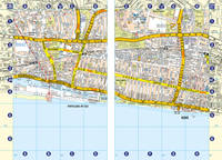
2001No marks or inscriptions. No creasing to covers or to spine. A lovely clean very tight copy with bright unmarked boards and no bumping to corners. 48pp. Guide to the London Eye.
Format (Bildbereich): 21 x 26 cm. Leicht gebräunt, insgesamt gut erhalten. Landkarten de
1972No marks or inscriptions. A lovely clean very tight copy with bright unmarked boards and no bumping to corners. Price clipped dust jacket not marked or torn with light creasing/rubbing to edges. 143pp. The British Isles as it looked forty years ago.
1963No marks or inscriptions to contents. Slight creasing to front corners, creasing to spine. Very clean very tight pages with slightly dusty boards, small mark to front, a little rubbing to spine and no bumping to corners. 214pp. Routes around Britain for the car traveller using many by-roads to get the traveller to a destination more quickly (1963 style). The book avoids the industrial areas - as these are not 'worthy of recommendation to the tourist' !
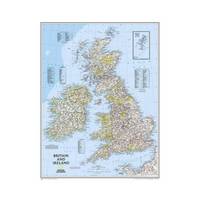
2013ref. 1-0792250230Natl Geographic Society Maps 2013. Map. New. lam map edition. 1 pages. 24.00x2.00x2.00 inches. Natl Geographic Society Maps unknown
200116mo, 172 pages, colour maps. eng
ref. 1845876997.Gpaperback. Good. Access codes and supplements are not guaranteed with used items. May be an ex-library book. paperback
ref. 0008445230.Gpaperback. Good. Access codes and supplements are not guaranteed with used items. May be an ex-library book. paperback
2004ref. 1190668Frankfurt am Main; Berlin; Bern; Bruxelles; New York; Oxford; Wien: Peter Lang, 2004. 306 S. Softcover.
1973ref. nf183Solar Broché 1973 In-8, (21x10.5 cm), broché, couverture illustrée, 181 pages, manuel ; pliures sur le dos, bon état. Livraison a domicile (La Poste) ou en Mondial Relay sur simple demande.
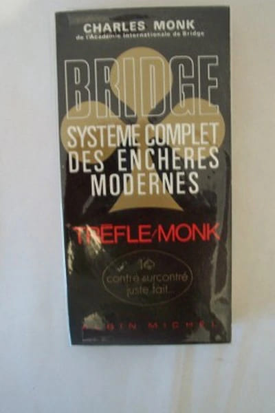
ref. 4404Albin Michel 1970 livre guide 21*10,5 276 pages
1947ref. dm504Editions du vieux Monaco Brochure 1947 In-12 (11,5 x 17,7 cm), brochure, 95 pages ; rousseurs et quelques marques d'usage sur les plats,par ailleurs assez bon état général. Livraison a domicile (La Poste) ou en Mondial Relay sur simple demande.
ref. 3451Paris, Fayard, 1973 14 x 20, 446 pp., cartonnage + jaquette, très bon état
ref. 85092Verviers, Les Nouvelles Editions Marabout, 1979. 11 x 18, 185 pp., broché, très bon état.