|
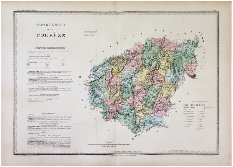
DUFOUR (Auguste-Henri).
[CORRÈZE] Département de la Corrèze.
Paris, Maison Bouasse-Lebel et ancienne Maison Basset réunies, [circa 1860]. 538 x 751 mm.
Bookseller reference : LBW-5911
|
|
|
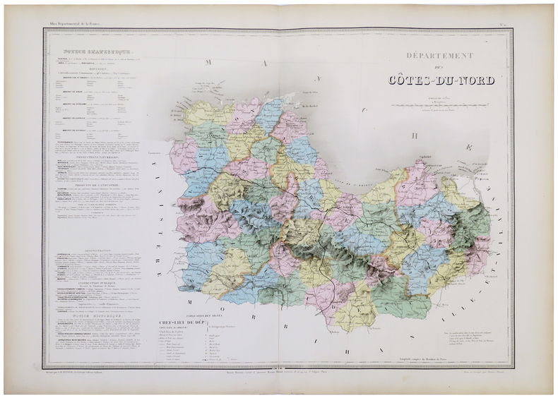
DUFOUR (Auguste-Henri).
[CÔTES-d'ARMOR] Département des Côtes-du-Nord.
Paris, Maison Bouasse-Lebel et ancienne Maison Basset réunies, [circa 1860]. 547 x 743 mm.
Bookseller reference : LBW-5328
|
|
|
DUFOUR (Auguste-Henri).
[FINISTÈRE] Département du Finistère.
Paris, Maison Bouasse-Lebel et ancienne Maison Basset réunies, [circa 1860]. 544 x 758 mm.
Bookseller reference : LBW-5331

|
|
|
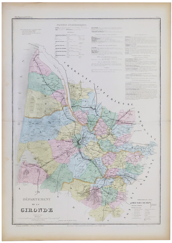
DUFOUR (Auguste-Henri).
[GIRONDE] Département de la Gironde.
Paris, Maison Bouasse-Lebel et ancienne Maison Basset réunies, [circa 1860]. 761 x 534 mm.
Bookseller reference : LBW-5332
|
|
|
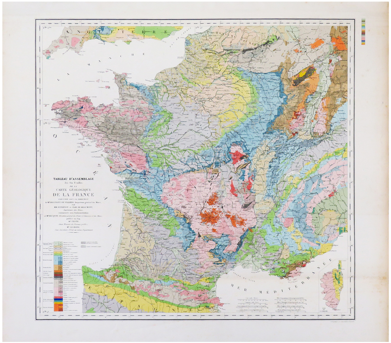
DUFRÉNOY (Armand) & BEAUMONT (Léonce Élie de) & ANDRIVEAU-GOUJON (Eugène).
[GÉOLOGIE] Tableau d'assemblage des six feuilles de la Carte géologique de la France exécutée sous la direction de M.r Brochant de Villiers, Inspecteur Général des Mines, par MM. Dufrénoy et Élie de Beaumont, ingénieurs des Mines, commencée sous l'administration de M.r Becquey, Directeur général des Ponts et Chaussées des Mines, publiée en 1841.
Paris, E. Andriveau-Goujon, 1864. 537 x 564 mm.
Bookseller reference : LBW-6836
|
|
|
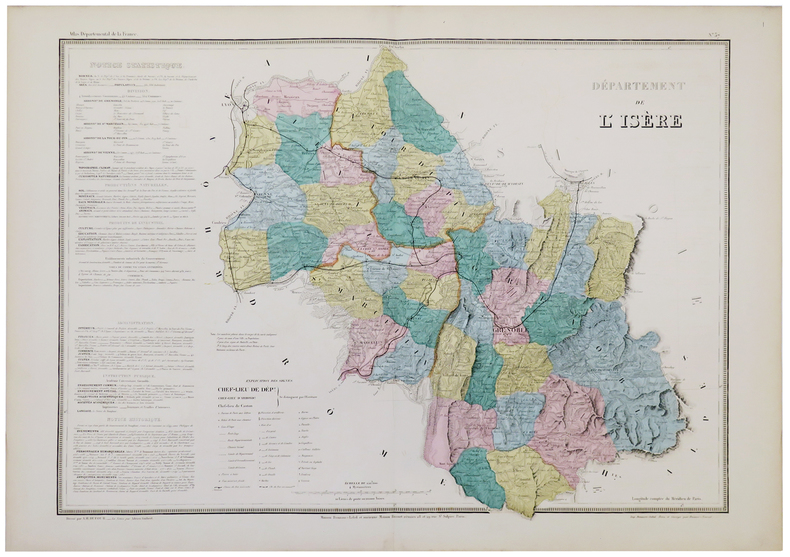
DUFOUR (Auguste-Henri).
[ISÈRE] Départements de l'Isère.
Paris, Maison Bouasse-Lebel, [circa 1860]. 540 x 748 mm.
Bookseller reference : LBW-5333
|
|
|
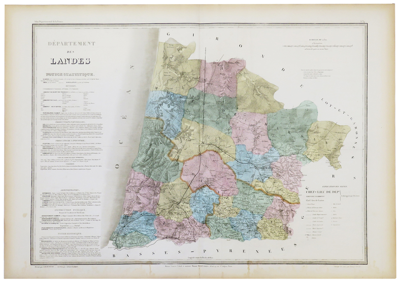
DUFOUR (Auguste-Henri).
[LANDES] Département des Landes.
Paris, Maison Bouasse-Lebel et ancienne Maison Basset réunies, [circa 1860]. 545 x 747 mm.
Bookseller reference : LBW-5334
|
|
|
DUFOUR (Auguste-Henri).
[LOIRE-ATLANTIQUE] Département de la Loire Inférieure.
Paris, Maison Bouasse-Lebel et ancienne Maison Basset réunies, [circa 1860]. 543 x 750 mm.
Bookseller reference : LBW-5335

|
|
|
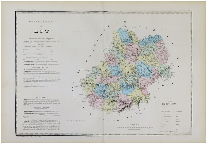
DUFOUR (Auguste-Henri).
[LOT] Département du Lot.
Paris, Maison Bouasse-Lebel et ancienne Maison Basset réunies, [circa 1860]. 542 x 748 mm.
Bookseller reference : LBW-5924
|
|
|
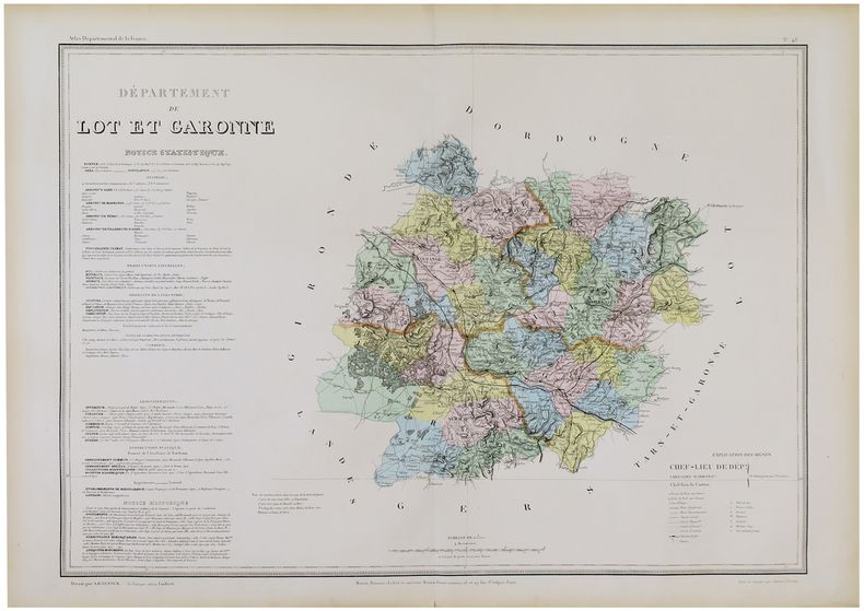
DUFOUR (Auguste-Henri).
[LOT-et-GARONNE] Département de Lot et Garonne.
Paris, Maison Bouasse-Lebel et ancienne Maison Basset réunies, [circa 1860]. 547 x 746 mm.
Bookseller reference : LBW-5925
|
|
|
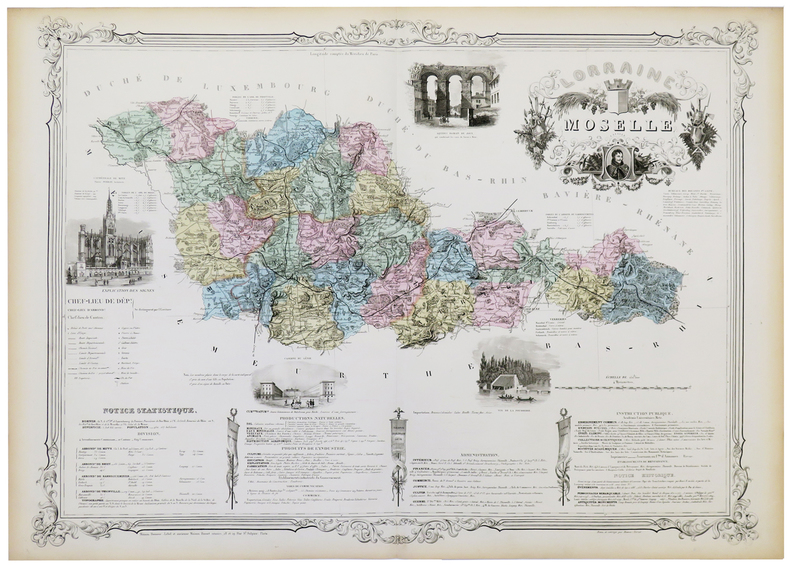
DUFOUR (Auguste-Henri).
[MOSELLE] Lorraine. Moselle.
Paris, Maison Bouasse-Lebel et ancienne Maison Basset réunies, [circa 1860]. 582 x 806 mm.
Bookseller reference : LBW-5339
|
|
|
DUFOUR (Auguste-Henri).
[NIÈVRE] Département de la Nièvre.
Paris, Maison Bouasse-Lebel et ancienne Maison Basset réunies, [circa 1860]. 540 x 746 mm.
Bookseller reference : LBW-5967

|
|
|
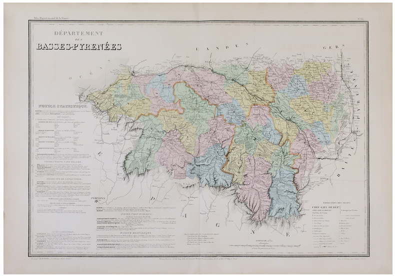
DUFOUR (Auguste-Henri).
[PYRÉNÉES-ATLANTIQUES] Département des Basses-Pyrénées.
Paris, Maison Bouasse-Lebel et ancienne Maison Basset réunies, [circa 1860]. 540 x 754 mm.
Bookseller reference : LBW-5883
|
|
|
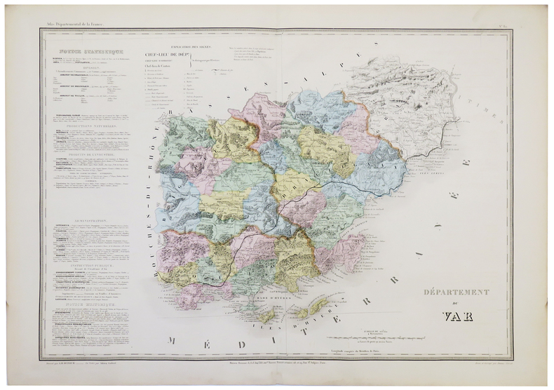
DUFOUR (Auguste-Henri).
[VAR] Département du Var.
Paris, Maison Bouasse-Lebel et ancienne Maison Basset réunies, [circa 1860]. 533 x 753 mm.
Bookseller reference : LBW-5344
|
|
|
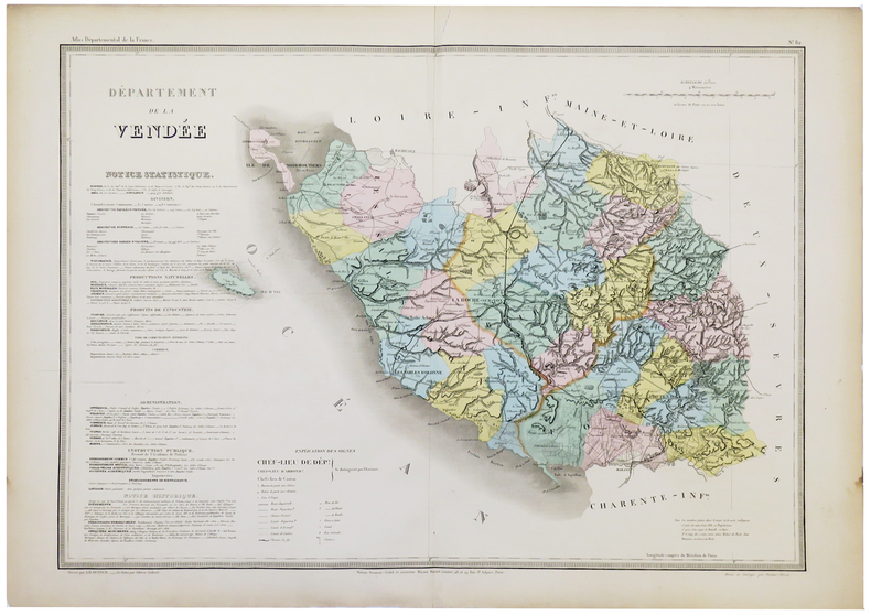
DUFOUR (Auguste-Henri).
[VENDÉE] Département de la Vendée.
Paris, Maison Bouasse-Lebel et ancienne Maison Basset réunies, [circa 1860]. 539 x 752 mm.
Bookseller reference : LBW-5345
|
|
|
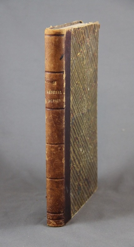
DUFOUR Guillaume-Henri:
Campagne du Sonderbund et événements de 1856. Précédé d’une notice biographique.
Neuchâtel, Genève, Lib. J. Sandoz; Lib. Desrogis, 1876. In-8 de [2]-250-[2] pages, demi-basane brune,.
Bookseller reference : 6645
|
|
|
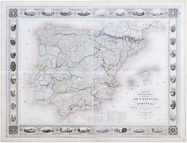
DUFOUR (Auguste-Henri).
Carte administrative, physique et routière de l'Espagne et du Portugal, indiquant les canaux, les rivières navigables, les chemins de fer, et les nouvelles divisions des provinces &c.
Paris, Bulla Frères, 1864. En deux feuilles pouvant être jointes pour former une carte de 0,95 x 1,25 m.
Bookseller reference : LBW-6823
|
|
|
DUFOUR (Guillaume-Henri).
Carte hydrographique, itinéraire et administrative de l'Empire français, comprenant la Belgique et les provinces du Rhin et indisuant toutes les voies de communications ainsi que les limites des préfectures, sous-préfectures et cantons, dédiée à S.M. l'Empereur.
Lanée 1862 1 vol. en feuilles carte en couleurs entoilée (au format 154 x 152 cm), se repliant sous étui de percaline marine. Grande et belle carte de la France à l'échelle 1/700 000e. Quelques rousseurs au dos toilé, sans atteinte à la carte. Très bon état.
Bookseller reference : 52792
|
|
|
Dufour Guillaume Henri:
Carte Dufour - Fac-similé.
Wabern, Office fédéral de topographie, 1988. Etui au majestueux format de 42 x 60 cm. Bien complet des 25 planches, pliées en deux, au format 80 x 40 cm. A noter que la planche de titre fait partie des planches comptées, comme le confirme le feuillet de répartition des cartes.
Bookseller reference : 18327

|
|
|
DUFRESNOY, Lenglet:
Catalogue des meilleures cartes géographiques générales et partculières avec quelques remarques sur la choix qu'on en doit faire (Paris 1742).
Amsterdam, Meridian Publishing Co., MCMLXV, (), pt. in-8°, 252 p., brochure originale.
Bookseller reference : 40607aaf
|
|
|
DUFOUR, Guillaume Henri (1787 - 1875):
Der Sonderbunds- Krieg und die Ereignisse von 1856. (Mit einer Editionsvorbemerkung) und eingeleitet durch eine biographische Skizze (von Edouard Sayous). 3. Aufl.
Basel, Schwabe, 1882, in-8vo, Front.-Portr. (Gen. Dufour; leicht stockfleckig) + 3 Bl. + 180 S. + 5 Kartenskizzen auf 4 Faltblättern, Vorsatz mit Besitzvermerk, Hldr. mit goldgepr. Rückentitel und etwas vergoldung, Rücken leicht verblasst, sonst sehr gutes Exemplar.
Bookseller reference : 44590aaf
|
|
|
DUFOUR (Auguste-Henri);
Grèce moderne.
Paris Armand Le Chevalier 1863 555 x 754 mm.
Bookseller reference : LBW-1069

|
|
|
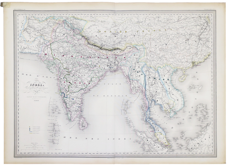
DUFOUR (Auguste-Henri).
Indes, Colonies anglaises.
Paris, Paulin et Le Chevalier, 1858. 554 x 753 mm.
Bookseller reference : LBW-5181
|
|
|
DUFOUR, Landeskarte:
Landes Karte Schweiz 1:25.000: Auf Lwd. aufgezogen in Orig.-Schuber :
Bressanini & Mühlhaupt sculps., (1849) in-8vo, montée sur toile / auf Lwd aufgezogen, unvollständig, je 5 Karten in fünf Schuber mit Titelschild auf rotes Leder mit Aufschrift ‘Landes Karte 1: 25 000 Dem SAC zur Jahrhunderfeier - Eidg. Militärdepartement’. PAR CARTE 50.- Ens. 250.-
Bookseller reference : 13286aaf
|
|
|
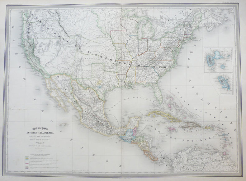
DUFOUR (Auguste-Henri);
Mexique Antilles et Californie.
Paris Paulin et Le Chevalier 1858 547 x 753 mm.
Bookseller reference : LBW-939
|
|
|
Dufour, Auguste Henri / Amari, Michele Benedetto Gaetano.
Carte de Sicilie dans son état actuel [...] Avec les réductions de la carte ancienne d'après Ptolémée et de la carte arabe d'après Edrisi. Paris, Lemercier, 1859.
Engraved map. 550 x 690 mm (image), 595 x 760 mm (sheet). Scale 1:519,210. 18 sections mounted on paper. Rare topographical map of Sicily, featuring two inset maps after Ptolemy and Al-Idrisi, allowing an immediate comparison of the depictions of the island in the 2nd, 12th, and 19th centuries. The main map identifies a remarkable number of towns and villages, including Palermo, Catania, Syracuse, Mazara, Caltanissetta, and Nicosia, as well as mountains, roads and paths. Two additional insets show Malta and the Aeolian Islands. Engraved by the German-French engraver and cartographer Erhard Schieble (1821-80). - Slightly foxed. Rarely seen at auction.
|
|
|
DUFOUR, Auguste-Henri y DUVOTENAY, Thunot.
El Globo. Atlas Histórico Universal de Geografía Antigua, de la Edad Media y Moderna.
Madrid, Biblioteca Ilustrada de Gaspar y Roig, Editores, 1852. 4to. mayor; 292 pp. de texto y 44 mapas dobles grabados en acero por Ramón Alabern, (de 46, faltando los correspondientes a Cuba y Chile - Perú). Encuadernación en media piel, de la época.

|
|
|
Dufour, Guillaume Henri.:
Topographische Karte der Schweiz: Blatt XI, Pontarlier. Yverdon. Vermessen und herausgegeben auf Befehl der Eidgenössischen Behörden. Topographischer Atlas im Maasstab 1 : 100`000.
18 Segmenten auf Leinen aufgezogen. Aufgefaltet 55 x 75 cm. Landkarten de
|
|
|
Dufour, Guillaume Henri:
Topographische Karte der Schweiz: Blatt VII, Porrentruy - Solothurn (mit Nachträgen bis 1868). Vermessen und herausgegeben auf Befehl der Eidgenössischen Behörden. Topographischer Atlas im Maasstab 1 : 100.000.
18 Segmenten auf Leinen aufgezogen. Aufgefaltet 55 x 75 cm. - Stempel und Bezeichnung auf Leinenrücken. Landkarten de
|
|
|
Duguid A. Fortescue/Neal JIP. maps J. I.
Official History of the Canadian Forces in the Great War 1914-19: General Series Volume 1: Aug. 1914-Sept. 1915
Ottawa: J.O. Patenude 1938. 1st printing. VG/Good dust jacket. xxviii 596 p. folding color maps/charts folding map on front pastedown addenda/corrigenda slip laid in indexes 8vo; J.O. Patenude hardcover
Bookseller reference : 46436

|
|
|
DUGUID Col. A. Fortescue; NEAL Captain J. I. P. maps
Official History of The Canadian Forces in The Great War 1914-1919 General Series Vol. 1: From the Outbreak of War to the Formation of the Canadian Corps August 1914 - September 1915
Ottawa: Published by authority of the Minister of National Defence 1938. Hardcover. Very good/Fair. xxv 596 p. 25 cm. 9 fold-out colour maps and charts. Red cloth hardcover with gold lettering. In mylar-covered dustjacket with large chip and tear in rear and spine head. Canadian Army Medical Corps stamps on front endpapers. <br/><br/> Published by authority of the Minister of National Defence hardcover
Bookseller reference : 116352

|
|
|
DUMONT D'URVILLE (Jules-Sébastien-César) & SAINSON (Louis-Auguste de).
[AUSTRALIE/NOUVELLE-ZELANDE] Nouvelle-Hollande - Nouvelle-Zélande.
[Paris, 1833]. 370 x 233 mm.
Bookseller reference : LBW061b0
|
|
|
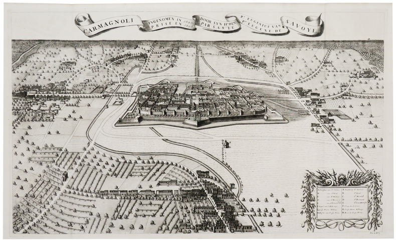
DUMONT (Jean).
[CARMAGNOLA] Carmagnoli ingenomen in 1691 door Syn H.t den P.r Eugenius van Savoye - Carmagnoli prise en 1691 par S.A.S. le P.r Eugène de Savoye.
[La Haye, Isaac van der Kloot, 1729]. 494 x 819 mm.
Bookseller reference : LBW-6099
|
|
|
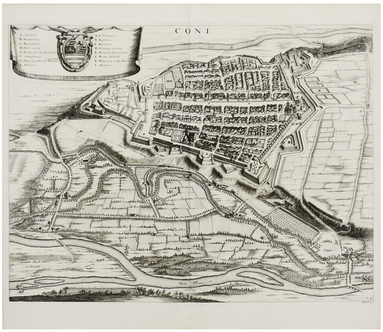
DUMONT (Jean).
[CUNEO] Coni.
[La Haye, Isaac van der Kloot, 1729]. 445 x 577 mm.
Bookseller reference : LBW-6129
|
|
|
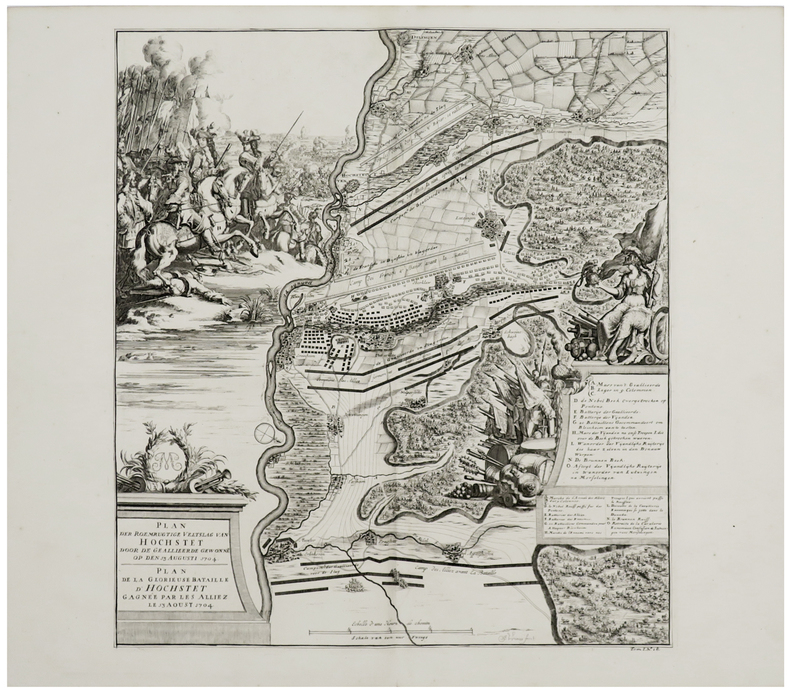
DUMONT (Jean).
[HÖCHSTÄDT] Plan der roemrugtige veltslag van Hochstet door de geallieerde gewonne op den 13 augusti 1704 - Plan de la glorieuse bataille d'Hochstet gagnée par les alliez le 13 aoust 1704.
[La Haye, Isaac van der Kloot, 1729]. 476 x 428 mm.
Bookseller reference : LBW-6130
|
|
|
DUMONT D'URVILLE (Jules-Sébastien-César) & GOUPIL (Ernest).
[JAVA] Entrée du canal de Samarang (Ile de Java).
[Paris, 1841-1854]. 260 x 391 mm.
Bookseller reference : LBW-1312

|
|
|
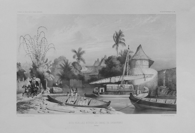
DUMONT D'URVILLE (Jules-Sébastien-César);LE BRETON (Louis);
[JAVA] Site sur les bords du canal de Samarang (Ile Java).
Paris 1841-1854 262 x 358 mm.
Bookseller reference : LBW-1311
|
|
|
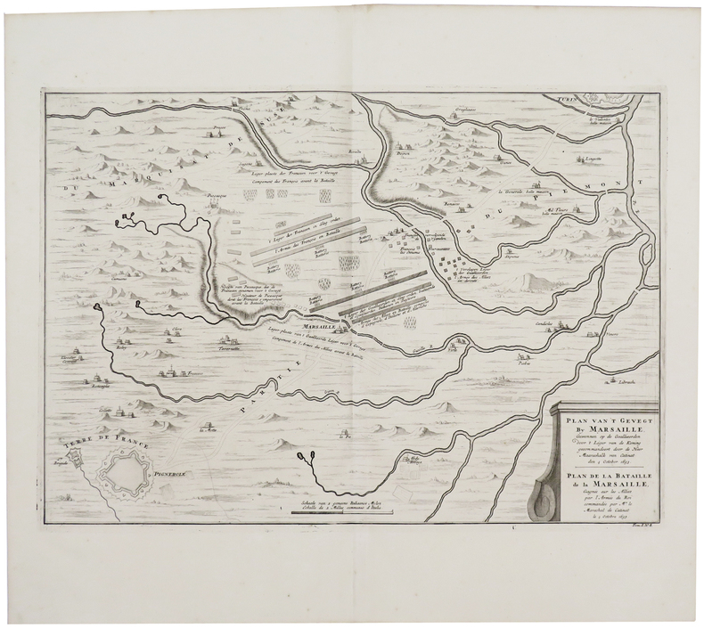
DUMONT (Jean).
[MARSAGLIA/PINEROLO] Plan van't gevegt by Marsaille [...] van Catinat den 4 october 1693 - Plan de la bataille de La Marsaille [...] par Mr le méaréchal de Catinat le 4 octobre 1693.
[La Haye, Isaac van der Kloot, 1729]. 368 x 533 mm.
Bookseller reference : LBW-6131
|
|
|
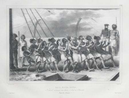
DUMONT D'URVILLE (Jules-Sébastien-César) & RAFFET (Auguste).
[NOUVELLE-ZELANDE] Baie Houa-Houa. Naturels exécutant une danse à bord de l'Astrolabe (Nouvelle-Zélande).
[Paris, 1833]. 263 x 348 mm.
Bookseller reference : LBW061b5
|
|
|
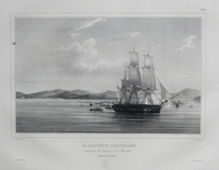
DUMONT D'URVILLE (Jules-Sébastien-César) & SAINSON (Louis-Auguste de).
[NOUVELLE-GUINEE] La corvette l'Astrolabe, attaquée par les naturels de la côte nord (Nouvelle Guinée).
[Paris, 1833]. 243 x 342 mm.
Bookseller reference : LBW061b7
|
|
|
DUMONT D'URVILLE (Jules-Sébastien-César);SAINSON (Louis-Auguste de);
[NOUVELLE-ZELANDE] Nouvelle-Zélande.
Paris, [1833]. 352 x 262 mm.
Bookseller reference : LBW061aa
|
|
|
DUMONT D'URVILLE (Jules-Sébastien-César) & SAINSON (Louis-Auguste de).
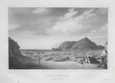
[NOUVELLE-ZELANDE] L'Anse de l'Astrolabe (Nouvelle-Zélande).
[Paris, 1833]. 257 x 362 mm.
Bookseller reference : LBW061b1
|
|
|
DUMONT D'URVILLE (Jules-Sébastien-César) & SAINSON (Louis-Auguste de).
[NOUVELLE-ZELANDE] Nouvelle-Zélande.
Paris, [1833]. 332 x 275 mm.
Bookseller reference : LBW061ab
|
|
|
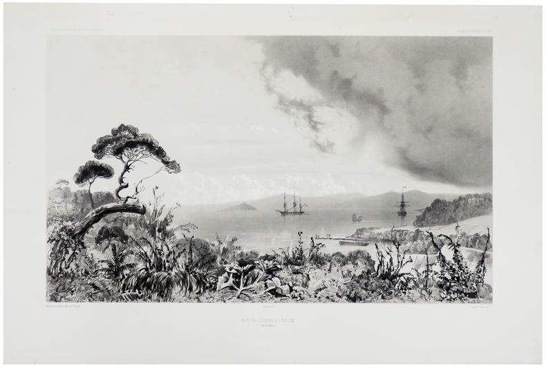
DUMONT D'URVILLE (Jules-Sébastien-César) & LE BRETON (Louis).
[NOUVELLE-ZELANDE] Baie de Sarah's Bosom (Iles Auckland).
Paris, [1841-1854]. 282 x 426 mm.
Bookseller reference : LBW-1309
|
|
|
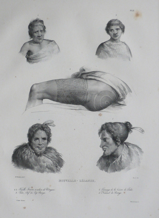
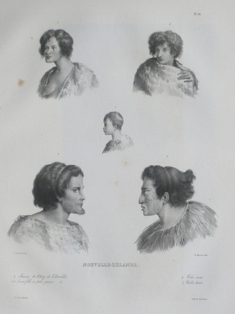
DUMONT D'URVILLE (Jules-Sébastien-César).
[NOUVELLE-ZÉLANDE] Nouvelle-Zélande. Costume des guerriers de Shouraki - Costume des habitans de Houa-Houa.
[Paris, 1833]. 250 x 330 mm.
Bookseller reference : LBW-5462

|
|
|
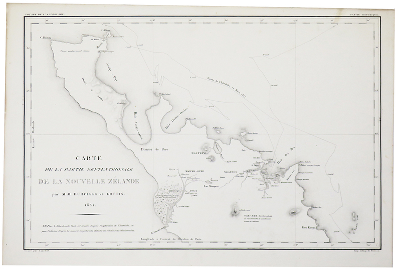
DUMONT D'URVILLE (Jules-Sébastien-César).
[NOUVELLE-ZÉLANDE] Carte de la partie septentrionale de la Nouvelle Zélande par M.M. Durville et Lottin.
[Paris, 1833]. 302 x 460 mm.
Bookseller reference : LBW-5460
|
|
|
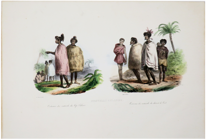
DUMONT D'URVILLE (Jules-Sébastien-César).
[NOUVELLE-ZÉLANDE] Nouvelle Zélande. Costumes des naturels du Cap Palliser - Costumes des naturels du Détroit de Cook.
[Paris, 1833]. 202 x 380 mm.
Bookseller reference : LBW-5465
|
|
|
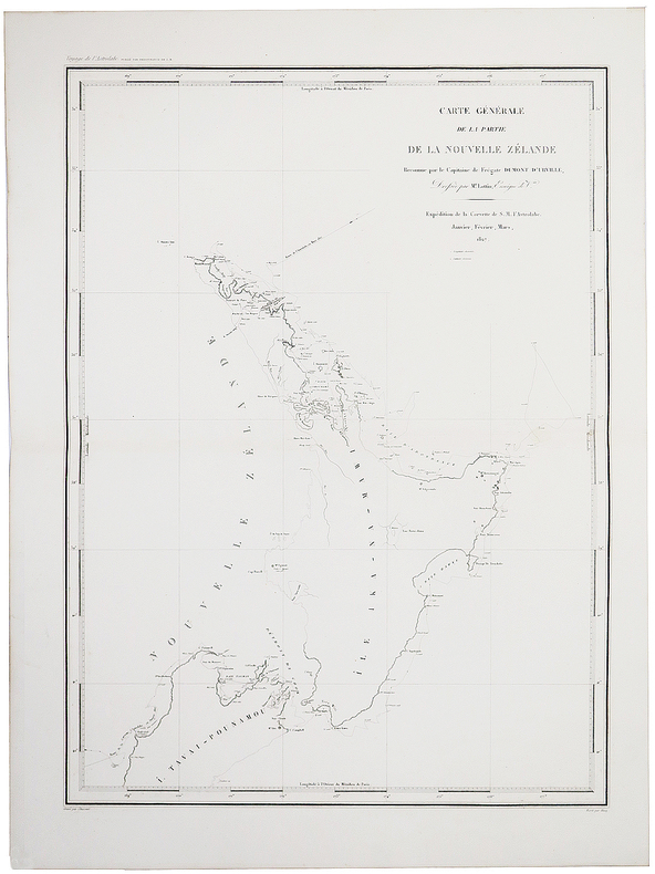
DUMONT D'URVILLE (Jules-Sébastien-César).
[NOUVELLE-ZÉLANDE] Carte générale de la partie de la Nouvelle Zélande reconnue par le Capitaine de Frégate Dumont d'Urville, dressée par M.r Lottin, enseigne de V.au.
[Paris, 1833]. 581 x 429 mm.
Bookseller reference : LBW-5457
|
|
|
DUMONT (Jean).
[OUDENAARDE] Plan der veldslag van Oudenaerde den 11 July 1708 - Plan de la bataille d'Oudenaerde du 11 juillet 1708.
[La Haye, Isaac van der Kloot, 1729]. 484 x 585 mm.
Bookseller reference : LBW-6128

|
|
 Receive by email
 Download as PDF document
 RSS feed


