|
|
|
Battisti, Carlo - Giacomelli, Gabriella
I nomi locali del Burgraviato di Merano. Vol. II, Parte II.
cm. 17 x 24, iv-256 pp. Dizionario toponomastico atesino - Serie II 430 gr. iv-256 p.
|
|
|
Battisti, Carlo - Giacomelli, Gabriella
I nomi locali del Burgraviato di Merano. Vol. II, Parte I.
cm. 17 x 24, 268 pp. Dizionario toponomastico atesino - Serie II 430 gr. 268 p.
|
|
|
Battisti, Carlo - Gori, Lavio - Piacentini, Anna Maria
I nomi locali del Basso Isarco. Parte III.
cm. 19 x 27,5, 418 pp. con 1 c. ripiegata. Dizionario toponomastico atesino - Serie I 730 gr. 418 p.
|
|
|
Battisti, Carlo - Montecchini, Maria
I nomi locali della Pusteria. Parte I.
cm. 19 x 27,5, 510 pp. Dizionario toponomastico atesino - Serie I 1060 gr. 510 p.
|
|
|
Battisti, Carlo - Montecchini, Maria
I nomi locali della Pusteria. Parte II: La giurisdizione di Brunico.
cm. 19 x 27,5, 400 pp. Dizionario toponomastico atesino - Serie I 838 gr. 400 p.
|
|
|
Battisti, Carlo - Montecchini, Maria
I nomi locali della Pusteria. Parte III: Giurisdizione di Castel Tures.
cm. 19 x 27,5, 484 pp. con 4 tavv. f.t. Dizionario toponomastico atesino - Serie I 1005 gr. 484 p.
|
|
|
Battisti, Carlo - Montecchini, Maria
I nomi locali della Pusteria. Parte IV: Aggiunte e indici.
cm. 19 x 27,5, xxxviii-200 pp. Dizionario toponomastico atesino - Serie I 503 gr. xxxviii-200 p.
|
|
|
Battisti, Carlo - Vecchi, Maria Luisa
Commento al foglio 11. I nomi locali della Valle del Sarca.
cm. 17 x 24, 180 pp. Atlante Toponomastico della Venezia Tridentina 285 gr. 180 p.
|
|
|
Battisti, Carlo - Ventura, Elisabetta
Commento al foglio 14. I nomi locali del Basso Trentino Occidentale.
cm. 17 x 24, 120 pp. Atlante Toponomastico della Venezia Tridentina 192 gr. 120 p.
|
|
|
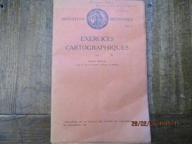
BAULIG (Henri)
Exercices cartographiques.
1927 Strasbourg, Publications de la faculté des lettres, 1927. In-8 broché, 52 pages plus table des matières.
Bookseller reference : 3143
|
|
|
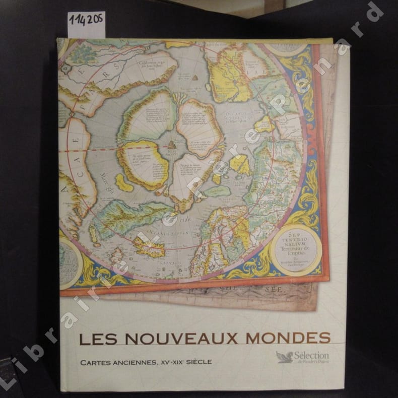
BAYNTON-WILLIAMS, Ashley & Miles
Les nouveaux mondes. Cartes anciennes, XVe-XIXe siècle.
2007 Sélection du Reader's Digest - 2007 - Grand in-folio, cartonnage noir sous jaquette illustrée en couleurs de l'éditeur, dans son emboîtage cartonné toilé jaune - 224 p. - Très riche iconographie in et hors texte en couleurs - PREVOIR UNE AUGMENTATION DE FRAIS DE PORT EN CAS D'ENVOI POSTAL
Bookseller reference : 114205
|
|
|
Baynton Williams Roger
Investing in Maps
New York: Clarkson N. Potter Inc. Publisher 1969. Fine condition in a Fine dust jacket. NOT price clipped $7.95. NO chips. NO tears. NO creases. Protected by a removable Brodart clear-plastic sleeve. Bright shiny clean square. Sharp corners. NOT a library discard. NO owner's name or bookplate. NO underlining. NO highlighting. NO margin notes. 1969. First U. S. Edition. A useful guide to collecting maps that can be found on the market today rather than museum pieces or extreme rarities. Covers map-makers engravers publishers values etc. Over 100 illustrations many in full color. Bound in the original gilt-stamped dark blue cloth. Complete with dust jacket. Oversize Hardcover. 8.5" wide by 12" tall. This large heavy book will require extra postage for Priority and International shipments but only the standard charge for media mail. First U. S. Edition. Oversize Hardcover. Fine condition/Fine dust jacket. 160pp. Great Packaging Fast Shipping. Clarkson N. Potter Inc., Publisher Hardcover
Bookseller reference : 018246
|
|
|
BAYNTON-WILLIAMS (Ashley)
Town and City Maps of the British Isles 1800-1855.
First Edition, folio, 56 coloured plates, orig. cloth, d.w. This book includes the work of nine leading cartographers spanning the first half of the nineteenth century.
|
|
|
Baynton-Williams, Roger
Investing in Maps
No marks or inscriptions. No creasing to covers or to spine. A lovely clean crisp very tight copy with bright unmarked boards and no bumping to corners. 160pp. An excellent study on the history of maps and cartography with many illustrated examples in superb condition.

|
|
|
Baynton-Williams,Ashley. Baynton-Williams,Miles.
Les nouveaux mondes: Cartes anciennes, XVe - XIXe siècle.
Grâce à ce livre, vous allez remonter dans le passé et découvrir un monde où des créatures exotiques et d'étranges indigènes peuplent les blancs laissés sur les cartes, où des monstres marins et des îles mouvantes rôdent au large de côtes incertaines, où la frontière entre mythe et réalité n'est pas établie. Fruit de cinq siècles d'exploration, plus de 120 cartes d'océans et de continents, de mont <br/> STATO: NUOVO.<br/> TITOLO: Les nouveaux mondes: Cartes anciennes, XVe-XIXe siècle. <br/> AUTORE: Baynton-Williams,Ashley. Baynton-Williams,Miles.<br/> EDITORE: Selection du Reader's Digest<br/> DATA ED.: 2007,<br/> EAN: 9782709818896

|
|
|
Bayton Williams
INVESTING IN MAPS
London: Barrie & Rockliff 1969. 160pp well illustrated throughout some in colour. A very nice copy in fine condition. 1st edition. hardback. Fine/Fine. 4to - over 9�" - 12" tall. Barrie & Rockliff Hardcover
Bookseller reference : H182
|
|
|
BAZGAR SHAH - Avec la collaboration de Régis GUYOTAT - Cartographie réalisée par Alain et Vera Marigo
AFGHANISTAN LA RESISTANCE AU COEUR. (Chronologie afghane - Naïm, enfant espion - L'arrestation - Les Khans de Gerdab - Des prisons du roi aux geôles communistes - Pechawar ou le temps de l'exil - Yad-Datche (carnets) - Le temps des commandants - Le temps des calamités - La soviétisation en marche - La liberté demain)
PARIS, Editions Denoël -1987 - Broché - In-8, 140 x 225 mms - Couverture illustrée couleurs - Photographies et cartes NB HT - Cartographie réalisée par Alain et Vera Marigo - En annexe nombreux facs-similé d'écritures - 229 pages + table - Bon exemplaire tat -
Bookseller reference : 14690
|
|
|
BEAUTEMPS BEAUPRE
CARTE DES COTES DE FRANCE . Partie comprise entre La Pointe de Perray et la Pointe de la Courbe .( LES PERTUIS) . Levée en 1824 - 1825 par les ingénieurs géographes de la Marine sous les ordres de M Beautemps Beaupré . Nouvelle édition d' après les travau
1887 1887 P, Service hydrographique de la Marine , 1887 , grande carte gravée de 95 x 66 cm . Carte courte de marge ( découpée pour une question d' encombrement ?) . Quelques annotations de navigation . Langue: Français
Bookseller reference : M18482
|
|
|
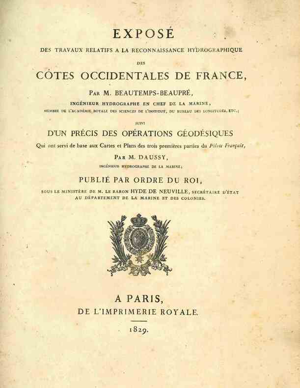
BEAUTEMPS-BEAUPRE (Charles-François).
Exposé des travaux relatifs à la reconnaissance hydrographique des côtes occidentales de France suivi d'un précis des opérations géodésiques qui ont servi de base aux cartes et plans des trois premières parties du Pilote Français par M. Daussy.
A Paris, de l'Imprimerie Royale, 1829. 1829 1 vol. in-4° (291 x 225 mm) de: [2] ff. (titre, table); 124 pp.; 1 grande carte dépliante: «Trigonométrique des côtes occidentales de France par M. Daussy». (Quelques rousseurs, plis et petites déchirures à la carte). Demi-toile verte d'époque, dos lisse titré en lettres dorées, plats recouverts de papier marbré vert.
Bookseller reference : 4945
|
|
|
Beaurain, Chevalier de :
Histoire militaire du duc de Luxembourg, contenant le détail des marches, campemens, batailles, sièges et mouvements des armées du Roi et celles des Alliés en Flandre ; ouvrage dédié et présenté à S.M. Louis XV. Nouvelle édition plus correcte et accompagnée des cartes générales du Pays.
La Haye, Benjamin Gibert, 1756 ; tomes premier et second : Campagne de 1690 et campagne de 1691 ; deux tomes reliés en un volume, in-4 ; demi-basane à coins havane, faux-nerfs dorés, pièce de titre vert clair, tranches mouchetées de bleu (reliure ancienne) ; XVI, 90 ; 146 pp., 5 grandes cartes dépliantes (Nouvelle carte du Comté de Flandre, dressée sur des mémoires fidèles ; Carte du Comté de Flandres par Guillaume de l'Isle ; Carte des camps de Saint-Amand et de Leuse, les 2 et 17 mai 1690, par le chevalier de Beaurain ; Carte des camps de Leuse et d'Hauterive les 17 et 20 mai 1690, par le chevalier de Beaurain ; Carte des camps d'Hauterive et d'Harlebeck les 20 et 21 mai 1690, par de Beaurain).
Bookseller reference : 5629
|
|
|
BEAULIEU, Sébastien de Pontault (seigneur de)
Plan et cartes des villes d'Artois - Les plans et profils des principales villes et lieux considérables du comté de Flandre, (---) du comté d'Alost ou Flandre impériale (---) - (---) du duché de Brabant (---), (---) du duché de Cambray (---), (---) du comté de Haynaut (---) - (---) du comté de Namur (---) - (---) du duché de Luxembourg(---) . Paris. Par le chev. De Beaulieu.
"Atlas in-4°oblong (17 x 20 cm) plein veau marron granité, dos à nerfs, pièce de titre de maroquin bordeaux, dos (mors) habilement restaurés. Ex-Libris contrecollés en garde. Serpente moderne en regard de la f. de titre : Plan et cartes des villes d'Artois. S.l.s.d. [1668]. Titre gravé. 2 f. (texte imprimé) - 5 f. (texte gravé, dont 1f. d'armoiries). 42 planches gravées. Les plans et profils des principales villes et lieux considerables du comté de Flandre. A Paris par le chevalier de Beaulieu, [vers 1668]. 1 f. (titre gravé), 6 f. (texte imprimé), 4 f. (texte gravé), 1f. Louis XIV vainqueur (reddition d'une ville de Flandre par Romeyn de Hooghe) 78 planches gravées. Les Plans et profils des principales villes et lieux considerables du comté d'Alost ou Flandre imperiale. A Paris par le Sr de Beaulieu, [vers 1668]. 1f. (titre gravé), 2 f. (texte gravé). 11 planches gravées. Les plans et profils des principales villes et lieux considerables du duché de Gueldre. A Paris par le chevalier de Beaulieu, [vers 1668]. 1 f. (titre gravé) 1 planche gravée. Les Plans et profils des principales villes et lieux considerables du duché de Brabant. A Paris, par le Sr de Beaulieu, [vers 1668]. 1f. (titre gravé), 1 f. (texte gravé), 8 planches gravées. Les Plans et profils des principales villes et lieux considerables du duché de Cambray. Avec la carte generale et les particulieres de chaqu. gouvert. S.l., par le chevalier de Beaulieu, [vers 1668]. 1 f. (titre gravé), 1f. (texte imprimé), 6 planches gravées. Les Plans et profils des principales villes et lieux considerables du comté de Haynaut. A Paris, par le chevalier de Beaulieu, [1668]. 1 f. (titre gravé), 1 f. (texte imprimé), 1f. (texte gravé), 34 planches gravées. Les Plans et profils des principales villes du comté de Namur. S.l., par le chevalier de Beaulieu, [vers 1668]. 1 f. (titre gravé), 1 f. (texte gravé), 7 planches gravées. Les Plans et profils des principales villes et lieux considerables du duché de Limbourg. S.l., par le chevalier de Beaulieu, [vers 1668]. 1 f. (titre gravé), 3 planches gravées. Les Plans et profils des principales cilles et lieux considerables du duché de Luxembourg. S.l., par le chevalier de Beaulieu, [vers 1668]. 1 f. (titre gravé), 2 f. (texte imprimé), 1 f. (texte gravé), 15 planches gravées. Très bon état. Seules les séries sur ALOST, BRABANT, LIMBOURG et LUXEMBOURG sont complètes. En tout 206 planches sans les titres gravés pour cet ensemble dit des ""petits beaulieu"". Étui."
Bookseller reference : 21432
|
|
|
BEATRICETTO Nicolas Beatrizet detto Thionville 1515 circa - Roma 1565
(La Valletta)
Terzo stato della pianta di La Valletta, pubblicata per la prima volta da Nicola Beatrizet.Nel cartiglio in basso a destra si legge: La sopra detta Citta è, d' Longhezza Canne 500. In circha et di Largezza Canne 300. In Circha. In quello i alto a sinistra una legenda con 11 punti con il titolo: Disegno de' porti e' forti del'Isola de Malta. In basso a sinistra sono riportate le indicazioni editoriali: Ant. Lafrerij Romae 1566. Nel mare, è disegnata la scala grafica, di 6 unità, priva di misura. Orientazione mediante una rosa dei venti dove sono indicati il Settentrione, Mezzo di, Oriente, Levante, il nord-est è in alto. Prima rappresentazione a stampa del porto e della rada dell’odierna La Valletta, attribuita dalla letteratura a Nicolas Beatrizet. Della prima stesura dell’opera, con la firma dell’autore, oggi si sono perse le tracce (cfr. Ganado-Schirò p. 135), ma l’esistenza è testimoniata da Almagià (1929) che riferisce di una pianta del porto di Malta, con medesimo titolo, recante in basso a sinistra la firma: Nicolaus beatricius lotharingius fecit e formis suis exc. Pertanto, la pianta può essere analizzata solo attraverso gli esemplari della seconda stesura che, in luogo della firma del Beatricetto, recano l’imprint editoriale: Romae 1563, cum gratia et privilegio. L’opera è stampata a Roma, con tutta probabilità dalla tipografia di Salamanca & Lafreri. Si basa sulla pianta manoscritta del 1558 attribuita a Bartolomeo Genga, un ingegnere militare italiano, che presentò al Gran Maestro Jean de la Valette un originale progetto per una cittadella fortificata da costruire sul promontorio che divideva il golfo. Tuttavia, altri dettagli, come la forma di Castel S. Elmo, sembrano essere desunti da fonti diverse. Ganado sostiene che probabilmente l’incisione sia stata realizzata per promuovere, nel mondo cattolico, una sorte di raccolta di fondi destinati alla costruzione della città fortificata; in cambio di un contributo veniva garantita l'indulgenza del Papa. Il primo stato della lastra, dunque, doveva già rispecchiare il progetto di Genga e fu probabilmente inciso nel 1558, come la pianta di Thionville, città natale del Beatricetto. Questo esemplare è databile 1566, anno in cui Lafreri ristampa la lastra originale, aggiornandola, emendandola e aggiungendo la propria firma. Il titolo è diverso e la tavola è arricchita dal un nuovo cartiglio contenente una legenda. La cittadella è rappresentata correttamente e segue la forma disegnata dall’architetto Francesco Laparelli. La lastra fu ereditata da Claudio Duchetti e quindi da Giacomo Gherardi ed è inserita nel catalogo redatto per la sua vedova (17-19 ottobre 1598, n. 197) dove è descritta come “la città di malta”. Venne acquisita, nel 1602, da Giovanni Orlandi che la ristampò inalterata con la sola aggiunta del proprio imprint. Il rame seguì poi la sorte delle lastre della tipografia Orlandi, che fu acquistata da Hendrik van Schoel e infine da Francesco de Paoli. Pertanto, sebbene non note, sono plausibili ulteriori tirature della lastra.Acquaforte e bulino in ottimo stato di conservazione.Stati & edizioni1°: a firma Nicolaus beatricius lotharingius fecit e formis suis exc.2°: come descritto, con imprint Romae 1563, cum gratia et privilegio.3°: cambia il titolo. Nel cartiglio in alto si legge: Disegno de porti et forti del’Isola de Malta con la Pianta dela nuova Citta Valetta edifficatta dal’Ill.mo et R.mp Sig.r Gran m[aest]ro. Fra Giovan de Valetta et per l’alphabetto qui sotto annottato si conoscera le cose piu Notabili apertenenti à sudetti luoghi. Segue una legenda alfanumerica (A-L). In basso a sinistra l’imprint Ant. Lafrerij Formis Romae. 1566.4°: aggiunto nel cartiglio in basso a destra l’imprint Ioanne Orlandi formis romae 1602. In the lower right-hand cartouche we read: a sopra detta Citta è, d' Longhezza Canne 500. In circha et di Largezza Canne 300. In Circha. In quello i alto a sinistra una legenda con 11 punti con il titolo: Disegno de' porti e' forti del'Isola de Malta. At the bottom left are the editorial indications: Ant. Lafrerij Romae 1566. In the sea, the graphic scale of 6 units, without measure, is designed. Orientation by means of a compass rose where the North, Middle of, East, Levant are, the north-east is at the top.First printed representation of the port and the bay of Valletta, attributed by the literature to Nicolas Beatrizet.This specimen can be dated 1566, when Lafreri re-prints the original plate, updating it, modifying it and adding its own signature. The title is different and the table is enriched by the new cartouche containing a legend.Etching and engraving in very good condition. Bifolco-Ronca (2018): n. 880, III/IV; Alberti (2009): n. 21; Almagià (1929): n. 33a; Ganado (2003): pp. 366-368 e 389-391, nn. 14, 34-35, tavv. 110, 131-132; Ganado-Schirò (2016): pp. 135-146, fig. 30; Pagani (2012): p. 84; Tooley (1939): nn. 361, 375.

|
|
|
BEATRICETTO Nicolas Beatrizet detto Thionville 1515 circa - Roma 1565
Thionville
In alto al centro, con caratteri grandi, si legge: THIONVILLE. In basso a sinistra, in un cartiglio di forma rettangolare: Vera Thiomvillae effigies sum, reddita docti Artificis manibus, quam modo Galli tenes, Dum tamen expugnor, cecidit fortissimus ille Stroza Italum Petrus gloria summa ducum. Anno domini. M.D.LVIII Die 22 Iunij. Sulla destra del cartiglio troviamo la firma: Nicolaus Beatrizet Lotaringus incidit: et formis. Orientazione nei quattro lati al centro con il nome dei punti cardinali: SEPTENTRIO, MERIDIES, ORIENS, OCCIDENS, il nord è in alto. Sono invertiti l’est e l’ovest. Pianta prospettica che raffigura la città durante la conquista del duca di Guisa. Possiamo dedurre dalla firma in lastra Nicolaus Beatrizet Lotaringus incidit: et formis, che venga incisa e pubblicata dall’artista lorenese. L’opera sembra essere il prototipo delle stampe dedicate all’avvenimento. L’assedio di Thionville si svolse dal 17 aprile al 23 giugno 1558. Si concluse con la vittoria dell’esercito francese comandato da Francesco di Guisa sull’esercito spagnolo. Il 17 aprile, le prime truppe del signore di Vieilleville arrivano sotto le mura di Thionville per prevenire l’arrivo delle razioni. Il 28 maggio arrivarono anche le truppe del duca di Guisa e Pietro Strozzi, nominato Maresciallo di Francia. Gli spagnoli tentarono di salvare le loro truppe intrappolate a Thionville, ma dopo due fallimenti, abbandonarono il presidio stesso. Il 21 giugno - come riportato nel cartiglio - il maresciallo Strozzi morì in seguito ad una ferita. Il 23 giugno, le truppe francesi presero possesso della città, ma il duca si oppone allo smantellamento delle fortificazioni. La città divenne francese, ma era completamente vuota perché a nessun residente fu permesso di rimanere. L’occupazione di Thionville dei francesi fu breve. Il 2 aprile 1559, Enrico II firma il trattato di Cateau-Cambrésis: Spagna e Francia si restituivano le conquiste fatte l’una a danno dell’altra negli ultimi otto anni, ma la Francia mantenne però Metz, Toul e Verdun. La prima tiratura è quella più diffusa nelle raccolte cinquecentesche. Attraverso un percorso che non siamo riusciti a ricostruire - come analoghe opere del Beatrizet, infatti, l’opera non è elencata nel catalogo Lafreri - la lastra fu acquistata da Giovanni Orlandi che ne realizzò una ristampa (1602) e quindi ceduta al fiammingo van Schoel (1614) autore dell’ultima edizione nota. Bulino, impresso su carta vergata coeva, con margini, in eccellente stato di conservazione. Esemplare del secondo stato di quattro, con l’indirizzo di Giovanni Orlandi e la data 1602. Bibliografia Bifolco-Ronca, Cartografia e topografia italiana del XVI secolo, pp. 1082-1083, tav. 446, II/IV; Destombes (1970): H.I. n. 12; Ganado (1994): p. 211, n. 26; Adhémar (1938): p. 94; Arrigoni-Bertarelli (1932): n. 24; Bartsch (1813): vol. XV, p. 271, n. 106 (TIB 29, p. 374); Bianchi (2003): n. 121; Robert-Dumesnil (1865) vol. IX, p. 178, n. 113. Top center, in large letters, reads: THIONVILLE. In the lower left corner, in a cartouche of rectangular shape: Vera Thiomvillae effigies sum, reddita docti Artificis manibus, quam modo Galli tenes, Dum tamen expugnor, cecidit fortissimus ille Stroza Italum Petrus gloria summa ducum. Anno domini. M.D.LVIII Die 22 Iunij. On the right of the cartouche we find the signature: Nicolaus Beatrizet Lotaringus incidit: et formis. Orientation in the four sides in the center with the name of the cardinal points: SEPTENTRIO, MERIDIES, ORIENS, OCCIDENS, the north is at the top. East and west are reversed. Perspective plan that represents the city during the conquest of the Duke of Guise. We can deduct from the signature on the plate Nicolaus Beatrizet Lotaringus incidit: et formis, which is engraved and published by the artist Lorraine. The work seems to be the prototype of the prints dedicated to the event. The siege of Thionville took place from April 17 to June 23, 1558. It ended with the victory of the French army commanded by Francis of Guise over the Spanish army. On April 17, the first troops of the Lord of Vieilleville arrived under the walls of Thionville to prevent the arrival of rations. On May 28, the troops of the Duke of Guise and Pietro Strozzi, appointed Marshal of France, also arrived. The Spanish tried to save their troops trapped in Thionville, but after two failures, they abandoned the garrison itself. On June 21 - as reported in the cartouche - Marshal Strozzi died following a wound. The 23 June, French troops took possession of the city, but the duke opposed to the dismantling of the fortifications. The city became French, but it was completely empty because no residents were allowed to stay. The occupation of Thionville by the French was brief. On April 2, 1559, Henry II signed the Treaty of Cateau-Cambrésis: Spain and France returned to each other the conquests made to the detriment of the other in the last eight years, but France kept Metz, Toul and Verdun. The first issue is the most common in sixteenth-century collections. Through a path that we have not been able to reconstruct - as similar works of Beatrizet, in fact, the work is not listed in the catalog Lafreri - the plate was purchased by Giovanni Orlandi who made a reprint (1602) and then sold to the Flemish Hendrick van Schoel (1614) author of the last known edition. Engraving, impressed on contemporary laid paper, with margins, in excellent condition. Exemple of the second state of four, with the address of Giovanni Orlandi and the date 1602. Literature Bifolco-Ronca, Cartografia e topografia italiana del XVI secolo, pp. 1082-1083, tav. 446, II/IV; Destombes (1970): H.I. n. 12; Ganado (1994): p. 211, n. 26; Adhémar (1938): p. 94; Arrigoni-Bertarelli (1932): n. 24; Bartsch (1813): vol. XV, p. 271, n. 106 (TIB 29, p. 374); Bianchi (2003): n. 121; Robert-Dumesnil (1865) vol. IX, p. 178, n. 113.

|
|
|
BEAULIEU SEBASTIEN DE PONTEULT ( 1612 - 1674 )
CARTE DE GOUVERNEMENT DE PORTOLONGONE
INCISIONE IN RAME, cm.43 X 54,5 + AMPI MARGINI ( cm.61 X 91 ). OPERA TRATTA DA " LE GLOURIEUSES CONQUISTES DE LOUIS LE GRAND ROY DE FRANCE ET DE NAVARRE ", IN PRIMO PIANO SCENA DI BATTAGLIA NAVALE TRA LA FLOTTA FRANCESE E QUELLA SPAGNOLA NELLA GUERRA TRA LE DUE POTENZE, SULLO SFONDO IL TERRITORIO DI PORTOLONGONE CON LE SUE FORTIFICAZIONI. NELLA PARTE ALTA, CARTIGLI CON LE INDICAZIONI DEI LUOGHI E LA STORIA DELLA BATTAGLIA. IN BASSO A DESTRA, RIQUADRO CON L'ISOLA D'ELBA E LA COSTA TOSCANA PROSPICENTE. BELLA VEDUTA IN OTTIMA CONSERVAZIONE, CARTA VERGELLATA FORTE. ID, 6704

|
|
|
Bedeschi Lorenzo
L'America non ha biciclette
copertina di Corrado Corazza

|
|
|
Bedfordshire County Council
A CATALOGUE OF THE MAPS IN THE Bedfordshire County Muniments Part II
Bedford: Bedfordshire County Council 1939. 47pp. Frontis.strip filed diagram. 1st edition. Paper Wrappers. Fine. 8vo. Bedfordshire County Council Hardcover
Bookseller reference : R495
|
|
|
Bedfordshire County Council
CATALOGUE OF THE ENCLOSURE AWARDS. Supplementary CatalogueI
Bedford: Bedfordshire County Council 1939. 45pp. Frontis. plan. Supplementary Catalogue of Maps and List of awards upon Tithe in the County of Bedfordshire Bedfordshire County Muniments Part III. 1st Edition. paper wrappers. Fine. 8vo. Bedfordshire County Council Hardcover
Bookseller reference : R479
|
|
|
Beers F. W
Atlas of Morris Co. New Jersey : From Actual Surveys and Records by and under the Direction of F.W. Beers Assisted by A. B. Prindle & Others
New York: F. W. Beers; A.D. Ellis; G.G. Soule 1868. Near Fine condition. NO chips. NO tears. A bright clean tight copy. The spine is square and flat with NO creases. NO owner's name or bookplate. Pages are bright white clean and crisp. This is an undated modern facsimile of the 1868 original. Oversize Softcover with black cloth spine. 10.75" wide by 14" tall. This atlas consists of a printed title-page; an outline map of Morris County; 31 single and double-page maps; a Table of Distances for Morris County; and 2 pages of lithographic views of 6 buildings George Washington's Headquarters in 1779/80; Boonton Academy; Schooley's Mountain Seminary; etc. Included are maps of: Washington; Chester; Mendham; Brookside; Stephensburg; Whippany; Morris; Morristown; Passaic; Green Village; New Vernon; Chatham; Madison; Troy; Hanover; Chatham Long Hill; Parsippany; Roxbury; Drakesville; Randolph; Dover; Oram; Jefferson; Flanders; Milton; German Valley; Schooley's Mountain; Rockaway; McCainsville; Succasunny; Hanover; Boonton; Montville; Boonton Borough; and Pequannock. Laid in is a facsimile of an old map of Morristown scale: 20 rods to the inch that unfolds to 22" wide by 25" tall. The map is keyed to the locations of Morristown businesses such as livery stables markets boot and shoe sellers manufactures physicians hotels editors merchants etc. This large book will require extra postage for Priority and International shipments but only the standard charge for media mail. Facsimile Edition. Oversize Softcover. Near Fine condition. Unpaged but 64 pages. F. W. Beers; A.D. Ellis; G.G. Soule Paperback
Bookseller reference : 016331
|
|
|
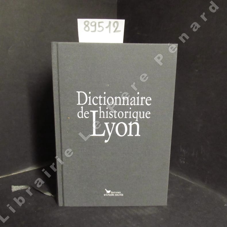
BEGHAIN Patrice - BENOIT Bruno - CORNELOUP Gérard - THEVENON Bruno
Dictionnaire historique de Lyon
2009 Edition Stéphane Bachès - 2009 - Fort in-8, broché, cartonnage toilé gris de l'éditeur - Riche iconographie in et hors texte en N&B et en couleurs
Bookseller reference : 89512
|
|
|
BEHRMANN, Walter:
Ueber die Niederdeutschen Seebücher des 15. und 16. Jahrhunderts. (Nachdruck).
Amsterdam, Meridian, 1978, gr. in-8°, VI + 110 S. + 4 Karten in losen Blättern (davon 3 in Farbe), Original-Broschüre.
Bookseller reference : 9460aaf
|
|
|
Beiser A. e redattori di TIME-LIFE.
LA TERRA.
(Codice CW/3326) In 4° (28 cm) 192 pp. Cieli, crosta terrestre, paesaggio, fossili ecc. Ottimo testo a cura di noti esperti, molte straordinarie foto a colori a piena pagina, vari bei disegni. Bibliografia, indici. Cartone editoriale. Buono stato. ~~~ SPEDIZIONE IN ITALIA SEMPRE TRACCIATA

|
|
|
Beiser Arthur e redattori di LIFE.
LA TERRA.
(Codice CV/4334) In 4° (28 cm) 192 pp. Cieli, crosta terrestre, paesaggio, fossili ecc. Illustrazioni a colori e in nero. Bibliografia, indici. Cartone editoriale, ottimo stato. Allegato grande poster a colori del National Geographic: NOTTE SULLA TERRA. ~~~ SPEDIZIONE IN ITALIA SEMPRE TRACCIATA

|
|
|
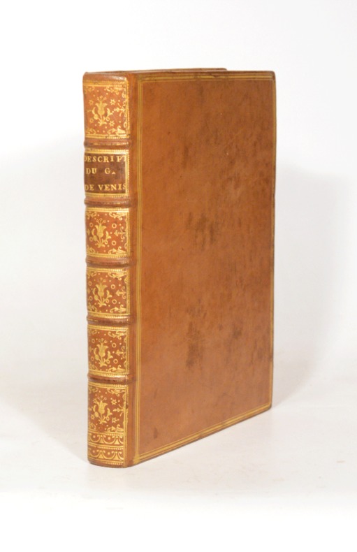
BELLIN (Jacques-Nicolas).
DESCRIPTION GÉOGRAPHIQUE DU GOLFE DE VENISE ET DE LA MORÉE. Avec des Remarques pour la Navigation, et des Cartes et Plans des Côtes, Villes, Ports et Mouillages.
1771 Paris, Imprimerie Didot, 1771. In-quarto (204 X 255 mm) veau blond, plats ornés d'un encadrement de triple filet doré, dos cinq nerfs filetés, caissons dorés ornés aux petits fers avec fleuron central, roulettes en queue, pièce de titre maroquin marron, coupes et coiffes filetées, bordure intérieure, tranches rouges (reliure de l'époque) ; (1) f. blanc, XII-235 pages, 49 planches hors-texte, (1) f. blanc.
Bookseller reference : 004496
|
|
|
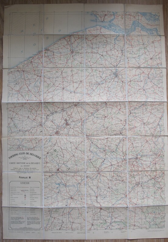
BELGIQUE CARTOGRAPHIE
Touring Club - Carte routière de la Belgique au 1/200.000e Feuille III (Flandres)
Touring Club, 1932. 37,5 x 97,5 cm. Carte sur toile pliée. Tirages en 4 couleurs.
Bookseller reference : 81577
|
|
|
BELFIORE Placido -
Sulle moderne cartografie catastali.
(Torino, 1952) stralcio con copertina posticcia muta, pp. 160/168. - !! ATTENZIONE !!: Con il termine estratto (o stralcio) intendiamo riferirci ad un fascicolo contenente un articolo di rivista, sia che esso sia stato stampato a parte utilizzando la stessa composizione sia che provenga direttamente da una rivista. Le pagine sono indicate come "da/a", ad esempio: 229/231 significa che il testo è composto da tre pagine. Quando la rivista di provenienza non viene indicata é perchè ci è sconosciuta. - !! ATTENTION !!: : NOT A BOOK : “estratto” or “stralcio” means simply a few pages, original nonetheless, printed in a magazine. Pages are indicated as in "from” “to", for example: 229/231 means the text comprises three pages (229, 230 and 231). If the magazine that contained the pages is not mentioned, it is because it is unknown to us.

|
|
|
Belle Forest Francois
Pourtraict de la magnique Cite' de Venise
(370 X 300) mm dimensione della tavola. (157 X 252) mm dimensione della veduta. Filigrana con lettera B sormontata da giglio. Incisore anonimo. Proviene da "La Cosmographie universelle de tout le monde". Belle Forest Francois (1530-1585). Cassini N.21: "La pianta è inserita in una sontuosa cornice architettonica, ricca di elementi araldici, putti, animali, ecc. In alto, al centro in caratteri tipografici "Pourtraict de la magnique Citè de Venise". Nell'interno della cornice e al di sopra della pianta:"Venise". Lungo il lato inferiore, entro il riquadro, 71 rimandi in italiano, segnati da lettere. Al centro del lato sinistro della cornice, entro uno scudo, il monogramma dell'editore Nicolas Chesneau che esercitò pure l'attività di incisore in alcune opere uscite a Parigi tra il 1556 e il 1583. Al centro del lato opposto, entro uno scudo, il monogramma di un artista ignoto, probabilmente un disegnatore tedesco della seconda metà del XVI secolo." Moretto N. 31.

|
|
|
BELLIN Jacques Nicolas -
Teatro della guerra marittima, e terrestre fra la Gran Bretagna, le Colonie Unite, la Francia, la Spagna, ed Olanda che comprende la raccolta delle carte nautiche, e terrestri. Necessario per l’intelligenza de’ fogli periodici per uso de’ novellisti.
Venezia, presso Vincenzo Formaleoni, in Ruga de’ due Pozzi S.ta Sofia, 1781, 4° legatura in cartonato coevo, tagli spruzzati, frontespizio inciso in rame con vignetta e cornice, e 37 (di 44) belle carte geografiche in calcografia, quasi tutte di grandi dimensioni e più volte ripiegate. Ciascuna carta è accompagnata da un’”illustrazione” testuale impaginata su due colonne con un fregio tipografico al centro (pp. 68 di 78). Sono presenti le seguenti carte: Carta ridotta del globo terreste, Carta dell’isola di Ceylan, Carta dello Stretto della Sonda ed Isole vicine, Carta dell’isola Celebes ov. Macassar, Carta particolare dell’isole Molucche, Carta dell’isole Filippine, I e II, Carta dell’Arcipelago di S.Lazzaro ov. le Isole Marianne, Il paese degli Ottentotti ne’ contorni del Capo di Buona Speranza, Carta della Bassa Guinea tra il Capo Tres Puntas e l’Equatore, Carta delle coste della Guinea dal Capo Verga sino al paese d’Issini, Impero del Monotapa e stati vicini, Carta della Costa d’Oro, CArta dei Regni di Congo Angola e Benquela con li paesi vicini, Carta del Senegal, Carta dell’Isole di Capo Verde, Carta del Golfo del Messico e dell’Isole Antille, Carta della Guyana, Carta della Virginia della baja Chesapeack e paesi vicini, Carta della Carolina e Giorgia, Carta della Baia di Hudson, Carta dell’Acadia Isola Reale e paesi vicini, Carta del corso del fiume di S.Lorenzo dalla foce fin sopra Quebec, Corso del fiume S.Lorenzo nel Canada’, Carta del Golfo di S.Lorenzo e paesi vicini (Isola di Terra Nuova), Carta dell’Isola di San Domingo, Carta dell’Isola della Martinica, Carta dell’Isola della Guadalupa, Carta dell’Isola di Grenada, Prospettiva di Gibilterra (molto bella e grande, con didascalie), Baja di Gibilterra, Carta dell’Isole Maldive, Carta dell’Isola di S.Cristoforo, Carta dell’Isola di Giammaica, Carta dell’Isola di Santa Lucia, Carta dell’Isola della Barbada. Legatura Dorso mancante, piatti molto lenti; frontespizio rifilato ai margini bianchi (per ca. 2 cm. per lato) a filo con la battuta dell’incisione; internamente, piccoli strappi marginali ad alcune carte; una macchia all’”illustrazione della carta dell’Isola di Capo Verde”; lievissime, rare fioriture; ma carta, nel complesso, ancora fresca e ben conservata. Ampi i margini.

|
|
|
BELLIN, JACQUES - NICOLAS.
Plan de l'Isle d'Elbe.
Tratta dal “Le Petit Atlas Maritime", Tome IV, N. 81, Francia, 1764 circa. Incisione in rame all'acquaforte, colore d'epoca, cm 18 x 23 (alla lastra) più margini. Jacques Bellin (1703 – 1772). Esemplare in tenue coloritura e in ottimo stato di conservazione. .

|
|
|
BELLIN, JACQUES NICOLAS - ROUILLE, M.
Carte réduite du Golphe de S.t Laurent. Contenant l'Isle de Terre – Neuve et Partie de la Coste Des Esquimaux, l'Isle Royale, L'isle S.t Jean et Celle D'Anticosti & ca. Dressée au dépost des Cartes Plans et Journaux de la Marine pour le Service des Vaisseaux du Roi par ordre de M. Rouillé.
Paris, 1754. Incisione in rame all'acquaforte, b/n, cm 56,5 x 89,7 (alla lastra) più margini. Cartiglio in alto a destra, margini graduati su tutto il perimetro. Rara carta nautica del mare orientale del Canada e del Golfo di San Lorenzon. Rare nautical maps of Eastern Canada Sea and the Gulf of Saint Laurent. Tranne un punto di ossidazione sul margine sinistro del foglio, esemplare stampato su carta forte, in ottimo stato di conservazione. .

|
|
|
BELLINI PAOLO.
Carte geografiche della Polonia. (sec. XVI-XIX). Dalla collezione di Jan Wladyslaw Wos.
in 8°, cop. edit. con sovracc. edit. ill., pp. 197,(3), con ill. n.t., ottimo es.
|
|
|
BELLOTTI Beatrice - D'OREFICE Maurizio - GRACIOTTI Roberto -
Saggio di rilevamento geomorfologico in Alta Valtellina (Vedretta de' Piazzi) : esempio di applicazione della normativa per la Carta Geomorfologica d'Italia in scala 1:50000. Geomorphological mapping in Alpine environment (Valtellina, Vedretta de' Piazzi) : a test of the rules for the geomorphological maps of Italy at the 1:50000 scale.
Roma, 1997, 4to stralcio con copertina posticcia muta, pp. 26 con 3 figure ed una cartina in nero, una carta a colori, 22 illustrazioni fotografiche a colori ed una carta a colori sciolta, più volte ripiegata. - !! ATTENZIONE !!: Con il termine estratto (o stralcio) intendiamo riferirci ad un fascicolo contenente un articolo, completo in se, sia che esso sia stato stampato a parte utilizzando la stessa composizione sia che provenga direttamente da una rivista. Le pagine sono indicate come "da/a", ad esempio: 229/231 significa che il testo è composto da tre pagine. Quando la rivista di provenienza non viene indicata é perché ci è sconosciuta. - !! ATTENTION !!: : NOT A BOOK : “extract” or “excerpt” means simply a few pages, original nonetheless, printed in a magazine. Pages are indicated as in "from” “to", for example: 229/231 means the text comprises three pages (229, 230 and 231). If the magazine that contained the pages is not mentioned, it is because it is unknown to us.

|
|
|
Bellotti Felice
Grande Nord
tavole non numerate in bianco e nero fuori testo

|
|
|
Bellotti Felice
Prodigioso Congo
96 tavole in bianco e nero fuori testo

|
|
|
Bellotti Felice
Terra Maya [MESSICO]
disegni nel testo numerose tavole a colori e in bianco e nero fuori testo

|
|
|
BENET PHILIPPE, RENATA HOLZBACHOVA
Delhi, agra, Rajahstan un art de vivre indo-musulman .
2003 ACR éditions 2003, 336 pages, grand in 4 reliure cartonnée toilée jaune, très bon état avec jaquette en bon état .
Bookseller reference : 14406
|
|
|
BENGT DANIELSSON
L'île du Kon-Tiki.
1943 Editions Albin Michel, 1943, 332 pages, in 8 broché, état correct, quelques usures et frottements, insolé, papier jauni, traduction M.Gay et Gerd. de Mautort.
Bookseller reference : 14331
|
|
|
BENNO cas oorthuys
Voici Florence.
Flammarion, contacts avec le monde, sans date, in12 broché, 95 pages, bon état.
Bookseller reference : 5220
|
|
|
BENASSI Umberto
Esposizione di cartografia parmigiana e piacentina nel Salone della Palatina. Catalogo
In 16, pp. 43 + (5). Br. ed. con annotazione manoscritta al piatto anteriore. Catalogo delle carte parmigiane e piacentine esposte durante il primo congresso della Societa' italiana per il progresso delle Scienze (Parma, settembre 1907) contenente l'elenco delle piante e carte topografiche delle Province parmensi, piante prospettiche di Parma, bozza di lavori idraulici per il Duca a tre miglia da Fontevivo, disegno per l'abbellimento del palazzo del governatore di Parma... Non contiene illustrazioni.
|
|
|
BENCINI Piero
Risoluzione di problemi GEODETICI e TOPOGRAFICI con le MACCHINE CALCOLATRICI SUPERAUTOMATICHE. Corposo estratto originale dal Bollettino di Geodesia e Scienze Affini, anno 12, n. 1, gen.-feb.-mar. 1953
In-8° (cm. 24x17), pp. 24 (da p. 143 a p. 166) + 36 TABELLE di calcoli delle coordinate o di controllo di anomalie eo di castati, o specchi di equazioni ecc.<; e con 13 FIGURE geom. nel testo. Cartoncino leggero editoriale a graffe metalliche. Censito come estratto in sole 2 bibl.
|
|
|
Bencini,Alberto - Malesani,Piergiorgio.
Fiume Arno: acque, sedimenti e biosfera.
<br/> TITOLO: Fiume Arno: acque, sedimenti e biosfera. <br/> AUTORE: Bencini,Alberto - Malesani,Piergiorgio.<br/> EDITORE: Olschki Ed.<br/> DATA ED.: 1993,<br/> COLLANA: Coll. Accademia toscana di scienze e lettere «La Colombaria» - Serie Studi, 133.<br/> EAN: 9788822240712
|
|
|
 Receive by email
 Download as PDF document
 RSS feed


