|
Chisholm Geo. G.
THE WORLD AS IT IS: A Popular Account of the Countries and Peoples of the Earth
London: Blackie & Son 1885. Volume One only of two. cxiv 468pp. Original half calf with raised bands and dec. compartments. Green morocco label with titles in gilt. Original pub. half calf binding bound by Blackie of an interesting and well illustrated view of the world in the late Victorian period. 9 maps 16 plates. 1st Edition. hardcover. Fine. small 4to. Blackie & Son Hardcover
Bookseller reference : MH045
|
|
|
CHOUQUER Gérard
"L'étude des paysages; essais sur leurs formes et leur histoire."
Paris, Editions Errance, 2000. 18 x 25, 208 pp., quelques cartes et figures en couleurs et en N/B, broché, très bon état (cachet d'ex-propriétaire).
Bookseller reference : 91896
|
|
|
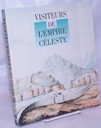
Chollet Helene cartographie
Visiteurs de l'Empire Celeste. Musee national des Arts asiatiques-Guimet 18 mai - 29 Aout 1994
Paris: the museum 1994. Paperback. 211p. vivid color reproductions throughout supplemented with modern diagrammatic maps showing different expeditions softbound in 10x8 inch frenchfold wraps. Expect a severe vertical crease to front cover with creasing of several adjacent leaves including titlepage and instances of pencilled comment in three locations: half-title and pages 146 176. A good reading copy the volume remains entirely useful. the museum paperback books
Bookseller reference : 264321 ISBN : 2711830381 9782711830381
|
|
|
CHRIST YVAN
Les métamorphoses de la Normandie .
1967 Balland 1967 bon état 217 pages in 4 reliure cartonnée toilée verte avec jaquette en état d'usage .Nombreuses photographies Charles Ciccione
Bookseller reference : 9308
|
|
|
CHRISTIE'S.
Important cartography: Atlases, maps and globes. Christie's. 15 November 2006, London. [Auction catalogue].
New English Paperback. 4to. (28 x 24 cm). In English. 134, [1] p., color ills. Important cartography: Atlases, maps and globes. Christie's. 15 November 2006, London. [Auction catalogue].
|
|
|
Christie's.
VALUABLE PRINTED BOOKS AND MANUSCRIPTS INCLUDING MAPS AND ATLASES.
(Codice BB/0779) In 8º (27 cm) 230 pp. Catalogo d'asta, 231 pezzi preziosi descritti e illustrati con numerose tavole in gran parte a colori. Prezzi di stima in dollari e euro. Brossura editoriale, come nuovo. ~~~ SPEDIZIONE IN ITALIA SEMPRE TRACCIATA

|
|
|
Christoph Weigel
1718, Carta dell'Italia Meridionale, C.Weigel
1718, Carta dell'Italia Meridionale, C.Weigel Litografia con acquarellatura coeva. Italia antiqua ab Octavio Augusto in Regiones XI descripta. Norimbergae apud Chri. Weigelium cum Privilegio S.C.M. Norimberga,1718, misura del foglio cm.39x47. Ottime condizioni, piega centrale editoriale. Rara rappresentazione, con ottima coloritura.

|
|
|
Christophorus Cellarius
1701, Carta dell'Italia, incisione su rame dal Cellario
1701, Carta dell'Italia, incisione su rame dal Cellario Italia Antiqua. Tratto da Notitia Orbis Antiqui sive Geographia Plenior di Christophorus Cellarius MDCCI (1701). Misura dell'incisione cm.20x30 su foglio cm.24x33, colorata a mano. Ottime condizioni. Rara rappresentazione, con ottima coloritura.

|
|
|
Christophorus Cellarius
1701, Italia Centrale, Mappa, incisione su rame dal Cellario
1701, Italia Centrale, Mappa, incisione su rame dal Cellario Latii Utriusque Delineatio. Tratto da Notitia Orbis Antiqui sive Geographia Plenior di Christophorus Cellarius MDCCI (1701). Misura dell'incisione cm.20x30 su foglio cm.24x33, colorata a mano. Ottime condizioni. Rara rappresentazione, con ottima coloritura.

|
|
|
Christophorus Cellarius
1701, Mappa dell'Italia, incisione su rame dal Cellario
1701, Italia, incisione su rame dal Cellario Regiones Italiae ex Augusti Caesaris Divisione. Tratto da Notitia Orbis Antiqui sive Geographia Plenior di Christophorus Cellarius MDCCI (1701). Misura dell'incisione cm.20x30 su foglio cm.24x33, colorata a mano. Ottime condizioni. Rara rappresentazione, con ottima coloritura.

|
|
|
Christos G.Zacharakis
DE SITU INSULAE CRETAE. Tesseries aiones entypis chartographias tis Kritis - Four Centuries of printed cartography of Crete 1477-1800
Historical overwiew Nikos Andriotis, Translation P.Kapsambelis. Text in english and greeke. Book in beautiful blue canvas with golden tits on the plate and back, with hundreds of color illustrations, pp 345. Very rare book - Cartography
|
|
|
Christyn Jean-Baptiste
Les delices des Pais-Bas ou description generale de les dix-sept Provincs, de ses principales Villes and de les lieux les plus renommez
24°, mm 140x750, pp. 456, (10), piena pelle coeva con dorso a cinque nervi e scomparti riccamente impressi da decori e motivi floreali, titolo in oro su tassello, piccole mancanze alle cuffie, segni d'uso alle cerniere e generali segni del tempo ai piatti, nel complesso un buon esemplare genuino. Antiporta allegorica incisa e 27 tavole ripiegate di incisioni raffiguranti città, vedute, palazzi e monumenti; ingiallite uniformemente le pagine, nitide e ben fresche le carte ripiegate. Edizione originale di questa rinomata guida più volte ristampata nel secolo successivo, non comune così completa delle tavole poste rispettando le indicazioni per il legatore poste in fine del volume. ID 6453

|
|
|
CHUBB (Thomas)
The Printed Maps in the Atlases of Great Britain and Ireland. A Bibliography, 1579-1870. With an Introduction by F.P. Spent, and Biographical Notes on the Map Makers, Engravers and Publishers.
4to, xvii, 476pp., frontis., 31 plates, orig. cloth.
|
|
|
CIAMPI Gabriele -
Appartenenza cartografica dell'arcipelago Hanish-Zuqur (Mar Rosso) .
Firenze, 1998, 8vo stralcio con copertina posticcia muta, pp. 313/325 con numerose cartine in nero e a colori. - !! ATTENZIONE !!: Con il termine estratto (o stralcio) intendiamo riferirci ad un fascicolo contenente un articolo, completo in se, sia che esso sia stato stampato a parte utilizzando la stessa composizione sia che provenga direttamente da una rivista. Le pagine sono indicate come "da/a", ad esempio: 229/231 significa che il testo è composto da tre pagine. Quando la rivista di provenienza non viene indicata é perché ci è sconosciuta. - !! ATTENTION !!: : NOT A BOOK : “extract” or “excerpt” means simply a few pages, original nonetheless, printed in a magazine. Pages are indicated as in "from” “to", for example: 229/231 means the text comprises three pages (229, 230 and 231). If the magazine that contained the pages is not mentioned, it is because it is unknown to us.

|
|
|
CIAMPI Gabriele -
L'immagine del Cossovo. Cartografia e aerofotografia.
Firenze, 1999, 8vo stralcio con copertina posticcia muta, pp. 528/556 con illustrazioni fotografiche in nero e numerose carte in nero e a colori. - !! ATTENZIONE !!: Con il termine estratto (o stralcio) intendiamo riferirci ad un fascicolo contenente un articolo, completo in se, sia che esso sia stato stampato a parte utilizzando la stessa composizione sia che provenga direttamente da una rivista. Le pagine sono indicate come "da/a", ad esempio: 229/231 significa che il testo è composto da tre pagine. Quando la rivista di provenienza non viene indicata é perché ci è sconosciuta. - !! ATTENTION !!: : NOT A BOOK : “extract” or “excerpt” means simply a few pages, original nonetheless, printed in a magazine. Pages are indicated as in "from” “to", for example: 229/231 means the text comprises three pages (229, 230 and 231). If the magazine that contained the pages is not mentioned, it is because it is unknown to us.

|
|
|
CIBIN Ubaldo - CALABRESE Lorenzo - PERINI Luisa -
L'evoluzione della costa emiliano-romagnola: un quadro conoscitivo a supporto delle strategie di difesa.
Sant'Arcangelo di Romagna, 2007, 8vo stralcio con copertina posticcia muta, pp. 89/104 con 5 fotografie aeree e 5 grafici. - !! ATTENZIONE !!: Con il termine estratto (o stralcio) intendiamo riferirci ad un fascicolo contenente un articolo, completo in se, sia che esso sia stato stampato a parte utilizzando la stessa composizione sia che provenga direttamente da una rivista. Le pagine sono indicate come "da/a", ad esempio: 229/231 significa che il testo è composto da tre pagine. Quando la rivista di provenienza non viene indicata é perché ci è sconosciuta. - !! ATTENTION !!: : NOT A BOOK : “extract” or “excerpt” means simply a few pages, original nonetheless, printed in a magazine. Pages are indicated as in "from” “to", for example: 229/231 means the text comprises three pages (229, 230 and 231). If the magazine that contained the pages is not mentioned, it is because it is unknown to us.

|
|
|
Ciceri (Eugène ; 1813-1890) :
a) Les Pyrénées dessinées d’après nature et lithographiées. Texte explicatif. Première partie : Luchon et ses environs ; Luchon, Lafont. (Toulouse Typ. J. Pradel et Blanc)b) Deuxième partie : Hautes et basses Pyrénées. Luchon, Lafont,
soit 2 tomes, reliés en un volume in folio oblong, cartonnage de percaline marron à fers dorés spéciaux et à froid sous le titre “Souvenir des Pyrénées” par Eug. Ciceri. Lafont-libraire-Editeur 40 allées d’Etigny-Luchon, dos chagrin marron foncé, nerfs, caissons de filets dorés, titre doré, tranches dorées ; s.d. [1870 ou 1873, BNF] ; a) [1] f. de Titre, 8 pp. sur 2 colonnes, 1 plan et une carte dépliante lithographiés par Salette à Toulouse, 28 lithographies dont 8 dépliantes (2 ou 4 panneaux), tirées par Becquet à Paris pour l’éditeur Goupil. b) [1] f. de titre, 12 pp. de texte sur 2 colonnes, 32 lithographies dont 9 dépliantes (2 panneaux), idem. Soit en tout 60 lithographies dessinées et mises sur pierre par Eugène Ciceri, dont 17 dépliantes, non compris le plan et la carte également lithographiés.
Bookseller reference : 21335
|
|
|
Cinque Enrica G.
Rappresentazione antica del territorio. Ton Pinákon
ill.
|
|
|
Cirelli Roberto.
TERREMOTO IERI E OGGI.
(Codice TP/0588) In 4° (30) 286 pp. I terremoti in Irpinia, fino a quello del 1980. Centinaia di foto, testo in 4 lingue. Brossura editoriale, ottimo stato. ~~~ SPEDIZIONE IN ITALIA SEMPRE TRACCIATA

|
|
|
Citmap Corporation Russell Madsen publisher
The Complete City Maps of Michigan hardcover edition
Wyoming Michigan: Citmap Corporation Scarce Hardcover edition. Very Good condition. Bound in the original blue boards stamped in white red and black. Covers only lightly rubbed. Inner hinges are perfect. Bright clean square and tight. Corners are NOT bumped. NO owner's name or bookplate. NO remainder mark. Pages are clean and crisp. NO underlining. NO highlighting. NO margin notes. Oversize Hardcover. 8.75" wide by 11.25" tall. From publisher's promo sheet laid-in: "Accurate readable maps for all cities over 1000 pop. with street indexes.". 1st ed No additional printings listed. Oversize Hardcover. Very Good condition/No jacket probably as issued. 527pp. Citmap Corporation Hardcover
Bookseller reference : 015526
|
|
|
Civelli Giuseppe
Gran Carta d'Italia
Serie di 28 tavole incise in rame di mm 545 x 405 su carta di cellulosa a comporre una grande carte dell'Italia di mm 1980 x 2500. Confini acquarellati a mano. Ottimo esemplare. Questa notevole carta venne dedicata dall'editore ad Adriano Balbo.
|
|
|
Civelli Giuseppe; Arrigoni Ferdinando
Europa in 16 fogli disegnata ed incisa sotto la direzione del Capitano Ferd. Arrigoni dedicata dall'Editore Giuseppe Civelli e C. ai mecenati dell'arte cartografica
16 incisioni calcografiche di mm 535 x 672 alla battuta su carta di cotone di buona sostanza, a formare una grande e dettagliatissima pianta dell'Europa di circa 3 x 2 m. I fogli sono separati e mai intelati. Alcune fioriture saltuarie. Importante opera cartografica ottocentesca.
|
|
|
CIVELLI, G. (ITALIA - CARTOGRAFIA)
Gran Carta d’Italia disegnata ed incisa colla scelta delle opere più recenti ed accreditate di Geografia pubblicata per cura di G. Civelli e Comp. e dai medesimi dedicata all’illustre Geografo italiano Adriano Balbi Consigliere Imperiale al servizio di S.M.I.R.A. ...
Milano, 1845. In folio massimo (cm. 60); bella legatura coeva in mezza pelle con ricchi fregi in oro al dorso; grande Etichetta in pelle verde con scritta in oro e ricca cornice in oro al piatto anteriore. Axs
|
|
|
CLAVAL PAUL
Eléménts de géographie humaine .
1980 Editions genin librairies techniques 1980 bon état 436 pages in 8 broché coins légèrement cornés.
Bookseller reference : 9011
|
|
|
CLAUDE FILLIEUX
Merveilleux Cambodge.
1962 Connaissance de l'Asie, Société Continentale d'Editions Modernes Illustrées, Bibliophiles de l'Aventure,1962, 362 pages, 64 planches hors texte en héliogravure, 25 cartes et croquis, et 8 planches hors texte couleurs, grand in 8 reliure éditeur cartonnée et toilée orange, motifs sur le 1er plat, titres or, bon état, quelques petites rousseurs, avec rodhoïde.
Bookseller reference : 14560
|
|
|
Clapmar, Arnold
Arn. Clapmarii De arcanis rerum publicarum libri sex, illustrati a Ioan. Corvino ic. Accessit Chr. Besoldi de eadem materia discursus. Nec non Arnoldi Clapmarii et aliorum conclusiones de iure publico
2 opere in un volume, 120x70 mm, pp. (40), 51, (5), 340, (2), 53, (37); 120, incisione a piena pagina all'antiporta con un geografo che disegna sul mappamondo, vignetta incisa al frontespizio. Opere aggiunte: Christophori Besoldi De Arcanis Rerum Publicarum Dissertio; Arnoldi Clapmarii, Francisci Roselli et W. Heinrici Ruprechti Conclusiones de Iure Publicoogni. Ogni opera ha un proprio frontespizio. Rilegatura coeva in piena pergamena rigida con unghie, titolo manoscritto al dorso, ex libris privato applicato al contropiatto, leggero alone all'angolo inferiore lontano dal testo complessivamente a 30 carte. Esemplare genuino.

|
|
|
Clark Audrey N
Longman Dictionary of Geography Human and Physical
Harlow Essex UK: Longman Publishing Group 1985. Near Fine condition in Very Good dust jacket. This is NOT a library discard. A bright clean square tight copy of the hardcover edition. Sharp corners. NO owner's name or bookplate. NO remainder mark. Pages are crisp. No underlining. No highlighting. No margin notes. Besides the dictionary this reference includes four useful appendices: Greek and Latin roots; Conversion tables; Map of time zones; and Random number table. Bound in the original black boards lettered in shiny gold on the spine. First Edition. Hardcover. Near Fine condition/Very Good dust jacket. 8vo. ix 724pp. Longman Publishing Group Hardcover
Bookseller reference : 013905 ISBN : 0582352614 9780582352612
|
|
|
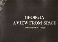
Clark William Z. Jr. Arnold C. Zisa & Richard C. Jones
Georgia A View From Space: An Atlas of Landsat-1 Imagery
<p>Atlanta: Georgia Dept. of Natural Resources. 1976. 33pp. illus. paperback oblong folio: Very Good. An unusual study in black and white photos and maps.</p> Atlanta: Georgia Dept. of Natural Resources paperback
Bookseller reference : 20587
|
|
|
Claudio Cerreti
La raccolta cartografica dell'Istituto Italo Africano. Presentazione del fondo e guida alla consultazione
In 8°, pp. 181. Brossura originale. Ottimo esemplare.

|
|
|
Clercq de Ren ; Goeminne Luc
kaart- en landboek van Deinze binnen (1765)
, Provincie Oost-Vlaanderen 2020, 2020 Hardcover, 391 pagina's, Nederlands, 345 x 250 x 40 mm, Nieuwstaat, illustraties / foto's in kleur en z/w,. ISBN 9789082732863.
Bookseller reference : 57737
|
|
|
Cleave, Richard ; Campbell, Edward ; Blaine, Michael; et al.
The Holy Land Satellite Atlas - Volume 2: The Regions.
320X245 mm. 248 pages. Hardcover. Cover slightly worn. In good condition. PLEASE NOTE: This item is overweight. We may ask for extra shipping costs.
|
|
|
Cleave, Richard; Campbell, Edward; Blaine, Michael; et al.
The Holy Land Satellite Atlas - Volume 1: Terrain Recognition [SIGNED]
340x250 mm. 152 pages. Hardcover. Cover edges and spine edges slightly bumped. In good condition.
|
|
|
Clercq de René ; Goeminne Luc
kaart- en landboek van Deinze binnen (1765)
Hardcover, 391 pagina's, Nederlands, 345 x 250 x 40 mm, Nieuwstaat, illustraties / foto's in kleur en z/w,. ISBN 9789082732863. Wie op zoek is naar voorouders in Deinze of naar de voorgeschiedenis van percelen die in de gemeente gelegen zijn, kan vanaf nu Het Kaart- en Landboek van Deinze Binnen (1765) raadplegen. Het boek is het eindresultaat van een jarenlange studie door lokaalhistorici René De Clercq en Luc Goeminne. Net als het kadaster nu, bevat een landboek informatie over alle percelen die in Deinze gelegen zijn en over de eigenaars ervan. Maar in dit geval is het een momentopname van 1765. Daarnaast zijn er twee sets kaarten, waarvan één in kleur, opgenomen in het boek. Bovendien is er onderzoek gebeurd naar de verhouding tussen Deinze Binnen en Buiten, over het uitzicht van de stad, over de toponiemen, de verschillende soorten bewoners en eigenaars, het verenigingsleven en nog zoveel meer. Via de indrukwekkende personen- en plaatsnamenindicatie kan deze goudmijn efficiënt doorzocht worden.

|
|
|
Clerici Maestosi , Paola
Il teatro delle città d'Italia. Segni e sogno di un cartografo della rinascenza
Clerici Maestosi , Paola Il teatro delle città d'Italia. Segni e sogno di un cartografo della rinascenza. Roma, 2001, cm ill. 22 cm. 165 p. (0000000038395)

|
|
|
Clivio Marzoli, Carla (a cura di)
IMAGO ET MENSURA MUNDI. ATTI DEL IX CONGRESSO INTERNAZIONALE DI STORIA DELLA CARTOGRAFIA.
Mm 170x240 Opera completa - 3 volumi nella loro brossura originale, custodia editoriale figurata, complessive xvi-600 pagine con numerose figure in nero nel e fuori testo. Opera in condizioni di nuovo, solo la custodia presente leggeri segni del tempo. Spedizione in 24 ore dalla conferma dell'ordine.
|
|
|
Cluver (auch Clüver), Ph
Introductionis in universam geographicam, tam veterem quam novam, libri VI.
Amsterdam, Janssonius, 1661. M. 45 gef. gest. Ktn. u. 1 gef. Kpfr.-Taf. 4 Bl., 142 S., 1 Bl., 31 S. Prgt. d. Zt. Einbd. minimal angestaubt. Leicht gebräunt, teils etwas braunfl., sonst wohlerhalten. Titel in Rot u. Schwarz, unten überklebt.
Bookseller reference : 248607
|
|
|
Cluver, Philippe
Philippi Cluverii Introductionis in Universam Geographiam tam veterem, quam novam. Libri sex, illustrate, and Autcti Et P. Bertii Breviarum.
In-12°, mm 155, 85, pp. 436, con 4 carte di tavole ripiegate. Legatura coeva in piena pergamena, titolo manoscritto al dorso, qualche macchia esternamente e un restauro a una delle tavole ripiegate, peraltro ottimo esemplare. L'opera del Cluver divenne uno dei testi fondamentali nel campo della moderna geografia. Dalla sua prima apparizione nel 1624 ebbe numerose ristampe.

|
|
|
Cobb David A
New Hampshire Maps to 1900 An Annotated Checklist 1981 First Edition new
Hanover: New Hampshire Historical Society. 1981. Brand New in perfect condition. Bright shiny clean square and tight. Sharp corners. NO creases. NO owner's name or bookplate. NOT a remainder. Fresh crisp and unmarked - obviously never read. This cartobibliography gives detailed descriptions for 516 New Hampshire printed maps up to 1900 including topographic maps geologic maps early railroad maps early county and town maps fire insurance maps etc. Also describes a few early maps of New York and Vermont because of boundary questions as well as many 18th century maps of New England. Bound in the original maroon and white pictorial wraps. 6" wide by 9" tall. First Edition. Softcover. New. xviii 108pp. Great Packaging Fast Shipping. New Hampshire Historical Society. Paperback
Bookseller reference : 018850 ISBN : 0874511666 9780874511666
|
|
|
Cobb David A
New Hampshire Maps to 1900 An Annotated Checklist
Hanover: New Hampshire Historical Society. 1981. Appears unread. Very Near Fine condition. Bright clean square and tight. Sharp corners. NO creases. NO owner's name or bookplate. NOT a remainder. Pages are fresh crisp and unmarked - apparently never read. This cartobibliography gives detailed descriptions for 516 New Hampshire printed maps up to 1900 including topographic maps geologic maps early railroad maps early county and town maps fire insurance maps etc. Also describes a few early maps of New York and Vermont because of boundary questions as well as many 18th century maps of New England. Bound in the original maroon and white pictorial wraps. 6" wide by 9" tall. First Edition. Softcover. Very Near Fine condition. xviii 108pp. Great Packaging Fast Shipping. New Hampshire Historical Society. Paperback
Bookseller reference : 018844 ISBN : 0874511666 9780874511666
|
|
|
Cockx-Indestege Elly, Imhof Dirk, Meeus Hubert [edit.], Moermans Norbert.-
Ortelius Spieghel der Werelt, a facsimile for Francine de Nave
Antwerpen, Vereniging van Antwerpse Bibliofielen, 2009 Gebonden in kunstleder (atlas) bijdragen in twee boeken, samen in een katonnen omslag. ing. 63pp 76pp. text in nederlands en in English. Bound in artificial leather (atlas) contributions in two books, together in a cotton cover. ing. 63pp 76pp. text in Dutch and in English. ISBN 9789080885509.
Bookseller reference : 21734
|
|
|
Cockx-Indestege Elly, Imhof Dirk, Meeus Hubert [edit.], Moermans Norbert.-
Ortelius Spieghel der Werelt, a facsimile for Francine de Nave
Gebonden in kunstleder (atlas) bijdragen in twee boeken, samen in een katonnen omslag. ing. 63pp 76pp. text in nederlands en in English. Bound in artificial leather (atlas) contributions in two books, together in a cotton cover. ing. 63pp 76pp. text in Dutch and in English. ISBN 9789080885509. als spiegel van Peeter Heyns / as mirror of Peeter Heyns het drukken en de verspreiding van de eerste atlas edities van de zakatlas van Ortelius / the printing and selling of the first editions of Ortelius 's pocket atlas, description of facsimile editions, literature, De Nave; een portret en bibliografie with summary. as mirror of Peeter Heyns / as mirror of Peeter Heyns the printing and distribution of the first atlas editions of the pocket atlas of Ortelius / the printing and selling of the first editions of Ortelius' pocket atlas, description of facsimile editions, literature, De Nave; a portrait and bibliography with summary.

|
|
|
Codde, R./ Keyser, de, L.
Mer du Nord, c te, estuaire de l'Escaut, mer de l'Escaut. Atlas de Belgique
, Brussel, Koninklijke Belgische Academie, 1967 couverture souple, jaquette originale de l' diteur, 29,5 x 21 cm, 64 pp.
Bookseller reference : 56771
|
|
|
Codde, R./ Keyser, de, L.
Noordzee, kust, scheldemonding, zeeschelde. Atlas van Belgie:
, Brussel, Koninklijke Belgische Academie, 1967 softcover, originele uitgeversomslag, 29,5x21cm, 64pp.
Bookseller reference : 14247
|
|
|
Codazzi Agostino
Le memorie [AMERICA MERIDIONALE]
illustrazioni e cartine fuori testo

|
|
|
Codazzi Agostino
Memorie inedite di Agostino Codazzi sui suoi viaggi per l'Europa e nelle Americhe (1816-1822) [AMERICA MERIDIONALE]
6 carte 3 tavole a colori e 4 in bianco e nero fuori testo

|
|
|
CODAZZI Angiolina -
Di un atlante nautico di Giovanni Martines.
Firenze, 1922, 8vo stralcio con copertina posticcia muta, pp. 905/943 con 6 carte ripiegate. - !! ATTENZIONE !!: Con il termine estratto (o stralcio) intendiamo riferirci ad un fascicolo contenente un articolo di rivista, sia che esso sia stato stampato a parte utilizzando la stessa composizione sia che provenga direttamente da una rivista. Le pagine sono indicate come "da/a", ad esempio: 229/231 significa che il testo è composto da tre pagine. Quando la rivista di provenienza non viene indicata é perchè ci è sconosciuta. - !! ATTENTION !!: : NOT A BOOK : “estratto” or “stralcio” means simply a few pages, original nonetheless, printed in a magazine. Pages are indicated as in "from” “to", for example: 229/231 means the text comprises three pages (229, 230 and 231). If the magazine that contained the pages is not mentioned, it is because it is unknown to us.

|
|
|
Codde, R./ Keyser, de, L.
Mer du Nord, côte, estuaire de l'Escaut, mer de l'Escaut. Atlas de Belgique
couverture souple, jaquette originale de l'éditeur, 29,5 x 21 cm, 64 pp. Comité national de géographie, Comité national de l'Atlas. Atlas de Belgique : commentaire ; plein. 18.

|
|
|
Codde, R./ Keyser, de, L.
Noordzee, kust, scheldemonding, zeeschelde. Atlas van Belgie:
softcover, originele uitgeversomslag, 29,5x21cm, 64pp. Nationaal comite voor aardrijkskunde, commissie voor de nationale atlas. Atlas van Belgie: commentaar ; vol. 18.

|
|
|
COELLO, Francisco.
GERONA. ATLAS DE ESPAÑA Y SUS POSESIONES DE ULTRAMAR.
Gerona, Contornos de Gerona, Fondeadero de Tosa, Puerto de Blanes, contornos de Figueras, Bahia de Palamos, Puerto de Santa Cruz de la Selva, Islas Medas, Puerto de Cadaques. Coautor Pascual Madoz.
|
|
|
COLETTE NAST
"Connais-tu mon pays?" en Ecosse avec Donald.
1967 Hatier, bon etat, environ 30 pages de textes et d'illustrations, in8 reliure editeur cartonnée, illustrée, usures sur coiffes, coins legerement frottés.
Bookseller reference : 9256
|
|
 Receive by email
 Download as PDF document
 RSS feed


