|
|
|
KAISERLICH-KÖNIGLISCHES MILITAR-GEOGRAPHISCHES INSTITUT].
[MAP of OTTOMAN BALKANS] P.13. Dimotika. [Northern Greece - Western Thrace - Evros].
Very Good German Original color map on cloth. Folded. A good copy. Oblong folio. (45 x 51 cm). In German. [MAP of OTTOMAN BALKANS] P.13. Dimotika. [Northern Greece - Western Thrace - Evros]. A sheet of the collection of 'The general map of Central Europe'. appeared in the years between 1873-1876 with the work of Joseph Ritter von Scheda, (1815-1888) who was a general, geographer and cartographer.
|
|
|
KAISERLICH-KÖNIGLISCHES MILITAR-GEOGRAPHISCHES INSTITUT].
[MAP of OTTOMAN BALKANS] P.9. Galatz - Donau River.
Very Good German Original color map on cloth. Folded. A good copy. Oblong folio. (45 x 51 cm). In German. [MAP of OTTOMAN BALKANS] P.9. Galatz - Donau River. A sheet of the collection of 'The general map of Central Europe'. appeared in the years between 1873-1876 with the work of Joseph Ritter von Scheda, (1815-1888) who was a general, geographer and cartographer.
|
|
|
KAISERLICH-KÖNIGLISCHES MILITAR-GEOGRAPHISCHES INSTITUT].
[MAP of ROMANIA] M.10. Orsova. Danube River.
Very Good German Original color map on cloth. Folded. A good copy. Oblong folio. (45 x 51 cm). In German. [MAP of ROMANIA] M.10. Orsova. Danube River. Orsova is a port city on the Danube river in southwestern Romania's Mehedin?i County. It is one of four localities in the county located in the Banat historical region. It is situated just above the Iron Gates, on the spot where the Cerna River meets the Danube. A sheet of the collection of 'The general map of Central Europe'. appeared in the years between 1873-1876 with the work of Joseph Ritter von Scheda, (1815-1888) who was a general, geographer and cartographer.
|
|
|
KAISERLICH-KÖNIGLISCHES MILITAR-GEOGRAPHISCHES INSTITUT].
[MAP of SERBIA] M.11. Krusevac.
Very Good German Original color map on cloth. Chipped on folded places. Otherwise a clean copy. Oblong atlas folio. (46 x 52 cm). Toponyms in German. Shows Krusevac and its around in Serbia. A sheet of the collection of 'The general map of Central Europe'. appeared in the years between 1873-1876 with the work of Joseph Ritter von Scheda, (1815-1888) who was a general, geographer and cartographer.
|
|
|
KAISERLICH-KÖNIGLISCHES MILITAR-GEOGRAPHISCHES INSTITUT].
[MAP of WEST WALLACHIA - CRAIOVA] N.10. Kraiova.
Very Good German Original color map on cloth. Chipped on folded places. Oblong atlas folio. (46 x 52 cm). Toponyms in German. [MAP of WEST WALLACHIA - CRAIOVA] N.10. Kraiova. A sheet of the collection of 'The general map of Central Europe'. appeared in the years between 1873-1876 with the work of Joseph Ritter von Scheda, (1815-1888) who was a general, geographer and cartographer.
|
|
|
KAISERLICH-KÖNIGLISCHES MILITAR-GEOGRAPHISCHES INSTITUT].
[MAP] Mission antipaludique de l'Armee d'Orient: Carte des indices endemiques Macedoine, Thessalie, Serbie meridionale, confins albanais 1917 et 1918.
Very Good French Original b/w map. Oblong: 57x66 cm. In French. Folded. It includes for pieces: Title, structure physique de la region, Thessalie and main part which shows the area from Ohrida Lake on the west to Golf of Thessaloniki on the east. [MAP] Mission antipaludique de l'Armee d'Orient: Carte des indices endemiques Macedoine, Thessalie, Serbie meridionale, confins albanais 1917 et 1918.
|
|
|
KAISERLICH-KÖNIGLISCHES MILITAR-GEOGRAPHISCHES INSTITUT].
[MAP] Q.11. Cap Gülgrad. Kaliakra, Capo Calacria, Celigra Burun [and] Schwarzes Meer (Black Sea).
Very Good German Original color map on cloth. Folded. Oblong folio. (45 x 51 cm). In German. [MAP] Q.11. Cap Gülgrad. Kaliakra, Capo Calacria, Celigra Burun [and] Schwarzes Meer (Black Sea). Bulgarian Black Sea shores. A sheet of the collection of 'The general map of Central Europe'. appeared in the years between 1873-1876 with the work of Joseph Ritter von Scheda, (1815-1888) who was a general, geographer and cartographer.
|
|
|
KAISERLICH-KÖNIGLISCHES MILITAR-GEOGRAPHISCHES INSTITUT].
M.14. Kastoria [Kesriye in the Ottoman period].
Very Good German Original color map on cloth. Chipped on folded places. It needs repair. Oblong atlas folio. (46 x 52 cm). Toponyms in German. Shows Kastoria area in Greece. A sheet of the collection of 'The general map of Central Europe'. appeared in the years between 1873-1876 with the work of Joseph Ritter von Scheda, (1815-1888) who was a general, geographer and cartographer.
|
|
|
KAISERLICH-KÖNIGLISCHES MILITAR-GEOGRAPHISCHES INSTITUT].
O.9. Kronstadt.
Very Good German Original color map on cloth. Chipped on folded places. Oblong atlas folio. (46 x 52 cm). Toponyms in German. A sheet of the collection of 'The general map of Central Europe'. appeared in the years between 1873-1876 with the work of Joseph Ritter von Scheda, (1815-1888) who was a general, geographer and cartographer.
|
|
|
Kammerer, Albert
LA MER ROUGE, L'ABYSSINIE ET L'ARABIE DEPUIS L'ANTIQUITÉ, VOL. II [ONLY] Tome Deuxième: Les Guerres Du Poivre - Les Portugais Dans L'Océan Indien Et La Mer Rouge Au Xvie Siècle- Histoire De La Cartographie Orientale
Binding rubbed and worn, torn along spine, inner hinges strained and starting to crack. Dampstaining to margins of some plates and pages, else contents sound & tight. Endpapers browned. Spine cover browned. Some browning to boards. Some loss to spine cover ends. 1 corner edgeworn. ; Pp263-555 + pls CX-CLXIX, many text figures. Most of this volume concerns the history of cartography and is very nicely illustrated. ; Volume 2 Only; Vol. 2; Folio - over 12" - 15" tall
|
|
|
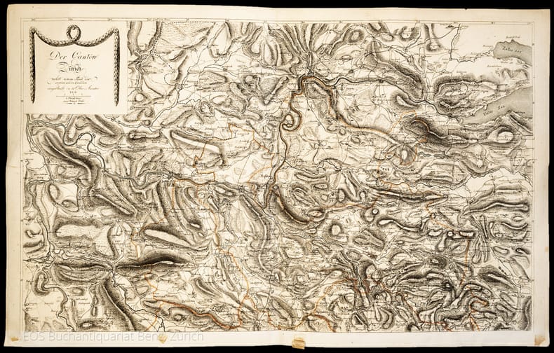
Kanton Zürich. –
Der Canton Zürich nebst einem Theil der angränzenden Cantonen, eingetheilt in 11 Ober-Aemter.
Zürich, Füssli, 1816. 2 Kupferstichkarten. 44 x 70 cm.
Bookseller reference : 1047CG
|
|
|
Karen De Coene
Carte blanche, de diplomatie van Ferraris in een Europa in omwenteling.
, lannoo, 2024 Gebonden, Hardcover 342 pag. 25x 6.8cm. ISBN 9789401495196.
Bookseller reference : 63281
|
|
|
KARL PEUCKER, (1859-1940).
[MAP] Karte von Bulgarien mit Ostrumelien und Tu?rk. Thrakien.; Mit kartographischen und statistischen Beilagen zum Versta?ndnis der orientalischen Krise.
Very Good German Original color map. Folded. A stamp of S. H. Weiss, Constantinople. Elephant folio. (82 x 65 cm). In German. Scale: 1/864.000. [MAP] Karte von Bulgarien mit Ostrumelien und Tu?rk. Thrakien.; Mit kartographischen und statistischen Beilagen zum Versta?ndnis der orientalischen Krise. Showing Bulgaria, Balkans, and Eastern Roumeli, and Turkish / Ottoman Thrace. A rare map. OCLC: 43528174.
|
|
|
Karp Abraham J
From the Ends of the Earth Judaica Treasures of the Library of Congress
New York / Washington: Rizzoli / Library of Congress 1991. Appears unread. Fine condition in a Near Fine dust jacket. The jacket would also be Fine but for some very light surface rubbing i.e. minor shelf wear. NO chips. NO tears. NO ceases. NO fading. Bright shiny clean square and tight. Sharp corners. Hinges are perfect. NO owner's name or bookplate. NOT a remainder. NOT a library discard. Fresh and crisp - apparently never read. 1991. First Edition. A spectacular array of Judaic Treasures with a scholarly and entertaining text complements over 300 color and monochrome photos. Among the highlights are illuminated Haggadot Torah scrolls maps and navigational tables including the ones used by Christopher Columbus Holy Land maps by Ptolemy Ortelius and other cartographic giants books and documents of American Jewish history musical compositions by Irving Berlin and the Gershwins early Hebrew books Einstein's Unified Field Theory manuscripts Sigmund Freud manuscripts letters of Jewish interest from Washington Jefferson Lincoln etc. Published to accompany a traveling exhibition opening at the Library of Congress and sponsored by the Project Judaica Foundation. Bound in the original gilt-stamped black cloth. Complete with dust jacket. Oversize Hardcover. 9.25" wide by 12.25" tall. This large heavy book will require extra postage for Priority and International shipments but only the standard charge for media mail. First Edition. Oversize Hardcover. Fine condition/Near Fine dust jacket. xxiv 376pp. Great Packaging Fast Shipping. Rizzoli / Library of Congress Hardcover
Bookseller reference : 019036 ISBN : 0847814505 9780847814503
|
|
|
Karp Abraham J
From the Ends of the Earth Judaica Treasures of the Library of Congress
New York / Washington: Rizzoli / Library of Congress 1991. Appears unread. Fine condition in a Very Good dust jacket. The jacket is rubbed i.e. normal shelf wear but has NO chips. NO tears. NO ceases. NO fading. Bright clean square and tight. Sharp corners. Hinges are perfect. NO owner's name or bookplate. NOT a remainder. NOT a library discard. Pages are fresh and crisp - apparently never read. 1991. First Edition. A spectacular array of Judaic Treasures with a scholarly and entertaining text complements over 300 color and monochrome photos. Among the highlights are illuminated Haggadot Torah scrolls maps and navigational tables including the ones used by Christopher Columbus Holy Land maps by Ptolemy Ortelius and other cartographic giants books and documents of American Jewish history musical compositions by Irving Berlin and the Gershwins early Hebrew books Einstein's Unified Field Theory manuscripts Sigmund Freud manuscripts letters of Jewish interest from Washington Jefferson Lincoln etc. Published to accompany a traveling exhibition opening at the Library of Congress and sponsored by the Project Judaica Foundation. Bound in the original gilt-stamped black cloth. Complete with dust jacket. Oversize Hardcover. 9.25" wide by 12.25" tall. This large heavy book will require extra postage for Priority and International shipments but only the standard charge for media mail. First Edition. Oversize Hardcover. Fine condition/Very Good dust jacket. xxiv 376pp. Great Packaging Fast Shipping. Rizzoli / Library of Congress Hardcover
Bookseller reference : 019037 ISBN : 0847814505 9780847814503
|
|
|
Katalog zur Ausstellung der 36. Mineralientage:
Von Ammoniten und Zwillingen.
<br/> TITOLO: Von Ammoniten und Zwillingen. <br/> AUTORE: Katalog zur Ausstellung der 36. Mineralientage:<br/> CURATORE: München, Neue Messe, 29.-31. Oktober 1999. Herausgegeben von Rainer Bode.<br/> EDITORE: Rehms Druck<br/> DATA ED.: 1999,<br/>
|
|
|
Kathleen Suit; David Peckarsky; Editor David JR. Peckarsky; Illustrator Cartography by Bob Lindquist & Sharon Iwai J. R.
Bellingham/ Mount Baker Washington Road & Recreation Map 5th Edition Great Pacific Recreation & Travel Maps
Great Pacific Recreation & Travel Maps 2010-02-01. Map. Good. Great Pacific Recreation & Travel Maps unknown
Bookseller reference : SONG0938011588 ISBN : 0938011588 9780938011583
|
|
|
Katz Riccardo
Malesia misteriosa
8 tavole fuori testo

|
|
|
KEARTON CHERRY
L'ile des manchots .
Boivin et cie 1953 bon état exemplaire de bibliothèque 181 pages in 12.
Bookseller reference : 3658
|
|
|
Kedar, Benjamin Z. ; Danin, Avinoam [Eds.]
Remote Sensing: The Use of Aerial Photographs and Satellite Images in Israel Studies [IN HEBREW]
IN HEBREW. Contains a map. 28.5x22 cm. 8+260 pages. Hardcover. In good condition.
|
|
|
Kedar, Benjamin Z. ; Danin, Avinoam [Eds.]
Remote Sensing: The Use of Aerial Photographs and Satellite Images in Israel Studies [IN HEBREW]
IN HEBREW. Contains a map. 28.5x22 cm. 8+260 pages. Hardcover. Cover slightly rubbed. Cover corners slightly bumped. Else in good condition.
|
|
|
Keith Thomas
A NEW TREATISE ON THE USE OF THE GLOBES or a Philosophical View of the Earth and Heavens
London: Longman Orme Brown Green & Longmans 1839. ND but preface dated Walworth 1839. xxiv 364pp 7 folding plates at the rear.12pp pub. cat. dated August 1841 London. Bound in the pub. green fine pebble gren cloth with gilt titles to the spine. Pasted -down end-papers list Longmans 'New School Books'/ Neat owners sig. dated 1842. Thomas Keith 1759-1824. The first edition was pub. in 1805. a new Edition Considerably Improved. Hardback. V.g. 8vo. Longman, Orme, Brown, Green & Longmans Hardcover
Bookseller reference : TH327
|
|
|
KELLER Georg (Francoforte 1568 - 1634)
Venetiae
LA GUERRA DELL'INTERDETTO Rara pianta prospettica della città incisa da Georg Keller nel 1607. La tavola è pubblicata nella Relationis Historicae Semestralis Continuatio… del 1607. L’opera, meglio conosciuta anche come “Messrelationen”, edita a Francoforte a partire dal 1591, veniva stampata in occasione delle fiere di primavera ed autunno, per fornire notizie sui principali avvenimenti internazionali il cui autore era Jacobus Francus, uno pseudonimo usato da diversi scrittori, inclusi Conrad Lautenbach e Conrad Memmius. “Georg Keller di Francoforte fu uno dei maggiori interpreti del cambiamento di gusto grafico della fine del ‘500, quando l’illustrazione eseguita su piastra di rame prese il sopravvento sulla silografia. Le sue numerose vedute di città risalgono senza eccezioni a modelli precedenti e spesso stranieri” (cfr. Cassini, Piante e vedute prospettiche di Venezia, 1970, p. 69). “La pianta della città con numerosi toponimi si rifà alle piante prospettiche della fine del XVI secolo riprendendo i motivi iconografici della pianta prospettica di F. Hogenberg. L’estensione nella raffigurazione della terraferma che comprende a sud la foce dell’Adige e del Po deriva dalla pianta di C. Stimmer. G. Keller (1568-1634) fu autore di numerose vedute di città incise a Berlino su lastre di rame” (cfr. Romanelli-Biadene, Venezia, Piante e Vedute, 1982 p. 37, n. 24). “Nella parte superiore è illustrato un trasferimento militare. Nella parte inferiore fa bella mostra una vistosa parata di navi” (cfr. Moretto, Venetia, Le immagini della Repubblica, 2001, p. 114, scheda 49). Come correttamente affermato da Moretto, rispetto alla tradizionale iconografia della città, la pianta presenta la raffigurazione di “elementi” militari. Come detto, la pianta è inserita nelle “Messerelationen”, ed è quindi una cosiddetta carta d’occasione, nata per descrivere un determinato avvenimento. In questo caso l’opera viene realizzata per documentare la cosiddetta guerra dell'interdetto (1606 – 21 aprile 1607). Fu una vertenza fra la Repubblica di Venezia e lo Stato Pontificio, scoppiata nel 1606 a causa dell'arresto a Venezia di due preti cattolici accusati di reati comuni e dell'adozione da parte della Serenissima di una serie di leggi volte al contenimento della proprietà ecclesiastica. Il pontefice Paolo V (1605 - 1621) minacciò di porre l'interdetto sulla città, ossia di colpirla con una sorta di scomunica collettiva che avrebbe posto Venezia al di fuori della Chiesa, impedendo ogni forma di amministrazione dei sacramenti: l'ultimatum papale fu respinto e il Papa mise in atto quanto aveva minacciato. Grazie alla mediazione della Francia, tuttavia, si giunse ad un compromesso: Venezia fu liberata dall'interdetto. Il foglio è pubblicato nella Relationis Historicae Semestralis Continuatio, Jacobi Franci Historische Beschreibung aller Denckwürdigen Geschichten, so sich hin und wider in Europa, Hoch- und Nider Teutschland, auch in Franckreich. L’opera, meglio conosciuta anche come “Messrelationen”, edita a Francoforte a partire dal 1591, veniva stampata in occasione delle fiere di primavera ed autunno, per fornire notizie sui principali avvenimenti internazionali. Le prime edizioni della raccolta erano firmate a nome di Jacobus Francus, che era lo pseudonimo usato da diversi scrittori, inclusi Conrad Lautenbach e Conrad Memmius. Una Messrelation era una pubblicazione stampata in occasione delle fiere del libro di Francoforte e Lipsia (le più grandi d'Europa all'epoca) che riportava notizie sulle novità politiche e militari dall'ultima fiera. Le Messrelationen sono viste come precursori dei moderni giornali, poiché furono i primi mezzi di informazione stampati ad essere pubblicati periodicamente. Lo studioso austriaco Michael von Aitzing (ca. 1530-1598) è comunemente considerato il loro inventore, avendo pubblicato per la prima volta una Relatio Historica (stampata a Colonia... THE WAR OF THE INTERDICT Rare perspective map of the city engraved by Georg Keller in 1607. The plate is published in the Relationis Historicae Semestralis Continuatio... of 1607. The work, also better known as "Messerelationen" published in Frankfurt beginning in 1598, was printed at spring and autumn fairs to provide news of major international events whose author was Jacobus Francus, a pseudonym used by several writers, including Conrad Lautenbach and Conrad Memmius. "Georg Keller of Frankfurt was one of the major interpreters of the change in graphic taste at the end of the 1500s, when illustration executed on copperplate took over from silography. His numerous views of cities go back without exception to earlier and often foreign models" (cf. Cassini, Piante e vedute prospettiche di Venezia, 1970, p. 69). "The plan of the city with numerous place names refers to the perspective plans of the end of the sixteenth century taking up the iconographic motifs of the perspective plan of F. Hogenberg. The extension in the depiction of the mainland, which includes the mouth of the Adige and the Po to the south, is derived from the plan of C. Stimmer. G. Keller (1568-1634) was the author of numerous views of cities engraved in Berlin on copper plates" (cf. Romanelli-Biadene, Venezia, Piante e Vedute, 1982 p. 37, n. 24). "In the upper part a military transfer is illustrated. In the lower part a showy parade of ships is on display" (cf. Moretto, Venetia, Le immagini della Repubblica, 2001, p. 114, plate 49). As correctly stated by Moretto, compared to the traditional iconography of the city, the map presents the representation of military "elements". As mentioned, the plan is included in the "Messerelationen", and is therefore a so-called "occasion" map, created to describe a specific event. In this case the work is made to document the so-called war of the interdict (1606 - April 21, 1607). It was a dispute between the Republic of Venice and the Papal State, which broke out in 1606 because of the arrest in Venice of two Catholic priests accused of common crimes and the adoption by the Serenissima of a series of laws aimed at the containment of ecclesiastical property. The pope Paul V (1605 - 1621) threatened to put an interdict on the city, that is to say to strike it with a sort of collective excommunication that would have placed Venice outside the Church, preventing any form of administration of the sacraments: the papal ultimatum was rejected and the Pope put into effect what he had threatened. Thanks to the mediation of France, however, a compromise was reached: Venice was freed from the interdict. The sheet is published in the Relationis Historicae Semestralis Continuatio, Jacobi Franci Historische Beschreibung aller Denckwürdigen Geschichten, so sich hin und wider in Europa, Hoch- und Nider Teutschland, auch in Franckreich. The work, also known as "Messerelationen", published in Frankfurt since 1598, was printed on the occasion of spring and autumn fairs, to provide news about major international events. Early editions of the collection were signed in the name of Jacobus Francus, which was the pseudonym used by several writers, including Conrad Lautenbach and Conrad Memmius. A Messrelation was a print published in the 16th to 18th century for the book fairs in Frankfurt and Leipzig (the largest in Europe at their time) which reported news about political and military news since the last fair. Messrelationen are seen as precursors to modern newspapers as they were the first printed news media to be published periodically. The Austrian scholar Michael von Aitzing (ca. 1530–1598) is commonly seen as their inventor, having published for the first time a Relatio Historica (printed in Cologne) at the autumn 1583 book fair in Frankfurt, in which he related the events in the Low Countries since February 1580. This was a huge success and from 1588 Aitzing published his "relations" twice a year, for the Easter book fair ...

|
|
|
KELLER Heinrich
ORIGINAL VON KELLER'S ERSTER REISEKARTE DER SCHWEIZ.
Verlag von Heinrich Keller, Zuerich, 1852. Bella e dettagliata carta geografica e stradale della Svizzera (cm. 49x67) litografata a colori, montata su tela e suddivisa in 12 riquadri. Include una piccola mappa del Tirolo e altre 4 mappe itineranti: 1) da Basilea e Strasburgo a Parigi - 2) dalla Svizzera verso le regioni della Bavaria, Wuertemberg e il Tirolo - 3) dalla Svizzera a Milano, Genova e Torino - 4) da Ginevra verso Lione e Chambery. Applicate sul verso dei riquadri, piccole cartine geografiche a colori delle principali citt svizzere - Zurigo, Lucerna, Basilea, Berna, Friburgo e Ginevra - e 4 piccole mappe, sempre a colori: Plan des Rigibergs (Mount-Righi) - Charte des Gesichtskreises vom Rigi-Kulm (1821) - Panorama prise au sommet du Mont-Righi (1823) - Schweiz. Flaechen-Inhalt, Einwohner-Zhal und Confession der Kantone (1850).Ben conservata, in una custodia in cartonato (cm. 23x12,6).
Bookseller reference : 117643
|
|
|
KELLER Heinrich
ORIGINAL VON KELLER’S ERSTER REISEKARTE DER SCHWEIZ.
Bella e dettagliata carta geografica e stradale della Svizzera (cm. 49x67) litografata a colori, montata su tela e suddivisa in 12 riquadri. Include una piccola mappa del Tirolo e altre 4 mappe itineranti: 1) da Basilea e Strasburgo a Parigi - 2) dalla Svizzera verso le regioni della Bavaria, Wuertemberg e il Tirolo - 3) dalla Svizzera a Milano, Genova e Torino - 4) da Ginevra verso Lione e Chambery. Applicate sul verso dei riquadri, piccole cartine geografiche a colori delle principali città svizzere - Zurigo, Lucerna, Basilea, Berna, Friburgo e Ginevra - e 4 piccole mappe, sempre a colori: “Plan des Rigibergs (Mount-Righi) - Charte des Gesichtskreises vom Rigi-Kulm (1821) - Panorama prise au sommet du Mont-Righi (1823) - Schweiz. Flaechen-Inhalt, Einwohner-Zhal und Confession der Kantone (1850)”. Ben conservata, in una custodia in cartonato (cm. 23x12,6).

|
|
|
KELLER'S (original Von).
Zweiter Reisekarte der Schweiz. (Gravée par J. Scheuemnann).
Carta intelata della misura 65,5 x 43 Divisa in riquadri e ripiegata con brossura originale a chiusura e riportante i titoli e la legenda dei simboli. Carta acquarellata a mano e comprende oltre al territorio svizzero, la parte italiana con i laghi 'Maggiore e di Como'.

|
|
|
KELLER, H.:
Lithographierte Ausgabe von Keller’s Erster Reisekarte der Schweiz.
Zürich, Verlag von Heinr. Keller, 1846, gr. in-8°, 12 Segmenten von 12x22 cm, auf Leinen aufgezogen, Auf Umschlag Werbung für das Verlagshaus Gottfr. Keller.
Bookseller reference : 94288aaf
|
|
|
KER DAVID
A travers le sahara .
Paul duval app 1920 bon état 193 pages in 8.Traduction de marie de chateau verdun couverture illustrée couleur.
Bookseller reference : 1405
|
|
|
KERMABON Adh. JACQUEZ.-
Atlas des Lignes Télégraphiques Aériennes Construites en France de 1793 à 1852.-
Etabli d'après les ordres de Mr le Directeur Général des Postes et des Télégraphes Sous la direction de Mr Jacquez, Bibliothécaire de l'Administration Par Adh. Kermabon, Commis principal des Postes et des Télégraphes. Paris. 1892. In-plano (360 x 502 mm) cartonnage rouge d'éditeur imprimé et orné en noir, gardes bleues, 3ff., 48 cartes planimétriques en couleurs, montées sur onglets et très grande carte (ca 428 x 770 mm) des lignes télégraphiques aériennes de France 1793-1852. Mors du 1er plat fendu sur 21 cm, planche 33 (Gironde entièrement et uniformément brunie, sinon bel exemplaire malgré de tout petits défauts. De toute rareté.
Bookseller reference : ORD-12168
|
|
|
Kerr D. G. G. Editor; Cartography Preparation by Major C. C. J. Bond With Drawing by Ellsworth M. Walsh Assisted by Edward Ba
A Historical Atlas of Canada First Edition "Third reprinting 1963"
Toronto: Thomas Nelson and Sons 1960. Oversized hardcover with wraparound map also reproduced on unclipped $5.00 dust jacket ix 120 pages including maps and/or other illustrations on almost every page; just a hint of shelf wear to cover corners but book very gently used tight in binding very clean and unmarked throughout; DJ gently bumped along top and bottom edges one tiny tear to spine top. See also our listing for Historical Atlas of Prescott & Russell Stormont Dundas & Glengarry Counties Ontario Illustrated H. Belden & Co. Toronto 1862-1879-1881. Hard Cover. Very Good /Very Good -. Thomas Nelson and Sons Hardcover
Bookseller reference : 040823
|
|
|
KERR D. G. G. EDITOR; CARTOGRAPHY PREPARATION BY MAJOR C. C. J. BOND DLS. WITH DRAWING BY ELLSWORTH M. WALSH ASSISTED BY EDWA
A Historical Atlas Of Canada
Thomas Nelson and Sons Toronto: 1961. Hardcover with dustjacket. Good condition but dustjacket is only fair. Emphasis has been placed on simplicity and clarity with the elimination of unnecessary and cluttering details. Physical features including relief have been shown on most maps and in as pictorial a fashion as possible. Includes an Index and Bibliography. Thomas Nelson and Sons, Toronto: 1961 hardcover
Bookseller reference : 90073X1
|
|
|
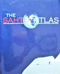
Kershaw Robert Managing Editor. Cartography By James Auld
The Sahtu Atlas. Maps and Stories From the Sahtu Settlement Area in Canada's Northwest Territories
Sahtu Gis Project. 2005 Second printing hardcover in tall glossy boards with dust jacket. 68 pp. Tables photographs maps. Fine/Fine. Please ignore the shadow on the photos. . Hardcover. Fine/Fine. Bin 118. Sahtu Gis Project. hardcover
Bookseller reference : 255890 ISBN : 0973763000 9780973763003
|
|
|
KERSHAW (Kenneth A.)
Early Printed Maps of Canada. I. 1540-1703.
4to, vi, 320pp., presentation inscription from the author, numerous illustrs., orig. cloth, d.w. slightly worn.
|
|
|
KHARTIS V.
[GREEK MAP of BYZANTINE CONSTANTINOPLE] Byzantion Konstantinoupolis: To petrion kai ta peristh autou. Khartis topographikos - arkhaiologikos ikpointheis kai katartistheis upo Misn.
Very Good Greek, Modern (post 1453) Original b/w city map of Byzantine Constantinople printed in 1936, Noemvrios (November). Oblong: 32x46 cm. In Greek (Modern). Folded. Scale: 1:2000. [GREEK MAP of BYZANTINE CONSTANTINOPLE] Byzantion Konstantinoupolis: To petrion kai ta peristh autou. Khartis topographikos - arkhaiologikos ikpointheis kai katartistheis upo Misn. It show Haliç (The Golden Horn) section and shores of Constantinople.
|
|
|
KIEPERT Heinrich
ATLAS ANTIQUUS. Duodecima edizione interamente rifatta ed aumentata con indice dei nomi. Dodici carte da servire allo studio dell'Istoria antica.
In-4° (cm. 37X24,5, frontespizio (coi titoli delle carte in italiano + 27 pag9ie di INDICI + 12 CARTE GEOGRAFICHE su TAVOLE DOPPIE litografiche a COLORI con nomenclatura LATINA 1) Orbis terrarum altero p. Chr. saeculo antiquis notum.(con riquadri: secundum Eratostenem, secundum Ptolemaeum). 2) Imperia Persarum et Macedonum (con riquadri: Regna Diadochorum medio II° a. Chr. saeculo; regna Graecorum II° a. Chr. saeculo), 3) Aegyptus (con pianta di Tebe e di Alessandria) + Phoenice et Palaestina (con piente di Gerusalemme). 4) Asia citerior (Medio Oriente). 5) Graecia cum insulis et oris Maris Aegaei (inclusa la Turchia Occid. con riquadro di Troas et Hellespontus). 6) Graecia (con riquadri: pianta di Atene e topogr. dei dintorni): 7) Italia. 8) Italiae pars media (e 3 riquadri: Magna Graecia, Siracusae, Latium antiquissimum). )) Pianta di Roma Urbs ab Augusti Imp. tempore cum muris ab Aureliano et Honorio conditis (grandi riquadri di Forum Romanum et Fora Caesarum cum Capitolio; Roma Urbs tempore liberae reipublicae). 10) Hispania Mauretania et Africa (con riq. Provinciae Carthaginensibus subditae). 11) Gallia, Britannia, Germania (riq. Provinciae Danuvieneses). 12) Imperium romanum (riq. In Praefecturas, Dioceses, Provincias divisum, e tabella "Ordo temporum quibus singulae provinciae sun ditionem populi Romani venerunt. Ogni carta e Dizionario segnalati a penna, su margini scaglionati. Cartone edit. di bella gradfica, dorso e angoli edit. in tela Preziosa e prodigiosa miniera di dati per chiunque si occupi di classici e di storia antica. Ottimo l'interno, evidenti tracce del tempo al pur solido esterno.
|
|
|
KIEPERT Heinrich / KRAATZ Leop. / SULZER J.
GRIECHENLAND mit den INSELN und KÜSTEN der Aegäischen Meeres / GRAECIA cum ISULIS et ORIS maris AEGAEI. Carta geografica in scala 1: 2.500.000, litografia a colori.
Cm. 46,1x35,8, ripiegata entro copertine editoriali in cartoncino a stampa, anteriore e posteriore, di cm. 18,2x11,8. Schrift von Leop. KRAATZ, Terrain von J, SULZER. Fessure alle pur già rinforzate fessure facilmente ri-restaurabili senza perdite lungo alcune pieghe. Collana "Karten zur alten Geschichte".
|
|
|
Kiepert, H. u. C. Wolf
Historischer Schul-Atlas zur alten, mittleren u. neueren Geschichte. (3. Aufl.).
Berlin, Reimer, 1886. Quer-4°. 36 farb. Ktn. OHlwd. Einbd. gelockert u. etwas abgegriffen. St. a. Tit.
Bookseller reference : 625040
|
|
|
Kier R. S. L. E. Garner and L. F. Brown Jr.. Cartography by James W. Macon Dan F. Scranton Barbara M. Hartmann and David M.
Land Resources of Texas : A Map of Texas Lands Classified According to Natural Suitability and Use Considerations Bureau of Economic Geology Land Resources Laboratory Series.
Bureau of Economic Geology. 1977. Book. Very Good. Soft cover. ORIGINAL 1977 PUBLICATION; Four 4 large folded maps and softcovers text in printed envelope complete for this publication; light browning of envelope; tears along edges of envelope; o/w text and maps in very good condition. . Bureau of Economic Geology. Paperback
Bookseller reference : 028346
|
|
|
Kindermann, Joseph Karl
Die Provinz Inner-Oesterreich oder die Herzogthümer Steyermark, Kaernten Und Krain, die Grafschaften Goerz Und Gradisca und das Deutsch-Oesterreichische Litorale
11 (su 12) grandi incisioni calcografiche di mm 622 x 530 alla battuta, su carta vergata molto forte. Margini amplissimi (circa 100 mm). Tutti i fogli in ottime condizioni. Questo importante atlante austriaco , di cui a noi manca solo il foglio 12, è così composto: 1) Primo foglio con il titolo, la pianta generale e le indicazioni tipografiche racchiuse in cornicetta ed altri due riquadri con descrizioni e legende geografiche; 2) "Der Noerdliche Theil von Understeyermark oder der Graetzerkreis" datato 1789; 3)"Der Mittlere Theil von Unter-Steyermark oder der Marburger Kreis" datato 1792; 4)"Der Sudliche Theil von Untersteyermark oder der Cillier Kreis" datato 1793; 5)"Der Oestliche Theil von Obersteyermark oder der Brucker Kreis" datato 1792; 6)"Derwestliche Theil von Oberteyermark oder der Judenburger Kreis" datato 1793; 7) "Unterkaernten oder der Klagenfurter Kreis" datato 1790; 8) "Oberkaernten oder der Villacher Kreis" datato 1791; 9) Il nono :"Oberkrain oder der Laybacher Kreis" datato 1797; 10) "Unterkrain oder der Neustaedtler" datato 1796; 11) "Innerkrain oder der Adelsberger Kreis" datato 1795.
|
|
|
KING (William)
A Map of a Tract of Country Surrounding Belvoir Castle; Including Extensive Districts of the Counties of Leicester, Lincoln & Nottingham; and the whole of the County of Rutland. Accurately laid down from a Survey taken in the Years 1804.5.&6. by W. King.
large scale engraved map (1165 x 1440 mm), with contemporary outline colouring, dissected into 32 sections and laid on linen, calligraphic title and dedication and mileage scale, slight browning and faint offsetting, folding into contemporary slipcase which is worn and torn, manuscript label pasted on upper cover "Hunting Map, H. Lowe". The first issue of this rare map of Belvoir Castle and the surrounding area, King issued a corrected edition in 1836 which is of similar rarity.
|
|
|
KING'S LIBRARY, BRITISH MUSEUM.
Catalogue of Maps, Prints, Drawings, Etc. Forming the Geographical and Topographical Collection attached to the Library of His late Majesty King George the Third, and Presented by His Majesty King George the Fourth to the British Museum.
First edition, 2 vols., 8vo (215 x 140 mm), [4], 732; [4], 535, [1, blank], clxxxiv (index)pp., with half-titles, small neat stamp to title, recent green cloth, a very nice set. The map collection was an important constituent of the Royal library (Samuel Johnson recommended buying maps locally in his famous letter to Barnard); The King's Topographical Collection of around 50,000 maps, charts, prints and drawings formerly owned by George III and donated to the Library by George IV, included antiquarian drawings by William Stukeley, large collections of views by Samuel Hieronymus Grimm, the Bucklers and Edward Blore, and the drawings from Captain Cook's voyages or Robert Hay's of Egypt. A privately printed folio edition was printed in the same year.
|
|
|
KINGSLEY (David)
Printed Maps of Sussex 1575-1900.
First Edition, frontis., 40 plates., orig. cloth, d.w.
|
|
|
Kipcik Ivan
Cartes geographiques anciennes
In 4° leg. edit. sov. fig. col. pp. 240, con ill.ni anche col. ben tenuto
|
|
|
Kirk R.M.
RATES AND FORMS OF EROSION ON INTERDITAL PLATFORMS AT KAIKOURA PENINSULA, SOUTH ISLAND, NEW ZEALAND.
(Codice GL/0327) In 8º 43 pp., 11 figures, 7 tables. Excerpt. No covers, stapled spine. Very good. ~~~ SPEDIZIONE IN ITALIA SEMPRE TRACCIATA

|
|
|
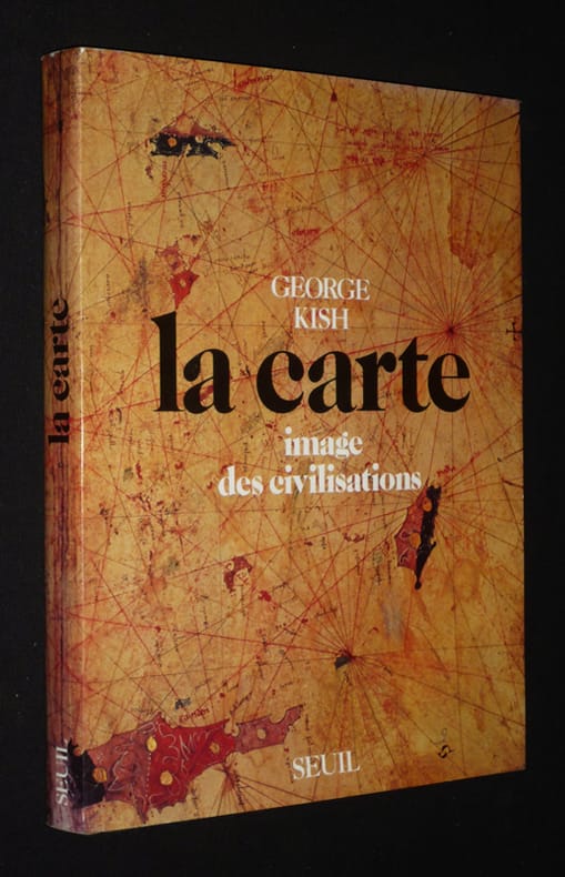
KISH George
LA CARTE . Image des civilisations .
Jaquette Couverture rigide P, Seuil , 1980 , in4° toile , jaquette illustrée , 287pp 108 planches avec notes expliqatives. Langue: Français
Bookseller reference : M12417
|
|
|
Kish George
La Carte : Image des civilisations
Seuil Cartonné avec jaquette 1980 In-4 (21,5 x 28,7 cm), cartonné avec jaquette, 287 pages, iconographie en noir et en couleurs ; quelques petites marques d'usage sur les bords de la jaquette, par ailleurs très bon état. Livraison a domicile (La Poste) ou en Mondial Relay sur simple demande.
Bookseller reference : xf193
|
|
|
KITABHANE-I SUDI COLLECTION (Published by).
[MAP of NEW EUROPE] Sudi Bey Yeni Harita Külliyatindan Yeni Avrupa.
Very Good Turkish, Ottoman (1500-1928) Original color map. Chipped on folded places. Folded. Slightly toning on paper. Oblong atlas folio. (62 x 89 cm). In Ottoman script. Map of New Europe. Scale: 1/10.000.000. Gregorian: 1927. It's printed from 'Sudi Bey' Map Corpus. This was a map serie printed in the early Republican period in Turkish with Arabic letters. Very decorative map with its color flags of various countries longitudinal on right and left sides of map. Sudi printing house was an Ottoman / Turkish publisher who was one of the longest-running of Turkish publishers.
|
|
|
KITABHANE-I SUDI COLLECTION (Published by).
[MAP of NEW OCEANIA] Sudi Bey Yeni Harita Külliyatindan Yeni Okyanusya.
Very Good Turkish, Ottoman (1500-1928) Original color map. Chipped on folded places. Folded. Slightly toning on paper. Oblong atlas folio. (63 x 94 cm). In Ottoman script. Map of New Oceania. It shows Australia, Bahr-i Muhit-i Kebir, Pacific Ocean, New Zealand, Micronesia et alli. Scale: 1/20.000.000. Gregorian: 1927. It's printed from 'Sudi Bey' Map Corpus. This was a map serie printed in the early Republican period in Turkish with Arabic letters. Very decorative map with its color flags of various countries longitudinal on right and left sides of map. Sudi printing house was an Ottoman / Turkish publisher who was one of the longest-running of Turkish publishers.
|
|
|
Kitchen T.
Map of Asia
London: G.G.& J. Robinson Paternoster Row 1799. Folding folio map of Asia with outline hand-colour. An attractive map of Asia at the end of the eighteenth century probably engraved by Thomas Kitchen. Nice hand-coloured to the boundaries of the countries stretching from Arabia to Japan and down to Java and New Guinea Nice wide margins 38 x 47.5 cms. image 34 x39 cms. This large scarce map appeared in several publicatons including Clement Cruttwells 1799 Atlas. see House of Commons Map Collection. PLEASE EMAIL FOR PHOTOS. Original Map. Folding Map. Fine. Folio. Printed Map. G.G.& J. Robinson, Paternoster Row unknown
Bookseller reference : Map913
|
|
|
KITCHIN
Map of BEDFORDSHIRE
1747. UNCOLOURED V.G. 6 X 7 . 1747. unknown
Bookseller reference : Map045
|
|
|
 Receive by email
 Download as PDF document
 RSS feed


