|
|
|
Landwirtschaftliche Akademie Bonn (Hrsg)
Studienordnung für die Studierenden der Geodäsie und Kulturtechnik an der Königlichen landwirtschaftlichen Akademie Bonn-Poppelsdorf. (Neudruck vom Oktober 1904).
Bonn, Carl Georgi Universitäts-Druckerei und Verlag, 1904. 8° (22x14), 24 S., OKart (Brosch), Umschlag etwas verletzt und mit dekorativem Besitzvermerk, 2 Eckknicke, ordentliches Exemplar,
Bookseller reference : 43986AB

|
|
|
Lanfranconi, Alberto.
La montagna vuota. le meraviglie, le avventure, i segreti degli abissi della terra nella grotta più estesa e profonda d'Italia.
<br/> STATO: USATO, COME NUOVO.<br/> TITOLO: La montagna vuota. le meraviglie, le avventure, i segreti degli abissi della terra nella grotta più estesa e profonda d'Italia. <br/> AUTORE: Lanfranconi, Alberto.<br/> EDITORE: Bramante Editrice<br/> DATA ED.: 1985,<br/>
|
|
|
LANG, A
Kleine Kartengeschichte Frieslands zwischen Ems und Jade. Entwicklung der Land- u. Seekartographie von ihren Anfängen bis zum Ende des 19. Jahrhunderts.
Norden, (Soltau), 1962. 102 S. m. zahlr. Karten im Text u. auf, teils ausklappbaren Tafeln (Hier büst du to Huus 6). OKart. (Umschlag gebräunt).
Bookseller reference : 1320763
|
|
|
Langenmaier, Th
Alte Kenntnis u. Kartographie der zentralafrikanischen Seenregion. Diss.
München, 1916. M. 3 (st. 4) gef. farb. Ktn. VII, 141 S. Hlwd. M. Rücken- u. Deckelsign. u. mehr. Bibl.-St.
Bookseller reference : 192317
|
|
|
Langenmaier,Theodor (Dr.).
Lexikon zur alten Geographie des suedoestlichen Aequatorialafrika.
<br/> NOTE: leg. molto allentata, guasti e lacune al dorso.<br/> TITOLO: Lexikon zur alten Geographie des suedoestlichen Aequatorialafrika. <br/> AUTORE: Langenmaier,Theodor (Dr.).<br/> CURATORE: Mit 50 Textskizzen.<br/> EDITORE: L.Friedrichsen & Co.<br/> DATA ED.: 1918,<br/> COLLANA: Coll.Abhandlungen des Hamburgischen Kolonialinstituts, Band XXXIX. Reihe C. Geographie, Geologie, Mineralogie und
|
|
|
LANNIER L
L'Europe.
1909 Choix de lectures de géographie Belin 1909 état d'usage 992 pages in 12 reliure demi-basane dos cuir marron à 5 nerfs, plats percaline verte aux armes du lycée Henry IV.l'ouvrage comporte 44 vignettes, 10 cartes en couleurs 53 cartes in texte.
Bookseller reference : 7634
|
|
|
Lanzoni,Primo.
Geografia, economica commerciale universale.
<br/> TITOLO: Geografia, economica commerciale universale. <br/> AUTORE: Lanzoni,Primo.<br/> CURATORE: Ottava edizione interamente rifatta da G.Assereto.<br/> EDITORE: Hoepli<br/> DATA ED.: 1926,<br/> COLLANA: Coll.Manuali.<br/>
|
|
|
Lanzoni,Primo.
Geografia, economica commerciale universale.
<br/> STATO: DA COLLEZIONE, MOLTO BUONO.<br/> TITOLO: Geografia, economica commerciale universale. <br/> AUTORE: Lanzoni,Primo.<br/> CURATORE: Decima edizione rifatta e aggiornata da G.Assereto.<br/> EDITORE: Hoepli<br/> DATA ED.: 1935-1939,<br/> COLLANA: Coll.Manuali. Con Appendice 1939 XVII, sull'Africa Orientale Italiana e l'Autarchia.<br/>
|
|
|
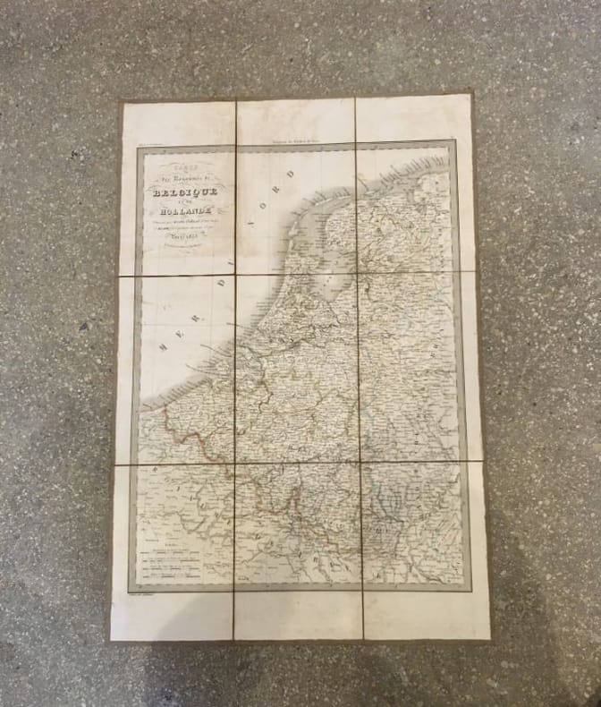
LAPIE (Pierre et Émile) [et] JÄCK (Carl); SOTZMANN (Daniel Friedrich)
Carte des royaumes de Belgique et de Hollande [et] Carte générale des États Prussiens
Paris, chez Eymery, Fruger et Cie, 1833. 66 x 44 cm [et] Berlin, Simon Schropp et Comp., 1802. 67,5 x 103 cm, étui et chemise (chemise et étui défraîchis, rousseurs, déchirures de la toile).
Bookseller reference : 18660
|
|
|
Lapierre Dominique
Luna di miele intorno al mondo
illustrazioni

|
|
|
Lapp Ralph E.
Il drago della fortuna [Oceano Pacifico]
1 cartina 15 fotografie in bianco e nero

|
|
|
Laura et Giorgio ALIPRANDI
Les GRANDES ALPES dans la CARTOGRAPHIE (1482-1885)
Un ouvrage de 360 pages en couleurs, grand format, nombreuses illustrations, relié sous jaquette illustrée et coffret
Bookseller reference : LFA000aa
|
|
|
LAURENS VAN DER POST
Plume de flamant.
1956 Editions Albin Michel, 1956, 378 pages, en partie non coupé, in 8 broché, état d'usage, usures et frottements sur les bords des plats, coins cornés, avec jaquette en état d'usage (usures et frottements).
Bookseller reference : 18612
|
|
|
LAURENT, Rene.
Les Ports de la côte et du Zwin (des plans anciens aux photographies aériennes).
in-4to, 160 pp., illustrations broche, couv. Tres bel exemplaire [PIL-5A]
|
|
|
LAURENT, Rene.
Les Ports de la côte et du Zwin (des plans anciens aux photographies aériennes).
Bruxelles, Archives Generales du Royaume, 1986. in-4to, 160 pp., illustrations broche, couv.
Bookseller reference : 80524
|
|
|
LAURO Giacomo (1561-1645/50)
CORTONA CITTÀ ANTICHISSIMA IN TOSCANA METROPOLI GiA' DI TURRENIA
Pianta della città tratta da Heroico Splendore delle Città del Mondo, rarissima pubblicazione stampata per la prima volta a Roma nel 1639, e successivamente, ampliata con l’aggiunta di dieci nuove opere, nel 1642. In alto, lungo il bordo, il titolo CORTONA CITTÀ ANTICHISSIMA IN TOSCANA METROPOLI Già DI TURRENIA .Stef. a sinistra lo stemma della famiglia Medici, a destra nel riquadro sormontato dal blasone di famiglia la dedica Al Mol. Ill.e e Mol.e Ecc.te Sig. et P[at]ron[us] mio Colend.o Il S.r Galeotto Redolfini Dottor di legge Gentilhuomo Cortonese. Si come li antichi Re Tirreni habitatori della Città di Cortona patria di V.S. con l’osservanza della Tramontana ritrovarono esquisito muodo di navigare e guerreggiar: per mare, che per ciò denotare, portar per arme con le stelle i scacchi e furono Chiamati Re Dolfini, così io con l’ossequio verso V.S. guidato quasi da novella Tramontana dalla benignità delle sue stelle, mi trovo hora arrivato in sicuro porto di esporre al gusto universale questa pianta e historia da gravi autori raccolta in viste ragione fondata, onde tenga certa seranza che dall’istessa ne sarà fugata la malvagità degl’invidi detrattori, le Dedico dunque a V.S. a questo effetto, e le fò riverenza di Roma. Di V.S. Molt. Ill.re e M.re Ecc.te humilis. S. Iacomo Lauro s. Rom. D.D. In basso lungo il bordo: a sinistra la firma I. Lauro Romano f. 1634; al centro Piero Berettini Coortonese delin. a destra In Roma con licenza de Superiori e Privil. Del Som[m]o Pont. Nei due riquadri in basso disposta su cinque colonne una legenda numerica di 58 rimandi a luoghi, cose e monumenti notabili. Orientazione con una rosa dei venti con il nord-est in alto. Acquaforte, dimensioni 192x237 mm. Pianta prospettica delineata dal celebre pittore ed architetto Pietro Berrettini da Cortona (1596-1669). L’opera è inserita nel piccolo opuscolo (A–K4) dal titolo HISTORIA DELL’ANTICHISSIMA CITTÀ DI CORTONA IN TOSCANA, CON UNA CRONOLOGIA DELLI RE D’ETRURIA E D’ALTRI RE E PRINCIPI, DI GIACOMO LAURO, ROMANO. Dedicata al molt’Illustre e molto Rever. Sig. & Padron Colendissimo IL SIG ANDREA TRZEBICKI Scolastico della Cathedrale di Plocia Gentilhuomo Polaccho. In Roma, Appresso Lodovico Grignani MDCXXXIX. La dedica a Andrzej Trzebicki, prete polacco-lituano poi eletto vescovo di Cracovia, è datata 1° settembre 1639, mentre la pianta venne realizzata 5 anni prima, nel 1634, come si evince dalla data che segue la firma del Lauro. Reca incisa, nel cartiglio in alto a destra, la dedica a Galeotto Ridolfini di Cortona. Le evidenti abrasioni e cancellature nel testo della dedica lasciano supporre che esista una tiratura antecedente dell’opera, che si suppone quindi che circolasse ben prima della pubblicazione nell’opuscolo. Giacomo Lauro, fu incisore, stampatore e conoscitore di antichità attivo prevalentemente in ambito romano tra il 1583 e il 1645. Non si conosce la data e il luogo di nascita, ma il fatto che egli firmasse le sue opere come "Jacobus Laurus Romanus" lascia presumere che fosse originario di Roma. Nulla si conosce della sua formazione. La prima testimonianza documentaria che attesta la sua presenza a Roma, in cui è definito "intagliatore di rame romano", risale al 1583; mentre la sua prima stampa conosciuta è un Tiberio con la daga (o Il gladiatore), pubblicata da Claudio Duchetti nel 1585. Nonostante abbia affrontato tematiche storiche, mitologiche, devozionali, il Lauro è noto soprattutto per la produzione di piante e vedute di città, a cominciare dalla veduta a volo d'uccello di Rocca Contrada (Arcevia), realizzata nel 1594 per Angelo Rocca su disegno di Ercole Ramazzani. Negli anni 1630-45, Lauro si dedicò alla pubblicazione di una serie di piante e descrizioni di città italiane e straniere in forma di piccoli opuscoli, alcuni dei quali furono raccolti nel 1639 sotto il titolo di Heroico splendore delle città del mondo. Le piante di Lauro, dunque, furono il frutto ... Map of the city taken from Heroico Splendore delle Città del Mondo, a very rare publication printed for the first time in Rome in 1639, and later, expanded with the addition of ten new works, in 1642. Giacomo Lauro, was an engraver, printer and connoisseur of antiquities active mainly in Rome between 1583 and 1645. We do not know the date and place of birth, but the fact that he signed his works as "Jacobus Laurus Romanus" suggests that he was a native of Rome. Nothing is known about his education. The first documentary evidence of his presence in Rome, in which he is defined as a "Roman copper engraver", dates back to 1583; while his first known print is a Tiberius with a dagger (or The Gladiator), published by Claudio Duchetti in 1585. Although he dealt with historical, mythological, devotional themes, Lauro is mainly known for the production of plans and views of cities, starting with the bird's eye view of Rocca Contrada (Arcevia), made in 1594 for Angelo Rocca on a drawing by Ercole Ramazzani. In the years 1630-45, Lauro dedicated himself to the publication of a series of maps and descriptions of Italian and foreign cities in the form of small pamphlets, some of which were collected in 1639 under the title of Heroico Splendore delle Città del Mondo. Lauro's plans, therefore, were the result of a long research work, based on primary sources, and published for the first time in books or pamphlets with text related to the history of the city. Thomas Ashby writes: "In the years 1630-1645 the Lauro published a considerable number of descriptions of cities in many pamphlets with text, all in small oblong folio. The plants are not all original [...] Many times have been used as sources, of course, the beautiful plates of the Atlas of Lafrèry. But other maps were also contributed - much was taken either from the work of Braun and Hogenberg, Civitales Orbis Terrarum, or even in this case from common sources. There is no lack of contact with Matteo Florimi of Siena, who in no case did his own work, but always copied the work of others. Some of these maps were collected under the following title, engraved in 1639; HEROICO SPLENDORE DELLE CITTA DEL MONDO LIBRO PRIMO DI IACOMO LAURO ROMANO Dove si uedono le piante di molte Citta Ill.ri e di molte non più state alla stampa con le loro origini et atti segnalati, et quanto si estende il dominio di esse sino alli presenti tempi in Roma l’Anno di nostra salute 1639” (see Thomas Ashby, L'Heroico splendore delle città del mondo, in "La Bibliofilia", XXXI (1929), pp. 105-122). The work was reprinted in 1642 with imprint in Roma l’Anno di nostra salute 1642 /Con priuilegio del somo Pontefice, et d'altri Potent.ti Con licenza de Superiori. Although the title page speaks of "Book one" a second volume of the collection was not published. Copper engraving, printed on contemporary laid paper, with margins, very light oxidation, otherwise in excellent condition. Very rare. Bibliografia Thomas Ashby, Un incisore antiquario del Seicento, I, Note intorno alla vita ed opere di Giacomo Lauro, in “La Bibliofilia”, XXVIII (1926-27), pp. 361-373; II, L'opera "Antiquae Urbis splendor", ibid., pp. 453-460; III, ibid., XXIX (1927), pp. 356-369; IV, L'Heroico splendore delle città del mondo, ibid., XXXI (1929), pp. 105-122.

|
|
|
LAURO Giacomo (1561-1645/50)
Rocca Contrada
Prototipo delle piante a volo d’uccello della città, commissionato da Angelo Rocca, disegnato da Ercole Ramazzani ed inciso da Giacomo Lauro nel 1594. L’opera viene dedicata al Cardinale Rastucci. In basso, a sinistra, lo stemma di Rocca Contrada, in basso a destra lo stemma di Angelo Rocca. Esemplare di secondo stato, con la data 1608, che reca in alto lo stemma del Cardinale Bandini, nuovo dedicatario. “Nel 1594 l’autorevole Angelo Rocca (1545-1620), agostiniano vescovo di Tagaste, biblista e bibliofilo, nativo di Rocca Contrada (oggi Arcevia), commissiona per motivi celebrativi un suo rilievo al pittore Ercole Ramazzani, arceviese, allievo di Lorenzo Lotto” (cfr. Giorgio Mangani, Geopolitica del paesaggio, p. 71). La città di Rocca Contrada, oggi Arcevia, nella Diocesi di Senigallia, quindi parte del Ducato di Urbino, ma in qualche maniera sottoposta al controllo pontificio, nonostante le sue modeste dimensioni, svolse, soprattutto tra XV e XVI secolo, un certo ruolo nel controllo di un'area collegata all’accesso della strada per Roma. Per questo motivo era stata fortificata e risultava come luogo "inespugnabile" nelle trattazioni corografiche e geografiche, che ne lodavano il clima e si cimentavano con costante ripetitività nell'interpretazione etimologica del nome geografico. È probabile, tuttavia, che la città non avrebbe avuto l'attenzione cartografica che invece ha avuto, se uno dei suoi più autorevoli figli, lo studioso agostiniano Angelo Rocca (Rocca Contrada, 1545 - Roma 1620), filologo, biblista e, dal 1605, vescovo di Tagaste, grande collezionista di libri che furono al l'origine della biblioteca Angelica di Roma, che da lui prende il nome, non avesse commissionato, al pittore locale Ercole Ramazzani (Rocca Contrada, 1530-1598), un disegno della città. Ramazzani, arceviese, lavorava tra Marche e Umbria nello stile del manierismo degli Zuccari con una particolare sensibilità paesaggistica che tradisce evidentemente anche un'attività cartografica e vedutistica, all'epoca naturale complemento dell'attività pittorica. Suo fu infatti il disegno del rilievo di Rocca Contrada commissionato da Rocca ed eseguito nel 1594. Un nuovo stato dell'incisione del 1608 fu invece dedicato a Ottavio Bandini, divenuto cardinale protettore di Rocca Contrada quando era Legato della Marca, succedendo nel 1603 al Rusticucci, dopo la sua morte. Opera rarissima, il cui solo esemplare noto di primo stato (1594) è quello conservato alla Biblioteca Angelica di Roma, fondata proprio da Angelo Rocca. Acquaforte e bulino, impressa su carta vergata coeva con filigrana “ancora nel cerchio con stella”, con margini, piccolo foro di bruciatura nel lato destro, per il resto in eccellente stato conservativo. Bibliografia Anselmo Anselmi, La pianta panoramica di Roccacontrada, oggi Arcevia, disegnata da Ercole Ramazzani nel 1594, in “La Bibliofilía” Vol. 8, No. 10/11 (Gennaio-Febbraio 1907), pp. 366-372. Prototype of the bird's eye view of the city, commissioned by Angelo Rocca, designed by Ercole Ramazzani and engraved by Giacomo Lauro in 1594. The work is dedicated to Cardinal Rastucci. Bottom left, the coat of arms of Rocca Contrada, bottom right the coat of arms of Angelo Rocca. Example of the second state, dated 1608, with the coat of arms of Cardinal Bandini at the top, the new dedicatee. “Nel 1594 l’autorevole Angelo Rocca (1545-1620), agostiniano vescovo di Tagaste, biblista e bibliofilo, nativo di Rocca Contrada (oggi Arcevia), commissiona per motivi celebrativi un suo rilievo al pittore Ercole Ramazzani, arceviese, allievo di Lorenzo Lotto” (cfr. Giorgio Mangani, Geopolitica del paesaggio, p. 71). Rocca Contrada, today called Arcevia, a very small town which in fifteenth and sixteenth centuries experienced a brief period of political and military importance. It is probable, however, that the city would not have had the cartographic attention that it had, if one of its most authoritative sons, the Augustinian scholar Angelo Rocca (Rocca Contrada, 1545 - Rome 1620), philologist, biblical scholar and, from 1605, bishop of Tagaste, great collector of books that were at the origin of the Biblioteca Angelica of Rome, which takes its name from him, had not commissioned a drawing of the city to the local painter Ercole Ramazzani (Rocca Contrada, 1530-1598). Ramazzani, arceviese, worked between Marche and Umbria in the style of the mannerism of the Zuccari with a particular landscape sensibility that evidently betrays also an activity cartographic and vedutistica, to the epoch natural complement of the pictorial activity. His was in fact the sketch of the relief of Rocca Contrada commissioned by Rocca and executed in 1594. A new state of the engraving of 1608 was instead dedicated to Ottavio Bandini, who became cardinal protector of Rocca Contrada when he was Legate of the Marca, succeeding Rusticucci in 1603, after his death. A very rare work, whose only known exemplar of the first state (1594) is the one preserved in the Biblioteca Angelica in Rome, founded by Angelo Rocca himself. Literature Anselmo Anselmi, La pianta panoramica di Roccacontrada, oggi Arcevia, disegnata da Ercole Ramazzani nel 1594, in “La Bibliofilía” Vol. 8, No. 10/11 (Gennaio-Febbraio 1907), pp. 366-372.

|
|
|
Laut Peter
Agricultural Geography: Volume 1 � Systems Subsistence and Plantation Agriculture
Nelson Melbourne 1970. Reprint. Softcover. Fair Condition. Illustrator: Photographic and Illustrations. preface by author list of illustrations acknowledgements guide to further reading and references and index. The text is illustrated with numerous black-and-white photographs maps tables illustrations and figures. Illustrated card cover with yellow and white coloured titles to the front panel and white coloured titles to the back strip. Black and white photograph of author to the rear book panel. A small book about what comprises agricultural geography and widely so and why agricultural activities are done in the manner in which they are done so. Creasing to the book corners with a large triangular crease to the front right hand corner. Reading creases to the back strip with browning light foxing and stains to the text block edges. Age toning of the pages. Tape residue can be seen to the first few pages and last few pages of the book � were a previous owner has covered the book in plastic and the tape has seeped. Size: 12mo standard paperback. 276 pages. Please refer to accompanying picture s. Illustrator: Photographic and Illustrations. Quantity Available: 1. Category: Farming & Rural Life; Geography; Science & Technology. Inventory No: 0120394. . Nelson paperback
Bookseller reference : 0120394

|
|
|
Lavagna Elvio; Lucarno Guido
Geocartografia. Guida alla lettura delle carte geotopografiche
br. Il complesso lavoro di compilazione del cartografo e l'enorme quantità di dati tradotti in una carta rendono facile intuire quante informazioni si traggano da una lettura corretta e come lo studio di un territorio si arricchisca di ulteriori motivi di interesse e curiosità. "Geocartografia" introduce i principi di base delle scienze cartografiche e guida alla lettura delle carte geotopografiche, risolvendo i problemi più significativi che derivano dal loro uso. Le numerose illustrazioni e gli esercizi proposti a fine capitolo rendono il libro un efficace sussidio didattico. In questa seconda edizione sono stati apportati aggiornamenti sugli aspetti tecnologici e si è aggiunto un nuovo capitolo di esercitazioni svolte, con l'intento di guidare il lettore non solo alla lettura più completa e consapevole delle carte, ma anche nella progettazione di escursioni alla scoperta dei territori che vi sono rappresentati. Una trattazione concisa di questi argomenti può essere utile, infatti, per chi utilizza le carte nella pratica dell'escursionismo e dell'orienteering e desidera trarne i dati necessari per il riconoscimento degli elementi presenti nel territorio. "Geocartografia" è una guida anche per chi compie ricerche sul campo di carattere geologico, geomorfologico, ecologico o più in generale relative alla geografia fisica, umana ed economica di un territorio.

|
|
|
Lavallée, Joseph; Guéroult, Adolphe; Lacroix, Frederic; De Gregory; De Colonna
1: Spagna. 2: Spagna dall'espulsione dei mori sino all'anno 1847. Isole Baleari e Piziuse. Sardegna. Corsica
2 volumi, 8°, 23 cm, pp. 506; 479; 30; 5; 166, 2 carte geografiche ripiegate al primo volume e 107 incisioni complessivamente. testo su due colonne, Rilegatura coeva in mezza pelle, titolo in oro su tassello al dorso, piatti marmorizzati. Fanno parte di: L'universo o storia e descrizione di tutti i popoli ec, loro religioni, costumi, usanze ec. Leggere tracce d'uso al dorso del secondo volume, per il resto esemplare molto buono

|
|
|
LAVIS-TRAFFORD M. A., de
Commentaire sur l'oeuvre relative aux ALPES des TOPOGRAPHIES, CARTOGRAPHES et ECRIVAINS au cours de la deuxième moitié du XVIe siècle et sur l'EVOLUTION de la CARTOGRAPHIE en général au cours du XVIe. siècle.
Estratto originale da: L'évolution de la cartographie de la région du Mont-Cenis et de ses abords aux 15. et 16. siècles. In-4° (cm. 27x21), pp. 16. Brossura editoriale, ma i bordi del piatto anteriore sono asportati, con perdita di due sillabe di stampato solo al verso. Interno buono. Esemplare da studio. Censito in sole 3 bibl. italiane. Così com'è
|
|
|
Lavis-Trafford, M.-A. de
L'évolution de la cartographie de la région du Mont-Cenis et de ses abords aux XVème et XVIème
1949 Librairie Dardel, Chambéry, 1949. In-4 broché. 125 pages, 12 planches, 2 cartes
Bookseller reference : 1692
|
|
|
Lavizzari Luigi
Escursioni nel Canton Ticino
16°, mm 160x110, pp. 978, una carta di errata al fondo, una carta ripiegata del Cantone in antiporta, una veduta di Lugano fuori testo. Legatura moderna in tutta tela con titolo su tassello rosso al dorso. Esemplare in buono stato, leggermente rifilato e con sporadiche lievi gore alle prime pagine. Rara edizione originale di questa esauriente guida del Ticino che non tratta solo di problemi storico-artistici, ma anche politici, statistici, economici e attinenti la storia naturale del cantone.

|
|
|
LAVOISIER RENE FRIC
Oeuvres de Lavoisier, correspondance.
Albin Michel, préface de Louis de Broglie, 1957, 285 pages, in 4 broché, état d'usage, coins cornés, usures sur les bords des plats, les mors et le dos de l'ouvrage.
Bookseller reference : 12292
|
|
|
Le Bas, Philippe
Allemagna di Filippo Le Bas. Prima versione italiana
8°, 23 cm, pp. 485, 2 carte geografiche ripiegate e 200 tavole incise fuori testo, rilegatura coeva in mezza pelle, titolo in oro su tassello al dorso, piatti marmorizzati, testo su due colonne. Fa parte di: L'Universo o storia e descrizione di tutti i popoli, ec, loro religioni, costumi, usanze, ec. Esemplare molto buono. Il primo volume di due

|
|
|
LE BAUT L.
Plans et cartes. Graphiques et diagrammes. Guide des travaux pratiques de géographie à l'usage des établissements scolaires.
Couverture souple. Broché. 54 pages.
Bookseller reference : 104032

|
|
|
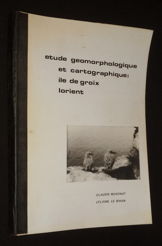
Le Bihan Lyliane,Muxonat Claudie
Etude géomorphologique et cartographique : Ile de Groix - Lorient
Dos carré collé In-4 (21 x 29,5 cm), dos thermocollé, 158 pages, sans date ni mention d'éditeur, document tapuscrit ; quelques traces et marques d'usage sur les plats et tranches, coins du premier plat recourbés, par ailleurs intérieur frais, assez bon état. Livraison a domicile (La Poste) ou en Mondial Relay sur simple demande.
Bookseller reference : nh971
|
|
|
LE BRAS, Hervé et TODD, Emmanuel
Le mystère français
2013 Ed. du Seuil / La République des Idées - Coll. La République des idées (dirigée par Pierre Rosanvallon et Ivan Jablonka) - 2013 - Fort In-8 broché - 309 p. - Nombreuses cartes de la France en couleurs
Bookseller reference : 101895
|
|
|
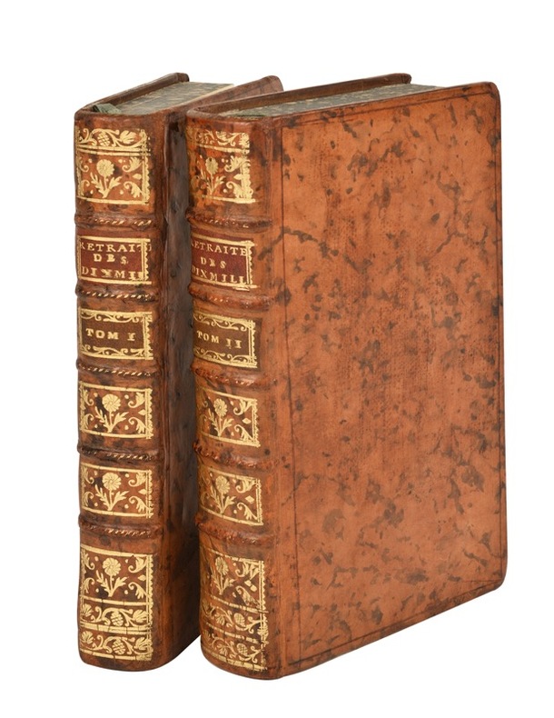
Le Cointe (Jean-Louis) :
Commentaires sur la retraite des dix-mille de Xénophon ; ou nouveau traité sur la guerre, à l’usage des jeunes officiers.
Paris, Nyon, Saillant, Desaint, 1766 ; 2 tomes in-12, veau marbré, dos à nerfs décoré et doré, pièces de titre grenat, tranches marbrées (reliure de l’époque) ; [2], LII, 357, [1]p., 1 planche dépliante (bataille de Counaxa) ; 52], 580, [4] pp., (1 carte dépliante, trajet des Dix-mille) ; (sign. : a-b12, c2, A-P12 [pl.1] ; A, 2A12, B4, [pl.2]).
Bookseller reference : 21691
|
|
|
LE FLOC'H Jean-Louis
Etudes Scientifiques. Mars 1975 - J.-L. Le Floc'h. La cartographie en Afrique.
Paris, Le Caire: Editions et Publications des Pères Jésuites en Egypte, 1975 in-8, 60 pages, illustrations. Broché.
Bookseller reference : 1105489
|
|
|
Le Hon,H. (le capitaine).
Périodicité des grands déluges résultant du mouvement graduel de la ligne des apsides de la Terre. Théorie prouvée par les faits
<br/> TITOLO: Périodicité des grands déluges résultant du mouvement graduel de la ligne des apsides de la Terre. Théorie prouvée par les faits géologiques. Deuxième Ed. revue, augmentée et enrichie de deux cartes.: L'Europer antédiluvienne et la rupture de l'Isthme du Pas de Calais.<br/> AUTORE: Le Hon,H. (le capitaine).<br/> EDITORE: Dunod, Lacroix Van Meene et Cie Ed.<br/> DATA ED.: 1861,<br/> C
|
|
|
Le Plongeon Alice D.
Here and There in Yucatan. Miscellanies [MESSICO]
12 tavole fuori testo

|
|
|
LE ROUGE, GEORGE LOUIS.
Le Duché de Savoye.
Chez Basset, Paris, 1785. Incisione in rame, colore d’epoca, cm 50,5 x 64,5 (alla lastra). Attivo fra il 1740 e il 1780, ingegnere militare di professione, Le Rouge s’interessò alla cartografia e produsse opera di rara bellezza, coprendo un ampio raggio di soggetti, tra cui piani di fortificazioni, campagne militari, piante di città, atlanti e carte nautiche. Anche se con una impressione leggermente stanca, bell’esemplare marginoso e in bella coloritura.

|
|
|
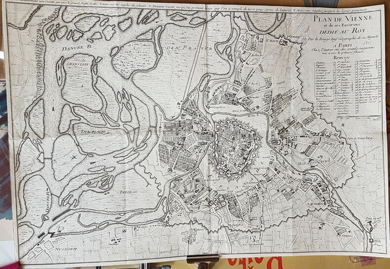
LE ROUGE.-
Plan de Vienne (Autriche) et de ses Environs. Avec commentaire dans la marge supérieure: On a fait dernièrement une Cunette par tout le grand fossé, et des bonets sur les angles du glacis. I. Douane rasée jusqu'au
premier étage que l'on a rempli de terre pour servir de batterie. Y. Maisons rasées jusqu'à la ligne ponctuée.- Paris. L'Auteur. (1742). Grand plan de 560 x 385 mm en noir et plan, petites marges ca 8mm. Explications dans le cartouche. Traces de plis d'origine sinon très bon état. Photo sur demande.
Bookseller reference : ORD-17880
|
|
|
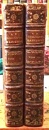
LE SAGE (Alletz Pons-Augustin);
Le GÉOGRAPHE PARISIEN ou le Conducteur chronologique et historique des Rues de Paris, contenant l'abrégé de la France, l'origine de Lutèce, la situation de Paris, ses divers accroissemens, l'étymologie des rues, leurs tenans et aboutissans, leurs longueurs et largeurs, les anecdotes, époques, traits historiques; …considéré relativement à l'utilité publique et à l'agréable. Dédié à M. de Sartine.
Valleyre, Vve Duchesne, Prault Paris 1769 2 vol. 2 vol. in-8 de 3 ff.n.ch. 386 pp. et 2 ff.n.ch. 420 pp. 3 ff.n.ch.; veau raciné de l'époque, dos à nerfs orné, pièces de titre et de tomaison, tranches rouges.
Bookseller reference : 12812
|
|
|
Le Sage, A.R. (d.i. E.A. de las Cases)
Historisch-Genealogisch-Geographischer Atlas. Aus dem Französischen der neuesten Ausgabe ins Deutsche übertragen u. mit zwei politisch geograph. Übersichten vermehrt v. A.v. Dusch.
Carlsruhe, (1826-1831). Fol. M. lith. Titel- u. Widmungsblatt sowie 43 teilkolor. doppelblattgr. Tab., davon 24 m. teilkolor. lith. Ktn. Tab. 13 mit einem Anhangbl. 3 Bl. (2 Bl. vom Inh.-Verz. sind doppelt eingeb.). Hldr. m. aufgezog. OU. Dieser aber teils nicht mehr vorhanden. Rücken nur noch zur knappen Hälfte vorhanden. Einbd. berieben u. bestoßen. Innen teils etwas braun- bzw. stockfl.
Bookseller reference : 197784

|
|
|
LE SAULNIER DE VAUHELLO , WISSOCQ , CAZEAUX , DARONDEAU et JEHENNE .
SONDES D ' ATTERRAGE DE LA COTE SUD OUEST DE LA FRANCE ET DE LA COTE NORD D ' ESPAGNE . Faites en 1828 - 1829 par .
P, Dépôt général de la Marine 1831, grande carte gravée de 93 x 65 cm . Edition d ' Avril 1888 . Court de marge . Marge supérieure légèrement froissée . Quelques annotations de navigations . Langue: Français
Bookseller reference : M18484
|
|
|
LE SERVICE GEOGRAPHIQUE DES F. F. L. L. (Pressed, published and drawn by).
[MAP of SYRIA AND LEBANON] Syrie & Liban: Carte Touristique.
Very Good French Scarce color lithographed tourist map of Syria and Lebanon, showing international boundaries, transportation, archaeological, historical, and military ruins, water features, distances between places and populated places. Relief is shown by hachures, bathymetric tints, and spot heights. Includes 28 attractive drawings in red of tourist sites in Syria and Lebanon: Damas, Palmyre, Afqa, Hama, Homs, Meyrouba, Saida, Beit ed-Dins, Djebail, Led Cedres, Krak des Chevaliers, Massiaf, Antioche, Deir Smane, El Goilla, Aleppo, etc. "Relief is shown by contours and spot heights. Includes 28 drawings of tourist sites in Syria and Lebanon, listing the city. "7 -49". On lower right margin.'". Free French Forces was the government-in-exile led by Charles de Gaulle during the Second World War, and its military forces, that continued to fight against the Axis powers as an Allied nation, following the Fall of France. Set up in London in June 1940, it organized and supported the Resistance in Occupied France, and established a foothold within several French colonies in Africa. Original color lithograph map of Syria and Lebanon. 57x72 cm., on sheet 63x84 cm. In French. Scale: 1:1.000.000. Edition of May 1942.
|
|
|
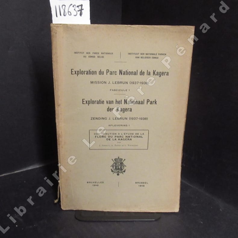
LEBRUN, J. - TATON, A. - TOUSSAINT, L.
Contribution à l'étude de la flore du parc national de la Kagera. Exploration du Parc National de la Kagera, Mission J. Lebrun (1937-1938), Fascicule 1. Exploratie van het National Park der Kagera, Zendig J. Lebrun (1937-1938), Aflevering 1.
1948 Institut des Parcs Nationaux du Congo Belge / Instituut der Nationale Parken van Belgisch Congo - 1948 - In-8, broché - 160 p. - Planches hors texte en N&B en fin d'ouvrage - Ouvrage non coupé (jamais lu)
Bookseller reference : 118637
|
|
|
LECLERCQ JULES
Voyage dans le nord de l'Europe (un tour en norvège , une promenade dans la mer glaciale 1871-1873).
1877 Alfred mame 1877 état d'usage 349 pages reliure percaline rouge dos à 5 nerfs tranches dorées titres et caissons or nombreuses gravures ,quelques rousseurs sur le texte .
Bookseller reference : 6336
|
|
|
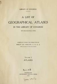
LeGear Clara Egli Le Gear
A List of Geographical Atlases in the Library of Congress with Bibliographical Notes : Volume 8
Washington D. C.: Library of Congress / U. S. Government Printing Office 1974. Very Good EX-LIBRARY. Hinges are perfect. Pages are clean and crisp. NO underlining. NO highlighting. NO margin notes. 1974. First Edition. Volume 8 comprising the Index to Volume 7 titles 10255-18435. From the preface: "Indexed in this volume are areas subjects map authors engravers lithographers publishers etc. and atlas titles with distinctive words." Subtitle: "A Continuation of Four Volumes by Philip Lee Phillips." Bound in the original blue cloth gilt-stamped over a red spine panel. This First Edition measures 7" wide by 10" tall which is a larger format than the 1996 Martino reprint. BIBLIOGRAPHICAL NOTE: Volume 8's ISBN listed here was mistakenly duplicated for Volume 9 The Comprehensive Author List when it was published in 1992. First Edition. Hardcover. Very Good EX-LIBRARY/No jacket as issued. v 190pp. Great Packaging Fast Shipping. Library of Congress / U. S. Government Printing Office Hardcover
Bookseller reference : 019878 ISBN : 084440117X 9780844401171
|
|
|
LeGear Clara Egli; Le Gear
United States Atlases : A List of National State County City and Regional Atlases in the Library of Congress and Cooperating Libraries new HARDCOVER in publisher's shrinkwrap
Mansfield Centre Connecticut: Martino Fine Books 1997. Brand New in perfect condition. 2 vols in 1. STILL SEALED in the publisher's clear plastic SHRINKWRAP. NO rubbing. NO fading. Bright clean square and tight. Sharp corners. NO owner's name or bookplate. NO remainder mark. Fresh and crisp -- obviously never read. n. d. but 1997. HARDCOVER reprint limited to 150 copies of the 1950 and 1953 Library of Congress originals. 2 volumes bound as 1 with a total of 767 pages. Because this edition is bound in sturdy cloth it is much better suited to heavy use than the paper bindings of the original editions. A welcome reprint of an important and scarce reference. Described here are 6696 atlases. Entries are first arranged geographically and by subject national; state; and within the various states by county/parish city and region; special subject atlases include agriculture aviation canals climate coal geology history languages railroads etc. Then the atlases are re-listed by author/publisher in the index. A typical entry includes the atlas title; cartographer; publisher; city and date of first publication; dimensions in centimeters; number of pages plates and maps; the number that are colored etc. Occasional notes on contents. In the second part copies of the atlases held by some 180 libraries are located. Hodgkiss/Tatham KEYGUIDE TO INFORMATION SOURCES IN CARTOGRAPHY: "An indispensable reference for students of American history or of the development of American cartography." Bound in the original gilt-stamped blue cloth. Besterman 6267. Sheehy CL288. KEYGUIDE 94. 1997 reprint of 1950/53 originals. Hardcover. New/in publisher's shrinkwrap. 2 vols in 1: viii445pp. xiii301pp. 767 total. Great Packaging Fast Shipping. Martino Fine Books Hardcover
Bookseller reference : 017766 ISBN : 1578980550 9781578980550
|
|
|
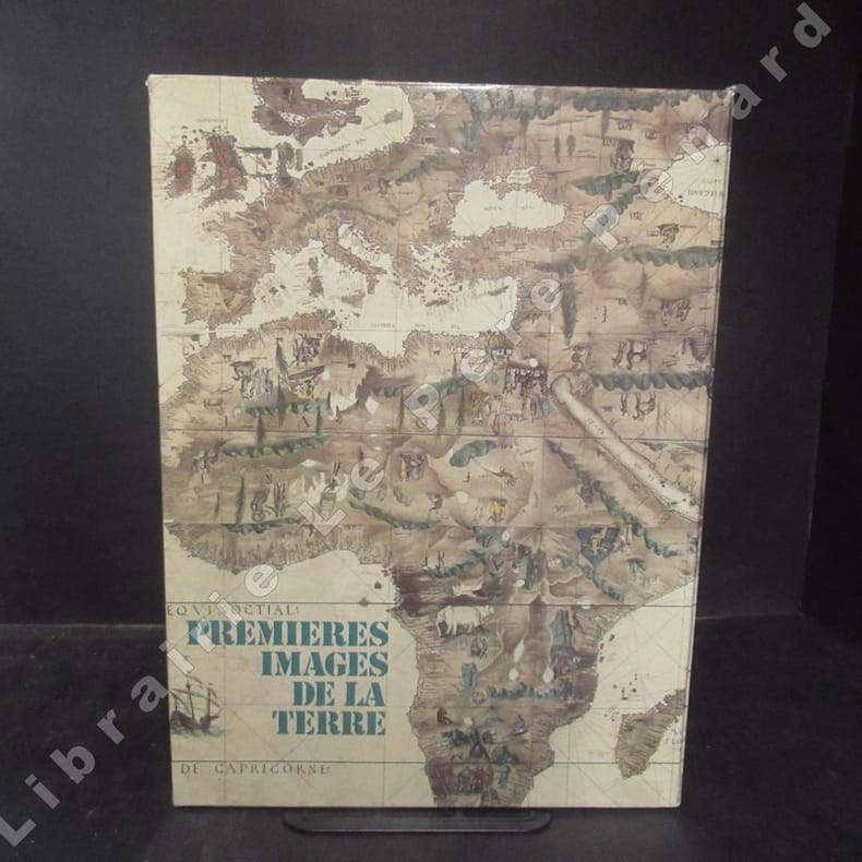
LEINEKUGEL LE COCQ, Max
Premières images de la Terre
1977 Editions Joël Cuénot - 1977 - In-4, cartonnage toilé avec titre doré au dos dans son emboîtage illustré - 96 pages - Très nombreuses illustrations en couleurs et en N&B
Bookseller reference : 112232
|
|
|
LEINEKUGEL LE COCQ, Max:
Premières images de la terre (cartes - portulans - voyages).
Joël Cuénot, 1977, gr. in-4to, 96 p., richem. ill avec des cartes, dessins et reproductions en couleurs et en noir, reliure en toile originale, emboîtage orig. ill. en couleurs.
Bookseller reference : 78180aaf

|
|
|
LELIO PAGANI
CARTOGRAFIA DEL NUOVO MONDO
IN 4° gr.( cm.38 X 27,5 ), c.36, COPERTINA EDITORIALE CARTONATA RIGIDA ILLUSTRATA A COLORI CON TITOLO. TAVOLE 49 in b/n/col. DI CUI MOLTE A DOPPIA PAGINA. CON RELATIVE SCHEDE. INTRODUZIONE E SCHEDE DI LELIO PAGANI. RISGUARDI FIGURATI. OTTIMA CONSERVAZIONE.

|
|
|
LELIO PAGANI ( INTRODUZIONE DI )
COSMOGRAPHIA
IN 4° gr. ( cm.38 X 27 ), pp.XV + TAVOLE XXVII a DOPPIA PAGINA a COLORI. COPERTINA EDITORIALE CARTONATA RIGIDA ILLUSTRATA A COLORI CON TITOLO. LE MAPPE, RIPRODUCONO IL CODICE LAT. V F. 32 ( XV SEC.) DELLA BIBLIOTECA NAZIONALE DI NAPOLI, <BR>DI CLAUDIO TOLOMEO. TESTO SU DUE COLONNE IN LINGUA INGLESE. OTTIMA CONSERVAZIONE. ID 4827

|
|
|
LELIO PAGANI ( PRESENTAZIONE DI )
CITTA' DEL MONDO EUROPA - AMERICHE
IN 4° gr.( cm.38 X 27,5 ), pp. VIII + TAVOLE XXIX a col. COPERTINA EDITORIALE CARTONATA RIGIDA ILLUSTRATA A COLORI CON TITOLO. IN QUESTO VOLUME VENGONO PRESENTATE 29 DELLE 58 TAVOLE CONTENUTE NELL'OPERA DI G. BRAUN e F. HOGENBERG, CIVITATES ORBIS TERRARUM, EDITA A COLONIA NEL 1572 PRESSO TH. GRAMINAEUS. OTTIMA CONSERVAZIONE.

|
|
|
LEMOINE-ISABEAU C., BRAGARD P., CAPEL H., DANCKAERT L. et De GRAEVE J.
Cartographie belge dans les collections espagnoles, XVIe au XVIIIe siècle.
Bruxelles, Crédit Communal de Belgique, 1985. 21 x 30, 111 pp., nombreuses cartes et plans en couleurs et en N/B, broché, très bon état (1 cachet d'ex-propriétaire).
Bookseller reference : 91023
|
|
|
LEMOINE-ISABEAU Claire
"La cartographie du territoire belge de 1780 à 1830; entre Ferraris et le Dépôt de la Guerre de Belgique."
Bruxelles, Musée Royal de l'Armée, 1998. 16 x 24, 391 pp., nombreuses cartes et illustrations, broché + jaquette, très bon état (sauf cachet d'ex-propriétaire).
Bookseller reference : 91732
|
|
|
LEMOINE-ISABEAU Claire
La carte de Belgique et de l'Institut Cartographique Militaire (Dépôt de la Guerre) 1830-1914. Centre d'histoire militaire, N° 23.
Bruxelles, Musée Royal de l'Armée, 1988. 16 x 24, 332 pp., 17 cartes, illustrations en couleurs et en N/B, broché, très bon état (sauf cachet d'ex-propriétaire).
Bookseller reference : 91733
|
|
|
 Receive by email
 Download as PDF document
 RSS feed


