|
MOULE, Thomas
Map of HERTFORDSHIRE
London: George Virtue No 26 Ivy Lane 1848. No Binding. Vg. 10.75"x 8.25" Later hand-colour <br/> <br/> George Virtue No 26 Ivy Lane unknown
Bookseller reference : Map 255
|
|
|
MOULE, Thomas
Map of ISLE OF WIGHT
London: George Virtue 1848. No Binding. Vg. 10.75"x 8.25" Later hand-colour. Original steel engraving <br/> <br/> George Virtue unknown
Bookseller reference : Map 303
|
|
|
MOULE, Thomas
Map of LINCOLNSHIRE
London: George Virtue 1848. No Binding. Vg. 10.75"x 8.25" Later hand-colour. Original steel engraving <br/> <br/> George Virtue unknown
Bookseller reference : Map 353
|
|
|
MOULE, Thomas
Map of NORFOLK
London: George Virtue 1848. re-issue . No Binding. Vg. 21 x 27 cms. Original un-coloured state with the later railway lines added since the first issue in 1832. Finely engraved views of Norfolk. A nice original dark impression steel engraving. <br/> <br/> George Virtue unknown
Bookseller reference : Map 824
|
|
|
MOULE, Thomas
Map of NORTHAMPTONSHIRE
London: George Virtue 1848. re-issue . No Binding. Vg. 21 x 27 cms. Original un-coloured state with the later railway lines added since the first issue in 1832. Finely engraved views of Northamptonshire. A nice original dark impression steel engraving. <br/> <br/> George Virtue unknown
Bookseller reference : Map 825
|
|
|
MOULE, Thomas
Map of NORFOLK
London: George Virtue 1848. No Binding. Vg. 10.75"x 8.25" Later hand-colour. Original steel engraving <br/> <br/> George Virtue unknown
Bookseller reference : Map 399
|
|
|
MOULE, Thomas
Map of NOTTINGHAMSHIRE
London: George Virtue 1848. No Binding. Vg. 10.75"x 8.25" Later hand-colour. Original steel engraving <br/> <br/> George Virtue unknown
Bookseller reference : Map 474
|
|
|
MOULE, Thomas
Map of OXFORDSHIRE
London: George Virtue 1848. re-issue . No Binding. Vg. 21 x 27 cms. Original un-coloured state with the later railway lines added since the first issue in 1832. Finely engraved views of Oxford and decorative cartouche. Small closed tear to upper left edge 2cms and a little edge soiled to reverse. A nice original dark impression steel engraving. Wide margins <br/> <br/> George Virtue unknown
Bookseller reference : Map 819
|
|
|
MOULE, Thomas
Map of OXFORDSHIRE
London: George Virtue 1848. No Binding. Vg. 10.75"x 8.25" Later hand-colour. Original steel engraving <br/> <br/> George Virtue unknown
Bookseller reference : Map 492
|
|
|
MOULE, Thomas
Map of SUSSEX
London: George Virtue 1848. No Binding. Fine. 10.75"x 8.25" Later hand-colour. Original steel engraving <br/> <br/> George Virtue unknown
Bookseller reference : Map 595
|
|
|
MOULE, Thomas
THE ENVIRONS OF LONDON
London: George Virtue 1848. re-issue . No Binding. Vg. W. Hughes. 27 x 21 cms. Original un-coloured state first issue in 1832. Finely engraved map of London spanning Harrow in the west to Barking in the east Wimbledon in the south to Finchley in the north. A nice original steel engraving with a dark impression. Some pencil lines on the reverse not affecting map <br/> <br/> George Virtue unknown
Bookseller reference : Map 821
|
|
|
Mountford C. P.
Uomini bruni e sabbie rosse. Attraverso l'Australia selvaggia
illustrazioni

|
|
|
MOXON (Joseph)
A Tutor to Astronomie and Geographie. Or an easie and speedy way to know the use of both the globes, coelestial and terrestrial. In six books. The first teaching the rudiments of astronomie and geographie. The shewing by the globe; the solution of 2. Astronomical and geographical prob. 3. Problemes in navigation. 4. Astrological problemes. 5. Gnomonical problemes. 6. Trigonometrical problemes. More fully and amply than hath yet been set forth either by Gemma Frisius, Metius, Hues, Wright, Bl?w, or any others that have taught the use of the globes; and that so plainly and methodically that the meanest capacity may at first reading apprehend it, and with a little practice grow expert in these divine sciences. With an appendix shewing the use of the Ptolomaick sphere. The second edition, corrected and enlarged. By Joseph Moxon, hydrographer to the Kings most Excellent Majesty. Whereunto is added the antient poetical stories of the stars shewing reasons why the several shapes and forms are pictured on the coelestial globe. As also a discourse of the antiquity, progress and augmentation of astronomie.
Second edition, corrected and enlarged, [8], 242, [8], 40pp., additional engraved title in Latin with allegorical border, laid-down with two closed tears to fore-edge, title lightly stained with a couple of marginal chips, some general age-toning, engravings and woodcuts in the text including one full page, orig. calf, rebacked, joints rubbed, head of spine chipped. Joseph Moxon (1627?1691) established himself as a printer and globe and instrument maker in London. After visiting Amsterdam to study printing, Moxon brought back W. J. Blaeu's handbook of globes, then just published, and translated it into English as "A tutor to astronomy and geography" in 1659. The work was superseded when Moxon published a totally new handbook in 1659, "A tutor to astronomie and geographie". This work was specially designed for an English market rather than Dutch, and became Moxon's most popular work relating to globes. This second edition is corrected and greatly enlarged. A variant second edition which is not listed in Wing, it varies from Wing M3023 in having a separate pagination for the 40-page "Antiquity, Progress, and Augmentation of Astronomie."; ESTC finds 3 copies located at Cambridge, Wellcome and Staatsbibliothek zu Berlin.

|
|
|
Moxon, Joseph
MAP Paradise or the Garden of Eden with the Countries Circumjacent Inhabited By Patriachs
London: Richard Blome 1705. re-issue . No Binding. Vg. Folio. 50x42cms. Nice dark impression printed on thick paper. Single original plain red ink hand drawn crossing borders to the image edges and repeated in the blank verso. Uncoloured map. Originally engraved by Joseph Moxon in 1671 this later issue of 1705 by Richard Blome has the cartouche and coats of arms and lower engraving re-engraved and the lower part of the plate removed and replaced with a irnage of small hills! The Jonas and his whale engraving has also been re-engraved at the centre top of the image. Now measuring 27x45cms. Very wide margins. Joseph Moxn 1627-1699. The map was first designed by Nicolas Visscher. <br/> <br/> Richard Blome unknown
Bookseller reference : Map901
|
|
|
Moxon, Joseph
MAP The Forty Years Travel of the Children of Israel Out of Egypt Through the Red
London: Richard Blome 1705. re-issue . No Binding. Vg. Folio. 50x42cms. Nice dark impression printed on thick paper. Single original plain red ink hand drawn crossing borders to the image edges and repeated in the blank verso. Uncoloured map. Originally engraved by Joseph Moxon in 1660 this later issue of 1705 by Richard Blome has the cartouche and corner engraving removed and rplaced by a compass and pair of dividers. Very wide margins. Joseph Moxn 1627-1699. The map was first designed by Nicolas Visscher. <br/> <br/> Richard Blome unknown
Bookseller reference : Map902
|
|
|
MOËSSARD (Lt-Colonel P.)
La Topographie.
Nombreuses figures. Paris, Gauthier-Villars et Fils & G. Masson, Éditeur «Encyclopédie Scientifique des Aide-Mémoire, publiée sous la direction de M. Léauté», sans date. In-8 (19x11cm) cartonnage éditeur beige orné. 203pp.
Bookseller reference : WOC-1674

|
|
|
Muenster, Sebastian
Von dem Schwabenland und seinem fuernemmen Staetten und Flaecken / Herrschaften und Fruchtbarkeit. [kolorierter Original-Holzschnitt / colored original woodcut].
o.J.
Bookseller reference : 40593AB

|
|
|
MULLER (Karl)
Geographi graeci minores : Tabulae in Geographos graecos minores A Carolo Mullero instructae. Pars prima
Parisis, editore Ambrosio Firmin Didot, 1855, grand in-8 (26x18), 2ff. et 29 cartes. Demi toile, frottements. Complet de ses cartes colorisées en bordures.
Bookseller reference : PHO-2591
|
|
|
Muller, A H; & J M Lathrop; Thomas Flynn
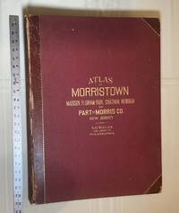
Atlas of Part of Morris Co. N. J. Embracing Town of Morristown The Boroughs of Madison Florham Park Chatham and Mendham: Morris Township and Parts of Chatham Hanover Mendham and Passaic Townships
Philadelphia Pennsylvania: A. H. Muller Publisher 1910. Condition of the binding is Good but for rubbing at the corners and outer hinges cracked. SEE PHOTOS. Inner hinges are PERFECT having been reinforced by the publisher/bookbinder with sturdy maroon cloth. Housed in a Fine custom-made maroon cloth-covered clamshell case. SEE 2 PHOTOS its outside and both inner halves when opened. Condition of all maps is NEAR FINE - FINE. Pages are clean and unmarked. NO tears or foxing. SEE PHOTOS. This atlas consists of 25 i. e. 26 counting the Index map hand-colored lithographic linen-backed double page maps. The maps are color-keyed to the locations of each of the following: stone buildings brick buildings frame or half frame buildings stables or barns green houses steam railroads electric railroads water pipes sewers improved roads and fire hydrants. SEE PHOTOS. The double page maps open to an impressive 31.50" across by 22.25" tall. Each map did have a maroon leather numbered tab i. e. Index and 1-25 however the numbers for tabs 15-19 are broken/missing. SEE PHOTOS. Full title: "Atlas of Part of Morris Co. N. J. Embracing Town of Morristown The Boroughs of Madison Florham Park Chatham and Mendham: Morris Township and Parts of Chatham Hanover Mendham and Passaic Townships compiled from actual surveys official records and private plans by J. M. Lathrop and Thomas Flynn Civil engineers. Under the direct management and supervision of A. H. Muller Publisher 530 Locust Street Philadalphia PA. 1910." Collated and complete per table of contents. Includes a STREET INDEX. Bound in the original maroon cloth with maroon leather spine and corners. Gilt-stamping is still bright. SEE PHOTOS. The textblock could be easily rebacked with no re-sewing required since all pages/maps are still securely bound together. Oversize Hardcover. 17" wide by 22.50" tall. This massive extremely heavy book will require SUBSTANTIAL extra postage at our cost based on your location. LeGear ATLASES OF THE UNITED STATES L2343. Phillips A LIST OF GEOGRAPHIC ATLASES 3834. First Edition. Oversize Hardcover. Good - Fine condition/Fine clamshell case. Illus. by NOT a library discard. Atlas folio. Great Packaging Fast Shipping. A. H. Muller, Publisher Hardcover
Bookseller reference : 028278
|
|
|
Multiple Contributors
Newsweek Magazine, August 7, 1950 - Cover Photo of GIs in Korea
80 pages. Contents: The Korean War: New Troops Bolster Battered GI's; The Sea War: British Coastal Patrol; Bright Spots in the Korean Picture (by General Carl Spaatz); Cartography of Aggression: How Reds Could Strike in Asian Hot Spots, the Middle East and Europe (inc. maps); 'Hell Country': Of Mud, Muck, and Human Excrement Where Raw Troops Become Tough Veterans Overnight; The Reds: How They Do It; The Allies: Men for (Gen. Douglas) MacArthur; The Great Results of Korea; Mobilization: Maybe Muddling, but We're Moving; The Congress: Tangled Motives - and Plans; The Presidency: All in a Day's Work; Espionage: Friends of Harry Gold; Supplies: The Build-up Battle; Crime: The Mad Butcher; Taxes: More - But How Much?; Racial: A Stay for Willie (McGee); Manpower: Men (and Women) Wanted; Significance - How Korea Has Changed the World Picture; Britain: Defense Stirrings; Belgium: Rioting Over Leopold (III); Medicine: Britons OK Health Plan Despite Beefs; Science: Dark Beacon to Cleanliness; Economy: What Controls? And How Far to Go?; Aircraft: War Output Takes Time; Aluminum: Less Pans, More Planes; War Measures - Or Hysteria?; Religion: 'To Seek for All Men...'; Sports: Passing of an Unlicensed Hero - Big Bill Lange; and Perspective: What Are We Fighting For? Full page colour vintage print advertising including The General Tire, Studebaker Trucks, and Ford Trucks. Monsanto ad on back cover. Binding intact. Small mailing label bottom right front cover. Handwritten notation on front cover under date. Contents clean and unmarked. Average wear. A sound vintage copy. Book

|
|
|
MUNSTER Sebastian.
Ostia antica (Versione tedesca) Da Cosmographia Universalis.
Una pagina per metà con testo e l'altra con la veduta. Misure della veduta , cm. 15x12. Carta leggermente brunita.

|
|
|
MUNSTER, Sebastian.
Altera generalis tab. secundum Ptol.
Xilografia in bianco e nero incisa su doppio foglio (cm. 325x395), titolo lungo il margine superiore e testo descrittivo latino al verso. Carta del Mondo Antico raffigurato secondo la concezione Tolemaica. Comprende i territori che si estendono dall'Atlantico (colonne di Ercole) fino all'Indocina e dall'Artico all'Equatore. In alto a sinistra, l'Europa, in basso l'Africa, ancora concepita come un unico grosso blocco senza fine, sono ben delineati il corso del fiume Niger e del Nilo. L'Oceano Indiano è visto come un enorme bacino chiuso. In basso a destra "Tapobrama" (Sumatra o Ceylon). L'India è divisa in due parti, India e India extra Gange (attuale sud est asiatico). I territori dell'estremo sud del mondo erano considerati abitati da mostri, pertanto, sconosciuti. Il tutto circondato da nuvole e dodici teste di venti, con i loro nomi riportati su stendardi (Zephirus, Aquilo, Vulturnus, Lips Africus, Auster,…). Bella e rara incisione in buono stato di conservazione tratta dalla "Cosmographiae Universalis", edizione latina del 1572. Pubblicata per la prima volta in tedesco nel 1544 ed in latino l'anno successivo, l'opera raggiunse in breve un enorme successo editoriale, grazie alla ricchezza delle illustrazioni ed alle numerose carte geografiche che l'arricchiscono. . .
|
|
|
MUNSTER, Sebastian.
Europae Tabula
Xilografia in bianco e nero incisa su doppio foglio(cm. 325x395), titolo "Europae Tabula" lungo il margine superiore. Una delle prime rappresentazioni del continente europeo. Il suo insolito orientamento con il nord nella parte inferiore del foglio e il Mar Mediterraneo nella parte superiore, la rende particolarmente interessante. Montagne, foreste, fiumi e città popolano la terraferma. Un grande veliero anima l'Oceano Atlantico. Testo latino al verso. Tratta dalla "Cosmographiae Universalis"nell'edizione latina del 1572. Pubblicata per la prima volta in tedesco nel 1544 ed in latino l'anno successivo, l'opera raggiunse in breve un enorme successo editoriale, grazie alla ricchezza delle illustrazioni ed alle numerose carte geografiche che l'arricchiscono. Bella e rara incisione in buono stato di conservazione. Double-page woodcut map of Europe from Sebastian Münster's famous "Cosmographia". Black and white; Latin text on verso. Sebastian Munster (1489 - 1552) was one of the three most renowned cartographers of the sixteenth century, along with Mercator and Ortelius. Munster's Geographia and Cosmographia Universalis were two of the most widely read and influential books of the period. The Cosmographia was a geographical as well as historical and ethnographic description of the world. . .
|
|
|
MUNSTER, SEBASTIAN.
Italie.
Dalla “Cosmographiae Universalis”, Basilea, 1550 circa. Silografia, b/n, cm 20 x 30 (il foglio). Edizione tedesca con testo e quadro inciso su entrambi i lati del foglio (al verso, in un più piccolo quadro, una Italia spoglia ma intera con segnalate le principali città). La carta è rappresentata con il nord orientato in basso, nella classica rappresentazione tipica della scuola tedesca dell'inizio del XVI secolo. Sebastian Munster (1488 – 1552). Uniforme ingiallimento del foglio con traccia di nastro adesivo al centro del margine inferiore e una piccola mancanza all'angolo inferiore destro. In più che accettabile stato di conservazione.

|
|
|
MUNSTER, SEBASTIAN.
Sardinia Insula.
Basilea, 1550 circa. Xilografia, b/n, cm 21 x 32,3 (il foglio). Dalla “Cosmographiae Universalis” (lib. VI – Basileae, Henrichum Petri, 1550), la pag. 274 dell’atlante, come riportato in alto a sinistra, al margine bianco superiore. Edizione latina incisa da H. Petri, con riquadro figurato (cervo o muflone) al verso del foglio. Si vede la punta meridionale della Corsica con segnalata Bonifacio. Il disegno dell'isola, il cui titolo è inserito in un nastro svolazzante che la abbraccia, mostra una semiologia elementare; i rilievi sono rappresentati da vedute prospettiche di mucchi di talpa allineati a catena; i fiumi da un tratto forte; il mare da un tratteggio ondulato con strisce bianche e nere alternate; la vegetazione è simboleggiata da gruppi di alberelli, mentre i centri abitati sono segnalati da prospettini di case e torri. Sebastian Munster (1488 – 1552). Impressione leggermente stanca con lievi tracce di ingiallimento che però non disturbano l’esemplare. Foglio con due leggere pieghe trasversali ma in buono stato di conservazione.

|
|
|
MUNSTER, SEBASTIAN.
Sardinia Insula.
Basilea, 1550 circa. Xilografia, b/n, cm 20 x 30 (il foglio). Dalla “Cosmographiae Universalis” (lib. VI – Basileae, Henrichum Petri, 1550). Edizione tedesca con riquadro figurato (la città di Napoli vittima di catastrofe) al verso del foglio. Si vede la punta meridionale della Corsica con segnalata Bonifacio. Il disegno dell'isola, il cui titolo è inserito in un nastro svolazzante che la abbraccia, mostra una semiologia elementare; i rilievi sono rappresentati da vedute prospettiche di mucchi di talpa allineati a catena; i fiumi da un tratto forte; il mare da un tratteggio ondulato con strisce bianche e nere alternate; la vegetazione è simboleggiata da gruppi di alberelli, mentre i centri abitati sono segnalati da prospettini di case e torri. Sebastian Munster (1488 – 1552). Foglio con alcune gualciture, discreto stato di conservazione.

|
|
|
Murer, Jos
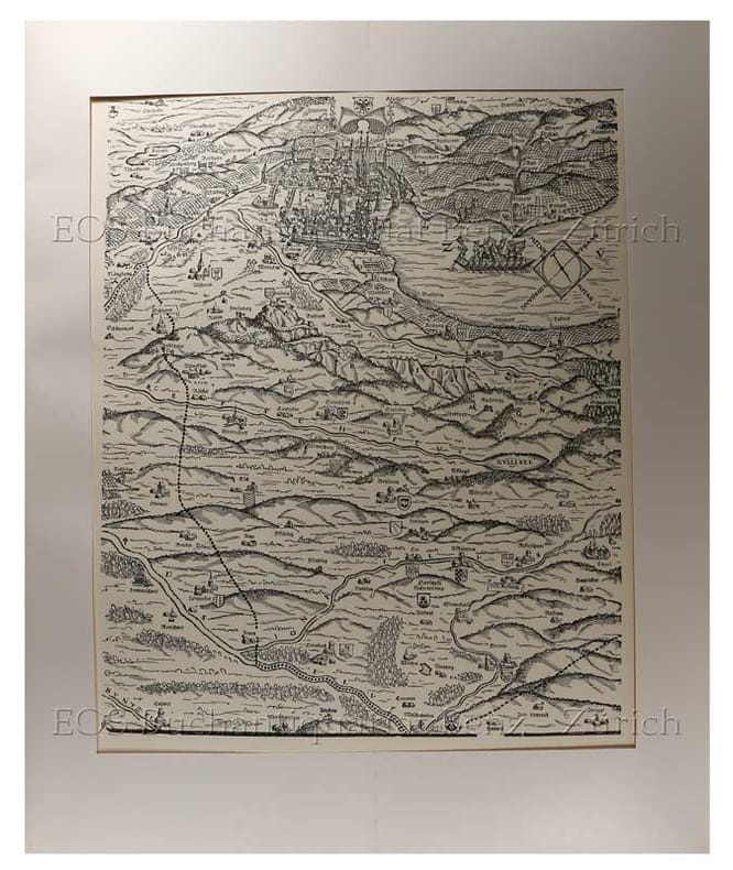
Karte des Kantons Zürich 1566.
Zürich., Matthieu., 1967. 58 x 48 cm. 6 Holzschnitte und 10 Bordürenteile. In Originalmappe. + Wichtig: Für unsere Kunden in der EU erfolgt der Versand alle 14 Tage verzollt ab Deutschland / Postbank-Konto in Deutschland vorhanden +, bild
Bookseller reference : 2427DB

|
|
|
Murer, Jos;
Karte des Kantons Zürich 1566.
Zürich. Matthieu. 1967 58 x 48 cm. 6 Holzschnitte und 10 Bordürenteile. In Originalmappe.
Bookseller reference : 2427DB
|
|
|
Murray, Hugh; Revised by Thomas G Bradford
The Encyclopaedia Encyclopedia of Geography. with a New Map of the United States Revised with Additions by Thomas G. Bradford 3 volumes with hand-colored map
Philadelphia: Lea and Blanchard 1846. PHOTOS UPON REQUEST. 3 volumes complete. Very Good condition. Bound in the publisher's brown cloth lettered in shiny gold on the spine. All gilt is as bright and shiny as new. A very nice set -- solid clean square and tight. Inner hinges are perfect. Corners are NOT bumped. Moderate rubbing/fraying to spine ends. Previous owner's name. A few small brown speckles foxing on the endpapers. Text pages are clean and crisp with little or no foxing. NO underlining. NO highlighting. NO margin notes. This 1846 edition is largely a reprint of the edition first published in 1837 which was copyright 1836. The only apparent change here is a 24-page addition to vol. 3 entitled: SUPPLEMENT TO THE ENCYCLOPAEDIA OF GEOGRAPHY CONTAINING STATISTICAL AND OTHER MATTER BRINGING DOWN THE WORK TO THE YEAR 1842." Among other things the supplement includes county-by-county population records from the 1840 census plus updated statistics on agriculture steam power imports/exports etc. Based on paginations found in Sabin this supplement was probably first published in 1843. The set is well-illustrated with 82 maps and about 1100 other engravings on wood. There are sections on astronomy by William Wallace botany by William Jackson Hooker geology by Robert Jameson and zoology by William Swainson. Volume III has a nice 2-page multi-color steel-engraved map of the U.S. It was drawn by J. Drayten after Tanner and features neatly hand-colored borders around each state and territory. Index Index to Supplement. Subtitle: "Comprising a Complete Description of the Earth Physical Statistical Civil and Political; Exhibiting Its Relation to the Heavenly Bodies Its Physical Structure The Natural History of Each Country and the Industry Commerce Political Institutions and Civil and Social State of All Nations." Oversize Hardcover. This heavy 3 volume set will require extra postage for Priority and International shipments. But for media mail you pay only our standard charge for 1 volume and we ship the other 2 volumes at no extra cost. Sabin 51499. New Edition with Supplement. Oversize Hardcover heavy. Very Good condition. Illus. by Drayten J hand-colored steel-engraved map of the U.S. 8vo. 597 592 648 pages. Great Packaging Fast Shipping. Lea and Blanchard Hardcover
Bookseller reference : 008628
|
|
|
MUSSINI Maria Luisa, MURARO Monica
ANTICHI CASELLI NELLA PROVINCIA DI REGGIO EMILIA.
In-8 (cm. 28), brossura muta, sovracoperta editoriale illustrata, pp. 271, (1), con illustrazioni in bianco e nero nel testo. Allo stato di nuovo (brand new copy).
|
|
|
MUSTAFA ÖNDER.
From past to present illustrated history of Turkish cartography.= Geçmisten günümüze resimlerle Türk haritacilik tarihi. Translated by Bülent Koç, Cemil Sökün.
New English Paperback. Oblong 4to. (21 x 30 cm). In English and Turkish. 392 p., color and b/w ills. From past to present illustrated history of Turkish cartography.= Geçmisten günümüze resimlerle Türk haritacilik tarihi. Mostly military map makers and cartography.
|
|
|
MUZAFFER SERBETÇI.
Türkiye haritaciligi bibliyografyasi. 2 volumes set . Vol. 1. Kitaplar - tezler, (1800-2000). Vol. 2. Makaleler - bildiriler, (1924-2000).
Fine Turkish Paperback. Pbo. Roy. 8vo. (24 x 17 cm). In Turkish. 2 volumes set (76 p.; 230 p.). Türkiye haritaciligi bibliyografyasi. 2 volumes set . Vol. 1. Kitaplar - tezler, (1800-2000). Vol. 2. Makaleler - bildiriler, (1924-2000). Bibliography of Turkish cartography.
|
|
|
Muzzi Salvatore
Dizionario geografico universale. Compilato sulle migliori opere relative e giusta le più recenti divisioni politiche col vocabolario di que' nomi antichi geografici che hanno mutato radicalmente oggidì

|
|
|
MYRDAL JAN
VIAGGIO IN CINA, FOTOGRAFIE DI GUN KESSLE
numerosissime foto in bianco e nero e a colori
|
|
|
Mystic River Historical Society
The Story of One Corner of Connecticut in Sixteen 16 Maps
Connecticut: Mystic River Historical Society Very Good condition. Cover soil. NO owner's name or bookplate. NO ink stamps. NO underlining. NO highlighting. NO margin notes. This undated portfolio has reproductions of 16 historic maps of Connecticut and vicinity. Most are single sheets although five measure 20" wide by 16" tall when unfolded. The maps are laid-in loose except for one which is printed on the front cover of the portfolio. Also included are 3 loose sheets of text that give background information on each map. Subtitle: A Bicentennial Project of the Mystic River Historical Society. The maps included are: Captain John Smith's Map of New England 1614; Map of Connecticut circa 1625; A Map of New England 1677; Connecticut and Parts Adjacent 1777; Old Homes and Homesites of Groton Connecticut; Benedict Arnold at New London 1781; Our Corner of Connecticut in 1833; Borough of Stonington in 1851; Our Corner of Connecticut in 1854; The Present-day Mystic Area in 1854; Groton Bank in 1868; Noank Poquonoc and Old Mystic in 1868; The Town of Stonington in 1868; Our Corner of Connecticut in 1868. Oversize Softcover. 10.5" wide by 14.5" tall This large book will require extra postage for Priority and International shipments but only the standard charge for media mail. . First Edition Thus presumed. Softcover portfolio. Very Good condition. Illus. by NOT a library discard. Oversize Softcover. Great Packaging Fast Shipping. Mystic River Historical Society Paperback
Bookseller reference : 008732
|
|
|
MÉRIAN
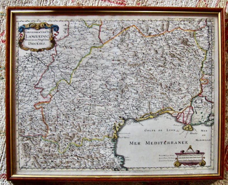
Gouvernement Général du Languedoc divisé en ses vingt deux diocèses.
Encadré Très bon 1650 31 x 39 cm avec le cadre.
Bookseller reference : 5997
|
|
|
MÖRZER BRUIJNS, M. F. und R. J. Benthem
Spectrum Atlas van de Nederlandse landschappen. Het ontstaan van het landschap / Waddeneilanden en Waddenzee / De zeekleigebieden van Groningen en Friesland / De Friese Wouden en Meren en het zuiden van het Groningse Westerkwartiert / De Gronings-Drentse veenkoloniën en Westerwolde / De Drentse zangronden / De Kop van Overijssel en Zuidwest- Drente / Twente en Salland / De Achterhoek, de Lihmers en het Montferland / De Gelderse Peel / Zuid-Lumbzrg / De Brabantse zandgronden / Zeeland en Goeree-Overflakkee / Het mondingsgebied van de grote rivieren en de Biesbosch / Het Groene Midden / Utrechtse Heuvelrug, Kromme-Rijngebied, Eemvallei en Gelderse Vallei / Het Gooi en de Vechtstreek / De duinen / West-Friesland en de voormalige zeeboezem Zijpe / Het polderland van Noord-Holland / Het voormalige Zuiderzeegebiet / De toekomst van het landschap / Bibliografie. Waddeneilanden en Waddenzee / De zeekleigebieden van Groningen en Friesland / De Friese Wouden en Meren en het zuiden van het Groningse Westerkwartiert / De Gronings-Drentse veenkoloniën en Westerwolde / De Drentse zangronden / De Kop van Overijssel en Zuidwest- Drente / Twente en Salland / De Achterhoek / De Gelderse Ijssel u.v.m.
Utrecht: Uitgeverij Spectrum, 1979. 272 S. mit zahlreichen Abbildungen; 4°; gebunden, illustrierter Orig.-Pappband;
Bookseller reference : 146145

|
|
|
Münster, Sebastian
Atlas Cosmographia, 1588. Cosmographey, oder Beschreibung aller Länder.
RARE LIMITED EDITION - COPY #95 OF 500. Reprint of a 16th century Atlas displaying maps of the four known continents: Europe, Africa, Asia and America. The book itself is a portfolio of 26 folded maps of various regions, complete with floral and figurative decoration. The book features a short preface in English, German and Dutch. 350x225mm. Unpaginated. Black cloth Hardcover with cloth straps. Cover slightly worn and slightly dirty. Rear cover edge bumped. Rear cover corners bent. Pages yellowing. [SUMMARY]: Save for some light external wear, this rare reprint of an historical atlas is in very good condition. PLEASE NOTE: This item is overweight. We may ask for extra shipping costs.
|
|
|
MÜNSTER, Sebastian
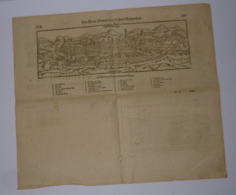
Die Statt Montpellier mit ihrer Gelegenheit. Sans date.
"4 pages in-4° extraites d'une édition 16° siècle en allemand de la Cosmographie de Sebastian Munster dont la gravure sur bois représentant la ville de Montpellier; un petit trou en partie inférieure et un petit accident sur la légende supérieure sinon très bon état. Carte 31 cm x 10,3 cm"
Bookseller reference : 19020
|
|
|
N. A.].
[MAP OF EAST & SOUTHEAST ANATOLIA AND CAUCASIA BORDERS] Erzurum, Van, Bitlis vilâyetleri ile bunlara civar olan Trabzon, Sivas, Harput ve Diyarbekir vilâyetlerinin bâzi kisâmi.
Very Good Turkish, Ottoman (1500-1928) Extremely rare huge chromo-lithograph map in 24 sheets mounted on canvas, showing a large zone including Midyat (Mardin), Mosul, Mt. Cilo (Resko-Buzul) on the southeast; Kahta (Adiyaman), Munzur Mt., Divrigi (Sivas) on the west; the Black Sea on north and Turkish borders to Armenia, Azerbaijan on the east, and to Russia on the northeast. In addition shows in separate little portions, roads, mountains and hills, lakes, and telegraph and post ways and borders in that zone. Not in any libraries and any collection. An attractive map with its huge size and decorative surface. Several toponyms are underlined in red ink. Otherwise a very good example. Original folded map mounted on canvas. 118x112 cm. In Ottoman script (Turkish with Arabic letters). Scale: 1/630.000.
|
|
|
N. A.].
[OTTOMAN MAP of CAUCASIA] [Eastern shores of Black Sea] Batum - Poti.
Very Good Turkish, Ottoman (1500-1928) Original color map. Elephant folio. (67 x 45 cm). In Ottoman script. Scale: 1/400.000. [OTTOMAN MAP of CAUCASIA] Shores of Black Sea / Batum - Poti. Shows Black Sea shores of Batum and Poti of Georgia. Mostly shown Black Sea in the map, but from southeast to northwest, a coastline reaches from Batum city to Adler (?). Some toponyms are in Turkish, but mostly Russian and Georgian in Arabic (Ottoman) script. A handsome and calligraphic Ottoman map.
|
|
|
N. A.].
[OTTOMAN MAP of CAUCASIA] Yekaterinodar - Yeysk - Maykob - Anapa.
Very Good Turkish, Ottoman (1500-1928) Original color map. Atlas folio. (55 x 46 cm). In Ottoman script. Scale: 1/400.000. [OTTOMAN MAP of CAUCASIA] Yekaterinodar - Yeysk - Maykob - Anapa. Shows Krasnodar, Maikop, Yeysk, Anapa and shores of Black Sea. At northeast, map shows Kuban river (Kuban nehri) and its basin in Circassia (Republic of Adygea). Maykop is the capital city of the Republic of Adygea in Russia, located on the right bank of the Belaya River (a tributary of the Kuban River). Yekaterinodar (Krasnodar) at north of map, near to Maykop. From northwest to south east, map shows Black Sea shores of the extensive area with interesting details in Ottoman Turkish script. Also shown Belaya, Chokhrak and Dakh Rivers in addition all south land of Krasnodar Krai of the Northwestern Caucasus until southern Georgian borders and Georgia. Almost all toponyms are in Ottoman Turkish.
|
|
|
N. A.].
[OTTOMAN MAP OF RHODES] Rodos.
Very Good Turkish, Ottoman (1500-1928) Original color map. Folded. Oblong atlas folio. (50 x 60 cm). In Ottoman script. Shows Rhodes and Tilos Islands. Scale: 1/200.000. Hegira: 1332 = Gregorian: 1916. Not description on map-maker. This is one of the series of the Bonn projection maps which are the first map series in modern techniques in Turkey and the Ottoman Empire. This is one of the series of the Bonn projection maps which are the first map series in modern techniques in Turkey and the Ottoman Empire. In order to produce these maps covering Turkish territory, Reconnaissance Branch was incorporated into The Mapping Commission. The maps were produced in the datum based on the latitude and longitude of Ayasofya Mosque in an equal area Bonn Projection. The field works for the 123 sheets covering the country were conducted by 76 staff. The production was completed in 18 years starting from east-west. Fieldworks continued without stopping except in the years 1914 and 1920. This map series called also reconnaissance maps contributed a lot to producing 1:25.000 scale maps. A very detailed and attractive map of Rhodes Island showing its harbors and Ottoman place names.
|
|
|
N. Pellati
Contribuzione alla storia della cartografia geologica in Italia
In 8 (cm 16,5 x 24,5), pp. 35 + (1b). Pagine intonse. Brossura editoriale. Estratto editoriale dagli Atti del Congresso internazionale di Scienze storiche (Roma, 1903). Saggio in cui Pellati, dopo avere fatto la storia della Cartografia geologica, presenta l'elenco cronologico delle carte geologiche o mineralogiche riguardanti il territorio italiano con i nomi degli autori. Importante repertorio bibliografico dedicato alla cartografia.
|
|
|
n.n.
Nieuwe geographische en historische atlas van de Zeven Vereengde Nederlandsche Provintien; bestaande inde vijftig nieuwe accurate kaarten, waar onder veele particuliere gemeeten heemraadschappen, plans van de voornaamste steden ...
Amsterdam, Van Kampen, 1970 Hardcover met stofomslag, 20 x 13.5 cm, nederlandstalig. Goede staat.
Bookseller reference : 66597
|
|
|
n/a
Mercator. Reizen in het onbekende.
Paperback, 260x210mm, 124p, throughout colour illustrations, Dutch (NL) edition . ISBN 978908586628213. Het wereldbeeld van de Europeaan werd in de zestiende en zeventiende eeuw gevoelig uitgebreid, een nieuwe wereld ging open. Ontdekkingsreizigers, handelaars en diplomaten schreven hun reiservaringen neer in dagboeken en verslagen. Ze schetsten een beeld van recent ontdekte gebieden, waaruit we vandaag kunnen afleiden hoe toen naar andere culturen gekeken werd. De reisverhalen werden soms aangedikt met de nodige portie fantasie, maar gaven ook vaak een nauwkeurige beschrijving van exotische streken. Het waren belangrijke bronnen van informatie voor de cartografie, die bijgevolg een explosieve groei kende. Ook de kennis van de navigatie groeide aanzienlijk als gevolg van de verkenningsdrang van reizigers. De enorme maritieme expansie zorgde er immers voor dat er behoefte was aan nieuwe technieken en instrumenten om veilig en snel een bestemming te bereiken. De ontwikkeling van de cartografie, waarin Gerard Mercator een sleutelrol speelde, vergrootte op haar beurt de mobiliteit van de Europeaan. Het was voor de zestiende-eeuwse avontuurlijke reiziger niet ongewoon om voor een lange tijd op handelsmissie of studiereis te vertrekken. Een van die jonge avonturiers was Balthasar iii Moretus. Hij maakte meerdere reizen door Europa, onder meer naar Italie, en schreef zijn indrukken ervan in dagboeken neer. Mercator: Reizen in het onbekende brengt deze boeiende periode van wisselwerking tussen het reisgedrag van de Europeaan en de ontwikkeling van de cartografie letterlijk en figuurlijk in kaart.
|
|
|
N/A + VAN GEERTSOM E.H.
ANNALEN VAN DEN OUDHEIDKUNDIGEN KRING VAN HET LAND VAN WAAS.deel 64 (2 e aflevering).
, Sint-Niklaas, 1961, Gebrocheerd, originele geillustreerde uitgeversomslag z/w, 17,5x27cm, p. 121 t/m p. 323, geillustreerd z/w.
Bookseller reference : 20950
|
|
|
N/A + VAN GOETHEM R.
ANNALEN VAN DEN OUDHEIDKUNDIGEN KRING VAN HET LAND VAN WAAS.deel 65 (2e aflevering).
, Sint-Niklaas, 1962, Originele geillustreerde uitgeversomslag z/w, 17,5x27cm, 168 p. geillustreerd z/w.
Bookseller reference : 20954
|
|
|
N/A.
ANNALEN VAN DE KONINKLIJKE OUDHEIDKUNDIGE KRING VAN HET LAND VAN WAAS.deel 85,
, Sint-Niklaas, 1982.**, Originele geillustreerde uitgeversomslag z/w, 17,5x27cm, 190pp, geillustreerd in kleur en z/w.
Bookseller reference : 11058
|
|
|
N/A.
ANNALEN VAN DE KONINKLIJKE OUDHEIDKUNDIGE KRING VAN HET LAND VAN WAAS. Deel 76,
, Sint-Niklaas, 1973.**, Originele geillustreerde uitgeversomslag z/w, 17,5x27cm, 185 - 322pp, geillustreerd z/w.
Bookseller reference : 11064
|
|

 Receive by email
 Download as PDF document
 RSS feed
 Permanent link


