|
Kitchin Thomas
A MAP OF THE WESTERN PART OF THE ROMAN EMPIRE
London: W. Strachen and T. Cadell 1781. 41.5 x 48.5 cms. Nice wide margins. Folding map uncoloured and printed on heavy paper. One small hole on a fold. PLEASE EMAIL FOR PHOTOS. printed Map. Fine. W. Strachen and T. Cadell Paperback
Bookseller reference : Map904
|
|
|
Klandorf,Hillar.
Asia Occidentale.
<br/> TITOLO: Asia Occidentale. <br/> AUTORE: Klandorf,Hillar.<br/> CURATORE: Traduz. dall'inglese di Renato Massa.<br/> EDITORE: Edizioni Futuro<br/> DATA ED.: 1986,<br/> EAN: 9788876500596
|
|
|
KLEBERT HAEDENS MICHEL DEON ARPAD ELFER
Londres que j'aime.
Editions SUN, 1970, 134 pages, in4 reliure éditeur cartonnée et toilée beige titre noir, avec coffret d'origine, état correct, quelques usures et frottements sur le dos+ jaquette en état d'usage.
Bookseller reference : 9635
|
|
|
Klein, J
Methoden raumbildlicher Darstellung u. ihr Verhältnis zur Karte unter bes. Berücksichtigung d. Panoramen von Delkeskamp. Diss.
Frankfurt, 1961. 4°. M. 60 Abb. 114 S. OBr. Klammersn angerostet OU. etwas gebräunt.. St. a. Tit. Ohne d. Beil.! (BAW. Veröff. d. Geodätischen Komm C 43; Mitt. d. Inst. f. angew. geodäsie 42).
Bookseller reference : 143710
|
|
|
Klemp, E
Kommentar zum Atlas der großen Kurfürsten. Commentary on the Atlas of the Great Elector.
Stuttgart, Berlin, Zürich, Belser, (1971). 4°. M. mont. farb. Front. u. Abb. 293 S. OHldr. in Pp.-Schuber. Neuwertiges Ex.
Bookseller reference : 174876
|
|
|
Klemp, Egon [Hrsg.]
Africa auf Karten des 12. bis 18. Jahrhunderts. (Africa on maps dating from the twelfth to the eighteenth century). Seventy-seven photo copies from european Map Collections. Editor and Author, on behalf of the Deutsche Staatsbibliothek Berlin, Egon Klemp.
Leipzig, Edition Leipzig, 1968. 2°. 53 cm. 77 Doppelblatt. Original-Leinenband und 61-seitiges kartoniertes Begleitheft.
Bookseller reference : 53265BB

|
|
|
Klemp, Egon [Hrsg.]
America in maps. Dating from 1500 to 1856. Compiled and edited by Egon Klemp.
New York [u.a.], Holmes & Meier Publishers, 1976. 2°. 52 cm. 293 Seiten. Original-Leinenband im illustrierten Pappschuber.
Bookseller reference : 51715BB ISBN : 841902003

|
|
|
Klinefelter Walter
A Fourth Display of Old Maps and Plans : Studies in Postal Cartography new in dust jacket
La Crosse Wisconsin: Sumac Press 1978. NEW in a NEW dust jacket. The jacket is protected by a removable Brodart clear-plastic sleeve. Sharp corners. First Edition Limited to 300 copies. Includes a hand-mounted genuine 13 cent Ben Franklin The Theatre of War USA bicenntenial stamp from 1976. Illustrated with numerous facsimiles of stamps showing maps. Tells their stories. Published by Emerson Wulling at the Sumac Press. Bound in the original red cloth stamped in bright gold. Complete with errata page and dust jacket. First Edition 1/300 copies. Hardcover. New/New. 8vo. 67pp. Great Packaging Fast Shipping. Sumac Press Hardcover
Bookseller reference : 021557
|
|
|
Klinefelter Walter
A Further Display of Old Maps and Plans complete with errata slip and ORIGINAL printed paper jacket
La Crosse Wisconsin: Sumac Press 1969. Very Fine condition in a Very Near Fine printed paper dust jacket. The original jacket would be FINE but for the slightest touch of sunning to its spine. PHOTOS AVAILABLE UPON REQUEST. Protected by a removable Brodart clear-plastic sleeve. Sharp corners. NO owner's name or bookplate. Pages are fresh crisp and unmarked. NO highlighting. NO underlining. NO margin notes. Here are the stories of 27 postage stamps and the decorated maps that adorn them. Like a postage stamp album there is space to mount the actual stamps if you so choose. Complete with errata slip which provides corrections to 4 errors points and which states this is "the first state of the first issue of the first edition of this book." Published by Emerson Wulling at the Sumac Press. Bound in the original rust-color cloth stamped in bright gold on the spine. Complete with the original white paper dust jacket printed in dark blue NOT clear acetate as on some others copies being offered for sale. First Edition 1/300 copies. Hardcover. Very Fine condition/Very Near Fine dust jacket. 8vo. Unpaged but about 70 pages. Great Packaging Fast Shipping. Sumac Press Hardcover
Bookseller reference : 021457
|
|
|
Klinefelter Walter
A Small Display of Old Maps and Plans : Studies in Postal Cartography
Iowa City: The Prairie Press 1962. A beautiful copy. Fine condition in a Fine dust jacket. The jacket is protected by a removable Brodart clear-plastic sleeve. NOT price clipped $4.00. NO rubbing. NO fading. NO chips. NO tears. NO creases. NO owner's name or bookplate. Sharp corners. First Edition Limited to 550 copies. Frontispiece features a hand-mounted genuine 3 cent stamp from 1955 showing a diagram of Fort Ticonderoga. Illustrated with numerous facsimiles of stamps showing maps or plans. Tells their stories. Printed by Carroll Coleman at The Prairie Press in Iowa City Iowa. Bound in the original blue patterned paper-covered boards with a black cloth spine and printed paper spine label. Complete with dust jacket. First Edition 1/550 copies. Hardcover. Fine condition/Fine dust jacket. 83pp. Great Packaging Fast Shipping. The Prairie Press Hardcover
Bookseller reference : 021562
|
|
|
Klinefelter Walter
A Third Display of Old Maps and Plans : Studies in Postal Cartography new in dust jacket
La Crosse Wisconsin: Sumac Press 1973. BRAND NEW in a BRAND NEW dust jacket. The jacket is protected by a removable Brodart clear-plastic sleeve. NO rubbing. NO fading. NO creases. First Edition Limited to 300 copies. Frontispiece features a hand-mounted genuine 6 cent stamp that reproduces the first map of Canada's Coppermine River Country as issued. Illustrated with 36 facsimiles of stamps showing maps. Published by Emerson Wulling at the Sumac Press. Bound in the original blue cloth stamped in bright gold on the spine. Complete with dust jacket. Press Preterite 132. First Edition 1/300 copies. Hardcover. New/New. 8vo. 79pp. Great Packaging Fast Shipping. Sumac Press Hardcover
Bookseller reference : 021456 ISBN : 0911462104 9780911462104
|
|
|
Klinefelter, Walter.
A FURTHER DISPLAY OF OLD MAPS & PLANS.
Original red full cloth binding. Limited to only 300 copies. The second in a remarkable series of books that describes stamps that use cartography in their design. With spaces provided for the owner to tip in the actual stamps. REF 7
|
|
|
Klyberg Albert T.; & Peter L. Henderson; Frederick W. Bogert; Lewis F. Owen; Lewis M. Haggerty; Edward A. Stewart; D. Stanton H
Bergen County Historical Society Papers Revolutionary War Round Table Papers
Hackensack New Jersey: Bergen County Historical Society 1960. Near Fine condition. Clean tight unmarked copy. NO owner's name or bookplate. First Edition. Softcover. 6" wide by 9" tall. In this issue are 8 articles relating to the American Revolution: ACTION AT PARAMUS MARCH 23 1780 by Albert T. Klyberg; FORT LEE BLUFF by Peter L. Henderson; LOYALISTS OF BERGEN COUNTY by Frederick W. Bogert; REBELS REBELLIOUS by Lewis F. Owen; THE BRAINERDS AND BROTHERTON by Lewis M. Haggerty; ROBERT ERSKINE by Edward A. Stewart; ROBERT ERSKINE'S MAPS FOR WASHINGTON by D. Stanton Hammond; ANTHONY WAYNE IN WAYNE NEW JERSEY by Edgar B. Rohrbach. Bibliographies. Bound in the original salmon-color printed wraps. First Edition. Softcover. Near Fine condition. vi 112pp. Bergen County Historical Society Paperback
Bookseller reference : 014937
|
|
|
Klüwer, Philipp
Neue Karte des alpinen und verbündeten Rätien und seiner Untertanengebiete. - Die Rätia-Karte von Fortunat Sprecher von Bernegg und Philipp Klüwer aus dem Jahre 1618.
Dietikon-Zürich., Verlag Bibliophile Drucke Josef Stocker., 1976. Kupferstich. Kartengrösse: 65 x 52 cm. + Wichtig: Für unsere Kunden in der EU erfolgt der Versand alle 14 Tage verzollt ab Deutschland / Postbank-Konto in Deutschland vorhanden +
Bookseller reference : 1019DG
|
|
|
Klüwer, Philipp
Neue Karte des alpinen und verbündeten Rätien und seiner Untertanengebiete. - Die Rätia-Karte von Fortunat Sprecher von Bernegg und Philipp Klüwer aus dem Jahre 1618.
Dietikon-Zürich., Verlag Bibliophile Drucke Josef Stocker., 1976. Kupferstich. Kartengrösse: 65 x 52 cm. + Wichtig: Für unsere Kunden in der EU erfolgt der Versand alle 14 Tage verzollt ab Deutschland / Postbank-Konto in Deutschland vorhanden +, Karte - Rhätien
Bookseller reference : 892DG

|
|
|
Klüwer, Philipp
Neue Karte des alpinen und verbündeten Rätien und seiner Untertanengebiete. - Die Rätia-Karte von Fortunat Sprecher von Bernegg und Philipp Klüwer aus dem Jahre 1618.
Dietikon-Zürich., Verlag Bibliophile Drucke Josef Stocker., 1976. Kupferstich. Kartengrösse: 65 x 52 cm. + Wichtig: Für unsere Kunden in der EU erfolgt der Versand alle 14 Tage verzollt ab Deutschland / Postbank-Konto in Deutschland vorhanden +, A|B [2 Warenabbildungen]
Bookseller reference : 762DG

|
|
|
Knorr, H
Zu d. Abbildungen d. Internationalen Weltkarte u. d. Weltluftfahrtkarte im Maßstab 1:1 000 000 in hohen Breiten.
Frankfurt, 1962. 4°. M. 1 Anl., 15 Tab. u. 11 Abb. 40 S. OBr. Klammern angerostet. Umschl. leicht angestaubt u. m. St. (BAW. Veröff. d. Geodätischen Komm B 87; Mitt. d. Inst. f. angew. Geodäsie 50).
Bookseller reference : 162356
|
|
|
KOEMAN, C
Lucas Janszoon Waghenaer. Sa vie et son "Spieghel der Zeevaerdt"
1 Vol. In-4 t. editoriale pag. 72 varie ill. n.t PROG 42101 CATT_ATT 56
|
|
|
Koeman, Dr. Ir. and Homan, H.J.A.
Atlantes Neerlandici volume VI : A supplement to the volumes I-V and a bibliography of geographical, celestial and thematic atlases published in the Netherlands between 1880 and 1940
, Canaletto, Alphen aan den Rhijn, 1985 Hardcover, 249 pages, ENG / NL , 315 x 245 x 22 mm, in New condition, illustrated in colour / b/w. ISBN 9789064696237.
Bookseller reference : 61440
|
|
|
KOEMAN,C.
Atlantes Neerlandici. 6 Volumes.
Complete set of Koeman's original six volume reference, a "Bibliography of terrestrial, maritime and celestial atlases and pilot books, published in the Netherlands up to 1880." Koeman published these volumes from Amsterdam between 1967 and 1985. The volumes contain descriptions with illustrations of Ortelius' "Theatrum 0rbis Terrarum"; the "Epitome", "Caert-Thresoor" and "Atlas Minor"; De Jode's "Speculum Orbis Terrarum"; the Atlases of the XVII Provinces; and the Low Countries up to c.1650. Vol. I, 1967, 377 pp. Vol. II, 1969, 549 pp. Vol. III, 1969, 220 pp. Vol. IV, 1970, 519 pp. Vol. V, 1971, 287 pp. Vol. VI, 1985, 249 pp. A most valuable reference with Dutch and English text.

|
|
|
Koemann Dr.C.
The history of Abraham Ortellius and his Theatrum Orbis Terrarum.
Ril., cm 28x22, pp 64, ill. in b/n..

|
|
|
KOFFMAHN O.
Die Britischen Inseln in 3 Blättern. Cartes N° 36 à 39, extraites de Stielers Hand-Atlas. Une carte d'ensemble et les Iles britanniques en 3 feuilles.
- 4 cartes 40 x 50 cm, pliées en 2.
Bookseller reference : 70144
|
|
|
Koitzsch, R
Vermessungskunde für Kartographen sowie alle ingenieurtechn. Mitarbeiter d. Karten- u. Vermessungswesens. 2 Tle.
Gotha, Haack, 1957-60. 4°. M. 2 Beig., 3 Taf., 121; 105 Fig. u. 17; 54 Abb. 271; 184 S. OBr. (Petermanns geogr. Mitteil. Erg.-H. 263 u. 269; Kartenpraxis).
Bookseller reference : 214012
|
|
|
KRAMM, Heinrich. - ZÖGNER, Lothar
Karten in Bibliotheken. Festgabe für Heinrich Kramm zur Vollendung seines 65. Lebensjahres.
Bonn Bad Godesberg, Bundesforschungsanstalt für Landeskunde und Raumordnung Selbstverlag, 1971. in-8°, 133 Seiten mit 9 Schwarzweissabbildungen und einer Faltkarte.
Bookseller reference : 81054
|
|
|
KRAMM, Heinrich. - ZÖGNER, Lothar
Karten in Bibliotheken. Festgabe für Heinrich Kramm zur Vollendung seines 65. Lebensjahres.
in-8°, 133 Seiten mit 9 Schwarzweissabbildungen und einer Faltkarte. Bel exemplaire - VERY GOOD +++ [SO-8]
|
|
|
KRANKLIN Alfred
LES ANCIENS PLANS DE PARIS , Notices historiques et topographiques.
Leon Willem, Paris, 1878.
Bookseller reference : 1036
|
|
|
KRETSCHMER Konrad -
Die Historischen Karten zur Entdeckung Amerikas. Atlas nach Konrad Kretschmer, Mit 22 Tafeln, Überarb. Reprint-Ausgabe des Originals von 1892, Hg. Institut für Iberoamerika-Kunde, Hamburg, & Gesellschaft für Erdkunde zu Berlin.
Leipzig, Umschau, 1991, in-folio tutta tela editoriale con cofanetto in cartone rigido illustrato a colori, pp. 118 con 22 tavole a colori a doppia pagina fuori testo. Stato di nuovo. Edizione di 1000 esemplari numerati, il ns. n. 161.
|
|
|
Kretschmer, Konrad
Die historischen Karten zur Entdeckung Amerikas. Atlas nach Konrad Kretschmer. Überarbeitete Reprint-Ausgabe des Originals von 1892 herausgegeben vom Institut für Iberoamerika-Kunde, Hamburg in Zusammenarbeit mit der Gesellschaft für erdkunde zu Berlin.
Frankfurt am Main, Umschau, 1991. Folio. 51 cm. 118 Seiten, XXII Blatt. Original-Leinenband im illustriertem Schuber.
Bookseller reference : 53266BB

|
|
|
Krüger, L
Lotabweichungen. H. 5: Ausgleichung d. astronomisch-geodätischen Netzes I. Ordnung nördlich d. europäischen Längengradmessung in 52 Grad Breite.
Berlin, 1916. 4°. M. 7 Textabb. 134 S. OBr. Umschl. angeschmutzt u. m. St. Rücken etwas berieben. (Veröffentl. d. Königl. Preus. Geodät. Insti. N.F. 68)
Bookseller reference : 159742
|
|
|
Krüger, L
Über d. Bestimmung d. Winkelgewichte in Basisnetzen.
Berlin, 1920. 4°. M. 8 Abb. 49 S. OBr. Klammerheftung lose u. rostig. (Veröffentlichung d. Königl. Preuszischen Geodätischen Institutes. N.F. 81)
Bookseller reference : 159754
|
|
|
KUBNICK HENRI
Charcot et les éxpéditions polaires .
Mame découvertes - exploits héroiques 1940 bon état 126 pages in 8.Couverture cartonnée rouge illustrée d'un portrait de Charcot .
Bookseller reference : 2188
|
|
|
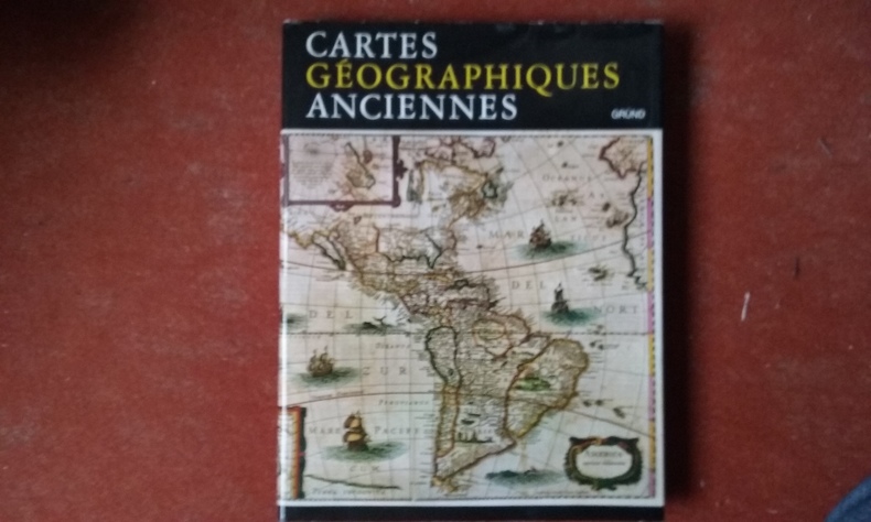
KUPCIK Ivan
Cartes géographiques anciennes. Evolution de la représentation cartographique du monde : de l'Antiquité à la fin du XIXe siècle
Gründ, 1981, 240 p., grand in-8 cartonnage toile beige, coll. "Beaux objets d'autrefois", 30 illustrations en couleur h.-t., 74 illustrations in-t., jaquette, bon état
Bookseller reference : QWA-3360

|
|
|
KUPCIK Ivan
Cartes géographiques anciennes. Evolution de la représentation cartographique du monde : de l'Antiquité à la fin du XIXe siècle
Gründ, 1981, grand in-8 cartonnage toile beige, 240 p., coll. "Beaux objets d'autrefois", 30 illustrations en couleur h.-t., 74 illustrations in-t., jaquette, très bon état.
Bookseller reference : QWA-6218
|
|
|
Kuyper, J
Nederlandsch Oost-Indië.
1900. Hugo Suringar. Dertiende druk. Blattgrösse: 42,5 x 100 cm. + Wichtig: Für unsere Kunden in der EU erfolgt der Versand alle 14 Tage verzollt ab Deutschland / Postbank-Konto in Deutschland vorhanden +, A|B [2 Warenabbildungen]
Bookseller reference : 1805AG

|
|
|
Kuyper, J.:
Nederlandsch Oost-Indië.
1900. Hugo Suringar. Dertiende druk. Blattgrösse: 42,5 x 100 cm.
Bookseller reference : 1805AG

|
|
|
Kyram, Dan [Curator] / Budow Ben-David, Carolyn; Morris, Diana; Weiss, Amanda [Ed.]
Echoes of Egypt: Photographs, Lithographs, Prints and Maps from the Collection of Dan Kyram
275x210 mm. 131+11 pages. Softcover. Inner cover slightly rubbed. First and last pages slightly stained - NO damage to text. Else in good condition.
|
|
|
KÖNIG, Viola
DIE SCHLACHT BEI 'SIEBEN BLUME' - Konquistadoren, Kaziken und Konflikte auf alten Landkarten der Indianer Südmexikos.
Bremen, Edition Temmen, 1993. 192 Seiten, mit vielen tls. farbigen Abbildungen; Farbig illustrierter fester Originaleinband mit Deckel- und Rückentitel; quer-kl.-4to.(ca. 20 x 21 cm).
Bookseller reference : 1711734210x
|
|
|
König, Viola
Vermessen: Kartographie der Tropen: Begleitbuch zur Ausstellung des Ethnologischen Museums, Berlin-Dahlem, 20.05. bis 27.08.2006 <MAT=/NOMAT=T/CLK?IKT=1016&TRM=27.08.2006%5D> [hrsg. von Viola König. Red. Andrea Nicklisch
Berlin, Ethnologisches Museum, Staatliche Museen zu Berlin 2006. 109 S.: zahlr. Ill., Kt., 30cm 109 S.: zahlr. Ill., Kt. Broschur
Bookseller reference : 60584

|
|
|
Kövesligethy,Radó de.
Seismonomia. In honorem I. Consessus Associationem Internationalem Seismologicam procurantium Romam convocati.
<br/> NOTE: piatti e interni ingialliti; kievi segni d'uso alla leg.<br/> TITOLO: Seismonomia. In honorem I. Consessus Associationem Internationalem Seismologicam procurantium Romam convocati. <br/> AUTORE: Kövesligethy,Radó de.<br/> CURATORE: Publicandam curavit Societas Seismologica Italica.<br/> EDITORE: coi Tipi della Società Tipografica<br/> DATA ED.: 1906,<br/> COLLANA: Estratto dal Bolletti
|
|
|
Kühnen
Das Mittelwasser d. Ostsee bei Travemünde - Marienleuchte - Wismar - Warnemünde - Arkona - Swinemünde - Pillau - Memel u. d. Mittelwasser d. Nordsee bei Bremerhaven in d. Jahren 1898-1910.
Berlin, 1916. 4°. M. 2 Taf.207 S. OBr. Hint. Umschl. lose. Vord. Umschl. gebräunt u. eingerissen. Taf. 2 am Rand eingerissen. (Veröffentlichung d. Königl. Preuszischen Geodätischen Institutes. N.F. 70)
Bookseller reference : 159743
|
|
|
L'AFRICA colle tracce degli antichi e recenti viaggi sì marittimi che terrestri degli Europei in essa.
Carta incisa in rame e acquarellata a mano.
Carta di cm 37 x 50 alla battuta, più i margini, su tav. piegata a metà. Tratta da 'Atlante storico, geografico, genealogico, cronologico e letterario di M. A. Le Sage in ogni sua parte corretto, ampliato e proseguito sino all'anno corrente. Prima Veneta Edizione'.

|
|
|
L'ALEMAGNA dopo il Congresso di Vienna 1815, o Confederazione Tedesca.
Carta incisa in rame e acquarellata a mano.
Carta di cm 36 x 50 alla battuta, più i margini, su tav. piegata a metà. Tratta da 'Atlante storico, geografico, genealogico, cronologico e letterario di M. A. Le Sage in ogni sua parte corretto, ampliato e proseguito sino all'anno corrente. Prima Veneta Edizione'.
|
|
|
L'AMERICA STORICA, FISICA E POLITICA NEL 1825 ..
Carta incisa in rame e acquarellata a mano.
Carta di cm 39,5 x 53 alla battuta, più i margini su tre lati, su tav. piegata a metà. A sinistra il 'continente meridionale', a destra quello 'settentrionale'. Tratta da 'Atlante storico, geografico, genealogico, cronologico e letterario di M. A. Le Sage in ogni sua parte corretto, ampliato e proseguito sino all'anno corrente. Prima Veneta Edizione'.

|
|
|
L'ASIA conforme alle più moderne mappe.
Carta incisa in rame e acquarellata a mano.
Carta di cm 36,5 x 50,5 alla battuta, più i margini, su tav. piegata a metà. Tratta da 'Atlante storico, geografico, genealogico, cronologico e letterario di M. A. Le Sage in ogni sua parte corretto, ampliato e proseguito sino all'anno corrente. Prima Veneta Edizione'.
|
|
|
L'AUVERGNE.-
Carte Officielle du Service Géographique de l'Armée (1/200.000).-
Paris. France Tourisme. 1929. Grande carte couleurs de 96 x 62 cm, repliée 18 fois, sous étui de papier fort (17x21cm) imprimé en noir sur un face avec publicité en rouge et noir pour Dunlop sur l'autre. Nombreuses publicités également en rouge et noir au dos. Bon exemplaire.
Bookseller reference : ORD-5636
|
|
|
L'EUROPA COLLE POLITICHE DIVISIONI DEL 1827 ..
Carta incisa in rame e acquarellata a mano.
Carta di cm 38,5 x 52 alla battuta, più i margini, su tav. piegata a metà. Tratta da 'Atlante storico, geografico, genealogico, cronologico e letterario di M. A. Le Sage in ogni sua parte corretto, ampliato e proseguito sino all'anno corrente. Prima Veneta Edizione'. Piccolissima apertura senza mancanze al margine bianco inferiore, in corrispondenza della piegatura; piccoli segni di penna al margine bianco in alto a sinistra.
|
|
|
L'ISLE (Guillaume de)
L'AMRIQUE MERIDIONALE - AMERICA MERIDIONALIS IN SUAS PRAECIPUAS PARTES DIVISA, AD USUM SERENISSIMI BURGUNDIAE DUCIS.
Dresse sur l'observations de M.rs de l'Academie Royale des Sciences & quelques autres, & sur les Memoires les plus recens. chez Pierre Mortier, A Amsterdam, s.d. (1708 ca.). Bellissima carta geografica dell'America Meridionale (cm. 51 x 60), inc. in rame con coloritura dei confini coeva. In basso a sx un bel cartiglio figurato racchiude il titolo e le Scale. Molto ben conservata.
Bookseller reference : 153394
|
|
|
L'ISLE (Guillaume de)
L'AMRIQUE SEPTENTRIONALE - AMERICA SEPTENTRIONALIS IN SUAS PRAECIPUAS PARTES DIVISA, AD USUM SERENISSIMI BURGUNDIAE DUCIS.
Dresse sur l'observations de M.rs de l'Academie Royale des Sciences & quelques autres, & sur les Memoires les plus recens. chez Pierre Mortier, A Amsterdam, s.d. (1708 ca.). Bellissima carta geografica dell'America Settentrionale (cm. 51 x 60), inc. in rame con coloritura dei confini coeva. Titolo racchiuso entro bel cartiglio (fanno da cornice Nettuno, Poseidone, un mostro marino e delle conchiglie) in alto a sx; un altro cartiglio con le Scale, in alto a dx. E' da considerarsi fondamentale per la cartografia della California: pi volte rappresentata come un'isola fino alla met del XVIII secolo, Guillaume De l'Isle fu uno dei primi geografi a correggere questo errore e ripristinare la sua forma peninsulare. La regione dei Grandi Laghi, basata su Coronelli, mostra citt strategiche di propriet francese come Tadousac, Quebec, Fort Sorel, Montreal e Fort Frontenac, mentre la Valle del Mississippi indica la recente colonizzazione di Biloxi da parte d'Iberville, con i forti situati a Bon Secours e Saint-Louis. E' la prima mappa stampata in cui viene raffigurato il Mar dei Sargassi.Si differenzia dalla carta pubblicata nel 1700 da De L'Isle (chez l'Auteur) per lo spostamento del cartiglio con il titolo e la scala delle miglia (rispettivamente in alto a sx e in alto a dx); l'Avertissement non stato stampato e sul margine superiore stato aggiunto il titolo in Latino.Guillaume Delisle (Parigi 1675 - ivi 1726), celebre cartografo francese (detto il geografo o il cartografo, per distinguerlo dal fratello Nicolas detto l'astronomo). Nel 1700 pubblic una carta generale del mondo e carte speciali delle sue quattro parti, nonch una carta particolare dell'Italia, nelle quali, spostandosi dalla tradizione tolemaica che ancora ispirava la cartografia del tempo e basandosi solo sulle nuove determinazioni astronomiche, radicalmente corresse la rappresentazione della Terra. Questi lavori, nei quali seppe dimostrare una grande accuratezza e un singolare spirito critico, gli valsero nel 1702 l'ammissione all'Acadmie. La sua produttivit non si arrest mai sicch pubblic ben 134 carte generali e speciali di provincie francesi e di stati e paesi d'Europa ed estraeuropei, nelle quali seppe sempre bene utilizzare i nuovi materiali... (Cfr. Encicl. Ital. Treccani,XII, pp. 540-41). Molto ben conservata.
Bookseller reference : 153390
|
|
|
L'ISLE (Guillaume de)
L'ASIE DIVISEE EN SES PRINCIPALES REGIONS... - ASIA DIVISA IN IMPERIA, REGNA & STATUS IN QUAE DISTRIBUITUR, AD USUM SERENISSIMI BURGUNDIAE DUCIS.
A l'usage de M.r le Duc de Bourgogne. chez Pierre Mortier, A Amsterdam, s.d. (1708 ca.). Bellissima carta geografica dell'Asia (cm. 51 x 60), inc. in rame con coloritura dei confini coeva. In alto a sx, titolo entro bel cartiglio figurato; in alto a dx, Echelle entro cartiglio. Nella carta se peuvent voir l'estendue des Empires Monarchies, Royaumes, et Estats qui partagent presentement l'Asie / Recueilli des divers Memoires, et sur les Relations les plus Nouvelles / Par G. DE L'ISLE, Geographe ordinaire de Roy. Molto ben conservata.
Bookseller reference : 153396
|
|
|
L'ITALIA COLLE PRINCIPALI SUE DIVISIONI IN PRINCIPATI ED IN REPUBBLICHE dal medio evo verso il 1400.
Carta incisa in rame e acquarellata a mano.
Carta di cm 38 x 50 alla battuta, più i margini, su tav. piegata a metà. Ampio testo storico-descrittivo incorniciato a destra e a sinistra. Tratta da 'Atlante storico, geografico, genealogico, cronologico e letterario di M. A. Le Sage in ogni sua parte corretto, ampliato e proseguito sino all'anno corrente. Prima Veneta Edizione'. Strappetto senza mancanze al centro del margine bianco inferiore
|
|
 Receive by email
 Download as PDF document
 RSS feed


