|
[ATLAS]
Recueil de cartes géographiques, plans, vues et médailles de l'ancienne Grèce, relatifs au Voyage du Jeune Anacharsis, précédé d'une analyse critique des cartes.
Paris, De Bure, 1789. 1 vol. in-4°, basane écaille, dos lisse orné de fleurons dorés, pièce de titre en maroquin brique, encadrement d'un triple filet doré sur les plats, tranches marbrées. Reliure de l'époque frottée, épidermures au dos, coiffe sup. élimée, coins émoussés. xlij pp. et 31 planches et cartes gravées en taille-douce, dont 16 repliées, par Guillaume de La Haye et Berthault, et 11 rehaussées en couleurs.
书商的参考编号 : 25368
|
|
|
[Atlas] – DARBY (H.C.) et Harold FULLARD.
The New Cambridge Modern History : Atlas.
Cambridge, Cambridge University Press, 1978, gr. in-8°, xiv-319 pp, 2e édition revue et corrigée, 288 cartes en couleurs, index, broché, couv. illustrée, bon état (The New Cambridge Modern History, Vol. XIV). Texte en anglais
书商的参考编号 : 118369
|
|
|
[ATLAS]. RIZZI-ZANNONI J. A. B.-
Étrennes Géographiques 1760.-
Paris. Ballard. 1760. In-16 (80 x 120 mm) plein maroquin rouge, dos à 5 nerfs entièrement orné, triple filet encadrant les plats et fleurs en écoinçons, gardes de papier dominoté à motifs en damier vert et or, 4ff. (titre, avertissement et catalogue des cartes) et 26 cartes doubles en couleurs, montées sur onglet. Les cartes contenues dans ce recueil ont été réduites par Rizzi-Zannoni qui a suivi principalement les cartes de M. D'Anville (d'après l'avertissement). Reliure un peu fatiguée, page de titre piquée, cartes en bel état. Bon exemplaire.
书商的参考编号 : ORD-15076
|
|
|
[Atlanten] - Phillips, Philip Lee u. Clara Egli le Gear
A List of Geographical Atlases in the Library of Congress. With Bibliographical Notes. 9 Bände.
Mansfield, Martino, o. J. (um 1990; Nachdruck der Ausgabe Washington 1909-1992). Gr.-8°. Zus. ca. 6000 S., OLwd.-Bde.
书商的参考编号 : 43475
|
|
|
[ATLAS - EUROPE]. CLEYNHENS, Bernardus
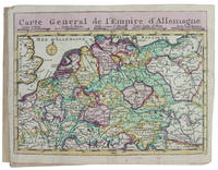
Accuraat geografisch kaart-boekje of zak-atlas van het keyzerryk en geheel Duytsland de Oostenrykse Nederlanden nevens een groot gedeelte van Vrankryk het Canaal de hoek van Engeland en verder aangrenzende landschappen; alwaar den tegenwoordigen oorlog gevoerd wordt.
Haarlem 1730. Small 8vo 16 x 10 cm. Bernardus Cleynhens Half textured red cloth ca. 1860 sewn on 2 tapes chemical-marbled sides in brown and blue. With 25 double-page engraved maps 2 overview maps the second serving as a key to the 23 numbered detail maps and an engraved plate with 8 scales all hand-coloured partly in outline. The 2 overview maps slightly wider than the others have a flap folded in at each side. Further with 1 rococo woodcut tailpiece 1 woodcut decorated initial and a fleuron on the title-page. 40 23 1 blank pp. plus maps and plate of scales. A surprisingly rare pocket atlas illustrating the theatre of the "tegenwoordigen" present war probably meaning the War of the Austrian Succession 1740-1748 but possibly the Seven Years' War 1756-1763. The title-page notes that it is suited for officers travellers and lovers of geography to carry in a pocket. The text in Dutch gives a geographic description only of "Duytsland" Germany including Austria Bohemia and a few other areas whereas the maps also cover the Low Countries the English Channel northwest France and to the east as far as Warsaw Krakow and Belgrade. The 23 detail maps were designed so that they could be assembled with the key map to make a single wall map whose cartographic image would measure 53 x 90 cm.With a contemporary owner's bookplate embossed stamp and library labels. With the text leaves somewhat browned not affecting the maps or the plate with scales and the first 2 leaves slightly worn but generally in good condition. A rare pocket atlas from the War of the Spanish Succession.l Koeman I Cle 1; STCN 2 copies; WorldCat 2 copies. hardcover
书商的参考编号 : 17253
|
|
|
[Atlas - France] Lattre, Jean
Le Voyageur Curieux ou Vues des Routes de France.
Paris circa 1770. Paperback. Very Good. Chez Lattre Graveur Ordinaire de Monseigneur le Dauphin de Monseigneur le Duc d'Orleans et de la Ville. Engraved title-page dedication and 7 full-page engraved maps with original hand-color. 8vo format 10x6¾ inches original blue paste-paper wrappers light wear; minor worm track confined to the margins. A charming eighteenth-century traveler's guide from Paris to Compiegne. OCLC locates one copy listed under a different publisher. <br/><br/> paperback
书商的参考编号 : D18502
|
|
|
[ATLAS - HISTORICAL].
Atlas historique. - Souvenirs historiques. - Tableaux et cartes.
Montpellier 1851. Contemporary bindings: vol. 1 red half goatskin with binder's/stationer's ticket of "Papeterie Sijas Montpellier" red textured paper sides "E.M." in gold on front board marbled endpapers Wolfe 159; vol. 2 black half goatskin black embossed paper sides "C. du M." in gold on front board marbled endpapers Wolfe 112; vol. 3 black sheepskin "C. du M." in gold on front board white watered-silk endleaves. Folio vol. 1 and large 4to 32 x 25.5. cm. vols. 2-3. Neatly written manuscripts on paper with 23 graphically vibrant maps coloured in outline with subtly shaded washes in grey for the coasts and numerous bright colours for political boundaries and with calligraphic headings. 3 volumes. A 3-volume historical manuscript atlas with beautiful manuscript maps the volumes titled: Atlas historique Souvenirs historiques and Tableaux et cartes. The Atlas historique contains finely calligraphed chronological tables displaying events in ecclesiastical history the history of the Roman Empire and France from the first century to 1850 followed by coloured double-page maps of France the Ottoman Empire Europe and the Roman Empire. The Souvenir historiques has the same structure but is solely devoted to the history of England Spain Germany and Italy covering the period from the fifth century to 1850 with coloured double-page maps of the British Isles the Iberian Peninsula the German states and Italy. The Cartes et tableaux is the most ambitious volume containing no fewer than 14 coloured double-page maps including two world maps maps of Africa Asia America Oceania Europe etc. and numerous chronological tables.The ink has sometimes left a browned shadow on the back of the leaves or facing leaves and occasionally eaten a small hole in the paper but the atlas is otherwise in very good condition. Bindings slightly chafed. A graphically vibrant French historical manuscript atlas. unknown
书商的参考编号 : D6GE1B01U79O

|
|
|
[ATLAS - HAND-COLORED MAPS; Lenglet du Fresnoy]
Methode pour Etudier la Geographie dans Laquelle on Donne une Description exacte de l'Univers tiree des meilleurs Auteurs & formee sur les Observations de Messieurs de l'Academie Royale des Sciences. Avec un Discours Preliminaire sur l'etude de cette Science & un Catalogue des Cartes Geographiques des Relations Voyages & Descriptions les plus necessaires pour la Geographie Tomes I-III
Amsterdam: Aux dépens de la Compagnie 1718. Hardcover. Good. Contemporary speckled calf handsomely rebacked but one board detached; gilt-stamped lettering in tan leather spine label second compartment gilt-stamped ornament on 5 raised bands and direct in spine compartments; 3 volumes 12mo 163x95mm; pp. 10 336 35; 16 333 51; 14 468 32; with hand-colored engraved half-title in Volume I 18 hand-colored plates many folding hand-colored decorative head- and tail-pieces. Front rear board on volume one detached. Boards a bit scuffed along the edges; corners bumped; spines dry. Internally bright and clean; previous owner's tasteful bookplate. Plates are lovely. <br/><br/> Aux dépens de la Compagnie hardcover
书商的参考编号 : D14120
|
|
|
[ATLAS - LOW COUNTRIES]. [COLOM, Jacob Aertsz].
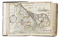
La description de XVII. Provinces avec les Terres Circonvoicins a Scavoir Champagnie Picardie Liege Retelle &c.
Antwerp 1652. 4to 18 x 14.5 cm. Jan Huyssens Later 17th-century mottled calf sewn on 4 double cords gold-tooled spine and board edges. With a double-page letterpress title-page with a frame built up from typographic ornaments and 39 unnumbered double-page engraved maps of the northern and southern Low Countries by Jacob Aertsz. Colom each map coloured in outline. Interleaved with 38 blank leaves and with a manuscript table of contents 3 3 blank pp. at the end. Double-page title-page and 39 double-page maps. Second known copy of a pocket-atlas published at Antwerp but containing a selection of the maps of the Low Countries originally published by Jacob Aertsz. Colom at Amsterdam in 1635 with the title De Vyerighe Colom the title Colom had first used for his famous pilot guide in 1632 and the name he had given to his Amsterdam printing office where he worked from 1622 to his death in 1673 as a bookseller printer and mapmaker. The only other copy known is at the Royal Library in Brussels. The Vyerighe Colom with 47 maps and 3 plates and with extensive text in Dutch and French went through several editions in the 17th century but it was once thought that all editions before his death in 1673 had been published at Amsterdam by Colom himself. The Royal Library copy like the present one contains 39 maps but each contains one map not in the other so there are forty in total: the present copy includes Drentiae not in the Royal Library copy which includes Le terres entre la Meuse Vahal et Rhin not present here. The maps are also bound in a different order.The present edition is of great interest and gives cause to review Colom's activities. It is printed from Coloms plates so Colom may have licenced the Antwerp publisher to produce a variant edition of his Vyerighe Colom to broaden his market possibly reacting to the signing of the Peace of Münster in 1648 which finally ended the Eighty Years War and opened trade and communication between the northern and southern Low Countries. Jan Huyssens made an entirely new and practical atlas out of Colom's Vyerighe Colom. He omitted all text and the three plates that do not show maps and selected only maps of general interest leaving out the map of the ancient Low Countries and such typical Dutch maps as the separate maps of the polders De Zype Beemster Wormer Purmer Byllemermeer and Waterland also - at least in the present copy - completely rearranging the maps more in order of their geographical sequence. The title suggests that Huyssens originally planned to include a text so the present extremely rare edition may be the only surviving result of an abandoned project.l Koeman & Van der Krogt 365.23 IIIB pp. 644-645 2 copies: the present & Royal Library Brussels; UniCat 99095764 Royal Library Brussels only; cf. Koeman II Col 1 1635 Amsterdam ed.; not in KVK; STCV; WorldCat. unknown
书商的参考编号 : 5476
|
|
|
[ATLAS -- WORLD].
Rand McNally & Co.’s indexed atlas of the world: containing large scale maps of every country and civil division upon the face of the globe together with historical descriptive and statistical matter relative to each. Illustrated. . . .
Chicago & New York: Rand McNally & Co. 1892. Thick elephant folio. 16.5 x 23 x 3 in. 597 1 pp. plus 4 pp. Classified List of Subscribers in Portland Oregon. With over 150 wax engraved colour maps colour diagrams and charts many double-page numerous black & white text maps for cities streets and townships. Full embossed brown morocco over beveled boards gilt lettering & embossed borders on front cover gilt decoration & lettering on spine gilt inner dentelles marbled endpapers spine rebacked w/ original laid back down minor repairs to leather on back cover some scuffing edgewear wear to corners still a VG copy with superb clean interior. First edition thus of the subscriber’s edition of Rand McNally & Co.’s famed Indexed Atlas which encompasses both Western and Eastern Hemispheres offering an essential cartographic and historic reference for the world at the height of the Victorian era on the eve of the 1893 Columbian Exposition in Chicago Illinois. The detailed maps for the United States drew upon the 1890 census results and presented the population of every city town village and settlement in America at the time including Alaska the Indian Territory and Oklahoma all with maps present as well as many large maps of major cities such as Chicago including the site of the forthcoming Columbian Exposition a Chicago Railway Terminal map as well as such cities as Baltimore Cincinnati Louisville San Francisco and many others. Rand McNally & Co. were famed for their relief plate engraving process was engraving which produced fine detailed maps with exceptional detail and colour in competition with such companies as Colton Asher & Adams of New York Matthews-Northrup Co. and George Cram. The atlas also encompasses large detailed maps of Africa India China Asia Europe the Russian Empire and more along with detailed economic and statistical charts across the World. This Indexed Atlas was also released in other variations such as two volumes for Eastern and Western Hemispheres as well as a more compact version with less maps and descriptive text and without the subscriber’s list although all were issued with the same title page. The subscriber’s list for Portland reads as a Who’s Who of the most important firms in the business at the time including the Weinhard Brewery Stranahan & Du Puy architects the Portland Bottline Works owned by Cordes & Johannsen Max Smith’s Vienna Cafe Edison General Electric the Portland Cracker Company and many more. Worldcat locates 7 copies California State Notre Dame & Toronto Complete w/ varying paginations; Univ. of Illinois & Rutgers Vol. I only Rutgers substantially incomplete; Case Western Reserve copy not listed as present in their catalogue LOC; See: Phillips & Le Gear A List of Geographical Atlases in the Library of Congress Vol. I 975. Rand, McNally & Co., hardcover
书商的参考编号 : 55835
|
|
|
[ATLAS 1576]. PORCACCHI, Thomaso
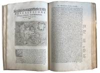
L'Isole Piu Famose del Mondo descritte da Thomaso Porcacchi da Castiglione Arretino e Intagliate da Girolamo Porro Padovano. Con l'Aggiunta di molte Isole All'Illre. S Conte Georgie Trivltio . In Venetia. Appresso Simon Gaglignani & Girolamo Porro. MDLXXVI. 1576. Second and Enlarged Edition
Venice: Calignani & Porro 1576. Foliated 29.7 x 20.9cm a large complete untrimmed copy The enlarged Second Edition small folio 29.8 x 20.2cm 24201.1 colophon foliated with 47 copper plate maps decorated initial letters head and tail pieces in later full vellum red leather label gilt titles title page is lightly sprinkled with tiny spots a very good to fine large complete untrimmed copy of this enlarged edition containing 17 additional maps not in the first edition of 1752. fine. ~ ~ ~ ~ <br /> Header:. Porcacch. The Most Famous Islands Of The World. 1576. <br /> <br /> ~ ~ ~ Shirley. The Mapping of the World 127; The World Encompassed 87; Phillips. Atlases I67; European Americana 576/35; Sabin 64149; JCB I 263-264; Adams P-1905. This is one of the most beautiful works of its kind produced in the 16th century and is the ï¬rst to have maps engraved on copper rather than on woodblocks. "The popularity of Bordone's Isolario brought forth a successor which from both the cartographical and topographical point of view was far more distinguished. Porcacchi's description of the "most famous islands of the world" included the areas represented in the other atlas and devoted the third book to islands of the New World of the Pacific and the Indian Ocean. " "The ï¬rst world map is a ï¬nely-executed reduction of Camocio's large world map of 1567 one of the last in the long line of derivatives from Gastaldis prototype of 1546. The illustrated tract on islands presented here is said to be Porcacchi's most important work. - <br /> <br /> ~ ~ ~ Most of the maps included are: Iceland Hebridean islands and Orkney Gotland Hibernia Ireland England Scotland Sealand Maiorica Menorica Spain Malta Venice Italian archipelago corfu Curzolari Ionia Kefalonia island in the Ionian Sea Zante Morea Cerigo Candi of Indonesia Scarpanto Rhodi Santorini Milo Nixsia Cyrus Metellino Constantinople Stalimene Aegean Negroponte Greece Ciprus Temistitan Mondo Nuouo Spagnola Cuba San Lorenzo Peru S.Giovanni deL isole Molucche Indonesia and Del Mappamondo. The word Atlas was first used in the first collection of maps by Gerardys Mercator's "Atlas sive cosmographicae. 1585-1595 Calignani & Porro unknown
书商的参考编号 : 43595
|
|
|
[Atlas Spheroidal et Universel de Geographie]
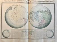
Cartography World 1860 Coloured world map: Tableau des Regions circumpolaires ou carte sphéroïdale des deux pôles 1 p.
Five different perspectives of the world globe with regard to the circumpolars. Printed on one big sheet 580 x 860 mm. Map in French language with:Hemisphere Austral Hemisphere Boreal Figure pour l'inclimaison et declinaison tableau figuratif des lignes sans declinaison et sans inclinaison et notice sur les phenomenes magnetique decrits dans cette carte. Lithographed. Visible fold in the middle but further in good condition. Intersting boreal and austral hemispheres. From: Atlas Spheroidal & Universel de Geographie. Printed in Paris by Sarazin.Text above the globes: Tableau des Regions circumpolaires ou carte sphéroïdale des deux pôles avec le developpement complet des deux Hemispheres jusqu'a l'Equateur d'apres les lois de la perspective et l'explication des phenomenes Magnetiques de la Declinaison et de l'inclinaison de l'aiguille aimantee.NL Decoratieve atlas van de wereld Aardrijkskunde met boreale hemisfeer bovenkant aardbol en australe hemisfeer onderzijde aardbol. unknown
书商的参考编号 : PR121406
|
|
|
[Atlas Spheroidal et Universel de Geographie]
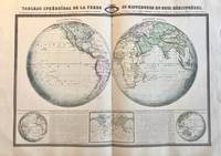
Cartography World 1860 Coloured world map: Tableau sphéroïdal de la terre ou mappemonde en deux hémisphères 1 p.
Five different perspectives of the world globe with regard to the hemispheres. Printed on one big sheet 580 x 860 mm. Map in French language with: Hemisphere occidental Hemisphere oriental aspect complementaire de l'hemisphere oriental and occidental and tableau des lignes isothermes ou carte d'egales températures.Text above the globes: Tableau sphéroïdal de la terre ou mappemonde en deux hémisphères ou la Projection donnant a la Terre l'aspect Concave est remplacee par la Projection plus rationnelle figurant sa Convexité et résumant à l'aide de Lignes Isothermes le Système de l'Egalité des Températures à differentes latitudes du Globe.NL Decoratieve atlas van de wereld Aardrijkskunde met isothermen hemisferen temperatuur lijnen etc. unknown
书商的参考编号 : PR121407
|
|
|
[Atlas – wine; Paris, Lyons and Mediterranean Railway]
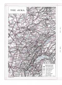
Atlas P.L.M. Jura Burgundy
Paris: J. Barreau Imp. Edit.; Paris Lyons and Mediterranean Railway No Date. Quarto-sized booklet stapled in wrappers 26.5 x 19 cm. 19 1 pages. Illustrated with two maps in black and red and with two color plates and many black and white illustrations in the text. The text is a review of towns and cities in the Jura and Burgundy with small inset photographic images of famous buildings in each. In illustrated beige wrappers decorated and titled in dark green burgundy and gilt. Fine. J. Barreau, Imp. Edit.; Paris, Lyons and Mediterranean Railway unknown
书商的参考编号 : 8371
|
|
|
[Atlas; Advertising]
'The Wilson Atlas Pocket Edition. No Better Whiskey in the World'. Die cut advertising
New York: Wilson Distilling Company Inc 1942. Fine. Unusual WWII era die cut atlas consisting of four circular panels printed on front and back with the 2 hemispheres of the globe in color on the front panels. These open to 2 panels of color illustrations featuring Wilson's Whiskey elegantly presented on a silver tray in front of a globe with the tag lines "No Better Whiskey in the World . Wilson That's All".<br /> <br /> The verso opens to 4 panels of printed text under the heading "Do You Know That" with interesting facts about nations around the world including this unusual information concerning Australia: "About one third of the adult population owns property and four fifths possess bank accounts."!<br /> <br /> Opens to 24 x 6 1/4"; folds to 6 x 6 1/4". Fine condition very bright and clean. Not found on Trove. OCLC: 1086382147 records only one copy at the Newberry Library. Wilson Distilling Company Inc unknown
书商的参考编号 : 25894

|
|
|
[Atlas; Russo-Japanese War]
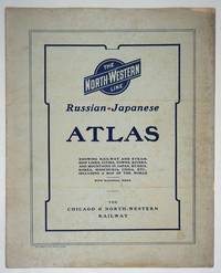
The Chicago & North-Western Russian-Japanese War Atlas: showing Russia-in-Europe and Russia-in-Asia Japan Korea Manchuria and China and the entire theater of operations in the Far Eastern Conflict
Chicago: Rand McNally and Company; Chicago and North Western Railway Company 1904. First printing. Staplebound Wraps. Very good condition. Maps of the Russo-Japanese War five maps with a key printed in the margins comprised by the North-Western Line on inside front cover b&w World map; Asia; Eastern China; Japan and Korea all in color and 'the Only Double-Track Railway Between Chicago and the Missouri River and the Route of the Overland Limited' inside the back cover b&w. <br /> <br /> OCLC: 928938679 at Newberry Library Baskes Collection. Small folio printed paper wrappers grey covers with blue titles on front/back. Maps in color and b&w. Covers dusty slt. chip on foredge original folds. Rand McNally and Company; Chicago and North Western Railway Company unknown
书商的参考编号 : 27334
|
|
|
[ATLAS]
ATLAS OF DORCHESTER WEST ROXBURY AND BRIGHTON CITY OF BOSTON
1899. ATLAS. ATLAS OF DORCHESTER WEST ROXBURY AND BRIGHTON CITY OF BOSTON in one volume. Boston: L. J. Richards 1899. Folio. 22" Street index plus 40 double page maps measuring 32" x 22". Bound in 1/2 leather which is largely absent. Front board is detached. Interiors are clean and free from staining with the exception of some light red or graphite pencil annotations on a few plates and soiled end-papers. Plates with pencil annotations: 28 29 30 37 39. Maps printed in as many as seven colors. A good copy. unknown
书商的参考编号 : 86734

|
|
|
[ATLAS]
ATLAS OF THE CITY OF BOSTON VOLUME 6 WEST ROXBURY
1896. ATLAS. ATLAS OF THE CITY OF BOSTON VOLUME 6 WEST ROXBURY. Philadelphia: G. W. Bromley and Co. 1896. Second edition. Folio 22.5". Contains street index outline and index map and 30 double-page maps measuring 22.5" by 32". Maps have only minor soiling to margins and occasional pencil annotations plates 1 and 27. FFEP and title page have large chips. Bound in half leather now mostly chipping or absent. In need of rebacking front board detatched. unknown
书商的参考编号 : 86739

|
|
|
[ATLAS]
ATLAS OF THE CITY OF BOSTON Vol. 7 BRIGHTON MASS
1890. ATLAS. ATLAS OF THE CITY OF BOSTON Vol. 7 BRIGHTON MASS. Philadelphia: G. W. Bromley & Co. 1890. Folio. 22" Contains 30 double page maps - outline and index map and 29 plates - measuring 32" x 22" with only slight marginal staining near spine at head. Maps are drawn at scale of either 600 100 or 150 ft/inch. Bound in 1/2 leather missing much of leather covering and has detached and chipped FFEP. Front hinge very weak. unknown
书商的参考编号 : 86735

|
|
|
[ATLAS]
ATLAS OF THE CITY OF BOSTON: SOUTH BOSTON
1899. ATLAS. ATLAS OF THE CITY OF BOSTON: SOUTH BOSTON. Philadelphia: G. W. Bromley Co. 1899. Folio 23". Street index and 33 double-page maps - outline and index map and 32 plates - measuring 32.5" x 22.5". Ffep missing. Outline and index map has tear near bottom where sheet folds. Plate 1 partly detached. Plates 29 30 31 are detached. Plates 2 and 32 have pencil annotations. Bound in 1/2 leather which is flaking. Interiors are bright some soil. Good. unknown
书商的参考编号 : 86736

|
|
|
[ATLAS]
ATLAS OF THE TOWNS OF REVERE AND WINTHROP SUFFOLK COUNTY MASS
1906. ATLAS. ATLAS OF THE TOWNS OF REVERE AND WINTHROP SUFFOLK COUNTY MASS. Boston: Whitman & Howard 1906. Folio. 22". Double page maps measure 32" by 22". All plans are drawn to a scale of 150 feet to one inch except index map. Includes street index outline and index map and 25 double-page maps. Interiors are in good condition with some light staining throughout at head and spine pencil or ink annotations to title page and plates 3 4 5 8. Exteriors are fair with heavily worn half-leather with black cloth boards and gilt-stamped edges. A good copy. unknown
书商的参考编号 : 86732

|
|
|
[ATLAS]
ATLAS OF THE CITY OF CHELSEA AND THE TOWNS OF REVERE AND WINTHROP
1896. ATLAS. ATLAS OF THE CITY OF CHELSEA AND THE TOWNS OF REVERE & WINTHROP MASS. Philadelphia: G. W. Bromley and Co. 1896. Folio 22.5". Contains street index outline and index map and 22 double-page maps measuring 22.5" by 32". Maps have only minor soiling to margins and occasional pencil annotations plates 12 17 18 21 and 22. Bound in half leather now mostly chipping or absent. In need of rebacking front board detached. As is. unknown
书商的参考编号 : 86740

|
|
|
[ATLAS]
Nieuwen Atlas der Jeugd of duydelyke grondregels om de Geograhie gemakkelyk en op korten tyd te leeren.
Antwerpen:: C. M. Spanoghe 1786. First Dutch translation. old paste-grain decorated paper boards sewn over tapes. Old ink ownership signature; a very attractive copy. 12mo. Engraved frontispiece 22 folding engraved maps with outline color and 2 folding plates. C. M. Spanoghe, hardcover
书商的参考编号 : 60376
|
|
|
[ATLAS]
Ordnance Survey Atlas of England and Wales. Quarter Inch to the Mile.
1922. Ordnance Survey Southampton. 1922. Landscape 4to. Maroon cloth gilt to upper board. 24 linen-backed colour maps each measuring 75 x 35 cm. Extremities a llittle rubbed; a little mild soiling and some surface scratch marks to boards with discolouration to cloth at bottom edge of rear board; small white paint spots to spine. All maps clean and sound. hardcover
书商的参考编号 : 83019
|
|
|
[Atlas]
Robinson's Australian and New Zealand Atlas.
H.E.C. Robinson Ltd. Sydney. ND c1934. 8vo non paginated. Soft cover with simple green and pink artwork slighty soiled with a sound adhesive dark green spine and period advertising on both sides of rear cover in very good condition text in excellent condition with no tears or prior owner markings present. A series of 22 beautifully coloured and annotated maps sequentially bound together adequately describes this somewhat frail publication making it all the more rare in this very good condition H.E.C. Robinson Ltd. Sydney. ND (c1934) paperback
书商的参考编号 : 46641
|
|
|
[Atlas]
Smith's New General Atlas containing Distinct Maps of all the Principal Empires Kingdoms & States throughout the World carefully delineated from the best Authorities extant
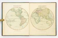
London: Printed for C. Smith Mapseller Extraordinary to his Royal Highness the Prince of Wales 1809. First Edition. Hardcover. Very Good. London Printed for C. Smith Mapseller Extraordinary to his Royal Highness the Prince of Wales 1809. Folio 404 × 330 mm engraved title leaf letterpress contents leaf and 43 hand-coloured copper-engraved maps numbered as 45 the map of Germany comprises two double-page sheets numbered 19-20 and 21-22. All leaves are printed one side only; all maps are dated 1808. Modern half calf and cloth with a gilt-lettered contrasting leather title-label on the spine; short scratch to the leather on the rear cover; title page a little tanned and discoloured around the margins by the leather corners of an earlier binding; scattered light foxing; insignificant short tears to some margins now sealed; trifling signs of age and use; overall in excellent condition. An attractive Georgian atlas 'on a Scale sufficiently large for the Purposes of general Reading and yet not too inconvenient for the Study or the Table' advertisement at the foot of the contents page. The three maps showing Australia 'Eastern Hemisphere' 'The World on Mercator's Projection' and 'Asia' all show the southern coast of the continent as uncharted. The expeditions of Flinders and Baudin had both charted this coast in 1802 but their maps were not published until 1814 and 1811 respectively. Printed for C. Smith, Mapseller Extraordinary to his Royal Highness the Prince of Wales hardcover
书商的参考编号 : 127861
|
|
|
[Atlas]
The "Geographia" Road Atlas of Great Britain.
Geographia Ltd. London. 1923. Cr 8vo 128pp. Red cloth boards in fair condition with a fraying worn spine with early hinging and the title embossed in black on the front board and spine text is in very good condition though with significant tanning of title page and endpapers and prior owner highlightings of certain destinations. In an age of GPS navigation perusing a gem like this early road atlas is a real journey back in time and a must for any tourist from this era. It even includes a perpetual lamplighting table in Great Britain relative to London. Geographia Ltd. London. 1923. hardcover
书商的参考编号 : 46644
|
|
|
[Atlas]
The Times Atlas of the World
New York: Times Books 1980. Hardcover. fine. Comprehensive edition. xl227pp. Folio. Illustrated with coloured maps and photos. Original black cloth with gilt lettering on front cover and spine in dust jacket. Fine condition. 1980 Times Books hardcover
书商的参考编号 : 122499
|
|
|
[ATLAS] BROOKES, R
Brookes's General Gazetteer Improved; or a New and Compendious Geographical Dictionary. Containing a Description of the Empires Kingdoms States Provinces Cities Towns Forts Seas Harbours Rivers Lakes Mountains Capes &c. in the Known World.
Philadelphia: Jacob Johnson. First American Edition. Hardcover. Very Good. Tree calf red leather spine label. 8 folded maps. Complete. Worn as almost always; front joint cracked spotting and toning creasing to maps. But a very respectable copy. <br/><br/> Jacob Johnson hardcover
书商的参考编号 : D19537
|
|
|
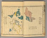
[ATLAS] Bridgeman, EC translated by Mitsukuri Ge E C
RENPO SHIRYAKU 2 vols
1871. ATLAS Bridgeman E.C. translated by Mitsukuri Genpo. RENPO SHIRYAKU 2 vols. Tokyo Zodiacal date of Meiji 4 1871. String-bound Japanese-style fukuro-toji. An interesting work by Bridgeman the Chinese missionary originally published in Chinese but here marked for reading as Japanese kanbun. Thus not a translation as we might understand the term but a long standing aid for literate Japanese to understand the original classical Chinese. With a number of bw and some color maps of the USA along with a text describing US history culture economics etc. A bit of cover soiling outside and the scattered signs of insect damage internally but overall a very good copy. Upon comparison to the original Japanese edition of 1861 there is not much to choose between them. unknown
书商的参考编号 : 89428
|
|
|
[ATLAS] MORSE JEDIDIAH
The American Universal Geography; or a View of the Present State of All the Kingdoms States and Colonies in the Known World and of the United States of America In particular.
Boston: J. T. Buckingham for Thomas & Andrews 1805. Hardcover. Good. Two volumes. A matched set: volume one is a fifth edition with old stamps and bookplates from Meadville Theological School; volume two is a fourth edition bookplate of Anne and Clarence Kilburn. Both in contemporary calf spine labels; volume two with front board detached. Engraved maps throughout. Contents with occasional spotting and toning a few of the maps with creases and short edge tears but quite respectable relative to other sets. <br/><br/> J. T. Buckingham, for Thomas & Andrews hardcover
书商的参考编号 : D19536
|
|
|
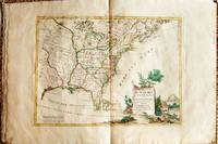
[ATLAS] ZATTA, Antonio
LE COLONIE UNITE DELL'AMERICA SETTENTRIONALE. DI NUOVO PROJEZIONE
Venice: Antonio Zatta 1778. First Edition. Softcover. Some minor worming to inner marginal folds of maps occasional spotting. Complete with vibrant coloring. Close to Fine. Oblong folio 16 1/4" x 12" bound in contemporary limp decorated paper covers. Containing 15 double-page engraved maps including the double-page title each beautifully hand-colored depicting Bermuda; the east coast of North America from Nova Scotia to Florida west to the Great Lakes and south to "Luigiana" and "Messico"; Lake Superior and its coast with an inset of eastern Florida including the Keys and Bahamas; Canada between the Ottawa River and Hudson Bay; Labrador; Lake Michigan including parts of Michigan Illinois Indiana Wisconsin Minnesota and Iowa; Lake Huron Ontario Erie Ohio Pennsylvania New York the Hudson River Long Island and western New England; the Canadian and New England coast from Acadia and the Bay of Fundy down the coast to the Long Island Sound; Virginia the Mississippi and Missouri Rivers Louisiana and the Carolinas; Maryland New Jersey Virginia and the Carolinas; Jamaica; the Gulf of Mexico including the coast between Florida and New Orleans north into Indian territory; the east coast of northern Florida Georgia up to Cape Fear; Newfoundland and Cape Breton; and Hudson Bay. <br/><br/> Antonio Zatta paperback
书商的参考编号 : 019206
|
|
|
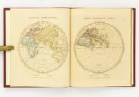
[Atlas]. ARROWSMITH, Aaron
Orbis Terrarum Veteribus Noti Descriptio. A Comparative Atlas of Ancient and Modern Geography from Original Authorities and upon a New Plan for the Use of Eton School
London: The Author 1828. First Edition. Hardcover. Very Good. London The Author 1828. Large quarto 358 × 295 mm vi pages engraved title dedication and index printed rectos only plus 53 extensively hand-coloured maps all printed recto or verso only with all but the last one - the Western Hemisphere - presented as facing pairs modern followed by ancient. Later quarter red morocco and cloth spine lettered in gilt; top corners slightly bumped; all edges speckled red; a few small inkspots to the top edge with minimal bleeding into a few top margins; all maps offset; blotted ink marks to the top corner of the map of 'Terra Sancta' map 20; trifling signs of age and use; overall in excellent condition. The extensive hand-colouring would appear to be the exception rather than the rule hand-coloured in outline only. The Author hardcover
书商的参考编号 : 142642
|
|
|
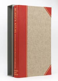
[Atlas]. BLAEU, Willem Janszoon
Blaeu's Atlas of England Scotland Wales and Ireland
London: Thames and Hudson 1970. Hardcover. Fine. London Thames and Hudson 1970s facsimile edition/ 1645 and 1654. Folio xvi pages plus 115 double-page maps 5 in colour and 2 facsimile colour title pages all plates printed one side of each leaf only. Half morocco and cloth; tiny light mark to the leading edge; endpapers slightly discoloured by the leather turn-ins; essentially a fine copy with the lightly scuffed slipcase. Number 26 of only 500 copies; with an introduction by R.V. Tooley. Thames and Hudson hardcover
书商的参考编号 : 129115
|
|
|
[Atlas]. Bellin, Jaques Nicholas
Old Maps of the World: Sets 1 through 5 North America South America Mexico/Central America Africa Asia.
Cleveland OH: Bloch and Compant 1959. First edition. Hard Cover. Very Good mild ex-library. Folio pp 10 per volume. Full set consists of Set 1: North America feat. maps produced in 1757; Set II: South America feat. maps produces 1753-57; Set III: Mexico Central America and the West Indies feat. maps produced 1754-58; Set IV: Africa feat. maps produced 1738-46; and Set V: Asia feat maps produced 1748-52. In very good condition only minor library markings. This series is a good set of old reference maps from around the world. Bloch and Compant hardcover
书商的参考编号 : 10437
|
|
|
[Atlas]. Helmfrid, Staffan (special ed) and Dept of Human Geography, University of Stockholm
Landscape and Settlements A volume of the National Atlas of Sweden.
Stockholm: SNA Publishing 1994. First edition. Blue Full Leather With Gilt Lettering. Very good condition but mild ex-library. Folio pp. 160. Indexed profusely illustrated in b/w and color. A very nice ex-library copy of this scarce volume of the National Atlas of Sweden. SNA Publishing hardcover
书商的参考编号 : 14585
|
|
|
[Atlas]. Helmfrid, Staffan (special ed) and Dept of Human Geography, University of Stockholm
The Geography of Sweden A volume of the National Atlas of Sweden.
Stockholm: SNA Publishing 1994. First edition. Blue Full Leather With Gilt Lettering. Very good condition but mild ex-library. Folio pp. 160. Indexed profusely illustrated in b/w and color. A very nice ex-library copy of this scarce volume of the National Atlas of Sweden. SNA Publishing hardcover
书商的参考编号 : 14586
|
|
|
[ATLAS]. La Perouse, John Francis Galaup
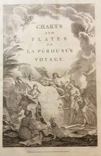
Charts and Plates to La Perouse's Voyage
London: Published as the Act directs Nov 1st 1798. by G.G.& J. Robinson 1798. Folio. 43x 27cm. 17" x 14.5". Atlas Volume First English Edition foliated engraved frontis portrait and engraved title-page 68 fine engraved plates maps charts and views many double page and include several plate illustrations on botanical and ornithological subjects. The plates are numbered 2 - 69 without the world map as usual plates are all very good to fine in contemporary half crimson morocco and marbled boards binding heavily dust worn similar wear on the edges upper hinge loose internally very good to fine condition. The map of the world is sometimes described as wanting however it would usually be in the two volume and is not call for in the list of plates <br /> <br /> ~ ~ ~ Hill #'s 972-979. "La Perouse expedition was one of the most important scientific explorations ever undertaken to the Pacific and North West Coast of North America. Hill. "Sabin 38960; Cox I-67. Fine copy of this Important 'Surveying Atlas' to the Pacific and west coast of North America. 1798. The plates are spectacular. - Atlas to the English edition of the report of the famous voyage around the world. Cook Bougainville and La Pérouse contributed decisively to the exploration of the Pacific. <br /> On the unexpected publication of this famous voyage at Paris in the previous year 1797 there was considerable competition among English publishers to bring out the English translation. Three different translations were made and published during 1798-99 and different engravers were employed for making the plates. Stockdale's appeared first in June 1798. Robinson's edition of 1799 is the most esteemed edition in English later editions being usually based on it." The atlas bears the date 1798 in the imprint but was published together with two text volumes in 1799. Published, as the Act directs, Nov, 1st, 1798. by G.G.& J. Robinson unknown
书商的参考编号 : 43609
|
|
|
[Atlas]; Ewing Thomas Murray
EWING'S NEW GENERAL ATLAS Containing Distinct Maps of All the Principal States and Kingdoms Throughout the World; in which the Most Recent Geographical Discoveries are accurately delineated.
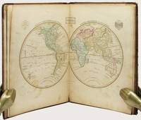
Edinburgh: Oliver & Boyd ca. 1835. Early printing undated. Fully illustrated with 27 maps the map of the world double-page all hand-coloured. Two additional maps are affixed to the endpapers and are extra to those included in the book. These were sometime added by an owner of the volume. 4to publisher's original brown calf over brown cloth covered boards the spine lettered in gilt the upper cover with hand-printed titling label. vi 27 maps on 28 pages A very well preserved copy. The binding with some wear from time and use still strong and showing minor separation at the free-flies and pastedowns the maps all in good order clean and well coloured. EARLY PRINTING OF EWING'S GENERAL ATLAS. Now scarce as a complete book many copies have been broken up with the maps sold separately. The maps have been handcoloured and are preserved very well. A double-page world map is presented first and then the maps of the countries of European countries and Russia Asia Africa North America and South America. The U.S. map is quite interesting in that it includes only the states and territories recognized at the time of publication. The country is show bordering the Atlantic on the East but extending only into the Missouri Territory and Arkansas in the west. Oliver & Boyd hardcover
书商的参考编号 : 33158
|
|
|
[BARTHELEMY (Jean-Jacques)].
Voyage du Jeune Anacharsis en Grèce, dans le milieu du quatrième siècle avant l'ère vulgaire.
A Paris, Etienne Ledoux, 1821. 1821 7 vol. de texte in-8° (220 x 145 mm) non rognés et 1 vol. datlas oblong (225 x 280 mm) de : vol. 1. 1 frontispice gravé ; [3] ff. (faux titre, imprimeur, titre, avertissement) ; CXL (dont table) ; 354 pp. ; vol. 2. [2] ff. (faux titre, imprimeur, titre) ; II (table) ; 506 pp ; vol. 3. VI (faux titre, imprimeur, titre, table) ; 482 pp ; vol. 4. VI (faux titre, imprimeur, titre, table) ; 488 pp ; vol. 5. VI (faux titre, imprimeur, titre, table) ; 479 pp ; vol. 6. [3] ff (faux titre, imprimeur, titre, table) ; 436 pp ; vol. 7. [2] ff (faux titre, imprimeur, titre) ; 448 pp (dont table). ; vol. datlas. [3] ff. (faux titre, imprimeur, titre, table) ; 38 planches dont plusieurs dépliantes et certaines coloriées à laquarelle ; [1] p. (explication des médailles) ; 1 planche de médailles. Un total de 39 planches. (rares tâches, ensemble frais). Demi veau rouge d'époque, plats recouverts de percaline rouge, dos à nerfs orné, titres et tomaisons dorés, gardes de papier marbré. (Reliure frottée aux coiffes, coupes et coins, mors de latlas usés, ensemble bien conservé).
书商的参考编号 : 5590

|
|
|
[BIBLE ATLAS] RICHARD PALMER
The Bible Atlas; or Sacred Geography Delineated in a Complete Series of Scriptural Maps.
Boston: Crocker & Brewster 1830. Hardcover. Very Good. Publisher's cloth boards gilt modern cloth over spine. 26 hand-colored engraved maps some folded. Contents lightly toned some offsetting as typical; generally speaking a nice copy. <br/><br/> Crocker & Brewster hardcover
书商的参考编号 : D19538
|
|
|
[CALLEWAERT, CONSTANT] / ATLAS
Atlas complet de géographie physique et politique
Total 85 planches lecons et cartes en regard. 2e édition- lithographed coloured maps for the greater part folding 22 x 17 cm. oblong. Bruxelles : Callewaert Freres 1858 CALLEWAERT CONSTANT / ATLAS Very rare. Keywords Europe Europa history Geography Geographical Geographic cartography Book # 2218 unknown
书商的参考编号 : 2218
|
|
|
[CANADA -- ATLAS]. WALLING, H[enry] F[rancis] (Ed), HUNT, T[homas] Sterry, BELL, Robert, et al
Tackabury’s atlas of the dominion of Canada with general descriptions by. . . .
Montreal Toronto & London: George N. Tackabury Printed by the Burland-Desbarats Lithographic Co. 1875. Folio. 14.25 x 17.75 in. 251 1 pp. Colour lithograph illustrated title page showing the Parliament Building in Ottawa Canada from photograph by W. Notman 53 colour lithograph maps many double-page many tables. Publisher’s plum-coloured embossed cloth gilt decorative lettering on front cover marbled endpapers nicely rebacked in simulated black calf corners renewed some wear & rubbing to corners 1 leaf w/ repairs to creases minor tidemark to upper right corner not affecting maps still G copy. First edition of this fine atlas of Victorian-era Canada including maps of climatology possessions provinces prior to Alberta Saskatchewan & Newfoundland becoming provinces plat maps of counties Railways as well as maps of the United States and Europe. Of particular interest are the city maps of Quebec Ottawa London Hamilton Kingston Toronto and Montreal. This excellent reference work also provides a comprehensive list of railways in Canada steamships in use lists post offices railway stations cities and populations as well as business cards located by city and town. George N. Tackabury, [Printed by the Burland-Desbarats Lithographic Co.], hardcover
书商的参考编号 : 51587
|
|
|
[CHATELAIN (Henri-Abraham), GUEUDEVILLE (Nicolas)
Atlas historique ou Nouvelle Introduction à l'Histoire, à la Chronologie & à la Géographie Ancienne et Moderne, représentée dans de Nouvelles Cartes, ...par Mr C***. Avec des Dissertations sur l'Histoire de chaque Etat par Mr Gueudeville.Tomme II, Première partie qui comprend l'Allemagne, la Prusse, la Hongrie & la Bohème.
Amsterdam Chatelain 1708 in-folio velin sur cartons, lies marron (reliure de remplacement ) titre, frontispice (Romain de Hooge), (6ff.nc), 90pp., 26 planches doubles h.t., 7 chronologies (33ff.),
书商的参考编号 : 17300
|
|
|
[CHEMINS de FER] - LE LEDIER.-
La France en poche. Départements et Colonies, avec un index alphabétique des localités mentionnées dans l'atlas et des tableaux donnant par réseau toutes les stations de chemin de fer.
P., Garnier, sans date (vers 1900 / 1910), in 8° étroit relié pleine percaline verte illustrée de l'éditeur, plus de 100 cartes et 107 pages d'index ; cartes imprimées en couleurs sur papier faort.
书商的参考编号 : 70380
|
|
|
[CHINA -- ATLAS]. HERRMANN, Albert
Historical and commercial atlas of China. Harvard-Yenching Institute Monograph Series Volume I.
Taipei Taiwan: Ch’eng Wen Publishing Co. P.O. box 22605 1970. Folio. 8.25 x 13.25 in. 112 pp. With 84 colour maps & diagrams many double-page. Blue linen gilt lettering on spine NF copy. First Taipei Ch’eng Wen reprint edition of this uncommon atlas first issued by Harvard University press in 1935. The colour maps trace China’s geography and political development from 1900 B.C. through 1930 with detailed maps charting the evolution of Asia and Asiatic empires. Of particular interest are the two final maps tracing the Chinese diaspora throughout the world and specifying population numbers of Chinese-Americans in the U.S. between the Wars. Ch’eng Wen Publishing Co., P.O. box 22605, unknown
书商的参考编号 : 58684
|
|
|
[CISTERCIEN, RELIGION , ATLAS, ART RELIGIEUX ] - MEER (Frederic van der ) -
Atlas de l'ordre cistercien.
Paris, Editions sequoia, 1965 ; in folio, 308 pp., cartonnage de l'éditeur. Avec jaquette sous boitage carton.
书商的参考编号 : 202103103
|
|
|
[COLLECTIF] / LOSTALOT-BACHOUE (Edmond de)
Le Monde - Histoire de tous les peuples depuis les temps les plus reculés jusqu'à nos jours [complet en 10 volumes].
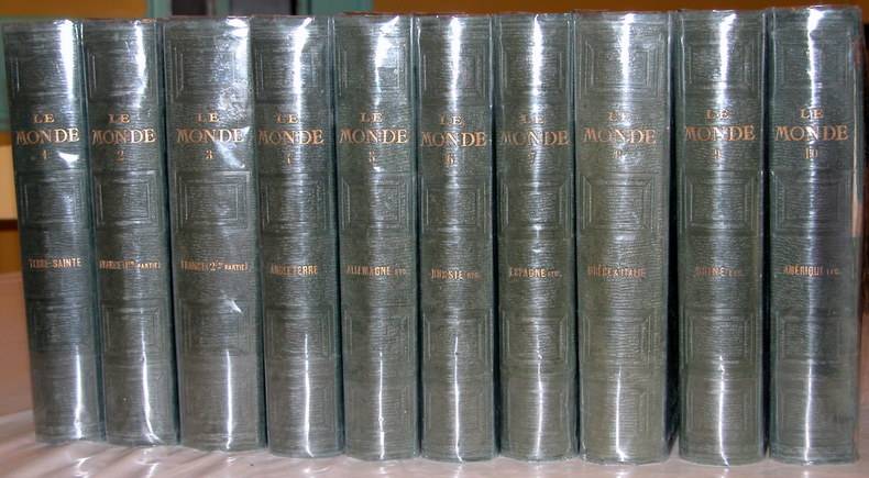
Paris, Lebigre-Duquesne frères, 1859 10 volumes In-8° (15,2 x 23cm) Reliure éditeur pleine percaline vert foncé; dos ornés de 4 caissons à froid, titres dorés; plats en encadrement à froid; gardes jaunes. Vol.1: 1 faux-titre, 1 titre, 508p., 2 feuillets, 34 planches hors texte dont 1 frontispice et 2 dépliantes; Vol.2: 1 feuillet, IX + 480p., 1 feuillet, 31 planches hors texte; Vol.3: 1 faux-titre, 1 titre, 618p., 1 feuillet, 39 planches hors texte; Vol.4: VI + 546p., 1 feuillet, 46 planches hors texte; Vol.5: VIII + 476p., 30 planches hors texte; Vol.6: 1 faux-titre, 1 titre, 1 feuillet, 492p., 1 feuillet, 31 planches hors texte; Vol.7: 1 faux-titre, 1 titre, II + 503p., 2 feuillets, 32 planches hors texte; Vol.8: 1 faux-titre, 1 titre, 33 planches hors texte; Vol.9: VIII + 539p., 34 planches hors texte; Vol.10: 1 faux-titre, 1 titre, 489p., 31 planches hors texte. Rousseurs, quelques pâles mouillures marginales dans les 7è et 8è volumes; 10è volume endommagé: charnière du dessus fendue, mouillures plus importantes sur une cinquantaine de premières pages, tache d'humidité sur le 1er plat.
书商的参考编号 : 14966
|
|
|
[COLLECTIF] / LOSTALOT-BACHOUE (Edmond de)
Le Monde - Histoire de tous les peuples depuis les temps les plus reculés jusqu'à nos jours [complet en 10 volumes].
Histoire du "monde" en 10 volumes: Tome 1/Terre Sainte ou Palestine; Tomes 2 et 3/France (1ère et 2è parties); Tome 4/Angleterre; Tome 5/Allemagne, Autriche, Prusse, Suisse; Tome 6/Russie, Pologne, Suède, Danemark; Tome 7/Espagne, Portugal, Pays-Bas (Belgique et Hollande); Tome 8/Grèce, Italie; Tome 9/Asie: Chine, Japon, Perse, Arabie, Turquie, Inde et Afrique: Egypte, Alger, Tunis, Tripoli; Tome 10/Amérique: découverte par Christophe Colomb, Amérique du Nord, Antilles, Mexique, Guatemala, Brésil, Guyane, Pérou, Colombie, Nouvelle-Grenade et Vénézuela, Chili, provinces du Rio de La Plata, missions du Paraguay, Esquimaux; Océanie; texte sur 2 colonnes; par Antoine-Jean CASSE DE SAINT-PROSPER (1790-1841), de SAURIGNY, Augustin Amédée DUPONCHEL, le baron Modest Andréevitch KORFF, Hippolyte BELLOC et l'abbé Guillaume MARTIN, revue et continuée (jusqu'en 1855) par Edmond de LOSTALOT-BACHOUE (1832-1893). Exemplaire complet des 10 volumes et des "340 belles gravures sur acier" annoncées: 341 planches hors texte dont 1 portrait de Lostalot-Bachoué en frontispice. Français

|
|
|
[Collectif] Journal Le Monde
Atlas Universel.
français Paris, Sélection du Reader's Digest, 1982. Grand in-folio de XL-130 pp. de cartes + Index; reliure simili-cuir de l'éditeur. Première édition. En très bon état. Petits frottements à la reliure.
|
|

 ?????????
 ?????PDF???
 RSS feed
 ??
??


