Author Not StatedMareMagnum

12.227 resultados
1926Approx. 46" x 30" coloured map indicating mineral deposits. Clear tape repairs to upper edge. Library markings. Average wear. Map
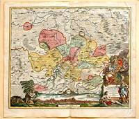
1717ref. 61880Nuremberg.: Johann Baptist Homann. 1717. A beautifully engraved hand coloured map of North East Germany showing the area around Erfurt in detail. In the centre of the map is a small plan of Erfurt which is also shown as a panoramic view at the foot of the map and titled 'St. Petersburg'. An elaborate decorative title cartouche in the lower right corner depicts allegorical figures surrounded by the produce of the land including sheaves of wheat; a beehive; and a cornucopia of fruits. Cherubs holding a coat of arms float up from the scene on the right while on the lower left a centaur sits meditatively beneath a pine tree amongst slaughtered cattle. Physical features of the area are illustrated and farming areas shown by fields which criss-cross across the map. A clear dark impression the work of an outstanding German cartographer who in 1715 was appointed as imperial geographer by Emperor Charles VI. This map also includes "Schwan See" Swan Lake under a town of the same name which has since disappeared. Hand coloured two very minor splits at upper and lower edges on centre fold and not affecting engraved area a handsome map 54 x 61.5 cm. . [Johann Baptist Homann.] unknown
1630Buon esemplare della carta del mondo di Henricus (Hendrick) Hondius. Prova del terzo stato di quattro, con la data 1663 che sostituisce l'originale 1630, che si trova nell'Atlas Contractus di Jan Jansson e negli atlanti marini di H. Van Loon.I cartigli abbelliti e le illustrazioni bizzarre fanno di questa mappa un eccellente esempio di cartografia olandese in stile barocco. Circondata da scene mitiche e bestie fantastiche, la carta del mondo stessa include affascinanti illustrazioni di velieri, mostri marini e pesci.Henricus Hondius era figlio del famoso cartografo Jodocus Hondius, il cui ritratto appare nella mappa in basso a sinistra. La carta include anche i ritratti di Gerard Mercator, Claudio Tolomeo e Giulio Cesare. Questi ritratti non sono solo accattivanti e storicamente rilevanti, ma probabilmente sono intesi a connettere la cartografia olandese (esemplificata da Hondius e Mercator) alla tradizione cartografica classica.L'atlante di Mercator-Hondius è stato pubblicato per la prima volta dal padre del cartografo, Joducus Hondius, che acquistò le lastre dell'opera di Mercator, ristampandole ed integrandole con un numero sempre crescente di sue mappe. Oltre alle numerose e bellissime illustrazioni sono notevoli nella carta diverse curiosità geografiche, tra cui la California come isola, le reti fluviali e i laghi del Nord America e le coste dell'Australia. In Sud America, lo Stretto di Le Maire appare ora ad est dello Stretto di Magellano. Lo Stretto di Le Maire era stato scoperto solo quindici anni prima della pubblicazione del primo stato di questa mappa, quando Jacob Le Maire e Willem Schouten condussero una circumnavigazione per minare il monopolio commerciale della Compagnia olandese delle Indie Orientali (VOC). L'inclusione della costa australiana in questa mappa traccia l'inizio della conoscenza olandese del continente australiano, quando la notizie di una "sconosciuta massa di terra ignota meridionale" si stava rapidamente diffondendo.Acquaforte, finemente colorata a mano, in ottime condizioni. A good example of the Henricus Hondius’ world map, a third state with the date 1663 that can be found in the Atlas Contractus of Jan Jansson and in sea atlases of Van Loon.The embellished cartouches and whimsical illustrations make this map an excellent example of baroque-style Dutch cartography. Bordered by mythical scenes and fantastic beasts, the world map itself includes charming illustrations of sailing vessels and fish, adding further visual interest to an already engaging tableau.The mapmaker Henricus Hondius was the son of famed cartographer Joducus Hondius, whose portrait appears at bottom left. The map also includes portraits of Gerardus Mercator, Claudius Ptolemy, and Julius Caesar. These portraits are not only eye-catching and historically relevant, but also serve to establish Dutch cartography (exemplified by Hondius and Mercator) alongside the Roman cartographic tradition.The Mercator-Hondius atlas was first published by the mapmaker’s father, Joducus Hondius. Joducus Hondius secured Mercator’s map engravings from Mercator’s relatives and republished them, along with his own work. The atlas was incredibly commercially successful, and its world map remained unchanged from Mercator’s depiction until the creation of this map by Henricus Hondius and partner Jan Jansson. This Hondius-Jansson version of the Mercator world map was included in all issues of the Mercator-Hondius atlases from 1633 until at least 1658.In addition to the numerous beautiful illustrations and map details, several geographic features included on this map are notable, including California as an island, the riverine networks and lakes of North America, and the coastline of Australia. California is shown here as an island, reflecting a widespread belief among Europeans from the sixteenth to eighteenth centuries. In South America, the Le Maire Strait now appears east of the Strait of Magellan. The Le Maire Strait had been discovered only fifteen years before the first state of this map was published, when Jacob Le Maire and Willem Schouten led a circumnavigation to undermine the trade monopoly of the Dutch East India Company (VOC). Setting this map apart from its contemporaries, it also includes an early appearance of Australia's northern coastline. The inclusion of the Australian coast on this map traces the beginning of Dutch knowledge of the Australian continent, preserving a moment in time when “The Unknown Southern Land” was quickly becoming known.Copperplate with fine hand colouring, in good condition. Shirley, The Mapping of the World: Early Printed World Maps, 1472-1700, map 336
1587Rarissima pianta prospettica della città dal Gianicolo, incisa da Ambrogio Brambilla per il tipografo Girolamo Franzini. Si tratta di una piccola pianta, dipendente da quella che il Brambilla stesso incise per Claudio Duchetti nel 1582, aggiornata in parte alla riforma urbanistica di Sisto V. Sono raffigurati gli obelischi di S. Pietro, S. Giovanni e S. M. Maggiore e la via Nova. L’opera è di grandissima rarità; Hülsen (1915) descrive due esemplari nei cataloghi di inizio secolo delle librerie antiquarie romane Rappaport e Lang. Marigliani (2007) riproduce l’esemplare di una collezione privata romana, con una legenda è molto nutrita, addirittura stampata su una lastra separata; è composta da 136 rimandi, dei quali i primi 114 derivano dalla pianta del 1582.In alto, nel riquadro di sinistra, troviamo il titolo e le indicazioni editoriali: NOVA URBIS ROMAE DESCRIPTIO ANNI 1587. Per Ambrosiu s brambilla spictore[m] delineatu s et incisa m. Nel riquadro di destra si legge: Roma fu edifficata gl’anni del mondo 5550 e da poi la destruttione de Troia anni 753 da Romolo, e Remo, fratelli nati da Silvia figliola de Numitore Re de Albano: fu anticame[n]te il suo circuito de le mura miglia 32.Orientazione nei quattro lati al centro con il nome dei punti cardinali: SEPTENTRIO, MERIDIES, OCCIDENS, ORIENS, il nord è a sinistra. Acquaforte e bulino, stampata su carta vergata coeva, con ampi margini, in perfetto stato di conservazione.BibliografiaBifolco - Ronca, Cartografia e Topografia italiana del XVI secolo (2018), pp. 2406-2407, tav. 1238; Ganado (1994): II, n. 116 e III. n. 93; Hülsen (1915): XVIa, p. 63-64, n. 80; Marigliani (2007): n. 60. A very rare map of the city from the Janiculum Hill, engraved by Ambrogio Brambilla for the publisher Girolamo Franzini. It is a small map, based on the one that Brambilla himself engraved for Claudio Duchetti in 1582, partly updated to the urban reform of Sixtus V. The obelisks of S. Pietro, S. Giovanni and S. M. Maggiore and the via Nova are represented. The work is of great rarity; Hülsen (1915) describes two examples in the catalogs of the beginning of the century of the Roman antique bookshops Rappaport and Lang. Marigliani (2007) reproduces the exemple of a private Roman collection, with a very large legend, even printed on a separate plate; it is composed of 136 references, of which the first 114 derive from the map of 1582.Above, in the left box, we find the title and the printing details: NOVA URBIS ROMAE DESCRIPTIO ANNI 1587. For Ambrosiu s brambilla spictore[m] delineatu s et incisa m. Orientation in the four sides with the name of the cardinal points: SEPTENTRIO, MERIDIES, OCCIDENS, ORIENS, the north is on the left. Etching and engraving, printed on contempoary laid paper, with wide margins, in perfect condition.LiteratureBifolco - Ronca, Cartografia e Topografia italiana del XVI secolo (2018), pp. 2406-2407, tav. 1238; Ganado (1994): II, n. 116 e III. n. 93; Hülsen (1915): XVIa, p. 63-64, n. 80; Marigliani (2007): n. 60. Bifolco - Ronca, Cartografia e Topografia italiana del XVI secolo (2018), pp. 2406-2407, tav. 1238.
Format: 48,5 x 56,5 cm (bis zur äußeren Einfassungslinie beschnitten). *Generalkarte der Schweiz. Justus Danckerts (1635-1701) war Kupferstecher und Verleger in Amsterdam, Sohn des Kartenhändlers Cornelius Danckerts, er gründete um 1656 eine eigene Kartenoffizin. Gut erhalten. Landkarten de
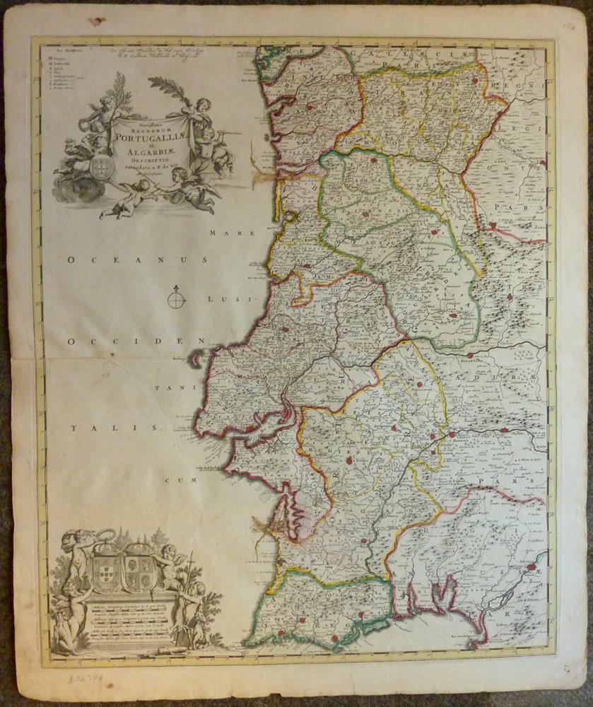
1680ref. 52309Amsterdam, Frederic de Wit, [ca. 1680]. Darstellung ca. 58,5 x 48,5 cm, Blattgröße ca. 64,5 x 54 cm.
Madrid-Barcelona, Librería de Locadio López-Librería de Juan Llordachs, 1879. 4to. mayor; 2 hs. y 17 mapas dobles coloreados. Pérdida de la mitad del mapa de América Latina. Encuadernación en tela estampada.
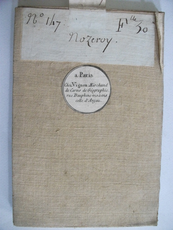
ref. 6734marchand de cartes de géographie Paris. N°147 feuille 30 NOZEROY carte entoilée.Pliée 13x20cm dépliée 90x60 échelle 10 000 toises.
1782ref. 55917Wien, L. Hochenleiter, um 1782. (22 x 37 cm.). Engraved map (bird-eye-view) with ships in the sea, fortification and bombardment. Text in Spanish. Mildly brownspotted.
1782Wien, L. Hochenleiter, um 1782. (22 x 37 cm.). Engraved map (bird-eye-view) with ships in the sea, fortification and bombardment. Text in Spanish. Mildly brownspotted.
Madrid, Aguilar, 1961. Folio; 455 pp. Mapas, gráficos y fotografías. Encuadernación original en tela, ligeramente fatigada.
1823ref. 6335Livorno, Tipografia Vignozzi, 1823. 1 tome divisé en deux volumes de 352 pages et de la page 353 à 739, demi-vélin blanc à coins, dos lisse, pièce de titre en maroquin vert.
1697Mappa di Roma del XVII secolo, incisa a Roma da Antonio Barbey e pubblicata da Domenico de Rossi.Si basa sulla grande pianta murale di Giovan Battista Falda, ma mostra con particolare cura gli interventi urbani sotto il pontificato di papa Innocenzo XII, tra i quali la dogana di mare a Ripa Grande (1694). Sono inoltre contenute nella pianta una serie di interessanti note e i nomi delle ville e vigne entro le mura della città.Comprende un elegante cartiglio con titolo e stemma in alto, e un secondo cartiglio con un lungo elenco che individua 464 luoghi di interesse nella Città Eterna.La mappa è orientata a nord-est in alto e comprende siti antichi e moderni. "I lotti edificati sono campiti con puntinato e vengono indicati i nomi di molte strade. L'impostazione generale e vari dettagli denotano la derivazione di questa pianta dalla grande del Falda cui il Barbey apportò però numerosi aggiornamenti. Sono infatti riportati i nuovi interventi di Innocenzo XII tra i quali la dogana di mare a Ripa Grande (1694). Sono inoltre contenute nella pianta una serie di interessanti note e i nomi delle ville e vigne entro le mura della città. In basso a sinistra è scritto Ant. Barbey Sculp. ed a destra Domenico de Rossi [...] l'anno 1697 il di 25 maggio. Sotto il titolo in alto è riportata la dedica a Mons. Ranuccio Pallavicino Governatore di quest'alma Città e vice Camerlengo [...] Innocenzo XII felicemente regnante. Sui due lati legenda con 464 numeri di rimando ed elenco dei XIV rioni, e, in basso a destra, l'indice delle chiese di Roma" (cfr. Marigliani p. 253). Incisione in rame con bellissima coloritura a mano, alcune pieghe di carta perfettamente restaurate, per il resto in buono stato di conservazione. Rara. Bibliografia Frutaz n. 162, Scaccia Scarafoni n. 206, Huelsen n. 135; Marigliani n. 159. Map of Rome from the 17th century, engraved in Rome by Antonio Barbey and published by Domenico de Rossi. It is based on the large wall map by Giovan Battista Falda, but shows with particular care the urban interventions under the pontificate of Pope Innocenzo XII, including the sea customs house at Ripa Grande (1694). The map also contains a number of interesting notes and the names of the villas and vineyards within the city walls. It includes an elegant cartouche with title and coat of arms at the top, and a second cartouche with a long list identifying 464 places of interest in the Eternal City. The map is oriented north-east at the top and includes ancient and modern sites. Built-up lots are dotted and the names of many streets are indicated. The general layout and various details indicate that this map derives from Falda's great map, to which Barbey however made numerous updates. In fact, the new interventions of Innocent XII are shown, including the sea customs house at Ripa Grande (1694). The map also contains a series of interesting notes and the names of the villas and vineyards within the city walls. At lower left is written Ant. Barbey Sculp. and on the right Domenico de Rossi [...] the year 1697 the 25th of May. Under the title at the top there is the dedication to Monsignor Ranuccio Pallavicino Governor of this great City and Vice Camerlengo. On both sides a legend with 464 reference numbers and a list of the XIV districts, and, at the bottom right, the index of the churches of Rome (cf. Marigliani p. 253). Copper engraving with fine later hand colour, few repaired paper folds, otherwise in good condition. Rare. Bibliografia Frutaz n. 162, Scaccia Scarafoni n. 206, Huelsen n. 135; Marigliani n. 159.
1816Pianta della città di Roma basata sulla mappa di Giovanni Battista Nolli (1692-1756). Incisione di Pietro Ruga. Con una legenda (I - XIV), scala e titolo "Nuova pianta di Roma moderna estratta dalla grande del Nolli: nell'angolo in basso a destra, corretta ed accresciuta de 'nomi delle contrade indicate al loro rispettivo sito".Include 4 piani inserti del Pantheon, della basilica di San Paolo, del mausoleo di Santa Costanza e della chiesa di San Lorenzo.Si tratta della prima edizione della pianta che il Ruga disegnò ed incise per l'editore Venanzio Monaldini, il cui successo e diffusione è testimoniato dal fatto che venne ristampata in successive sei edizioni fino al 1843. Sul lato destro sono raffigurate le piante del Mausoleo di Santa Costanza, Basilica di San Paolo e Panthon; in alto a destra San Lorenzo fuori le mura. IN basso a destra, sopra al titolo, è inciso l'elenco dei 14 Rioni. Nella pianta, assai dettagliata, da notare l'emiciclo di Piazza del Popolo realizzato solo per metà.Incisione in rame, in 20 sezioni posate su lino e più volte ripiegate, racchiuse in astuccio in cartonato coevo. Ottime condizioni. Town plan of Rome based on map by Giovanni Battista Nolli, ( fl. 1692-1756). Engraved by Pietro Ruga. With a key (I - XIV), scale and text "Nuova pianta di Roma moderna estratta dalla grande del Nolli : corretta ed accresciuta de' nomi delle contrade indicati al loro rispettivo sito", in lower right corner.Includes 4 inset plans of the Pantheon, St. Paul's basilica, the mausoleum of St. Costanza and the church of San Lorenzo.Dissected in 20 sections and laid on linen, as issued. Fine condition.A fine and rare 1843 case format map of Rome, Italy by Venanzio Monaldini. This extraordinary map of Rome heavily references, with various updates and revisions, the seminal 1734 map of Rome by Giovanni Battista Nolli. Nolli’s map was the first modern map of Rome and basis of almost all subsequent maps of Rome until approximately 1870, when Rome became the capitol of Italy and more modern plans were issued. Depicts the city in extraordinary detail labeling all streets, ferry crossings, bridges, parks, and historic buildings. Surrounded by plans of important buildings including the Mausoleum of Saint Constance, the Basilica of St. Paul, a layout of the Pantheon, and the floor of the Church of Saint Lorenzo. This map was designed with the traveler in mind and thus bisected and backed with linen for easy folding. Comes with original slipcase. Most likely engraved by Pietro Ruga, a prominent Rome based engraver best known for his architectural plans and views. Published from Venanzio Monaldini’s bookshop on 79 Piaza di Spagna, Rome, Italy. Marigliani, Le Piante di Roma nelle collezioni private, p. 307, n. 233. Scaccia Scarafoni p. 258.
ref. SLIVCN-7649988536908JEUX D'ENFANTS S.A.
1767ref. 34617(København, 1767). Prospekt af Nyborg set fra landsidens fæstningsanlæg. (17x25 cm.). Stukket af A. Lode. På skrivepapir.
1767(København, 1767). Prospekt af Nyborg set fra landsidens fæstningsanlæg. (17x25 cm.). Stukket af A. Lode. På skrivepapir.
1958ref. 1094Nyon, Ed. du Courrier de La Côte, 1958. In-8 de 176 pages, cartonnage rouge illustré d'éditeur, dos muet.
ref. 219397Paris, Lanée, Succr de Longuet, (1900) carte dépliante de 51 x 73 cm repliée au format in-12, en feuille, imprimée en couleurs, entoilée, étiquette de titre imprimée ancienne de l'éditeur au verso.
ref. 219399Paris, maison Andriveau-Goujon, Henry Barrère, (début XXe) carte dépliante de 51 x 71 cm repliée au format in-12, en feuille, imprimée en couleurs, entoilée, étiquette de titre imprimée de l'éditeur au verso. Quelques discrètes annotations manuscrites à l'encre noire.
1785ref. LBW-3632[1785]. 398 x 490 mm.
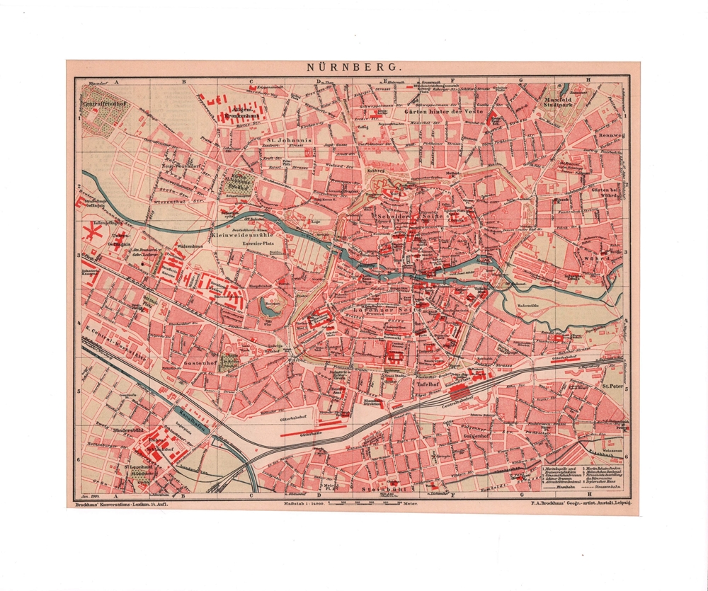
1905ref. 76432Leipzig, F. A. Brockhaus, [ca. 1905]. Bildgröße 20,5 x 26,5 cm. Unter Feinkartonpassepartout.
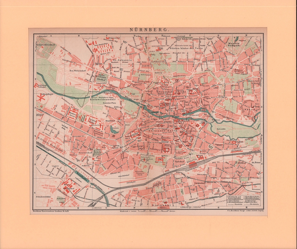
1905ref. 76433Leipzig, F. A. Brockhaus, [ca. 1905]. Bildgröße 20,5 x 26,5 cm. Unter Feinkartonpassepartout.
1767ref. 34556(København, 1767). Kobberstukket prospekt af Nysted med skibe i forgrunden. (17,5x26 cm.). Stukket af J. Haas. På skrivepapir.
1767(København, 1767). Kobberstukket prospekt af Nysted med skibe i forgrunden. (17,5x26 cm.). Stukket af J. Haas. På skrivepapir.