Speed, JohnBiblio.com
1,312 results
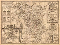
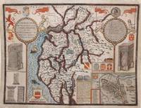
1616ref. M8779London: John Sudbury & George Humble 1616. Good a few marginal tears upper left corner replaced not affecting the image. Reinforced with acid free tissue paper on the back of the margins. . Notes: StolenBeautiful map of Cumberland northern England showing mountains rivers and major towns with an inset of Carlisle armorials and a vignette of a battle scene. John Speed 1552 –1629 was an English cartographer and historian. He is known as England's most famous Stuart period mapmaker. His maps of English counties are often found framed in homes throughout the United Kingdom.For a series of maps Speed partnered with Dutch engraver Jodocus Hondius. Size : 384x507 mm 15.12x19.96 Inches Coloring: Original Hand Coloring Category: Maps Europe United Kingdom England; John Sudbury & George Humble unknown
ref. 75869London John Sudbury & George Humble nd. Large Map. Approx 20 x 16 inches engraved area. Hand coloured. Mounted. Double-sided with list of hundreds and Description of the County on reverse. Framed. In very good condition. Lovely colouring. Centre crease. Double glazed Frame. Some masking tape reinforcement to bottom of map. Glass may need to be removed for transit/posting if sent abroad. London, John Sudbury & George Humble nd
1646ref. 23413London: William Humble 1646. Other. In excellent condition. 386 by 513mm 15¼ by 20¼ inches. 386 by 513mm 15¼ by 20¼ inches. Copper engraving uncolored as published. William Humble unknown
1924ref. 23501Reilly & Lee Chicago 1924. HARDBACK NODustJacket 1924 EARLY Edition VG/VG- NOJAckeT SOLD AS-IS Dark Olive Green & Black Decorated cloth Light SOIL Rub Wear & Tiny Chips Extremities InteRioR nice Tight Light FOXinG & Water Stain Last Page Near Hinge 208 pgs Cover spine sunned & small Tears Along Spine edge & extremities Small Round Stain Back Cover Small 8vo. This copy is solid but the extremities are worn and sunned it lacks the frontispiece plate and there is a gift inscription on the front endpaper. . OUT OF PRINT. Hard Cover. Reilly & Lee Chicago hardcover
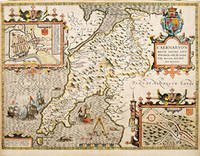
1627ref. 64225London. c. 1627. John Speed 1552-1629 is arguably the most famous name in early English cartography. In 1610 he published his wonderful and historic atlas 'The Theatre of Great Britain'. In 1627 he published another edition entitled 'A Prospect of The Most Famous Parts of The World' published in London by John Sudbury and George Humble. Speed based his maps on the earlier works done by Christopher Saxton and John Norden. His maps have always been keenly sought after as include many decorative features. Examples include: compass roses cherubs coats of arms mannerist style decoration prominent town plans stylish calligraphy and well defined regional physical features. John Speed's maps proved so popular that they were issued for many years after his death. This decorative and attractive example is of the Welsh county of Caernarvonshire. Size: 420 x 525 mm. Copperplate engraving with later hand colour. Fair to good condition. Repair to lower centrefold. Margins slim and 'chipped'. unknown
1623ref. 9847London George Humble 1623. Copper engraving image 38 x 50.5 cm sheet size 41.5 x 53 cm fine original hand colour blank verso. An unusual example: the map was coloured trimmed to the edge of the printed image and mounted on thick paper in the 17th century perhaps as part of a special commission from a wealthy patron. Typically surviving Speed maps have been extracted from atlases and have descriptive text on the verso. However some examples were sold as loose sheets without any text on the back sometimes the text was supplied as side panels on either side of the map and occasionally these were bound into atlases when supplies of a particular map had run out and these broadsheets were the only copies to hand. It is also possible that an entire atlas was created in this fashion. John Speed 1552-1629 is unquestionably the most significant English map-maker of the seventeenth-century. A brief note from Granger's Bibliographical History of England 1779 contains most of the information we have about Speed's life: "John Speed who was bred a Tailor was by the generosity of Sir Fulk Grevil his patron set free from a manual employment and enabled to pursue his studies to which he was strongly inclined by the bent of his genius. The fruits of them were his Theatre of Great Britain containing an entire set of maps of the counties drawn by himself his History of Great Britain richly adorned with seals coins & medals from the Cotton collection; and his Genealogies of Scripture first bound up with the Bible in 1611 which was the first edition of the present English translation. His maps were very justly esteemed & his History of Great Britain was in its kind incomparably more complete than all the histories of his predecessors put together ." The first edition of Speed's "Theatre" was published in 1612. It was the first atlas of the British Isles and the first attempt made by an Englishman to match the achievements of the great continental publishing houses - although much of the engraving of the copper plates was performed in Amsterdam by Jodocus Hondius. Speed was an antiquary and intended that his atlas should be read in conjunction with his history of Britain. He managed to include a great deal of historical detail on his 'modern' county maps and the inset town plans some surveyed by himself together comprise the first collection of town plans of the British Isles all in all making the Theatre a highly decorative as well as a useful volume. It was a great success and there were editions printed throughout the seventeenth-century. Map unknown
1676ref. 33174Bassett and Chiswell 1676. This map is from John Speed's The Theater of the Empire of Great Britaine with the english text on the back. Presenting well uniform toning later hand-coloring. Border strengthened at the back with acid free tape. 545 by 435mm 21½ by 17¼ inches. Bassett and Chiswell unknown
1646ref. 23403London: William Humble 1646. Other. In excellent condition. 384 by 514mm 15 by 20¼ inches. 384 by 514mm 15 by 20¼ inches. Copper engraving uncolored as published. William Humble unknown
1610ref. 247261Sudbury & Humble 1610. Map. Engraving with hand coloring. Image measures 15 x 20". This wonderfully decorated map depicts the island of Anglesey off the northwest coast of Wales. The island is centered on the map and labeled with towns rovers as well pictorial mountains and trees. A strapwork title cartouche features the coat of arms of England flanked by a lion and a unicorn. Below two elegant ships sail the beautifully patterned ocean surrounding an elaborate and colorful compass rose. In the lower left corner of the map showing part of Wales is an ornamental scale topped with strapwork cherubs a peacock and the country's coat of arms. A similar border frames the inset of Beaumaris in the upper right of the map which shows a plan of the port city labeled according to a key including its famous castle. The map appeared in Speed's atlas "The Theatre of the Empire of Great Britaine." It is in good condition with but margins are cropped. Expert repair to right corners. John Speed 1552-1629 is widely considered to be the most famous English cartographer of the 17th century. His atlas "The Theatre of the Empire of Great Britaine" contained the first set of individual county maps of England and Wales as well as significant town plans that are in many cases the first visual records of their subjects. This map of Anglesey is a beautiful example of his work. Sudbury & Humble unknown
1610ref. 247261Sudbury & Humble 1610. Map. Engraving with hand coloring. Image measures 15 x 20". This wonderfully decorated map depicts the island of Anglesey off the northwest coast of Wales. The island is centered on the map and labeled with towns rovers as well pictorial mountains and trees. A strapwork title cartouche features the coat of arms of England flanked by a lion and a unicorn. Below two elegant ships sail the beautifully patterned ocean surrounding an elaborate and colorful compass rose. In the lower left corner of the map showing part of Wales is an ornamental scale topped with strapwork cherubs a peacock and the country's coat of arms. A similar border frames the inset of Beaumaris in the upper right of the map which shows a plan of the port city labeled according to a key including its famous castle. The map appeared in Speed's atlas "The Theatre of the Empire of Great Britaine." It is in good condition with but margins are cropped. Expert repair to right corners. John Speed 1552-1629 is widely considered to be the most famous English cartographer of the 17th century. His atlas "The Theatre of the Empire of Great Britaine" contained the first set of individual county maps of England and Wales as well as significant town plans that are in many cases the first visual records of their subjects. This map of Anglesey is a beautiful example of his work. Sudbury & Humble unknown books
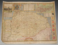
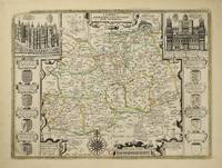
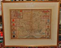
ref. 9128London: Henry Overton at the White Horse without Newgate. 1612-1743. No binding. Very Good. 380 x 510 mm. early outline colour in good condition. This map is by arguably the most famous English cartographer John Speed 1552-1629 and first published in the 'Theatre of the Empire of Great Britain' 1612. It was the first atlas of the whole British Isles. He was a tailor by trade and had a fascination for history. He used numerous sources for the counties and had the plates engraved by Jodocus Hondius in Amsterdam. The book took several years to prepare hence earlier dates appear on some. This issue is from the extremely rare post Bassett and Chiswell edition by Henry Overton in 'England Fully Described' 1743. Speed's maps are noted for being the first to include the boundaries of the hundreds and for introducing town plans on the maps. This includes inset views of Richmond and Nonsuch Palaces with Coats-of-arms at the sides. Following the Bassett and Chiswell edition of 1676 the plates were sold by Christopher Browne of which only a handful of examples bound together exist. Browne disposed of them it is believed in 1713 upon his retirement. Despite Skelton citing their ownership by Henry's father John Overton c.1700 the evidence appears otherwise. The date 1713 is arrived at by the fact that the last known advert by Browne was in the 'Daily Courant' 14 August 1712 and by 1715 his shop was occupied by George Willdey. Also in 1713 Henry Overton abandoned his scheme for a series of county maps and ceased production of newly engraved plates. There are four distinct issues by Overton over some thirty years. This is an example of 1743 edition of Overton following the removal of '1610' from Hondius' imprint lower left. Hodson 138; Shirley 2004 T.Spe 1n. Henry Overton at the White Horse without Newgate. 1612-[1743] unknown
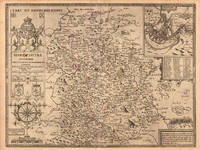
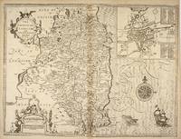
ref. 49671London: Tho. Bassett and Richard Chiswell. 1676. Original engraved map 38 x 51 cm. Uncoloured. Inset of Dubline. Good impression very light tanning to centre-fold minor crease at margin of lower right corner. London: Tho. Bassett and Richard Chiswell. [1676] unknown
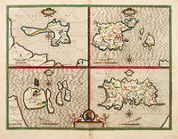
1646ref. 63961London. c. 1646. An excellent map by John Speed of the English Islands of: Farne and Holy Island off the Northumbrian coast; and the Channel Islands of Jersey and Guernsey. Each quatered map has a compass rose dividers and a mileage scale. Size: 430 x 550 mm. Copperplate engraving. Hand coloured. Good condition. Some minor staining to the centrefold and surrounding area. unknown
1918ref. 24648Reilly and Lee Company CHICAGO 1918. HBDJ 1918. Early Edition Hardcover. Book Condition: Very Good -. Dust Jacket Condition: FAIR AS-IS FADED. Light sunning to extremities cloth at head and tail of spine dust soil to block edges DJ with Campfire Girls series advertisement on rear panel FOX SOIL end with camp fire girls in Old Kentucky shows some wear with chipping at head and tail of spine and cornertips 3 1/2" closed tear at hinge of front flap some dust soil and sunning 255 pgsNO ADS in Back. Small 8vo with the DJ listing 5 titles on the rear flap ends with Mary Louise Adopts a Soldier. Full bound blue Decorated cloth with navy titles on front board and spine Cvr Light Wear. Some sunning to cloth at head and tail of spine light dust soil to block edges booksellers' stickers on front and rear pastedowns. DJ Shows significant wear with Tiny & Small Chips Extremities Edges Yet Titles in Blue & Faded Orange & Illustration INTACTInner flap DJ tiny chipping along all edges 1/2" chipped from head and tail of Darkened Spine DJ affects Titles & Publ sOmewhat some sunning and dust soil. Back DJ Soil Fox & Edge Chipping Yet Titles INTACT End with Camp Fire Girls at Hurricane Island Interior tight crisp and relatively clean FOX & WEAR. B/W Frontispiece by Alice Carsey of 5 Girls with FlagLike Dresses on Carry Banner Says Liberty Girls of Dorfield on Streets . Front Inner Flap DJ Taped Detached Priceclipped Blank Endpaper Small Stickers rub wear .This book was written to show what important tasks girls can/may accomplish when spurred on by patriotism. Mary wanted to do her Bit. so she organized Liberty Girls Formed Liberty Shop which in their capable Hands became one busiest spots in Dorfield. Sent thousands of useful presents to gallant soldiers of Uncle Sam. Mary busy Stomping out German Propaganda in city. etc. Hard Cover. Reilly and Lee Company CHICAGO hardcover
1997ref. 032510Collector Grade Publications 1997. Hardcover. Fine. Fine clean hard cover first edition with near fine dust jacket. Size: 8vo - over 7¾" - 9¾" Tall; Oblong Collector Grade Publications hardcover
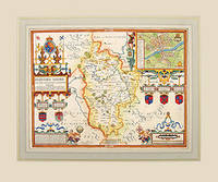
1627ref. 57319Theatre of the Empire of Great Britain published by Bassett and Chiswell. c. 1627. Speed's map of Bedfordshire embelished with four strapwork cartouches surrounding the town plan of Bedford the coats of arms of the Earls and Dukes of Bedford the title commentary and the scale. First published in 1611 today the work of John Speed is regarded highly by map collectors historians and artists due to the intricate nature and artistic beauty of the maps. Copper engraving. Fine condition. Mounted size: 71.5 x 60 cm Hand coloured. Size: 50 x 38.5 cm. 19½ x 15 inches unknown
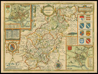
1627ref. 11770London: Performed by Iohn Speede and are to be sold by George Humble in ye Popes head alley 1627. 380 by 510mm. 15 by 20 inches. Engraved map with hand colouring. A beautifully coloured map of Northamptonshire with inset maps of Northampton and Peterborough and a vignette with text of the Battle of Edgecote Moor where Richard Neville Duke of Warwick defeated Edward IV during the Wars of the Roses. John Speed 1552-1629 was the outstanding cartographer of his age. His 'Theatre of Great Britain' was the first atlas of the British Isles: Speed prepared the maps himself about two years before they were published. His maps and books dominated the seventeenth-century English market. The present map is taken from the 1627 English edition published by George Humble. Chubb XXV. Performed by Iohn Speede and are to be sold by George Humble in ye Popes head alley, unknown
1921ref. 23510Reilly & Lee Chicago 1921. HARDBACK NODustJacket F-/VG NOJACKET SOLD AS-IS 1921 1st Edition Original Publishers Blue Lined Cloth lettered In Black Front & Back Nice condition with Spotting & FoXing on Spine Cover altho Title is Bright Interior Nice Tight Clean light FoX Wear 223 pgs .B/W Glossy Frontispiece of Josie & Mary Louise by Harry W. Armstrong . First Edition. Hard Cover. Reilly & Lee Chicago hardcover
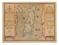
1610ref. 1082171610. London: John Speed circa 1610. 16 x 21" hand-colored map with decorative vertical borders containing elaborate strapwork cartouches mileage scales and dividers. Mounted edges slightly foxed and have tiny chips; very good. § Second state. The first map of the Island alone and the first based on actual survey was that of Thomas Durham of 1595 first published by Speed circa 1605 and reprinted many times over the next century. Illustrates the dispute over the Island by the four mythological beasts with riders holding the flags of the conflicting countries. unknown
1610ref. 1082171610. London: John Speed circa 1610. 16 x 21" hand-colored map with decorative vertical borders containing elaborate strapwork cartouches mileage scales and dividers. Mounted edges slightly foxed and have tiny chips; very good. § Second state. The first map of the Island alone and the first based on actual survey was that of Thomas Durham of 1595 first published by Speed circa 1605 and reprinted many times over the next century. Illustrates the dispute over the Island by the four mythological beasts with riders holding the flags of the conflicting countries. unknown books
1680ref. mon0000023721London: for R. Scot T. Baffet 1680. LATER EDITION. Small 4to. 54pp.i disbound recto of title-page repaired illustrated with two engravings one of which is a title-page vignette foredge of title-page chipped not affecting image or text. The poem celebrates a brawl in the Wood Street Compter or debtors' prison. The title-page vignette a copperplate illustrates a brawl; the other plate a full-page woodcut shows a scene at the gate of the prison. The date of the first edition of this work is uncertain but circa 1628 is guessed.rnWing S4896; Lowndes 2164; Grolier Whither to Prior 771. London: for R. Scot, T. Baffet, unknown
1632ref. 53668London: Printed by John Dawson for George Humble 1632. Third Edition revised and enlarged. Hardcover. Good-. Folio. 22 1042pp. 1043-1086 leaves 1087-1237 85pp. Contemporary calf backed in brown buckram manuscript lettering in white at spine. Frontispiece portrait engraving of John Speed by S. Savery mounted. Title page with publisher's device and double frame. Decorative and historiated head- and endpieces and initials. Revised enlarged and newly corrected with sundry descents of the Saxon Kings their marriages and arms. All pages framed in black with marginalia. A catalog of the religious houses colleges etc. in England Wales Scotland and Ireland. Illustrated with numerous woodcuts and genealogical tables throughout including coins coats of arms crests royal seals etc. Covers scuffed and worn at edges. Inked name on inside front cover; hinges reinforced with cream cloth tape. Frontispiece mounted and reinfored on verso at edges slightly ragged at gutter not affecting portrait or text. Few repairs with small pieces of tape in margins not affecting text. Last leaf of index reinforced with paper strip along fore-edge on front lettering slightly obscured on verso. Block lightly age-toned. Binding in overall fair interior in good engraving and woodcuts in very good condition. Third edition a variant of the 1631 edition published as a continuation of the author's Theatre of Great Britaine both works being listed in the table of contents. The foliated section ff. 1043-1086 contain A Catalogue of the Religious Houses Colleges and Hospitals Sometimes in England and Wales running title. ESTC S997. Printed by John Dawson for George Humble hardcover
1632ref. 53668London: Printed by John Dawson for George Humble 1632. Third Edition revised and enlarged. Hardcover. Good-. Folio. 22 1042pp. 1043-1086 leaves 1087-1237 85pp. Contemporary calf backed in brown buckram manuscript lettering in white at spine. Frontispiece portrait engraving of John Speed by S. Savery mounted. Title page with publisher's device and double frame. Decorative and historiated head- and endpieces and initials. Revised enlarged and newly corrected with sundry descents of the Saxon Kings their marriages and arms. All pages framed in black with marginalia. A catalog of the religious houses colleges etc. in England Wales Scotland and Ireland. Illustrated with numerous woodcuts and genealogical tables throughout including coins coats of arms crests royal seals etc. Covers scuffed and worn at edges. Inked name on inside front cover; hinges reinforced with cream cloth tape. Frontispiece mounted and reinfored on verso at edges slightly ragged at gutter not affecting portrait or text. Few repairs with small pieces of tape in margins not affecting text. Last leaf of index reinforced with paper strip along fore-edge on front lettering slightly obscured on verso. Block lightly age-toned. Binding in overall fair interior in good engraving and woodcuts in very good condition. Third edition a variant of the 1631 edition published as a continuation of the author's Theatre of Great Britaine both works being listed in the table of contents. The foliated section ff. 1043-1086 contain A Catalogue of the Religious Houses Colleges and Hospitals Sometimes in England and Wales running title. ESTC S997. Printed by John Dawson for George Humble hardcover books
1998ref. 032509Collector Grade Publications 1998. Hardcover. Fine. Fine clean hard cover first edition with fine dust jacket. Size: 8vo - over 7¾" - 9¾" Tall; Oblong Collector Grade Publications hardcover
ref. 78599London Fleet Street Thomas Bassett 1676. Framed size approx 28 x 23 inches. Engraved surfaces approx 20 x 15 ins. Double-glazed in gold wood frame with ivory mount behind glass. Front and Back. In very good condition. Some darkening/tanning to paper vertical centre crease. Some slight fading to print in some areas. Lovely bright crisp colouring. Very small tear to top l/h corner. Centre fold and edges darkened on rear side. Else a beautiful clean example. Original engraved map with hand colouring. Coloured letterpiece on rear side. London, Fleet Street, Thomas Bassett, 1676 unknown