Speed, JohnBiblio.com
1,309 results
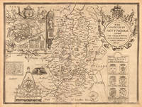
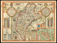
1646ref. 23423London: William Humble 1646. Other. In excellent condition. 383 by 514mm 15 by 20¼ inches. 383 by 514mm 15 by 20¼ inches. Copper engraving uncolored as published. William Humble unknown
1646ref. 23401London: William Humble 1646. Other. In excellent condition. 385 by 510mm 15¼ by 20 inches. 385 by 510mm 15¼ by 20 inches. Copper engraving uncolored as published. William Humble unknown
1646ref. 23402London: William Humble 1646. Other. In excellent condition. 387 by 512mm 15¼ by 20¼ inches. 387 by 512mm 15¼ by 20¼ inches. Copper engraving uncolored as published. William Humble unknown
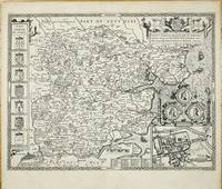
ref. 10906London: 1612. No binding. Good. FIRST EDITION. 390 x 520 mm. two minor margin tears repaired otherwise in good condition. FIRST EDITION. This attractive map of the county of Essex is by arguably the most famous English cartographer John Speed 1552-1629. It was published in the first edition of the 'Theatre of the Empire of Great Britain' 1612. It was the first atlas of the whole British Isles. He was a tailor by trade and had a fascination for history. He used numerous sources in this case John Norden 1547-1625 and had the plates engraved by Jodocus Hondius in Amsterdam. The book took several years to prepare hence earlier dates appear on some but in this case no earlier proof exists. His maps are noted for being the first to include the boundaries of the hundreds and for introducing town plans on the maps here being the city of Colchester. A fine dark impression. Skelton 1970 7. 1612 unknown
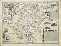
ref. 10905London: 1612. No binding. Good. FIRST EDITION. 390 x 510 mm. with light even toning otherwise in excellent condition. FIRST EDITION. This attractive map of the county of Hertfordshire is by arguably the most famous English cartographer John Speed 1552-1629. It was published in the first edition of the 'Theatre of the Empire of Great Britain' 1612. It was the first atlas of the whole British Isles. He was a tailor by trade and had a fascination for history. He used numerous sources in this case John Norden 1547-1625 and had the plates engraved by Jodocus Hondius in Amsterdam. The book took several years to prepare hence an earlier proof of this county exists. His maps are noted for being the first to include the boundaries of the hundreds and for introducing town plans on the maps here being the town of Hertford along with a plan of the roman town of Verolanium upper right. A fine dark impression. Hodson 1974 7.2; Skelton 1970 7. 1612 unknown
1665ref. 1789London: to be sould by Roger Rea the Elder and younger at the Golden Cross in Cornhill against the Exchange 1665. 410 by 550mm. 16.25 by 21.75 inches. Double-page engraved map fine contemporary outline hand colour upper left and right margins skilfully repaired margins reinforced with japan paper. The map bears the imprint of Roger Rea the Elder and Younger. The Reas had purchased the rights to Speed's work form William Garrett in 1659 who had previously purchased them from the widow of William Humble in the same year. Skelton suggests that the father and son intended a new edition of the atlas for the Restoration of 1660. However the atlas would appear not to have been published until 1665. This is borne out by an advertisement in the Term Catalogue by the subsequent owners of the plates Thomas Bassett and Richard Chiswell in 1675: "Mr John Speed's. Geography of the Kingdoms of England Scotland and Ireland. together with his Prospect. all in one entire Volume hath been for seven Years past out of Print the greatest part of an Impression then newly Printed being destroyed by the late dreadful Fire 1666". This is borne out by the rarity of the Rea edition of the atlas. There is evidence that they planned an edition of 1666 as there are impressions of Sussex Buckingham and Derby with Rea's imprint which bear that date. Rea would later sell the plates to Bassett and Chiswell who would publish a new edition in 1676. to be sould by Roger Rea the Elder and younger at the Golden Cross in Cornhill against the Exchange, unknown
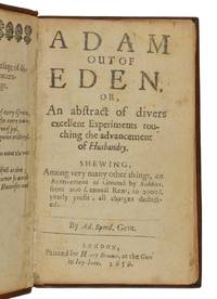
ref. 42597London: Printed for Henry Brome at the Gun in Ivy-lane 1659. First edition small 8vo 140 x 90 mm 8 163 i.e. 179 5pp. without final blank leaf page 179 misnumbered 163 the last leaf bears vertical half-title: Speeds husbandry woodcut headpieces leaf before title repaired at gutter a few leaves close-trimmed at top margin just affecting pagination a few closed tears some light toning and soiling recent full calf title direct on spine in gilt. The book details various experiments and methods for improving farming and land management. It includes a wide range of agricultural topics but is particularly known for an example of how to significantly increase the profits from land by using rabbit warrens which was claimed to increase the annual rent from £200 to £2000. Other chapters include Coles to be had at Pits near Nottingham to the Trent side and so by Boats to Newark Turnips on Devonshire lands and those grown at Hackney and Potatoes are excellent for making bread cakes paste and pyes. Wing S.4877; Henrey 349; Rothamsted p. 140; McDonald pp. 103-107; Schwerdt II 170; Fussell p.54. London: Printed for Henry Brome, at the Gun in Ivy-lane, 1659 unknown
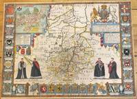
1676ref. M9963London: Thomas Bassett & Richard Chiswell c.1676. Very Good. Notes: Map shows 25 university armorials four scholars the Royal Crest and a plan of Cambridge. English text on verso. Size : 385x525 mm 15.16x20.67 Inches Coloring: Original Hand Coloring Category: Maps Europe United Kingdom England Counties; Thomas Bassett & Richard Chiswell, unknown
1933ref. 52594Chicago:: Buxton Publishing Co. 1933. First edition. publisher's cloth in pictorial dust jacket. 1944 ink gift inscription; otherwise very near fine in a jacket with numerous long splits and tears neatly reinforced with tissue on verso; and a number of one-inch chips. Folio. Illustrated from photographs throughout. Buxton Publishing Co., hardcover
1632ref. 26948London: Printed By John Dawson for George Humble and are to be Sold in Popes-head Pallace at the Figure of the White Horse 1632. Book. Good Plus. Full Leather. Third Edition. Folio. The Third Edition. Revised enlarged and newly corrected with sundry descents of the Saxon Kings Their Marriages and Armes. Pp. 10ff 1-1042 "A Catalogue of the Religious Houses Within the Realme of England and Wales with their Orders Founders Benefactors and Values ." beginning on page 1043 to p. 1086 comprising 128 pages but numbered on the rectos only 1087-1237 5 - Conclusion 80 - Index. Richly illustrated with wood engraved head and tail pieces initials coins coats of arms crests royal seals genealogies etc. text in two columns and with side-notes. Early probably early 18th-century binding in double gilt-framed light brown leather boards edges stained red. Modern leather rebacking in contrasting dark brown leather with gilt stamped dark brown leather spine label new plain endpapers. Covers scuffed else very good. Interior primarily clean and bright however does have occasional old faint tide-lines to either corners fore-edge or upper edge. Bottom quarter of 10th leaf excised possibly a contemporary handwritten note faint ink traces seen above the cut-line very occasional contemporary ink notes and corrections in margins page 11/12 wanting instead there are two page 15/16s very small and narrow wormhole from p. 663 to p. 682 still eminently readable with only loss of single letters lacks frontispiece portrait. Overall quite a good clean copy. Speed's 'History' was dedicated to James I and was first published in 1611 as a continuation of the 'Theatre of Great Britaine.' Although this book is complete in itself the first four books listed in the contents apply to The Theatre of the Empire of Great Britaine. ESTC S997. Printed By John Dawson for George Humble and are to be Sold in Popes-head Pallace at the Figure of the White Horse Hardcover
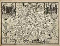
ref. 10353London: John Sudbury and George Humble. 1612. No binding. Good. FIRST EDITION. 380 x 510 mm. with small lower margin tear just into the neatline repaired light water stain to the upper centrefold otherwise a dark impression in good condition. FIRST EDITION. This map of Surrey is by arguably the most famous English cartographer John Speed 1552-1629 and was first published in the 'Theatre of the Empire of Great Britain' 1612. It was the first atlas of the whole British Isles. He was a tailor by trade and had a fascination for history. He used numerous sources for the counties and had the plates engraved by Jodocus Hondius in Amsterdam. The book took several years to prepare hence earlier dates appear on some. Speed's maps are noted for being the first to include the boundaries of the hundreds and for introducing town plans on the maps. This includes inset views of Richmond and Nonsuch Palaces with Coats-of-arms at the sides. Sharp 1929 p. 15; Shirley 2004 T.Spe 1b. John Sudbury and George Humble. 1612 unknown
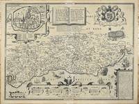
ref. 10899London: John Sudbury and George Humble. 1612. No binding. Good. FIRST EDITION. 385 x 510 mm. dark impression 1 cms. centrefold repair lower margin light even toning throughout otherwise in very good condition. FIRST EDITION. This attractive map of the county of Suffolk is by arguably the most famous English cartographer John Speed 1552-1629. It was published in the first edition of the 'Theatre of the Empire of Great Britain' 1612. It was the first atlas of the whole British Isles. He was a tailor by trade and had a fascination for history. He used numerous sources in this case John Norden 1547-1625 and had the plates engraved by Jodocus Hondius in Amsterdam. The map included many improvements over that of Norden's map which survives in just one known example at the Royal Geographical Society. Of note is the legend lower right describing the Battle of Hastings which commences 'William the Bastard Duke of Normandy .'. The book took several years to prepare hence earlier dates appear on some in this case Skelton cites one earlier proof exists. His maps are noted for being the first to include the boundaries of the hundreds and for introducing town plans on the maps here being the city of Chichester. A fine dark impression. Shirley 2004 T.Spe 1b; Skelton 1970 7; Worms & Baynton-Williams 2011. John Sudbury and George Humble. 1612 unknown
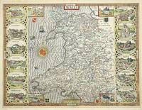
ref. 9137London: William Humble. 1612-46. No binding. Good. 385 x 515 mm. with recent outline and wash colour in good condition. This map is by arguably the most famous English cartographer John Speed 1552-1629. First published in the 'Theatre of the Empire of Great Britain' 1612. It was the first atlas of the whole British Isles. He was a tailor by trade and had a fascination for history. He used numerous sources for the counties and had the plates engraved by Jodocus Hondius in Amsterdam. This issue is from the 1646 edition published by William Humble. Speed's maps are noted for being the first to include the boundaries of the hundreds and for introducing town plans on the maps. Here we find on the left panel Beaumaris Carnarvan Harlieg Cardigan Penbrok and Carmarthen. The right side bears Denbigh Flint Montgomery Radnor Brecknok and Cardife. Booth p. 30; Evans 1964 p. 7; Roberts 1994 pp. 34-9; Shirley 2004 T.Spe 1g; Skelton 1970 48. William Humble. 1612-[46] unknown
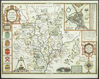
ref. 11764London: John Sudbury and George Humble. 1610-12. No binding. Good. FIRST EDITION. 385 x 515 mm. recent outline and wash colour two very small holes top and bottom of the centrefold just outside the borders otherwise in very good condition. John Speed's fine map of the county of Worcestershire from the first edition of his atlas the 'Theatre of the Empire of Great Britain'. The map is derived from that published by Christopher Saxton in 1577 and 'Augmetr: and published by John Speede citize of London' by the addition of boundaries. The source for much of this information was the Parliamentary Rolls'. Roads are not yet identified. A fine town plan of Worcester is provided as an inset. It is the first known plan of the town and believed to be the work of Speed himself. The draft manuscripts for many of these reside at Merton College Oxford. The atlas provided the first comprehensive collection of English town plans some the earliest of their kind. A battle scene below describes the Battle of Evesham of 1265 in which Simon de Montfort Earl of Leicester was defeated and killed by the forces of Henry III. Five coats of arms of nobles in the county flank the left border. John Speed 1552-1629 is the best known and among collectors the most popular British cartographer. He was like his father a tailor by trade with a passion for history. On joining the Society of Antiquaries he took his first steps towards the compilation of the atlas that has placed him among the cartographic immortals. In 1611 he produced the 'History of Great Britain' and his atlas the 'Theatre of the Empire of Great Britain' was published to accompany it. The 'Theatre .' was the first atlas of the British Isles ever produced containing sixty-seven maps which in addition to the counties of England and Wales also included general maps of the Heptarchy England in Anglo-Saxon times Great Britain and Ireland England Wales Scotland and the Provinces of Ireland together with maps of the Isles of Wight and Man and the Channel Islands. Preparation for the atlas took several years and the maps are all engraved by Jodocus Hondius in Amsterdam. Bendall Sarah 2002 'Draft Town Maps for John Speed's 'Theatre of the Empire of Great Britaine'' in Imago Mundi 54 pp. 30-45; Hind 1952-64 II pp. 67-95; Schilder MCN VII pp. 481-2; Schilder 2008 VIII pp. 165-70; Shirley 2004 T.SPE-1b; Skelton 1966; Skelton 1970 7; Tooley 1977; Worms & Baynton-Williams 2011. John Sudbury and George Humble. 1610-[12] unknown
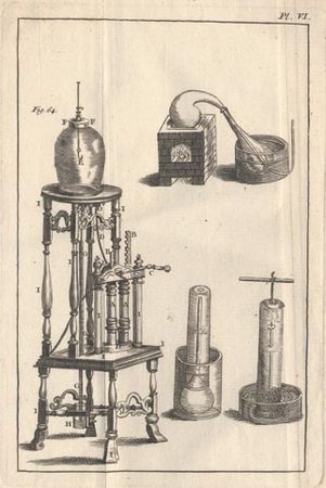
1742ref. 2698Paris, David Fils, 1742 ; in-8 ; plein veau marbré, dos à nerfs décoré, pièce de titre grenat, tranches rouges (reliure de l'époque) ; XVI pp., 458 pp., (5) ff. de table, (2) pp. (explication des parties de la machine pneumatique), (1) f. de privilège ; vignette de titre gravée par Duflos et 6 planches dépliantes.
1676ref. LBW-7057Londres, Thomas Bassett and Richard Chiswell, [1676]. 402 x 522 mm.
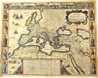
1676ref. M10992London 1676. Very Good. Notes: English text on verso. Map of the Roman Empire it is surrounded by views of the cities of Geneva Rome Jerusalem Venice and Constantinople and Alexandria and figures displaying the customary dress of Italians Egyptians Turks and Spaniards with their wives. John Speed 1552 –1629 was an English cartographer and historian. He is known as England's most famous Stuart period mapmaker. His maps of English counties are often found framed in homes throughout the United Kingdom. For a series of maps Speed partnered with Dutch engraver Jodocus Hondius. Size : 393x509 mm 15.47x20.04 Inches Coloring: Original Hand Coloring Category: Maps Europe Continent; Maps Asia Continent; unknown
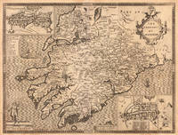
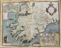
1627ref. M10917London 1627. Good backed on acid free tissue paper for long term preservation. Notes: Map of the Province of Munster with inset maps of Cork and Limerick. John Speed was a renown British cartographer 'Theatre of Great Britain' was the first atlas of the British Isles. Munster Old Irish Muma the southwestern province of Ireland comprising the counties of Clare Cork Kerry Limerick Tipperary and Waterford. Size : 388x506 mm 15.28x19.92 Inches Coloring: Hand Colored Category: Maps Europe Ireland; unknown
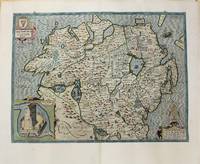
1627ref. M10918London 1627. Good backed on acid free tissue paper for long term preservation. Notes: John Speed map of The Province Ulster in Northern Ireland with an inset showing Enis Kelling Fort Fort of Enniskillen. John Speed was a renown British cartographer 'Theatre of Great Britain' was the first atlas of the British Isles. Size : 382x515 mm 15.04x20.28 Inches Coloring: Hand Colored Category: Maps Europe Ireland; unknown
1971ref. mon0000459675Angus and Robertson 1971T. paperback. Good. in x in x in. Ex-library book usual marking. Clean copy in good condition. Angus and Robertson paperback
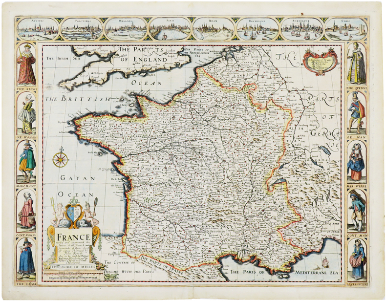
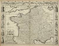
ref. 5318London: Sold by Tho:Bassett in Fleetstreet and Richard Chiswell in St. Pauls Church Yard. 1627-76. No binding. Very Good. 410 x 525 mm. in excellent condition. A very attractive example from the most prestigious English world atlas of the seventeenth century by John Speed 1552-1629. The carte-a-figures panels at the side depict various national dress from those of the King and Queen at the top to tradesmen. The top of the map bears eight views of French towns including Angiers Poictiers Poitiers Orleans Paris Roan Rochelle Bordeaux and Calis Calais. The whole is engraved by Dirck Gryp who signs the plate bottom centre. Speed is the most famous of all the English map-makers. His two most celebrated publications are 'The Theatre of the Empire of Great Britain' covering the British Isles first published in 161112 and the 'Prospect of the Most Famous Parts of the World' first published in 1627. Speed was a tailor by profession with a great interest in history and maps. He wanted to produce an English atlas of the same high standards and quality as those published on the continent. The 'Prospect of the Most Famous Parts of the World' was published in 1627 two years before the death of Speed. Ownership of the atlas passed through various hands until sometime after 1668 when Roger Rea sold the rights to Thomas Bassett and Richard Chiswell. Bassett was a specialist in legal books and Chiswell was the publisher for the Royal Society. The final 1676 edition of the 'Prospect' includes eight further maps on seven sheets appearing for the first and only time. Phillips 'Atlases' 488; Shirley BL T.Spe 1j; Skelton 92; Wing S4886. Sold by Tho:Bassett in Fleetstreet and Richard Chiswell in St. Pauls Church Yard. 1627-[76] unknown
1676ref. 53206The Theatre of the Empire of Great Britain. T Bassett & R Chiswell. 1676. A very attractive map of Suffolk with inset of Ipswich enclosed in an elegant border. On the right of this is a pictorial reference to Bodicia Queen of the Iceni who occupied the area today known as East Anglia. On the left stands a Roman General. Numerous coats of arms of the Dukes and Earles of Suffolk and Clare adorn either side. At the bottom left a cherub holds dividers over the scale on the right a cupid holds a wind rose. Copper engraving. Fine condition good margins but some slight offsetting. Mounted size: 72 x 60 cm. Hand coloured. Size: 51 x 38 cm. 20 x 15 inches. unknown
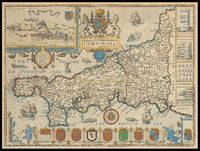
1710ref. 21976London: And Now Sold by Henry Overton at the White Horse without Newgate London 1710-1743. 385 by 510mm. 15.25 by 20 inches. Speed's map of Cornwall Double-page engraved map with hand colour. A map of Cornwall from one of the Overton editions of the first large-scale atlas of the British Isles Speed's 'Theatre'. In the top left-hand corner is a prospect of 'Launceston or Ancient Dunhevet'. Along the right-hand side of the map four antiquities are illustrated including the Hurlers Stones which according to legend are men petrified for playing hurling on a Sunday. The sea around the peninsula is filled with sea-monsters and ships. John Speed 1552-1629 was the outstanding cartographer of his age. By trade a merchant tailor but by proclivity a historian it was the patronage of Sir Fulke Greville poet and statesman that allowed him to pursue this interest in earnest. His 'Theatre of Great Britain' from which the present work is drawn was first published in 1611 or 1612 and is 'the earliest English attempt at atlas-production on a grand scale' Skelton. Drawing heavily on the work of Saxton and Norden little of Speed's cartography is original he acknowledges 'I have put my sickle into other mens corne' instead it is his blend of cartography and history incorporating town-plans vignettes and genealogy that makes Speed an innovator. This map is from one of the editions of the 'Prospect' published by Henry Overton between ca. 1710 and 1743. Unlike in earlier editions the verso of the maps tend to be blank. And Now Sold by Henry Overton at the White Horse without Newgate London,
1986ref. 14185E Rutherford New Jersey U.S.A.: Putnam Pub Group. New. Hardcover. FREE UPGRADE to Courier/Priority Shipping Upon Request - IN STOCK AND IMMEDIATELY AVAILABLE FOR SHIPMENT - -- with a bonus offer--; 014185; AUTHORS AMERICAN GUILLAIN BARRE SYNDROME . 1986. 0399130861 . Putnam Pub Group hardcover
1971ref. 28242Louisville KY: J. B. Speed Art Museum. As New. Paperback. FREE UPGRADE to Courier/Priority Shipping Upon Request - IN STOCK AND IMMEDIATELY AVAILABLE FOR SHIPMENT - AS NEW THE TEXT BLOCK IS PRISTINE CLEAN UNMARKED AND IN EXCELLENT CONDITION - . Light creasing curling and smudging to covers. -- with a bonus offer--; T-SPEEDMONUM . 1971. J. B. Speed Art Museum paperback