|
Schweiger-Lerchenfeld, Amand Freiherr von
Atlas der Himmelskunde auf Grundlage der Ergebnisse der coelestischen Photographie. 62 Kartenblätter (mit 187 Einzeldarstellungen) und 67 Folio-Bogen. [Von Amand Freiherr von Schweiger-Lerchenfeld].
Wien, Pest & Leipzig: A. Hartleben 1898. 259 Seiten (= 67 Folio-Bogen), 62 Blätter. Mit ca. 540 Abbildungen. 2° (40 x 29 cm). Orig.-Leinenband. [Hardcover / fest gebunden].
Bookseller reference : 3111265

|
|
|
Schweinfurth, U.. Flohn, H.. Domrös, M
Studien zur Klimatologie des südasiatischen Raumes. / Studies in the Climatology of South Asia.
Wiesbaden., Franz Steiner Verlag., 1970. Herausgegeben vom: Südostasien-Institut, Univerität Heidelberg, Institut für Geographie. (South Asia Institute, Heidelberg University, Department of Geographie). 16 Seiten Text (darin eine umfangreiche Bibliographie), 15 farbige Karten, davon eine Folienkarte (eingeordnet).Inhalt: Klimatologische Forschungen im Südasien-Institut der Universität Heidelberg. Studien zur synoptischen Klimatologie des Indo-Pakistanischen Subkontinments. Ein Niederschlagsatlas des Indo-Pakistanischen Subkontinents nach Regentagen.; Zustand: Großformatiger Ringordner mit eingelegten Blättern, aus einer Institutsbibliothek ausgeschieden, unterer Rücken mit Kleberesten eines entfernten Aufklebers, Titelblatt mit Bibliotheksstempel. 56 x 48 cm OLeinen.
Bookseller reference : 048994
|
|
|
Schweizerische Verkehrszentrale Lausanne und Z?rich (Hrsg.)
Die Schweiz - Taschenatlas f?r den Automobilisten.
Bern, K?mmerly & Frey, o. J. [um 1934]. original kartoniert, 8?, 16 S., 32 S. Karten und Index; Zustand: gut +, Bunstiftnummern auf Umschlag
Bookseller reference : K-1880

|
|
|
Schweizerischer Blindenverband (Hg.)
Taschen - Weltatlas.
Kümmerly & Frey Verlag. 8° klein, mit 32 Länder-Karten Einband min. beschabt und bestoßen, altersbedingte Bräunungen, ger. Gebr.sp., kartoniert
Bookseller reference : 8339
|
|
|
Schwier, Werner et al. (Hg.)
Atlas Filmhefte. - [84 Ausgaben]. -
Duisburg [später Frankfurt am Main]:, Atlas-Filmverleih [später Osterrieth], o.J. (1961-1969). 84 Hefte; jeweils 16-20 Seiten, OHftgen., 20 x 23 cm (quer).
Bookseller reference : 99278HB

|
|
|
Schäfer, Friedhelm, und Werner H. Veith
Die Kartenthemen der Lautatlanten : eine vergleichende Dokumentation zum deutschen Sprachraum in Europa.
Tübingen : Niemeyer, 1989. VII, 91 S. Gr. 8°. OBroschur. (Studien zum Kleinen Deutschen Sprachatlas ; 3)
Bookseller reference : 30620
|
|
|
Schönfelder, Peter (Herausgeber)
Verbreitungsatlas der Farn- und Blütenpflanzen Bayerns : für die Bayerische Botanische Gesellschaft zum 100jährigen Jubiläum und die Regensburgische Botanische Gesellschaft zum 200jährigen Jubiläum.
Stuttgart : Ulmer, 1990. 752 S. : graph. Darst., Kt. ; 30 cm + Folienkt.-Beil. (8 Bl.) Fol. , Leinen mit OU in Pappschuber
Bookseller reference : 136886

|
|
|
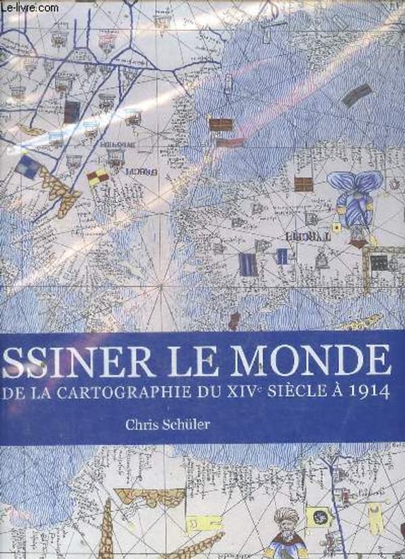
Schüler Chris
Dessiner le monde - Atlas de la cartographie du XIVe siècle à 1914.
Editions place des victoires. 2010. In-Folio. Relié. Bon état, Couv. convenable, Dos satisfaisant, Intérieur frais. 383 pages - nombreuses cartes en couleurs hors texte - tranches dorées - jaquette en bon état - étiquette collée sur la page de garde.. Avec Jaquette. . . Classification Dewey : 912-Atlas, cartes et plans
Bookseller reference : R100059466
|
|
|
Scobel (Hrsg.), A
Andrees allgemeiner Handatlas in 126 Haupt- und 137 Nebenkarten. Vierte, völlig neu bearbeitete und vermehrte Auflage
Bielefeld, Verlag von Velhagen & Klasing, 1899. 186 Tafn. + 179 S. 2° Folio, Leinen
Bookseller reference : 92494

|
|
|
Scobel, A
Velhagen und Klasings neuer Volks- und Familienatlas.
Velhagen & Klasing, Bielefeld 1901. Mit 100 farbigen Kartenseiten. Folio. Geprägte OLwd. Rücken an den Gelenken beschädigt. Einbandkanten berieben.
Bookseller reference : 22705
|
|
|
Scobel, A. Prof. (Hrg.)
Andrees Allgemeiner Handatlas - Jubiläumsausgabe. in 139 Haupt- und 161 Nebenkarten nebst vollständigem alphabetischem Namensverzeichnis. - Jubiläumsausgabe -
Bielefeld, Verlag Velhagen & Klasing, 1906. 5. völlig neu bearbeitete und vermehrte Auflage - 1. Abdruck. mit 126 mehrfarbigen Haupt-Karten nebst weiteren 137 Karten. ill. OHLdr., 207 doppelblattgroße Kartenseiten + 188 (2) S. Register, 2° [3 Warenabbildungen]
Bookseller reference : 14659

|
|
|
Scobel, A. Prof. (Hrg.)
Andrees Allgemeiner Handatlas - Jubiläumsausgabe. in 126 Haupt- und 137 Nebenkarten nebst vollständigem alphabetischem Namensverzeichnis. - Jubiläumsausgabe -
Bielefeld, Verlag Velhagen & Klasing, 1906. 5. völlig neu bearbeitete und vermehrte Auflage mit 126 mehrfarbigen Haupt-Karten nebst weiteren 137 Karten. ill. OHLdr., 207 doppelblattgroße Kartenseiten + 188 (2) S. Register, 2° [8 Warenabbildungen]
Bookseller reference : 15503

|
|
|
Scobel, A. Prof. (Hrg.)
Andrees Allgemeiner Handatlas Ausgewählte, völlig neue bearbeitete Ausgabe in einem Bande von Dr. Konrad Frenzel.
Bielefeld, Verlag Velhagen & Klasing, 1937. [9. völlig neu bearbeitete und vermehrte Auflage] mit 100 mehrfarbigen Haupt-Karten nebst weiteren 211 Neben-Karten. (blaue) ill. OLwd., vii, 16 S., 100 doppelblattgroße Kartentafeln, 122 S. Index, 2° [2 Warenabbildungen]
Bookseller reference : 14670

|
|
|
Scobel, A. Prof. (Hrg.)
Andrees Allgemeiner Handatlas in 228 Haupt- und 211 Nebenkarten nebst vollständigem alphabetischem Namensverzeichnis in separatem Band.
Bielefeld, Verlag Velhagen & Klasing, 1928. 8. völlig neu bearbeitete und vermehrte Auflage - Vierter Abdruck. mit 224 gefalteten doppelblattgroßen Kartentafeln (mit Leinenfalz) (dunkelblaues) ill. OHLdr.(Schmuckvorsätze), 6; 224 Tafeln + VI; 634 S.( Register), 2° bzw. 4° (2 Bände zus.)
Bookseller reference : 5138

|
|
|
Scobel, A. Prof. (Hrg.)
Andrees Allgemeiner Handatlas. BUCHKASTEN ! in 90 Hauptkarten mit 140 Nummern nebst sep. vollständigem alphabetischen Namensverzeichnis. (dieses fehlt)
Bielefeld, Verlag Velhagen & Klasing, 1893. 3. völlig neu bearbeitete und stark vermehrte Auflage. ill. OHLdr.-Buchkasten, 140 lose beiliegende doppelblattgroße Kartenseiten,, 2° (30,5 x 45,5 cm) [3 Warenabbildungen]
Bookseller reference : 15210

|
|
|
Scobel, Albert
Andrees allgemeiner Handatlas. 5. Aufl. In 139 Haupt- und 161 Nebenkarten nebst vollständigem alphabetischem Namenverzeichnis. Jubiläumsausgabe. Herausgegeben von Prof. A. Scobel 5. völlig neu bearbeitete und vermehrte Auflage. - zweiter revidierter Abdruck
Bielefeld, Leipzig, Velhagen & Klasing 1907. Folio. 207 Bll. ( Karten) / 186 S.(Register) Gebundene Ausgabe, Rücken beschabt oder bestoßen, Rücken an den Kapitalen angeplatzt und rissig, Buchblock und Karten in gutem Zustand.
Bookseller reference : 61958

|
|
|
Scott W. Atlas MD
In Excellent Health: Setting the Record Straight on America's Health Care Hoover Institution Press Publication
Hoover Institution Press. Hardcover. GOOD. Spine creases wear to binding and pages from reading. May contain limited notes underlining or highlighting that does affect the text. Possible ex library copy that’ll have the markings and stickers associated from the library. Accessories such as CD codes toys may not be included. Hoover Institution Press hardcover
Bookseller reference : 3189956080 ISBN : 0817914447 9780817914448

|
|
|
Scott W. Atlas
In Excellent Health : Setting the Record Straight on America's Health Care
Hoover Institution Press 2012. Hardcover. Good. Disclaimer:A copy that has been read but remains in clean condition. All pages are intact and the cover is intact. The spine may show signs of wear. Pages can include limited notes and highlighting and the copy can include previous owner inscriptions. An ex-library book and may have standard library stamps and/or stickers. At ThriftBooks our motto is: Read More Spend Less.Dust jacket quality is not guaranteed. Hoover Institution Press hardcover
Bookseller reference : G0817914447I3N10 ISBN : 0817914447 9780817914448

|
|
|
Scott W. Atlas MD
In Excellent Health: Setting the Record Straight on America's Health Care Hoover Institution Press Publication Hardcover
2012-07-07. Good. Ships with Tracking Number! INTERNATIONAL WORLDWIDE Shipping available. May not contain Access Codes or Supplements. May be re-issue. May be ex-library. Shipping & Handling by region. Buy with confidence excellent customer service! unknown
Bookseller reference : 0817914447q ISBN : 0817914447 9780817914448

|
|
|
Scott W. Atlas MD
In Excellent Health: Setting the Record Straight on America's Health Care Hoover Institution Press Publication Hardcover
2012-07-07. New. Ships with Tracking Number! INTERNATIONAL WORLDWIDE Shipping available. May be re-issue. Buy with confidence excellent customer service! unknown
Bookseller reference : 0817914447n ISBN : 0817914447 9780817914448

|
|
|
Scott W. Atlas MD
In Excellent Health: Setting the Record Straight on America's Health Care Hoover Institution Press Publication
Hoover Institution Press 2012-01-03. Hardcover. Used:Good. Hoover Institution Press hardcover
Bookseller reference : DADAX0817914447 ISBN : 0817914447 9780817914448
|
|
|
Scott W. Atlas
Magnetic Resonance Imaging of the Brain and Spine
Lippincott Williams & Wilkins. Used - Very Good. Former Library book. Great condition for a used book! Minimal wear. Lippincott Williams & Wilkins unknown
Bookseller reference : GRP115465838 ISBN : 078176985x 9780781769853

|
|
|
Scott W. Atlas
Magnetic Resonance Imaging of the Brain and Spine : Head and Neck
Lippincott Williams & Wilkins 2001. Hardcover. Good. Disclaimer:A copy that has been read but remains in clean condition. All pages are intact and the cover is intact. The spine may show signs of wear. Pages can include limited notes and highlighting and the copy can include previous owner inscriptions. At ThriftBooks our motto is: Read More Spend Less.Dust jacket quality is not guaranteed. Lippincott Williams & Wilkins hardcover
Bookseller reference : G0781720362I3N00 ISBN : 0781720362 9780781720366

|
|
|
Scott W. Atlas
Magnetic Resonance Imaging of the Brain and Spine
Lippincott Williams & Wilkins. Used - Good. Ships from the UK. Former Library book. Shows some signs of wear and may have some markings on the inside. 100% Money Back Guarantee. Your purchase also supports literacy charities. Lippincott Williams & Wilkins unknown
Bookseller reference : GRP115033631 ISBN : 078176985x 9780781769853
|
|
|
Scott W. Atlas
Magnetic Resonance Imaging of the Brain and Spine
Lippincott Williams & Wilkins 1990. Hardcover. Good. Disclaimer:A copy that has been read but remains in clean condition. All pages are intact and the cover is intact. The spine may show signs of wear. Pages can include limited notes and highlighting and the copy can include previous owner inscriptions. At ThriftBooks our motto is: Read More Spend Less.Dust jacket quality is not guaranteed. Lippincott Williams & Wilkins hardcover
Bookseller reference : G0881676942I3N00 ISBN : 0881676942 9780881676945

|
|
|
Scott W. Atlas MD. M. D.
Magnetic Resonance Imaging of the Brain and Spine 2 Vol Set Volume 1
Lippincott Williams and Wilkins 2001. Volume 1. This is an ex-library book and may have the usual library/used-book markings inside.This book has hardback covers. In good all round condition. No dust jacket. Please note the Image in this listing is a stock photo and may not match the covers of the actual item2550grams ISBN:9780781720366 Lippincott Williams and Wilkins hardcover
Bookseller reference : 5139729 ISBN : 0781720362 9780781720366

|
|
|
Scott W. Atlas
Magnetic Resonance Imaging of the Brain and Spine
2016-02-07. New. Ships with Tracking Number! INTERNATIONAL WORLDWIDE Shipping available. May be re-issue. Buy with confidence excellent customer service! unknown
Bookseller reference : 1469873206n ISBN : 1469873206 9781469873206

|
|
|
Scott W. Atlas
Magnetic Resonance Imaging of the Brain and Spine 2 Vol Set
Lippincott Williams and Wilkins 2001. This is an ex-library book and may have the usual library/used-book markings inside.This book has hardback covers. In fair condition suitable as a study copy. No dust jacket. Please note the Image in this listing is a stock photo and may not match the covers of the actual item2650grams ISBN:9780781720366 Lippincott Williams and Wilkins hardcover
Bookseller reference : 4534823 ISBN : 0781720362 9780781720366
|
|
|
Scott W. Atlas Editor
Magnetic Resonance Imaging of the Brain and Spine
Raven Pr 1991-01-01. Hardcover. Used:Good. Raven Pr hardcover
Bookseller reference : DADAX0881676942 ISBN : 0881676942 9780881676945

|
|
|
Scott W. Atlas Editor
Magnetic Resonance Imaging of the Brain and Spine
Lippincott Williams & Wilkins 1996-01-15. 2 Sub. Hardcover. Used:Good. Lippincott Williams & Wilkins hardcover
Bookseller reference : DADAX0781702828 ISBN : 0781702828 9780781702829

|
|
|
Scott W. Atlas
Magnetic Resonance Imaging of the Brain and Spine 2 Volume Set
Lippincott Williams & Wilkins 2002-01-15. Third. Hardcover. Used:Good. Lippincott Williams & Wilkins hardcover
Bookseller reference : DADAX0781720362 ISBN : 0781720362 9780781720366
|
|
|
Scott W. Atlas
MRI of the Brain and Spine
Lippincott Williams & Wilkins . U. New. Lippincott Williams & Wilkins unknown
Bookseller reference : 647986867 ISBN : 0781714451 9780781714457
|
|
|
Scott W. Atlas Richard T. Kaplan
Pocket Atlas of Cranial Magnetic Resonance Imaging
LWW. Used - Very Good. Great condition for a used book! Minimal wear. LWW unknown
Bookseller reference : GRP66285164 ISBN : 0781735734 9780781735735

|
|
|
Scott W. Atlas; Richard T. Kaplan
Pocket Atlas of Cranial Magnetic Resonance Imaging
Lippincott Williams & Wilkins 2001-09-15. Paperback. Good. Lippincott Williams & Wilkins paperback
Bookseller reference : SONG0781735734 ISBN : 0781735734 9780781735735
|
|
|
Scott W. Atlas
Power to the Patient: Selected Health Care Issues and Policy Solutions
Paperback. New. The debate rages on over how to cope with the rising costs of medical care - proposed solutions range from a single payer system with a broad government control to loosely defined market-driven plans. The authors look at three key elements of health care costs and offer thoughtful realistic suggestions to help stem the tide of rising expenses for everyone. paperback
Bookseller reference : A9780817945923 ISBN : 081794592x 9780817945923

|
|
|
Scott W. Atlas
Power to the Patient: Selected Health Care Issues and Policy Solutions HOOVER INST PRESS PUBLICATION
Hoover Institution Press 2005-02-25. Paperback. Used:Good. Hoover Institution Press paperback
Bookseller reference : DADAX081794592X ISBN : 081794592X 9780817945923

|
|
|
Scott W. Atlas
POWER TO THE PATIENT HOOVER INST PRESS PUBLICATION
Hoover Institution Press 2005-02-25. Paperback. Good. Hoover Institution Press paperback
Bookseller reference : SONG081794592X ISBN : 081794592X 9780817945923
|
|
|
Scott W. Atlas MD
Reforming America's Health Care System: The Flawed Vision of ObamaCare Hoover Institution Press Publication
Hoover Institution Press. Used - Good. Ships from Reno NV. Shows some signs of wear and may have some markings on the inside. 100% Money Back Guarantee. Shipped to over one million happy customers. Your purchase benefits world literacy! Hoover Institution Press unknown
Bookseller reference : GRP90310556 ISBN : 0817912746 9780817912741

|
|
|
Scott W. Atlas MD
Reforming America's Health Care System: The Flawed Vision of ObamaCare Hoover Institution Press Publication
Hoover Institution Press. Used - Very Good. Great condition for a used book! Minimal wear. Hoover Institution Press unknown
Bookseller reference : GRP70448692 ISBN : 0817912746 9780817912741
|
|
|
Scott W. Atlas MD Editor
Reforming America's Health Care System: The Flawed Vision of ObamaCare HOOVER INST PRESS PUBLICATION
Hoover Institution Press 2010-10-22. Hardcover. Used:Good. Hoover Institution Press hardcover
Bookseller reference : DADAX0817912746 ISBN : 0817912746 9780817912741
|
|
|
Scott W. Atlas
Restoring Quality Health Care: A Six-Point Plan for Comprehensive Reform at Lower Cost Hoover Institution Press Publication
2016-03-04. Good. Ships with Tracking Number! INTERNATIONAL WORLDWIDE Shipping available. May not contain Access Codes or Supplements. May be re-issue. May be ex-library. Shipping & Handling by region. Buy with confidence excellent customer service! unknown
Bookseller reference : 0817919449q ISBN : 0817919449 9780817919443

|
|
|
Scott W. Atlas
Restoring Quality Health Care: A Six-Point Plan for Comprehensive Reform at Lower Cost Hoover Institution Press Publication
2016-03-04. New. Ships with Tracking Number! INTERNATIONAL WORLDWIDE Shipping available. May be re-issue. Buy with confidence excellent customer service! unknown
Bookseller reference : 0817919449n ISBN : 0817919449 9780817919443

|
|
|
SCULLARD (H. H.).
Petit Atlas de l'Antiquité classique.
Bruxelles, Sequoia, 1963, in-8°, 240 pp, 14 cartes hors texte en couleurs, 234 photos reproduites en héliogravure, figures, cartes et plans dans le texte, index, reliure souple illustrée de l'éditeur, pt accroc au dos, bon état
Bookseller reference : 22917
|
|
|
SCULLARD H.H.
PETIT ATLAS DE L'ANTIQUITE CLASSIQUE
SEQUOIA. 1963. In-8. Broché. Bon état, Couv. convenable, Dos satisfaisant, Intérieur frais. 240 pages - nombreuses photos, cartes et illustrations en noir et blanc et en couleurs dans et hors texte - 1 carte en couleur sur les contre-plats.. . . . Classification Dewey : 912-Atlas, cartes et plans
Bookseller reference : RO20187511
|
|
|
Seager, Joni. (Hrsg.)
Der Öko-Atlas. Aus dem Englischen von Volker Englisch (Text) und Walter Erlenbach (Karten). Deutsche Erstausgabe. Mit 37 Karten, meist auf Doppeltafeln sowie Ländertabellen mit Statistiken.
Bonn, Dietz Nachf., 1992. Gr.-8°. [24,5 x 17,5 cm]. 128 Seiten. Mit einem Register. Farbig illustrierter Originalkarton. - Ein sehr gut erhaltenes, annähernd neuwertiges Exemplar ohne Eintraungen. 2. durchgesehene Auflage.
Bookseller reference : 18144AB

|
|
|
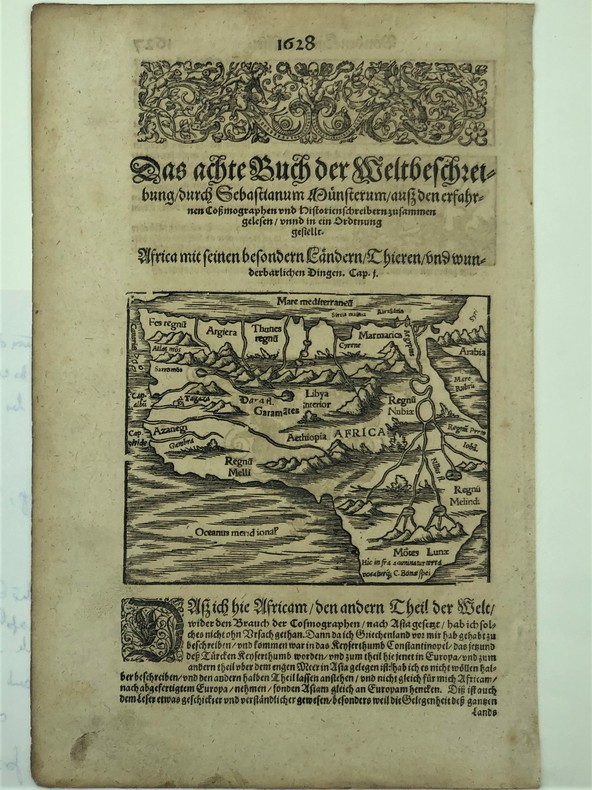
SEBASTIEN MUNSTER
Afrique par Sébastien Munster extrait de la Cosmographie universelle (XVIe).
Afrique par Sébastien Munster extrait de la Cosmographie universelle (XVIe). une feuille(340x217mm) représentant l'Afrique (155x125mm)avec un bandeau et une lettrine,au verso deux vignettes représentant un grand oiseau picorant un cadavre humain,un griffon attaquant un chevalier .Illustrations d'une édition de Sebastian Münster, 'Cosmographia', probablement imprimée par Petri à Bâle, c.1544-52
Bookseller reference : PHO-418
|
|
|
SECRETARIA DE OBRAS PUBLICAS
Mexico. Mapa turistico de carreteras. Tourist Road Map.
CHEZ L'AUTEUR. 1971. In-8. En feuillets. Bon état, Couv. convenable, Dos satisfaisant, Intérieur frais. Carte et plans dépliants, illustrés en couleurs, de 78 / 93 cm. Légendes en espagnol.. . . A l'italienne. Classification Dewey : 912-Atlas, cartes et plans
Bookseller reference : RO80133215
|
|
|
Sedlmeier, Anton, Joachim Vossen und Karl Maag
Stadtatlas Regensburg. Eine Veröffentlichung der Regensburger Kulturstiftung der REWAG
Regensburg: Friedrich Pustet Verlag, 2006. 27,5 x 27,5 cm ; Pp.
Bookseller reference : 102116

|
|
|
Seedorf, Hans Heinrich / Meyer, Hans-Heinrich
Landeskunde Niedersachsen. Natur- und Kulturgeschichte eines Bundeslandes. Hrsg. im Auftr. des Niedersächsischen Landtages. 2 Bde. (= komplett).
Neumünster, Wachholtz, 1992/1996. 517; 896 S. Mit graph. Darstellungen, Abb. und Ktn. 29 cm. OLn. m. SU.
Bookseller reference : 98273

|
|
|
Seeger, Wolfgang
Atlas of Topographical Anatomy of the Brain and Sourrounding Structures for Neurosurgeons, Neuroradiologists, and Neuropathologists. [By Wolfgang Seeger].
Wien & New York: Springer-Verlag 1978. IX, (1), 15 pages. With 258 figures on tables in appendix. 4° (32 x 25 cm). Original cloth binding with original dust jacket and simple cardboard slipcase. [Hardcover].
Bookseller reference : 3141512

|
|
 Receive by email
 Download as PDF document
 RSS feed


