|
ANTOINE FREITAG
ATLAS DU MONDE CHRETIEN - L'EXPANSION DU CHRISTIANISME A TRAVERS LES SIECLES
ELSEVIER. 1959. In-4. Relié. Bon état, Couv. convenable, Dos satisfaisant, Intérieur frais. 215 pages. Nombreuses photos et cartes en noir et blanc ainsi qu'en couleurs dans le texte et hors texte.. . . . Classification Dewey : 912-Atlas, cartes et plans
Bookseller reference : RO30103013
|
|
|
ANTOINE VAN DER HEYDEN
ATLAS DE L'ANTIQUITE CLASSIQUE
SEQUOIA. 1961. In-4. Relié. Bon état, Couv. convenable, Dos satisfaisant, Intérieur frais. 218 pages. Nombreuses photos, illustrations et cartes en noir et blanc dans le texte et hors texte.. . . . Classification Dewey : 912-Atlas, cartes et plans
Bookseller reference : RO30100994
|
|
|
Antoine Sfeir, Pierre Vallaud, fouche eric ...
Atlas d'initiation économique
HACHETTE JEUNESSE. 1990. In-4. Relié. Bon état, Couv. convenable, Dos satisfaisant, Intérieur frais. 92 pages illustrées en couleur. . . . Classification Dewey : 912-Atlas, cartes et plans
Bookseller reference : RO20265274 ISBN : 2010146018

|
|
|
Anthoine E.,Prudent F.,Schrader F.
Atlas de géographie moderne
Librairie Hachette et Cie Relié 1909 In-folio (26,5 x 38,5 cm), reliure demi-peau à coins, dos lisse, non pagné, 64 cartes en couleurs + cartes en noir et blanc ; mors fendus, manques de cuir et épidermures aux mors, coiffes et coins, en l'état. Livraison a domicile (La Poste) ou en Mondial Relay sur simple demande.
Bookseller reference : ko1365
|
|
|
Anthology signed Pack Robert and Parini Jay editors; Julia Alvarez James Atlas Erica Jong Gary Soto Ishmael Reed and Gar
AMERICAN IDENTITIES: CONTEMPORARY MULTICULTURAL VOICES
Hanover NH:: Middlebury College Press 1994. Fine in a fine dustjacket. Uncommon signed. First printing. The sixth of the Breadloaf anthologies - poetry stories and essays with an introduction by Pack and Parini. This copy is SIGNED by SIX contributors: Julia Alvarez at her poem 'Homecoming'; James Atlas at 'Chicago Highbrow Erica Jong at 'How I Got to Be Jewish' Ishmael Reed at 'Distant Cousins' Gary Soto at "One Last Time' and Garrett Hongo at "Kubota." Among the 40 contributors are Julia Alvarerez Pinckney Benedict Larry Brown Melvin Dixon Michael Dorris Garett Hongo Robert Houston Erica Jong Yusef Komunyakaa Paul Mariani Linda Pastan Gay Talese Richard Rodriguez Julia Ortiz Cofer Ron Powers Ishmael Reed Sarah Shulman Gary Soto Gore Vidal Terry Tempest Williams and Clara Yu. Notes on the contributors 373 pp. Middlebury College Press, hardcover
Bookseller reference : 29059 ISBN : 0874516412 9780874516418

|
|
|
Anton Kaspar KUZEL; Johann LAUNSKY VON TIEFFENTHAL: Leopold SALZMANN; Friedrich RIVIER (Lith.):
CARTE VOM KREISE KLAGENFURTH IM HERZOGTHUME KAERNTHEN; entworfen mit Benützung der neuesten Vermessungen; Seiner Excellenz dem Hochwohlgebornen Herrn Joseph Camillo Freiherrn von Schmidburg […] in tiefster Ehrfurcht dedicirt. In mehreren Farben grenz- und teils flächenkolorierte, mit Bergstrichen und Gradnetz versehene lithografische Karte in 4 Teilen auf 16 Segmenten, mit verzierter Titelkartusche, topographischer Tabelle unter Angabe der landwirtschaftlichen Nutzflächen, Höhenprofil, Legende und Maßstabsangabe in graphischer Form (Wiener Zoll bzw. Deutsche Meile gegen Klafter, ca. 1:120.000), jeweils 4 Segmente auf graues Leinen aufgezogen.
Äußerst seltene Karte des Klagenfurter Kreises, einer Verwaltungseinheit des Herzogthums Kärnten ab 1748. – Der Klagenfurter Kreis umfasste je nach Gebietsstand im heutigen Österreich die Bezirke St.Veit an der Glan, Wolfsberg, Klagenfurt sowie Klagenfurt Land und den Bezirk Völkermarkt, im heutigen Slowenien die historische Region Slovenska Koroška. Die geographischen Namen sind teils farblich unterstrichen. – Erhaltung: Karte leicht stockfleckig, sonst sauberes, kräftig lithografiertes Exemplar. – Seltenheit: Äußerst selten, gemäß IKAR, KVK, OCLC/WorldCat und OBV sind weltweit lediglich in 4 institutionellen Beständen nachweisbar (Berlin (SBB, 2x), Wien (ÖNB) und Yale). JAP/APO nennt für die letzten über 30 Jahre keine Auktionsergebnisse.
|
|
|
ANVILLE (Jean-Baptiste Bourguignon d').
Complete Body of Ancient Geography by Mons. d'Anville. Member of the Royal Academy of Belles-Lettres, of the Academy of Science at Petersburg, and Secretary to the Great Duke of Orleans.
London, Robert Laurie and James Whittle, 1795, in-folio, (2) pp, 13 cartes montées sur onglet et réhaussées en couleurs, reliure demi-basane fauve, dos lisse avec doubles filets dorés, pièce de titre basane havane (rel. de l'époque), bon état
Bookseller reference : 120642
|
|
|
ARAGO M:
Annuaire pour l’an 1851, publié par le bureau des longitudes. Augmenté de notices scientifiques.
Paris, Bachelier, 1850. In-18 de 512, 28 pages. Demi-basane verte, dos lisse orné de filets dorés.
Bookseller reference : 2609

|
|
|
ARDAGH JOHN
ATLAS DE LA FRANCE
EDITIONS DU FANAL. 1992. In-4. Relié. Bon état, Couv. convenable, Dos satisfaisant, Intérieur frais. 240 pages. Nombreuses illustrations en noir et blanc et en couleurs dans le texte et hors texte.. Avec Jaquette. . . Classification Dewey : 912-Atlas, cartes et plans
Bookseller reference : RO30057075
|
|
|
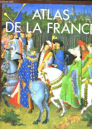
Ardagh John & Jones Colin
Atlas de la France.
Fanal. 1992. In-4. Reli. Bon tat, Couv. convenable, Dos satisfaisant, Intrieur frais. 240 pages - jaquette en bon tat - nombreuses photos et cartes en couleurs dans et hors texte.. Avec Jaquette. . . Classification Dewey : 912-Atlas, cartes et plans
Bookseller reference : R320144472

|
|
|
Ardagh John, Colin Jones
Atlas de la France
Editions du Fanal Cartonné avec jaquette 1992 In-4 (24,5 x 31 cm), cartonnage d'éditeur de couleur marron sous jaquette illustrée en couleurs, 240 pages, 385 illustrations dont 345 en couleurs et 50 cartes géographiques in texte ; quelques frottements à la jaquette, par ailleurs bon état. Livraison a domicile (La Poste) ou en Mondial Relay sur simple demande.
Bookseller reference : gf945
|
|
|
ARDOUIN-DUMAZET Victor-Eugène.
VOYAGE EN FRANCE, 9è série. DAUPHINÉ, III (3) : GRAISIVAUDAN ET OISANS (Terres-Froides - Grande-Chartreuse - Grenoble - Mateysine - Oisans - Haut et Bas Graisivaudan - Plateaux Viennois). Partie du département de l'Isère.
1911 Paris et Nancy, librairie Berger-Levrault, 1911. Troisième édition refondue, en partie originale. La plus grande partie de cet ouvrage a paru en 1896 sous le titre "Le Bas-Dauphiné", qui comprenait également le département de la Drôme désormais édité à part. La présente édition contient 5 chapitres entièrement nouveaux, et 25 cartes dont 2 dépliantes. In-12 de 389-28 pp., avec index des lieux et sommaire de tous les volumes de la collection in fine. Reliure de l'éditeur, pleine percaline grise, titre noir et or, tranche supérieure rouge, gardes illustrées. Couvertures d'origine conservées, avec une carte sur le premier plat. Des taches claires sur la tranche supérieure, coins et coiffes émoussés, petites taches peu visibles en bordure des plats. Intérieur en très bon état, exempt de rousseurs. Cartes dépliantes impeccables. Vignette d'ex-libris collée au contreplat. Bel exemplaire, malgré les défauts signalés.
Bookseller reference : 18700

|
|
|
Ardovini, Roberto und Tiziano Cossignani
Atlante delle Conchiglie di Profondita del Mediterraneo.
Ancona. L'Informatore Piceno, 1999. 112 Seiten. Mit zahlreichen farbigen Abbildungen. Originalpappband. 29 cm
Bookseller reference : 297018

|
|
|
Arendts, Carl
Naturhistorischer Schulatlas zugleich mit Berücksichtigung der Technologie. Für den methodischen Unterricht bearbeitet. 33 Tafeln enthaltend 388 Abbildungen in Holzschnitt. Nebst einem erläuterndem Texte. ERSTAUSGABE.
Leipzig, Brockhaus, 1858. 47 Seiten, 33 doppelseitige Tafeln. 24 cm. Originalpappband.
Bookseller reference : 225849

|
|
|
ARMAND, Jean dit Mustapha
Voyages d’Afrique faicts par le commandement du Roy. Ou sont contenues les navigations des Fraçois, entreprises en 1629 & 1630 sous la conduite de Monsieur le Commadeur de Razilly des costes Occidentales des Royaumes de Fez & de Marroc… Ensemble la description des susdits Royaumes, Villes, Coustumes, Religion, Mœurs & commoditez de ceux dudit pays… Le tout illustré de curieuses observations par Jean Armand, Turc de Nation… Récit de deux expéditions organisées par Richelieu sur les côtes du Maroc
« Édition originale extrêmement rare » des Voyages d’Afrique d’Armand (Chadenat). Séduisant exemplaire en vélin de l’époque. Paris, Nicolas Traboulliet, 1632. Petit in-8 de (1) f.bl., (4) ff., 320 pp. et (1) f.bl. Relié en plein vélin ivoire à recouvrement de l’époque, dos lisse avec le titre et la date calligraphiés. Reliure de l’époque. 161 x 102 mm.
Bookseller reference : LCS-2366
|
|
|
Armstrong, Joe C.W.
From Sea Unto Sea: Art & Discovery Maps of Canada
Approximately 75 pages. "Brings together for the first time thirty-eight stunning, original Canadian maps - many of them national treasures - and the fascinating stories of the explorers and cartographers who made them. From Gastaldi's woodcut map of 1556 in which monsters roam the sea, through Champlain's 1612 collage map of Canada's bounty, to Sanson's foundation map of 1656 - the first to show all five Great Lakes - this superb 'atlas' takes the modern navigator on a voyage of rediscovery to Canada's beginnings, beginnings not only in strength and adventure but also in humanity and art. Charts a compelling route to the nation's past." - from dust jacket. Book clean and unmarked with light wear to navy cloth boards. Price clipped dust jacket bears two closed tears and average wear. Overall a nice copy of this spectacular work. Book
|
|
|
ARNBERGER, Erik (Redaktion)
Grundsatzfragen der Kartographie, herausgegeben von der Österreichischen Kartographischen Gesellschaft. Beiträge von E. Arnberger, F. Aurada, H. Bobek, L. Brandstätter, J. Breu, G. Hake, A. Heupel, G. Jensch, I. Kretschmer, K.-H. Meine, E. Meynen, H. Schiede, R. Schweissthal, E. Spiess und W. Witt.
Wien, Österreichische Geographische Gesellschaft, 1970. (4) 307 Seiten; Original-Leineneinband mit Deckel- und Rückentitel; gr.-8vo.(ca. 24 x 18 cm).
Bookseller reference : 453057801xbvk
|
|
|
Arndt, Heinz-Peter
Handy-Autoatlas : Deutschland, Österreich, Schweiz und Europa ; [der Richtige für's Handschuhfach!].
München [u.a.] : RV-Verl., [1996]. XVI, 448, 336 S. : überw. Kt., graph. Darst. 8°. 1. Aufl., Laufzeit 1998 OKSt. (weicher Einband, abwaschbar).
Bookseller reference : 11657
|
|
|
Arndt, J./ Lütgens, R./ Muhle, W./ Petersen, J
Hirts Erdkunde in Stichworten.
Breslau, Ferdinand Hirt, 1941. 8°. Heft 2, 3, 4, und 5 . Mit zahlreichen Abbildungen und Bildern. OriginalBroschur, gebunden.
Bookseller reference : 24612
|
|
|
Arnold B. Armstrong Writer; Audrey Ashley Writer; Crane Wilbur Writer; Harry Essex Writer; John C. Higgins Writer; Leopold Atlas
The Film Noir of Anthony Mann: T-Men/Raw Deal
Roan Archival Group 1999-10-26. DVD. New. Roan Archival Group unknown
Bookseller reference : 004708 ISBN : 6305436312 9786305436317
|
|
|
Arnz, J. (Josef)
Atlas der alten Welt in XVI illuminirten Charten [illuminierten Karten]. Nach den besten Hülfsmitteln [Hilfsmitteln] zum Gebrauch in Gymnasien, entworfen von J. Arnz. 6te Auflage.
Düsseldorf, im Verlage der lithographischen Anstalt von Arnz & Co. Ohne Jahr (um 1842). 19 nicht num. Blätter. Quer-2° (35 x 27,5 cm). Halbleinenband der Zeit mit schönem grünem Marmorpapierbezug.
Bookseller reference : 5119876

|
|
|
Arnz, Josef
Atlas der Alten Welt Hrsg. u. verlegt von der lithographischen Anstalt von J. Arnz
Düsseldorf: Arnz, 1820. 11 Blatt Format 25 x 20 cm gebundene Ausgabe, Pappband der Zeit
Bookseller reference : 62677

|
|
|
Arpád, Papp-Vary
Budapest. Hier: Atlas.
Budapest, Cartographia., 1991. 4°. [15 : 26 cm = B/H]. 61 Seiten. Mit einem Index. Originalleinenband mit farbig illustriertem Schutzumschlag. - Ein sehr gut erhaltenes, sauberes Exemplar in fester Bindung und ohne Eintragungen. 1. Auflage.
Bookseller reference : 66086AB

|
|
|
ARRIEN FLAVE.
Histoire des expéditions d’Alexandre ; rédigée sur les mémoires de Ptolémée et d’Aristobule, ses lieutenans. Traduction nouvelle par P. Chaussard.
ARRIEN FLAVE. Histoire des expéditions d’Alexandre ; rédigée sur les mémoires de Ptolémée et d’Aristobule, ses lieutenans. Traduction nouvelle par P. Chaussard. Paris, Genets, an XI-1802. In-4 (200x270mm), 196pp., relié pleine basane, dos lisse orné, pièce de titre et de tomaison, reliure d’époque usagée, petit manque de cuir sur le dos, Intérieur frais. Édition ornée de 2 tableaux et de 14 planches dépliantes (plans, médailles et ordre de bataille). ATLAS SEUL.
Bookseller reference : P2-1A-5

|
|
|
ARRON E. S., LEWIS K. B.
MAHIA BATHYMETRY, COASTAL CHART SERIES, 1:200 000 at Lat. 41°S
New Zealand Oceanographic Institute - DSIR. 1992. In-8. Broché. Très bon état, Couv. fraîche, Dos impeccable, Intérieur frais. 1 carte dépliable très grand format en couleur dans sa pochette plastique d'origine.. . . . Classification Dewey : 912-Atlas, cartes et plans
Bookseller reference : RO40107772

|
|
|
Arrowsmith, A(aron):
Orbis terrarum veteribus noti descriptio. A Comparative Atlas of Ancient and Modern Geography, from original authorities, and upon a new plan, for the use of Eton School, by A. Arrwosmith, Hydrographer to His Majesty.
London, by the Author, 1828. Folio. 27 num. Doppelblätter, mit insgesamt 53 gest. mit handkolorierten Karten. Halbpergament d. 19. Jh. mit Rückenschild.
Bookseller reference : 5099CB
|
|
|
Arrianus, Flavius
Atlas apart zu: Histoire des expéditions d'Alexandre; rédigée sur les Mémoires de Ptolémée et d'Aristobule, ses lieutenans ; par Flave Arrien de Nicomédie, surnommé le nouveau Xénophon, Consul et Gèneral romain, disciple d'Épictète. Traduction nouvelle, par P. Chaussard. Imprimerie de Charles Pougens.
Paris, Genets, 1802. II, 196 Seiten, 2 Tab., 14 (teilw.) ausklappbare Tafeln: Karten, Ausrüstung etc., H 26 x 21 cm, Halbleder Pappband der Zeit. - Einband Gebrauchsspuren, innen sehr guter Zustand. fest gebunden/ hardcover
Bookseller reference : ALT2842

|
|
|
ARRON E. S., LEWIS K. B.
MAHIA BATHYMETRY, COASTAL CHART SERIES, 1:200 000 at Lat. 41°S
New Zealand Oceanographic Institute - DSIR. 1992. In-8 Carré. Broché. Très bon état. Couv. fraîche. Dos impeccable. Intérieur frais. 1 carte dépliable très grand format en couleur dans sa pochette plastique d'origine. 2nd edition. N.Z. Ocean. Inst., Division of Marine and Freshwater Science.

|
|
|
Arrowsmith & Hughes Atlas.:
The Scripture Atlas for the use of Schools.
London. S.P.C.K. circ. 1880. Thin cloth over boards. With 10 Maps and Plans. Outline Colour. Engraved by Hughes and Arrowsmith. Index. Good London. S.P.C.K. circ. 1880. hardcover
Bookseller reference : 22283
|
|
|
Arrowsmith, A(aron)
Orbis terrarum veteribus noti descriptio. A Comparative Atlas of Ancient and Modern Geography, from original authorities, and upon a new plan, for the use of Eton School, by A. Arrwosmith, Hydrographer to His Majesty.
London, by the Author, 1828. Folio. 27 num. Doppelblätter, mit insgesamt 53 gest. mit handkolorierten Karten. Halbpergament d. 19. Jh. mit Rückenschild. + Wichtig: Für unsere Kunden in der EU erfolgt der Versand alle 14 Tage verzollt ab Deutschland / Postbank-Konto in Deutschland vorhanden +
Bookseller reference : 5099CB
|
|
|
ARTIGUES
1 CARTE EN COULEUR DE : CARTE ROUTIERE POUR AUTOMOBILISTES ET CYCLISTES - NORD DE LA FRANCE ET BELGIQUE - DIMENSION 70 Cm X 90 Cm.
TARIDE A.. NON DATE. In-Plano. En feuillets. Etat d'usage, Couv. convenable, Dos satisfaisant, Intérieur acceptable. 1 CARTE EN COULEUR DE : CARTE ROUTIERE POUR AUTOMOBILISTES ET CYCLISTES - NORD DE LA FRANCE ET BELGIQUE - DIMENSION 70 Cm X 90 Cm.. . . . Classification Dewey : 912-Atlas, cartes et plans
Bookseller reference : R320040392
|
|
|
Artistes Divers Swt El Atlas Khaled Cheb Mami Cheb Aïssa Bellemou Mazouzi Sawt El Atlas Alabina
Mega Raï Vol.2
Wagram 2000 13x14x1cm. 2000. CD.
Bookseller reference : 500004117

|
|
|
ARTARIA & CO.
[MAP of TURKISH BALKANS] Egri Palanka (Kriva Palanka).
Very Good German Original color map on cloth. A little foxing on cloth. Very good. Folded. Folio. (57 x 46 cm). In German with Turkish place names in Latin script. 40-42 Egri Palanka (Kriva Palanka): Serbien, Bulgarien, Türkei. Serbian, Bulgarian and Turkish borders. Map shows from south to the north: Tikves, Vardar River (Axios), Radovista, Stip (Istib), Ezevopolje, Plackovica, Bereketli, Mustafa Ovasi (Mustafa Plain), Kliseli, Kocana, Vinica, Egri (Kriva) Palanka, Kozjak, Sveli Ilija, Kjustendil (Köstendil), et alli. 39'30' östlich v. Ferro. (Longitude given from Ferro- El Hierro island).
|
|
|
ARTARIA & CO.
[MAP of TURKISH BALKANS] Phthiotis, Canal Atalanti, I. Euboea (Evvia, Evripos, Negroponte, Golf v. Volo (Pagasetikos), Skiathos, Skopelos (Peparethos), Chiliodromia (Ikos), Magnesia, Cholkis.
Very Good German Original color map on cloth. A little foxing on cloth. Very good. Folded. Folio. (51 x 46 cm). In German with Greek place names in Latin script. [MAP of TURKISH BALKANS] Phthiotis, Canal Atalanti, I. Euboea (Evvia, Evripos, Negroponte, Golf v. Volo (Pagasetikos), Skiathos, Skopelos (Peparethos), Chiliodromia (Ikos), Magnesia, Cholkis. (Longitude given from Paris). Scarce.
|
|
|
Articles by GÜNSEL RENDA, IDRIS BOSTAN, MAHMUT AK, FIKRET SARICAOGLU.
Before and after Pîrî Reis: Maps at Topkapi Palace.= Pîrî Reis'ten önce ve sonra: Topkapi Sarayi'nda haritalar. Edited by Alev Taskin.
Very Good Very Good English Paperback. Dust wrapper. 4to. (28 x 24 cm). In English and Turkish. 235 p., color and b/w ills. Before and after Pîrî Reis: Maps at Topkapi Palace.= Pîrî Reis'ten önce ve sonra: Topkapi Sarayi'nda haritalar. Edited by Alev Taskin. Before and After Pîrî Reis: Maps at Topkapi Palace Pîrî Reis is one of the foremost names in the history of Turkish cartography and navigation. This exhibition explores his role in the history of Turkish mapping as well as that of subsequent cartographers.
|
|
|
Articles by GÜNSEL RENDA, IDRIS BOSTAN, MAHMUT AK, FIKRET SARICAOGLU.
Before and after Pîrî Reis: Maps at Topkapi Palace.= Pîrî Reis'ten önce ve sonra: Topkapi Sarayi'nda haritalar. Edited by Alev Taskin.
New New English Paperback. Dust wrapper. 4to. (28 x 24 cm). In English and Turkish. 235 p., color and b/w ills. Before and after Pîrî Reis: Maps at Topkapi Palace.= Pîrî Reis'ten önce ve sonra: Topkapi Sarayi'nda haritalar. Edited by Alev Taskin. Before and After Pîrî Reis: Maps at Topkapi Palace Pîrî Reis is one of the foremost names in the history of Turkish cartography and navigation. This exhibition explores his role in the history of Turkish mapping as well as that of subsequent cartographers.
|
|
|
ASHTON DORE.
NEW YORK.
ALBIN MICHEL.. 1972.. In-8. Broché. Bon état, Couv. convenable, Dos satisfaisant, Intérieur acceptable. 288 pages. Jaquette illustrée en couleurs. 150 illustrations et photographies en noir et blanc et couleurs, dans le texte et hors texte.. Avec Jaquette. . . Classification Dewey : 912-Atlas, cartes et plans
Bookseller reference : R150000910

|
|
|
Ashdown, Raymond R. und Stanley H. Done
Topographische Anatomie des Pferdes. Raymond R. Ashdown ; Stanley Done. Übers. von Margrit u. Bertram Schnorr. Fotogr. von Susan A. Evans / Farbatlanten der Veterinäranatomie
Stuttgart : Enke, 1988. 304 S. mit Ill. 31 x 26 cm, Werkstoffeinband ohne Schutzumschlag im OSchuber [4 Warenabbildungen]
Bookseller reference : 43516

|
|
|
ASHTON DORE.
NEW YORK.
ALBIN MICHEL.. 1972.. In-8 Carré. Broché, Jaquette. Bon état. Couv. convenable. Dos satisfaisant. Intérieur acceptable. 288 pages. Jaquette illustrée en couleurs. 150 illustrations et photographies en noir et blanc et couleurs, dans le texte et hors texte. Architecture, sculpture, peinture. Guides culturels du monde. Photographies de Mario CARRIERI. Naissance d'une métropole, l'âge de fer, l'art de année 1960.

|
|
|
Asim K. Bej Editor Jackie Aislabie Editor Ronald M. Atlas Editor
Polar Microbiology: The Ecology Biodiversity and Bioremediation Potential of Microorganisms in Extremely Cold Environments
CRC Press 2009-12-23. 1. Hardcover. Used:Good. CRC Press hardcover
Bookseller reference : DADAX1420083848 ISBN : 1420083848 9781420083842

|
|
|
ASKERÎ HARITA KOMUTANLIGI].
[MILITARY MAP of OTTOMAN CAUCASUS] Kafkasya Darü'l-Harekâti. (Fasil: 3 - Numero: 3). Tiflis ve civari, Bahr-i Siyah, Don Kazaklari, Kalmuk, Kirgiz, Bahr-i Hazer-i Kuzgun Denizi (Derya-i Hazar), Kuban Kazaklari, Çerkezistan, Maveraünnehir, Nogay, Termerek Kazalari etc.
Very Good Turkish, Ottoman (1500-1928) Original b/w map on cloth. Very good. Folded. Oblong atlas folio. (54 x 71 cm). In Ottoman script. Scale: 1/2.000.000. [MILITARY MAP of OTTOMAN CAUCASUS] Kafkasya Darü'l-Harekâti. (Fasil: 3 - Numero: 3). Tiflis ve civari, Bahr-i Siyah, Don Kazaklari, Kalmuk, Kirgiz, Bahr-i Hazer-i Kuzgun Denizi (Derya-i Hazar), Kuban Kazaklari, Çerkezistan, Nogay, Termerek Kazalari etc. Military map of Ottoman Caucasus. Shows Tbilisi and around, Khazar Sea, Kuban Cosacks, Don Cosacks, Kalmuks, Kyrgyzstan, Circassia, Nogai, Termerek Cosacks, Maveraünnehir, etc.
|
|
|
Asklepios Medical Atlas
Cáncer de Mama
2013. Paperback. Very Good-New. Rare book paperback
Bookseller reference : 459012 ISBN : 8415351453 9788415351450
|
|
|
Asklepios Medical Atlas
Diabetes Miniguías
2014. Paperback. Very Good-New. Rare book paperback
Bookseller reference : 493491 ISBN : 8415950713 9788415950714
|
|
|
Association Géographie Active
Atlas de la Gironde.
Association Géographie Active. 1993. In-4. Broché. Bon état, Couv. convenable, Dos satisfaisant, Intérieur frais. 121 pages - couverture contrepliée - nombreuses cartes, photos en couleurs dans et hors texte.. . . . Classification Dewey : 912-Atlas, cartes et plans
Bookseller reference : RO80264634

|
|
|
Association Momentanée Proverbes, Eveau, JNC
Promenade verte régionale (Gouvernement de la Région de Bruxelles-Capitale. Le Ministre-Président Charles Picqé)
De Rouck Cartography. Non daté. In-8. Broché. Bon état, Couv. convenable, Dos satisfaisant, Intérieur frais. Carte de la région de Bruxelles en français et néerlandais en couleurs.. . . . Classification Dewey : 912-Atlas, cartes et plans
Bookseller reference : R260195956

|
|
|
Association Pour l Atlas De La France De l Est
Atlas De l Est
Strasbourg: Librairie Istra 1970. 58 planches. Bolted. Tres Bon. 41 Cm X 38 Cm. Ex-Library. Librairie Istra Hardcover
Bookseller reference : 037145
|
|
|
Association of British Chambers of Commerce
The Chambers of Commerce atlas.
anglais In-folio de XV-30 pp. de texte et 112 pp. de cartes montées sur onglet ; demi-chagrin noir à coin bordé d'un double filet doré, tranche de tête dorée (reliure de l'éditeur).
|
|
|
Astronomie - Encyclopédie ATLAS Du Ciel
Astronomie - Encyclopédie ATLAS Du Ciel - Volumes 20 à 24
Editions Atlas brochure 1983 32*5 pages en format 22 - 29 cm - photos en couleurs
Bookseller reference : 017670
|
|
|
Astronomie - Encyclopédie ATLAS Du Ciel
Astronomie - Encyclopédie ATLAS Du Ciel - Volumes 26+ 27
Editions Atlas brochure 1983 32*2 pages en format 22 - 29 cm - photos en couleurs
Bookseller reference : 017673
|
|
|
Astronomie - Encyclopédie ATLAS Du Ciel
Astronomie - Encyclopédie ATLAS Du Ciel - Volume 30
Editions Atlas brochure 1983 32 pages en format 22 - 29 cm - photos en couleurs
Bookseller reference : 017678
|
|
 Receive by email
 Download as PDF document
 RSS feed


